Rebar in hatcheries could distort navigation sense in young salmon and trout

Iron and steel in hatcheries, including rebar supporting concrete structural elements, could be distorting the ability of salmon and trout to navigate using the earth’s magnetic fields according to a study released today by Oregon State University.

The exposure to iron and steel distorts the magnetic field around the young fish, affecting the fish’s “map sense” and their ability to navigate, said Nathan Putman, who led the study while working as a postdoctoral researcher in the Oregon Department of Fisheries and Wildlife, part of OSU’s College of Agricultural Sciences.

For decades, scientists have studied how salmon find their way across vast stretches of ocean.

Steelhead.
Spawning Steelhead (Oregon State University).

In a study last year, Putman and other researchers presented evidence of a correlation between the oceanic migration patterns of salmon and drift of the Earth’s magnetic field. They confirmed the ability of salmon to navigate using the magnetic field in experiments at the Oregon Hatchery Research Center.

That earlier research confirmed that fish possess a map sense, determining where they are and which way to swim based on the magnetic fields they encounter.

“The better fish navigate, the higher their survival rate,” said Putman, who conducted the research at the Oregon Hatchery Research Center in the Alsea River basin last year. “When their magnetic field is altered, the fish get confused.”

Subtle differences in the magnetic environment within hatcheries could help explain why some hatchery fish do better than others when they are released into the wild, Putman said.

The study suggests that stabilizing the magnetic field by using alternative forms of hatchery construction may be one way to produce a better yield of fish, he said.

“It’s not a hopeless problem,” he said. “You can fix these kinds of things. Retrofitting hatcheries with non-magnetic materials might be worth doing if it leads to making better fish.”

The new findings follow the  earlier research by Putman and others that confirmed the connection between salmon and the Earth’s magnetic field.

Researchers exposed hundreds of juvenile Chinook salmon to different magnetic fields that exist at the latitudinal extremes of their oceanic range.

Fish responded to these “simulated magnetic displacements” by swimming in the direction that would bring them toward the center of their marine feeding grounds.

Putman repeated that experiment with the steelhead trout and achieved similar results. He then expanded the research to determine if changes to the magnetic field in which fish were reared would affect their map sense. One group of fish was maintained in a fiberglass tank, while the other group was raised in a similar tank but in the vicinity of iron pipes and a concrete floor with steel rebar, which produced a sharp gradient of magnetic field intensity within the tank. Iron pipes and steel reinforced concrete are common in fish hatcheries.

The scientists monitored and photographed the juvenile steelhead, called parr, and tracked the direction in which they were swimming during simulated magnetic displacement experiments. The steelhead reared in a natural magnetic field adjusted their map sense and tended to swim in the same direction. But fish that were exposed to the iron pipes and steel-reinforced concrete failed to show the appropriate orientation and swam in random directions.

More research is needed to determine exactly what that means for the fish. The loss of their map sense could be temporary and they could recalibrate their magnetic sense after a period of time, Putman said. Alternatively, if there is a critical window in which the steelhead’s map sense is imprinted, and it is exposed to an altered magnetic field then, the fish could remain confused forever, he said.

“There is evidence in other animals, especially in birds, that either is possible,” said Putman, who now works for the National Oceanic and Atmospheric Administration. “We don’t know enough about fish yet to know which is which. We should be able to figure that out with some simple experiments.”

Map showing the ocean range of Chinook salmon and how the fish sense magnetic fields.  Fish with a "northern orientation" swim south and vice versa. (University of Oregon)
Map showing the ocean range of Chinook salmon and how the fish sense magnetic fields. Fish with a “northern orientation” swim south and vice versa. (Oregon State University)

Putman’s findings were published this week in the journal Biology Letters. The research was funded by Oregon Sea Grant and the Oregon Department of Fish and Wildlife, with support from Oregon State University. Co-authors of the study are OSU’s David Noakes, senior scientist at the Oregon Hatchery Research Center, and Amanda Meinke of the Oregon Hatchery Research Center.

NRDC delivers “unequivocal congratulations” to Rio Tinto for Pebble Mine divestment

NRDC ad
Natural Resources Defence Counsel ad in the Financial Times thanking RIo Tinto (NRDC)

The US based Natural Resources Defence Counsel environmental group, a major opponent of both the Keystone XL and Northern Gateway pipeline projects, is praising Rio Tinto for divesting its interests in the controversial Alaska Pebble Mine project.

The NRDC is, in fact, so pleased, with Rio Tinto that they took out an expensive full page ad in London’s Financial Times to congratulate the mining and smelting giant which, of course, owns Rio Tinto Alcan and the aluminum smelter in Kitimat.
Related
Rio Tinto donates $19 million Pebble Mine stake to charity

The National Resources Defence Counsel is often a favourite target for  the Harper government and oil-patch conservatives who see it as one of the foreign environmental groups interfering in Canadian affairs.

A delegation from the NRDC and Alaska First Nations met with Rio Tinto’s top executives in London, according to a blog post on the organization’s website by Joel Reynolds, its senior lawyer and western director, Pebble Mine: Delivering Congratulations, Not Petitions, to Rio Tinto


In the blog Reynolds writes

We’ve gone each year [to corporate shareholder meetings or to meet corporate executives] to fight the Pebble Mine — a 21st Century example of what the mining industry will do if given free reign, based on promises of safety, sustainability, and technological innovation that can’t be kept and must not be believed….

In 2010, I also traveled to Tokyo to meet with leadership of Mitsubishi Corporation, a former significant Pebble shareholder that quietly sold all of its interest in the project eight months later.

This has become an essential aspect of our advocacy with multi-national corporations: meeting privately with company leadership and participating in the once-a-year public gathering of their shareholders, of which – in order to gain access — we are one. Attending the shareholder meetings is no fun, requiring immersion in a world where natural resources are for extraction and exploitation, where representatives from far-flung communities seeking remediation and redress from contamination recount the tragic impacts of mining on their daily lives.

But this year promised to be different for the residents of Bristol Bay – and for those of us supporting their cause.

NRDC meets with Rio Tinto
NRDC director and lawyer Joel Reynolds shows a copy of the Financial Times ad to Kim Williams, Executive Director of the Alaska Nunamta Aulukestai, Rio Tinto CEO Sam Walsh, Reynolds, Rio Tinto Chair Jan de Plessis, Rio Tinto Director of Copper Jean-Sebastien Jacques and Bobby Andrew, Yupik elder and spokesperson for Nunamta Aulukestai (NRDC)

Reynolds goes on to write that a week after Rio Tinto announced the divestment, they were meeting with RT CEO Sam Walsh and senior executives in the London headquarters:

We were there to thank them for listening to the people of Bristol Bay who, by overwhelming numbers, have consistently voiced their opposition to the mine – a project that embodies the greatest threat ever posed to the economic lifeblood of the region, the Bristol Bay wild salmon fishery.

Each of us in turn – including Bobby Andrew (Yupik elder and spokesperson for Nunamta Aulukestai, an association of Bristol Bay village corporations and tribes; Kim Williams, Executive Director of Nunamta Aulukestai; and Bonnie Gestring, Circuitrider for Earthworks) — delivered a simple message:  that Rio Tinto had fulfilled its commitment to Bristol Bay’s communities to act responsibly in a manner consistent with protection of the wild salmon fishery and the wishes of the people who depend on it.  Given the scope of the proposed Pebble Mine and the unavoidable risks of contamination associated with its location, there is only one responsible course – divestment – and that is precisely what Rio Tinto had done.  The company deserved congratulations, and we conveyed it unequivocally.

Later, meeting with Rio Tinto directors, Reynolds presented the board with a copy of the ad from the Financial Times.

In the blog, Reynolds noted that Vancouver-based Northern Dynasty Minerals is determined to proceed with the project and so the NRDC says “despite major progress against the Pebble project, our work isn’t done, and we remain committed to continuing the fight – along with our Members and activists in support of the people of Bristol Bay.”

In taking out the ad, NRDC’s Taryn Kiekow Heimer, Senior Policy Analyst, Marine Mammal Protection Project, said:

NRDC and its 1.4 million members and activists join the people from Bristol Bay, Alaska Natives, commercial fishermen, sportsmen, jewelers, chefs, restaurant and lodge owners, and conservationists in thanking Rio Tinto for showing environmental and financial leadership by divesting from Pebble Mine.

The Haisla Nation and other groups often quoted NRDC studies on pipelines in their presentations before the Northern Gateway Joint Review Panel.

Kitmat Votes: What the Joint Review Panel said about the Exxon Valdez disaster

Excerpts from the Northern Gateway Joint Review Panel report relating to the Exxon Valdez disaster.

Northern Gateway told the Joint Reivew Panel that

on a worldwide basis, all data sets show a steady reduction in the number
and size of oil spills since the 1970s. This decline has been even more apparent since regulatory changes in 1990 following the Exxon Valdez oil spill, which required a phase-in of double-hulled tankers in the international fleet. No double-hulled tanker has sunk since 1990. There have been five incidents of double-hulled tankers that have had a collision or grounding that penetrated the cargo tanks. Resulting spills ranged from 700 to 2500 tonnes

The Haisla countered by saying:

The Haisla Nation said that, although there have been no major spills since the Exxon Valdez spill in Prince William Sound, there were 111 reported incidents involving tanker traffic in Prince William Sound between 1997 and 2007. The three most common types of incidents were equipment malfunctions, problems with propulsion, steering, or engine function, and very small spills from tankers at berth at the marine terminal. The Haisla Nation said that, in the absence of state-of-the-art
prevention systems in Prince William Sound, any one of those incidents could have resulted in major vessel casualties or oil spills.

There were disputes about how the Exxon Valdez affected species in the Prince William  Sound area:

Northern Gateway said that, although crabs are known to be sensitive to toxic effects, they have been shown to recover within 1 to 2 years following
a spill such as the Exxon Valdez incident. Northern Gateway said that Dungeness crab was a key indicator species in its assessment of spill effects.

Northern Gateway said that potential effects to razor clams are not as well studied. It said that sediment toxicity studies after the Exxon Valdez spill did not suggest significant effects on benthic invertebrates. Following the Exxon Valdez and
Selendang Ayu oil spills in Alaska, food safety closures for species such as mussels, urchins, and crabs were lifted within 1 to 2 years following the
spill.

In response to questioning from the Council of the Haida Nation regarding potential spill effects on herring, Northern Gateway said that herring were a key indicator species in its spill assessment.
Northern Gateway said that the Exxon Valdez spill did not appear to cause population-level effects on Prince William Sound herring.

As did throughout its report, the Joint Review Panel gave great weight to Northern Gateway’s evidence:


Northern Gateway said that potential effects of oil stranded on the shorelines and in the intertidal environment were assessed qualitatively with particular reference to the Exxon Valdez oil spill. It said that the entire intertidal zone along affected
shorelines would likely be oiled, coating rocks, rockweed, and sessile invertebrates. Some of the diluted bitumen could penetrate coarse-grained intertidal substrates, and could subsequently be remobilized by tides and waves. There were
relatively few shoreline areas with potential for long oil residency. Northern Gateway said that the stranded bitumen would not be uniformly distributed, and that heavy oiling would likely be limited to a small proportion of affected shoreline. Northern
Gateway said that, compared to the Exxon Valdez oil spill, the simulation suggested that more dilbit would be distributed along a shorter length of shoreline.

Northern Gateway said that, due to the relatively sheltered conditions in Wright Sound, and in the absence of cleanup, most of the stranded oil would be weathered or dispersed into the marine environment within 3 to 5 years. It said that,
while weathering and dispersal could represent an important secondary source of hydrocarbon contamination of offshore or subtidal sediments, the weathered hydrocarbons themselves would have lower toxicity than fresh dilbit.

Northern Gateway assessed potential effects on key marine receptors including marine water quality, subtidal sediment quality, intertidal sediment
quality, plankton, fish, and a number of bird and mammal species. The company said that acute effects from monocyclic aromatic hydrocarbons such as benzene, toluene, ethylbenzene, and xylene may briefly occur in some areas. Acute effects from polycyclic aromatic hydrocarbons were not likely due to their low water solubility.
Northern Gateway said that chronic adverse effects on the subtidal benthic community were not predicted. After a large spill, consumption advisories for pelagic, bottom-dwelling and anadromous fish, and invertebrates from open
water areas and subtidal sediments would probably be less than 1 year in duration. Northern Gateway said that consumption advisories for intertidal communities and associated invertebrates, such as mussels, could persist for 3 to 5 years or longer in
some sheltered areas.

But dilbit is different from heavy crude

In response to questions from the Haisla Nation and the United Fishermen and Allied
Workers Union, Fisheries and Oceans Canada said that, although it had a great deal of information on conventional oils, the results of research conducted on the biological effects of conventional oil products may not be true for dilbit or unconventional products. Fisheries and Oceans Canada said that it was not in a
position to quantify the magnitude and duration of impacts to marine resources

The United Fishermen and Allied Workers Union said that, because there are so many variables, each spill is a unique event, and some results will be unknowable. It said that a spill the size of the Exxon Valdez incident would affect the entire ecosystem
in the project area, and that recovery to pre-spill conditions would be unlikely to ever occur. It said that a spill the size of the Exxon Valdez oil spill would likely have similar effects in the project area because marine resources in the project area are
similar to those in Prince William Sound. It argued that the cold, sheltered, waters of the Confined Channel Assessment Area would likely experience reduced natural dispersion and biodegradation of oil, leading to heavier oiling and longer recovery
times than seen in Prince William Sound and elsewhere.

The United Fishermen and Allied Workers Union said that patches of buried oil from the Exxon Valdez oil have been found on sand and gravel beaches overlain by boulders and cobbles. It said that effects from a tanker spill associated with the
Enbridge Northern Gateway Project would likely be more severe than the Exxon Valdez oil spill due to the more persistent nature of dilbit and the lack of
natural cleaning action in the sheltered waters of the Confined Channel Assessment Area.

The Gitxaala Nation’s experts said that large historical spill events are not necessarily good indicators of what will happen in the future. They
argued that each spill has unique circumstances and there is still significant uncertainty about the effects of major spills.
The Gitxaala Nation concluded Northern Gateway had failed to adequately consider the potential consequences on ecological values of interest to the Gitxaala.

Gitga’at First Nation said that a spill of dilbit greater than 5,000 cubic metres would result in significant, adverse, long-term, lethal, and sublethal effects
to marine organisms, and that effects would be particularly long-lasting on intertidal species and habitats. It also said that effects from a tanker spill associated with the project would probably be more severe than the Exxon Valdez oil spill, due to
the more persistent nature of dilbit and the lack of natural cleaning action in the sheltered waters

The JRP told how Nothern Gateway looked at the scientific evidence:

The company used a case study approach and reviewed the scientific literature for environments similar to the project area. The review examined 48 spills, including the Exxon Valdez oil spill in 1989, and 155 valued ecosystem components from  cold temperate and sub-arctic regions. Northern Gateway said that the scientific evidence is clear that, although oil spills have adverse effects on biophysical and human environments, ecosystems and their components recover with time.

Pacific herring, killer whales, and pink salmon were species that were extensively studied following the Exxon Valdez spill and were discussed by numerous participants in the Panel’s process.

As referred to by the Haisla Nation, Pacific herring are listed as “not recovering” by the Exxon Valdez Oil Spill Trustee Council. The Trustee Council said that, despite numerous studies to understand the effects of oil on herring, the causes constraining population recovery are not well understood.

Northern Gateway said that scientific evidence indicates that a combination of factors, including disease, nutrition, predation, and poor recruitment
appear to have contributed to the continued suppression of herring populations in Prince William Sound.

Northern Gateway said that 20 years of research on herring suggests that the Exxon Valdez oil spill is likely to have initially had localized effects on herring eggs and larvae, without causing effects at the population level. Northern Gateway said
that, even after 20 years, the effects of the spill on herring remain uncertain. It said that there has also been convergence amongst researchers that herring declines in the spill area cannot be connected to the spill.

Northern Gateway said that herring stocks along the entire coast of British
Columbia have been in overall decline for  years and that herring were shown to recover within 1 to 2 years following the Nestucca barge spill.

A Gitxaala Nation expert noted the uncertainty in interpreting the decline of herring following the Exxon Valdez oil spill and said that the debate is not likely to ever be settled.

The Living Oceans Society said that the Exxon Valdez Oil Spill Trustee Council reported that some killer whale groups suffered long-term damage from initial exposure to the spill. Northern Gateway’s expert said the research leads him to
conclude that the actual effects on killer whales of the Exxon Valdez spill are unknowable due to numerous confounding factors. He said that the
Exxon Valdez Oil Spill Trustee Council has not definitively said that killer whale mortalities can be attributed to the spill. A Government of Canada
expert said that the weight of evidence suggests that the mortality of killer whales was most likely related to the spill.

Northern Gateway said that mass mortality of marine fish following a spill is rare. In response to questions from the Haisla Nation, Northern Gateway said that fish have the ability to metabolize potentially toxic substances such as polycyclic aromatic hydrocarbons. It said that international experience with oil spills has demonstrated that fin fishery closures tend to be very short in duration.
Northern Gateway said that food safety programs for fin fish conducted following the Exxon Valdez spill and the Selendang Ayu spill in Alaska indicated
that the finfish were not affected by the spill and that the fish were found, through food safety testing programs, to be safe to eat.

The Haisla Nation referred to the Exxon Valdez Oil Spill Trustee Council report that discussed the complexities and uncertainties in the recovery status of pink salmon. It said that, by 1999, pink salmon were listed as recovered and that the
report noted that continuing exposure of embryos to lingering oil is negligible and unlikely to limit populations.

Northern Gateway said that the longterm effect of the spill on pink salmon survival is
best demonstrated by the success of adult returns following the spill. Northern Gateway said that, in the month following the spill, when there was still
free oil throughout Prince William Sound, hundreds of millions of natural and hatchery pink salmon fry migrated through the area. It argued that these fish would arguably be at greatest risk from spill-related effects but that the adult returns 2 years later were one of the highest populations ever. Northern Gateway said that sockeye and pink salmon appear to have been unaffected by the Exxon Valdez spill
over the long term.

In response to questions from the Council of the Haida Nation and the United Fishermen and Allied Workers Union, Northern Gateway said that effects
on species such as seaweed, crabs, and clams have been shown to be relatively short-term, with these species typically recovering within 2 years or less
following a spill, depending on circumstances.

Northern Gateway said that, based on the Exxon Valdez spill, the level of hydrocarbons dissolved or suspended in the water column would be expected
to be substantially lower than those for which potential toxic effects on crabs or fish may occur.

In response to questions from BC Nature and Nature Canada, Northern Gateway said that the Exxon Valdez oil spill indicates which species of birds are most susceptible to oiling. Seabirds are generally vulnerable to oil spills because many species spend large amounts of time at sea. Diving seabirds such as murres are particularly vulnerable to oiling because they spend most of their time on the surface, where oil is found, and tend to raft  together. Thus, these species often account for most of the bird mortality associated with oil spills.

More than 30,000 seabird carcasses, of which 74 per cent were murres, were recovered following the Exxon Valdez spill and it was initially estimated
that between 100,000 and 300,000 seabirds were killed. However, detailed surveys of breeding murres in 1991 indicated no overall difference from pre-spill levels confirming rapid recovery of this species.

Northern Gateway said that, although potential toxicological effects from oil spills on
birds have been well documented in laboratory studies, the ultimate measure of recovery potential is how quickly birds return to their natural abundance and reproductive performance. It said that recovery is often difficult to measure due to
significant natural variation in populations and the fact that the baseline is often disputed. It said that this can lead to misinterpretation of results depicting recovery.

At the request of Environment Canada, Northern Gateway filed two reports on the susceptibility of marine birds to oil and the acute and chronic effects of the Exxon Valdez oil spill on marine birds. Northern Gateway said that marine birds are
vulnerable to oil in several ways such as contact, direct or indirect ingestion, and loss of habitat.
It said that many marine bird populations appear to have recovered from the effects of the Exxon Valdez spill, but some species such as harlequin ducks and pigeon guillemots have not recovered, according to the Exxon Valdez Oil Spill Trustee
Council. It said these reports demonstrate that marine birds are susceptible to marine oil spills to varying degrees depending on the species, its life
history and habitat, and circumstances associated with the spill.
Northern Gateway concluded that:
• Marine, freshwater, and terrestrial environments recover from oil spills, with recovery time influenced by the environment, the valued ecosystem components of interest, and other factors such as spill volume and characteristics
of the oil. Depending on the species and circumstances, recovery can be quite rapid or it can range from 2 to 20 years. Other scientific reviews have indicated that recovery of marine environments from oil spills takes 2 to 10 years.
• Different marine ecosystem components recover at different rates. Recovery time can range from days or weeks in the case of water quality, to years or decades for sheltered, soft sediment marshes. Headlands and exposed rocky shores can take 1 to 4 years to recover.
• Little to no oil remained on the shoreline after 3 years for the vast majority of shoreline oiled following the Exxon Valdez spill,
• The Exxon Valdez Oil Spill Trustee Council concluded that, after 20 years, any remaining Exxon Valdez oil in subtidal sediment is no longer a concern, and that subtidal communities are very likely to have recovered.
• Because sheltered habitats have long recovery times, modern spill response gives high priority to preventing oil from entering marshes and other protected shoreline areas.
• Valued ecosystem components with short life spans can recover relatively rapidly, within days to a few years. Recovery is faster when there is an abundant supply of propagules close to the affected area. For example, drifting larvae from
un-oiled marine and freshwater habitats will rapidly repopulate nearby areas affected by a spill.
• Plankton recovery is typically very rapid.
• Seabed organisms such as filter feeders may be subject to acute effects for several years, depending on location, environmental conditions, and degree of oiling.
• Marine fisheries and other human harvesting activities appear to recover within about 2 to 5 years if the resource has recovered and has not been affected by factors other than the oil spill.
• Protracted litigation may delay resumption of fisheries and other harvesting.
• Local community involvement in spill response priorities and mitigation plans can reduce community impacts and speed recovery of
fisheries and harvesting activities.
• A long life span typically means a long recovery time, in the case of bird and mammal populations that can only recover by local reproduction rather
than by immigration from other areas.
• Fast moving rivers and streams tend to recover more quickly than slow flowing watercourses, due to dispersal of oil into the water column by turbulence, which can enhance dissolution, evaporation, and microbial degradation.
• Drinking water and other water uses can be affected by an oil spill for weeks to months. Drinking water advisories are usually issued. Groundwater use may be restricted for periods ranging from a few weeks to 2 years, depending on
the type of use.

• Groundwater can take years to decades to recover if oil reaches it. Groundwater does not appear to have been affected in the case of Enbridge’s Kalamazoo River spill, near Marshall, Michigan.

• Freshwater invertebrates appear to have recovered within 2 years in several cases.
• Freshwater fisheries may recover fully in as little as four years, with signs of partial recovery evident after only a few months. The ban on consumption of fish in the Kalamazoo River was to be lifted approximately two years following
the spill.
• Human activities are affected by factors such as cleanup activities, safety closures and harvesting bans. These typically persist for months to a few years.
• Appropriate cleanup can promote recovery, while inappropriate cleanup techniques can actually increase biophysical recovery time.
Modern spill response procedures carefully consider the most appropriate treatment for the oil type, level of contamination, and habitat type.
The Living Oceans Society noted the following in relation to potential recovery of the marine environment following a spill:
• Physical contamination and smothering are primary mechanisms that adversely affect marine life, particularly intertidal organisms.
• Birds and mammals suffer the greatest acute impact when exposed to oil at or near the water surface.
• Marine communities have variable resiliency to oil spills, from highly tolerant (plankton, kelp beds), to very intolerant (estuaries and sea otters). Impacts to communities and populations are very difficult to measure due
to lack of scientific methods to measure long term,sublethal, and chronic ecological impacts.
• As the return of the marine environment to the precise conditions that preceded the oil spill is unlikely, a measurement of spill recovery can be
based on a comparison of un-oiled sites with oiled sites of similar ecological characteristics.
• The Exxon Valdez oil spill killed many birds and sea otters. Population-level impacts to salmon, sea otters, harbour seals, and sea birds appear to have been low. Wildlife populations had recovered within their natural range of variability after 12 years.
• Intertidal habitats of Prince William Sound have shown surprisingly good recovery. Many shorelines that were heavily oiled and then cleaned appear much as they did before the spill. There is still residual buried oil on some beaches. Some mussel and clam beds have not fully recovered.
• The marine environment recovered with little intervention beyond initial cleaning. Natural flushing by waves and storms can be more effective than human intervention.
• Wildlife rescue and rehabilitation efforts had a marginal beneficial effect on the recovery of bird and mammal populations
• The impacted area of Prince William Sound had shown surprising resiliency and an ability to return to its natural state within the range of natural variability.
• The Exxon Valdez oil spill had significant and long-lasting effects on people and communities.

Questioning experts

The Panel posed a series of questions to experts representing Northern Gateway, federal government participants, and the Gitxaala First Nation regarding the potential recovery of marine ecosystems following a large oil spill.
Northern Gateway said that past marine spills have demonstrated that, over time, the environment will recover to a pre-spill state, and that most species fully recover. It said that species associated with the surface of the water tend to be most susceptible to oil spills, and that cleanup efforts can help direct and
accelerate natural restoration processes.
Federal government experts generally agreed with Northern Gateway’s responses, although they stressed that effects could be felt in areas other than the water surface, such as intertidal and subtidal zones. They said that it is difficult to define
and assess effects and recovery, depending on the species and availability of baseline information.
They said that most species may fully recover over time, and that the time frame for this recovery can be extremely variable depending on species and circumstances.
The Gitxaala Nation’s experts noted the potential for effects on species at the water surface and in intertidal areas, and noted exceptions to the notion that
the marine environment will naturally restore itself.
They said that full recovery can occur, depending on the circumstances, but is not guaranteed. They said that it is difficult to assess spill effects in the absence
of adequate baseline information.


Despite the quarter century of studies on the Exxon Valdez inicident, the paucity of studies prior to the spill mean that arguments will continue over “baseline information.”

Participants told the Panel that a lack of baseline information has often made it difficult to separate spill-related effects from those that were caused by natural variation or other causes not related to a spill.

Northern Gateway acknowledged the need for adequate baseline information. Parties such as Coastal First Nations, Raincoast Conservation Foundation, and the Gitxaala Nation said that Northern Gateway had provided insufficient baseline information to assess future spill-related effects. The Kitsumkalum First Nation asked how
spill-related effects on traditionally harvested foods could be assessed in the absence of baseline information.

The Haisla Nation noted the importance of collecting baseline data in the Kitimat River valley to compare with construction and spill-related impacts. The Haisla Nation submitted a report outlining important considerations for a baseline
monitoring program. One recommendation was that the program should engage stakeholders and be proponent-funded. In response to questions
from Northern Gateway, the Haisla Nation noted that a design along the lines of a before/after control/impact model would be appropriate.

In response to these comments, Northern Gateway noted its commitment to implement a Pipeline Environmental Effects Monitoring Program. Northern Gateway’s
proposed framework for the monitoring program indicates that a number of water column, sediment, and biological indicators would be monitored.
The Raincoast Conservation Foundation said that one of the principal lessons learned from the Exxon Valdez oil spill was the importance of collecting abundance and distribution data for non-commercial species. Because baseline information was
lacking, spill effects on coastal wildlife were difficult to determine. Environment Canada also noted the importance of adequate baseline information to
assess, for example, spill-related effects on marine birds.

Northern Gateway outlined the baseline measurements that it had already conducted as part of its environmental assessment. It also said that is
would implement a Marine Environmental Effects Monitoring Program. Northern Gateway said that the initial baseline data, plus ongoing monitoring,
would create a good baseline for environmental quality and the abundance, distribution, and diversity of marine biota. In the event of an oil spill
it would also help inform decisions about restoration endpoints.

Northern Gateway said that it would provide Aboriginal groups with the opportunity to undertake baseline harvesting studies. In response to questions from the United Fishermen and Allied Workers Union, Northern Gateway said that baseline information gathered through the environmental effects monitoring program would also be relevant to commercial harvest management and for assessing compensation claims in the event of a spill.
The Kitimat Valley Naturalists noted the ecological importance of the Kitimat River estuary.

The Joint Review Panel, in its conclusions and ruling, generally agreed with the energy industry that affects of a major oil spill would be temporary.

The Panel heard evidence and opinion regarding the value that the public and Aboriginal groups place on a healthy natural environment.

The Panel finds that it is not able to quantify how a spill could affect people’s values and perceptions.
The Panel finds that any large spill would have short-term negative effects on people’s values, perceptions and sense of wellbeing.

The Panel is of the view that implementation of appropriate mitigation and compensation following a spill would lessen these effects over time. The
Panel heard that protracted litigation can delay recovery of the human environment.

The Panel heard that appropriate engagement of communities in determining spill response priorities and developing community mitigation plans can also lessen effects on communities. Northern Gateway has committed to the development
of Community Response Plans
The Panel’s finding regarding ecosystem recovery following a large spill is based on extensive scientific evidence filed by many parties, including information on recovery of the environment from large past spill events such as the Exxon Valdez
oil spill. The Panel notes that different parties sometimes referred to the same studies on environmental recovery after oil spills, and drew different conclusions. In its consideration of natural recovery of the environment, the Panel focused
on effects that are more readily measurable such as population level impacts, harvest levels, or established environmental quality criteria such as
water and sediment quality criteria.
The Panel finds that the evidence indicates that ecosystems will recover over time after a spill and that the post-spill ecosystem will share functional attributes of the pre-spill one. Postspill ecosystems may not be identical to pre-spill ecosystems. Certain ecosystem components may continue to show effects, and residual oil
may remain in some locations. In certain unlikely circumstances, the Panel finds that a localized population or species could potentially be permanently affected by an oil spill. Scientific studies after the Exxon Valdez spill indicated that the vast majority of species recovered following the spill and that functioning ecosystems, similar
to those existing pre-spill, were established.
Species for which recovery is not fully apparent, such as Pacific herring, killer whales, and pigeon guillemots, appear to have been affected by other
environmental factors or human influences not associated with the oil spill. Insufficient pre-spill baseline data on these species contributed to
difficulties in determining the extent of spill effects.
Based on the evidence, the Panel finds that natural recovery of the aquatic environment after an oil spill is likely to be the primary recovery
mechanism, particularly for marine spills. Both freshwater and marine ecosystem recovery is further mitigated where cleanup is possible, effective, and beneficial to the environment.
Natural processes that degrade oil would begin immediately following a spill. Although residual oil could remain buried in sediments for years, the Panel finds that toxicity associated with that oil would decline over time and would not cause
widespread, long-term impacts.

The Panel finds that Northern Gateway’s commitment to use human interventions,
including available spill response technologies, would mitigate spill impacts to ecosystems and assist in species recovery. Many parties expressed concerns about potential short-term and long-term spill effects on resources that they use or depend on, such as drinking water, clams, herring, seaweed, and fish. The weight of
evidence indicates that these resources recover relatively rapidly following a large oil spill.

For example, following the Selendang Ayu and Exxon Valdez spills in Alaska, fin fish were found, through food safety testing programs, to be safe to eat. Food safety closures for species such as mussels, urchins, and crabs were lifted within 1 to
2 years following the spills.
The actual time frame for recovery would depend on the circumstances of the spill. Until harvestable resources recover, various measures are typically put in place, such as compensation,harvest restrictions or closures, and provision of
alternative supply.
It is difficult to define recovery of the human environment because people’s perceptions and values are involved. This was made clear to the
Panel through oral statements and oral evidence.
The Panel finds that oil spills would cause disruptions in people’s lives, especially those people who depend on the marine environment for sustenance, commercial activities and other uses. The extent and magnitude of this disruption
would depend on the specific circumstances associated with the spill. The Panel views recovery of the socio-economic environment as the time when immediate impacts and interruption to people’s lives are no longer evident, and the
natural resources upon which people depend are available for use and consumption.
The Panel heard that assessing the potential recovery time of the environment is often complicated by challenges in separating background or unrelated events from spill-related effects. There can be natural variation in species populations,
and other natural and human-induced effects can also make it difficult to determine which impacts are spill-related and which are not.
The Panel notes that Northern Gateway has committed to collect baseline data and gather baseline information on harvest levels and values through initiatives such as its Environmental Effects Monitoring Program, Fisheries Liaison
Committee, and traditional harvest studies. The Panel finds that these commitments go beyond regulatory requirements and are necessary. This information would contribute to assessments of spill effects on resource harvesting values,
post-spill environmental recovery, and loss and liability determinations.
The Panel is of the view that it is not possible to predict a specific time in which overall recovery of the environment may occur. The time for recovery would depend on the type and volume of product spilled, environmental conditions,
the success of oil spill response and cleanup measures, and the extent of exposure of living and non-living components of the environment to the product spilled. Recovery of living and non-living components of the environment would
occur over different time frames ranging from weeks, to years, and in the extreme, decades.
Even within the same environmental component, recovery may occur over different time frames depending on local factors such as geographic location, the amount of oiling, success of cleanup, and amount of natural degradation.
Based on the physical and chemical characteristics described for the diluted bitumen to be shipped and the fate and transport modelling conducted, the Panel finds that stranded oil on shorelines would not be uniformly distributed on
shorelines and that heavy oiling would be limited to specific shoreline areas. The Panel accepts Northern Gateway’s prediction that spilled dilbit could persist longer in sheltered areas, resulting in longer consumption advisories for intertidal
communities and associated invertebrates than in more open areas.

Based on the scientific evidence, the Panel accepts the results of the
chronic risk assessment that predicted no significant risks to marine life due to oil deposition in the subtidal sediments.
For potential terrestrial and marine spills, the Panel does not view reversibility as a reasonable measure against which to predict ecosystem recovery. No ecosystem is static and it is unlikely that an ecosystem will return to exactly the same
state following any natural or human induced disruption. Based on the evidence and the Panel’s technical expertise, it has evaluated whether or not functioning ecosystems are likely to return after a spill. Requiring Northern Gateway to
collect baseline data would provide important information to compare ecosystem functions before and after any potential spill.

The Panel finds that Northern Gateway’s ecological and human health risk assessment models and techniques were conducted using conservative assumptions and state of the art models. Combined with information from past spill events, these assessments provided sufficient information to inform the Panel’s deliberation on
the extent and severity of potential environmental effects. The Panel finds that this knowledge was incorporated in Northern Gateway’s spill prevention strategies and spill preparedness and response planning. Although the ecological risk assessment
models used by Northern Gateway may not replicate all possible environmental conditions or effects, the spill simulations conducted by Northern Gateway provided a useful indication of the potential range of consequences of large oil spills in
complex natural environments.

First Nations historical herring harvest offers “deep time perspective” to modern managers, SFU study says

SFU archaeologists
Iain McKechnie and Dana Lepofsky examine ancient herring fish bones that tell the story about how gigantic herring fisheries were for thousands of years in the Pacific Northwest. (SFU)

The herring, now dwindling on on the Pacific Coast, was once “superabundant” from Washington State through British Columbia to Alaska and that is a warning for the future, a new study says.

A team of scientists lead by Simon Fraser University argue that the archaeological record on the Pacific Coast offers a “deep time perspective” going back ten thousand years that can be a guide for future management of the herring and other fish species.

An archaeological study looked at 171 First Nations’ sites from Washington to Alaska and recovered and analyzed 435,777 fish bones from various species.

Herring bones were the most abundant and dating shows that herring abundance can be traced from about 10,700 years ago to about the mid-nineteenth century with the arrival of Europeans and the adoption of industrial harvesting methods by both settlers and some First Nations.

That means herring were perhaps the greatest food source for First Nations for ten thousand years surpassing the “iconic salmon.” Herring bones were the most frequent at 56 per cent of the sites surveyed and made up for 49 per cent of the bones at sites overall.

The study was published online Monday, February 17, 2014, in Proceedings of the National Academy of Sciences (PNAS). Simon Fraser University researchers Iain McKechnie, Dana Lepofsky and Ken Lertzman, and scientists in Ontario, Alberta and the United States are its co-authors.

The study is one of many initiatives of the SFU-based Herring School, a group of researchers that investigates the cultural and ecological importance of herring.

“By compiling the largest data set of archaeological fish bones in the Pacific Northwest Coast, we demonstrate the value of using such data to establish an ecological baseline for modern fisheries,” says Iain McKechnie. The SFU archaeology postdoctoral fellow is the study’s lead author and a recent University of British Columbia graduate.

Co-author and SFU archaeology professor Dana Lepofsky states: “Our archaeological findings fit well with what First Nations have been telling us. Herring have always played a central role in the social and economic lives of coastal communities. Archaeology, combined with oral traditions, is a powerful tool for understanding coastal ecology prior to industrial development.”

The researchers drew from their ancient data-catch concrete evidence that long-ago herring populations were consistently abundant and widespread for thousands of years. This contrasts dramatically with today’s dwindling and erratic herring numbers.

“This kind of ecological baseline extends into the past well beyond the era of industrial fisheries. It is critical for understanding the ecological and cultural basis of coastal fisheries and designing sustainable management systems today,” says Ken Lertzman, another SFU co-author. The SFU School of Resource and Environmental Management professor directs the Hakai Network for Coastal People, Ecosystems and Management.

Map of First Nations sites with fish bones
Map of First Nations’ archaeological sites with high numbers of fish bones. Herring is abundant in sites throughout the Strait of Georgia. In 71% of sites, herring makes up at least 20 per cent of the bones found at the site. (SFU/PNAS)

Heiltsuk tradition

The paper says that the abundance of herring is additionally mirrored in First Nations’ place
names and origin narratives. They give the example of the 2,400-y-old site at Nulu where herring
made up about 85 per cent of the fish found in local middens. In Heiltsuk oral tradition, it is Nulu where Raven first found herring. Another site, 25 kilometres away at the Koeye River, has only has about 10 per cent herring remains and is not associated with herring in Heiltsuk tradition.

(In an e-mail to Northwest Coast Energy News, McKechnie said “there is a paucity of archaeological data from Kitimat and Douglas Channel. There is considerable data from around Prince Rupert, the Dundas Islands and on the central coast Namu/Bella Bella/ Rivers Inlet area and in southern Haida Gwaii.”)

The study says that the archaeological record indicates that places with abundant herring were consistently harvested over time, and suggests that the areas where herring massed or spawned were more extensive and less variable in the past than today. It says that even if there were natural variations in the herring population, the First Nations harvest did not affect the species overall.

It notes:

Many coastal groups maintained family-owned locations for harvesting herring and herring roe from anchored kelp fronds, eel grass, or boughs of hemlock or cedar trees. Herring was harvested at other times of the year than the spawning period when massing in local waters but most ethnohistorical observations identify late winter and springtime spawning as a key period of harvest for both roe and fish.

The herring and herring roe were either consumed or traded among the First Nations.

Sustainable harvests encouraged by building kelp gardens,wherein some roe covered fronds were not collected, by minimizing noise and movement during spawning events, and by elaborate systems of kin-based rights and responsibilities that regulated herring use and distribution.

Industrial harvesting

Industrial harvesting and widespread consumption changed all that. Large numbers of herring were harvested to for rendering to oil or meal. By 1910, the problem was already becoming clear. In that year British Columbia prohibited the reduction of herring for oil and fertilizer. There were reports at that time that larger bays on the Lower Mainland were “being gradually deserted by the larger schools where they were formerly easily obtained.”

But harvesting continued, in 1927 the fishery on eastern Vancouver Island, Columbia, processed
31,103 tons of herring. The SFU study notes that that is roughly twice the harvest rate for 2012 and would also be about 38 per cent of the current herring biomass in the Strait of Georgia.
In Alaska, reduction of herring began in 1882 and reached a peak of 75,000 tons in 1929.

As the coastal populations dwindled, as with other fisheries, the emphasis moved to deeper water. By the 1960s, the herring populations of British Columbia and Washington had collapsed. Canada banned herring reduction entirely in 1968, Washington followed in the early 1980s.

In the 1970s, the herring population off Japan collapsed, which opened up the demand for North American roe, which targeted female herring as they were ready to spawn. That further reduced the herring population so that the roe fishery is now limited to just a few areas including parts of the Salish Sea and off Sitka and Togiak, Alaska.

The First Nations food, social and ceremonial herring fishery continues.

Government fishery managers, scientists, and local and indigenous peoples lack consensus on the cumulative consequences of ongoing commercial fisheries on herring populations. Many First Nations, Native Americans, Alaska Natives, and other local fishers, based on personal observations and traditional knowledge, hypothesize that local herring stocks, on which they consistently relied for generations, have been dramatically reduced and made more difficult to access following 20th century industrial fishing

Deep time perspective

The SFU study says that some fisheries managers are suggesting that the herring population has just shifted to other locations and other causes may be climate change and the redounding of predator populations.

But the study concludes, that:

Our data support the idea that if past populations of Pacific herring exhibited substantial variability, then this variability was expressed around a high enough mean abundance such that there was adequate herring available for indigenous fishers to sustain their harvests but avoid the extirpation of local populations.

These records thus demonstrate a fishery that was sustainable at local and regional scales over millennia, and a resilient relationship between harvesters, herring, and environmental change that has been absent in the modern era.

Archaeological data have the potential to provide a deep time perspective on the interaction between humans and the resources on which they depend.

Furthermore, the data can contribute significantly toward developing temporally meaningful ecological baselines that avoid the biases of shorter-term records.

Other universities participating in the study were the University of British Columbia, University of Oregon, Portland State University, Lakehead University, University of Toronto, Rutgers University and the University of Alberta.


RELATED:

BC First Nations Opposition to Commercial Herring Fisheries supported by DFO

Fisheries minister ignored advice from own scientists

Oil spill caused “unexpected lethal impact” on herring, study shows

Pension funds pressure Rio Tinto to dump out of controversial Alaska Pebble Mine

Rio_Tinto_LogoRio Tinto says “it intends to undertake a strategic review” of its stake in the highly controversial Pebble Mine project near Bristol Bay, Alaska.

In a news release, Rio Tinto says it is considering its future holdings in a Vancouver-based mining company named Northern Dynasty, which now is the main proponent of the copper and gold mine project. Rio Tinto “through QIT-Fer et Titane Inc., an indirect wholly-owned subsidiary of Rio Tinto plc, owns 18,145,845 common shares of Northern Dynasty, representing approximately 19.1 per cent of Northern Dynasty’s issued and outstanding shares.”

Rio Tinto says the review is part of the financially troubled conglomerate’s review of its mining holdings: “Rio Tinto will consider the Pebble Project’s fit with the Group’s strategy of investing in and operating long life and expandable assets, and with the strategy for its Copper business, which is focused on its four producing assets (Kennecott Utah Copper, Oyu Tolgoi and its interests in Escondida and Grasberg), and two development projects, La Granja in Peru and Resolution in Arizona.”

The Pebble Mine project is as controversial in Alaska and the western United States as the Northern Gateway pipeline project is in British Columbia. Critics say the proposed huge open pit copper and gold mine could endanger the Alaska headwaters of the Kvichak and Nushagak rivers, considered two of the world’s great salmon spawning grounds. Both flow into the “salmon nursery” in Bristol Bay, where young salmon go to feed, possibly also imperiling salmon stocks from both Alaska and British Columbia

On November 4, 2013,  the City of New York and the State of California, whose pension funds have large holdings of Rio Tinto stock, wrote to CEO Sam Walsh, asking the company to reassess the project.

New York City controller John Liu and California state controller John Chiang said their letter was prompted when Rio Tinto rival Anglo-American sold its share of the controversial project in September.

Their letter cited environmental concerns, including the fact that the project would leave 10 billion tonnes of mining waste near the salmon spawning grounds, increased regulatory scrutiny from the US Environmental Protection Agency and what the two controllers called “reputational risks” including opposition from Alaska First Nations and even jewelry companies like Tiffany & Co and Zales and Jostens. The letter cited a poll which showed 73 per cent of Americans, 84 per cent of Alaskans and 98 per cent of Bristol Bay residents opposed the project.

Rio Tinto replied on November 14, in a letter not from CEO Walsh but from John-Sebastian Jacques, chief executive of the copper division, saying Rio Tinto would “encourage a responsible approach among all shareholders” and the company would continue to “review and analyze” the risks involved.

On December 19, the two controllers then called upon Rio Tinto to divest itself of the Northern Dynasty shares, calling, according to the Associated Press, Rio Tinto’s response “perfunctory.”

Rio Tinto spokesman David Outhwaite told AP the strategic review is not connected to that letter or a letter the financial officers sent Walsh.

Ango-American, one of Rio Tinto’s giant mining rivals, pulled out of the Pebble Mine project in September.  Teck Cominco and Mitsubishi had pulled out earlier, leaving Rio Tinto as the only major company involved in the project.

When it decided to sell its share back to Northern Dynasty, Anglo-American also cited a “strategic review” of the company’s operations.

At the time, Rio Tinto’s Jennifer Ruso told the Alaska Dispatch,  the company “will only participate in the project if it can be constructed, operated and closed in a manner that preserves the water, salmon, fisheries, wildlife and the environment. The project must also be developed in accordance with our strict standards for health, safety, environmental protection, cultural heritage, and community relations.”

Northern Dynasty and Rio Tinto then said they were considering an underground mine instead of an open pit operation, which did not satisfy environmental critics of the project.

On December 13, Northern Dynasty reported that it had re-acquired 100 per cent ownership of the Pebble Mine project after completing the pull out deal with Anglo-American.

The company, however, is looking for new partners. It says:

Our primary focus is to select the right partner for Northern Dynasty and the right investor for Alaska, a company with sufficient financial resources and technical capabilities, working experience in the United States and a shared commitment to environmentally sound and socially responsible development. We have little doubt that Pebble will attract major mining company interest in the months ahead.

The news release says that Northern Dynasty has spent US$556 million over the past few years and “substantial progress has been made toward our goal of permitting, constructing and operating a world-class, modern and environmentally responsible mine at Pebble that will co-exist with the fisheries resources of southwest Alaska.”

Northern Dynasty LogoIn the news release, Northern Dynasty President & CEO Ronald Thiessen said Pebble’s engineering design, environmental science and regulatory planning were advanced that the company would begin to ask for US and Alaska permitting under the National Environmental Policy Act (NEPA) sometime the first quarter of 2014.

It describes the project this way:

The Pebble Project is an initiative to responsibly develop a globally significant copper, gold and molybdenum deposit in southwest Alaska into a modern, long-life mine, which will benefit not only Northern Dynasty, but the people, culture and industries of the State of Alaska, as well as suppliers, consultants and industries in the Lower 48 United States of America.
A recent study authored by IHS Global Insight, entitled The Economic and Employment Contributions of a Conceptual Pebble Mine to the Alaska and United States Economies found the Pebble Project has the potential to support 15,000 American jobs and contribute more than $2.5 billion annually to US GDP over decades of production.

The Pebble Project is located 200 miles southwest of Anchorage on state land designated for mineral exploration and development. It is situated in a region of rolling tundra approximately 1,000 feet above sea-level, 65 miles from tidewater on Cook Inlet and presents favourable conditions for successful mine site and infrastructure development.

As the Alaska Dispatch reported when Anglo-American pulled out, the copper and gold deposits are so extensive and potentially valuable that pressure to develop the mine will continue despite the threat to salmon and the Alaska environment.

Clio Bay: Ward Cove, Alaska, benchmark for log remediation

Special report: Clio Bay cleanup: Controversial, complicated and costly

Ward Cove
Ward Cove, Alaska, in 2005, after the remediation of the bay was completed in 2001 and old industrial buildings were being demolished. (EPA)


Ward Cove, just eight kilometres west of Ketchikan, Alaska, was so polluted by effluent from pulp and saw mills and a fish plant, and filled with 16,000 sunken lots that it qualified for a U.S. Environmental Protection Agency Superfund cleanup.

The Ward Cove project is now considered a benchmark for cleaning up similar bays. Alaska officials emphasized to Northwest Coast Energy News, that while Ward Cove does provide guidelines for capping and dredging logs, they were not aware of any project where logs were capped that did not have other forms of contamination.

If you take a look at satellite images of Clio Bay, BC and Ward Cove side by side you immediately you see the similarities and differences between the two bodies of water. (Note due to parameters of Google Earth, images are slightly different scales)

Satellite image of Clio Bay
Google Earth image of Clio Bay
Google Earth image of Ward Cove, Alaska

Both Clio Bay and Ward Cove are 1.6 kilometres long, somewhat elbow shaped, off a main channel and surrounded by mountains.Ward Cove is 0.8 kilometres wide. Clio Bay is about 0.5 kilmetres wide, 0.8 at its widest point. Both have steep slopes from the mountains. Ward Cove is 61 metres deep at the mouth of the cove, descreasing toward the head. Clio Bay is deeper, 182 metres at the mouth, 90 metres in the centre and between 20 metres and 9 metres at the head.

Both Clio Bay and Ward Cove are subject to tidal circulation. Both Clio Bay and Ward Cove are also influenced by fresh water. Ward Cove is fed by Ward Creek, a smaller Walsh Creek and runoff precipitation the enters the cover from the steep mountain slopes. Clio Bay is fed by one creek, a number of small streams and mountain slope runoff, especially during the spring melt.

Haisla Chief Counsellor Ellis Ross estimates there are between 10,000 and 20,000 sunken logs in Clio Bay. The official summary from the United States Environmental Protection Agency said there were 16,000 sunken logs in Ward Cove.

The major difference with Ward Cove is that it was the site of major industrial development including a pulp mill, a sawmill and a fish plant. That meant the level of pollutants in Ward Cove were much higher than in Clio Bay, which has never been used for an industrial plant. It was the pollutants in Ward Cove, mainly ammonia, hydrogen sulfide, and 4-methylphenol combined with the thousands of sunken logs that made the cove a target cleanup and the associated studies.

A fish plant, Wards Cove Packing opened in 1912 and ceased operations in 2002. The Ketchikan Paper Company mill began operating in 1954 and closed in 1997. Prior to 1971, with the rise of the enviromental movement no permits were required by KPC for discharging effluent into the cove. After that the US Environmental Protection Agency issued a discharge permit and monitored effluent. Throughout the time the KPC mill was operating, the EPA says, “high volumes of log storage (approximately 7 billion board feet) caused accumulation of bark waste and sunken logs at the bottom of the cove.” Gateway Forest Products, a sawmill and veneer plant, continued to store logs in Wards Cove until 2002.

A 2009 monitoring report, conducted by the US Army Corps of Engineers after the cleanup for the EPA noted:

An ecological risk assessment was also conducted using a food-web assessment to estimate risks of bioaccumulative chemicals to representative birds and mammals at the top of the Ward Cove food web. The chemicals evaluated were arsenic, cadmium, mercury, zinc, chlorinated dioxins/furans, and PAHs. The results of this assessment indicated that there are no unacceptable risks to higher trophic level organisms in Ward Cove.

A human health risk assessment was conducted to identify potential risks posed by chemicals detected in sediments or seafood (e.g., fish, shellfish). Ingestion of seafood that may contain chemicals bioaccumulated from the sediments was identified as the only complete exposure pathway for humans. The chemicals that were evaluated included: arsenic, cadmium, mercury, zinc, phenol, 4-methylphenol, chlorinated dioxins/furans, and PAHs. Results concluded that sediments in Ward Cove do not pose an unacceptable risk to human health.

A 2007 report on the Wards Cove remediation from the Alaska Department of Environmental Conservation, noted:

The continuing residues impairment in Ward Cove is caused by the historical accumulation of wood waste on the bottom of the cove. The waste includes an estimated 16,000 sunken logs over at least 75 percent of the bottom and decomposing pulp, wood, and bark waste in sediments in thicknesses up to 10 feet over at least 50 percent of the bottom. Wood waste residues can displace and smother organisms, alter habitat, release leachates, create anoxic conditions, and produce toxic substances, all of which may adversely affect organisms that live both on top of sediments and within sediments.

That is a similar problem to Clio Bay.

The report notes that problems with oxygen increase with depth, noting:

The dissolved oxygen impairment was due largely to the fish-processing waste discharge from the seafood processing facility until 2002, and it was limited to the summer months in deeper waters of the cove (below the picnocline, or stratification layer, approximately 10 meters deep). With that discharge removed, limited monitoring in August and September 2003 indicated that dissolved oxygen impairment might remain near the bottom in waters at depths of 30 meters and greater at certain times and locations due to low natural levels of dissolved oxygen and the continuing decomposition of wood waste. Above 30 meters depth, the waters of the cove appeared to meet the [Alaska state] standard for dissolved oxygen. However, there may be limited capacity for waters at 30 meters and deeper to receive additional loading of oxygen-demanding materials and still meet the standard in summer months.

That should mean that the worries about oxygen depletion at Clio Bay are justified due to Clio’s greater depth.

Studies of the biology of Ward Cove began in 1951, with more in the 1960s and one in 1974. In 1995, Ketchikan Paper Company signed a consent decree with the EPA that called for remediation of Ward Cove, In 2000, KPC and Gateway Forest Products signed a second consent decree with the EPA. Those agreements called on the companies to dredge sediments to improve navigation, remove logs and other debris from the dredging areas and “placing a thin-layer cap of 15-30 cm (six to 12 inches) of sand over about 11 hectares (27 acres) of sunken logs.”

The major studies of Ward Cove began in 1995 after first consent decree. The remediation did not take place until the initial studies were complete in 1999, with dredging and capping taking place from November 2000 to March 2001.

The EPA positioned 13 water quality monitoring stations which operated from 1997 to 2002, to measure salinity, temperature and disolved oxygen, nine inside Ward Cove and four outside the cove in Tongass Narrows. Those studies showed that levels of dissolved oxygen in the cove varied by season, depth and location. Many species from salmon to mobile bottom dwellers like crabs were often able to detect and avoid low oxygen areas.

The plan

The EPA and the companies involved planned the remediation so that it included both dredging, capping logs and sediment and leaving some areas where nature would take its course.

The reports say that complete dredging, removal and disposal of the contamination would have cost $200 million,  The total actual cost of the Ward Cove Remediation Project, beginning with development of the Remedial Design Work Plan, was estimated to have cost $3,964,000 (in 2000 US dollars).

The EPA says cost for the capping component of the project “including preliminary field investigations and reporting, design and plans development, post construction engineering, procurement, construction management, project management, mobilizationm demobilization, engineering/QC and science support, surveys, and capping items” was $2,563,506. Based on the volume of capping material placed, the unit cost of log capping for the Ward Cove Remediation Project was $110 per cubic yard.

Sunken logs retrieved at Ward Cove.
Old logs retrieved from Ward Cove, Alaska during dredging operations to improve navigation. (EPA)

The plan called for dredging about 17,050 cubic yards in the area near the cove’s main dock and the dredging of 3,500 yards metres nearby to improved navigation. Before the dredging, 680 tonnes of sunken logs had to be removed. After dredging, a “thin-layer cap of clean, sandy material” was placed in dredged areas unless native sediments or bedrock was reached during dredging.

In other areas, most covered in sunken logs, the plan called for placement of a thin-layer cap (approximately 6- to 12-inches) of clean, sandy material, with the possibility of “mounding” dropping mounds of sand on specific areas. The 2009 report says the area of sand deposits actually increased “due to the fact that thin layer placement was found to be successful over a broader area, and it was not necessary to construct mounding.”

The plan called for natural recovery in areas where neither capping nor mounding was practicable and so about 50 acres was left alone. (DFO says it plans to leave some parts of Clio Bay uncapped as “reference areas.”)
Slope and sand

Sand capping at Ward Cove
A dredging barge depositing clean sand (originally from Sechelt, BC) during capping operations at Ward Cove, Alaska in 2001. (EPA)

Two studies were carried out as part of the remediation at Ward Cove that do not appear to be contemplated at Clio Bay. The first looked at the “ability of the organic material to support the weight of 15 to 30 centimetres of sand.” Standard engineering equations used at other fill and capping sites were used as part of that study. A second study was carried out to determine the “minimum safety for a given slope,” which given the steep mountains that line Clio Bay, are likely to be factor in the deposit of marine clay. That study determined “For a silty fine sand and a factor of safety of 1.5, the maximum slope would be approximately 40 per cent.”

Those studies led to the conclusion that for the Ward Cove remediation project, the material to be placed on the fine organic sediment could not be gravel and course sand.”

That’s because the larger gravel and course sand “would tend to sink into the sediment and would not provide quality benethic (seabottom) habitat.”

The project decided to use “fine to medium sand with minimal fines.” It also concluded “Because of the very soft existing sediments and steep slopes at Ward Cove, the … material must be released slowly so that the settling velocity is low and bed impact minimized.”

That meant that the EPA had look for a source of quality sand that met their criterion. The sand was found at Construction Aggregates in Sechelt, BC, loaded on 10,000 tonne deck barges, tugged up the coast, unloaded onto land using a conveyor and stockpiled while more tests were done to determine how to deposit the sand on the sunken logs.

Sand bucket at Ward Cove
Dredging bucket modified to deposit sand during capping operations at Ward Cove, Alaska. (EPA)

Sand was placed on a smaller barge and taken to the deposit site. Initial tests were done with a mechanical dredge equipped with a clamshell bucket. The operator deposited the sand using “swaths” released from the bucket. To make it work properly, the bucket, as supplied by a manufacturer had to be modified by welding baffle plates to the bucket and lengthening the chains to insure consistent deposition of the sand. Two computers with special software called WINOPS, designed for dredging operations  “provided the operator and deck engineer the precise locations of the derrick barge position” in order to ensure precise deposition of the sand. WINOPS dredge positioning and guidance software. The WINOPS system made use of three differential global positioning receivers. One GPS receiver was located at the top of the derrick and provided the center positioning of the dredge bucket. Two fixed receivers, one near the starboard center spud and one near the center aft, provided the barge position and heading.

Although using marine clay is likely to produce different engineering challenges at Clio Bay, it is not currently clear that the project has contemplated the level of precision that was used at Ward Cove.

While KM LNG must find a way to dispose of the marine clay from the Bish Cove excavation site, there is a silver lining for the Haisla Nation’s aim of restoring both Clio Bay and the other 50 sites in their traditional territory, since the Kitimat Sand Hill would likely be a ready resource for any future projects.
Monitoring

The EPA considered the project finished in September 2001, and long term monitoring began, with major updates every five years in 2004 and 2009.

An EPA report on the 2004 review showed that the three sand-capped areas and one shallow natural recovery area (not sand-capped) had achieved biological recovery; three other natural recovery areas tested had not achieved biological recovery but were making significant progress.

The  2004 studies showed that benethic (sea bottom) communities in uncapped areas showed “species commonly found in areas where organic enrichment is low or declining.” adding “In three other natural recovery areas, benthic communities have not progressed as far toward recovery but are making significant progress.

By the time of the 2009 update, most of the old industrial infrastucture on land at Ward Cove had been demolished and the land area was slated for redevelopment. Many of the companies that had been there had either gone out of business or had declared bankruptcy and the land was taken over by the Ketchikan Gateway Borough,mostly through foreclosure.

The EPA declared that “The remedial action construction is complete, and the remedial action is an operating or ongoing remedial action.”

The 2009 report says that the project was successful in eliminating sediment toxicity. The area was then quickly being recolonized by a diverse bottom dwelling macroinvertebrate species and those species were spreading beyond the specific study areas, so recovery of Ward Cove is expected to continue.

However the 2004 report went on to say that “the achievement of stable benthic biological communities with balanced species composition in more than 75 percent of the area with documented coverage by wood residues on the bottom of Ward Cove” would happen within 40 years from the 2004 study.

The next review of Ward Cove is slated for August 2015.


Sand capping
Diagram of a sand capping operation from a barge. (US Army Corps of Engineers)


Diagram of a sediment capping operation knowing as diffusion (US Army Corps of Engineers)


Termie
Diagram of a Japanese system called tremie that uses a hose system to deposit capping material on the seabed. (US Army Corps of Engineers)

[rps-include post=5057]

Clio Bay Editorial:Hire the experts. This is not the time to be learning on the job

Special report: Clio Bay cleanup: Controversial, complicated and costly

Editorial:

Hire the experts. This is not the time to be learning on the job.

Everyone in the Kitimat and Kitamaat Village are facing a dilemma, a dilemma that should have been solved a year ago, when it was first known that the KM LNG project at Bish Cove had grossly underestimated the amount of marine clay and other material that has to be removed for the liquified natural gas terminal, a total of about 3.5 million metric tonnes.

The Haisla and Chevron are proposing that much of the clay be deposited over sunken logs in Clio Bay.

Chevron, which only took over operations at KM LNG in December 2012, is still learning on the job.

When the Clio Bay capping plan became public, far too late in the process, only then did Chevron begin to take a serious look public worries about the environmental problems that might result from depositing all that marine clay in Clio Bay.

Chevron hired Stantec, a well-known international  consulting firm with close ties to the energy industry and some experience in remediation to evaluate Clio Bay. Although Chevron said in a statement that Stantec is a company  “with extensive experience in many major habitat restoration projects,” it appears that Stantec, in the case of Clio Bay, is a jack of all environmental trades and master of none, just learning on the job.

In answer to questions by Northwest Coast Energy News, Chevron cited two studies supplied to them by Stantec. One was Chris Picard’s (now with the Gitga’at First Nation) study of Clio Bay which anyone can find by using a Google Search. The second was an overview chapter of west coast North American logging practices from a book published 22 years ago.

Any of the web saavy undergraduate journalism students I once taught at Ryerson University could have done better. This semi-retired reporter, without the resources he once had in a major newsroom, easily found the studies of the log filled Ward Cove, the State of Alaska’s recommended remediation practices, the capping procedures recommended by the US Army Corps of Engineers and more. Chevron did not mention Stantec citing the 1995 DFO study of nearby Minette Bay which can easily be found on the DFO website.

A letter from Fisheries and Oceans to District of Kitimat Council only mentions Dungeness crab and not the Haisla desire to restore halibut and cod to Clio Bay. That can only raise suspicions that the DFO is also depending solely on Chris Picard’s limited survey of Clio Bay.

In Alaska, at Ward Cove, there were almost five years of studies on the ocean environment before part of the cove was dredged and parts of the cove with thousands of logs there were capped with fine sand.

The people of Kitimat and Kitamaat want the LNG project to proceed. Everyone wants a clean and sustainable ocean enviroment, whether in Clio Bay, Minette Bay or down Douglas Channel. The problem of that 3.5 million cubic metres of marine clay must be handled in a timely fashion so the LNG terminal can move to the next step in the coming months. There is no time for five years of studies before proceeding.

This site would not normally endorse one large corporation over another.

There isn’t time for Chevron and Stantec to be learning on the job, its technicians racing in their boats between Clio Bay and Bish Cove trying to figure out what is going on and casually asking people what they think. No time at all.

The clock is ticking. Chevron and Apache, in partnership with both the Haisla and the District of Kitimat, should immediately hire the companies that do have the expertise in remediating a northwest Pacific coast bay filled with sunken logs, the companies that cleaned up Ward Cove in Alaska. Integral Consulting was the main environmental consulting contractor at Ward Cove, assisted by another large firm, Exponent  and by Germano and Associates, a company that  according to its website specializes in “rapid seafloor reconnaissance”. Both Integral and Exponent are, like Stantec, giant international consulting firms.  In this case, experience has to count. While Stantec’s website does list remediation projects, none are similar to Clio Bay.

A letter from Fisheries and Oceans to the District of Kitimat says that:

Chevron will be required to conduct a pre-construction, construction and post construction monitoring program. Pre-construction monitoring will include collection of baseline information that will be used to assess effectiveness monitoring during and at the completion of the project. Water quality monitoring for turbidity and total suspended solids will be undertaken during construction to determine if established performance criteria are met.

From the reports available from both the EPA and the State of Alaska it appears that the companies that cleaned up Ward Cove did just what DFO is asking, assess and monitor.  Another reason to hire the experts rather than the newbies.

Why a three way partnership? Chevron/Apache and the Haisla Nation are already partners in the Clio Bay plan. Adding the District of Kitimat would establish trust and make sure that the results of any scientific and engineering studies, plans and operations would be available to the people of Kitimat (as well as some Haisla members who feel they were excluded) as part of the ongoing process. The partnership would make up for the lack of transparency up until now, make sure the public is kept up-to-date and not just by Chevron’s and DFO’s communications people since reports to the District could be reviewed by the engineering staff and members of council.

It is likely that those companies that worked at Ward Cove could quickly let everyone know whether the idea of capping at Clio Bay with marine clay is a viable option and if it is viable how to do it properly rather than just dumping the clay from a barge using a hose. If marine clay is not viable for Clio Bay, it is likely that those firms could advise whether one of the original plans, to dump the clay in the deep ocean, is a better solution, or if there is another alternative that no one has thought of.

Kitimat and Kitamaat are lucky. The recommended practice for capping sunken logs is using sand. There is here a ready source at the Kitimat Sand Hill. If marine clay is not a viable option, or for future projects, the Sand Hill can easily be used to fulfill the aims of both the Haisla Nation and the residents of Kitimat to clean up Clio Bay, Minette Bay and eventually all 50 other sites identified along Douglas Channel by DFO in 1997. Those consulting firms have the expertise in this area and that expertise should be utilized.

Learning from the job

Even though sand has a track a record in capping, using marine clay from Bish Cove  to cap the logs at Clio Bay is probably a good idea, after all that marine clay was once at the bottom of the Ice Age Douglas Channel.

The use of sand for capping sites is well-known, there are established engineering parameters. At Ward Cove, there were studies of the angle of the slopes and how much weight of sand that the debris could hold.  Sand is very different from marine clay. At the moment, there are no engineering parameters for marine clay. It appears that no one has thought of doing slope analysis and load bearing engineering studies at Clio Bay.

Marine clay is a potential cap for all the sunken log sites on Douglas Channel and on the whole Pacific coast from Oregon to Alaska.  That means that Clio Bay is a pilot project that should be planned as carefully as possible, within the time constraints needed for construction of the LNG terminal, but not regarded as a rush job to get rid of that clay.  That means taking the time needed to do all the necessary scientific and engineering studies before the first drop of clay heads to the bottom. That is another reason to hire experts who actually know what they are doing so everyone can learn from the job.


Standards

No matter how the cleanup of Clio Bay proceeds, KM LNG, the Haisla and the District of Kitimat are facing another dilemma. What standards and benchmarks should be applied to the project?

By law, the Department of Fisheries and Oceans is responsible and will, of course, be monitoring the cleanup.

Despite assurances in a letter to the District of Kitimat, it is clear that DFO too is learning on the job.

At the moment, DFO has no standards for remediation, because the Conservative omnibus bills have gutted environmental standards in Canada. Even before the omnibus bills and the LNG rush, cleaning up log dumps was on the DFO low low priority list.

The letter from DFO to District of Kitimat council shows what knowledgeable sources have told us, DFO will be navigating Clio Bay from a desk in Kamloops (of all places). The same sources say that the Prince Rupert office of DFO, which has the expertise on the northwest coast is out of the loop on this project. The residents of the northwest coast already know there are not enough fisheries officers to properly monitor the coast. DFO “estimates” the annual recreational halibut catch (perhaps by using fish entrails rather than the traditional chicken?). DFO has retired or laid off many scientists who have studied the coast. Others have left on their own. The remaining scientists are muzzled by the Harper government, with anything they could say filtered by the Prime Minister’s Office, so it is likely that no one in the northwest will actually trust what they say.

Normally in a free and democratic society, the government tells local residents when a major operation like the remediation of Clio Bay is going to occur.  In this case, Fisheries and Oceans did not tell anyone in Kitimat anything until the District of Kitimat Council requested information.

On Monday, Sept. 30, a representative of Chevron will make a presentation to District Council. DFO did nothing more than send a letter that said: “Regretfully, Fisheries and Oceans Canada is unable to attend the scheduled council meeting.” Nobody, in the whole department? One is tempted to say, “That’s not good enough.” Then you remember that if DFO appeared before Council, the presenter would have to face possibly awkward questions from both members of Council and the media. That just doesn’t happen in Stephen Harper’s Canada, not in Ottawa and certainly not in Kitimat.

Despite what DFO has said in its letter, this regulatory vacuum leaves the Kitimat region no choice. Since Canada has no standards, when the Clio Bay project proceeds, the best available standards are those set by Alaska, which has the same type of coast and climate. The Clio Bay clean up should therefore be measured against those Alaska standards.
[rps-include post=5057]

PART FOUR: State Department assessment of the railway to Rupert route for bitumen

Here are edited portions of the EIS assessment for a major oil terminal at Prince Rupert

Environmental Setting

The EIS says “the local surface geology at the Prince Rupert site consists of bedrock (granitic rocks) overlain by glacial outwash and a thin soil cover.” and goes on to note that “Prince Rupert is located along the coastal region of Canada, which is seismically active.”

Potential Impacts

At Prince Rupert, depth to bedrock is expected to be relatively shallow, so rock ripping and some blasting could be necessary. The impacts of rock ripping and blasting are limited to the immediate area and would not result in any significant impacts to the underlying or nearby geology. Excavation activities, erosion of fossil beds exposed due to grading, and unauthorized collection can damage or destroy paleontological resources during construction.

(The report notes that The potential for finding paleontological resources in the areas that would be disturbed is unknown. But the area of the coast has been heavily metamorphisized and most fossils, so far, have been found further inland, largely along the Copper River near Terrace)

In terms of geologic hazards, the Prince Rupert terminals would be located along the coastal region of Canada, which is seismically active. In addition, the presence of steep slopes increases the risk of landslides and the port’s coastal location increases the risk of flooding…. The Prince Rupert rail terminals and port facilities would be designed to withstand potential seismic hazards and flooding…

Construction of the proposed terminals and port expansion in Prince Rupert would result in the disturbance of approximately 3,500 acres (1,400 hectares) of land for the construction of the rail terminal complex and approximately 1,200 acres (487 hectares) for the expansion of the port. Potential impacts to the soils resources of the area could result from vegetation clearance, landscape grading, and recontouring to ensure proper drainage, the installation of storm water drainage systems, construction of the required infrastructure, and other construction activities.
One of the primary concerns during construction activities is soil erosion and sedimentation.
Potential impacts to soils from erosion are expected to occur in areas where the slopes are greater than 20 per cent and where the erosion potential due to their nature is high. Based on available landscape and soils information, the soils found in the area are not highly erodible and the required infrastructure would be located in areas that are relatively flat. Therefore, the impact of the proposed terminal complex and port construction activities on soil erosion would be minor.


Groundwater
Environmental Setting

The Prince Rupert Terminals and port expansion would occur in British Columbia on Kaien Island, which receives about 102 inches of rainfall per year. The terminals would be located on an inlet that is part of the eastern Pacific Ocean on the Venn Passage near the much larger Inland Passage, which extends from Washington State to Alaska along the islands and mainland of British Columbia, Canada. Venn and Inland Passages are marine (salt water) waterbodies. The islands consist of bedrock (granitic rocks) overlain by glacial outwash and a thin soil cover.
Groundwater is shallow, poor quality, and unused. Drinking water is derived from lakes on the mainland. Water quality in the terminal complex area is seawater and inland brackish.

Potential Impacts

During construction of the facilities at Prince Rupert, the primary potential impacts to groundwater would be spills or leaks from construction equipment. Mitigation for these impacts includes having in place appropriate plans in place and appropriate cleanup materials available.
During operations of the facilities at Prince Rupert, the primary potential impacts to groundwater would again most likely be spills or leaks from operation equipment or associated with crude oil unloading of railcars. Although the initial impacts of potential releases or spills may be contained or limited to soil, potential impacts to groundwater may occur depending on the depth to groundwater, soil characteristics (e.g., porosity, permeability), spill volume and extent, and whether the spill reaches surface water bodies, some of which are interconnected to groundwater.

Surface Water
Environmental Setting

The upland character surrounding the potential Prince Rupert terminal area is dominated by bog forest uplands and the flowing surface water bodies are predominantly precipitation- and shallow groundwater-fed intermittent streams. Some open waterbodies are present in the southeast portion of Kaien Island. Tidal shore zones are of a rugged and rocky nature and receive wave energy generated by naturally occurring fetch and large wakes from marine traffic. Winter winds are strong and from the southeast to southwest, with surface currents predominantly northward from the Hecate Strait. Lighter summer winds have less influence on currents and allow freshwater runoff from land and deep water tidal effects to exert more control and provide variation in summer current patterns. Significant wind and tidal mixing tend to occur where waters are shallow and around islands and rocky points of land. The coastal landscape is predominantly fjords carved into the granitic Coast Mountains, created by the last of several glacial periods approximately 12,000 years ago. Shores tend to be rocky and steep with beaches restricted to sheltered areas adjacent to estuaries and the navigable straits and channels provide a wide variety of exposures and habitats.

Potential Impacts

Construction of the facilities at Prince Rupert would disturb approximately 4,700 acres. The primary potential impacts to surface waters include erosion and sedimentation and spills/leaks of hazardous materials. Mitigation for these impacts includes having in place appropriate SPCC plans in place and appropriate cleanup materials available.
During operations, the primary potential impacts to surface waters include storm water runoff, spills, or leaks from operation equipment or associated with crude oil unloading of railcars.
Provision of storm water management measures would mitigate the impacts of stormwater runoff.

Terrestrial Vegetation
Environmental Setting

The Prince Rupert terminals and port facilities would be located in the Coastal Gap Level III Ecoregion. The vegetation immediately adjacent to the Pacific Ocean includes stunted, opengrowing western red cedar, yellow cedar, and western hemlock with some stunted shore pine and Sitka spruce . There are also open areas present within the affected areas. It is unclear if biologically unique landscapes or vegetation communities of concern exist within the proposed Prince Rupert terminal complex boundary.

Potential Impacts

The proposed rail terminal complex and port facilities at Prince Rupert would require the clearing of up to 4,700 acres of natural vegetation, most of which is forested based on aerial photo interpretation. There does not appear to be any biologically unique landscapes or communities of conservation concern within the terminal complex boundary. Nearly all of these impacts would be permanent as natural habitats are converted for use as rail terminals and port facilities.

Wildlife
Environmental Setting

Many wildlife species use this coastal area for hunting, foraging, roosting, breeding, and nesting (Tourism Prince Rupert 2012). Wildlife characteristic of this ecoregion include grizzly bear (Ursus arctos horribilis), black bear (Ursus americanus), mountain goat (Oreamnos americanus), black-tailed deer (Odocoileus hemionus
columbianus), wolf (Canis lupus), moose (Alces alces), mink (Mustela sp.), bald eagle
(Haliaeetus leucocephalus), seabirds, shorebirds, waterfowl, and grouse (Tetraoninae)
The Prince Rupert terminal complex would be located in the Northern Pacific Rainforest(Region 5) bird conservation region, which is an ecologically distinct region in North America…

The coast of the Northern Pacific Rainforest is characterized by river deltas
and pockets of estuarine and freshwater wetlands set within steep, rocky shorelines. These wetlands provide critical nesting, wintering, and migration habitat for internationally significant populations of waterfowl and other wetland-dependent species. The area includes major stopover sites for migrating shorebirds, especially western sandpipers (Calidris mauri) and dunlins (Calidris alpina). Black oystercatchers (Haematopus bachmani), rock sandpipers (Calidris
ptilocnemis), black turnstones (Arenaria melanocephala), and surfbirds (Aphriza virgata) are common wintering species. Nearshore marine areas support many nesting and wintering sea ducks. Many seabirds breed on offshore islands, including important populations of ancient murrelet (Synthliboramphus antiquus), rhinoceros auklet (Cerorhinca monocerata), tufted puffin (Fratercula cirrhata), common murre (Uria aalge), western gull (Larus occidentalis), glaucouswinged gull (Larus glaucescens), and Leach’s storm-petrel (Oceanodroma leucorhoa). Pelagic
waters provide habitat for large numbers of shearwaters (Calonectris spp. and Puffinus spp.), storm-petrels (Hydrobatidae), and black-footed albatross (Phoebastria nigripes)

Potential Impacts

Direct impacts could occur due to vegetation removal or conversion, obstructions to movement patterns, or the removal of native habitats that may be used for foraging, nesting, roosting, or other wildlife uses (Barber et al. 2010). Indirect impacts to wildlife are difficult to quantify and are dependent on the sensitivity of the species, individual, type and timing of activity, physical parameters (e.g., cover, climate, and topography), and seasonal use patterns of the species (Berger 2004). Most of these impacts would be essentially permanent.

Fisheries
Environmental Setting

Prince Rupert is an important deepwater port and transportation hub of the northern coast of British Columbia. It is located on the northwest shore of Kaien Island, which is connected to the mainland by a short bridge. The town of Prince Rupert is just north of the mouth of the Skeena River, a major salmon-producing river. Key commercial fisheries include Pacific salmon, halibut, herring, and groundfish, which are processed from Prince Rupert.

Prince Rupert area supports a high density of streams and rivers that host an array of valuable recreational fisheries for salmon, steelhead (anadromous rainbow trout), rainbow trout, lake trout, cutthroat trout, char, Arctic grayling, and northern pike .

Potential Impacts

New impacts to commercial and recreational fisheries’ habitats from the construction and operation of the facilities in Prince Rupert could include marine intertidal zones as well as fish spawning zones (e.g., herring), if present. There would likely be short-term impacts to the benthic (bottom dwelling) community during construction of the berths and mooring facilities. Bottom-dwelling
fish (i.e., halibut, flounder, and rockfish) and marine invertebrates (i.e., clams, mussels, crabs, and other bivalves and crustaceans) could potentially be impacted during construction as well, but these affects are expected to be minor and temporary or short-term in duration.

Additional shipping traffic would increase underwater sound because large vessels, including tankers, put out relatively high noise levels. Fish and other aquatic organisms (including invertebrates and marine mammals) use sound as a means of communication and detection within the marine acoustic environment. Increased shipping traffic could mask natural sounds by increasing the ambient noise environment from Prince Rupert Harbor and along the marine route to the Gulf Coast area. Long-lasting sounds, such as those caused by continuous ship operation, can cause a general increase in background noise and there is a risk that such sounds, while not causing immediate injury, could mask biologically important sounds, cause hearing loss in affected organisms, and/or have an impact on stress levels and on the immune systems of aquatic species.

Exotic and invasive species are sometimes transferred in the ballast water of tanker ships.
Monitoring and controls would need to be implemented to treat ballast water discharged into Prince Rupert Harbor such that invasive or exotic species would not be released into the marine environment.

Threatened and Endangered Species

This section focuses on animal and plant species present in the Prince Rupert area that are Canada SARA protected. As a coastal area along the Pacific Migratory Bird Route, and an area that receives a lot of precipitation and is heavily forested, many wildlife species inhabit the area, as discussed in Section 5.1.3.6, Wildlife. According to the British Columbia (B.C.) Conservation Data Centre (2012), only one SARA threatened/endangered species is known to occur in Prince Rupert—the green sturgeon (Acipenser medirostris), a Pacific Ocean inhabitant. In addition, several SARA special concern species occur in Prince Rupert, including western toad (Anaxyrus boreas), coastal tailed frog (Ascaphus truei), North American racer (Coluber constrictor), grey whale (Eschrichtius robustus), and Stellar sea lion (Eumetopias jubatus)

Potential Impacts

The green sturgeon is typically found along nearshore marine waters, but is also commonly observed in bays and estuaries. The expansion of the proposed port facility could have minor adverse effects on the green sturgeon, but the sturgeon could readily avoid the port area.
Increased shipping traffic at Prince Rupert and as the vessels transit to the Gulf Coast area refineries may affect the feeding success of marine mammals (including threatened and endangered species) through disturbance, because the noise generated by tankers could reduce the effectiveness of echolocation used by marine mammals to forage for food. Whales use underwater vocalizations to communicate between individuals while hunting and while engaged in other behaviors. Increased underwater noise from additional shipping traffic could disrupt these vocalizations and alter the behavior of pods of whales. Moreover, additional boat and
tanker traffic could also increase the potential for collisions between marine mammals and shipping vessels. These effects would be additive in nature and could potentially add to existing disturbance effects and collision risks caused by the current level of shipping traffic, commercial and recreational fishing, and cruise ship passage.

Land Use, Recreation, and Visual Resources
Environmental Setting

Land use, recreation, and visual resources for the Prince Rupert area where the new terminals and expanded port facilities would be built differ sharply from the other terminal sites. Prince Rupert is located on an inlet of the Pacific Ocean in a heavily forested area of British Columbia.
Urban land use is generally limited to the communities in and around the city of Prince Rupert, with some small outlying communities and villages in the area. Given Prince Rupert’s role as a terminus of the Alaska Ferry System, many people see the port and surrounding areas in a recreational context. The area is largely undeveloped and would be sensitive to changes in the visual landscape.

Potential Impacts

If constructed on previously undeveloped land, the new facilities would primarily impact mixed forest… The construction and operational impacts on land use, recreation, and visual resources at the Lloydminster, Epping, and Stroud terminal complex sites and along the Cushing pipeline route would be the same as for the Rail/Pipeline Scenario.

Socioeconomics
Environmental Setting

Population/Housing

Construction and operations activities are not expected to have a significant effect on population and housing for this scenario. Because construction and operations job estimates have not yet been determined for this scenario, worker requirements for Prince Rupert, Lloydminster, and Epping are assumed to be minor..additional temporary housing could be needed in Prince Rupert… Prince Rupert only has about 740 hotel/motel rooms

Local Economic Activity

Tanker infrastructure and operations would be affected as ships transport crude oil from Prince Rupert through the Panama Canal to Texas ports near Houston.

Direct construction expenditures for facilities at Prince Rupert would be approximately $700 million, with approximately 1,400 annual construction jobs, based on the cost estimates of the proposed Enbridge Northern Gateway marine terminal in Kitimat

Despite the large population of First Nations people in the Prince Rupert area, Canada does not have a similar definition to minorities as the Keystone report applied under US law and so it notes “Impacts to minority and low-income populations during construction and would be similar to those described for the proposed [Keystone] Project and could possibly result in increased competition for medical or health services in underserved populations. Canada does not define HPSA and MUA/P, so it is unknown whether or not the minority populations in Prince Rupert or Lloydminster exist in a medically underserved area.

Tax Revenues and Property Values

It says construction of a new terminal Prince Rupert would generate provincial sales taxes, goods and services taxes, and hotel taxes. Construction of the tank and marine terminals at Prince Rupert…would involve large numbers of road trips by heavy trucks to transport construction materials and equipment to and from the sites. Construction in Prince Rupert could also potentially involve vessel deliveries of material. This traffic could cause congestion on major roadways, and would likely require temporary traffic management solutions such as police escorts for oversize vehicles.

Cultural Resources

Despite the rich heritage of First Nations in the Prince Rupert area, the Keystone alternative study reported;

No cultural resources studies have been conducted for the Prince Rupert area. Review of aerial photographs shows that a small portion of the area that could potentially be developed has already been disturbed by development, including port facilities, structures, and roads. This preliminary review shows that most of the area appears undeveloped and would have the potential for intact buried cultural resources.

The report notes that “Any ground disturbance, especially of previously undisturbed ground, could potentially directly impact cultural resources.”

It goes on to note that the potential to

include intact buried cultural resources would require evaluation through research and cultural resources surveys. If cultural resources were identified, follow-up studies could be required. In general terms, the archaeological potential of heavily disturbed areas, such as might be found in active rail yards or within developed transportation corridors, is normally lower than in undisturbed areas.

Archaeological potential is also contingent upon factors such as access to water, soil type, and topography, and would have to be evaluated for each area to be disturbed. Aboveground facilities have the potential to indirectly impact cultural resources from which they may be visible or audible. The potential for increased rail traffic to contribute to indirect impacts would require consideration.

Air and Noise

The report also summarizes the possible green house gas emissions for the rail and tanker project as whole from Prince Rupert to the Gulf Coast refineres and notes that overall

On an aggregate basis, criteria pollutant emissions, direct and indirect GHG emissions, and noise levels during the operation phase for this scenario would be significantly higher than that of the proposed [Keystone XL] Project mainly due to the increased regular operation of railcars, tankers, and new rail and marine terminals.

Air Quality

The rail cars and tankers transporting the crudes would consume large amounts of diesel fuel and fuel oil each day….The criteria pollutant emissions would
vary by transportation segment, particularly during marine-based transit. Oil tankers traveling from the Prince Rupert marine terminal through the Panama Canal to Houston/Port Arthur pass through several different operational zones, including reduced speed zones leading into and out of the ports, North American Emission Control Areas where the use of low-sulfur marine fuel is mandated, and offshore areas where the tankers travel at cruise speeds.

During the return trip, tankers are filled with seawater (ballast) to achieve buoyancy necessary for proper operation, which affects the transit speeds of the vessel. Furthermore, the tankers spend several days loading or unloading cargo at each marine terminal with auxiliary engines running (an activity called hoteling). The tanker emissions accounted for return trips (i.e., both loaded cargo going south and unloaded cargo going north).

In aggregate, the total operational emissions (tons) estimated over the life of the project (50 years) are several times greater than those associated with the combined construction and operation of the proposed Keyston XL Project

Greenhouse Gases

Direct emissions of GHGs would occur during the construction and operation of the Rail/Tanker Scenario. GHGs would be emitted during the construction phase from several sources or activities, such as clearing and open burning of vegetation during site preparation, operation of on-road vehicles transporting construction materials, and operation of construction equipment for the new pipeline, rail segments, multiple rail and marine terminals, and fuel storage tanks.

Due to limited activity data, GHG emissions from construction of the Rail/Tanker Scenario were not quantified; however, these emissions would occur over a short-term and temporary period, so construction GHG impacts are expected to be comparable to the proposed [Keystone XL] Project.
During operation of the railcars and tankers that comprise this scenario, GHGs would be emitted directly from the combustion of diesel fuel in railcars traveling over 4,800 miles (7,725 km) and fuel oil in marine tankers traveling over 13,600 miles (21,887 km) round-trip.

The Rail/Tanker Scenario would also result in indirect emissions of GHGs due to the operation of 16 new rail terminals, an expanded port, and potential pumping stations. The new rail terminal in Prince Rupert would be projected to require 5 MW of electric power to operate, possibly bring indirect GHG emissions

Noise

Noise would be generated during the construction and operation of the Rail/Tanker Scenario. Noise would be generated during the construction phase from the use of heavy construction equipment and vehicles for the new pipeline, rail segments, and multiple rail and marine terminals, and fuel storage tanks. Due to limited activity/design data, noise levels from the construction of this scenario were not quantified; however, this noise would occur over a short term and temporary period, so construction noise impacts are expected to be comparable to those
of the proposed Project. During operation of the railcars and tanker ships that comprise this scenario, noise would be generated from the locomotives, movement of freight cars and wheels making contact with the rails as the train passes, train horns, warning bells (crossing signals) at street crossings, and tanker engines during hoteling and maneuverings at the new rail and marine terminals in Prince Rupert.

(Noise from ocean going vessels which is a concern for coastal First Nations and environmental groups is covered later on impact on wildlife)


Climate Change Effects on the Scenario
Environmental Setting

The Keystone study looks at the affects of climate change, but concentrates largely on the Gulf Coast beause the most of the Rail/Tanker Scenario was outside of the boundaries of the study, but it does note that the sea levels are projected to rise due to glacial melting and thermal expansion of the water. The rate, total increase, and likelihood of the rise is in part dependent on how rapid the ice sheets warm and is a source of ongoing scientific uncertainty.

The United States Global Change Research Program (USGCRP) estimates that sea level rise could be between 3 to 4 feet by the end of the century.

Increasing sea level projected due to climate changes as described above shifts the impact of mean high tide, storm surge, and saltwater intrusion to occur further inland and this would negatively affect reliable operation of the port infrastrucure for tanker traffic. Mitigation of these climate effects could be addressed by making engineering and operational changes at the port.

Potential Risk and Safety
Environmental Setting

The Rail/Tanker Option would combine the risk inherent in both pipeline and oil tanker
transport. However, the risks and consequences for using oil tankers to transport the hazardous materials are potentially greater than the proposed Project. Overall, crude oil transportation via oil tankers has historically had a higher safety incident rate than pipelines for fire/explosion, injuries, and deaths.

Spills have been reported while the vessel is loading, unloading, bunkering, or engaged in other operations

The main causes of oil tanker spills are the following:
• Collisions: impact of the vessel with objects at sea, including other vessels (allision);
• Equipment failure: vessel system component fault or malfunction that originated the release of crude oil;
• Fires and explosions: combustion of the flammable cargo transported onboard;
• Groundings: running ashore of the vessel; and
• Hull failures: loss of mechanical integrity of the external shell of the vessel.

From 1970 to 2011, historical data shows that collisions and groundings were the maincauses of oil tanker spills worldwide.

Potential Impacts

Loading and unloading of the railcars at tank farms near seaports could allow spills to migrate and impact seawaters and shorelines.

However, the loading and unloading are generally carried out under supervision and would be addressed promptly by the operators, limiting the potential migration and impacts of the spill to the immediate area.

Once the tanker is loaded and at sea, the propagation and impacts of a spill could become significant. Oil tankers may carry up to 2,000,000 bbl of oil

A release of oil at sea would be influenced by wind, waves, and current. Depending on the volume of the release, the spreading of oil on the surface could impact many square miles of ocean and oil birds, fish, whales, and other mammals and could eventually impact shorelines. Oil would also mix with particulates in sea water and degrade. As this occurs some oil will begin to sink and either be retained in the water column (pelagic) or settle to the ocean floor (sessile).

Pelagic oil could be consumed by fish or oil fauna passing though the submerged oil. Sessile oil could mix with bottom sediment and potentially consumed by bottom feeding fauna. Spills in ports-of-call could affect receptors similar to an open ocean release but also could temporarily affect vessel traffic and close ports for cleanup activities.

The identification of key receptors along the rail route alternative was not available for this evaluation. Therefore a comparison to the proposed project was not completed.

Surface Water

The Lloydminster to Prince Rupert portion of this route would begin in the western plains at the Saskatchewan/British Columbia border and travel west through an area of high-relief mountains with large valleys, referred to as the Cordillera region. From a water resource perspective, the plains region of Canada is characterized by relatively large rivers with low gradients. The plains rivers drain the Rocky Mountains to the Arctic Ocean. The Cordillera region is largely composed of northwest-southwest trending mountain ranges that intercept large volumes of Pacific
moisture traveling from the west towards the east. River systems in this region are supplied by a combination of seasonal rainfall, permanent snowfields, and glaciers.

The following are larger rivers crossed by the existing rail lines between Lloydminster and Prince Rupert:

• North Saskatchewan River, Alberta
• Pembina River, Alberta
• McLeod River, Alberta
• Fraser River, British Columbia
• Nechako River, British Columbia
• Skeena River, British Columbia

Wetlands

Spills within wetlands would most likely be localized, unless they were to occur in open, flowing water conditions such as a river or in the ocean. A crude oil spill in a wetland could affect vegetation, soils, and hydrology. The magnitude of impact would depend on numerous factors including but not limited to the volume of spill, location of spill, wetland type (i.e., tidal versus wet meadow wetland), time of year, and spill response effectiveness. The construction of additional passing lanes to accommodate increased train traffic resulting from this scenario could
result in permanent impacts to wetlands if passing lanes were constructed where wetlands occur.
However, as there is some leeway regarding the exact location of the passing lanes, it is expected that wetlands would be avoided by design.

Fisheries

The Rail/Tanker Scenario railroad route would cross numerous major streams and rivers in Canada, many of which support anadromous fish species such as salmon.

Anadromous species are those that spawn and rear in freshwater but migrate to the ocean at a certain size and age. Pacific salmon are large anadromous fish that support valuable commercial and recreational fisheries. Commercial fisheries for salmon occur in marine water and most recreational fishing for salmon occurs in freshwater. Salmon eggs are vulnerable to the effects of fine sediment deposition because female salmon deposit their eggs in stream bed gravels.

Despite this vulnerability, the overland railway route is not expected to present any new impacts to salmon unless there is a spill into its habitat, although the risk of spills does increase under this scenario due to the increase in the number of trains that would use the route.

Potential new impacts under the Rail/Tanker Scenario on commercially or recreationally significant fisheries along the route would be minor because the railroads that would be used are already built and in operation. However, the risk of an oil spill or release of oil or other materials still exists. The tanker portion of this route scenario is also subject to oil spill risk.

Threatened and Endangered Species

The rail route would cross over the Rocky Mountain region of western Alberta, which is inhabited by species such as the woodland caribou (Rangifer tarandus) (a SARA threatened species) and grizzly bear (a SARA special concern species). This region of British Columbia is home to a number of SARA threatened/endangered species, including the peregrine falcon (Falco peregrinus anatum) (SARA threatened), salish sucker (Catostomus sp.) (SARA endangered), white sturgeon (Acipenser transmontanus) (SARA endangered), caribou (southern mountain population) (SARA threatened), northern goshawk (Accipiter gentilis laingi) (SARA threatened), and Haller’s apple moss (Bartramia halleriana) (SARA threatened).

A number of additional SARA special concern species inhabit the regions of Canada that would be traversed by the Rail/Tanker Scenario, including but not limited to those special concern species expected to occur in the Prince Rupert region, and discussed above (B.C. Conservation Centre 2012).

Northwest Coast Energy News Special report links

What the Keystone Report says about Kitimat and Northern Gateway
What the Keystone Report says about the Kinder Morgan pipeline to Vancouver.
What the Keystone Report says about CN rail carrying crude and bitumen to Prince Rupert.
The State Department Environmental Impact Study of the railway to Prince Rupert scenario.

State Department news release

State Department Index to Supplemental Environmental Impact Study on the Keystone XL pipeline


Enbridge files massive river oil spill study with the Joint Review Panel

Kitimat River map from Enbridge study
A Google Earth satellite map of the Kitimat River used as part of Enbridge Northern Gateway’s oil spill modelling study.

Enbridge Northern Gateway today filed a massive 11-volume study with the Joint Review Panel outlining possible scenarios for oil spills along the route including the Kitimat and Morice Rivers in British Columbia.

The study, carried out by three consulting firms, Stantec Consuting and AMEC Environmental & Infrastructure both of Calgary and RPS ASA of Rhode Island, is called “Ecological and Human Health Assessment for Pipeline spills.”

Overall the models created by study appear to be extremely optimistic, especially in light of recent events, such as the damning report on by the US
National Transportation Safety Board and the finding of violations by the US Pipeline and Hazardous Material Safety Administration with Enbridge operations during the 2010 Marshall, Michigan, spill and subsequent cleanup difficulties encountered by Enbridge.

The executive summary of the report begins by saying

This document presents conservatively developed assessments of the acute and chronic risk to ecological and human receptors in the unlikely event of a full bore pipeline break on the proposed Enbridge Northern Gateway Pipeline project. Three representative hydrocarbon types (condensate, synthetic oil
and diluted bitumen) were evaluated with releases occurring to four different rivers representing a range of hydrological and geographic characteristics, under both low-flow and high-flow conditions. The analysis indicates that that the potential environmental effects on ecological and human health from each hydrocarbon release scenario could be adverse and may be significant. However, the probability of the releases as considered in the assessment (i.e., full bore rupture, with no containment or oil recovery) is low, with return periods for high consequence watercourses ranging from 2,200 to 24,000 years. Therefore, the significant adverse environmental effects as described in this report are not likely to occur.

So the study says that it is “conservative” that means optimistic, that a full bore pipelink break with no containment or recovery is “an unlikely event” and would probably occur every 2,200 and 24,000 years. Not bad for a pipeline project that is supposed to be operational for just 50 years.

The summary does caution:

The analysis has also shown that the outcomes are highly variable and are subject to a great many factors including the location of the spill, whether the hydrocarbons are released to land or directly to a watercourse, the size of the watercourse, slope and flow volumes, river bed substrate, the amount of suspended particulate in the water, environmental conditions (such as the time of year, temperature and wind speeds, precipitation, etc.), the types of shoreline soils and vegetative cover and most significantly, the type and volume of hydrocarbon released.

The highly technical study is Enbridge’s official response to those intervenors who have “requested additional ecological and human health risk assessment studies pertaining to pipeline spills” and a request from the Joint Review Panle for more information about “the long term effects of pipeline oil spills on aquatic organisms (including the sensitivity of the early life stages of the various salmon species), wildlife, and human health.”

The report presents modelling on the release of three hydrocarbons, diluted bitumen, synthetic oil and condensate at four river locations along the pipeline route for their potential ecological and human health effects, under two flow regimes (i.e., high and low flow), broadly representing summer and winter conditions.

Modelling was done for four areas:

• Chickadee Creek: a low gradient interior river tributary discharging to a large river system
located up-gradient from a populated centre within the Southern Alberta Uplands region
• Crooked River: a low gradient interior river with wetlands, entering a lake system within
the Interior Plateau Region of British Columbia
• Morice River: a high gradient river system along the western boundary of the Interior
Plateau Region of British Columbia
• Kitimat River near Hunter Creek: a high gradient coastal tributary discharging to a large
watercourse with sensitive fisheries resources, downstream human occupation, and discharging to the Kitimat River estuary

In one way, the study also appears to be a partial victory for the Kitimat group Douglas Channel Watch because the model for the Kitimat River is based on a spill at Hunter Creek, which has been the subject of extensive work by the environmental group, but the consulting study is markedly optimistic compared to the scenario painted by Douglas Channel Watch in its presentations to District of Kitimat council.

The study describes the Kitimat River:

The hypothetical release location near Hunter Creek is southwest of Mount Nimbus, in the upper Kitimat  River watershed, and flows into Kitimat River, then Kitimat Arm, approximately 65 km downstream. The area is in a remote location and maintains high wildlife and fisheries values. The pipeline crossing near Hunter Creek is expected to be a horizontal direction drilling (HDD) crossing. The release scenario
assumes a discharge directly into Kitimat River…

The streambed and banks are composed of coarse gravel, cobbles and boulders. Shoreline vegetation (scattered grasses and shrubs) occurs in the channel along the tops of bars. Vegetation is scattered on the channel banks below the seasonal high water mark and more developed (i.e., grasses, shrubs and trees) bove the seasonal high water mark.

Wildlife and fish values for the Kitimat River are high: it is important for salmon stocks, which also provide important forage for grizzly bears, bald eagles and osprey on the central coast. The Kitimat River estuary, at the north end of Kitimat Arm, also provides year-round habitat for some waterbirds and seasonal habitat for staging waterfowl.

There is considerable recreational fishing, both by local people and through fishing guides, on Kitimat River, its estuary and in Kitimat Arm. There is also likely to be a high amount of non-consumptive recreational activity in the area, including wildlife viewing, hiking and camping. The Kitimat River estuary, for example, is well known for waterbird viewing.

While no fish were captured at this location during the habitat survey, salmonoid fry and coho salmon were observed downstream. Previously recorded fish species in the area include chinook, coho and chum salmon, rainbow trout, Dolly Varden, and steelhead trout.

However, the next paragraph appears to show that a full bore rupture on the Kitimat River would have widespread consequences because it would cover a vast area of First Nations traditional territory, saying

Aboriginal groups with traditional territories within the vicinity of the Kitimat River hypothetical spill scenario site include the Haisla Nation, Kitselas First Nation, Kitsumkalum First Nation, Lax-Kw’alaams First Nation and Metlakatla First Nation.

It also acknowledges:

Oral testimony provided by Gitga’at First Nation and Gitxaala Nation was also reviewed in relation to this hypothetical spill scenario, although the traditional territories of these nations are well-removed from the hypothetical spill site.

The report then goes on to list “the continued importance of traditional resources” for the aboriginal people of northwestern BC.

especially marine resources. People hunt, fish, trap and gather foods and plants throughout the area and traditional foods are central to feasting and ceremonial systems. Food is often distributed to Elders or others in the community. Written evidence and oral testimony reported that Coho, sockeye, pink, and spring salmon remain staples for community members. Halibut, eulachon, herring and herring roe,
various species of cod, shellfish, seaweed, and other marine life are also regularly harvested and consumed, as are terrestrial resources, including moose, deer, beaver, muskrat and marten. Eulachon remains an important trade item. Written evidence provides some information on seasonality of use and modes of preparation. Seaweed is dried, packed and bundled and preserved for later use. Each species of
salmon has its own season and salmon and other fish are prepared by drying, smoking, freezing or canning. Salmon are highly valued and often distributed throughout the community…

Some areas used traditionally are not depicted geographically. Upper Kitimat River from the Wedeene River to the headwaters has long been used for trapping, hunting, fishing and gathering of various foods. Fishing, hunting and gathering activities take place along the lower Kitimat River and its tributaries. Marine resources are collected in Kitimat Arm, Douglas Channel, and Gardner Canal. Old village and
harvesting sites are located along the rivers and ocean channels in this vicinity.

Intertidal areas are important and highly sensitive harvesting sites that support a diversity of species. Many intertidal sites are already over harvested and are therefore vulnerable. Conservation of abalone has been undertaken to help the species recover. Some concern was expressed in oral testimony regarding the
potential for archaeological sites and the lack of site inventory in the area. Oral testimony made reference to the Queen of the North sinking and the potential for a similar accident to result in human health and environmental effects.

A spill at Hunter Creek

The model says that all three types of floating oil in Kitimat River under high-flow conditions would reach approximately 40 kilometres downstream from Hunter Creek while low-flow conditions showed variation.

Under what the study calls low flow conditions, most condensate would evaporate. The bitumen would cause “heavy shore-oiling” for the first 10 kilometres, with some oiling up to 40 kilometres downstream.

The most sedimentation would occur for synthetic oil, and the least for condensate. Synthetic oil under both flow conditions would have the largest amounts deposited to the sediments. This is because of the low viscosity of synthetic oil, which allows it to be readily entrained into the water where it may combine with suspended sediments and subsequently settle. Synthetic oil under high-flow conditions would result in the most entrained oil and so the most extensive deposition to the sediment. Diluted bitumen, for both flow conditions, would result in the most deposited on shorelines, with the remainder (except that which evaporated or degraded) depositing to the sediments.
The condensate also would also have significant entrainment, but higher winds prevailing in under low flow conditions would enhance evaporation and rapidly lower concentrations in the water as compared to high-flow conditions. In all scenarios, a large amount of entrained oil and high concentrations of dissolved aromatics would move down the entire stretch of Kitimat River and into Kitimat River estuary.

Long term scenario

The modelling appears to be extremely optimistic when it reaches four to six weeks after the pipeline breach, especially in light of the continued cleanup efforts in Michigan, estimating that the “fast-flowing” nature of the Kitimat River would disipate all the different forms of hydrocarbon in the study saying

 a fast-flowing coastal river like Kitimat River, with gravel or cobble bottom would be affected by a large volume of crude oil released in a short period of time.

Oiling of shoreline soils is heavy in the reaches between the release point and 10 km downstream, becoming lighter to negligible beyond 10 km. Deposition of hydrocarbons to river sediment is greatest for the synthetic oil and diluted bitumen (high flow) scenarios extending up to 40 kilometres downriver, with predicted hydrocarbon concentrations in sediment approaching 1,000 mg/kg dry weight. Deposition of hydrocarbons to river sediment is considerably lighter for the diluted bitumen (low flow) and condensate scenarios. In these scenarios, oiling of river sediment is negligible….

It says that within four weeks of the end of the acute phase of the spill scenarios, concentrations in river sediments and river water would decline becoming quite low at the end of two years.

As for the affects on plants and invertebrates:

Oiling of shorelines would be extensive, particularly at assessment locations within 10 kilometres of the pipeline break location, under both the high and low flow scenarios, for synthetic oil and condensate. High loadings occur as far as 25 kilometres downstream, again asusming that damage would begin to disipate after four weeks declining over the next one to two years. Predicted effects are generally less severe for the diluted bitumen spill scenarios, due to lower expected loading of oil onto shorelines. Low to negligible shoreline oiling would occur for Kitimat River under most of the scenarios at the 40 kilometres assessment location and points downstream. Based on this assessment, very little oiling of shorelines would extend to the estuary and the environmental effects would be minimal.

The study goes on to say that the “model suggests that there would be no significant risk to fish health based upon chronic exposure to petroleum hydrocarbons  for the oil spill scenarios in Kitimat River or the potentially affected areas within the estuary, either at four weeks or one to two years following the hypothetical spill events. Risk to developing fish eggs in Kitimat River and estuary at four weeks and one to two years again indicate no significant risk to developing fish eggs in spawning gravels.”

It also claims that “chronic risks” to wildlife would be minimal, with some elevated risk for “muskrat, belted kingfisher, mallard duck, spotted sandpiper and tree swallow,” if they were exposed to synthetic oil. The muskrat, mallard duck and spotted sandpiper
could be vulnerable to bitumen and diluted bitumen.

It then claims that “no significant effects of chronic exposure (to all hydrocarbons) would occur for grizzly bear, mink, moose, river otter, bald eagle, Canada goose, herring gull or great blue heron for the Kitimat River hydrocarbon spill scenarios.”

Again, it appears from the sutdy that the spotted sandpiper would be most vulnerable to “bulk weathered crude oil exposure” includingcondensate, diluted bitumen and synthetic oil.

For the Kitimat section it concludes:

In the unlikely event of an oil spill, recovery and mitigation as well as the physical
disturbance of habitat along the watercourse would be likely to substantially reduce the exposure of wildlife receptors to hydrocarbons as compared to the scenarios evaluated here.

Link to Volume One of the Enbridge Northern Gateway Report Ecological and Human Health Assessment for Pipeline Spills

Editorial: Harper wants to cut off funding for JRP intervenors. Conservatives allow hate speech, while curbing green speech.

The Conservative Party of Canada are sickening hypocrites on free speech.

Hate speech is OK. Green speech is not.

Hate speech is permitted, for it is “free speech.”  “Green speech,” on the other hand, is under constant attack from the Conservatives and their followers. While not subject to legal curbs (for now), we are seeing increasing pressure on those who advocate for the environment to shut up.

The Conservatives  today repealed sections of the human rights act concerning “hate speech” delivered by telephone and the Internet.  There was a free vote,  the Conservative MPs supported the repeal by 153 to 136.  It was a private members bill from Alberta Conservative MP Brian Storseth that repealed Section 13 of the human rights code, which covered with complaints regarding “the communication of hate messages by telephone or on the Internet.”

On the same day, in SunMedia, that Prime Minister Stephen Harper says his government will no longer fund any organization that comes before the Northern Gateway Joint Review opposing the pipeline.

According to Sunmedia story Taxpayer Funding Oil-Sands Activitists

The taxpayer tap pouring cash into the coffers of oilsands opponents could be turned off.

“If it’s the case that we’re spending on organizations that are doing things contrary to government policy, I think that is an inappropriate use of taxpayer money and we will look to eliminate it,” said Prime Minister Stephen Harper in Paris on Thursday.

Harper was responding to reports by Sun News Network that the Canadian Environmental Assessment Agency has showered more than $435,000 on groups participating in the review of the Northern Gateway pipeline proposal, that would connect Alberta’s oilsands to a tanker port in northern B.C.

So there we have it, a prime minister who heads a government elected by just 30 per cent of the Canadian electorate, who now decides who can afford to come before a public quasi-judicial body, the Northern Gateway Joint Review Panel. Support the government and the bitumen sands, fine, we’ll give you taxpayers’ dollars, even if you don’t need it. Oppose the government, and you do  it on your own dime.

Transnational energy companies have millions to spend to support their views on the oils sands, whether before the JRP or in a multi-million PR campaign. A poor community that could be devastated by an oil spill off the BC Coast doesn’t count.

In the age of the web, Facebook, Twitter and other social media, all speech is hard to control, as despotic governments around the world are finding.   Hate speech on the Internet is impossible to control.  All someone has to do is  have a server in a country like the United States, where the First Amendment permits it. Green speech will continue to be free on the Internet. The difference is that Conservatives are making every effort to make green speech ineffective in the political and public spheres in Canada.

The change in the Canadian hate law means little in a practical sense. So why did the Conservatives change the law?  Like their efforts to crush “green speech,”  repealing those hate speech clauses has absolutely nothing to do with free speech. The repeal is all about ideological control, the very opposite of free speech.

Behind this vote is the fact that conservatives have made it clear over the years that they despise human rights codes. Today’s act of repeal is nothing more than part the Conservatives  wide-ranging plan to incrementally, millimetre by millimetre, (probably through other private member’s bills) to dismantle all the progress that has been made in this country over the past 70 years.

The right wing media loves to promote the far out wacko cases of people who use the human rights law process, stories the right-wing repeats again and again. There have been wackos who use other legal procedures, including the civil courts and other judicial and quasi-judicial bodies. But the conservatives and their media allies only emphasize the wacko cases before a human rights tribunal.

Of course, the majority of comfortable (and most of whom are, as far as we know, white, male and straight) conservatives are never going to have to use a human rights tribunal to redress a grievance.  They were never beaten up on the school yard, never denied a job or housing.  Most of the people who go before human rights tribunals are on the margins of society.

At the same time, we see the ongoing campaign by conservatives to demonize “green speech,” speaking out for the environment. Conservatives, in politics and the media, are trying to curb the funding of foundations that support the environment, the government routinely calls environmentalists “radicals” and even “terrorists.” Now we have Harper saying, yet again, don’t you dare oppose government policy on the bitumen sands.

The right-wing media routinely heaps their scorn and yes, even hatred, for those who believe that life on this planet is threatened. Those right wing columnists will, of course, fight to death to protect their own free speech but most won’t even put in a single sentence of objection in their columns or reports about the conservative campaign against “green speech.”

Which brings us to the man, who while claiming to be a free speech advocate, is actually now the self-appointed head of Canada’s thought police, Ezra Levant of Ethical Oil. (Ethical Oil today triumphantly tweeted Harper’s statement  @EthicalOil Taxpayers funding anti-oilsands activists #EthicalOil #Cdnpoli… fb.me/V1AS7Tg2 )

Writing in the National Post, Jonathan Kay is full of praise for Levant:

a vigorous network of right-wing bloggers, led by Ezra Levant, began publicizing the worst abuses of human-rights mandarins…. In absolute numbers, the readership of their blogs was small at first. But their existence had the critical function of building up a sense of civil society among anti-speech-code activists, who gradually pulled the mainstream media along with them. In this sense, Mr. Levant deserves to be recognized as one of the most influential activists in modern Canadian history.

Influential activist, yes.  Free speech advocate? No. It is time the media stopped calling Levant a champion of free speech. He is not. Levant is a champion of causes he himself approves of,  especially the bitumen sands.  Free speech for anyone who opposes his agenda is subject at very least to attack and ridicule.

In his columns,  Levant advocated the curbing of the free speech of the thousands of  people of British Columbia who are defending their back yard from the energy industry. Levant is, of course, free to disagree with them, but don’t you dare oppose Ezra Levant or the bitumen sands,

Levant, rather than calling for more free speech in his columns, as his personal PR spin maintains,  advocated cutting off the people who live here in northwestern  British Columbia from the hearings of the Northern Gateway Joint Review panel, by saying too many people had signed up to testify.

Writing in SunMedia on December 10, 2011, Levant let off a broadside at the thousands of ordinary Canadians living and working along the route of the Northern Gateway pipeline who signed up to comment on the project, calling on Stephen Harper to fire chair Sheila Leggett for permitting too many people to speak at the hearings

[A]s of Friday, 4,453 people had typed in their names into Leggett’s website, signing up for the right to make a presentation.

[The JRP] allows anyone in the world — literally any person, any child, any foreign citizen — to simply type their name and address and get the right to testify before her panel.

It’s as trivial as clicking “like” on a Facebook page. That’s why Leggett needs another year. If another 40,000 people click on her website, will she delay things 10 years?

Skimming through the names is like reading petitions where wiseacres sign up as “I. P. Freely” or “John A. Macdonald.” Much of it is just junk, to jam up the system.

The website allows people to write a comment. Many of them are word-for-word replicas of each other. It’s a form letter campaign, arranged by professional environmental lobbyists. And it’s working. The only question is whether Leggett is naive, incompetent or biased against the pipeline.

Some of the forms have been faxed in. They helpfully have the fax signature stamp at the top of the page, showing which foreign-funded lobby group is working to gin up names. Like the Sierra Club, which received a $909,000 contract from the U.S. Tides Foundation and their Canadian affiliate to gin up opposition to the “tar sands.”

Those foreign billionaires are getting their money’s worth — they’ve managed to delay the hearings by a year before they’ve even started.

Levant was giving a completely inaccurate account of the Joint Review process. His column which echoes the ideological blindness of most his conservative columnist colleagues, speaks of foreign influence, repeating the big lie being propagated by the Conservative party,  started largely by blogger Vivian Krause, that there is an International California Conspiracy to undermine the Canadian energy industry.

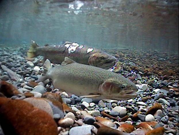
Dealing with a pipeline coming through some of the most geologically unstable country on the planet is not “trivial.”  The threat of a major oil spill on the British Columbia coast is not “trivial.”

I’ve attended, listened to the remote webcast or read the transcripts of much of the hearings. None–none– of the testimony can remotely be considered: “Much of it is just junk, to jam up the system.”

A fair estimate would say that 95 per cent of people who registered to comment live along the pipeline route or the BC coast. At least a dozen or more letters of comment are posted on the JRP site every day, which means thousands since Levant wrote the diatribe,  and it is clear that they are written by individuals with valid concerns, and none in recent months are form letters. (I check them, I doubt if Levant does)

In that column, Levant goes on about JRP chair Sheila Leggett:

She’s Stephen Harper’s bureaucrat, but she’s taking direction from foreign meddlers. For “whatever time it takes.”

What a fool. No court would permit such a gong show. And Leggett has court-like powers.

Last month, when Barack Obama delayed the Keystone XL pipeline from the oilsands to the U.S., Harper was appalled.

But Leggett was appointed by Harper. And she just pulled an Obama on our own country.

Leggett must be fired. Her job is not to listen to everyone in the world with an Internet connection. It’s to make the best decision in Canada’s interest.

Her Oprah-style hearings are unacceptable, and Harper should make that clear by sacking her.

Leggett was not fired. In fact, over the past six months, she has had a difficult time confining testimony to the narrow rules of evidence that do not permit someone to actually say they oppose the pipeline.  An intervenor had to testify “from personal knowledge” or if First Nations “from traditional knowledge.” So no hearings came close to being “a gong show.”

There hasn’t been a single “foreign meddler” testify in the past six months (although some intervenors, including the energy companies themselves, use experts from outside Canada).

In a later column, on January 7, 2012, the weekend before the hearings began here in Kitimat, Levant again toed the conservative party line in Pipeline review hearings allowing foreign input is ridiculous — we don’t need another country’s permission. It’s all Canada, Levant again repeated his big lie.

Those who testified at the Kitamaat Village hearings in the following days were from the Haisla Nation as well as Douglas Channel Watch and the Kitimat Valley Naturalists (both groups consist of mainly retired Kitimat residents).  There wasn’t a foreign billionaire in sight. Same with the hearings in the days and weeks that followed, First Nations, fishers, hunters, guides, birders, and yes environmental groups. (How dare those BC NIMBYs get in the way of an Alberta pipeline and its manifest destiny?)

In today’s SunMedia article, Environment Canada cautioned:

A spokesman for Environment Minister Peter Kent tells QMI Agency while that funding is often legally required, Kent wants to make sure “common sense prevails” in how it’s awarded.

With its majority, it is likely the Conservatives will change the rules, just as they are by abolishing DFO fisheries protection for salmon spawning streams. Again bottom line, if you support the government and you are rich, you can testify.  If you are poor, even if you are “directly affected,” tough luck.

The sad fact is that Levant has won, for now, his fight against free speech in BC, probably without knowing it.

More and more people are dropping out of the Joint Review Panel process, hearings scheduled for days now last just a day or an afternoon. That’s because given the position of Stephen Harper, Joe Oliver and Peter Kent, that the pipeline is going ahead no matter what, many of these people  who signed up to comment now see no reason to testify for 10 minutes on a subject that is a foregone conclusion. Here in the northwest, where long distance travel is concerned, it takes time and money to make the effort of participate. Why testify, if the government is going to ignore the concerns of the people who live here?

No wonder Ethical Oil sent out the celebratory tweet this afternoon.

The Conservatives have won a major in battle in their war on free speech in this country by making it not worth their while for many ordinary citizens, those who don’t have deep pockets for research and lawyers, to speak on the Northern Gateway Pipeline, at least before the Joint Review Panel. Now Harper government wants to cut off funds for the poorer intervenors.  If that happens, more opponents will drop out of the proceedings.

Kay, in his attack on the hate law calls it a  “system of administrative law that potentially made de facto criminals out of anyone with politically incorrect views about women, gays, or racial and religious minority groups.”

The National Post’s conservative friends (in its own newsroom and both in and out of Parliament)  are now looking for ways to make “defacto criminals out of anyone with the politically incorrect” view that the Northern Gateway Pipeline is not a new version of the “national dream.” After all,  Stephen Harper’s statement today means “that doing things contrary to government policy” is now politically incorrect.

Of course, if the pipeline breaches along the Kitimat River and the town is without a drinking water system for up to four years (in the worst case scenario), it will be Kitimat’s nightmare, not Canada’s. (In Don Mills, columnists will still be able to drink Toronto’s water or, perhaps, run to the corner store for a Perrier.)  If a bitumen tanker hits the rocky coast and sinks in the deep  cold-water fjords, it will largely be BC’s nightmare, and the BC taxpayers’ nightmare, not Edmonton’s or Toronto’s. If a pipeline buried under nine metres of west coast snow in a remote valley has a small–undetectable by computer– breach  in the darkest days of January and  the ongoing oil leak isn’t discovered for weeks or months, by that time it might also be “politically incorrect” for anyone Canada to object. (Of course, people in the region will object and strongly).

The fact is that these small c and large C conservative campaigns  against hate laws in terms of “free speech” are nothing more than the rankest hypocrisy. What most (not all) conservatives want is free speech for their ideas and only those ideas, especially if they want to shout their own hatred of certain groups from the rooftops or on the world wide web, while at the same time, many conservatives have been trying to shut down anyone with opposing views.

To a conservative, the freedom of speech and the freedom of religion that still drives too many numbers of gay teenagers to suicide, is always protected free speech, no matter the body count.

On the hand, to the same conservatives, free speech in Canada doesn’t include protecting the environment of the only planet we live on, especially if a small portion of the funding that speech comes from California. In conservative Canada, free speech belongs to American (that is foreign) oil billionaires like the Koch brothers. To conservatives, free speech does not apply to local BC groups, coalitions of often left-wing environmentalists and  often conservative anglers and hunters, trying to protect wild salmon.

Where’s George Orwell when we need him? In the Canada of Stephen Harper, the National Post and Sunmedia,  homophobic hatred is protected, preserving the planet is not protected.  In Canada in 2012 (or I should I say 1984+), the only acceptable political speech is support for the bitumen sands and the pipeline projects.

And you wonder why the public has such contempt for majority of politicians and most of the media?

Related links:

Editorial: Just asking: why didn’t anyone object to the Americans at the NEB LNG hearings in Kitimat?

Joint Review media analysis Part one: Calgary Herald columnist advocates curbing free speech on the Northern Gateway Pipeline hearings

(Deborah Yedlin of the Calgary Herald was another columnist who advocated limiting the number of people appearing before the Joint Review Panel. Perhaps this is another case of free speech for Albertans, but not people in BC?)