Oliver confirms Kitimat to become a public port

Joe Oliver
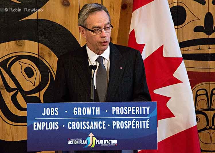
Minister of Natural Resources Joe Oliver answers a reporter’s question during a news conference in Terrace, March 19, 2013 (Robin Rowland)

Joe Oliver, the Minister of Natural Resources, has confirmed that the federal government intends to make Kitimat a public port.

Oliver was in Terrace, March 19, 2013, to announce the appointment of Vancouver lawyer Douglas Eyford as “Special Federal Representative on West Coast Energy Infrastructure.” Eyford’s job will be to “engage aboriginal communities in British Columbia and Alberta that are most likely to have an interest in West Coast energy infrastructure.”

Oliver was asked to confirm statements on the Transport Canada website that Kitimat would become a public port.

Oliver replied: “The news release was accurate. What the purpose is to make sure that the absolute highest standards of marine safety apply in the port of Kitimat. And we have as I announced yesterday and I had spoken about before at the port of Vancouver we have an extremely robust marine safety regime in place but we want to make sure that as resource development continues and as technology improves, we are at the world class level. As I also mentioned there has never been off the coast of British Columbia a major tanker spill and we want to keep that perfect record.”

No visit to Kitimat

Oliver was also asked if he intended to visit Kitimat during his visit to the northwest (Kitimat is a 40 minute drive from Terrace).  Oliver replied, “Not in this particular visit, I have to get back [to Ottawa] There’s a budget coming and I have to be in the House for that but I certainly expect to be going up there.”

The federal budget will be released on Thursday.

At Monday’s meeting of District of Kitimat council, some members quietly expressed frustration, to say the least, that Oliver, the man responsible for pushing the Northern Gateway pipeline through British Columbia to Kitimat had not bothered to include the town in his visit to the northwest.

Members of the District of Kitimat council, which on paper at least, is responsible for the port of Kitimat (even though it is really run by Rio Tinto Alcan) also expressed frustration that no one in Ottawa gave the council advance notice of the government decision to take the port public.

Asked for comment on Oliver’s statement, Rio Tinto Alcan officials in Kitimat also seemed unaware of the government announcement and promised a statement in the near future.

Oliver’s announcement in Vancouver Monday about a “world class” marine safety system and today’s announcement about the appointment of Douglas Eyford, appear to be a campaign by the Harper government to establish a stake in the middle ground in the pipeline debates, in hopes of undermining the opponents of the projects.

Skeena Bulkley Valley MP Nathan Cullen, in a news release, expressed reservations about Eyford’s appointment.

“The primary concern with the appointment, Cullen said, is that Mr. Eyford will report to the Prime Minister, not to Parliament or the public. “So, if Mr. Eyford’s report is in any way unfavourable to the Conservative pipeline agenda, what assurances do we have that his report will make its way into the public eye?

“It is also unclear how the appointment would affect Eyford’s work as the chief government negotiator for the federal government’s comprehensive land claims process, and what kind of effect his absence will have on that process.”


Coastal First Nations pull out of Joint Review Hearings in Prince Rupert

Coastal First Nations have pulled out of the Joint Review hearings in Prince Rupert.

In a news release, Art Sterritt, executive director said:

This is a David and Goliath scenario, said Art Sterritt. “It seems the only party that can afford this long and extended hearing process is Enbridge and, perhaps, the Federal Government. The average citizen can’t afford to be here and the Coastal First Nations cannot afford to be here.”

Sterritt, the executive director of the Coastal First Nations, said pulling out was a difficult decision because the Emergency Response Panel is dealing with important issues. “We planned to ask questions that included: does diluted bitumen sink; how quickly can a spill be responded to and how effective can cleanup be; how long will spilled oil remain in the ecosystem and what are the costs of a spill cleanup and who will pay.”

It is clear that more scientific study is needed on emergency preparedness, he said. “Despite the lack of information it is continuing with the process. Ultimately this means the JRP will not have the information it needs to make an informed recommendation and that in turn means the Federal Government will be making decisions not based on science.”

The funding disparity isn’t the only JRP issue the Coastal First Nations is unhappy with. “We are dismayed with the nature of the hearing process itself. Enbridge witnesses are not answering questions or their answers are self-serving and non-responsive. We see cross-examination answers by Enbridge witnesses which are crafted with, or provided by, other persons sitting behind these witnesses who cannot be cross-examined. This does not seem fair to us at all.”

We had agreed to participate in this process on the basis that the JRP was going to be a decision-maker on whether or not the project would go ahead. Then the Federal Government unilaterally changed the decision-making process, he said. “This was blatantly unfair and smacks of double dealing – something we as First Nation have become accustomed to with this government.”

Coastal First Nations will continue to monitor these proceedings and we will do what we can to participate given our limited resources, Sterritt said. “We are profoundly disappointed with the nature of this process. Taken together these problems undermine the legitimacy and authenticity of the hearing process, our pursuit of the true facts and, ultimately, a just result.”


Other groups and individuals have also long complained about the growing expensive of travel and monitoring costs for the Joint Review process.
 

DFO study on ancient Douglas Channel tsunamis shows minimal impact on Kitimat, devastation at Hartley Bay

A follow up study by the Department of Fisheries and Oceans on the discovery of prehistoric slope failure tsunamis in Douglas Channel concludes that the events would have had minimal impact on Kitimat but would have destroyed Hartley Bay.

The studies were filed by DFO with the Northern Gateway Joint Review Panel on Friday, November 16, following an earlier study the Geological Survey of Canada that reported the discovery of the submarine slope failures. The filing comes just three weeks after the region was shaken by a 7.7 magnitude earthquake off Haida Gwaii and a subsequent coast-wide tsunami warning.

The DFO follow up study was aimed at better understanding the dynamics of tsunamis during the two slope failure events on the southern end of Hawkesbury Island during the mid-Holecene period, between 5,000 and10,000 years ago.

The wave dynamic model study does not address the discovery by the Geological Survey of Canada of a possible fault line along Hawkesbury Island which could have been the cause of the slope failures.

The study estimates that the wave amplitude of the first tsunami reaching the proposed Enbridge Northern Gateway terminal site near Kitimat would have been about .09 to .12 metres. Since the actual wave height hitting land from a tsunami is one half of the amplitude, the height of tsunami waves reaching Kitimat at the time would have been about 60 centimetres or 23 inches. At Hartley Bay, on the other hand, the maximum estimated wave amplitude from the second tsunami would have been 15 metres, meaning a wave height of 7.5 metres or about 25 feet.

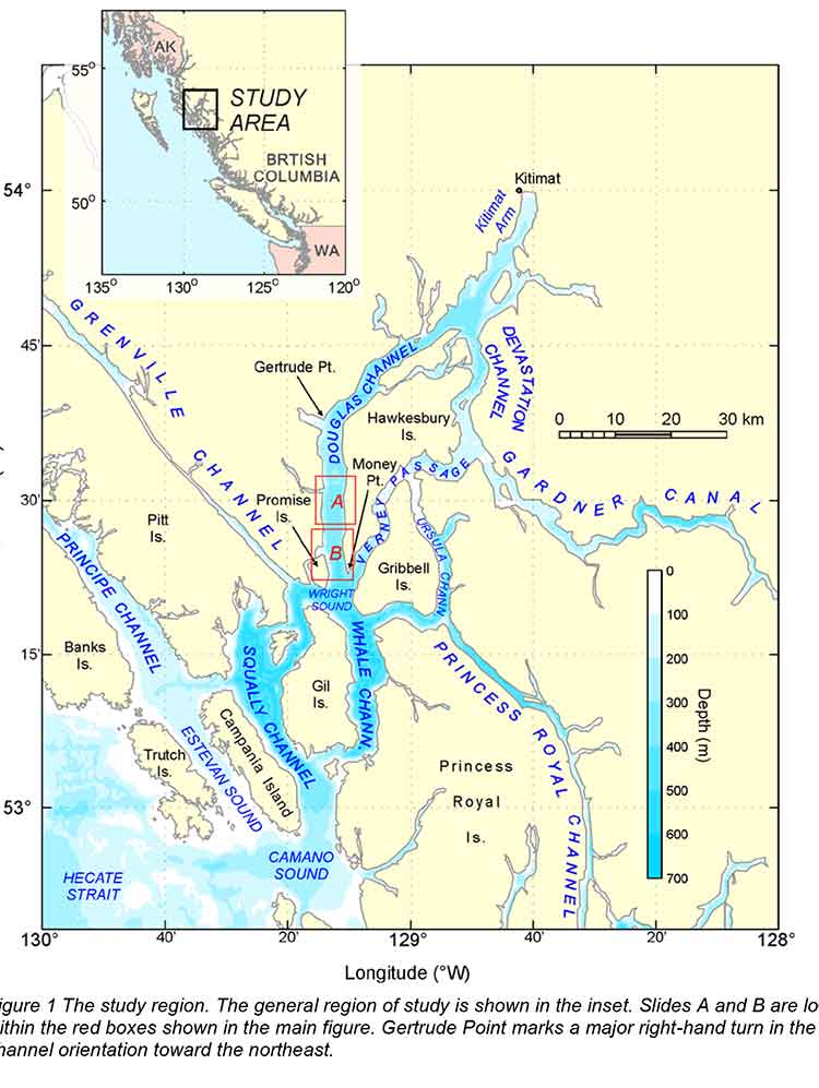
The main reason for the difference is that both the submarine slope failures occurred south of  the dogleg in Douglas Channel at Gertrude Point. That meant the configuration of the channel from Gertrude Point up to Kitimat would lessen the amplitude whereas because Hartley Bay was so close, it would be hit by a higher amplitude. The report says that because of their relatively short wavelengths, the tsunami waves undergo multiple reflections that the “high degree of scattering from the complex shoreline and bottom topography in Douglas Channel” would “combined with the flux of tsunami energy through adjoining waterways and channels” have caused a rapid decrease in the energy of the waves with distance south and north of the slide area.

The study also points out a crucial difference between the ancient slides and the two that occurred near Kitimat in 1974 and 1975, while the land near the head of the Kitimat arm were largely composed of material laid down by the glaciers, the large slope failures on Hawkesbury Island were blocks of an extremely hard igneous rock called diorite. Each of the prehistoric slides would have consisted of about 65 million cubic metres of rock.

The DFO report says

Coastal British Columbia is an area of steep slopes, extreme seasonal variations in soil moisture, large tidal ranges, and the highest seismicity in Canada. Hazards of this form have been well documented for the coastal region of British Columbia, and other fjord regions of the world’s oceans, including Alaska and Norway. These factors increase the potential for both submarine and subaerial slope failures in the region. Such events generally take place in relatively shallow and confined inner coastal waterways, and can present hazards in terms of tsunami wave generation.

The two prehistoric submarine slides are located about 10 kilometres apart on the
slope of southern Douglas Channel, near the southern end of Hawkesbury Island

The report says:

The failures are defined by scallop-shaped hollows located along the edge of the fiord wall and appear to be associated with detached blocks that extend out several hundred metres into the channel. The two block slides identified in Douglas Channel are characteristic of rigid-body submarine landslides, which differ considerably from the well-documented viscous submarine landslides with a lower specific gravity (density relative to water) of about 1.5 that occurred to the north of Douglas Channel along the inner slope of Kitimat Arm in 1974 and 1975.

The report’s modelling is “considered minimum values” because the do not include debris that would have spread into the fiord after initial slide. That debris is now buried by a thick layer of post-slide sediment.

DFO diagram of the model of Slide A on Hawkesbury Island (DFO)

The reconstruction model shows that the head of the more northern slide began at a depth of around 60 to 100 metre, while that of the more southern slide began at a depth of 75 to 120 metres.

The slides would have moved down slope at about 25 metres per second, coming to rest after about 30 seconds, 250 to 350 metres from the slope at a depth of 400 metres.

The northern slide, called by the scientists Slide A:

would have generated extremely large waves in the immediate vicinity of the failure
region within a minute of the submarine landslide. Waves in the numerical simulations reach amplitudes of 30 to 40 metres at the coast near the slide area

Submarine landslides cause delays between the arrival of the first waves and the arrival of subsequent higher waves, increasing in distance from the slide, because of “reflections and non-linear interaction” along the shoreline. For Slide A, the maximum wave amplitudes at Hartley Bay would have been six metres (meaning three metre waves) “Large amplitude waves with typical periods of around 50 seconds would continue for several tens of minutes.”

The leading tsunami waves generated by Slide A reach Kitimat Arm in roughly 20 min and have small amplitudes of only a few centimetres. Although later waves have higher amplitudes, the maximum wave amplitudes (which occur 50-55 minnutes after the failure event) are still only around 0.09 to 0.12 metres.

The southern slide on Hawkesbury, called Slide B by the scientists, would have moved 400 metres before stopping. It stared at a greater depth than Slide A, with not as much vertical displacement than Slide A. That means Slide B was slower than Slide A.

Slide B:

would have generated large waves in the vicinity of the failure region. Simulated waves reach the coast adjacent to the slide region within a minute of the failure event, with wave amplitudes of up to 10 metres. The waves also hit the opposite site of the channel within a minute of the failure event and then take an additional minute to reach Hartley Bay where waves reach amplitudes of 15 metres/ Powerful oscillations in the bay last for tens of minutes.
Waves with high amplitudes (more than 2 metres) also occur in the southern part of Douglas Channel, and in certain locations of Verney Passage.

According to the models, the leading tsunami waves would have reached the Kitimat Arm 22 minutes after the start of the slide. The maximum waves would have had amplitudes of 0.08 metres to 0.3 metres (6 inches), reach the Kitimat Arm 45 to 60 minutes after the start of the failure event.

The the tsunami waves generated by Slide B that impact Kitimat Arm,  although still of low amplitude, were somewhat higher than those generated by Slide A, despite the fact that Slide B was located further to the south and generated less energetic waves in the source region than Slide A.

This seeming paradox is explained by the slower motion of Slide B, which causes it to generate more wave energy in the low frequency band…Due to their reduced scattering and reflection, the relatively long and lower frequency waves generated by Slide B propagate more readily through the complex fjord system than the relatively short and higher frequency waves generated by Slide A.

Specifically addressing the proposed site of the Enbridge bitumen terminal, as well as potential tanker traffic in Douglas Channel, the detailed explanation of the modelling accompanying the DFO report says:

If similar submarine slides were to occur again somewhere in the same general area, they could present a significant risk to navigation and to nearby shore installations and coastal communities….

As with the tsunami generation regions, the highest waves and strongest currents in any particular region of the coastal waterway would occur near the shoreline. Based on the numerical findings, tsunamis generated by submarine landslides of the form identified for the southern end of Douglas Channel would have heights and currents that could have major impacts on the coastline and vessel traffic at the time of the event throughout much of Douglas Channel, but a minor impact on water levels, currents and hence vessel traffic in Kitimat Arm. Hartley Bay, at the southern end of Douglas Channel, would be impacted by high waves and strong currents, whereas Kitimat, at the northern end of Kitimat Arm, would experience negligible wave effects. Additional modelling would be required to assess the characteristics of possible tsunamis originating beyond the area of the two identified slope failures.

At the estimated propagation speeds of about 65 metres per second, the detailed model says it takes roughly 10 to 15 minutes for the simulated waves to propagate approximately 40 to 45 kilometres to the intersection of Douglas Channel and Kitimat Arm, where peak wave amplitudes would be diminished to less than one metre. It takes another 15 minutes for the waves to reach sites near the proposed Enbridge facilities in Kitimat Arm where wave amplitudes would be reduced to a few tens of centimetres and associated currents to speeds less than a few tens of centimetres per second.


Slide tsunami area map
Slide tsunami area study map (DFO)


Fisheries and Oceans-Modelling Tsunamis Associated with Recently Identified Slope Failures in Douglas Channel  (pdf)

Numerical data for DFO tsunami study (link to JRP)


Douglas Channel in Black and White

[photoshelter-gallery g_id=”G000034M5Z2_lI4Q” g_name=”Douglas-Channel-in-black-and-white” f_show_caption=”t” img_title=”iptch” pho_credit=”iptc” f_link=”f” f_send_to_friend_btn=”t” f_fullscreen=”t” f_topbar=”t” f_bbar=”t” f_htmllinks=”t” f_mtrx=”t” fsvis=”f” width=”615″ height=”461″ f_constrain=”t” bgcolor=”#AAAAAA” btype=”new” bcolor=”#CCCCCC” crop=”f” trans=”xfade” tbs=”10000″ f_ap=”t” bgtrans=”f” linkdest=”c” twoup=”f” f_bbarbig=”” f_enable_embed_btn=”f” f_show_watermark=”f” f_show_slidenum=”f” f_smooth=”f” f_up=”f” target=”_self” wmds=”llQ6QNgpeC.p1Ucz7U.Y5p9TTphsaUCWglrsuG3u3BJwmfV6PzC2SqyK_HnEz4rFhVjU4A–” ]

Photogallery. For full screen mode with captions, click on the box to the right of the bottom menu bar.

The long, magnificent fjord known as Douglas Channel was carved by a glacier thousands of years ago, some of the islands are rock uplifted by tectonic forces, others piled up by retreating glaciers.

So far, since I returned to Kitimat, I have had few chances to “go down the Channel,”  as the people of Kitimat say.

Of course, when I do go,  I always have a camera with me, even in the roughest weather–and the Channel can be rough most of the year.

It is in these waters that the energy industry, both the Enbridge Northern Gateway and the Liquefied Natural Gas projects want to use supertankers to send their products to markets in Asia. Many of the photographers who come to Douglas Channel in high summer choose to capture the brilliant colours of ocean, forest and mountain, as I have on several assignments.

For this gallery, I have chosen to use black and white to show the stark beauty of the mountains, the often menacing seas and the clouds, ever changing, as the westerly winds from the Pacific drive those clouds against the mountains.

Images from this gallery are available for purchase for personal, editorial and commercial  use on Photoshelter. Simply click on the image above.

JRP denies most requests from Coastal First Nations to question BC on Northern Gateway

The Northern Gateway Joint Review Panel has denied four out of the five requests from Coastal First Nations to question the province of British Columbia about its position on the controversial pipeline and tanker project. A decision on the fifth request is reserved pending a response from the province and other parties.

So far, the province has not participated in the Joint Review hearings nor has it filed any evidence.

A five part motion by the Coastal First Nations was an attempt to compel the government of Premier Christy Clark to participate.

The motion requested

a) compel the Province of British Columbia (Province) to file a technical report that was reported on in the Globe and Mail on 3 June 2012;

b) compel the Province to file any other reports or assessments it has;

c) allow intervenors to file information requests on any evidence filed by the Province;

d) compel the Province to indicate whether or not it will issue a Certificate for the
Project pursuant to the BC Environmental Assessment Act; and

e) compel the Province to indicate whether it intends to consult with First Nations on the
Project, and if so, how and when.

The JRP reserved its judgement on the request on item (a) to release the report mentioned in the Globe and Mail. A few days after Coastal First Nations made the request, lawyers representing the province requested an extension to respond to the CFN motion. The JRP gave both BC and Northern Gateway until July 16 to respond and then the CFN has until July 20 to reply.

On item (b) forcing the province to release other assessments, the JRP ruled that the information requested was “unclear and excessively broad” and so the request was denied.

On item (c) allowing intervenors to question on evidence from the province, the JRP ruled that Coastal First Nations had requested “a blanket right for parties to ask information
requests on evidence that is not yet filed.” The JRP said “ not persuaded that all parties ought to be given a blanket right to ask information requests on evidence that is not yet filed” and denied the request. The JRP added: “If a party believes it needs to ask a late information
request (as opposed to asking a hearing question) on specific evidence, the Panel will consider
that request.”

On items (d) and (e) the panel cited constitutional concerns, saying it related to authorizations in provincial jurisdiction and ruled “No justification is provided as to why this
information would be relevant to the federal review….” The JRP said it was “persuaded that it has any legal authority over these areas of provincial jurisdiction, or that it would be appropriate or relevant to the federal review, to obtain information about provincial affairs.”

JRP Ruling No 60 CFN Notice of Motion

Enbridge question on “marine vessel activity” on Douglas Channel gets obvious answer from the Haisla

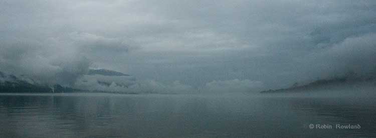
Fog shrouds Kitimat harbour
Fog and low clouds shroud Kitimat harbour on the morning of June 27, 2012. (Robin Rowland/Northwest Coast Energy News)

If there is a major disconnect between the people who live in the Kitimat region and the rest of Canada, it is the question of vessel traffic on the Douglas Channel, with Enbridge spinning that there is already major tanker traffic on the Channel.

This section from the Northern Gateway website, is often quoted by Enbridge supporters, the vast majority of whom live in Alberta, thousands of kilometres away, have never been to Kitimat, but, somehow from Calgary or Fort McMurray,  claim to know more about the Douglas Channel than people who live in Kitimat, including those who have sailed Douglas Channel for decades.

On its website Northern Gateway claims

According to numbers from the Port of Kitimat, not only have vessels carrying industrial products been travelling the channels safely for some 35 years, but so too have ships carrying petroleum products—like the one featured arriving in the Port of Kitimat through the Douglas Channel in the picture above.
In fact, some 1,560 vessels carrying methanol and condensate called on Kitimat port from 1982 to 2009 – that’s over 3,100 transits of vessels dedicated to the transport of petroleum products.
When you add vessel traffic of all industrial activity into Kitimat port, the number jumps to 6,112.
To be clear…the number of ships servicing industry arriving at Kitimat port between 1978 and 2009 is 6,112. That’s 12,224 transits!

So in its questions to the Haisla, Enbridge asked:

c) Please confirm that the Haisla Nation is aware of existing and proposed
marine vessel activity within its Traditional Territory, including:

(i) fuel barges

(ii) cargo/container ships

(iii) commercial fishing vessels

(iv) condensate tankers

(v) liquefied natural gas tankers


Enbridge’s question was an obvious attempt to enhance their spin on vessel traffic on the Douglas Channel, by fishing for an admission that large vessels already ply the Channel, something the residents of the Kitimat, both First Nations and non-aboriginal already know well.

In its response, the Haisla Nation replies:

The Haisla Nation is aware of the existing and proposed marine vessel activity within its Territory, including fuel barges, cargo/container ships, commercial fishing vessels, condensate tankers, and liquefied natural gas tankers.

The Haisla Nation is also aware of the increased cumulative effect of additional marine vessel activity as projects are approved. The presence of this shipping increases the significance of the potential impacts of the project on Haisla Nation aboriginal title and rights, through cumulative impacts.

The Haisla Nation is responsible for some of the vessel traffic within its Territory, with modern forms of transportation having replaced canoes. Until legal developments in the early 2000s which have defined the content of the honour of the Crown with respect resource decisions and potential impacts on First Nations, the Haisla Nation had little say about the projects with associated vessel traffic in its Territory.

While standard petroleum product tankers, many carrying condensate, a natural gas product, have been visiting Kitimat for years, there have. so far, been no supertankers, much less Very Large Crude Carriers. No bitumen carrying tankers have visited Kitimat, a fact always ignored by the region’s critics in Alberta and by Enbridge on its website.

Not only the filing by the Haisla Nation but most of the testimony at the recent public comment hearings in at Kitamaat Village, were about the fear of the growing cumulative effect of greatly increased tanker traffic on the Channel.

Alterra acquires coastal island wind farms to supply LNG plants, but how will it get to Kitimat?

Updated with Alterra comments.
Alterra Corp logoA Vancouver-based energy company, Alterra Power Corp, today, May 18, 2012, announced the acquisition of three wind farm sites off the northernwestern British Columbia coast.

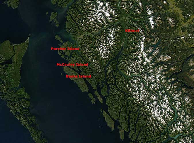
A news release from Alterra notes that the three “early-stage wind farm” sites, on Banks Island, Porcher Island and McCauley Island are “all within 150 kilometres of several proposed power-intensive LNG plant sites at Kitimat.”

The three sites plus one on Vancouver island will have an estimated generation capacity of over 1,000 megawatts for the four sites.

Alterra acquired the sites from English Bay Energy Limited. Alterra says “the sellers will receive royalty payments during the operations phase of the projects, and under certain circumstances the sellers may receive additional compensation of up to 1.34 million Alterra shares.”

The release quotes John Carson, Alterra’s Chief Executive Officer, as saying, “This transaction further positions us to play a major role in B.C.’s clean energy future. We look forward to advancing and ultimately building these wind projects as a part of the continued growth of Alterra and British Columbia.”


Satellite map of BC showing Kitimat and wind farm locations
A satellite image of northwestern BC showing the location of Kitimat and the three islands that are the location of the proposed windfarms to supply to Kitimat’s LNG projects. (Satellite image NASA/MODIS)

When informed of the announcement, Kitimat mayor Joanne Monaghan asked, “How are they going to get it here?”

While the three islands are within 150 kilometres of Kitmat, any transmission lines would have to somehow cross the Inside Passage and its heavy ship traffic, including cruise ships, ferries, fishing vessels and bulk carriers (not to mention potentially tankers),  and then also get over some of the most rugged mountain territory in Canada to reach any of the three liquified natural gas sites in Kitimat.

“I know that all of the LNG plants considering coming in here, including Shell, are talking about co-gen [co-generation of electricity using natural gas], because if they don’t do co-generation they’re going to have to bring all of this in from the Site C Dam and that is going to make it totally out of the range of their price,” Monaghan said. She also remarked that the cost of building transmission lines from the three off shore islands could also be prohibitive.

Alterra spokesman Anders Kruus said that supplying power from the islands to Kitimat a major consideration but added it  “would not be an insurmountable problem.”

He said the company’s predecessor before a merger, Plutonic Power, had built “the province’s largest run-of-river hydro facility at Toba Inlet not far from Powell River  (80 kilometres) and in the process of building that, beause the run-of-river facilty was quite far back, not accessible by roadway, you have to barge in, we built a 120 kilmetre long tranmission line out to Saltery Bay. So we’ve done it over the mountains.”  Kruus said.

“It’s early days,” Kruus said and the company now plans to compile more wind data before proceeding.  He acknowledged that the “intermittency of the wind” could be a problem with an LNG plant that requires a consistent, balanced power load and so the best “off-taker” (customer) for the wind energy electricity might likely be BC Hydro who could balance the power from the project within  its own system before supplying it to customers.

On its website, Alterra Power Corp describes itself as

a leading global renewable energy company, formed in 2011 through the merger of Magma Energy Corp and Plutonic Power Corp.  We operate six power plants totaling 570 MW of capacity, including two geothermal facilities in Iceland, a geothermal plant in Nevada, British Columbia’s largest run of river hydro facilities and the province’s largest wind farm. Our 300 MW share of production generates over 1,400 GWh of clean power annually. We have an extensive portfolio of exploration and development projects, a skilled international team of explorers, builders and operators as well as the strong financial capacity to support our aggressive growth plans.

More oil leaking from sunken WWII US transport near Hartley Bay, Gitga’at warn

Oil slick in Grenville Channel (Gitga`at First Nation Guardians)

The Gitga’at First Nation at Hartley Bay report that a large oil slick  has been spotted in Grenville Channel near Hartley Bay.  It is believed that the oil is coming from the  USAT Brigadier General M.G. Zalinski, a U.S. army transport ship that sank in 1946 with 700 tonnes of bunker fuel on board.

A news release from the Gitga’at says the oil spill is between  between two and five miles (four to eight kilometres) long and 200 feet wide (70 metres) inside the Grenville Channel.

A Canadian Coast Guard vessel from Prince Rupert is expected in the area sometime this afternoon.

The Gitga’at are sending their own Guardians to take samples and have chartered a plane to take aerial photos of the spill, the release says.

“If this spill is as big as the pilots are reporting, then we’re looking at serious environmental impacts, including threats to our traditional shellfish harvesting areas,” says Arnold Clifton, Chief Councillor of the Gitga’at Nation. “We need an immediate and full clean-up response from the federal government ASAP.”

The USAT Brigadier General M.G. Zalinski was carrying Bunker C when it sank. The First Nation says the Canadian government has been saying it would remove the oil and munitions from the ship since 2006, but with no results.

“Right now we’re focused on getting a handle on the size of the spill and the clean-up that’s required,” says Clifton. “But this incident definitely raises questions about the federal government’s ability to guard against oil spills and to honour its clean-up obligations. As a result, our nation has serious concerns about any proposal to have tankers travel through our coastal waters, including the Enbridge proposal.”

The spill is just the latest in a series of spills of bunker oil and diesel coming from the Zalinski and the BC Ferry Queen of the North, which sank in 2006. Despite government assurances of clean-up, both wreckages continue to leak fuel, fouling the marine environment, and heightening the fear of future oil spills.

The Gitga’at depend on the ocean for 40 per cent of their traditional diet.

According to Wikipedia, the Zalinksi was enroute from Seattle to Whittier Island, Alaska, when it struck rocks at Pitt Island on Grenville Channel 0n September 26 1946, 55 miles (88 kilometres)  south of Prince Rupert. The ship sank within twenty minutes, while her crew of 48 were rescued by the tug Sally N and the passenger steamer SS Catala. According to a report in The Vancouver Sun on  September 30, 1946, at the time of her sinking she was transporting a cargo of at least twelve 500-pound (230 kg) bombs, large amounts of .30 and .50 caliber ammunition, at least 700 tonnes of bunker oil, and truck axles with army type tires.

Oil was first spotted leaking in Grenville Channel in 2003 and the wreck of the Zalinski was identified later that year by a remotely operated undersea vessel.

Hartley Bay is the entrance to Douglas Channel where tankers will go to Kitimat for the proposed Northern Gateway pipeline and three liquified natural gas projects.


BC approves Pacific Trails Pipeline amendments

Anti-Pacific Trails Pipeline banner
A couple from Vancouver, who refused to give their names, unfurl an anti-Pacific Trails Pipeline banner at the British Columbia legislature in Victoria, Sunday, April 15, 2012. The man said he against all pipelines and that he was supporting the Wet’suwet’en First Nation. About 1,000 people marched through downtown Victoria to oppose the Enbridge Northern Gateway pipeline and coastal tanker traffic. (Robin Rowland/Northwest Coast Energy News)


The BC Environmental Assessment Office has approved an application to increase the capacity of the proposed 463 kilometre Pacific Trails Pipeline from the Summit Creek natural gas hub near Prince George to Kitimat.

The $1 billion pipeline project is crucial to the success of the KM LNG liquified natural gas export terminal at Kitimat, a partnership of Apache Corp., Ecana and EOG Resources.

The main thrust of the application was to increase the capacity of the pipeline to 1066.8 mm (42 inch) from the originally proposed 914 mm (36 inch). Pacific Trails will change the location of pump stations since the original proposal was for an import pipeline while now it is for export. There are also minor changes.

The proposal was generally considered pro forma since the main environmental review was completed under the original application approval in 2008 and the BC government was only considering the changes proposed by PTP.

The government report says officials were convinced that Pacific Trails would be able to handle problems with increased traffic and any potential risk involved in drilling under watercourses.

The Haisla submitted a number of technical questions about the impact of the larger pipes. While the BC Assessment office noted in its report that the Pacific Trails Pipeline is generally outside Haisla traditional territory, it is clear from the documentation that one of the Haisla concerns are any impacts on the Kitimat River watershed, as the questions concern the Stuart and Endako Rivers, the Morice and Gosnell Creeks and Weedene and Little Wedeene Rivers. The EAO ruled that the Haisla questions were outside the scope of the amendment or should be addressed in the “permitting process.”

Some Wet’suwet’en houses have been vocal in their opposition to the Pacific Trails Pipeline crossing their traditional territory, The Office of the Wet’suwet’en filed a strong objection to certain parts of the plan.

Given that the Minister of Natural Resources Joe Oliver and the federal government are now working to fast tracking all major resource projects, a comment from David de Wit, Wet’suwet’en natural resources manager is significant:

Fast tracking projects may result in overlooking important details [that] can have detrimental consequences. It is important to point out that the diligence required post-certification to ensure that impacts and effects on important resources are prevented or avoided is not satisfactory. This leaves the burden and legacy of any impacts to be borne by the Wet’suwet’en.

The letter goes on

We have invested considerable time and resources in the BC EAO review only to find that the level of detail required pre-certification leaves far too many unanswered questions critical for ensuring environmental effects and identification of potential infringements to our Title and associated rights from the project are avoided or minimized.

The EAO responded by saying the issues were covered by the original assessment and through the Oil and Gas Commission permit process. The letter from the Wet’suwet’en was, however, passed on to the Executive Director for further consideration

The Pacific Trials Pipeline, also known as the the Summit-to Kitimat pipeline will supply the Kitimat LNG project, a venture of the KM LNG partners, Apache Corp., Encana Corp., Apache Canada and EOG Resources. The $4.5-billion LNG terminal and facility will likely be operational by 2015, depending on how long it takes for the partners to line up Asian buyers.

Documents

BC Environmental Assessment office ruling on Pacific Trails Pipeline  (pdf)

Wet’suwet’en submission to the BC EAO  (pdf)


Enbridge presents strong case for marine safety planning

Enbridge made its strongest public case yet Tuesday, March 13, that improvements in marine safety worldwide since the Exxon Valdez disaster in 1989, make the chances of an accident involving ships carrying bitumen and condensate in Douglas Channel and the BC Coast highly unlikely.

But one of Enbridge’s own invited experts somewhat undermined the case by pointing out that in the event of a major tanker incident (as unlikely as Enbridge believes it may be) the resources of the federal and provincial governments are spread far too thin to deal with a major disaster.

The Enbridge Community Advisory Board held a public meeting Tuesday at Mt. Elizabeth Theatre, with three guests presenting a case that they also gave to the regular meeting of the advisory board earlier in the day.

The three guests were Capt. Stephen Brown, of the BC Chamber of Shipping, Capt. Fred Denning, of British Columbia Coast Pilots and Norm Fallows, an emergency response officer with the BC Ministry of the Environment, based in Smithers.

There were only a few dozen people in the theatre for the presentation, compared the full house for last year’s community forum that was sponsored by the District of Kitimat. One reason may be that many Kitimat residents preferred being in the stands for the Coy Cup hockey championships at Tamitik Arena rather than sitting through yet another presentation on the Northern Gateway pipeline.

Denning opened the presentations by explaining the role of the BC Coast Pilots. The BC Coast Pilots is a private firm that contracts with government’s Pacific Pilotage Authority to provide pilots to ships plying the coast of British Columbia. By law all vessels larger than 350 gross registered tonnes are required to use a marine pilot.

Both in his presentation and in the question and answer period, Denning stressed that pilots are traditionally independent from government and industry, with the responsibility to ensure the safety of shipping.

In the question and answer period, when an audience member pointed out that under the Transport Canada TERMPOL process, use of tugs in Douglas Channel and use of tethered tugs was “voluntary,” Denning replied that the pilots would be insisting on tethered escort tugs for tankers on Douglas Channel.

He explained that BC pilots are highly experienced mariners, usually with 25 years or more experience on the coast, the majority of that time as a ship’s officer. An applicant to become a pilot is put on a waiting list, and if accepted, then is trained both on ships and simulators and serves a six to 12 month apprenticeship.

He said that BC coastal pilots have a 99.89 per cent incident safety record.

BC pilots now carry a large laptop called a Portable Pilot Unit, which operates independent of the ship’s navigation and computer systems gathering navigation and other data, as a redundant safety system.

Denning expects that marine traffic on the BC coast will continue to increase because the ports of Vancouver and Prince Rupert are the closest to Asia by the Great Circle routes. Both cargo and the energy projects, whether the Enbridge Northern Gateway or the the liquified natural gas terminals will mean more ships and more work for the pilots.

The pilots are always consulted in the development of any new traffic or terminal projects in BC. Including design, testing the ship’s courses in simulators, recommending new navigational aides and training for the pilots. Pilots were consulted during the development of Deltaport and Fairiew container terminals as well as the cruise ship terminals in Victoria, Nanaimo and Campbell River.

The pilots are being consulted on both the Enbridge and LNG projects at Kitimat as well as the proposed expansion of the Kinder Morgan facility in Vancouver. For the existing Kinder Morgan terminal, pilots were involved in creating navigation aides and tug procedures for the Second Narrows.

Stephen Brown is a member of the Community Advisory Board as well as representing the Bureau of Shipping. He began with a detailed timeline of how shipping regulations have been tightened over the years since what is now the International Maritime Organization, a United Nations agency, was founded in 1948. He said the Exxon Valdez accident in 1989 triggered even tighter regulations, including the 1990 US Oil Pollution Act passed by Congress which required all ships have containment capability and a spill clean up plan. The act also ordered US shippers to phase out single hulled tankers beginning in 1995. In 1992, the IMO adopted a similar measure.
Since the 1990s, there have been new regulations preventing the dumping of ballast and creating higher standards for crew and officer training, including hours of work, watch keeping standards and environmental awareness.

Brown then went on to discuss shipping in narrow waterways which he said were similar to Douglas Channel, including the Straits of Dover between Britain and France, the Straits of Malacca between Singapore and Malaysia and the island of Sumatra, the Dardanelles and Bosporus Strait in Turkey (which traditionally are said to join Europe with Asia) and the Panama Canal. All those areas, he said, see heavy shipping traffic, including tankers, each year.

The narrowest passage is in the Bosporus, which is 698 metres wide, a little less than one half nautical mile.

Comparing the Bosporus with Douglas Channel, Brown said Douglas Channel is much wider, about three kilometres, meaning that inbound and outbound ships can pass a half kilometre apart.
He went over how tanker management has improved with double hulls and better overall construction standards,vetting of ships and crews, and creating “a culture of safety and respect for the environment.”

The final speaker Norm Fallows, from the BC Ministry of the Environment Emergency Management,  outlined the current emergency response system in the province. Central to any response to a oil spill or any other hazard materials problem is the “incident command system.” also used most often for fighting forest fires. The incident command system ensures that all public agencies and the private sector are cooperating and coordinating with one overall person in charge.

The province has a “polluter pay” policy, Fallows said, meaning that the “responsible party” must pay for all the cost involved. Sometimes, int he case of a meth lab, it is the unfortunate owner of a house that may have been rented by drug dealers.

Fallows said he is one of only 10 emergency response officers stationed across the province of British Columbia, In contrast, the State of Washington, with a much smaller land area than BC, has 79.

Any response to a spill has to do the best possible in the situation, Fallows said. He gave the example of burning off an oil spill in some circumstances because that was both the most cost effective solution that at the same time in those circumstances did the least harm to the environment.

In the early part of the first decade, Fallows said, some staff at the environment department were proposing what was called “Geographic Response Planning,” which involved surveying an area for both potential hazards and solutions, and bringing in local responders including fire, police and local industry. Planning for the GRP program had minimal funding, which was later dropped by the province.

In contrast, Fallows said, the state of Washington has spent millions of dollars creating a geographic response program for that state.

In response to questions from the audience, Fallows said that adequate emergency response in British Columbia needed “more resources” from both the provincial and federal governments.