Tanker study shows huge gaps in shipping and hazard data, documents show

The study of tanker shipping and tanker spills by Genivar for Transport Canada has revealed huge gaps in how the world monitors tanker traffic.
Genivar report
Cover of Genivar tanker report (Transport Canada)

Genivar says

Accident data was acquired from three main sources: the CCG Marine Pollution Incident Reporting System (MPIRS); the Lloyd’s casualty database; and spill incident records maintained by the International Tanker Owners Pollution Federation (ITOPF).

MPIRS lists all marine pollution incidents occurring in Canadian waters (CCG, 2013), with information on the region within Canada in which the incident occurred, type of material spilled, accident cause, and estimated pollution volume with multiple entries for a given incident showing updates of incident status and pollution amounts if applicable. The primary use of MPIRS in this study was for spill incidents in the smaller size categories… for which worldwide data was suspected to be unreliable due to under-reporting. MPIRS appeared to be a comprehensive listing of incidents that occurred in Canadian waters, and a summary of polluting incidents

It goes on to note that some key data has not been updated since the 1990s, largely prior to the introduction of double hulled tankers.

As noted, oil spill accidents were compiled on a worldwide basis.

In order to estimate the frequency for Canada, an exposure variable was required.

A series of studies by the U.S. Minerals Management Service (MMS, now known as
the Bureau of Ocean Energy Management, Regulation and Enforcement) investigated the occurrence rates of tanker accidents against various spill exposure variables and found that the simplest and most reliable indicator was volume of oil transported. Simply put, it was determined that spill rates could be expressed, for a range of spill size categories, as an average number of spills per billion barrels transported.

The MMS studies were updated periodically until the 1990s but have not been revisited since, but they did show a steady decrease in the likelihood of casualties and resulting spill volumes, due to a number of factors including tanker design, increasing governance and overall scrutiny of the marine transportation industry. The phased-in implementation of double-hull tankers may have also had a beneficial effect on spill rates in more recent years, particularly in the category of very large or catastrophic events… In any case, it is important in interpreting accident data to reflect current trends and implemented mitigation measures. The focus was on cargo volumes and accident rates over the past decade.

It goes on to say the volumes of crude carried is also under-reported to Lloyds.

In the case of crude oil and refined products carried as cargo, the exposure variable was simply the volume of each respective category carried on an annual basis for the period of interest. Information from the Lloyds APEX database was used for this purpose; it reports volumes of crude and refined products shipped worldwide, with a breakdown by year, country of origin, and country of destination. Compared with similar data from Canadian sources, the APEX data appeared to significantly under-report the carriage of refined products. As a result, the accident rates estimated and used in this study are likely somewhat conservative, that is, they overstate the likely frequency of refined products carried as cargo. For all calculations involving the potential spillage of refined products as cargo in Canadian waters, and for the apportioning of spill frequency among the various sectors and sub-sectors of Canada, Transport Canada commodity traffic data was used

Again about Lloyds data, until 2010, it was limited in its monitoring of the BC Coast.

In analyzing the Canadian movement data supplied by Lloyds, a major shortcoming was found in the data in that movements recorded prior to 2010 did not include broad classes of vessels such as ferries, passenger vessels, and pilot boats. Given that these vessels comprise a significant proportion of traffic movement in many sectors, only data covering the final two years of the record, 2010 and 2011, were used in the analysis.

The Lloyds data was also limited when it came to oil spills:

One limitation of the MPIRS data was that it did not classify spills as to whether they were from “cargo” as opposed to “fuel”, which would have been helpful in this study as these spill types were analyzed separately. As a result, for spills of refined products, which could have hypothetically been either cargo or fuel, assumptions were made based on the type of vessel involved, the type and severity of the incident, and other notes within MPIRS.

A database was acquired from Lloyds that detailed all marine casualties over the
past ten years regardless of whether the incident involved pollution…
This database was used to provide a breakdown of incidents by cause, and as an
initial listing of those incidents that did result in pollution. The Lloyds data was of
mixed quality when it came to the reporting of polluting incidents, with numerous
records only partially filled out, ambiguities in the reporting of spill volume, and
inconsistencies in the classification of the spilled material. A significant effort was
made to provide consistency and accuracy in the information, including cross-
referencing with other data sources.


So the Genivar report exposes a significant gap in the available data on oil spills.

It is certainly true that the number of major tanker accidents and spills have decreased since the Exxon Valdez disaster, a point frequently made by Enbridge at meetings in northwestern BC.

The expert panel report which said that Canada faces the risk of a major tanker disaster of 10,000 tonnes or more once every 242 years.

The Vancouver Sun quoted Transport Canada spokeswoman Jillian Glover on that risk of a spill on the Pacific Coast as saying. “This value must be understood in relative terms, such that the risk is considered high compared to the rest of the country only…Canada enjoys a very low risk of a major oil spill, evidenced by the lack of Canadian historical spills in the larger categories. Additionally, this risk assessment is before any mitigation measures have been applied, so that is a theoretical number before additional prevention initiatives are taken.”

Note that the government always talks about a “major oil spill,” but it appears from the gaps in the data that predicting the possibility and consequences of a medium sized or smaller oil spill is now not that reliable, even though such a spill could have disastrous effects on a local area. According to a map in both reports, the entire BC coast is at risk for a “low to medium” spill. This echoes the problems with the Enbridge Northern Gateway pipeline, where Enbridge based most of its projections on a “full bore breach” or major pipeline break and did little about a medium sized or smaller leak. Data analysis by Kelly Marsh of Douglas Channel Watch on the possibility of the cumulative effects of a medium sized and possibly undetected pipeline breach could have just as disastrous consequences for the Kitimat valley as a major pipeline break. The same is likely true at sea.
Oil spill dangers can linger for 40 years, report shows

Genivar report
Cover of Genivar tanker report (Transport Canada)

The Genivar report for Transport Canada on oil spills say that some persistent effects can last for more than 40 years, based on a study of a spill in Cape Cod, Massachusetts. The report  notes that persistent sub-surface oil is still a problem at Prince William Sound, site of the Exxon Valdez disaster in 1989.

On long-term effects, Genivar reports: “The ingestion of contaminated food (such as oiled mussels), may represent the most important exposure pathway for aquatic fauna during a chronic
phase. Chronic exposure to contaminated sediments is also important for fauna or
vegetation.”


It goes on to stay that “large-scale oil spills might have considerable long-term
consequences on social structure and public health, interfering with traditions and
causing cultural disruptions.”

It appears that in the case of an oil-spill, time may heal some wounds, but not all of them, at least if time is considered within human lifetimes and the lifetimes of other species.

Ecological recovery is measured by how quickly individuals and populations of
species return to pre-spill conditions. It is determined by factors such as oil type,
exposure duration, water temperature, degree of weathering, spill response and the
individual and species-specific life history traits. In most environmental habitats,
recovery is completed within 2-10 years after a spill event, but in some exceptional
cases, such as in salt marshes, effects may be measurable for decades after the
event.

In the case of the Exxon Valdez oil spill in Prince William Sound… in 1989, the persistence of sub-surface oil in sediments and its chronic exposure continues to affect some of the wildlife through delayed population reductions, indirect effects and trophic interactions 20 years beyond the acute phase of the spill.

It then goes on to stay that

Four decades after the oil spill In Wild Harbor (USA), Spartina alterniflora beds had a reduced stem density and biomass and mussels in oiled locations showed decreased growth and filtration rates.

According to a Boston Globe story, published at the time of the Deepwater Horizon oil leak in the Gulf of Mexico, in 2010, the Wild Harbor, an oil barge ran aground near Cape Cod in September, 1969, spilling 200,000 gallons of fuel, some of which is still there.

The Boston Globe story noted:

Today, Wild Harbor looks much like any other Cape Cod marsh, but the oil below the surface affects its resiliency. Fiddler crabs normally burrow deep down, funneling oxygen to the roots of marsh grass. Here, they stop digging when they reach the oil, turn sideways, and burrow back to the surface. They also act “drunk’’ from the oil they ingest, and predators can catch them more easily, research shows.

The Woods Hole Oceanographic Institute has been studying the Wild Harbor spill for the past 40 years.

At a recent conference, Dr. John Teal updated scientists on the “multi-decadal effects” of the Wild Harbor spill. According a blog on the conference:

At the time of the 1969 spill, lobsters, clams, and fish died by the thousands, but most people believed the harm would be temporary, reflecting the conventional wisdom of the time. Barge owners and oil industry experts even told residents that most of the oil would evaporate and any damage would only be short-lived. However, researchers at WHOI were not so sure and immediately began cataloging species and tracking where the oil was and kept at it for years. The researchers understood that the immediate, short term effects of oil pollution were already obvious and fairly well-understood, but that everyone was rather ignorant about the long-term and low-level effects of an oil spill….

Beginning three to five years after the spill, marsh grasses and marsh animals were again occupying most of the oiled area. An observer unfamiliar with Wild Harbor would not have been able to visually detect the oiled areas after just 10 years, and by the second decade after the spill, the marsh’s appearance had returned to normal. However, the WHOI researchers pointed out that for more than a decade after the spill, an oil sheen still appeared on the surface of the water when mud from the most heavily oiled parts of the marsh was disturbed….

In 2007, WHOI researchers documented that a substantial amount of moderately degraded petroleum still remained within the sediment and along eroding creek banks of the marsh oiled in 1969. They also demonstrated that the ribbed mussels that inhabit the oiled salt marsh, and are exposed to the oil, exhibited slower growth rates, shorter mean shell lengths, lower condition indices, and decreased filtration rates even when placed in a healthy marsh. Researchers have also documented detrimental effects of the 1969 oil spill on the salt marsh plants themselves.


Related Oil Spill on the Wild Harbor Marsh by John M. Teal and Kathryn A. Burns
The Genivar report goes on to note:

Long-term effects on the population in the aquatic environment (especially on mobile fauna) are especially difficult to confirm. Benthic [bottom dwelling] invertebrates may be more at risk than fish species due to the fact that more or less sessile organisms are likely to suffer higher initial rates of mortality and exhibit long recovery times as a result of
exposure to oil-saturated habitats.

Nearshore demersal [bottom-dwelling] fish can also suffer from long-term chronic exposure, as indicated in masked greenlings and crescent gunnels by biomarkers on hydrocarbons 10 years after the Exxon Valdez spill. Mortality in sea ducks and sea turtles due to chronic exposure was also reported many years after the spill and other results indicate that effects on cetacean populations can last beyond 20 years after the acute exposure phase.

As for the recovery of the economy after a spill, Genivar notes it is based “on the time required for effected industries to be fully restored to pre-spill conditions.

The length of time required is influenced by the duration of the aquatic area closures (e.g. commercial fisheries, recreational fisheries), the public perceptions on seafood safety and the perceived effects of the aesthetic quality of the environment. Even after the full ecological recovery of the aquatic resources, fisheries can be far from reestablished, as is still the case for herring fisheries in the Exxon Valdez spill area…

As reviewed by Genivar, negative perceptions associated with the quality of fishery products, even for fisheries that have not been contaminated and also for regions not directly affected by the spill, can be far more important than the direct economic losses. This also holds true for the tourism sector and all other related spinoff sectors.

“No need to scare people” about tanker disasters, Transport Minister tells Commons

“There is no need to scare people,” about tankers, Transport Minister Denis Lebel told the House of Commons on Thursday, March 28.

Lebel was answering a question from Skeena Bulkley Valley MP and NDP House Leader Nathan Cullen.

The official transcript from Hansard records Cullen’s question about the federal government’s unexpected declaration that Kitimat would become a public port.

Mr. Speaker, last week, in their panic to ram a bitumen pipeline through to British Columbia’s north coast, the Conservatives simply decreed that they would take over the Port of Kitimat. Rather than picking up the phone and talking with the local council or the Haisla Nation, the government parachuted in a minister from Toronto to make the announcement. There was no consultation, no respect, just bulldozers.
We see again the fundamental disrespect the government has for first nations here today. Now the Conservatives are scrambling, saying that they will consult after they have clearly made up their minds, the exact approach they take on the pipeline. When will the government start to respect the people of the northwest?

Lebel replied in French, and as is usual in Question Period did not answer Cullen’s question.

The official translation in Hansard reads.

Mr. Speaker, last week we announced the creation of an expert panel. These people will work together to think of how to improve things.
We have a very good system for dealing with oil spills. We will continue to move forward and keep everyone safe.
Canada has not had any major oil spills in its history. There is no need to scare people. We will continue to work on measures.
I thank all members of the panel led by Mr. Houston for their ability to find solutions.

This Youtube video shows Cullen’s question and Lebel’s response. The live translation is a little different, but the effect is the same.


Cullen later issued a news release commenting

Cullen’s question came on the heels of reports that neither Kitimat Council nor the Haisla Nation were consulted in advance of the federal government’s decision to take over the Kitimat port. The move represents an apparent ongoing tendency by the Conservative federal government to offer consultation with communities and First Nations, but only after they’ve already made their decision.

Cullen later reflected that, regardless of one’s position on the Northern Gateway pipeline, open and prior consultation is crucial to fostering good governance and the trust of the general public. By contrast, said Cullen, “the Conservatives are writing the book on how to ignore communities and First Nations, and damage public faith. This is just the latest chapter.”

Denis Lebel represents that land locked Quebec riding of  Roberval—Lac-Saint-Jean. The riding does have Lac St. Jean which is described in Wikipedia as

a large, relatively shallow lake in south-central Quebec, Canada, in the Laurentian Highlands. It is situated 206 kilometres north of the Saint Lawrence River, into which it drains via the Saguenay River. It covers an area of 1,053 km2 (407 sq mi), and is 63.1 m (207 ft) at its deepest point.

It is unlikely there will ever be a Very Large Crude Carrier on Lac St. Jean.

In its earliest statements the Harper Conservatives were careful to say that there had never been a tanker disaster on the west coast. Now, in its Orwellian fashion, the government is now saying “Canada has not had any major oil spills in its history.”

That statement, of course, ignores the Arrow tanker disaster off  Chedabucto Bay, Nova Scotia on  February 4, 1970, which the Environment Canada website, (as of April 1, 2013), describes this way

the calamity had reached catastrophic proportions. Out of the 375 statute miles of shoreline in the Bay area, 190 miles had been contaminated in varying degrees.

The Maritime Musem of the Atlantic wreck site describes a double barreled disaster where the oil was transferred to the Irving Whale, which later sank

There is also this report from a student at St Francis Xavier university.

 Related:

Analysis: The Harper government’s week of history-making blunders

Harper government outlines new tanker safety measures for west coast

The federal government outlined new tanker safety measures in Vancouver Monday, measures aimed at increasing support for the Enbridge Northern Gateway project and the Kinder Morgan pipeline twinning projects.

The detailed announcement as it appears on the Transport Canada website (as of 2250 PT Monday March 18) seems to redesignate the port of Kitimat, which has been private since the town was built 60 years ago, as a public port, saying (and misspelling the town’s name)

Public port designations: More ports will be designated for traffic control measures, starting with Kimitat.

The Transport Canada news release which also says Kitimat will be a public port does spell the name correctly.

Bill C-57 which was introduced in the House of Commons on Monday makes no mention of redesignating Kitimat as a public port. Bill C-57 is the bill needed to implement the measures announced by the government on Monday.

Other measures as outlined in the news release are:


Today, the government has also tabled the Safeguarding Canada’s Seas and Skies Act, which is amending the Canada Shipping Act, 2001. The proposed amendments will:

strengthen the current requirements for pollution prevention and response at oil handling facilities;
increase Transport Canada’s oversight and enforcement capacity by equipping marine safety inspectors with the tools to enforce compliance;
introduce new offences for contraventions of the Act and extend penalties relating to pollution; and
enhance response to oil spill incidents by removing legal barriers that could otherwise block agents of Canadian response organizations from participating in clean-up operations.
In addition, the Ministers announced eight measures to strengthen Canada’s tanker safety system:

Tanker inspections: The number of inspections will increase to ensure that all foreign tankers are inspected on their first visit to Canada, and annually thereafter, to ensure they comply with rules and regulations, especially with respect to double hulls.

Systematic surveillance and monitoring of ships: The government will expand the National Aerial Surveillance Program.

Incident Command System: The government will establish a Canadian Coast Guard (CCG) Incident Command System, which will allow it to respond more effectively to an incident and integrate its operations with key partners.

Pilotage programs: We will review existing pilotage and tug escort requirements to see what more will be needed in the future.

Public port designations: More ports will be designated for traffic control measures, starting with Kitimat.

Scientific research: The government will conduct scientific research on non-conventional petroleum products, such as diluted bitumen, to enhance understanding of these substances and how they behave when spilled in the marine environment.

New and modified aids to navigation: The CCG will ensure that a system of aids to navigation comprised of buoys, lights and other devices to warn of obstructions and to mark the location of preferred shipping routes is installed and maintained.

Modern navigation system: The CCG will develop options for enhancing Canada’s current navigation system (e.g. aids to navigation, hydrographic charts, etc) by fall 2013 for government consideration.


Skeena Bulkley Valley MP Nathan Cullen called the statement by Natural Resources Minister Joe Oliver and Transport Minister Denis Lebel as “greenwash.”

Cullen called the announcement in Vancouver “another attempt to distract from the real and serious environmental, social and economic threat the Northern Gateway pipeline poses to British Columbia.”

The government’s announcement that it will take new steps to increase inspections and aerial surveillance of tankers does not come close to addressing the real concerns that British Columbians and Canadians have about oil spills on the majestic BC coast, said Cullen.

“I think concerned citizens will look at these proposals and, like we have, conclude they’re half-measures,” said Cullen. “People have credible fears about the project,” noting a recent study from the University of British Columbia which pegged the potential costs of a major oil spill on BC’s north coast at $9.6 billion, and the fact that Northern Gateway hasn’t provided convincing real-world evidence that their primary spill response mechanisms – booms, skimmers and dispersants – will be able to work along the BC coast. Cullen also pointed to calculations by a 25-year veteran in the oil spill response industry, which used Enbridge’s own research to show a 8.7% to 14.1% chance of a major oil spill in the project’s first fifty years.

“The risks are enormous, and the consequences of a spill would be devastating,” Cullen noted. “But the prime minister and his cabinet appear to have already made up their minds about the project, so rather than actually listen and respond to the concerns of British Columbians, they’ll resort to half-measures and playing the public relations game.

“Since they came to a majority, the government has taken every opportunity to undermine our environmental assessment process, muzzle scientists, and slash protections for our lakes and rivers. And now they’re realizing they’ve axed their own credibility on the environment and public engagement. If the government were serious about convincing the public that this is a safe project, they’d take the time to sit down with the communities and address the big picture facts about this project, instead of going for the low-hanging fruit like they’ve done today.”

Links to Transport Canada backgrounders

Creation of the Tanker Safety Expert Panel

World-Class Tanker Safety System: Amendments to the Canada Shipping Act, 2001 (Safeguarding Canada’s Seas and Skies Act)

World-Class Tanker Safety System: Safe tankers through rigorous inspection and prevention

World-Class Tanker Safety System: liability and compensation


MORE TO COME

US calls for study that could relax double-hulled oil tanker regulations, citing costs to build, energy consumption

The United States Department of Transportation Maritime Administration has issued a call for a study that is calling into question the future of double-hulled oil tankers.

On August 6, 2012 the Maritime Administration, also known as MARAD, issued a “solicitation” for a study on the Safety, Economic and, Environmental Issues of Double Hulls.

In the call for the study, MARAD says:

Following the Exxon Valdez disaster, the passing of the Oil Pollution Act of 1990 (OPA 90) led to the requirement to replace single hull petroleum tankers with double hull tank vessels sailing in U.S. waters. This requirement was soon adopted by the International Maritime Organization (IMO) and became a worldwide regulation. This means that, today, tank vessels worldwide are carrying thousands of extra tons of steel in order to meet the double hull requirements.

Though these double hulls reduce the threat of oil pollution as a result of grounding, they significantly increase the amount of energy needed to propel a vessel and increase the amount of air pollution into the atmosphere. As a result, the maritime industry’s carbon footprint and criteria pollutant emissions are increased.
In addition to the need to burn more fuel, it is acknowledged that double hulls can cause several other problems which will be detailed in this study.

Here in Canada, Enbridge Northern Gateway and its supporters, in briefings on maritime and tanker safety on the west coast of British Columbia, have always said that the changes following the Exxon Valdez disaster in Prince William Sound and the subsequent US Oil Pollution Act as almost guaranteeing that such a disaster could not happen again.

Now it appears that some people in the U.S. Department of Transportation may be worried that increased use of double-hulled tankers will cost too much. There’s also the apparent question of balancing the carbon footprint of increased emissions from tankers with the danger from a hydrocarbon spill.

The request for the study was covered by tanker industry sites such as Marine Link but only surfaced in major media on Sunday, when The National, an English-language newspaper in Abu Dhabi broke the story, “US maritime agency considers overhaul of oil-spill regulation”

Reporter David Black notes:

In July last year, the IMO adopted binding regulations to limit the expected gas emissions increase by reducing fuel consumption of ships by as much as 15 million tonnes in 2020, a 14 per cent reduction, and by 2050, by as much as 1,013 million tonnes. This will lead to savings in fuel costs for the shipping industry of up to US$200 billion a year, says the IMO.

Black says that the US agency seems “to suggest by abandoning the additional weight of double hulls the savings would increase and pollution be cut further, adding “On the other hand, since the introduction of double hulls, pollution from major oil spills has been reduced to practically zero.”

The National story says even the tanker industry itself is worried about the move, quoting the the international tanker owners’ organization.

“We have noted reports about Marad’s intended study on tanker double hulls but, except for what we gather from press articles, we have little knowledge on the reasoning behind this,” said Bill Box, Intertanko’s senior manager for external relations.
“From our members’ experience, double-hull designs have evolved into safe and reliable ships with an excellent safety and pollution prevention record. We might provide comments when such a study would be released by Marad.”


The requirements for the double-hull study, as posted by the US government are:

1. The Contractor shall conduct an assessment of the history in the evolvement of “The Double Hull Rules”.

2. The Contractor shall conduct the assessment of any rules that are being proposed in bodies such as the IMO, U.S. Congress and other such bodies’ worldwide as they relate to additional hulls for environmental reasons.

3. The Contractor shall assess all the relevant safety issues related to double hulls for each class of vessel. E.g. Double bottoms are difficult and expensive to maintain and can result in corrosion problems. Unchecked corrosion in older double hull vessels can lead to cargo leakage into a double bottom and the buildup of dangerous vapor which could cause an explosion under certain conditions. The Contractor will obtain data from appropriate organizations which details the issues in double bottoms on older vessels including cracking, leakage, and the potential for vapor buildup.

4. The contractor shall conduct a complete economic study of the consequences of Double Hulls. E.g. they significantly add to the construction cost of vessels. They result in the loss of cargo space which also adds to the carbon footprint since an additional vessel(s) is needed to carry the same cargo tonnage.

5. The contractor shall assess the complete consequences of the carbon footprint of designing, constructing, maintaining and operating vessels with double hulls. E.g. Apart from the extra propulsive forces and fuel needed, the carbon footprint of double hull maintenance is substantially increased.

6. The Contractor shall prepare a report on the results of the project. The report shall be grammatically correct and must be professionally written to a high level of competence in the English language. The report must clearly specify the safety, economic and environmental issues details above.


Enbridge presents strong case for marine safety planning

Enbridge made its strongest public case yet Tuesday, March 13, that improvements in marine safety worldwide since the Exxon Valdez disaster in 1989, make the chances of an accident involving ships carrying bitumen and condensate in Douglas Channel and the BC Coast highly unlikely.

But one of Enbridge’s own invited experts somewhat undermined the case by pointing out that in the event of a major tanker incident (as unlikely as Enbridge believes it may be) the resources of the federal and provincial governments are spread far too thin to deal with a major disaster.

The Enbridge Community Advisory Board held a public meeting Tuesday at Mt. Elizabeth Theatre, with three guests presenting a case that they also gave to the regular meeting of the advisory board earlier in the day.

The three guests were Capt. Stephen Brown, of the BC Chamber of Shipping, Capt. Fred Denning, of British Columbia Coast Pilots and Norm Fallows, an emergency response officer with the BC Ministry of the Environment, based in Smithers.

There were only a few dozen people in the theatre for the presentation, compared the full house for last year’s community forum that was sponsored by the District of Kitimat. One reason may be that many Kitimat residents preferred being in the stands for the Coy Cup hockey championships at Tamitik Arena rather than sitting through yet another presentation on the Northern Gateway pipeline.

Denning opened the presentations by explaining the role of the BC Coast Pilots. The BC Coast Pilots is a private firm that contracts with government’s Pacific Pilotage Authority to provide pilots to ships plying the coast of British Columbia. By law all vessels larger than 350 gross registered tonnes are required to use a marine pilot.

Both in his presentation and in the question and answer period, Denning stressed that pilots are traditionally independent from government and industry, with the responsibility to ensure the safety of shipping.

In the question and answer period, when an audience member pointed out that under the Transport Canada TERMPOL process, use of tugs in Douglas Channel and use of tethered tugs was “voluntary,” Denning replied that the pilots would be insisting on tethered escort tugs for tankers on Douglas Channel.

He explained that BC pilots are highly experienced mariners, usually with 25 years or more experience on the coast, the majority of that time as a ship’s officer. An applicant to become a pilot is put on a waiting list, and if accepted, then is trained both on ships and simulators and serves a six to 12 month apprenticeship.

He said that BC coastal pilots have a 99.89 per cent incident safety record.

BC pilots now carry a large laptop called a Portable Pilot Unit, which operates independent of the ship’s navigation and computer systems gathering navigation and other data, as a redundant safety system.

Denning expects that marine traffic on the BC coast will continue to increase because the ports of Vancouver and Prince Rupert are the closest to Asia by the Great Circle routes. Both cargo and the energy projects, whether the Enbridge Northern Gateway or the the liquified natural gas terminals will mean more ships and more work for the pilots.

The pilots are always consulted in the development of any new traffic or terminal projects in BC. Including design, testing the ship’s courses in simulators, recommending new navigational aides and training for the pilots. Pilots were consulted during the development of Deltaport and Fairiew container terminals as well as the cruise ship terminals in Victoria, Nanaimo and Campbell River.

The pilots are being consulted on both the Enbridge and LNG projects at Kitimat as well as the proposed expansion of the Kinder Morgan facility in Vancouver. For the existing Kinder Morgan terminal, pilots were involved in creating navigation aides and tug procedures for the Second Narrows.

Stephen Brown is a member of the Community Advisory Board as well as representing the Bureau of Shipping. He began with a detailed timeline of how shipping regulations have been tightened over the years since what is now the International Maritime Organization, a United Nations agency, was founded in 1948. He said the Exxon Valdez accident in 1989 triggered even tighter regulations, including the 1990 US Oil Pollution Act passed by Congress which required all ships have containment capability and a spill clean up plan. The act also ordered US shippers to phase out single hulled tankers beginning in 1995. In 1992, the IMO adopted a similar measure.
Since the 1990s, there have been new regulations preventing the dumping of ballast and creating higher standards for crew and officer training, including hours of work, watch keeping standards and environmental awareness.

Brown then went on to discuss shipping in narrow waterways which he said were similar to Douglas Channel, including the Straits of Dover between Britain and France, the Straits of Malacca between Singapore and Malaysia and the island of Sumatra, the Dardanelles and Bosporus Strait in Turkey (which traditionally are said to join Europe with Asia) and the Panama Canal. All those areas, he said, see heavy shipping traffic, including tankers, each year.

The narrowest passage is in the Bosporus, which is 698 metres wide, a little less than one half nautical mile.

Comparing the Bosporus with Douglas Channel, Brown said Douglas Channel is much wider, about three kilometres, meaning that inbound and outbound ships can pass a half kilometre apart.
He went over how tanker management has improved with double hulls and better overall construction standards,vetting of ships and crews, and creating “a culture of safety and respect for the environment.”

The final speaker Norm Fallows, from the BC Ministry of the Environment Emergency Management,  outlined the current emergency response system in the province. Central to any response to a oil spill or any other hazard materials problem is the “incident command system.” also used most often for fighting forest fires. The incident command system ensures that all public agencies and the private sector are cooperating and coordinating with one overall person in charge.

The province has a “polluter pay” policy, Fallows said, meaning that the “responsible party” must pay for all the cost involved. Sometimes, int he case of a meth lab, it is the unfortunate owner of a house that may have been rented by drug dealers.

Fallows said he is one of only 10 emergency response officers stationed across the province of British Columbia, In contrast, the State of Washington, with a much smaller land area than BC, has 79.

Any response to a spill has to do the best possible in the situation, Fallows said. He gave the example of burning off an oil spill in some circumstances because that was both the most cost effective solution that at the same time in those circumstances did the least harm to the environment.

In the early part of the first decade, Fallows said, some staff at the environment department were proposing what was called “Geographic Response Planning,” which involved surveying an area for both potential hazards and solutions, and bringing in local responders including fire, police and local industry. Planning for the GRP program had minimal funding, which was later dropped by the province.

In contrast, Fallows said, the state of Washington has spent millions of dollars creating a geographic response program for that state.

In response to questions from the audience, Fallows said that adequate emergency response in British Columbia needed “more resources” from both the provincial and federal governments.

Costa Concordia followed course similar to Queen of the North

Costa Concordia course track
The track of the Costa Concordia before it ran aground, based on data from Lloyd's List and posted on the BBC News website.

Tracking data obtained by the definitive British shipping news service, Lloyd’s List (subscription required) and posted on both the Lloyd’s and the BBC News websites show that the cruise ship Costa Concordia was far off its assigned and programmed course before it ran aground near the island of Giglio.

The BBC reports:

Costa Cruises boss Pier Luigi Foschi accused Capt Francesco Schettino of sailing too close to a nearby island in order to show the ship to locals.

The captain blames the disaster on rocks which were not on his chart.


The data shows that the Costa Concordia, with 4200 passengers and crew on board veered close to the island of Giglio before hitting rocks just 150 metres from shore.  The closest any cruise ship has ever been authorized to come close to the island is 500 metres.

The course of the Costa Concordia, heading straight for an island, looks similar to the course taken by the Queen of the North when it hit Gill Island. The difference, of course, is that while the Queen of the North failed to make a course correction at Wright Sound, the Costa Concordia was apparently deliberately taken off course.

Bloomberg News reported:

The captain of a Carnival Corp. cruise liner ordered the ship off its programmed route, an “error” that caused it to hit rocks off Italy’s coast in an accident that killed at least six people, the chairman of the cruise ship’s operator said.

The Costa Concordia’s route was set electronically before it left Civitavecchia near Rome…and the ship shouldn’t have been so close to the Giglio island where it struck rocks, ripping a hole through its hull, Costa Crociere Chairman Pier Luigi Foschi said at a press conference in Genoa…

“We can’t deny that there was a human error,” he said. “The route had been properly programmed in Civitavecchia. The fact that the ship strayed from that course can only be due to a maneuver that was not approved, not authorized nor communicated to Costa Crociere by the captain of the ship.”

According to Reuters and other news reports, the danger is a devastating oil spill from the capsized ship. Italy risks environmental disaster if ship fuel leaks.

As the Costa Concordia shifted dangerously on Monday, Italy’s environment minister raised the prospect of an environmental disaster if the 2,300 tonnes of fuel on the half-submerged cruise ship leaks.

The ship’s fuel tanks were full, having just left the port of Civitavecchia, north of Rome, for a week-long Mediterranean cruise, when it ran aground on Friday…

The area where the ship capsized, off the island of Giglio, is a natural maritime park noted for its pristine waters, varied marine life and coral. It is known as an excellent diving site.

“The environmental risk for the island of Giglio is very, very high,” Environment Minister Corrado Clini told reporters. “The aim is to prevent the fuel leaking out of the ship. We are working to avoid this. It is urgent and time is running out.”

Related Links: Costa Concordia

AFP Ocean giants’ ban needed on Italy coasts: environmentalists
Toronto Sun Human blunders seen at heart of Italy ship disaster
AP via Globe and Mail Rescue operations resume in Italian cruise ship disaster

Related Links: RMS Titanic There are now so many comparisons to the sinking of the Titanic, almost a century ago, with the sinking of the Costa Concordia, that Google News has now created tracking link for those stories.

Cruise line issues statement emphasizing safety precautions, but blaming captain

The Coasta Cruise line Sunday issued a statement about the sinking of the liner Costa Concordia, which ran around off the island Giglio, near Tuscany, Italy on Friday. There were 4,200 passengers and crew on board when the ship hit a rock or reef, was beached and later sank on its side.  Five bodies have been recovered, three people have been rescued from the hulk and 17 people are still listed as missing.

Related: Editorial: BC and Canada must ask why the Costa Concordia sank

The statement emphasizes the lines safety record, training and safety precautions, then implicates the captain,  Francesco Schettino, with “significant human errors.”  It says Schettino had first joined the company in 2002 as a safety officer.

An earlier statement, issued Saturday, said the ship follows the same route  “52 times a year.”

Sunday statement 2015 hrs Central European Time

We at Costa Cruises are deeply saddened by this tragedy, and our hearts and prayers go out to everyone affected and offer the determined victims’ families her heartfelt condolences.

Over the past 48 hours, more than 1,100 Costa employees have been working tirelessly in the wake of this terrible event. We are working closely with the authorities to support ongoing search and rescue operations, and are focusing on ensuring that all guests and crewmembers return home safely.

Our immediate priority is to account for all passengers and crew and to secure the vessel to ensure that there are no environmental impacts. We have engaged the services of a worldwide leader specialized salvage company to develop an action plan and help establish a protection perimeter around the ship. It should be noted that the Prosecutor in charge has seized the ship and the DVR– so called “black box” containing all navigation data and the vessel can be accessed by Costa only with permission from the authorities.

We are working with investigators to find out precisely what went wrong aboard the Costa Concordia. While the investigation is ongoing, preliminary indications are that there may have been significant human error on the part of the ship’s Master, Captain Francesco Schettino, which resulted in these grave consequences. The route of the vessel appears to have been too close to the shore, and the Captain’s judgment in handling the emergency appears to have not followed standard Costa procedures. We are aware that the lead Prosecutor has levelled serious accusations against the ship’s Captain, who joined Costa Crociere in 2002 as a Safety Officer and was appointed Captain in 2006, after acting as Staff Captain as well. As all Costa Masters, he has been constantly trained passing all tests. In light of these accusations and the continuing investigation, it would be inappropriate for us to comment further at this time.

As we are learning more about the event itself and the evacuation, however, it is becoming clear that the crew of the Costa Concordia acted bravely and swiftly to help evacuate more than 4,000 individuals during a very challenging situation. We are very grateful for all they have done.

Costa is committed to ensuring that no such incident ever occurs again. Our number one priority is always the safety and security of our guests and crew and we comply with all safety regulations. (See background on Costa safety below).

Background on Costa’s commitment to safety

Costa complies very strictly with all safety regulations and our personnel are committed, first and foremost, to guest safety and security.

All crew members hold a BST (Basic Safety Training) certificate and are trained and prepared to emergency management and to assist passengers abandoning the ship with numerous drills. Roles, responsibilities and duties are clearly assigned to all crew members. Every two weeks all crewmembers perform a ship evacuation simulation. A lifeboat and evacuation drill for all guests is conducted within 24 hours of embarking, as required by law. Costa has a computerised system which ensures all passengers undergo this drill.

The skills of Costa crew are periodically tested by Coastguard authorities and an independent classification organization as per SMS (Safety Management Systems) requirements.

There are lifeboats and jackets on board in excess of the number required for all passengers and crew. Lifeboats are equipped with food and water supplies, first aid kits and communication and signalling equipment. All life-saving appliances are aligned to international standards and are subject to close, regular inspection by shipboard personnel and certification authorities. All Costa ships are certified by RINA and have been built to the highest standards and technologies.

Saturday statements

1730 CET

“I want to express our deep sorrow for this terrible tragedy that devastates us” – said Gianni Onorato President Costa Crociere – “I am here only now because, as you will understand, I have been from the down until now on the Isola del Giglio to be close to the rescue operations.

First at all, I would like to thank all the authorities, law enforcement and volunteers who made all efforts to help and assist our Guests involved in this terrible event.”

We are not at this time able to provide an answer to all the questions, because the competent authority are trying with our cooperative efforts to understand the reasons for this incident.

On the basis of the first evidences, still preliminary the ship Costa Concordia under the command of the Master Francesco Schettino was regularly sailing from Civitavecchia to Savona, when suddenly the ship stroked a rock.

The Master who was on the bridge at that time, understood the severity of the situation immediately performed a maneuver aimed to secure Guests and crew, and started the security procedures in order to prepare for an eventual ship evacuation.

Unfortunately, this operation was complicated as result of a sudden tilt of the ship that has made difficult the disembarkation.

Thanks to the commitment of all forces coordinated by the Coast Guard, from that moment on, rescue operations have been further strengthened.

From the first time the company mobilized all its resources ashore to put in to assist our guests and crew members and prevent possible environmental impacts.

1200 CET

The Costa Concordia accident happened tonight it’s a tragedy that deeply shocked our company.

Our first thought goes to the victims and we would like to express our deepest condolences to their families and friends.

We’re close to the people who have been injured and we’re following their progress.

All our efforts are now concentrated in assisting the guests and the crew who were on board, to bring them home as soon as possible.

The Costa Cruises customer service has already started contacting by phone all the guests who were supposed to board today in Savona and starting from tomorrow in the scheduled ports.

At the moment no changes have been planned to the schedule of the other Costa Cruises ships.

People looking for assistance can contact the call centre number 08453510552.

All the Costa Cruises people would like to thank from the deepest of their hearts the Guardia Costiera, the authorities and the citizens of the Giglio Island and of Porto Santo Stefano who helped and assisted the guests and the crew.

They also thank the doctors who are assisting the injured and anyone in need of assistance.

The Company is cooperating with the Authorities that are investigating on the accident.

0500 CET

It is a tragedy that deeply affects our company. Our first thoughts go to the victims and we would like to express our condolences and our closeness to their families and friends. In this moment all our efforts are focused on the completion of the last emergency operations, besides providing assistance to the guests and the crew who were onboard in order to have them going back home as soon as possible. The emergency procedures started promptly to evacuate the ship. The slope, gradually taken over by the ship, made the evacuation extremely difficult. We would like to express our profound gratitude to the Coast Guard and all the forces co-ordinated by the Coast Guard, including the authorities and citizens of the island “Isola del Giglio”, who have been involved in the rescue and assistance to guests and crew members. The company will fully co-operate with the relevant Authorities in order to determine the causes of what happened.

0100 CET

Costa Cruises confirms the evacuation of about 3,200 passengers and 1,000 crew members on board of the Costa Concordia. An incident occured near the island ‘Isola del Giglio’ of the coast of Italy. The evacuation started promptly, but the position of the ship has worsened, making it more complicated to complete the last part of the evacuation. At this moment, the cause of the incident cannot yet be confirmed. The Company is currently working with the highest commitment to provide all the needed assistance. The Costa Concordia was sailing across the Mediterranean Sea, starting from Civitavecchia with scheduled calls to Savona, Marseille, Barcelona, Palma de Mallorca, Cagliari and Palermo. About 1.000 passengers of Italian nationality were onboard, as well as more of 500 Germans, about 160 French and about 1.000 crew members.

The Guests had to embark today in Savona and in subsequent ports will be contacted directly by Costa Cruises.

Editorial: BC and Canada must ask why the Costa Concordia sank

How could one of the most modern cruise ships in the world, the Italian liner Costa Concordia, presumably with GPS, satellite navigation, modern charts both on paper and computers, triple redundant aircraft type “bridge navigation systems,” depth sounders and hopefully look outs, hit rocks near the island of Giglio off Italy in calm seas on a calm night in the Mediterranean?

Update: Ship’s owners blame human error
Northwest Coast Energy News Cruise line issues statement emphasizing safety precautions, but blaming captain

Media reports are saying the sinking of the Costa Concordia was caused by “human error.”AP via The Globe and Mail Cruise captain’s conduct blasted as divers find more bodies

Maritime authorities, passengers and mounting evidence pointed Sunday toward the captain of a cruise liner that ran aground and capsized off the Tuscan coast, amid accusations that he abandoned ship before everyone was safely evacuated and was showing off when he steered the vessel far too close to shore.

BBC Cruise captain ‘committed errors’, say ship’s owners

The company operating a cruise ship that capsized after hitting rocks off western Italy on Friday says the captain may have “committed errors”.

He appears to have sailed too close to land and not to have followed the company’s emergency procedures, Costa Crociere said in a statement.

Capt Francesco Schettino is suspected of manslaughter, but denies wrongdoing.

Daily Telegraph Cruise disaster: ship’s owners blame human error

Independent on Sunday Jan 15, 2012
Front page of the UK's Indpendent on Sunday Jan. 15, 2012

(Media reports are different. Some say rock, since there is clearly a huge rock lodged in the ship’s upturned hull seen in news photos and media video, or a reef or a sandbar)

It’s a question being asked around the world at the moment, as the rescue operation continues at this writing. It’s a question being asked up and down the coast of British Columbia, not only because similar cruise ships ply the Inside Passage but because of the debate over the possibility of bitumen-carrying supertankers on the coast.

There’s another question you’re already hearing on when the television networks interview experienced mariners and naval architects. The Mediterranean off the west coast of Italy isn’t exactly uncharted waters, that region has been sailed for “thousands of years.”

The headline in Sunday’s UK Independent, “We hit a rock, it shouldn’t have been there,” brings to mind Odysseus. When Odysseus left the bed of Circe, the seer, one of the things she warned him to beware of were the “wandering rocks.” Most scholars believe that the wandering rocks were far to the south of the accident scene. The British sailor Ernle Bradford, who sailed what he thought to be the route of Odysseus in the early 1960s, and published his story in Ulysses Found, believed the Wandering Rocks were in the Straits of Messina, and might have referred to eruptions from the volcano Stromboli.

The cause of the accident is under investigation by the Italian police, who are holding the ship’s captain, Francesco Schettino, for questioning. The sinking will also be investigated by Italian and presumably other maritime authorities (since there were many nationalities, including Canadians, on board).

It is highly unlikely that there were “wandering rocks” in the path of the Costa Concordia. That’s not the point, the point is that Odyssey reflects the fact the mariners from Mycenean Greece and even earlier the Minoans and Phoenicians were sailing the waters where the Costa Concordia grounded by at least 1250 BCE, the usually accepted date of the Trojan War. Local mariners and fishers probably sailed that area for a couple of thousand years before the first traders ventured into the Mediterranean. If we take 1250 BCE as a starting date for trading ships in that region, that is 3,262 years ago.

The island of Sardinia, not far from the sinking site was, according to scholars, (including the distinguished Robin Lane Fox in Travelling Heroes Greeks and Their Myths in the Epic Age of Homer), the cross roads of the Mediterranean from about 1100 BCE to about 700 BCE. That’s because with the limited capacity of the shore hugging galleys and freighters of the era, Sardinia was a perfect meeting and trading point for the Celts to the north, the Iberians to the West, the Etruscans and others in Italy, the Carthaginians and west African people to the south and the great traders of that age, the Greeks and the Phoenicians from the east.

odyssseusmosaic
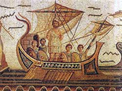
Odysseus as portrayed on a Roman mosaic.

Simple conclusion, if we take the date from 1100 BCE, the sea around Giglio has been charted for 3,112 years. Those scholars of the sea believe that the warnings Circe gave Odysseus were adapted by Homer from real sailing instructions probably passed down as oral poems in age, between the collapse of Mycenean culture and the rise of classical Greece, when only a tiny handful of Phoenicians could read or write.

One has to wonder if the bridge crew of the Costa Concordia had just had a Roman chart, whether or not the cruise ship could have avoided the rocks/sandbar/reef.

So what went wrong and what does that mean for the controversial plan to have hundreds of both bitumen and LNG laden tankers going up and down the British Columbia coast?

Britain’s Daily Telegraph is already asking what went wrong, in Cruise disaster: Perfect storm of events caused Costa Concordia crash. The Telegraph is pointing out something critical to the plans by Enbridge for a highly computerized navigation system for Douglas Channel, the Inside Passage and the British Columbia coast: that many of today’s bridge officers don’t have the skills that Capt. George Vancouver would have demanded even from the youngest teenaged  midshipman when he first charted the  west coast for the Royal Navy.

The captain was reported to have said he hit a rock that was not marked on his charts. But that failed to explain adequately the scale of the disaster, which experts said should be unthinkable….

The Concordia, whose officers were all Italian, will also have operated Bridge Team Management, a system adopted from the aviation industry whereby each operation is double and triple-checked by several members of the crew….

Modern ships are required to carry voyage data recorders which store detailed information about the vessel’s speed, position, heading, radar and communications…

The first thing investigators will have to determine is whether the vessel should even have been where it was.

A source close to the investigation told a leading Italian newspaper that the boat was on the wrong course — possibly due to human error — and was sailing too close to Giglio.

The ship should have passed to the west of the island, rather than the east, according to this theory.

Yesterday fishermen on Giglio and in Porto Santo Stefano said it was very unusual for such a large ship to attempt a passage to the east of the island….

Douglas Ward, a cruise ship expert and author of Berlitz Ocean Cruising and Cruise Ships, said: “Crew don’t have as much training as in the past.

“Ships today are built with completely enclosed navigation bridges and the navigators don’t even have to learn how to use a sextant, whereas marine officers in the past always had to.

“The advance in hi-tech navigation systems is so good that we have come to rely on them. But even these can fail — look at car satnavs.”

So if the Enbridge Northern Gateway project is approved, and even if Enbridge implements all the navigation improvements it says it will, it all comes down to the competence of a bridge crew. Perhaps a GPS could tell them to turn to port instead of starboard (as GPS units in cars sometimes do) and there could be tanker hitting Gill Island, just where the Queen of the North sank, even if it is tied to an escort tug.

What makes the sinking of the Costa Concordia  even more frightening is the negligence of Stephen Harper  and his cabinet cronies who are gutting Canadian Coast Guard and DFO resources on both the West and East Coasts.  It will be years before those super tankers might start coming up Douglas Channel.  There was lots of rescue capability on the coast of Italy from the Italian coast guard and local boats. What about the giant cruise ships, a key aspect of the British Columbia economy?  What if one of those ships got in trouble? The captain of the Costa Concordia was able to beach the ship right by the sea wall at the port of Giglio.  On the rocky coast of BC,   that giant cruise ship could go to the bottom in minutes just as the Queen of the North did, with little or no immediate hope of rescue.


Bradford's voyage
A detail of a map from Ernle Bradford's Ulysses Found, published in 1964, retracing the voyage of Odysseus. Homer's epic is probably a record of a voyage around 1250 BCE. The point where the Costa Concordia sank has been added.

Links: New South Pacific ship disaster spills fuel off Christmas Island

The grounding of a ship off Christmas Island, an Australian territory, is turning into an environmental disaster, according to local news reports.

A Panama-flagged cargo ship carrying phosphate, the MV Tycoon split in two at Flying Fish Cove off Christmas Island Sunday afternoon. Local authorities say a huge swell ripped the ship from its moorings. Experts warned that the spill was a potential disaster for the ecologically important area, with crabs, birds and coral all threatened.

ABC News (Australia)Locals to tackle Christmas Island shipwreck spill (Dramatic video)

Sydney Morning Herald
Sunken ship oil spill leaves endangered species at risk
(includes video report)
Tycoon has history of problems: Greenpeace

The Western Australian Disaster zone as oil slick threatens wildlife

Australian Associated Press (via Herald Sun) Oil spilling from ship at Christmas Island

The MV Tycoon broke up just hours after the container Rena broke up off New Zealand.