The second mate of the tug Nathan E. Stewart fell asleep on watch when the tug grounded off Bella Bella, on October 13, 2016, according to an investigation report released by the United States National Transportation Safety Board.
The NTSB also said “Contributing to the grounding was the ineffective implementation of the company’s safety management system procedures for watchstanding.”
The Nathan E. Stewart was pushing, not towing the barge, as the NTSB report notes:
The JAK system the tug used to push the barge (NTSB)
The tugboat Nathan E Stewart and the tank barge DBL 55 were connected through the JAK coupling system.1 Controlled from a panel on the tugboat’s bridge, this system uses a 16-inch-diameter, high-strength steel pin pneumatically actuated on each side of the vessel’s bow to lock the vessel into a fitted socket plate welded to each side of the barge’s inner notch. The plates have multiple sockets that run vertically, which allows the tugboat to position itself within the notch to accommodate changing barge drafts as well as to prevent, or minimize, the horizontal movement between the two units.
The NTSB says the grounding of the tug caused about $12 million US in estimated damage to the tug itself and the barge it was pushing.
The Nathan E. Stewart and barge on the rocks (RCMP/TSB)
The Nathan E Stewart spilled 29,000 gallons of fuel and lube oil, released into the ocean off Edge Reef, off Athlone Island in Seaforth Channel in the traditional territory of the Heiltsuk Nation.
Although no petroleum products were released from the empty fuel barge, a subsequent marine survey found that post accident survey of the DBL 55 found that the barge’s external double hull was significantly damaged from its bow completely aft to the skegs on the stern. There were multiple areas where the hull plating had been inset and penetrated. Some of the framing also had been damaged, but none of the inner steel plating comprising the bottom, sides,or top of the cargo tanks had been breached. The JAK socket plates on the inside of the barge’s notch showed slight damage,with the second recess(fromthe bottom up) on both socket plates indicating scarring and heavy contact. Repair costs for the barge were estimated at $5.6 million.
Prior to thegrounding, all the vessel’s vital systems were functional, and there were noindications of a mechanical failure thatmay haveled to the accident.
The NTSB says the tug was on autopilot when the second mate fall sleep on watch and it missed course correction near Ivory Island. The tug had a computerized electronic chart system (ECS) on board that should have sounded an alarm when the way point for the course correction was missed, but the mate told the NTSB, the tug was not using that navigation tool on the night of the accident. According to the second mate, it was
normal practice for the navigation team to not utilize that tool.
The NTSB report says had the ECS been utilized, the ECS would
have entered into an alarm mode after the second mate missed the port course change required near Ivory Island. Based on time, speed, and distance calculations, the alarm would have activated at approximately 0055 and thereby provided ample time for the second mate to take
corrective action to return the Nathan E Stewart to the intended track.
The United States Coast Guard says the US and Canadian Coast Guards will “conduct a towing evolution using a State of Alaska Emergency Towing System” on Friday afternoon off Juneau, Alaska.
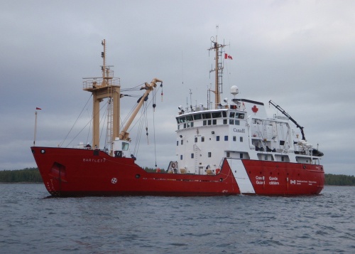
The participating vessels are the Canadian Coast Guard Marine Service Vessel and Ice Strengthened Medium Navaids Tender CCGS Bartlett and the US Coast Guard cutter USGC Maple. Like the Barlett, the Maple is also a buoy tender.
CCGS Barlett (Canadian Coast Guard)
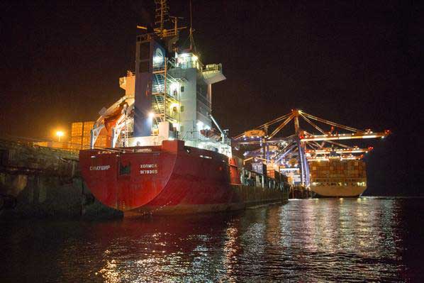
In 2014, when the Russian vessel Simushir was adrift off Haida Gwaii, the towing system on the Canadian Coast Guard’s Gordon Reid was inadequate and the line snapped. A commercial tug was hired to take the Simushir into port at Prince Rupert. As Northwest Coast Energy News reported in October, 2014, the US Coast Guard deployed the Alaska Towing System to Haida Gwaii but it wasn’t used at that time despite a record of success by the US Coast Guard in towing vessels off Alaska waters.
When the Russian container ship Simushir lost power in heavy weather west of Haida Gwaii last Thursday and driven by westerly winds came dangerously close to the rocky coast, Canada and British Columbia had to scramble to get vessels to the ship and try to tow it out of danger to Prince Rupert.
Like all other issues on the west coast, the debate is raging.
The Simushir tied up at the Ridley Island container port. (Prince Rupert Port Authority)
“Peter Lantin, president of the Haida Nation, told the media at the time, “It was luck.” On Tuesday, Lantin issued another statement, saying. ““Unfortunately, I don’t think anyone considers 20 hours a world class response time. The fact of the matter is that the federal government has little interest in protecting the west coast. From all indications their policy is to calculate an oil spill as an acceptable loss, based on a business model, not on the reality that coastal British Columbians live every day.”
It appears that the Simushir operation was lucky. The normal westerly winds that could have driven the ship onto the rocks of Haida Gwaii changed to southeasterly, keeping the Simushir off shore.
The American heavy duty tug Barbara Foss just happened to be available. The Barbara Foss was towing a cargo barge between Prince Rupert and Whittier, Alaska. The barge was left in Prince Rupert and the tug headed out off the coast of Haida Gwaii a trip that took about 48 hours. (There are also heavy duty Smit tugs at Prince Rupert which joined the operation on Hecate Strait to escort the Simushir into port. There are now reports that the Simushir‘s owners chose to hire the Barbara Foss rather than Smit)
The Canadian Coast Guard vessel Gordon Reid tows the Simushir away from the coast of Haida Gwaii. (Maritime Forces Pacific)
It took the first Canadian Coast Guard vessel, the Gordon Reid, about 14 hours to reach the Simushir (according to Coast Guard officials the original report of 20 hours was wrong). The Gordon Reid did manage to get lines on the Simushir and pull the ship away from the coast, only have the tow lines part (break) three times. So the three Coast Guard vessels, two from Canada, the Gordon Reid and the Sir Wilfred Laurier and the US Coast Guard cutter Spar had to wait for the Barbara Foss to arrive.
Jonathan Whitworth, CEO of Seaspan, speaking to Mark Hume of The Globe and Mail, “it was just bad luck” that none of the tugs that regularly work up and down the west coast were available at the time.
Whitworth told The Globe and Mail that there are about 80 boats between Alaska and Vancouver that could have towed the Simushir to safety. He said that the fact there were no tugs in the immediate vicinity as a “fluke.”
“We certainly have large tugs operating in Haida Gwaii on log barges, for example. So it will be a 6,000-horsepower tug that would [typically] be in that area. It just so happened that over the weekend our two biggest tugs which transit that area were down south,” Whitworth told The Globe and Mail.
Whitworth said that permanently stationing tugs at Haida Gwaii would be both be unnecessary and too expensive.“If there had been a tug stationed in Haida Gwaii then it could have responded possibly quicker. But who’s going to pay for that? Surprisingly from a tug owner it’s not going to be [my view] that there should be a tug every 50 metres up the coast.”
Effective response
In a news release, Rear Admiral Dan Abel, commanding the US Coast Guard 17th District, Alaska said.
“The trusted partnership we have with our Canadian counterparts continues to be a vital component to protecting lives at sea and mitigating potential maritime emergencies. We are pleased this case ended with a positive outcome; preparing for the worst case scenario is the first step in an effective prevention and response plan.”
The question now being asked up and down the BC coast has the provincial or federal governments really have an effective prevention and response plan? If the BC coast had trouble handling a container ship in trouble, how is it ever going to handle a Very Large Crude Carrier loaded with diluted bitumen?
According to the US Coast Guard, although the Simushir was adrift off the coast of Haida Gwaii, the incident triggered Alaska’s emergency response plan. “Coast Guard Sector Juneau deployed six members, including the sector’s commander, to Ketchikan to establish the foundation for a unified command and to exercise their sub area contingency plan with state and local partners.”
Key to Alaska’s response, is a system ready to go soon after a distress call is received. The Emergency Towing System (ETS) has prepackaged equipment that can be transferred to a disabled vessel either by helicopter or tug, depending on the size and position of the vessel in distress.
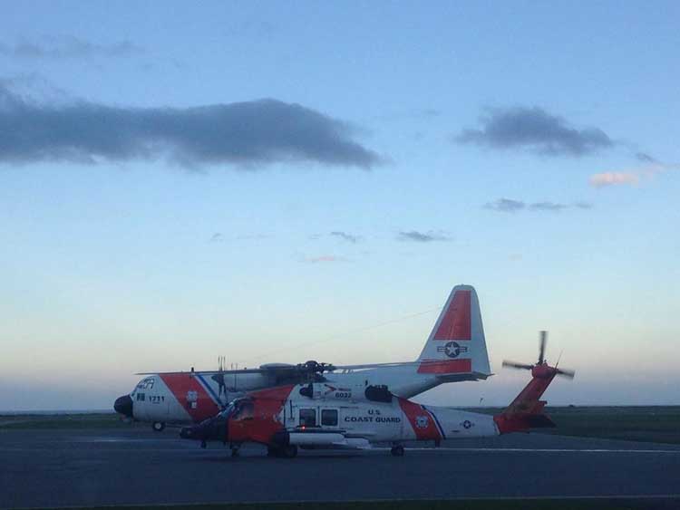
US Coast Guard C-130 Hercules and Skyhawk helicopter on standby at Sandspit airport. The Hercules carried one of Alaska’s Emergency Towing Systems in case it was needed. (US Coast Guard)
The United States Coast Guard deployed two of its Emergency Towing Systems last week to support the Simushir operation, one on a C-130 Hercules dispatched to Sandspit, the second on board the cutter Spar.
While the Alaska ETS systems were not used in the Simushir incident, how Alaska came up with the system is a lesson for British Columbia, for that state-wide program was started by the tiny municipality of Unalaska after a ship quite similar to the Simushir lost power and came within 15 minutes of running aground in Unalaska Bay.
Now just seven years later those Emergency Towing System packages are pre-positioned up and down the Alaska coast, while although Enbridge proposed the Northern Gateway in 2005, here in Canada both the provincial and federal governments make paper promises about a “world class” response system but so far nothing has happened.
Salica Frigo
Salica Frigo photographed in 2006 (Clipper/Wikipedia Commons)
The Salica Frigo incident in March 2007 was similar to the Simushir incident and like the Simushir, there was luck involved.
According to an Associated Press report at the time, quoting 2005 figures, Dutch Harbor and Unalaska was, for the 17th straight year, the United States leading fishing port for seafood landings in poundage. Commercial fishermen offloaded 887.6 million pounds of fish and shellfish in 2005. The value of its catch, $166.1 million, was second to New Bedford, Mass.
About three years earlier, another ship, the 225 metre (738-foot) Selandang Ayu experienced engine problems, shut off its engines, drifted and ran aground Dec. 9, 2004, in Skan Bay on Unalaska Island’s west side.
Six crewmen died when a US Coast Guard helicopter trying to rescue them crashed. The Selandang Ayu broke in two and spilled an estimated 321,000 gallons of fuel oil, contaminating 54 kilometres (34 miles) of coastline. AP reported that at the time of the Salica Frigo incident in 2007, the cleanup for the Selandang Ayu was more than $100 million.
The Salica Frigo was 135 metre (443 foot) Spanish-flagged ship, the same size as the Simushir.
On Thursday, March 8, 2007, the Salica Frigo was partially loaded with seafood and tied up at dock in Captain’s Bay in Dutch Harbor, Alaska Winds were from the north, from 30 to 40 knots gusting to 60 to 70 knots. The winds began to drive the Salica Frigo away from the dock and the local marine pilot, Capt. Stephen Moreno, consulting with the captain, ordered the ship to sea to ride out the winds. “He really didn’t have enough ground tackle to safely anchor,” Moreno told the AP.
The AP report says Moreno guided the Salica Frigo out to sea, plotted a safe course and then the pilot returned to port. At about, 3 am on March 9, the engine failed. It was not until an hour later, at 4 am, according to KIAL News the Salica Frigo’s captain called the marine pilots and the Coast Guard. North winds were blowing the ship back toward the harbor.
“If it had been from the south, he would have blown offshore,” Moreno told the AP.
The powerless ship drifted for more than three and a half hours toward the shore. Two tugboats came to the ship’s aid but could not establish lines to the stricken vessel.
Moreno and Coast Guard officials estimate the Salica Frigo was just 15 minutes from grounding when crew members were able to restart the engine at 6:43 a.m.
Emergency Towing System
Just weeks later, the Mayor of Unalaska, Shirley Marquardt created and convened a “Disabled Vessel Workgroup” that was tasked with developing a “an emergency towing capability for disabled vessels in the Aleutians using locally available tugboats and an emergency towing system.”
For a demonstration project from July 20 to August 1, 2007, Unalaska had put together and purchased a system suitable for vessels up to 50,000 dead weight tons (DWT) while the state, the the Alaska Department of Environmental Conservation was planning to purchase a system capable of towing vessel greater than 50,000 DWT.
The two types of Emergency Towing System packages are pictured in the operations manual. (Alaska Dept. of Environmental Conservation)
In a news release (pdf) at the time of the exercise, the Alaska Department of Environmental Conservation, said
In the last decade, several distressed or stricken vessels in the Aleutian Islands have adversely impacted the community of Unalaska. In a few cases, these incidents were the cause of environmental and economic repercussions.
In each situation, the vessel was a large tramper or cargo type ship, generally carrying fuel in bottom tanks, thus posing a significant pollution risk. Roughly 67% of port calls to Unalaska/Dutch Harbor in 2004 were either container ships or tramper/reefer vessels.
“These accidents can be devastating to Alaska’s environment and communities. Our goal is to enhance the ability of local assets to respond to distressed vessels in need of assistance due to engine failure,rudder failure, or any other failure which compromises the safe navigation of a vessel,” said DEC Commissioner Larry Hartig.
Tugs not always ready
The Emergency Towing System deployed on a tug. (Alaska Dept. of Environmental Conservation)
The other point in the 2007 ADEC news release is a note that tugs are not always equipped for operations such the one involving the Simushir
Generally tug boats (primary responders in this area) have some capability of retrieving vessels but they are not dedicated to this service and therefore the equipment aboard is not representative of equipment needs in this highly specialized situation. The recommended emergency towing system
will enhance local assets with the ability to respond to an emergency with all the proper equipment necessary to retrieve a distressed vessel.
The Unalaska resident tugs Gyrfalcon and James Dunlap are the most consistent local assets in the Unalaska region, but there are many other tugs in the area at any one time and thus this system is intended to be universally deployable.
The demonstration project, a partnership between the town, the state, the Coast Guard and the private sector was successful.
US Coast Guard helicopters deploy the Emergency Towing System (Alaska Dept. of Environmental Conservation)
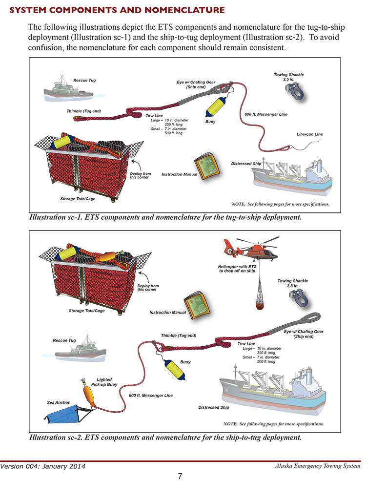
An Emergency Towing System (ETS) is a pre-staged package of equipment that may be deployed in the event a disabled vessel requires assistance in accessing a place of refuge. A manual that instructs responders on the operations of system as well as procedures for deployment accompanies the system. The system is designed to use vessels of opportunity to assist disabled vessels that are in Alaskan waters. It consists of a lightweight high performance towline, a messenger line used in deploying the towline, a lighted buoy, and chafing gear. These components may be configured to deploy to a disabled ship from the stern of a tugboat or airdropped to the ship’s deck via helicopter.
In December 2010, Unalaska’s plan worked, the town’s ETS system was deployed to assist the disable cargo vessel Golden Seas. “This equipment, along with the availability of an appropriate sized towing vessel helped avert a possible grounding.” the ETS website says.
Since 2007, the Alaska Department of Environmental Conservation has purchased and stored 10 inch Emergency Towing Systems at the USCG Air Station in Kodiak and Sitka, the Navy Supervisor of Salvage warehouse at Fort Richardson, and the Emergency Response warehouse in Adak, Alaska.
Map shows where the Emergency Towing System is deployed across Alaska/. (Alaska Dept. of Environmental Conservation)
The Emergency Towing System can be deployed by helicopter or by tug. A helicopter can lower the tote or cage containing the towing gear onto the deck of the distressed ship. If the tote or cage is carried to the scene by a tug the crew the usual procedure is to use a helicopter to deploy the tote/cage to the distressed vessel or the tug crew. Depending on the circumstances, and although it is not part of the regular system, the tug crew can also line-gun projectile across the deck of the distressed ship so the crew can pull a “messenger line” attached to the tow line on board.
And as for Canada, Gail Shea, Minister of Fisheries and Oceans, answering questions in the Commons Monday about the Simushir incident did nothing more than speak off a prepared script, answering two questions from Nathan Cullen, NDP MP for Skeena Bulkley Valley and from Joyce Murray, Liberal MP from Vancouver Quadra, she said future operations were the responsibility of the private sector,
The Russian ship lost power outside Canadian waters in very rough weather. The private sector provides towing service to the marine industry.
We are grateful that the Canadian Coast Guard was able to keep the situation under control in very difficult conditions until the tug arrived from Prince Rupert.
Whitworth told the Globe that with increased tanker traffic whether LNG or bitumen, the number of tugs on the coast will increase, a point also made by supporters of the various projects.
But without a real commitment from the government for marine safety on the west coast, it is clear, even with the prospect of Very Large Crude Carriers with bitumen or Liquefied Natural Gas tankers plying the coast, the Harper Government considers marine safety nothing more than a case of a paper ship upon a paper ocean.
With such indifference, it is likely that local communities up and down the British Columbia coast will have to follow the example of the small town of Unalaska, population 4,376 in 2010 and create the northwest coast’s own emergency system.
On Monday, October 20, 2014, the Minister of Fisheries and Oceans, Gail Shea, stood in the House of Commons during Question Period and proved she is not up for the job.
Answering questions from Opposition MPs about the incident of the Russian container ship, Simushir, which drifted dangerously close to the coast of Haida Gwaii, Shea got up and read a prepared script, a script with answers which ignored centuries of the laws and custom of the sea, as well as Canada’s own laws and treaty obligations, answers probably written by what are now known as “the kids in short pants” in the Prime Minister’s Office.
There was a time in this country when some ministers of the Crown took their responsibilities seriously. That idea that has decayed over the years and now has been gutted by the adminstration of Stephen Harper. As Ottawa pundits have noted recently, only a small handful of cabinet ministers in the Harper government have any real responsibility and only those are permitted to answer questions by themselves in the Commons. According to most Ottawa insiders, the less important ministers, like Shea, are basically told what to do by the prime minister’s office.
Gail Shea, Minister of Fisheries and Oceans, visited the Canadian Coast Guard Ship Leonard J. Cowley on Friday, December 6, 2013, to examine the fast rescue craft launching mechanism for offshore fishery patrols with Regional Director, Fleet, Stephen Decker and Captain Kerry Evely, Commanding Officer. The Cowley conducts fisheries patrols and monitors fishing activities under Canada’s commitment to the Northwest Atlantic Fisheries Organization. (DFO)
If the House of Commons under Harper could fall any lower, Shea’s attitude (or more likely the PMO’s attitude) on ship and coastal safety takes the Commons and ministerial responsibility to a new low—the bottom of the sea.
Nathan Cullen, NDP MP for Skeena Bulkley Valley, who represents Haida Gwaii first asked. “Mr. Speaker, on Friday, a Russian ship carrying more than 500 million litres of bunker fuel lost all power just off the coast of Haida Gwaii.The Canadian Coast Guard vessel, the Gordon Reid, was hundreds of kilometres away, and it took almost 20 hours for it to reach the drifting ship. Thankfully, favourable winds helped keep the ship from running aground, and a private American tugboat eventually towed it to shore. Is the minister comfortable with a marine safety plan that is based on a U.S. tugboat and blind luck in order to keep B.C.’s coast safe?”
Shea responded.
“Mr. Speaker, luck had nothing to do with the situation. The Russian ship lost power outside Canadian waters in very rough weather. The private sector provides towing service to the marine industry. We are grateful that the Canadian Coast Guard was able to keep the situation under control in very difficult conditions until the tug arrived from Prince Rupert.”
Cullen tried again:
“Mr. Speaker, if the government really wanted to show its gratitude to the Canadian Coast Guard maybe it would not have cut $20 million and 300 personnel from its budget. Even after the Gordon Reid arrived, its tow cable snapped three times. The Russian ship was only about a third as big as the huge supertankers that northern gateway would bring to the very same waters off the west coast. How can Conservatives, especially B.C. Conservatives, back their government’s plan to put hundreds of oil supertankers off the B.C. coast when we do not even have the capacity to protect ourselves right now?”
Shea replied: “Mr. Speaker, this Russian ship lost power outside of Canadian waters. The Canadian Coast Guard responded and kept the situation under control, under very difficult conditions, until the tug arrived from Prince Rupert.
We as a government have committed $6.8 billion through the renewal of the Coast Guard fleet, which demonstrates our support for the safety and security of our marine industries and for our environment.”
Next to try was Liberal MP Lawrence MacAulay from Cardigan.
“Mr. Speaker, the Russian container ship that drifted off the west coast raises serious concerns about the response capability of the Canadian Coast Guard. This serious situation was only under control when a U.S. tugboat arrived.”
Again Shea read her script: “This Russian ship lost power outside Canadian waters. On the west coast, the private sector provides towing services to the marine industry.’
The final attempt by Liberal Joyce Murray, from Vancouver Quadra, also led to a scripted answer. “ this was a private towing vessel that came to tow the vessel that was in trouble.”
Shea’s answers, especially her repeated reference to “territorial waters” set off a series of “What the…?” posts on Twitter from west coast mariners and sailors, wondering if Shea knew anything about maritime law.
The first question one must ask was Shea actually not telling the whole truth to the House of Commons (which is forbidden by House rules) when she said the Simushir was outside Canadian waters? The Haida Nation, in a news release, (pdf) says the Simushir was “drifting about 12 Nautical Miles North West of Gowgaia Bay located off Moresby Island off Haida Gwaii.”
International law defines territorial waters as a belt of coastal waters extending at most 12 nautical miles (22.2 km; 13.8 mi) from the baseline (usually the mean low-water mark) of a coastal state.
As Shea’s own DFO website says Canada has exercised jurisdiction over the territorial sea on its east and west coasts out to 12 nautical miles since 1970, first under the Territorial Sea and Fishing Zones Act and now under the Oceans Act. The baselines for measuring the territorial sea were originally set in 1967. While the exact position can and should be confirmed by the ship’s navigation logs and GPS track, it is clear that the container vessel could have been at one point after it lost power within Canada’s territorial waters.
Even if the Simushir wasn’t exactly within territorial waters, the ship was in what again Shea’s own DFO website calls the “contiguous zone “an area of the sea adjacent to and beyond the territorial sea. Its outer limit measures 24 nautical miles from the normal baseline zone.” In any case, the Simushir was well within what Canada says is its “exclusive economic zone” which extends 200 nautical miles from the coastal baseline.
Law of the Sea
So here is the first question about Shea’s competence.
How could she not know that the Simushir was well within Canadian jurisdiction, as defined by her own department’s website? Even if the minister hadn’t read the departmental website, wasn’t she properly briefed by DFO officials?
The second point, is that whether or not the Simushir was in actually in Canada’s territorial waters is irrelevant. Custom going back centuries, and now the United Nations Convention on the Law of the Sea and even the Canada Shipping Act all require the master of a capable vessel to render assistance once that vessel receives a distress call or sees that another vessel is in distress.
… the master of a ship at sea which is in a position to be able to provide assistance, on receiving a signal from any source that persons are in distress at sea, is bound to proceed with all speed to their assistance, if possible informing them or the search and rescue service that the ship is doing so.
And the Canada Shipping Act requires
Every qualified person who is the master of a vessel in any waters, on receiving a signal from any source that a person, a vessel or an aircraft is in distress, shall proceed with all speed to render assistance and shall, if possible, inform the persons in distress or the sender of the signal.
The master of a vessel in Canadian waters and every qualified person who is the master of avessel in any waters shall render assistance to every person who is found at sea and in danger of being lost.
Note the phrase any waters. Not just in Canadian territorial waters as the Shea, the minister responsible for the ocean seemed to imply in her Commons answers.
That once again calls into question Shea’s fitness to be a minister of the Crown.
If she did not know about the UN conventions on the law of the sea, of which Canada is signatory, or the Canada Shipping Act, she is not up for the job as Minister of Fisheries and Oceans.
If, as the minister responsible for oceans, she knew the law and was told by the PMO to mislead the House of Commons, she is is irresponsible and MPs should ask the Speaker if she actually broke the rules of the House.
Regulation Seven of the Annex on Search and Rescue Services states
Each Contracting Government undertakes to ensure that necessary arrangements are made for distress communication and co-ordination in their area of responsibility and for the rescue of persons in distress at sea around its coasts. These arrangements shall include the establishment, operation and maintenance of such search and rescue facilities as are deemed practicable and necessary, having regard to the density of the seagoing traffic and the navigational dangers, and shall, so far as possible, provide adequate means of locating and rescuing such persons.
Note that the regulation does not say within territorial waters, but “around its coasts.”
Rendering assistance
Canada has always rendered assistance to distressed vessels not just up and down the coast but around the world. Take the case of HMCS Chartlottetown. On February 3, 2008, HMCS Chartlottetown on anti-piracy and anti-terrorist patrol in the North Arabian Sea, spotted a rusty barge with some men stranded on the deck. It turned out the men were from Pakistan and that the vessel towing the barge had sunk with all hands, leaving only the men on the barge alive. The North Arabian Sea is far out side Canadian territorial waters.
In February, 2008. the crew of HMCS Charlottetown rescued the crew of a Pakistani barge that was drifting in the North Arabian sea after the tug that was hauling the barge sank. (Cpl Robert LeBlanc,/Canadian Forces Combat Camera)
On must wonder then if the Harper Government, or at least Minister Shea is suggesting that this country ignore centuries of maritime law and custom and, in the future, pass that barge by because it was not in Canadian waters?
Perhaps buried in the next omnibus bill we will see the Harper Government restrict rescue at sea to Canadian territorial waters. Farfetched? Well that is what Minister Shea’s answer in the Commons seems to suggest.
Given the cutbacks to the Coast Guard services over the past few years, and if there are going to be large tankers, whether LNG or bitumen, on the west coast, it is an open question whether or not the Harper government has actually made those “arrangements shall include the establishment, operation and maintenance of such search and rescue facilities as are deemed practicable and necessary, having regard to the density of the seagoing traffic and the navigational dangers, and shall, so far as possible, provide adequate means of locating and rescuing such persons.”
Now comes the question of the use of the tug Barbara Foss and the two Smit tugs that later joined to tow the Simushir into Prince Rupert harbour.
It is the responibility of the owner or manager of a disabled vessel, large or small, to contract with a tug or towing service to safely take it back to port. But, and it’s a big but, the tow begins only when it is safe to do so, if there is a danger of the ship foundering, sinking or running aground, it is the obligation of all the responding vessels to render assistance, not just the tug contracted to do the job.
(There are reports that the Simushir owners chose to hire the Barbara Foss rather than the heavy duty Smit tugs available at Prince Rupert. Jonathan Whitworth, CEO of Seaspan told Gary Mason of The Globe and Mail that there are about 80 boats on the west coast, capable of heavy-duty towing, but noted that as in the case of the Simushir, those vessels may not be available when needed)
While around the Lower Mainland of BC, even a small boat that has run out of gas or has engine trouble can get commercial assistance from many service providers, the same is not true of the north coast, or at Haida Gwaii, where are no such regular services. Seapan’s Whitworth told The Globe and Mail there is often a 6,000 horsepower log hauling tug that works off Haida Gwaii. but he also noted that it would be too expensive to have a tug permanently moored on the archipelago.
That means mariners who run out of gas or have engine trouble, say on Douglas Channel, have to call Prince Rupert Coast Guard radio and request assistance either from nearby vessels or from the volunteer Royal Canadian Marine Search and Rescue service. RCMSAR policy says that a the rescue boat will not tow a vessel if “commercial assistance is reguarly available.” If commercial assistance is not available RCMSAR is only obligated to tow the boat as far as a “safe haven,” where the boat can tie up safely or contract for that “commercial assistance.”
Here on Douglas Channel the safe haven is usually Kitimat harbour and thus during the summer frequently either a good Samaritan vessel or RCMSAR take the disabled vessel all the way to MK Bay.
Shea’s pat answer to the Opposition questions only betrayed the fact that the east coast minister is woefully ignorant of conditions on the northern coast of British Columbia.
In the old days, a minister who screwed up so badly would be asked to resign. That never happens any more. Ministerial responsibility has sunk to the bottom of the sea.
The bigger picture question seems to be. Why, if the Harper government is so anxious to get hydrocarbons, whether bitumen or natural gas to “tide water” does it keep going out of its way to show its contempt for the people who live on Canada’s west coast?
A note for the voters of Prince Edward Island, where Shea is the member for Egmont. Consider this, if a ship gets into trouble outside the 12 mile limit, trouble that could threaten your beautiful red sandy beaches, you’re likely on your own.
Zone maps for the North Coast marine draft plan. (MAPP)
District of Kitimat Council has urged residents to turn out in large numbers for consideration of the North Coast Draft Marine Plan at the Kitimat Valley Institute Tuesday, May 13, from 5:30 to 8:30.
In introducing the motion, Mayor Joanne Monaghan said she was worried that not enough Kitimatians, especially charter operators, boaters and fishers were aware of the meeting.
Another council member privately said he was worried that the Open House and Forum weren’t publicized enough so that the town could be checked off as having “been consulted.”
MAPP stands for Marine Planning Partnership for the North Pacific Ocean.
According to the documents the purpose of the North Coast Marine Plan “is to provide recommendations for achieving a sustainable balance between ecosystem health, social and cultural well-‐being and economic development through an ecosystem-‐based approach to planning and management.”
The plan is all about managing “common First Nation and provincial interests related to marine areas.”
The parners include the province and the Skeena First Nations Stewardship Society (NCSFNSS), representing the Metlakatla, Kitsumkalum, Kitselas, Haisla, Gitga’at, and Gitxaala Nations.
According to the doucments the North Coast plan area covers 27,000 kilometres of coastline;
that is indented with deep fjords and dotted with thousands of islands. It is a region of profound beauty, significant ecological diversity and remarkable cultural richness. Prince Rupert, Terrace and Kitimat are the largest communities in the North Coast plan area, which supports an overall population of approximately 42,000.
According to the summary of the plan:
The physical complexity of the North Coast includes a range of ecosystem types, including important estuaries that support distinct marine ecosystems and species. A diverse range of economic and community activities occur within the North Coast plan area. Commercial fisheries and associated processing facilities and logging have supported communities along the coast since the early 1900s. These activities continue to be important to the well-‐being of coastal communities. Port activities centered around the communities of Prince Rupert, Kitimat and Stewart, and active recreational fishing and tourism sectors, continue to be strong economic drivers in the area. North Coast First Nations living in the region have distinct cultural and spiritual heritages that are intricately linked to the marine environment and the long-‐standing sustainable use and management of marine resources.
The plan appears to overlap some areas where there have been environmental assessments of the Northern Gateway and the numerous liquified natural gas proposals.
The plan summary goes on to say:
The draft plan brings together science and Aboriginal knowledge, input from the technical staff of NCSFNSS (representing the Gitga’at, Gitxaała, Metlakatla, Kitsumkalum, Kitselas and Haisla Nations) and the Province. Key information and direction was provided by First Nations strategic marine use plans and existing provincial planning and policy documents.
Ecological, cultural and social and economic data sources were compiled and analysed by the joint technical team and contract support. Relevant background scientific reports and technical documents from the Pacific North Coast Integrated Management Area (PNCIMA) process were also used, along with the BC Marine Conservation Analysis. Additional information was drawn from government reports and publications, academic literature, industry or sector publications, discussions with experts and local knowledge. Advice was also incorporated from the North Coast Marine Plan Advisory Committee and public and stakeholder engagement.
The Pacific North Coast Integrated Management Area process was killed by the Harper government in the fall of 2011 . The decision to kill the PNCIMA was officially for budget reasons, but general speculation at the time was that Harper and then Natural Resources Minister Joe Oliver wanted to kill PNCIMA as one way of ensuring the government could push through the Northern Gateway project. The MAPP program was set up by the province and First Nations as a reaction to Harper’s decision.
It comes down to the idea that Harper will approve Gateway “in the national interest,” count on a vote split between the NDP and Liberals in British Columbia to avoid any consequences to the Conservative majority and then leave it up to Enbridge to actually get the job of building the pipeline and terminal project done.
Mason quotes “ a senior member of Mr. Harper’s government,” and while Mason doesn’t say what part of Canada the source is from, (unlikely in my view the source is from BC) what the member told Mason reveals that the Harper government is still mired in it the Matrix-world that has always governed its policy on Northern Gateway.
The first step, apparently coming in the next few days, is that the Harper government “rigorous” new tanker protocols for traffic along the west coast.
Even if the protocols are new, just who is going to enforce those policies?
Mason says:
Even if Gateway and the Kinder Morgan expansion went ahead, he argued, B.C. would still only see about 60 per cent of the annual oil tanker traffic the neighbouring state of Washington deals with. And yet Washington has an exceptionally clean record when it comes to the safe transport of oil in and out of its harbours – this, he noted, while operating under marine safety regulations that are not as rigorous as the ones Ottawa intends to put in place for the shipment of oil along the West Coast.
There are a lot big problems with that statement.
First, there’s an organization that the Mason’s source may have heard of known as the United States Coast Guard. The United States rigorously enforces its “weak” regulations, while Canada’s Coast Guard is plagued by staff shortages and budget cuts.
Second, the State of Washington also rigorously enforces its environmental regulations, not only on the coast but across the state. I have been told by retired British Columbia forestry and environmental officials (not to mention Fisheries and Oceans) that there are often more state environmental watch dogs in most Washington State counties than in all of northern British Columbia where the Northern Gateway is supposed to be going.
The September 2013, report by the US National Oceanographic and Atmospheric Administration on the export of Canadian bitumen sands through the US shows that the Washington Department of Ecology is working on strengthening regulations for both pipelines and (where it’s in state jurisdiction) tanker traffic. The same report says the state of Alaska Department of Environmental Conservation is updating its plans and possible regulations in anticipation that bitumen filled tanker traffic from Kitimat would come close to the coast en route to Asia.
Third, the coast of northern British Columbia is more rugged and stormy than the waters off Washington.
Who pays?
The one factor that the urban media seems to ignore, is the big question.
Who pays?
Who pays to enforce the 209 conditions that the Joint Review Panel imposed on the Northern Gateway project?
If the Harper government announces new tanker regulations in the coming days, who pays to enforce those regulations?
There were no provisions in the February budget for enforcing the 209 conditions. Rather there were continuing budget cuts to the very departments that the JRP ruled must be involved in the studying, planning, implementation and enforcement of the 209 conditions, Environment Canada, Fisheries and Oceans and Transport Canada.
So while Mason says “The federal government will play its part in meeting the five conditions laid out by the B.C. government for support of the project,” the response must be “Show me the money!”
During the recent plebiscite campaign, Northern Gateway finally revealed its plans for the “super tugs” that will escort tankers along the coast and up Douglas Channel. Owen McHugh, a Northern Gateway emergency manager said, “Adding these four or five tugs to the north coast provides a rescue capability that doesn’t exist in this format. So for any large commercial vessel that is traveling on our coast, this capacity to protect the waters of the north coast.” Those tugs and Northern Gateway’s plans to station teams at small bases along the coast means that the company is, in effect, creating a parallel, private, coast guard on the BC Coast.
What about the Coast Guard itself? The Harper government has been gutting Coast Guard resources along the coast even before it had its majority. It closed and dismantled the Kitsilano Coast Guard station in Vancouver. There is more dependence on the Royal Canadian Marine Search and Rescue volunteers, who have to raise money locally for modern rescue boats which cost up to $750,000. The money that government was “generously” giving to RCMSAR had to be split up to 70 stations in 42 communities along the coast as well as its administrative and training staff.
And speaking of boats, what about Coast Guard vessels on the coast? As the Globe and Mail has reported, the government’s shipbuilding program is already over budget and behind schedule. The aim is Arctic/Offshore Patrol Ships and new destroyers. With the crippling of HMCS Protecteur that has raised the concerns about the already troubled supply ship program.
Does anyone notice what is missing from that list? What’s missing are better Coast Guard vessels just to police all the expected tanker traffic on the west coast (whether LNG or bitumen) and no mention of dedicated spill response vessels, which under the “polluter pay” policy will likely be left to private contractors (and hope that the ships are available at the time of a spill)
How will we know?
Then there is the question of how will people even know if the 209 conditions are being enforced; whether or not the reports demanded by the Joint Review Panel are going be sitting on the National Energy Board server and ignored.
There is every indication, given the government’s obsession with secrecy that until there is a disaster the Canadian public will never know what’s going on. Harper’s muzzling doesn’t just cover government scientists, it covers the lowest level of bureaucrats, as District of Kitimat Council found out when low level DFO bureaucrats refused to appear publicly before council to discuss the risk to the Kitimat River.
So the scenario is, according to Mason’s source
“I think once this decision is made, Enbridge could have shovels in the ground the next day,” the member said. “They are ready to go. This means the First Nations could start realizing profits from this right away, as opposed to the promised profits from LNG, which may never materialize. I think they need to think about that.”
First, as part of the blunders is that the Conservatives have always made is the assumption that eventually the First Nations of British Columbia can be paid off, ignoring the commitment of the First Nations, especially on the coast, to protect the environment that sustained them for thousands of years.
While the LNG market is volatile, the “member” forgets that most of the First Nations of British Columbia have opposed the Northern Gateway since Enbridge first floated the idea in 2001. The current LNG rush didn’t start until after Japan shut down its nuclear power plants after the March 2011 earthquake, The first major anti-Enbridge rally, “The Solidarity Gathering of Nations” was held at Kitamaat Village in May 2010.
Writing off BC
It appears that Conservatives, in their election strategy have already written off Gateway opponents:
Still, there is a raw political calculus that needs to be taken into account. Polls measuring support for the pr.oject in B.C. vary, but generally have shown that anywhere from 55 to 60 per cent of the province opposes Gateway and 40 to 45 per cent support it. Isn’t that enough to scare off a government that needs critical votes in B.C. to win another majority?
“Let’s say 60 per cent are against it,” he said. “And that vote splits between the Liberals and the NDP come the next election. Who are the 40 per cent going to vote for?”
Mason also speculates that Harper will approve Gateway to stick it to Barack Obama and the delays on Keystone XL. As he points out that’s a political, not an economic decision.
There are civil disobedience classes being held across northwestern BC this month. Access to Information requests by the Vancouver Observer revealed increased RCMP surveillance of the anti-Gateway movement. There has always been talk of a “war in the woods” if the pipeline project is forced on an unwilling population.
So it comes down to a question that Mason and the Conservatives are avoiding. Mason’s source says Northern Gateway is crucial to the national interest:
“At the end of the day, you have to do what’s right, not what’s politically expedient,” he said. “You have to ask: What’s in the best interests of all Canadians?”
So given all that will the Harper government leave Enbridge to tough it out on its own?
Highly unlikely.
But will the Harper government, with its bean counting obsession on balancing the budget be willing to pay for all that is needed?
Highly likely.
There’s lots of marine clay along the pipeline route, laid down by ancient oceans. That brings to mind just one word. Quagmire, not just the wet, sticky BC mud but a political quagmire.
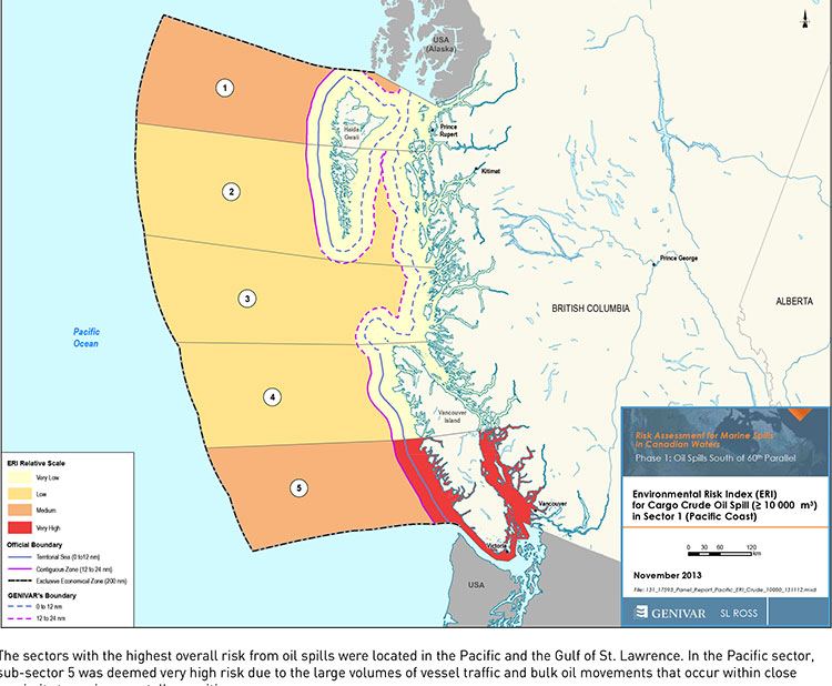
Transport Canada tanker report map shows current risk for spills in BC (Transport Canada)
Cover of Genivar tanker report (Transport Canada)
The possible effects of a bitumen spill on Pacific waters were not considered in the oil response preparedness report released last week by the Harper government, the background data study reveals.
The consulting firm that did the study for Transport Canada, Genivar Inc, had no reliable data on the effect of a bitumen tanker disaster—because, so far, there has been no major ocean disaster involving diluted bitumen.
Instead, Genivar, based its findings on potential hazards and response on existing data on crude oil spills.
The Genivar study, however, does warn, that if the Enbridge Northern Gateway project does go ahead, the spill risk from diluted bitumen carrying tankers in Douglas Channel and along the north Pacific coast will jump from “low” or “medium” to “very high.” If the twinning of the Kinder Morgan pipeline goes ahead, then the risk in Vancouver also jumps to “very high.”
The question of how bitumen might behave in the cold and choppy waters of the North Pacific was hotly debated during the Northern Gateway Joint Review hearings earlier this year. Enbridge Northern Gateway based its position on laboratory studies, studies that were challenged by environmental and First Nations intervenors, pointing both to the unknowns of the ocean environment and the continuing problems Enbridge has in cleaning up the spill in the Kalamazoo River in Michigan.
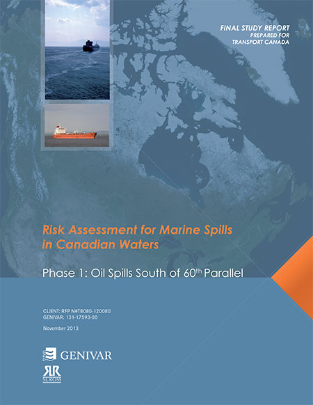
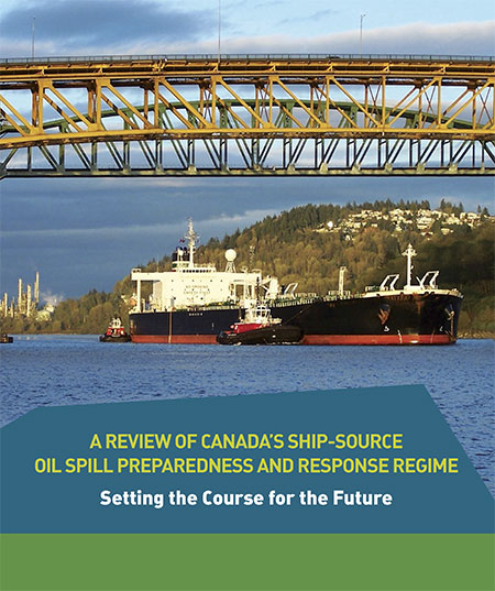
The Genivar report, Risk Assessment for Marine Spills in Canadian Waters Phase 1: Oil Spills South of 60th Parallel, was completed in November, then passed on to the “expert panel” that released their own report: A Review of Canada’s Ship-source Oil Spill Preparedness and Response Regime — Setting the Course for the Future. That second report was based not only on the data provided by Genivar but on the expertise of three panel members, their visits to some locations and input from government, industry, First Nations and municipalities.
The actual data report was not posted; it had to be requested through the Transport Canada website, which is how Northwest Coast Energy News obtained the background study.
The expert panel found “a very high risk” of oil spills in two areas of the Pacific Coast, in the north around the ports of Kitimat and Prince Rupert and in the heavy ocean traffic area of southern British Columbia, especially Port Metro Vancouver and into Washington State.
The expert panel made 45 recommendations that covered a wide range of issues including eliminating the present $161-million liability limit for each spill and replacing it with unlimited liability for polluters, annual spill training involving the Canadian Coast Guard, Environment Canada, provincial and local authorities and the private sector, increased and improved annual spill training exercises, basing risk assessment on local geography and conditions and faster emergency responses to spills.
The expert panel calls for greatly increased research on the ocean environment at a time that Harper government has been gutting environmental research across Canada, while spinning that its policies are “science based.”
The science and technology around both the movement of oil and spill response has advanced significantly over the past several decades. We feel that while some aspects of the Regime have kept pace with these developments, in some areas, Canada has fallen behind world-leading countries like Norway and France. This can be attributed to a general lack of investment in research and development as well as the lack of coordination between industry and government over research priorities.
The Government of Canada should work closely with industry to establish a national research and development program for oil spill preparedness and response. The program should be co-funded by industry and the Government, and the research priorities should be set through a collaborative process that involves academia, where possible. Like the Regime itself, we view this program as a partnership between industry and government.
We envision that this program would also seek to leverage the work being done internationally on oil spill preparedness and response. The program should seek to establish partnerships with other world-leading countries in order to stay current on international advances and new technologies.
The expert panel, however, does not say how the federal government is expected to pay for meeting BC Premier Christy Clark’s condition for a “world class” spill prevention and response system at a time that Finance Minister Jim Flaherty is determined to balance the budget and the Harper government is continuing to cut back government services.
Bitumen excluded
On bitumen, the Genivar data study says:
Modified bitumen products represent the majority of the “crude carried as cargo” in
Pacific sub-sector 5. They are not modelled as a separate category in this spill behaviour analysis but are represented as “persistent crude”.
Changes in spill behaviour depend to some extent on the environmental conditions at the time of the spill, as described in greater detail below. However, over the range of wind and sea conditions typically experienced in the Canadian marine environment, changes in oil properties are not overly sensitive to variations in climatic values, so a single set of wind and sea conditions will be used in the analysis.
The idea that “changes in oil properties” not being sensitive to variations in climate was also frequently challenged before the Joint Review Panel.
On the increase in traffic volume if the Northern Gateway project goes ahead, the Genivar report says.
Enbridge Inc. has proposed to construct a marine terminal at Kitimat, B.C. and a dual pipeline from the terminal to oil sands production in northern Alberta. The terminal would handle up to 193,000 barrels/day of imported diluents (i.e., low-gravity condensate) that would be piped to Alberta and used to dilute bitumen to enhance its flow properties. The diluted bitumen would then be piped to Kitimat at rates up to 525,000 barrels/day that would be shipped by tanker to export to markets in Asia and California.
At full capacity, the import of diluent and export of diluted bitumen would total up to 35 Mt/year. This amount is comparable to the currently-shipped volume in the Pacific sector related to volumes being exported from Vancouver and related to volumes being exported from the Alaskan to Washington State trade.
It goes on to say that the current tanker traffic on the north Pacific coast “has negligible risk in the near shore and intermediate zones, but significant potential spill frequency in the deep-sea zone related to the Alaskan trade.” Similarly, according to Genivar the environmental risk in the region “currently ranges from ‘medium’ to “very low” from near shore to deep-sea zones, respectively…. mainly driven by a combination of physical and biological features.”
The increase in traffic from Northern Gateway would likely increase the environmental risks. The the near shore risk from would jump from “very low” to “very high.” For the largest spill category, deep-sea risk would likely increase from “low” to “medium.”
No data on recreational or traditional First Nations fishery
To study the effect on an oil spill on the fishery, Genivar used data from the Department of Fisheries and Oceans as the provinces to gauge “the port value of commercial fishing and the value of the fish, shellfish and aquaculture” in each zone it studied and then compared it to the the national averages for commercial fishery. Those figures included any commercial fishery by First Nations.
But Genivar noted, there is no reliable data on either the recreational fishery or the First Nations traditional, food, social and ceremonial fishery, saying:
It is important to highlight that this indicator does not consider recreational or traditional fishing. The importance of this industry is notable and an oil spill could damage the recreational fishing stock as well. However, the absence of comparable data and the fact that this study is restricted to federal and international data, and some provincial data from Quebec and Ontario for commercial fisheries, limits the ability to include recreational fishing… Nevertheless, as an absolute index, it will provide an overall vulnerability in the event of an oil spill.
The ongoing impact of cutbacks at Fisheries and Oceans has had a continuing impact on the northwest, especially in the controversial halibut recreational fishery, where DFO has admitted that it is basically guessing the size of each year’s recreational halibut catch.
Tourism
Genivar also notes that lack of reliable data on the effect on a oil spill on tourism. The consultants go so far as to say one of the indicators they will use to measure the effect of any oil spill on tourism would come from “data extracted from the 2011 National Household Survey at the census division level and the accommodation and food services data will be used.”
The “National Household Survey” is also known as the long form census and it is the National Household Survey that the Harper government made voluntary rather mandatory, decreasing the reliability of the data. Global News recently analyzed those who had contributed to the survey and found that it poor people, the very rich and people in low population areas were least likely to fill out the voluntary census—which means the data for northwest BC is likely highly unreliable from the 2011 survey even though “The census divisions in coastal regions will be selected for each of the sub-sectors. This method will express the economic vulnerability of each sub-sector to a potential collapse in tourism following a spill.”
Despite the importance of cruise ship traffic on the west coast, Genivar notes, “In Canada, data for passenger vessels were unavailable.”
It also notes that “this study does not specifically take into account national parks and other landmarks, since their influence on tourism is indirectly included in the tourism employment
intensity index” so that Genivar could create what it calls the Human-Use Resource Index (HRI), even though that index appears to be based on incomplete data.
The study of tanker shipping and tanker spills by Genivar for Transport Canada has revealed huge gaps in how the world monitors tanker traffic.
Cover of Genivar tanker report (Transport Canada)
Genivar says
Accident data was acquired from three main sources: the CCG Marine Pollution Incident Reporting System (MPIRS); the Lloyd’s casualty database; and spill incident records maintained by the International Tanker Owners Pollution Federation (ITOPF).
MPIRS lists all marine pollution incidents occurring in Canadian waters (CCG, 2013), with information on the region within Canada in which the incident occurred, type of material spilled, accident cause, and estimated pollution volume with multiple entries for a given incident showing updates of incident status and pollution amounts if applicable. The primary use of MPIRS in this study was for spill incidents in the smaller size categories… for which worldwide data was suspected to be unreliable due to under-reporting. MPIRS appeared to be a comprehensive listing of incidents that occurred in Canadian waters, and a summary of polluting incidents
It goes on to note that some key data has not been updated since the 1990s, largely prior to the introduction of double hulled tankers.
As noted, oil spill accidents were compiled on a worldwide basis.
In order to estimate the frequency for Canada, an exposure variable was required.
A series of studies by the U.S. Minerals Management Service (MMS, now known as
the Bureau of Ocean Energy Management, Regulation and Enforcement) investigated the occurrence rates of tanker accidents against various spill exposure variables and found that the simplest and most reliable indicator was volume of oil transported. Simply put, it was determined that spill rates could be expressed, for a range of spill size categories, as an average number of spills per billion barrels transported.
The MMS studies were updated periodically until the 1990s but have not been revisited since, but they did show a steady decrease in the likelihood of casualties and resulting spill volumes, due to a number of factors including tanker design, increasing governance and overall scrutiny of the marine transportation industry. The phased-in implementation of double-hull tankers may have also had a beneficial effect on spill rates in more recent years, particularly in the category of very large or catastrophic events… In any case, it is important in interpreting accident data to reflect current trends and implemented mitigation measures. The focus was on cargo volumes and accident rates over the past decade.
It goes on to say the volumes of crude carried is also under-reported to Lloyds.
In the case of crude oil and refined products carried as cargo, the exposure variable was simply the volume of each respective category carried on an annual basis for the period of interest. Information from the Lloyds APEX database was used for this purpose; it reports volumes of crude and refined products shipped worldwide, with a breakdown by year, country of origin, and country of destination. Compared with similar data from Canadian sources, the APEX data appeared to significantly under-report the carriage of refined products. As a result, the accident rates estimated and used in this study are likely somewhat conservative, that is, they overstate the likely frequency of refined products carried as cargo. For all calculations involving the potential spillage of refined products as cargo in Canadian waters, and for the apportioning of spill frequency among the various sectors and sub-sectors of Canada, Transport Canada commodity traffic data was used
Again about Lloyds data, until 2010, it was limited in its monitoring of the BC Coast.
In analyzing the Canadian movement data supplied by Lloyds, a major shortcoming was found in the data in that movements recorded prior to 2010 did not include broad classes of vessels such as ferries, passenger vessels, and pilot boats. Given that these vessels comprise a significant proportion of traffic movement in many sectors, only data covering the final two years of the record, 2010 and 2011, were used in the analysis.
The Lloyds data was also limited when it came to oil spills:
One limitation of the MPIRS data was that it did not classify spills as to whether they were from “cargo” as opposed to “fuel”, which would have been helpful in this study as these spill types were analyzed separately. As a result, for spills of refined products, which could have hypothetically been either cargo or fuel, assumptions were made based on the type of vessel involved, the type and severity of the incident, and other notes within MPIRS.
A database was acquired from Lloyds that detailed all marine casualties over the
past ten years regardless of whether the incident involved pollution…
This database was used to provide a breakdown of incidents by cause, and as an
initial listing of those incidents that did result in pollution. The Lloyds data was of
mixed quality when it came to the reporting of polluting incidents, with numerous
records only partially filled out, ambiguities in the reporting of spill volume, and
inconsistencies in the classification of the spilled material. A significant effort was
made to provide consistency and accuracy in the information, including cross-
referencing with other data sources.
So the Genivar report exposes a significant gap in the available data on oil spills.
It is certainly true that the number of major tanker accidents and spills have decreased since the Exxon Valdez disaster, a point frequently made by Enbridge at meetings in northwestern BC.
The expert panel report which said that Canada faces the risk of a major tanker disaster of 10,000 tonnes or more once every 242 years.
The Vancouver Sun quoted Transport Canada spokeswoman Jillian Glover on that risk of a spill on the Pacific Coast as saying. “This value must be understood in relative terms, such that the risk is considered high compared to the rest of the country only…Canada enjoys a very low risk of a major oil spill, evidenced by the lack of Canadian historical spills in the larger categories. Additionally, this risk assessment is before any mitigation measures have been applied, so that is a theoretical number before additional prevention initiatives are taken.”
Note that the government always talks about a “major oil spill,” but it appears from the gaps in the data that predicting the possibility and consequences of a medium sized or smaller oil spill is now not that reliable, even though such a spill could have disastrous effects on a local area. According to a map in both reports, the entire BC coast is at risk for a “low to medium” spill. This echoes the problems with the Enbridge Northern Gateway pipeline, where Enbridge based most of its projections on a “full bore breach” or major pipeline break and did little about a medium sized or smaller leak. Data analysis by Kelly Marsh of Douglas Channel Watch on the possibility of the cumulative effects of a medium sized and possibly undetected pipeline breach could have just as disastrous consequences for the Kitimat valley as a major pipeline break. The same is likely true at sea.
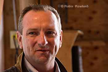
Seaspan ULC, the large BC-based marine transportation and shipbuilding company is keeping its on eye on future opportunities in Kitimat and along Douglas Channel, chief executive officer Jonathan Whitworth said Tuesday.
Jonathan Whitworth, CEO of Seaspan ULC, at the RCM SAR 63 boathouse. (Robin Rowland)
Whitworth was in Kitimat to meet members of the Royal Canadian Marine Search and Rescue Unit 63, which operates from the Nechako Dock.
He also met with members of the Haisla Nation while he was in town.
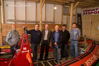
Kitimat SAR 63 is one of six stations which will receive $8,500 a year for three years, to help cover operating expenses, from the Dennis and Phyllis Washington Foundation, based in Missoula, MT. Seaspan is part of the Washington group of companies, that has holdings on the west coast of Canada and the United States, owned principally by Dennis Washington.
At the moment, Whitworth said, Seaspan operates the HaiSea in partnership with the Haisla Nation. “It’s a boat that you will see up and down the Channel, she does a lot of work for RTA as well as some of the others, mainly from the construction and the up and coming constrution from the new projects. We take a lot of time and effor to make sure our equipment looks good as well as operates well. That’s the kind of pride our crew puts in the vessels and the company supports.” he said. Seaspan barges are also used for the construction projects currently under way in Kitimat.
Whitworth said that while Douglas Channel is not yet “packed on the water,” shipping will likely increase in the coming years. “There are two big dominoes to fall, the first one is any of these big projects being talked about that are going to increase shipping in the Douglas Channel, be
it Chevron or Shell or the BC LNG project. They need to get approval first, that hasn’t happened yet. We understand it may be within the next six to twelve months before we hear some announcements. When that goes ahead, we can start looking at building new boats, be it escort tugs, or docking vessels, or additional vessels… That will help up us to know the time for when we need to deliver new boats for the Douglas Channel.”
Seaspan has always had a close relationship with the Canadian Coast Guard, Whitworth said and that relationship is even closer now that the Seaspan’s Vancouver Shipyards, was chosen by the federal government for the National Shipbuilding Procurement Strategy for non combat vessels. In February, the federal government announced (pdf) a series of preliminary contracts valued at a total of $15.7 million for the joint support ships, the CCGS John G. Diefenbaker polar icebreaker and the offshore fisheries science vessels.
The Washington Foundation is giving a multi-year donation of $1.1 million to three British Columbia marine and port community charitable organizations. Partnering with Sail and Life Training Society (SALTS), Vancouver Maritime Museum (VMM) and Royal Canadian Marine Search & Rescue (RCM-SAR).
Royal Canadian Marine Search and Rescue received $300,000 over three years. “Half of it $150,000 when to Royal Canadian Marine Search and Rescue Sooke training facility on Vancouver Island, that benefits all of the different stations in BC, they all get a chance to go train and at that training centre,” Whitworth said. “The remaining funds, the $150,000 was spread between six stations that are closely associated with Seaspan, so two in Vancouver harbour, North Vancouver, West Vancouver, two on the Fraser River, one at Delta and one at Richmond, one at Victoria and one right here in Douglas Channel in Kitimat.” The $8,500 covers approximately 35 per cent of the operating costs for Kitimat’s SAR 63 station every year for three years.
The Dennis and Phyllis Washington Foundation’s charitable donations are the organization’s first direct donation of their kind in Canada. Since its inception, the Washington Foundation has donated more than $144 million in the United States to hundreds of organizations that focus on education, health and human services, arts and culture, and community service.
Mike Halligan, Executive Director of the Washington Foundation, says today’s announcementis the start of an exciting inaugural collaboration with Canadian charitable organizations in British Columbia.
Members of RCM SAR Unit 63, on board “Snowflake Responder” with Seaspan CEO Jonathan Whitworth. (Robin Rowland)
Kitimat’s SAR 63 operates along Douglas Channel and down the Inside Passage as far as Butedale. Training takes place every Wednesday evening at the SAR 63 boathouse at the Nechako Dock. The unit will be recruiting new members in September. Anyone interested can contact training officer Duncan Peacock.
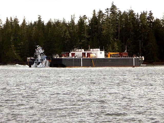
The Canadian Coast Guard says it will undertake “a significant environmental response operation” because more oil is leaking from the sunken Second World War United States Army Transport vessel, the Brigadier General M.G. Zalinski.
Hot tapping is a well-known and frequently used method of removing oil from the tanks of stricken vessels. Holes are carefully drilled into the side of the vessel to access fuel-tanks and then hot steam is pumped into the tanks. The steam increases the temperature of the oil and enables it to flow more easily. The oil is then pumped to the surface for safe disposal.
The procedure can be done with holes of very small sizes up to very large diameters. Hot tapping is used in both marine and land-based scenarios.
The red sections in the image above represent the fuel tanks of the Zalinski; the possible locations for hot tapping of the vessel. The yellow sections represent the cargo holds. (Canadian Coast Guard)
The Canadian Coast Guard says it “has engaged the Gitga’at First Nation and the Province of British Columbia to participate in the operation and maintain a presence at the wreck site” and will keep the Gitga’at First Nation informed of what is going on:
The Coast Guard recognizes that given their proximity to the Zalinski site and their interest in the oil recovery operation, the Gitga’at need to be informed on the progress of the operation and that they have important local knowledge and skill that will be beneficial to the operation.
The Coast Guard says that environmental monitoring in January and March of 2013, discovered “further upwelling” of oil and added new patches to the sunken vessel.
The Coast Guard says: “Although the patches from 2012 and 2013 remain in place, early patches have begun to leak and the Canadian Coast Guard has determined that the structural integrity of the vessel is deteriorating.”
USAT Brigadier General M.G. Zalinski (Canadian Coast Guard)
The USAT Brigadier General M.G. Zalinski was built in 1919 and served as a United States Army Transport vessel during the Second World War. It ran aground during a storm and sank in 1946 in the Grenville Channel about 100 kilometres south of Prince Rupert.
According to a Coast Guard News release, the wreck was “undetected” until the fall of 2003 in 34 metres of water near an underwater cliff about 20 metres from shore.
In September 2003, the United States Coast Guard Cutter Maple reported pollution in the Grenville Channel to the Canadian Coast Guard.
The CCGS Tanu investigated the source of the pollution and collected oil samples, but, the news release says, the vessel remained elusive and undetected.
A month later, more oil pollution was spotted so the Canadian Coast Guard used a remotely operated underwater vehicle which located the Zalinski.
New pollution was reported in the channel in October 2003 by a commercial airline pilot and at this time the Coast Guard suspected that the source of the upwelling of oil was an old wreck.
In 2003 and 2004, the Canadian Coast Guard contracted divers to patch the vessel to prevent the leak of oil.
The Coast Guard says it regularly monitored the site with the help of Transport Canada’s National Aerial Surveillance Program. Local First Nations Groups also monitored the wreck site.
More oil was spotted in April 2012, and at that time, contract divers patched the Zalinski with an epoxy that hardens underwater.
The Coast Guard says new dive footage has shown that metal rivets that hold the hull’s plates are corroding and that the hull is buckling.
as the state of the vessel deteriorates, the Coast Guard has determined that to prevent any harm to the environment, a significant operation should be undertaken to remove the oil from the vessel. The Canadian Coast Guard will be the on-scene commander for the duration of the operation, directing the recovery and the removal of marine pollutants from the vessel and actively monitoring the operation.
The Canadian Coast Guard has also engaged the province of British Columbia and local First Nations groups to solicit their feedback on the operation. On July 26, 2013, Public Works and Government Services Canada posted two requests for proposal seeking a third-party to conduct the oil removal operation and oil spill response services to assist in the case that any oil leaks from the vessel as the operation progresses.
Wreck sites for M.G. Zalinksi and Queen of the North (Canadian Coast Guard)
It is expected that the operation will begin in September 2013 and will conclude in December 2013. The Coast Guard says because the Grenville Channel is so narrow, some restrictions on vessel traffic in the Inland Passage will be needed.
The Grenville Channel is a narrow fjord-like waterway with significant tidal fluctuations and currents up to three knots. The shoreline is rocky and steep with little shoreline vegetation.
The Grenville Channel sees commercial fishing vessels, ferries, cruise ships, and pleasure craft transiting its waters on a regular basis, with increased frequency in the summer months. These waters, naturally shielded from stronger offshore winds and weather conditions, are the preferred route of many cruise ships.
The more mild sailing conditions and the stunning natural beauty of the area make the Grenville channel one of the scenic highlights of many marine travellers on Canada’s West Coast.

 The NTSB says the tug was on autopilot when the second mate fall sleep on watch and it missed course correction near Ivory Island. The tug had a computerized electronic chart system (ECS) on board that should have sounded an alarm when the way point for the course correction was missed, but the mate told the NTSB, the tug was not using that navigation tool on the night of the accident. According to the second mate, it was