West Coast “kelp highway” was the earliest route for First Peoples’ settlement of the Americas is the new scientific consensus

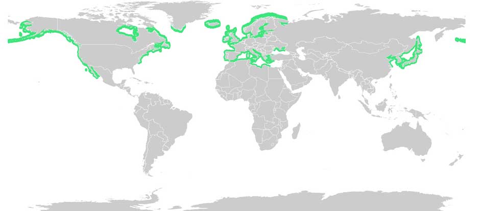
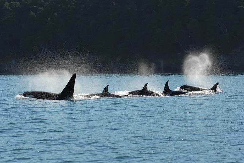
Most historians and archaeologists believe that the First Peoples to arrive in North America came down the West Coast on what they now call the “kelp highway.”

The review paper “The First Americans” was published this week in the prestigious journal Science.

Evidence from archaeological sites from the British Columbia coast to the southern tip of South America show that First Peoples had settled on both continents by at least 18,000 years ago, according to authors T.J. Braje at San Diego State University in San Diego, CA; T.D. Dillehay at Vanderbilt University in Nashville, TN; J.M. Erlandson at University of Oregon in Eugene, OR; R.G. Klein at Stanford University in Stanford, CA; T.C. Rick at National Museum of Natural History, Smithsonian Institution in Washington, DC.

The paper also says the DNA genomic data suggests a northeast Asian origin for Native American ancestors some time in the past 20,000 years.

(Science)

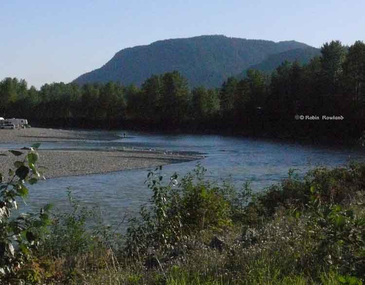
One of the key sites cited in the paper is Triquet Island in the traditional territory of the Heiltsuk Nation which has been dated to at least 14,000 years ago. Heiltsuk oral history has marked the island for generations, William Housty a member of the Heiltsuk told CBC News at the time the discovery was officially announced in April 2017, “Heiltsuk oral history talks of a strip of land in that area where the excavation took place. It was a place that never froze during the ice age and it was place where our ancestors flocked to for survival.”

The authors of the review say the new consensus on the “kelp highway” is a “dramatic intellectual turnabout” from the original idea that the first indigenous settlers followed an ice free corridor from a land bridge from Siberia down the centre of North America to form the “Clovis Culture”

The land bridge between northeast Asia and North America, commonly called Beringia, came about when sea levels fell during the last ice age. Although the original Beringia hypothesis has been disputed by some First Peoples, the paper says the Beringia hypothesis is still a factor—but much farther back in time, now about 24,000 years ago.

The paper says:

most archaeologists and other scholars now believe that the earliest Americans followed Pacific Rim shorelines from northeast Asia to Beringia and the Americas.

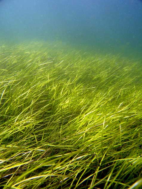
According to the kelp highway hypothesis, deglaciation of the outer coast of North America’s Pacific Northwest about 17,000 years ago created a possible coastal corridor rich in aquatic and terrestrial resources along the Pacific Coast, with productive kelp forest and estuary  ecosystems at sea level and no major geographic barriers

The paper says that kelp resources extended as far south as Baja California, and then—after a gap in Central America, where productive mangrove and other aquatic habitats were available—picked up again in northern Peru, where the cold, nutrient-rich waters from the Humboldt Current supported kelp forests as far south as Tierra del Fuego.

The other sites cited in the paper are

  • Huca Prieta, Peru 15,000 to 14,500 years ago
  • Paisley Caves, Oregon 14,000 years ago
  • Monte Verde, Chile 14,500 years ago
  • Page-Ladson, Florida 14,500 years ago
  • Channel Islands California 13,000 years ago
  • Quebrada Santa Julia and Quebrada Huentelauquén , Chile 13,000 years ago
  • Quebrada Tacahuay Peru 13,000 years ago
  • Quebrada Jaquay, Peru 13,000 years ago

In an earlier article in Science in August, Knut Fladmark, a professor emeritus of archaeology at Simon Fraser University who was one of the first to propose a coastal migration into the Americas back in 1979, said: “The land-sea interface is one of the richest habitats anywhere in the world,” noting that early Americans knew how to take full advantage of its abundant resources.

Testing the kelp highway hypothesis is challenging, the scientists say, because much of the archaeological evidence would have been submerged by rising seas since the end of the last “glacial maximum,” about 26,500 years ago.

The earlier that the First Peoples arrived, that means the land they originally settled is now the further offshore from the current coast  (land which is now likely also at greater depth under the current ocean). So the review says that finding the evidence means that, “enlarging already vast potential search areas on the submerged continental shelf.”

The authors say:

Although direct evidence of a maritime pre-Clovis dispersal has yet to emerge, recent discoveries confirm that late Pleistocene archaeological sites can be found underwater. Recent discoveries at the Page-Ladson site, in Florida produced 14,500-year-old butchered mastodon bones and chipped stone tools in the bottom of Florida’s Aucilla River.

The report says that “Several multidisciplinary studies are currently mapping and exploring the submerged landscapes of North America’s Pacific and Gulf of Mexico coasts, searching for submerged sites. .

In British Columbia, those studies (pdf) include the discovery by Daryl Fedje, an archaeologist at the University of Victoria and the Hakai Institute of 29 footprints on Quadra Island. A piece of wood embedded in a footprint’s fill provided the radiocarbon date of 13,200 years ago and the spear points lying and a cluster of bear bones at Gaadu Din cave on the Haida Gwaii dated to 12,700 years ago.

The review says that for much of the 20th century, most archaeologists believed humans first colonized the Americas about 13,500 years ago via the overland route that crossed Beringia and followed a long and narrow, mostly ice-free corridor to the vast plains of central North America. There,  according to the earlier theories, Clovis people and their descendants hunted large game and spread rapidly through the New World.

This was initially confirmed by twentieth-century discoveries of distinctive Clovis artifacts throughout North America. Some finds associated with mammoth or mastodon kill sites, supported this “Clovis-first” model.

The early studies decided then that “North America’s coastlines and their rich marine, estuarine, riverine, and terrestrial ecosystems were peripheral to the story of how and when the Americas were first settled by humans.”

Now the recent work along the Pacific coastlines of North and South America has revealed that these environments were settled early and continuously, providing a rich diversity of subsistence options and technological resources for New World hunter-gatherers.

A detail of the map from Science shows how off from the current coast the ancient shorelines reached (Science)

At the moment,  there is little evidence on the coast so far of the kind of  stone tools and fishtail points that had previously provided a road map that archaeologists used to trace the spread of “Clovis” Paleoindians throughout the Americas. Such a roadmap is lacking for “pre-Clovis” sites on the coast.

One proposal is that distinctive stemmed (“tanged”) chipped-stone projectile points, crescents (lunate-shaped), and leaf-shaped bifaces found in Japan, northeast Asia, western North America, and South America could be potential markers of an earlier coastal migration and  ties to Ice Age peoples in East Asia.

The problem of finding final proof of the kelp highway is that the First Peoples followed a coastal route from Asia to the Americas, so that finding evidence for their earliest settlements will require careful consideration of the effects of sea level rise and coastal landscape evolution on local and regional archaeological records.

The scientists note that around the globe, evidence for coastal occupations between  about 50,000 and 15,000 years ago are rare because of postglacial sea level rise, marine erosion, and shorelines that have migrated tens or even hundreds of kilometers from their locations at the ice age glacial maximum.

They say overcoming these obstacles requires interdisciplinary research focused on coastal areas with relatively steep offshore bathymetry, formerly glaciated areas where ancient shorelines have not shifted so dramatically, or the submerged landscapes that are one of the last frontiers for archaeology in the Americas


BC launching major study of Kitimat River, Kitimat Arm water quality

The Environmental Protection Division of BC’s Ministry of Environment is launching a major study of the water quality in the Kitimat valley, first on the Kitimat River and some of its tributaries and later on the Kitimat Arm of Douglas Channel.

There has been no regular sampling by the province in Kitimat since 1995 (while other organizations such as the District of Kitimat have been sampling).

Jessica Penno, from the regional operations branch in Smithers, held a meeting for stakeholders at Riverlodge on Monday night. Among those attending the meeting were representatives of the District of Kitimat, the Haisla Nation Council, LNG Canada, Kitimat LNG, Rio Tinto BC Operations, Douglas Channel Watch, Kitimat Valley Naturalists and the Steelhead Society.

As the project ramps up during the spring and summer, the ministry will be looking for volunteers to take water samples to assist the study. The volunteers will be trained to take the samples and monitored to insure “sample integrity.” Penno also asked the District, the Haisla and the industries in the valley to collect extra samples for the provincial study and to  consider sharing historical data for the study.

With the growing possibility of new industrial development in the Kitimat valley, monitoring water quality is a “high priority” for the province, Penno told the meeting. However, so far, there is no money targeted specifically for the project, she said.

Fishing and camping on the Kitimat River
Camping and fishing on the Kitimat River. (Robin Rowland/Northwest Coast Energy News)

The purpose of the study is to make sure water in the Kitimat valley meet the provinces water quality objectives, which have the aim of watching for degradation of water quality, upgrade existing water quality or protect for designated uses such as drinking water, wildlife use, recreational use and industrial water supplies as well as protecting the most sensitive areas. It also provides a baseline for current and future environmental assessment. (In most cases, testing water quality for drinking water is the responsibility of the municipalities, Penno said.  The province may warn a municipality if it detects potential problems, for example if a landslide increases metal content in a stream).

Under the BC Environment system, “water quality guidelines” are generic, while “water quality objectives” are site specific.

One of the aims is to compile all the studies done of the Kitimat River estuary by the various environmental impact studies done by industrial proponents.

The ministry would then create a monitoring program that could be effectively shared with all stakeholders.

At one point one member of the audience said he was “somewhat mystified” at the role of Fisheries and Oceans in any monitoring, noting that “when you phone them, nobody answers.”

“You mean, you too?” one of the BC officials quipped as the room laughed.

Water quality objectives

The last time water quality objectives were identified for the Kitimat River and arm were in the late 1980s, Penno told the meeting. The objectives were developed by the British Columbia government because of potential conflict between fisheries and industry at that time. The objectives were developed for the last ten kilometres of the Kitimat River and the immediate area around the estuary and the Kitimat Arm. “The Kitimat is one of the most heavily sport fished rivers in Canada,” she said.

However, the work at that time was only provisional and there was not enough water quality monitoring to create objectives that could be approved by the assistant deputy minister.

There has been no monitoring of the Kitimat River by BC Environment since 1995. “We’ve had a lot of changes in the Kitimat region, with the closure of Methanex and Eurocan, the modernization of Rio Tinto and potential LNG facilities.”

The main designated uses for the Kitimat River at that time were aquatic life, wildlife with secondary use for fishing and recreation.

She said she wants the stakeholders to identify areas that should be monitored at first on the river and the tributaries. Later in the summer, Environment BC will ask for suggestions for the estuaries of the Upper Kitimat Arm.

Participants expressed concern that the water supply to Kitamaat Village and the Kitimat LNG site at Bish Cove as well as Hirsch Creek and other tributaries should be included in the study. Penno replied that the purpose of the meeting was to identify “intimate local knowledge” to help the study proceed.

After a decade so of cuts, the government has “only so much capacity,” Penno said, which is why the study needs the help of both Kitimat residents and industry to both design the study and to do some of the sampling.

The original sampling station in the 1980s was at the Haisla Boulevard Bridge in Kitimat. A new sampling station has been added at the “orange” Kitimat River bridge on Highway 37. There is also regular sampling and monitoring at Hirsch Creek. The aim is to add new sampling points at both upstream and downstream from discharge points on the river.

The people at the meeting emphasized the program should take into consideration the Kitimat River and all its tributaries—if budget permits.

Spring freshette

Last year, the team collected five samples in thirty days in during four weeks in May and the first week in June, “catching the rising river quite perfectly” at previously established locations, at the Haisla Bridge and upstream and downstream from the old Eurocan site as well as the new “orange bridge” on the Kitimat River.

The plan calls for five samples in thirty days during the spring freshette and the fall rain and monthly sampling in between.

The stakeholders in the meeting told the enviroment staff that the Kitimat Valley has two spring freshettes, the first in March during the valley melt and later in May during the high mountain melt.

The plan calls for continued discussions with the industry stakeholders, Kitimat residents and the Haisla Nation.

The staff also wants the industrial stakeholders to provide data to the province, some of it going back to the founding of Kitimat if a way can be found to make sure all the data is compatible. One of the industry representatives pointed out, however, that sometimes data is the hands of contractors and the hiring company may not have full control over that data.

There will be another public meeting in the summer, once plans for sampling in the Kitimat Arm are ready.

Eel grass really a flower that stores more carbon than tropical forests, genome reveals

Eel grass is not a seaweed but a flowering plant that migrated to the sea, say scientists who have now mapped the eel grass genome. The study also shows that eel grass ( Zostera marina) is crucial in absorbing carbon dioxide in the soft sediments of the coasts.

Eel grasses form a carbon dioxide sink: “they store more carbon than tropical forests,” says Jeanine Olsen of the University of Groningen in the Netherlands who led the study.

Coastal sea grass ecosystems cover some 200,000 square kilometers, the study says. Those ecosystems account for an estimated 15 per cent of carbon fixed in global ocean, and also impact sulphur and nitrogen cycles.

The scientists argue that since sea grasses are the only flowering plants to have returned to the sea that is the most extreme adaptation a terrestrial (or even freshwater) species can undergo.

The science team says the Zostera marina genome is “an exceptional resource that supports a wide range of research themes, from the adaptation of marine ecosystems under climate warming and its role in carbon burial to unraveling the mechanisms of salinity tolerance that may further inform the assisted breeding of crop plants.”

A seagrass meadow. (Christoffer Boström)
A seagrass meadow.
(Christoffer Boström)

Sea grasses form the backbone of one of the most productive and biodiverse ecosystems on Earth, rivaling coral reefs and rain forests in terms of the ecosystem services they provide to humans.

Sea grass meadows are part of the soft-sediment coastal ecosystems found in all continents, with the exception of Antarctica. They not only form a nursery for young fish and other organisms, but also protect the coastline from erosion and maintain water clarity. ‘

The study, which sequenced the genome of the eel grass taken from the Archipelago Sea off Finland. published today, in the journal Nature, is the work of an international consortium of 35 labs, most of them in Europe, working with researchers from the U.S. Department of Energy Joint Genome Institute.

The study showed that eel grasses are completely submerged marine flowering plants, called by science angiosperms. It shows that eel grass is a member of the ancient monocot family.

The monocots include about 60,000 species, flowering plants that first appear above the soil as a single leaf. They include orchids, “true grasses,” as well as rice, wheat, maize and “forage grasses” such as  sugar cane, and the bamboos. According to Wikipedia, other economically important monocot crops include  palms  bananas , gingers, onions, garlic, lilies, daffodils,  irises, amaryllis,  bluebells and tulips.

Zostera marina is the first marine flowering plant have its genome fully sequenced. As well as finding the eel grass’s genetic ancestors the researchers were interested in understanding how the plant–and by extension other plants in the ecosystem–adapt to climate change.

As it adapted to  an underwater, coastal lifestyle, eel grass gained genes that allowed it to live in saltwater but lost genes involved in traits associated with land-based plants.

Olsen called this “arguably the most extreme adaptation a terrestrial (and even a freshwater) species can undergo.”

What she describes as the “use it, lose it, or change it” scenario, eelgrass modified its cell walls. The eel grass cell wall is very different from normal plant cell walls and more like that of sea algae, similar to the cell in seaweeds. The eel grass has lost genes associated with light-sensing, pollination and regulation of internal water balance.

Eel grass lost its stomata (which are used by land plants to ‘breathe’) but also all of the genes involved in stomatal differentiation. “The genes have just gone, so there’s no way back to land for sea grass,” Olsen says. Sex is entirely underwater involving long naked sperm filaments especially adapted for underwater fertilization of the tiny flowers.

The team compared the eel grass genome to duck weed, one of the simplest flowering plants and Zostera marina’s closest sequenced relative. They noted differences in genes related to cell wall structure due to adaptations to freshwater or terrestrial conditions. For example, plants such as duckweed have seemingly lost genes that help plants retain water in the cell wall, while eel grass has regained these genes to better deal with osmotic stress at low tide.

“They have re-engineered themselves,” said Olsen of the changes affecting the eelgrass cell walls. “Crop breeders may benefit from lessons on how salt tolerance has evolved in these plants.”

Eel grass distribution. (Wikipedia Commons(

With Zostera marina meadows stretching from Alaska to Baja California, and from the White Sea to southern Portugal, Olsen noted that these ecosystems afford researchers “a natural experiment to investigate rapid adaptation to warmer or colder waters, as well as to salinity tolerance, ocean acidification and light.”

Eel grass endangered

Jeremy Schmutz, head of the US Department of Energy’s genetic plant program, emphasized that while eel grasses are key players in coastal marine ecosystem functions and considered the “lungs of the sea,” they are also endangered. “There are estimates that nearly a third of the eel grass meadows worldwide have been destroyed by runoff into the ocean,” he said, “reducing their potential capabilities as carbon sinks. Thus, studying the adaptive capacity of eel grass is urgent to assist conservation efforts.”

An overarching question for Olsen’s team is how quickly eel grass can adapt to rapid climate change. The fact that Zostera marina grows along the coastline from Portugal to Scandinavia is being used as a natural experiment to investigate adaptation to warmer or colder water, as well as to salinity, ocean acidification and light.

BC Supreme Court rules province failed to consult First Nations on Northern Gateway

The B.C. government acted improperly and “breached the honour of the crown” when it signed away a provincial review and gave the federal Joint Review Panel for responsibility for assessing the environmental impact of the proposed Northern Gateway pipeline, Madam Justice Marvyn Koenigsberg of the Supreme Court of B.C. ruled Wednesday.

In a largely technical decision,  Justice Koenigsberg ruled that British Columbia must come to its own decision on Northern Gateway. That’s because what is called the “equivalency agreement” that handed the decision over to the federal agency was not “was reasonable or correct for the Province to exercise its discretion.”

She ruled the equivalency agreement “is invalid” and said the project cannot begin until a provincial environmental assessment certificate has been issued.

“The province is required to consult with the Gitga’at about the potential impacts of the project on areas of provincial jurisdiction and about how those impacts may affect the Gitga’at’s aboriginal rights, and how those impacts are to be addressed in a manner consistent with the honour of the Crown and reconciliation,” Koenigsberg ruled.

Read the judgement (pdf)

Justice_Koenigsberg_Coastal-First-Nations-v-British-Columbia-Environment

That may be the final nail in the Northern Gateway’s coffin. The province opposed the project at the JRP because the Northern Gateway had not met the five conditions for heavy oil transport that was set down by the government.

The court ruling comes shortly after British Columbia told the National Energy Board that it also opposed the $6.8-billion Kinder Morgan TransMountain pipeline because, at this point, that project cannot meet BC’s five conditions.

B.C. Justice Minister Suzanne Anton said the province is reviewing the Supreme Court decision.

There are 19 more court challenges to the Northern Gateway and to the Joint Review process, most  before the Federal Court of Canada.

cfn-logo-350

The Gitga’at First Nation and Coastal First Nations which brought the suit in January 2015 say that the ruling means Enbridge pipeline must now face provincial environmental assessment decision, which includes consultation with First Nations across the province.

“Approval of the project falls within federal jurisdiction and this decision from the B.C. Supreme Court does not change that approval or the project’s environmental assessment,” said Ivan Giesbrecht, communication manager for Northern Gateway, in a statement to the CBC.

Northern Gateway says the federal decision stands, and its still working to meet the 209 conditions set out by the NEB, along with the B.C. government’s conditions.

“Northern Gateway and the project proponents, including Aboriginal Equity Partners, remain committed to this essential Canadian infrastructure,” Giesbrecht told the CBC.

But among the 209 conditions attached to the approval by the  Joint Review Panel  Condition 2 said that construction must begin before December 31, 2016.  Under Conditions 20 and 21, Enbridge must have secured commitments for at least 60 per cent of the pipeline’s capacity at least six months before starting construction.

Enbridge still doesn’t have any customers and with the world price of oil below $40 US a barrel, the chances of getting customers are slim.  In its most recent NEB filing on December 21, 2015, Enbridge stated, “Further to its filing of June 29, 2015, Northern Gateway has not executed firm [transportation service agreements] with its prospective shippers.”

Koenigsberg ‘s ruling doesn’t official stop the Northern Gateway as some are celebrating.  Rather the decision means that  British Columbia must  set up its own review process and then come to a decision.  That decision could, in theory, approve Northern Gateway with  conditions just as the Joint Review Panel did.

The news release from the Coastal First Nations goes on to say:

The ruling, which is a major victory for the Gitga’at First Nation, means the equivalency agreement is invalid, that the government must now make its own environmental assessment decision regarding the Enbridge Northern Gateway pipeline, and that it must consult with and accommodate First Nations along the pipeline route about potential impacts to their Aboriginal rights and title.

“This is a huge victory that affirms the provincial government’s duty to consult with and accommodate First Nations and to exercise its decision-making power on major pipeline projects,” said Arnold Clifton, Chief Councillor of the Gitga’at First Nation.

“This ruling is an important victory for our communities and presents another hurdle to the Enbridge Northern Gateway pipeline,” said Chief Marilyn Slett, President of the Coastal First Nations. “It means the province must now sit down with First Nation communities across BC and find ways to address the severe and irreversible impacts of this project.”

The constitutional challenge was brought by the Gitga’at First Nation and the Coastal First Nations, and was argued by Joseph Arvay, Q.C., (and his colleagues Catherine Boies Parker and Tim Dickson at Farris LLP ) one of Canada’s pre-eminent constitutional lawyers and an expert in Aboriginal and administrative law.

“The province has been talking a lot about its opposition to oil pipelines in recent days,” said Art Sterritt, a member of the Gitga’at First Nation. “Now it must put its money where its mouth is and apply the same rigorous standards it advocated for during the Joint Review Panel process, while consulting with every single First Nation who would be affected by this project. We’ve said it before: The Enbridge Northern Gateway pipeline is dead.”

The ruling means that, until the province makes a decision on the Enbridge Northern Gateway pipeline and issues an Environmental Assessment Certificate, none of the approximately 60 permits, licenses and authorizations necessary for the project to proceed can be issued.

Kitimat’s unknown role in the First World War

Ninety-seven years ago, long before the main townsite was founded in the 1950s, (the Haisla Nation, of course, had been here for thousands of years) Kitimat was to play a short, now forgotten and unlucky role in the First World War with the launch of a vessel in New Westminster called the  War Kitimat as one of the many emergency new ships commissioned by the British government to replace vessels lost to Germany’s unrestricted submarine warfare that was sinking convoys taking vital supplies across the Atlantic.

During the First World War, over nine million gross tons of British ships were lost due to enemy action, both submarines and surface raiders. The worst losses came in the three months ending June 1917 when over 1.4 million gross tons were sunk.

In December, 1916, the Prime Minister David  Lloyd George’s British Government appointed a “shipping controller” to manage a worldwide shipbuilding program to replace the lost vessels, to be built quickly, efficiently and to a series of standard designs. Although the vessels were often different, they were called “standard ships.” It was the Great War’s equivalent of the Liberty Ships built during the Second World War.

Many of the orders were placed with Canadian companies, others with the Japanese shipyards and British owned or controlled shipyards in Hong Kong and Shanghai. Canada created or contracted 19 emergency shipbuilders which built 137 cargo ships and 15 trawler/minesweepers. Some of these yards were purpose-built, others were repair yards that were converted to construction yards; seven were in BC, nine were in Ontario and Quebec, and three were in the Maritimes.

Orders were also placed with shipyards in the United States, but when the Americans entered the war in 1917, those ships were requisitioned by the U.S. Government.

All the ships’ names were given the prefix “War” no matter where they were built in the world.

The Canadians built both steel hulled and wooden hulled cargo vessels, including the War Kitimat, as well as yachts and sailing yachts (which likely became the war time “trawlers”). The British built 12 different types of “dry cargo” vessels, five types of “coasters” plus tankers.  The United States also built wooden hulled cargo vessels (slightly larger than the Canadian versions) and various types of steel hull cargo ships.

The government of France also contracted Canadian shipyards for its own vessel building program.

In Canada, the BC Marine Railway Company was one of the prime contractors, and the job of building four ships was awarded to the New Westminster Shipbuilding & Engineering on Poplar Island, which can be seen today from New West’s Esplanade at Westminster Quay.

The First Nations of the area had used the island for generations and in 1871 the island was designated an Indian Reserve. During the small pox epidemic of 1889, with many members of the Vancouver area First Nations struck down by the disease, a hospital was built on the island. It is believed that many of those who died of smallpox were buried there. Because of the association with disease and death the island was abandoned until 1917, when the war time necessity meant a shipyard was built on the island.

The War Kitimat under construction in New Westminster (Canadian War Museum)

New Westminster Shipbuilding had the job of constructing four “war” class wooden hulled freighters, 2300 gross tonnes, 3300 dead weight tonnes, 250 feet long with a beam of 43.5 feet, with 322 nominal horse power triple reciprocating steam engines powered by two water tube boilers, turning a single screw capable of ten knots.

The company built four ships, the War Comox, War Edensaw, War Kitimat and War Ewen. The War Comox was first launched in April, 1918, but completion was held up as the shipyard waited for equipment from suppliers. That led to pressure to build, launch and complete the War Edensaw, which was launched in June 1918, and the War Kitimat, which was launched on  Sunday, August 18, 1918.

The War Kitimat immediately ran into trouble. According to the Times Colonist, right after launch the War Kitimat ran aground off New Westminster and had to be lifted off the Fraser  river bed by using jacks until was raised enough so that tugs could attach lines and tow it to deep water.  About a week later, the War Kitimat was  towed to Victoria for repairs and further fitting out (possibly to the Foundation Company shipyard which was also building five of the war class vessels. Foundation is now Seaspan’s Point Hope Marine)

The War Kitimat did make at least one voyage to Great Britain, but by the time it arrived, the war was coming to a close. After the Armistice on November 11, 1918, the ships were no longer needed and the British government sold most of them to shipping companies. (All the ships were UK registry, not Canadian)

Flag for Lloyd Belge line
Flag for Lloyd  RoyalBelge line

In 1919, the War Kitimat was sold to the Lloyd Royal Belge S.A. line of Antwerp, Belgium and renamed the Serbier.

On January 12, 1920, the Serbier, on a  voyage from Cartagena and Oran to Antwerp with zinc ore and general cargo on board, sprang a leak in her engine room during a “raging gale” in the Bay of Biscay and sank  80 nautical miles (150 km) off Penmarc’h, Finistère, France at 47°38′N 6°10′W. Her Capt. A. Canfrère and the crew were rescued by the French ship SS Docteur Pierre Benoit.

How the ship came to be named War Kitimat isn’t certain. It was probably named after the Kitimat River since other vessels in the War category were named Skeena, Stikine, Babine, Niagara, Ottawa (others were named for cities like Halifax or Toronto).

The Belgian shipping company did not give up on the name Serbier. It purchased another US-built War cargo ship, first named the War Hound by the British. After the US entered WWI in 1917 and took over the building there it became the Lake Huron, a US Navy Transportation Service mine carrier. From later in 1920, Royal Belge operated the new Serbier until 1924, when it passed through French, Norwegian, Danish and then as the Advance,  Finnish ownership. The Advance was seized in Panama by the United States in 1941 and renamed the Trojan. After the Second World War, the US returned the ship to Finland. It sailed as the Advance until it was sold a Greek shipping company in 1965 and scrapped at Piraeus in 1966.

Of the ships under British control, 821 ships were ordered by the UK shipping board and 416 were completed. Fourteen were lost to enemy action. The remaining orders were cancelled but often completed by the shipyards.

Many of the “war” or “standard” ships passed through various owners.

During the Second World War many played their original role and took part in the convoys that crossed the Atlantic.  Many were sunk during those crossings. Others, sold to growing Japanese shipping interests in the 1920s and 1930s, were sunk by US destroyers and submarines. Others like the War Hound /Serbier survived to the 1950s and 1960s.

Of the War Kitimat’s sister ships built in New Westminster, the War Comox was sold to an Italian company, renamed the Guidatta and scrapped at Genoa in 1925, The War Ewen was sold to a German company, renamed the Etienne Marcel and scrapped in Germany in 1925. The War Edensaw, under the original name, was carrying Admiralty stores from Constantinople to Malta,  when it caught fire on June 25, 1919 and sank 94 nautical miles east of the St. Elmo Lighthouse on Malta.

As for Poplar Island, it was zoned for industrial use but no one could come up with ideas for how to use the island.   New Westminster sold the island to Rayonier Canada in 1945, where it became an anchorage for log booms on the Fraser River. The successor company, Western Forest Products sold it back to New Westminster in 1995,  The island is still a wilderness area in the middle of urban Vancouver and subject to treaty and land claims negotiations with the area’s First Nations.

Related links
Poplar Island: A History as Thick and Colorful as the Trees

Emergency Shipbuilders of World War I

World War One Standard Built Ships

World War One Standard Built Ships (this is a different site to the one above)

Vessels Built by B.C. Marine Railway Co

The Ship’s List (database of ships, link is to Lloyd Royal Belege entry)


Editor’s Note:   Up until now Kitimat has not had a reason, unlike other communities, to mark Canada’s role in the First World War.  We suggest that should the District of Kitimat choose to do so either this year or in the next three years, August 18, the date of the launch of the War Kitimat might be an appropriate date, in addition to Remembrance Day on November 11.

Silja Festival leaves Kitimat

Rio Tinto Alcan’s Kitimat Modernization Project floating hotel or “flotel” the Silja Festival, also known as the Delta Spirit Lodge, left Kitimat harbour at about 5 pm, this afternoon, April 28, 2015.

There was no advance notice from Rio Tinto Alcan to the media or the community. However, it is clear that the Kitimat Modernization Project is in its a final stages, as there is a new sign on the Alcan Highway, saying KMP is  90 per cent complete.

The Silja Festival is bound for Vancouver according to marine traffic tracking websites.

Silja Festival leaves Kitimat
A tug helps Kitimat’s “flotel” the Silja Festival turn around after leaving the old Eurocoan dock, on the afternoon of April 28, 2015. (Robin Rowland/Northwest Coast Energy News)
Silja Festival leaves in Kitimat
The departing Silja Festival passes Kitamaat Village, April 28, 2015. (Robin Rowland/Northwest Coast Energy News)
Silja Festival leaves Kitimat
The Silja Festival heads down Douglas Channel after leaving Kitimat harbour, April 28, 2015. (Robin Rowland/Northwest Coast Energy News)


“Devastating megathrust earthquake” a “substantial hazard” for Haida Gwaii, Canada-US study warns

A “devastating megathrust earthquake” could hit Haida Gwaii sometime in the future, according to Canadian and US studies carried out after the magnitude 7.8 earthquake off Haida Gwaii on Oct. 27, 2012 and the 7.5 magnitude quake off Craig, Alaska, a few weeks later on Jan. 5, 2013.

The 2004 Indian Ocean earthquake and the 2011 Tōhoku earthquake in Japan, both accompanied by major tsunamis are recent examples of “great” (higher than magnitude 8.0) megathrust earthquakes. Most of the concern on the west coast has been the likelihood of a megathrust earthquake on the Cascadia Fault on the Juan de Fuca plate that stretches from northern California to the middle of Vancouver Island.

New Douglas Channel geological studies near completion

Is Kitimat ready for a “big one?”

The 2012 Haida Gwaii main shock was the second largest seismic event in Canada since the establishment of a modern seismograph network. The first was the 1949 Haida Gwaii/Queen Charlotte earthquake with a magnitude of 8.1 That 1949 Haida Gwaii earthquake was a strike-slip event, where the plates move side-to-side, similar to the 1906 San Francisco earthquake and other quakes on the San Andreas Fault in California.

The 2012 Haida Gwaii earthquake is characterized in the studies as a “mini-megathrust” event, where part of the crust is pushed upward, meaning that a larger megathrust could have much more destructive consequences from both the earthquake and a possible tsunami.

A diagram of the situation  off Haida Gwaii that triggered the October 2012 "mini megathrust" earthquake seen at the lower centre, while the 1949 slip strike   earthquake is seen at the top. (Bulletin of the Seismological Society of America)
A diagram of the situation off Haida Gwaii that triggered the October 2012 “mini megathrust” earthquake seen at the lower centre, while the 1949 slip strike earthquake is seen at the top. (Bulletin of the Seismological Society of America)

Complex system of faults

The new studies show that the Pacific and North America plate boundary off the coast of British Columbia and southeastern Alaska creates a system of faults capable of producing very large earthquakes. The scientists conclude that while the two earthquakes in 2012 and 2013 released strain built up over years on the tectonic plates, those events did not release strain along the Queen Charlotte Fault off the west coast of Haida Gwaii. That means the fault remains the likely source of a future large earthquake.

Map showing the pattern of earthquakes along the Queen Charlotte Fairweather Fault system and the location of the Queen Charlotte Terrace.  (Bulletin of the Seismological Society of America)
Map showing the pattern of earthquakes along the Queen Charlotte Fairweather Fault system and the location of the Queen Charlotte Terrace. (Bulletin of the Seismological Society of America)

A special issue of the Bulletin of the Seismological Society of America (BSSA), released Monday, April 6, 2015, contains 19 scientific and technical papers, outlining the results of the work carried out over the past two years.

The team estimated the rupture dimension of the 2012 Haida Gwaii earthquake to be about 120 kilometres long at a depth of about 30 kilometres.

The Craig earthquake ruptured the Queen Charlotte fault over a distance of more than 100 kilometres and at a depth of about 20 kilometres.

The two areas are joined in what is called the Queen Charlotte Fairweather Fault System. To the south the Queen Charlotte Fault also interacts with the Juan de Fuca plate that stretches from Vancouver Island to northern California.

“The study of these two quakes revealed rich details about the interaction between the Pacific and North America Plates, advancing our understanding of the seismic hazard for the region,” said Thomas James, research scientist at Geological Survey of Canada.

Two faults off Haida Gwaii

The studies conclude that the interaction between the plates off Haida Gwaii is much more complex than previously believed. Before the 2012 earthquake, the Queen Charlotte Fault, a strike-slip fault similar to the San Andreas Fault in California, was believed to be the dominating tectonic structure in the area. The 2012 tremor confirmed the existence of a previously suspected thrust fault beneath what is called the “Queen Charlotte Terrace,” to the west of the Queen Charlotte Fault, where the Pacific plate is sliding at a low angle below the North American plate.

The Queen Charlotte Terrace, which is about a kilometre below the surface of the ocean, is built up of layers of sediment, several kilometres thick, scraped off the oceanic plate as it subducts under the North American plate. It may also include some fragments of oceanic crust. For most of the terrace, it is “present as a clearly defined linear feature,” but the study adds: “north of about 53.5° N, a complex pattern of ridges and valleys appears.”

The earthquake was “essentially a mini-megathrust earthquake along the dipping plate interface of a subduction system,” one of the scientific papers says. The epicenter of the Haida Gwaii main shock was located about five kilometres landward (northeast) of the Queen Charlotte Fault. That probably means that the rupture was near the bottom of the locked plates, where the plate motion’s side to side movement is also thrusting downward. Significant aftershocks appeared to cluster on the periphery of the main rupture zone with most of the aftershocks occurring seaward to the west.

The scientists used GPS observations of crustal motion to locate the earthquake’s rupture offshore to the west of Haida Gwaii.

The situation off Haida Gwaii is complex because while the Pacific plate is converging with the North American plate at a rate of 15 to 20 millimetres a year, at the same time the two plates are slipping by each other toward the north northwest at angle of about 20 degrees at a rate of about 50 millimetres a year.

Honn Kao, a seismologist with the Geological Survey of Canada said, “This was an event the thrust interface of the plate boundary system, confirming that there is a subduction system in the Haida Gwaii area.

“The implication of a confirmed subduction zone is that in addition to the Queen Charlotte Fault, we now have another source which can produce devastating megathrust earthquakes in the area,” said Kao.

The study of the Haida Gwaii tremor looked at the causative faults, the rupture processes and depths of the main shock and sequence of strong aftershocks.

The Haida Gwaii earthquake generated a significant tsunami that left deposits indicating run-up exceeding 3 metres (maximum 13 metres) in a number of bays and inlets along about 230 kilometres along the west coast of Haida Gwaii. In Hawaii, a 0.8 metre wave was measured on a tide gauge.

In Queen Charlotte City perceptible shaking lasted for one and half to two minutes, with very strong shaking for about 30 seconds. The earthquake was felt as far away as Yukon Territory, Alberta, and Montana.

The study says “Damage was limited, in part owing to the sparse population, but also because of the seismic resistance of the generally low rise, wood-frame buildings on the islands. Felt intensities were at expected values close to the source zone, but regional intensities were smaller than predicted.”

The Haida Gwaii rupture also shook southeastern Alaska. The northwest direction of ground motion then may have influenced the timing of the Craig earthquake a few weeks later in January 2013. That earthquake occurred farther north in southeast Alaska, where relative plate motion is nearly parallel to the Queen Charlotte fault.

Aftershocks
.

Map showing the pattern of aftershocks following the October 2012 Haida Gwaii earthquake. (Bulletin of the Seismological Society of America)

The Haida Gwaii aftershocks clustered around the periphery of the rupture zone, both on the seaward and landward side of the plate boundary and reflected what the study calls “normal faulting behavior–caused by the bending, extending or stretching of rock– rather than the thrust faulting of the main shock.” The pattern of aftershocks is similar to those observed after the 2011 Japanese megathrust earthquake.

“Our observations of normal faulting imply that the main shock of the Haida Gwaii earthquake dramatically altered the stress field in the rupture zone, especially in a neighboring region,” Kao said.

The distribution of aftershocks occurred to the north of a previously identified seismic gap where large earthquakes have not occurred in historic times. The gap is located to the south of the where 1949 magnitude 8.1 Queen Charlotte earthquake ruptured.

Though the Haida Gwaii earthquake may have activated some part of the Queen Charlotte Fault, Kao said, it was limited and did not relieve stress along the seismic gap.

The study concludes:

The Haida Gwaii event confirmed substantial seismic and tsunami hazard from large thrust events on the plate margin along the southern Queen Charlotte fault. It occurred where relatively young oceanic lithosphere under thrusts North America and in some ways is an analog for the much larger megathrust earthquakes known to occur on the Cascadia subduction zone to the south, where the young Juan de Fuca plate and other small plates subduct beneath North America. The Haida Gwaii earthquake had a complex pattern of main shock rupture and aftershocks and a large tsunami.

Further study needed

The Geological Survey of Canada plans further studies to understand the formations off Haida Gwaii.
One question to ask is if there are any records of major earthquake events in the past history of Haida Gwaii. The study notes that the impact of the tsunami was relatively minor “in this region with steep rocky coastlines.” That means there are limited sources of coastal sediments that can be checked for past events. It adds: “Low-elevation lakes, ponds, and bogs may offer the best opportunities for paleotsunami studies” warning that large earthquakes in the past that produced tsunamis may have left little evidence in the “paleoseismic record of Haida Gwaii and similar settings worldwide.”


Megathrust

Megathrust earthquakes occur at subduction zones at destructive plate boundaries where one tectonic plate is subducted (forced underneath) by another. These interplate earthquakes are the planet’s most powerful, with moment magnitudes that can exceed 9.0. Since 1900, all earthquakes of magnitude 9.0 or greater have been megathrust earthquakes. During the rupture, one side of the fault is pushed upwards relative to the other, and it is this type of movement that is known as thrust. The displacement of the ocean in a thrust can trigger a tsunami.

Transform fault
A transform fault is one where the motion is predominantly horizontal. Those faults end abruptly and are connected on both ends to other faults, ridges, or subduction zones. The best-known (and most destructive) are those on land at the margins of tectonic plates. Transform faults are the only type of strike-slip faults at plate boundaries show strike-slip or side-to-side in movement.

Queen Charlotte Terrace
The Queen Charlotte Terrace is a 25 kilometre wide zone of built up marine sediment immediately west of the active Queen Charlotte fault. The crust is about 12 kilometres thick at the terrace. On Haida Gwaii, the earth’s crust is 18 kilometres thick at the eastern edge. On the BC mainland the crust is in excess of 30 kilometres thick.

Historic earthquakes.
The 1949 Haida Gwaii quake was one of the largest in the recorded history of North America.

The largest known earthquake along the coast was the megathrust event on the Cascadia fault on January 26, 1700 where the Juan de Fuca plate ruptured for about 1,000 kilometres along from what is now northern California to Vancouver Island, estimated at magnitude 9.0. The dating is based on a tsunami that hit Japan that had no associated local earthquake as well studies of tree rings from the remains of trees downed in the tsunami.


Related links
Kitimat to issue tsunami hazard and evacuation map

Afterearthquake Kitimat must immediately upgrade emergency communications

The earthshaking difference between Enbridge and LNG

DFO study on ancient Douglas Chanel tsunamis show minimal impact on Kitimat, devastation at Hartley Bay

Geological Survey of Canada identifies tsunami hazard, possible fault line on Douglas Channel

Scientists identify major Japanses style tsunami hazard for west coast

New Douglas Channel geological studies near completion

Three studies of the geology of Douglas Channel are near completion and publication, according to Natural Resources Canada. That news comes as studies, released today, warn of a major megathrust earthquake on the fault west of Haida Gwaii.

Northwest Coast Energy News asked the Geological Survey of Canada if there were any recent updates available after the agency said that a survey had located a “possible fault” on Hawkesbury Island during studies for the Enbridge Northern Gateway Joint Review Panel.

“Devastating megathrust earthquake” a “substantial hazard” for Haida Gwaii, Canada-US study warns

Is Kitimat ready for a “big one?”

Natural Resources Canada responded with a statement: “NRCan continues to conduct research studies in the area, including study of possible faults. Three scientific expeditions have been completed on board Coast Guard research ships. The first two reports are in the final stages of editing, and will be published in the coming months. The third expedition was just completed; therefore the third report will be available later.”

The initial joint survey by the Geological Survey of Canada and Fisheries and Oceans in September 2012, found a tsunami hazard and a possible seismic fault in Douglas Channel near Kitimat.

Fault zone map Douglas Chanel
A 2012 map from the Geological Survey of Canada showing the line of a possible seismic fault on Douglas Channel (Geological Survey of Canada)

The follow up study by Fisheries and Oceans, released about three weeks after the Haida Gwaii earthquake, in November 2012,  identified two slope failure events on the southern end of Hawkesbury Island during the mid-Holecene period, between 5,000 and 10,000 years ago. That study showed that the tsunami from the slope failure reaching Kitimat would have been about 60 centimetres or 23 inches. Hartley Bay would have been hit by a wave height of 7.5 metres or about 25 feet.

More recently there were slope failures nearer to Kitimat. The first slope failure occurred on October 17, 1974, triggering a 2.4 metre tsunami at low tide. Then on April 27, 1975 there was a second slope failure near low tide on the northeast slope of the Kitimat Arm that generated an 8.2 metre tsunami. The 1975 tsunami destroyed the Northland Navigation dock near Kitimat and damaged the Haisla First Nation docks at Kitamaat Village.

Thomas James, of the Geological Survey told Northwest Coast Energy news about the team’s finding on the Haida Gwaii earthquake: “The studies focused on the Haida Gwaii and Craig earthquakes which happened at the Pacific and North American plate boundary, west of Haida Gwaii, so east of Haida Gwaii there’s no comparable plate boundaries that gives rise of historic sieismisticity.”

As well as the fact that recent studies say the mainland margin coastal zone has had very little historical seismicity, it adds no currently active faults have been identified. A study ten years ago identified some very ancient faults which have not been active since the Eocene, about 33 to 56 million years ago.
GPS studies show that in northwestern British Columbia coastal block is moving northeast at the rate of just 5 millimetres a year.

Related links
Kitimat to issue tsunami hazard and evacuation map

Afterearthquake Kitimat must immediately upgrade emergency communications

The earthshaking difference between Enbridge and LNG

DFO study on ancient Douglas Chanel tsunamis show minimal impact on Kitimat, devastation at Hartley Bay

Geological Survey of Canada identifies tsunami hazard, possible fault line on Douglas Channel

Scientists identify major Japanses style tsunami hazard for west coast

The “wisdom of elders”: Post menopausal matriarchs lead Orca resident pods, study finds

Call it “the wisdom of elders.”

A new study concludes that British Columbia’s southern resident Orca pod is led by “post reproductively aged” females who help it survive during lean years.

According to the study, the older females serve as key leaders, directing younger members of the pod, and especially their own sons, to the best spots for landing tasty meals of salmon, helping their kin to survive. This leadership role takes on special significance in difficult years when salmon are harder to come by.

The researchers say the discovery offers the first evidence that a benefit of prolonged life after reproduction is that post-reproductive individuals act as repositories of ecological knowledge.

There are only three species on Earth where females go through menopause, human beings, killer whales and pilot whales.

Orca feeding chart
Older females lead Orca pods in hard times. (Current Biology)

“Menopause is one of nature’s great mysteries,” says Lauren Brent of the University of Exeter in the United Kingdom. “Our study is the first to demonstrate that the value gained from the wisdom of elders may be one reason female killer whales continue to live long after they have stopped reproducing.”

The scientists say in their paper this also provides insights into why human women continue to live long after they can no longer have children.

The study  is in Current Biology “Ecological Knowledge, Leadership, and the Evolution of Menopause in Killer Whales” by Lauren J.N. Brent, Daniel W. Franks, Emma A. Foster, Kenneth C. Balcomb, Michael A. Cant and Darren P. Croft, says:

Leadership by these females is especially prominent in difficult years when salmon abundance is low.

Female killer whales typically become mothers between the ages of 12 and 40, but they can live for more than 90 years. By comparison, male Orcas rarely make it past 50.

Resident pods feed mostly on Chinook salmon.  Chinook make up than 90 per cent of their diet during the summer.  The abundance of salmon fluctuates due to fishing by humans and weather changes such as El Nino and climate change. The study says that individual killer whales with information on where and when to find salmon provide other group members with considerable benefits.

To find out who were the leaders of the Southern Resident pod, the team analyzed 751 hours of video footage taken over 35 years of as many as 102 Southern resident killer whales in the coastal waters of British Columbia and Washington engaged in directional travel , collected during nine summer salmon migrations. The scientists also used multigenerational demographic records have been recorded for the Southern resident killer whales since 1976, allowing them to know the family relationships of the Orcas.


orcas
A killer whale pod swims in tight configuration.
(David Ellifrit, Center for Whale Research)

The study found that in any given year,  adult females were more likely to lead  the  pod’s group movement compared to adult males  They concluded that Orca matriarchs over the age of 35 years “the mean age at last reproduction for Southern resident females that lived past the age of peak adult female mortality” were more likely to lead the pod “compared to reproductively aged females.”

The scientists then compared fisheries data on Chinook salmon abundance to whale behavior. It showed that “post-reproductively aged females were more likely to lead group movement in years when salmon abundance was low.”

The scientists concluded that shows that prolonged life after the reproductive years allows the “individuals act as repositories of ecological knowledge.”

In the case of Orcas, the post menopausal matriarchs “lead group movement in and around salmon foraging grounds, and this is exaggerated when salmon are in low supply and the selective pressure to locate food is at its highest.”

The researchers also found that females are more likely to lead their sons compared to their daughters.

Daniel Franks of the University of York explained: “Killer whale mothers direct more help toward sons than daughters because sons offer greater potential benefits for her to pass on her genes. Sons have higher reproductive potential and they mate outside the group, thus their offspring are born into another group and do not compete for resources within the mother’s matriline. Consistent with this, we find that males follow their mothers more closely than daughters.”

So how does the study of Orca elders apply to human beings?

“In humans, it has been suggested that menopause is simply an artefact of modern medicine and improved living conditions,” said Darren Croft of the University of Exeter. “However, mounting evidence suggests that menopause in humans is adaptive. In hunter-gatherers, one way that menopausal women help their relatives, and thus increase the transmission of their own genes, is by sharing food. Menopausal women may have also shared another key commodity – information.”

Recent studies show that living beyond the age of 60 is much more comon in hunter-gatherer cultures than previsouly believed.

So the study concludes that in humans:

In hunter-gatherers, one way that menopausal women help their relatives, and thus improve their own inclusive fitness, is by sharing food.

Menopausal women may also share another key commodity—information. Humans were preliterate for almost the entirety of our evolutionary history and information was necessarily stored in individuals. The oldest and most experienced individuals were those most likely to know where and when to find food, particularly during dangerous and infrequent conditions such as drought.

As for Orcas:

Wild resident killer whales do not have the benefits of medical care, but, similar to humans, females can live for more than 40 years after they have ceased reproducing.  An individual resident killer whale’s ability to find salmon is crucial to their fitness; in years with low salmon abundance, resident killer whales are more likely to die and less likely to reproduce.

Our finding that postreproductively aged female killer whales are especially likely to lead group movement in years with low salmon abundance suggests that the ecological knowledge of elders helps explain why females of this species live long after they have stopped reproducing. Postreproductive female killer whales may provide other knowledge to their relatives. For example, postreproductive members of this socially complex species may have greater social knowledge that could help kin navigate social interactions.

In some other species, like African elephants, survival is enhanced in the presence of older female relatives, who are more capable of assessing social and predatory threats.

So the study asks “why is menopause restricted to some toothed whales and humans?”

The scientists believe that for evolution, menopause will only evolve when the benefits for the species outweigh the costs of terminating reproduction.

In humans, resident killer whales, and short-finned pilot whales,  when a female  usually stays in the immediate location of her family, that means that  the benefits she can gain through helping her relatives, increases with age.

Among Southern resident Orcas, neither sex leaves the family pod and “females are born into groups with their mothers and older siblings.”

As the female resident Orca ages, her older relatives who die are replaced by “her own nondispersing sons and daughters.” In ancestral humans, resident killer whales and short-finned pilot whales, the benefits of the elders helping therefore increase with age, which is thought to predispose these three species to menopause

The study notes that Orcas have a number of different “ecotypes” or cultures “which differ in their prey specialization, morphology, and behavior, and which in some cases represent genetically distinct populations.” That means “that not all ecotypes are characterized by the same social structure as resident killer whales” where females leave their birth pod. The say more study is needed to find out if menopause occurs in those Orca pods and what the role of older females is in those pods. The study also did not look at the northern residents who frequently visit Douglas Channel.

Phil Germuth, Enbridge’s “What the….” moment and what it means for British Columbia

Phil Germuth
Councillor Phil Germuth questions Northern Gateway officials about their plans for leak detection, Feb. 17, 2014 (Robin Rowland/Northwest Coast Energy News)

Enbridge Northern Gateway officials are loath (to put it mildly) to speak to the media but sometimes they let things slip. Earlier this summer, at a social event, I heard an Enbridge official (probably inadvertently) reveal that when the company’s engineers came before District of Kitimat Council earlier this year they were surprised and somewhat unprepared to fully answer the detailed technical questions from Councillor Phil Germuth on pipeline leak detection.

In January, 2015, Phil Germuth will take the centre chair as mayor at the Kitimat Council Chambers.

The results of the municipal election in Kitimat, and elsewhere across BC show one clear message; voters do want industrial development in their communities, but not at any price. Communities are no longer prepared to be drive by casualties for giant corporations on their road to shareholder value.

The federal Conservatives and the BC provincial Liberals have, up until now, successfully used the “all or nothing thinking” argument. That argument is: You either accept everything a project proponent wants, whether in the mining or energy sectors,  or you are against all development. Psychologists will tell you that “all or nothing thinking” only leads to personal defeat and depression. In politics, especially in an age of attack ads and polarization, the all or nothing thinking strategy often works. Saturday’s results, however, show that at least at the municipal level,  the all or nothing argument is a political loser. Where “all politics is local” the majority of people are aware of the details of the issues and reject black and white thinking.

Ray Philpenko
Northern Gateway’s Ray Philpenko gives a presentation on pipeline leak detection to Kitimat Council, Feb. 17. 2014. (Robin Rowland/Northwest Coast Energy News)

The Enbridge official went on to say that for their company observers, Germuth’s questions were a “what the…..” moment.  As in “what the …..” is this small town councillor doing challenging our expertise?

But then Enbridge (and the other pipeline companies) have always tended to under estimate the intelligence of people who live along the route of proposed projects whether in British Columbia or elsewhere in North America, preferring to either ignore or demonize opponents and to lump skeptics into the opponent camp. The Northern Gateway Joint Review Panel also lost credibility when it accepted most of Northern Gateway’s arguments at face value while saying “what the ……” do these amateurs living along the pipeline route know?

Pro Development

“I am pro-development,” Germuth proclaimed to reporters in Kitimat on Saturday night after his landslide victory in his campaign for mayor.

On the issue of leak detection, over a period of two years, Germuth did his homework, checked his facts and looked for the best technology on leak detection for pipelines. That’s a crucial issue here where pipelines cross hundreds of kilometres of wilderness and there just aren’t the people around to notice something is amiss (as the people of Marshall, Michigan wondered at the time of the Line 6B breach back in 2010). Enbridge should have been prepared; Germuth first raised public questions about leak detection at a public forum in August 2012. In February 2014, after another eighteen months of research, he was ready to cross-examine, as much as possible under council rules of procedure. Enbridge fumbled the answers.

So that’s the kind of politician that will be mayor of Kitimat for the next four years, technically astute, pro-development but skeptical of corporate promises and determined to protect the environment.

Across the province, despite obstacles to opposition set up by the federal and provincial governments, proponents are now in for a tougher time (something that some companies will actually welcome since it raises the standards for development).

We see similar results in key votes in British Columbia. In Vancouver, Gregor Roberston, despite some problems with policies in some neighborhoods, won re-election on his green and anti-tankers platform. In Burnaby, Derek Corrigan handily won re-election and has already repeated his determination to stop the twinning of the Kinder Morgan pipeline through his town. In Prince Rupert, Lee Brain defeated incumbent Jack Musselman. Brain, who has on the ground experience working at an oil refinery in India, supports LNG development but has also been vocal in his opposition to Northern Gateway.

The new mayor in Terrace Carol Leclerc is an unknown factor, a former candidate for the BC Liberal party, who campaigned mainly on local issues. In the Terrace debate she refused to be pinned down on whether or not she supported Northern Gateway, saying,  “Do I see Enbridge going ahead? Not a hope,” but later adding, “I’d go with a pipeline before I’d go with a rail car.”


election signs
Kitimat election signs. (Robin Rowland/Northwest Coast Energy News)

Plebiscite confirmed

Kitimat’s mayor and council elections also confirm that Northern Gateway plebiscite vote last April. Kitimat wants industrial development but not at the price of the community and the environment. The unofficial pro-development slate lost. A last minute attempt to smear Germuth on social media was quickly shot down by people from all sides of the Kitimat debate. Smears don’t usually work in small towns where everyone knows everyone.

Larry Walker, an environmentalist with a track record in municipal politics as an alderman in Spruce Grove, Alberta, won a seat. Together with Rob Goffinet and Germuth, that is three solid votes for the environment. The other new councillor is Claire Rattee who will be one to watch. Will the rookie be the swing vote as Corinne Scott was?

Mario Feldhoff who came to third to Goffinet in the overall vote (Edwin Empinado was second) is a solid councillor with a strong reputation for doing his homework and attention to detail and the unofficial leader of the side more inclined to support development. Feldhoff got votes from all sides in the community.

During the debates, Feldhoff repeated his position that he supports David Black’s Kitimat Clean refinery. But as an accountant, Feldhoff will have to realize that Black’s plan, which many commentators say was economically doubtful with oil at $110 a barrel, is impractical with oil at $78 a barrel for Brent Crude and expected to fall farther. Any idea of a refinery bringing jobs to Kitimat will have to be put on hold for now.

LNG projects are also dependent on the volatility and uncertainty in the marketplace. The companies involved keep postponing the all important Final Investment Decisions.

There are also Kitimat specific issues to deal with. What happens to the airshed, now and in the future? Access to the ocean remains a big issue. RTA’s gift of land on Minette Bay is a step in the right direction, but while estuary land is great for camping, canoeing and nature lovers, it is not a beach. There is still the need for a well-managed marina and boat launch that will be open and available to everyone in the valley.

Germuth will have to unite a sometimes contentious council to ensure Kitimat’s future prosperity without giving up the skepticism necessary when corporations sit on a table facing council on a Monday night, trying to sell their latest projects. That all means that Germuth has his job cut out for him over the next four years.