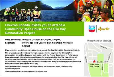
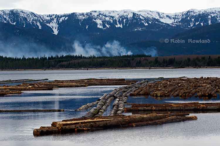
Special report: Clio Bay cleanup: Controversial, complicated and costly
Updated October 3, 2013, with DFO statement
One of the major concerns about Clio Bay is the possible lack of oxygen to support sealife. While some people have called Clio Bay “dead,” others have pointed to catches of crab, cod and salmon to dispute that.
The experience at Ward Cove, Alaska, even though it was more polluted than Clio Bay, shows that oxygen levels are highly variable, depending on season, location and depth.
In 1995, the DFO`s Institute of Ocean Siences studied dissolved oxygen levels in Minette Bay, and concluded, according to a report posted on the DFO website, that because Minette Bay was stagnant from May to November” and those conditions existed even before industrial development in the Kitimat Valley:
Examination of all the dissolved oxygen data showed that conditions before or early in the industrial development of the region were not significantly different from those observed in the 1995 to 1996 study. On the basis of these analyses we concluded that log storage and handling activities in the bay do not appear to have exacerbated the naturally occurring low dissolved oxygen conditions.
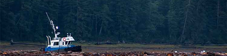
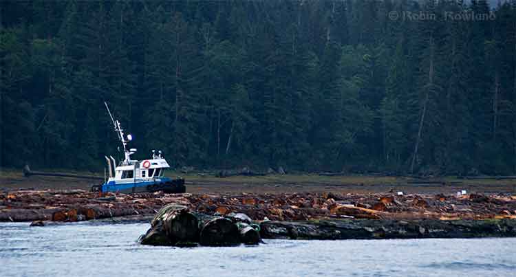
Ward Cove
The US Enviromental Protection Agency studied disolved oxygen levels at Ward Cove during water quality monitoring from 1998 to 2002. The monitoring found that dissolved oxygen levels of less than 4 milligrams per litre commonly occurred in Ward Cove during the summer and early fall. “During this time, hypoxic conditions (dissolved oxygen less than 2 milliggrams per litre) occurred occasionally at and near the bottom and less frequently in midwater areas. Hypoxia can be dangerous to both fish and bottom dwelling species.”
The EPA study showed that water circulation is restricted within Ward cove. A counter-clockwise circulation brings ocean water from Tongass Narrow into the cove along the south shore. That water usually exits after 15 days.
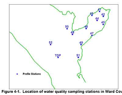
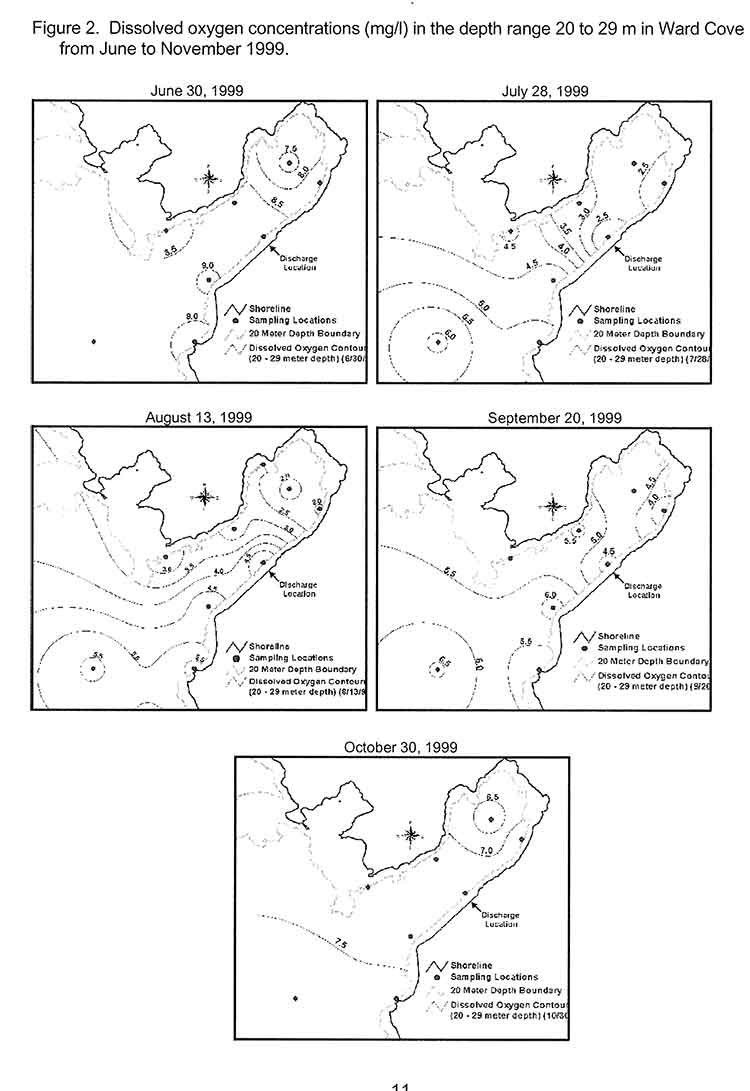
The EPA studied dissolved oxygen in Ward Cove from November 1995 to October 2002, using 13 monitoring stations, nine inside the cove and four outside in Tongass Narrows.
This monitoring found that the water column is strongly stratified during the summer resulting in poor mixing of bottom water. The EPA says during the monitoring period:
dissolved oxygen levels between 2 and 4 mg/1 were commonly observed in Ward Cove. These conditions began at water depths greater than approximately 20 metres in mid to late July and continued until early October, but oxygen levels between 2 and 4 mg/1 may also occur in water as shallow as 15 metres.
The EPA says the normal oxygen level for the surface waters of Ward Cove is approximately 8 mg/1 at 10°C. Under natural conditions and vertical stratification, dissolved oxygen levels in deeper waters can vary considerably and be reduced significantly below 8 mg/1 by respiration and the decay of organic materials, including sunken logs.
Since Clio Bay is deeper than Ward Cove, that means dissolved oxygen levels could be decreased at the greater depths.
Salmon
The Ward Cove study also confirmed laboratory studies that showed that salmon can detect and avoid areas of low oxygen. Coho, pink, sockeye, chum, steelhead, Dolly Varden and Cutthroat trout are all native to the cove. Introduced Chinook are also found at Wards Cove.
A Ward Cove report says:
Depressed dissolved oxygen conditions are unlikely to significantly affect the growth of juvenile or adult salmonids migrating through or feeding in or near Ward Cove. Some minor indirect effects, however, may occur as a result of hypoxia-induced changes to food chain organisms inhabiting the cove and adjacent waters.
The growth cycles of the adult stage of all seven anadromous salmon and trout species native to Ward Creek should be completed prior to their arrival in the cove from the ocean. Some feeding by adult cutthroat trout and Dolly Varden may occur in or near the cove as they hold in preparation for entering Ward Creek. The growth of subadult chinook salmon, a fish species not native to Ward Creek, is also not likely affected by exposures to these conditions.
Returning adult salmonids may be present in the cove when the lowest dissolved oxygen and highest water temperatures occur in late summer and early fall. Adult salmonids will usually avoid hypoxic conditions, except when staging to enter freshwater during the latter part of their annual spawning migrations. Severe depressed DO levels at this time in combination with low flows and high water temperatures in Ward Creek can result in adult mortality. Fish kills have not been observed recently in the cove, likely because the depressed DO conditions have not extended into a greater portion of the water column in combination with low flows in Ward Creek.
As for other species, the report says reaction varies, with species that are able to swim often leaving areas of depressed oxygen. Previous studies have shown that bottom dwelling species may be able to tolerate low oxygen for a short time and become susceptible if they don’t swim out of the area. Those species who are are not mobile, have weak swimming abilities, or live within the sediment are more likely to be susceptible.
That means that changes in oxygen level could mean that deaths or migration of mobile bottom dwelling species at a location, leaving the impression that species are no longer around, even though the changes may be seasonal. Scientific studies show that low oxygen levels can also make all species in that area vulnerable to disease due to stress. Low oxygen also limits swimming ability and makes a species more prone to predation.
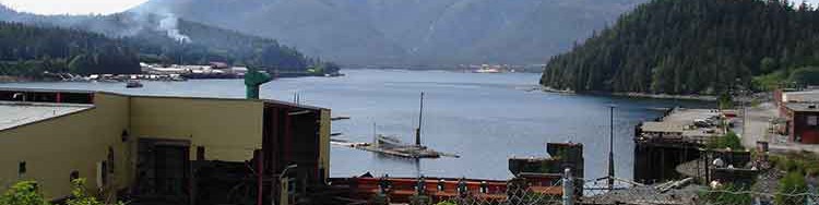
Minette Bay
From August 1995 until October 1996, the Department of Fisheries and Oceans (Institute of Ocean Sciences and the North Coast Division of Habitat Management) with the support local companies studied the water quality in Minette Bay.
A 1961 study of oceanography of the BC fjords and a second study of in 1968 had already reported finding low dissolved oxygen levels in Minette Bay.
As far back as 1975, the report says:
Concerns have been raised that the poor water quality of the bay is exacerbated if not caused directly by the log handling practices there. Other habitat disruptions have been attributed to the industrial activities associated with log handling practices in this bay, e.g. bottom scouring, bark litter, and sinkers.
The DFO report says that the purpose of our study of Minette Bay was to determine if log handling in the bay “significantly contributed to low dissolved oxygen concentrations.”
The study of Minette Bay was similar to the one then starting at Ward Cove, but on a much smaller scale, checking salinity, temperature and levels of dissolved oxygen.
The report says:
The renewal of Minette Bay deep waters occurs annually during the winter and early spring months. Renewal occurs in the form of multiple events, some of which penetrate to the bottom while others only affect the intermediate waters. These events are caused by the outbreaks of the Arctic air mass over the region. The cold air temperatures reduce run-off thereby increasing surface salinity while at the same time the strong outflow winds push the surface layer away from the head of Kitimat Arm and bring denser water closer to the surface. The cold outflow winds also cool and mix the surface waters. In the stagnant period from May to November, dissolved oxygen concentrations in the deep waters decline rapidly to near zero conditions by July and remain low until the late fall.
The 1995 study concluded, based on surveys and reports from the previous 45 years, that measurements of dissolved oxygen in 1951 before the Alcan smelter was built, through measurements in the 1960, were not different from the 1995 measurements in the deep waters.`and concluded “that log handling practices in the bay have not exacerbated the naturally occurring low DO conditions in the bay.”
`
It goes on to say while log storage and handling at Minette Bay had no apparent effect on dissolved oxygen:
other deleterious effects on water quality and habitat are possible. These impacts might include: the disruption of animal and plant ‘life on and in the sediments by the grounding of log booms or scouring of the bottom sediments by the movement of log booms; the alteration of the natural composition of the sediments and the benthic community by the accumulation of bark, whole logs and other wood debris on the sediments underneath the log storage areas and in the log dump zone; anoxia in sediments due to an increased organic load; and toxic concentrations of leachates from the logs and other wood debris.
It called for further studies of Minette Bay such as using an underwater camera, could provide a cost effective way to visually inspect and classify the bottom sediments. Those sediments could then be sampled
based on the preliminary mapping of sediment characteristics, log handling impacts and visual ·surveys. At these locations the benthic community should be sampled for diversity and species composition. This information by itself or in conjunction with historical surveys in the bay and Kitimat Arm may give a sense of the degree of impact that log handling operations are having on the ecology of Minette Bay.
It also called for studies for “two small inlets that have very shallow sills; Foch Lagoon which has a 4 metre deep sill at low water and the other is Kiskosh Inlet which has a 2 metre deep sill.”
It notes
Kiskosh Inlet has a maximum depth of about 53m and is more like Minette Bay than Foch Lagoon which has a much deeper basin (250m). Their very shallow sills suggest that the deep basin waters in these two inlets may be oxygen depleted. A comparison with Minette Bay may be instructive as there are no log storage or handling activities in either of these inlets.
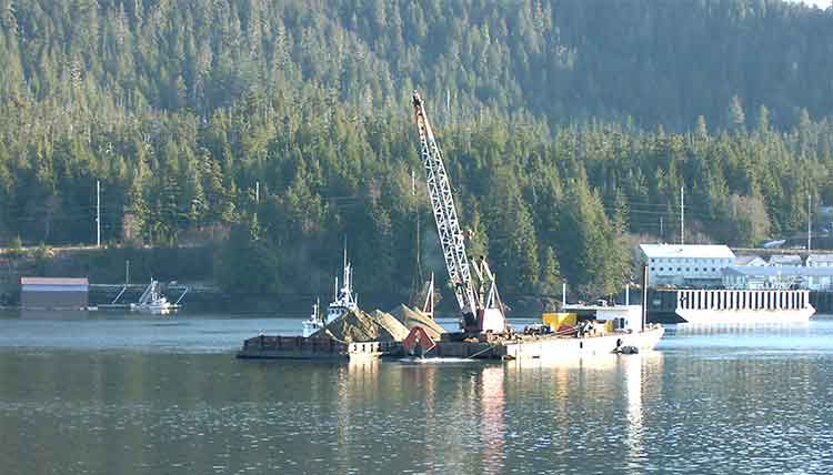
In 1997, DFO created a list of 52 sites on Douglas Channel that were used as active, abandoned or potential log dump sites, as targets for studies. The east and west sides of Minette Bay were two items on the list. Clio Bay, Foch Lagoon and Kiskosh Inlet were not on that list.
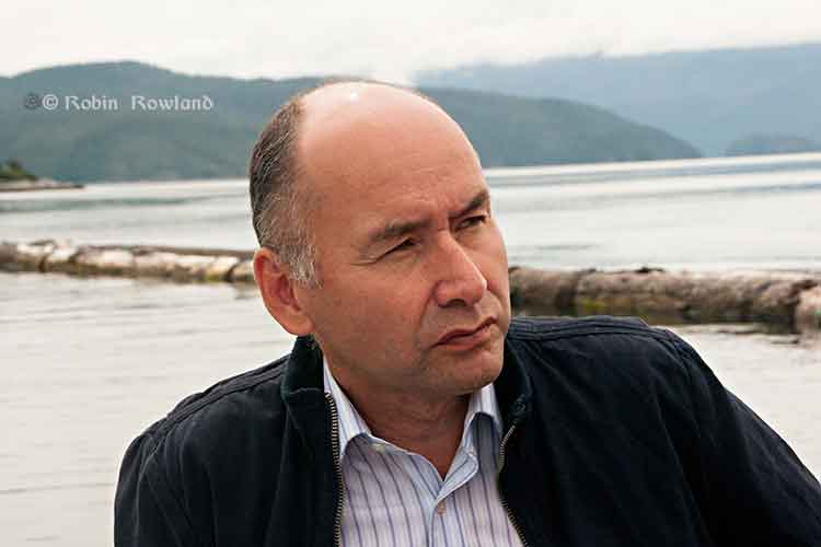
Haisla Chief Counsellor Ellis Ross says that if the Clio Bay capping project works, Minette Bay should be next.
Dissolved oxygen standards
The state of Alaska has set standards for dissolved oxygen in marine water with a minimum of six milligrams per litre in the one metre surface layer for coastal water and 5 milligrams per litre in estuaries, “except where natural conditions cause this value to be depressed,” with an additional standard of a minimum of 4 milligrams per litre at any one point in both coastal waters and estuaries.
In a statement to Northwest Coast Energy News, DFO spokesperson Carrie Mishima said, “Site-specific standards for dissolved oxygen levels will be developed for the enhanced site by sampling a control site having similar habitat parameters.”
It appears from documents posted on the DFO website that dissolved oxygen monitoring has been dismissed by DFO as too expensive until the issue became important to fish farming.
A 2005 DFO report on the Bay of Fundy noted
The time has therefore arrived for Canada to proceed seriously and rapidly toward the development and implementation of adequate dissolved oxygen standards and management protocols for the marine coastal zone and aquaculture. Such an effort will enable us to avoid the serious eco-socio-economic consequences associated with poor water quality. From a risk analyses perspective the dissolved oxygen issue might be classified as manageable. Aquaculture takes place in a relatively small proportion of the Canadian coastline and it is only within some of these areas that aquaculture is intense enough to pose potential problems. Hence, the likelihood of a major aquaculture induced depletion of dissolved oxygen is probably low to moderate and the impact of reductions is also probably low to moderate.
Another 2005 DFO report, again on aquaculture, based on meetings in Ottawa noted:
Dissolved oxygen is not yet an easily applied regulatory tool on a specific case-by-case basis, and views were mixed regarding its promise as a candidate for monitoring environmental quality in the coastal zone. However, it is one of the few options available for monitoring over hard bottoms. It is also a useful tool for predicting and assessing far-field effects in environments where oxygen levels may be a concern.
This despite the fact that Alaska and the EPA had been monitoring dissolved oxygen and setting standards for the previous decade.
Canada does not yet have national standards for dissolved oxygen levels in coastal waters. DFO says “site specific” standards will be applied at Clio Bay, but so far there are no details of what those standards will be.
[rps-include post=5057]