Kitimat Votes: 25th anniversary of Exxon Valdez disaster looms over Northern Gateway plebiscite

On March 24, 1989, the tanker Exxon Valdez plowed into Bligh Reef in Alaska’s Prince William Sound,  spilling 260,000 to 750,000 barrels or 41,000 to 119,000 cubic metres of crude oil.

That was 25 years ago. The media loves anniversary stories and the Exxon Valdez look-backs and updates are already ramping up—right in the middle of the Kitimat plebiscite on the Northern Gateway pipeline and terminal project.

The hashtag #ExxonValdez25 is beginning to trend, based on a Twitter chat for Monday sponsored by the US National Oceanic and Atmospheric Administration.

The voters of Kitimat who will have to cast their ballots on the Joint Review Panel’s interpretation of the Northern Gateway proposal will find once again that the JRP tilted toward the industry and downplayed the lingering risks from a major tanker disaster—and that means neither the pro nor the anti side can be happy with the events that will be marked on March 24, 2014.

The Exxon Valdez accident is part of the Joint Review Panel findings that the economic benefits of Northern Gateway outweigh the risks. The JRP generally accepted the industry position, taken by both Northern Gateway and by ExxonMobil that Prince William Sound has recovered from the Exxon Valdez incident, something that is fiercely debated and disputed.

One area that is not in dispute is that the Exxon Valez disaster brought laws that forced energy companies to use double-hulled tankers.  However, commercials that indicate that Northern Gateway will be using double-hulled tankers because the company respects the BC coast is pushing things a bit far, since those tankers are required by law.

Northern Gateway told the Joint Reivew Panel that

on a worldwide basis, all data sets show a steady reduction in the number
and size of oil spills since the 1970s. This decline has been even more apparent since regulatory changes in 1990 following the Exxon Valdez oil spill, which required a phase-in of double-hulled tankers in the international fleet. No double-hulled tanker has sunk since 1990. There have been five incidents of double-hulled tankers that have had a collision or grounding that penetrated the cargo tanks. Resulting spills ranged from 700 to 2500 tonnes

The Haisla countered by saying:

The Haisla Nation said that, although there have been no major spills since the Exxon Valdez spill in Prince William Sound, there were 111 reported incidents involving tanker traffic in Prince William Sound between 1997 and 2007. The three most common types of incidents were equipment malfunctions, problems with propulsion, steering, or engine function, and very small spills from tankers at berth at the marine terminal. The Haisla Nation said that, in the absence of state-of-the-art prevention systems in Prince William Sound, any one of those incidents could have resulted in major vessel casualties or oil spills.


Related: What the Joint Review Panel said about the Exxon Valdez disaster

A local daily newspaper, The Anchorage Daily News sums it all up:

The herring of Prince William Sound still have not recovered. Neither have killer whales, and legal issues remain unresolved a quarter of a century later. Monday is the 25th anniversary of the disaster, in which the tanker Exxon Valdez ran aground on Bligh Reef and spilled at least 11 million gallons of oil into the pristine waters of the sound.

Prince William Sound today looks spectacular, a stunning landscape of mountainous fjords, blue-green waters and thickly forested islands. Pick up a stone on a rocky beach, maybe dig a little, though, and it is possible to still find pockets of oil.

“I think the big surprise for all of us who have worked on this thing for the last 25 years has been the continued presence of relatively fresh oil,” said Gary Shigenaka, a marine biologist for the National Oceanic and Atmospheric Administration.

Britain’s Sunday Telegraph headlined: Exxon Valdez – 25 years after the Alaska oil spill, the court battle continues

The legal dispute over the spill is still ongoing, with the Telegraph’s Joanna Walters noting:

[S]tate senator Berta Gardner is pushing for Alaskan politicians to demand that the US government forces ExxonMobil Corporation to pay up a final $92 million (£57 million), in what has become the longest-running environmental court case in history. The money would primarily be spent on addressing the crippled herring numbers and the oiled beaches.
“There’s still damage from the spill. The oil on the beaches is toxic and hurting wildlife. We can’t just say we’ve done what we can and it’s all over – especially with drilling anticipated offshore in the Arctic Ocean – this is significant for Alaska and people around the world,” she told The Telegraph.

An ExxonMobil spokesman then told The Telegraph, the energy sector’s standard response:

Richard Keil, a senior media relations adviser at ExxonMobil, said: “The overwhelming consensus of peer-reviewed scientific papers is that Prince William Sound has recovered and the ecosystem is healthy and thriving.”
But federal scientists estimate that between 16,000 and 21,000 gallons of oil from the spill lingers on beaches in Prince William Sound and up to 450 miles away, some of it no more biodegraded than it was at the time of the disaster.

The Sunday Telegraph chronicles which species have recovered in Exxon Valdez: Animal populations in Prince William Sound, Alaska

Overall, the Exxon Valdez disaster was, as US National Public Radio reported, a spur to science. But NPR’s conclusion is the exact opposite of that from the Northern Gateway Joint Review Panel—at least when it comes to fish embryos.

Why The Exxon Valdez Spill Was A Eureka Moment For Science

Twenty-five years of research following the Exxon Valdez disaster has led to some startling conclusions about the persistent effects of spilled oil.
When the tanker leaked millions of gallons of the Alaskan coast, scientists predicted major environmental damage, but they expected those effects to be short lived. Instead, they’ve stretched out for many years.
What researchers learned as they puzzled through the reasons for the delayed recovery fundamentally changed the way scientists view oil spills. One of their most surprising discoveries was that long-lasting components of oil thought to be benign turned out to cause chronic damage to fish hearts when fish were exposed to tiny concentrations of the compounds as embryos.

(NPR also reports on the The Lingering Legacy Of The Exxon Valdez Oil Spill)

It seems that some species recovered better than others from the oilspill.

For example, the recovery of the sea otter population has received widespread media coverage, but with widely divergent points of view. The more conservative and pro-industry writers point to the recovery of the otter population, while environmental coverage stresses the quarter century it took for the otter population to rebound.

Scientific American online and other media outlets reported 25 Years after Exxon Valdez Spill, Sea Otters Recovered in Alaska’s Prince William Sound quoting a report from the U.S. Geological Survey that said that spill killed 40 percent of the 6,500 sea otters living in the sound and more in 1990 and 1991.USGS reported that the main sea otter population in the sound was 4,277 in 2013.

Although recovery timelines varied widely among species, our work shows that recovery of species vulnerable to long-term effects of oil spills can take decades,” said lead author of the study, Brenda Ballachey, research biologist with the U.S. Geological Survey. “For sea otters, we began to see signs of recovery in the years leading up to 2009, two decades after the spill, and the most recent results from 2011 to 2013 are consistent with recovery

The Joint Review Panel generally accepted Northern Gateway’s and the energy industry’s evidence on the Exxon Valdez incident and concluded

The Panel’s finding regarding ecosystem recovery following a large spill is based on extensive scientific evidence filed by many parties, including information on recovery of the environment from large past spill events such as the Exxon Valdez oil spill. The Panel notes that different parties sometimes referred to the same studies on environmental recovery after oil spills, and drew different conclusions.

In its consideration of natural recovery of the environment, the Panel focused on effects that are more readily measurable such as population level impacts, harvest levels, or established environmental quality criteria such as water and sediment quality criteria.

The Panel finds that the evidence indicates that ecosystems will recover over time after a spill and that the post-spill ecosystem will share functional attributes of the pre-spill one. Postspill ecosystems may not be identical to pre-spill ecosystems. Certain ecosystem components may continue to show effects, and residual oil may remain in some locations. In certain unlikely circumstances, the Panel finds that a localized population or species could potentially be permanently affected by an oil spill.

Scientific studies after the Exxon Valdez spill indicated that the vast majority of species recovered following the spill and that functioning ecosystems, similar to those existing pre-spill, were established.
Species for which recovery is not fully apparent, such as Pacific herring, killer whales, and pigeon guillemots, appear to have been affected by other environmental factors or human influences not associated with the oil spill. Insufficient pre-spill baseline data on these species contributed to difficulties in determining the extent of spill effects.

Based on the evidence, the Panel finds that natural recovery of the aquatic environment after an oil spill is likely to be the primary recovery mechanism, particularly for marine spills. Both freshwater and marine ecosystem recovery is further mitigated where cleanup is possible, effective, and beneficial to the environment.

Natural processes that degrade oil would begin immediately following a spill. Although residual oil could remain buried in sediments for years, the Panel finds that toxicity associated with that oil would decline over time and would not cause widespread, long-term impacts.

The Panel finds that Northern Gateway’s commitment to use human interventions, including available spill response technologies, would mitigate spill impacts to ecosystems and assist in species recovery..

It is clear, however, from the local coverage in Alaska and from the attention of the world’s media that Prince William Sound has not fully recovered from the Exxon Valdez incident (it may yet in who knows how many years). Anger and bitterness still remains among the residents of Alaska, especially since the court cases are dragging on after a quarter century.

Those are the kinds of issues that Kitimat residents will face when they vote in the plebiscite on April 12. Just who do the people of Kitimat believe, those who say the chances for a spill are remote and the environment and the economy will quickly recover? It probably depends on whether or not you consider 25 years quick. Twenty-five years is quick in geological time but it is a third or a half of a human life time.

As for the residents of Kitamaat Village, and probably many people in Kitimat, Haisla Chief Counsellor Ellis Ross summed it up in a Facebook posting on Sunday

If this happens in Kitamaat, all those campaigning for Enbridge will pack up and leave for another coastline to foul. Haisla don’t have much of a choice. We would have to stay and watch the court battles on who should pay what.

Ross is right. Whether it’s Prince William Sound or Douglas Channel, the people who live the region are stuck with the mess while the big companies walk away and the lawyers get rich.


Anniversary stories (as of March 23, 2000 PT)

Alaska Media

Valdez Star
First Associated Press story on Exxon Valdez Oil Spill reprinted

KTUU

Exxon Valdez Oil Spill 25th Anniversary: Alaskans Remember

Alaska Dispatch

Exxon Valdez oil lingers on Prince William Sound beaches; experts debate whether to clean it up

While Alaska’s Prince William Sound is safer, questions linger about preventing oil spills

Recalling the shock and sadness of Exxon Valdez spill 25 years ago

How the Exxon Valdez spill gave birth to modern oil spill prevention plans

Seward City News
25 years later Exxon Valdez memories still stink

Bristol Bay Times
Exxon lesson: Prevention, RCACs the key to avoiding future disaster

Anchorage Daily News
Red Light to Starboard: Recalling the Exxon Valdez Disaster

Exxon Valdez photogallery

25 years later, oil spilled from Exxon Valdez still clings to lives, Alaska habitat


World Media
Al Jazeera
The legacy of Exxon Valdez spill
The tanker ran aground 25 years, but the accident continues to harm the environment and human health

Vancouver Sun
Opinion: Oil spills — the 10 lessons we must learn Reality check: Next incident would ruin coastal economy

Seattle Times

Promises broken by the Exxon Valdez oil spill, 25 years later

SFGate

25 years since the Exxon Valdez spill

CNN
After 25 years, Exxon Valdez oil spill hasn’t ended

Where was the big aftershock? East of Haida Gwaii, USGS, west of Haida Gwaii, Natural Resources Canada

USGS map of Oct 31 aftershock
A map from the USGS shows that the latest 5.1 aftershock from the Oct. 27 earthquake occurred east of Haida Gwaii, in Hecate Straight. (USGS)

The latest aftershock from the 7.7 magnitude earthquake off Haida Gwaii occurred east of the islands, according to preliminary data released by the US Geological Survey. Canadian data, however, shows the quake west of Haida Gwaii.

The USGS marked the aftershock at 52.500°N 131.100°W at a depth of one kilometre or .6 mile. No tsunami warning was issued.

Natural Resouces Canada data puts the quake at 52.4 North 132.4 West, adding the earthquake “was felt at Queen Charlotte City and Skidegate. There are no reports of damage, and none would be expected.”

The NRC map shows the aftershock on the Queen Charlotte fault line.  However, if the USGS map is correct, an aftershock on the east side of Haida Gwaii could raise questions of the potential hazard for Douglas Channel.

Both services said the aftershock occurred at 3:15 am November 1, using Universal Time. An automatic bulletin from the Canadian earthquake centre recorded the quake as 5.0 20:15 PDT. Oct, 31, 97 km SSW of Queen Charlotte City.

No tsunami warning was issued.

According to the USGS the aftershock was

181km (112mi) SSE of Masset, Canada
208km (129mi) SSW of Prince Rupert, Canada
278km (173mi) SW of Terrace, Canada
493km (306mi) NW of Campbell River, Canada
679km (422mi) SSE of Juneau, Alaska

Natural Resources Canada map showing its call on the location of the Oct. 31 aftershock.

USGS link to add aftershock location to Google Maps


USGS earthquake report

Natural Resources Canada earthquake report

Northwest Coast Energy News will update this story if newer data is available Thursday morning. Although no tsunami warning was issued, tonight’s event is another example of the confusion that can result from automatically generated earthquake data. If the event east of Haida Gwaii is confirmed, it means that the level of tsunami hazard for Douglas Channel will have to be reconsidered.

After the earthquake: Kitimat must immediately upgrade its emergency communications

As a 7.7 magnitude earthquake hit off Haida Gwaii shortly after eight o’clock on Saturday, I was at the Haisla Recreation Centre as the Haisla Nation marked the return of the G’ps Golox totem pole. Like a boat being lifted by gentle waves, the Rec Centre began to quietly roll up and down, then the rolling seemed to accelerate just a bit. I realized that it was an earthquake. As I told CBC’s Ian Hanomansing  later in the evening, I have been in a number of earthquakes, and for me at least, this quake, at least at Kitamaat Village, the rec centre was not shaking as badly as in some of the others I have felt.

The subsequent events of the evening show that the emergency communication system in Kitimat needs immediate improvement.

Cell service

Cell phone service at the village is poor and after the rolling stopped neither myself nor my Kitimat Daily colleague Walter McFarlane was able to get “bars.”

Now as a former network producer for both CBC and CTV I have handled a large number of earthquake stories from around the world over the past quarter century (sitting at a desk, I should add). With that experience, I was hoping to get a cell hit at the village so I could bring up Twitter. I already subscribe to the US Geological Survey and Canadian earthquake alert feeds. The US and Canadian computers automatically report earthquakes within seconds of detection and send out a Twitter bulletin as the same time as those computers are alerting their human masters. If I had been able to get cell service I would have known within minutes that the Haida Gwaii earthquake was a major event. (I did follow the alerts from my computer once I got back to Kitimat itself).

Recommendation One. Cell service in Kitimat, Kitamaat Village, the harbour area must be upgraded as soon as possible. Telus has applied to council to erect a new cell tower here. Given the events of the past 24 hours, District Council should make sure that all parts of the District of Kitimat and the Haisla Nation have proper cell coverage no matter what service one subscribes to, not just for the convenience of subscribers but for emergency situations.

Automatic alerts

With experience one knows that in a situation such as Saturday night, the official websites such as the US Geological Survey and the Pacific Tsunami Warning Center as well as  Natural Resources Canada are often overwhelmed. That is why the media use RSS feeds, Twitter feeds and e-mail alerts. It is also important to realize that these emergency organizations have their own language and procedures. It appears that a lot of the confusion on Saturday came from misinterpretation of the various Canadian and US warning systems.

Recommendation Two. If Kitimat emergency services are not familiar with how the US based earthquake and tsunami centres work, they should be trained in those systems, simply because the Americans are well ahead of Canada in these areas because the alerts go out by computer automatically and are constantly updated and as Saturday night showed, are often quicker and farther ahead than the Canadian systems.

Once I was back in Kitimat, it was clear that communications were breaking down, and this was at a time the tsunami warning was still active. There were numerous messages on Twitter and Facebook, from residents of Kitimat either trying to find out what was going on or retweeting/reposting rumours including one that the Kildala neighbourhood was being evacuated. I am told that residents were calling the RCMP to ask what was going on. This was another breakdown since North District HQ in Prince George handles all police services in this region and were likely busy with quake calls on Haida Gwaii, so that information calls in Kitimat that should have been handled by an emergency services public communications person were being handled the Mounties.

There were reports that one man was going door to door in Kildala telling people to evacuate. Whether this person was well intentioned but misinformed or a imposter intent on mischief doesn’t matter, there was an information vacuum.

It was clear from Twitter that other districts and municipalities were using that service to spread official information. (I don’t follow other areas on Facebook so it is unclear if information was being posted on Facebook. There was certainly no official presence from Kitimat on Facebook Saturday night.) It appears from reports in the Kitimat Daily and tweets about the Northern Sentinel that Kitimat emergency services was sending information out by fax. While faxing information was an advance in the 1980s, faxes are obsolete in 2012. Many major newsrooms no longer use fax machines after being inundated by junk faxes and after they laid off all the editorial assistants who would have cleared those fax machines (even by the late 90s most faxes were dumped in the garbage unless the EA had been told to look for a specific fax). Also though it is now more than two years since I returned to Kitimat and I regularly freelance for Global, CBC and Canadian Press, I had no contact from anyone in emergency services (also I don’t have a fax machine).

Recommendation Three: The District of Kitimat must immediately bring its emergency communications into the 21st century, with Twitter accounts, a Facebook page and an emergency e-mail or text message plan for media and other officials who can get the messages. ( A number of jurisdictions already use text messages for emergency alerts at various graduated levels, official, media, public). When the main means of communication today is social media, an emergency organization can no longer follow outdated procedures, an organization must be on social media immediately it becomes clear that there is an emergency (as we are seeing with all the official tweets with the Hurricane Sandy crisis on the east coast)

CFTK

In an emergency situation, local radio and television are vital to communications and letting people know what is going on.

CFTK did a much better job on March 27. 1964 after Kitimat felt the magnitude 9.2 Good Friday Anchorage earthquake than it did on the weekend with the Haida Gwaii earthquake.

The inadequate coverage of the quake was certainly not the fault the of the current CFTK news staff who were working hard (probably on their own time and unpaid) keeping Twitter updated with what they knew. The fault lies with corporate management across the media which these days doesn’t want to spend the money and resources and training to fulfill the public service portion of their broadcast licence mandate.

(There was a similar breakdown in the May 2000, Walkerton, Ontario e-coli crisis where the local medical officer of health was initially unable to alert the public because local radio wasn’t staffed on the weekends–the local stations were taking satellite feeds from their corporate headquarters)

In 1964, long before satellites, when the microwave towers that joined CFTK to the Canadian networks were still being built, the staff of CFTK, then, of course under local management, went to a live special within an hour of the Anchorage quake being felt far off from Alaska in Kitimat. The CFTK anchors were keeping its audience updated with “rip and read” wire copy, a camera on an atlas for a map and phone interviews.

In contrast, on this Saturday night, CFTK was taking the CBC BC network feed which was a hockey rerun (hardly a show that attracts  major audience numbers and certainly not a vital broadcast) until the CBC management in Vancouver decided to go to full network news special.

Since CFTK is the station that broadcasts not only to Kitimat, but to Haida Gwaii as well, CFTK should have been ahead of Vancouver on this story, called in its staff and mounted their own live special, joining the CBC feed when it began but, as on an election night, breaking away for local news when justified. CFTK has a responsibility under its licence from the CRTC to provide that service to the northwestern region, not just sending what ad revenue it generates back to Astral.

Rio Tinto Alcan

Another question that must be asked in this situation is where was Rio Tinto Alcan on Saturday night? In all areas that were under a tsunami warning the first scrutiny and clue if there was to be a problem is that region would be found by observing what has happening between the low tide line and the maximum hide tide line. In Prince Rupert, from the Twitter feeds I saw, public officials were monitoring the waterfront and the tide lines and updating the public. RTA has all the advantages of the private port of Kitimat. It appears that monitoring the water level at the tide lines at the port of Kitimat was the responsibility of Plant Protection. Was RTA communicating what was happening with emergency services? Since RTA runs the private port, unlike in other jurisdictions, RTA had a responsibility to the people of Kitimat to report promptly to the public the conditions on the waterfront. Corporate public relations cannot just be sending out news releases with “good news.” That means that RTA public relations should have used its corporate Twitter account which usually sends out a news release every few weeks, to keep Kitimat updated on a minute-by-minute basis. If RTA communications staff in Kitimat do not have access to the RTA corporate Twitter account, they should establish their own local Twitter feed.

Both in 1964 and in 2012, the tsunami that came up Douglas Channel was minimal. But we know that this region does have a record of major quakes and that Douglas Channel has also experienced major landslides that can, in some circumstances, trigger a tsunami without an earthquake. The next few years will be seeing more industrial development along Douglas Channel which can also bring other hazards to the Kitimat region. While there are always communications breakdowns in situations like happened on Saturday, it is clear that the Kitimat emergency communications system needs a major upgrade to make sure the public is informed quickly and accurately of what is going on.


Earthquake, magnitude 6.4, strikes off west coast of Vancouver Island

Environment Earthquake

 Last updated 1444 PT

525-intensity-thumb-500x586-524.jpg
A 6.4  magnitude earthquake struck off the west coast of Vancouver Island at 12:41 PM PT, Friday, Sept. 9, 2011.  Iniitial reports say there were was no damage or injuries. The US Geological Survey first set the magnitude at 6.7, but that was later revised to 6.4  A 6.4  magnitude is considered a major earthquake.  The quake was not felt in the Kitimat region but was in Vancouver Island towns like Campbell River, Port Alice and Port Hardy.  In the small village of Zeballos, residents gathered quickly at an emergency gathering point, but it was soon clear that danger had passed and there were no injuries. Shaking was felt in Vancouver and Victoria, as far south as Seattle and east to Abbotsford. 

US Geological Survey page on the Vancouver Island earthquake.

The West Coast and Alaska Tsunami Warning Centre has not issued a tsunami alert.


To: U.S. West Coast, Alaska, and British Columbia coastal regions
From: NOAA/NWS/West Coast and Alaska Tsunami Warning Center
Subject: Tsunami Information Statement #1 issued 09/9/2011 at 12:43PM PDT

A strong earthquake has occurred, but a tsunami IS NOT expected along the California, Oregon, Washington, British Columbia, or Alaska coast. NO tsunami warning, watch or advisory is in effect for these areas.

Based on the earthquake magnitude, location and historic tsunami records, a damaging tsunami IS NOT expected along the California, Oregon, Washington, British Columbia, and Alaska coasts. Some of these areas may experience non-damaging sea level changes. At coastal locations which have experienced strong ground shaking, local tsunamis are possible due to underwater landslides.

The USGS says the epicentre was 119 km WNW of Ucluelet, 138 km WSW of Campbell River, 140 km SSE of Port Hardy and 289 km WNW of Victoria.

 US Geological Survey maps showing history of earthquakes off Vancouver Island.

Earthquakes Canada information page from Natural Resources Canada.

Emergency Info BC


Northwest coast hazards


526-hazardmap.jpg
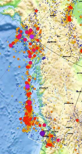
This detail of the Natural Resources Canada/ Earthquakes Canada shows the historical record of earthquakes along the northwest coast of British Columbia. The larger the circle, the greater the magnitude.

Most, not all, the earthquakes took place in the tetonic plate boundaries off the coast in the middle of the Pacfic Ocean, although the map does also show quakes on Haidi Gwaii. However, large quakes can be felt far inland.  The magnitude 9.2 Good Friday earthquake in Alaska in 1964 did shake the town of Kitimat.


Media links

CBC :Earthquake strikes off Vancouver Island’s west coast

Global BC 6.4 earthquake hits off Vancouver Island

Globe and Mail
6.4 earthquake hits off Vancouver Island