Clio Bay Editorial:Hire the experts. This is not the time to be learning on the job

Special report: Clio Bay cleanup: Controversial, complicated and costly

Editorial:

Hire the experts. This is not the time to be learning on the job.

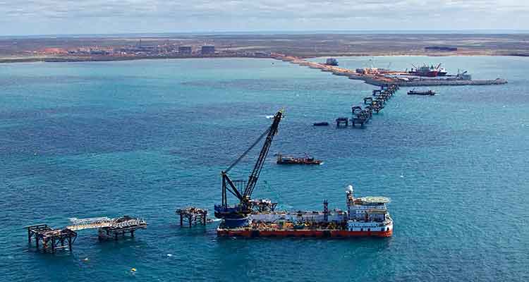
Everyone in the Kitimat and Kitamaat Village are facing a dilemma, a dilemma that should have been solved a year ago, when it was first known that the KM LNG project at Bish Cove had grossly underestimated the amount of marine clay and other material that has to be removed for the liquified natural gas terminal, a total of about 3.5 million metric tonnes.

The Haisla and Chevron are proposing that much of the clay be deposited over sunken logs in Clio Bay.

Chevron, which only took over operations at KM LNG in December 2012, is still learning on the job.

When the Clio Bay capping plan became public, far too late in the process, only then did Chevron begin to take a serious look public worries about the environmental problems that might result from depositing all that marine clay in Clio Bay.

Chevron hired Stantec, a well-known international  consulting firm with close ties to the energy industry and some experience in remediation to evaluate Clio Bay. Although Chevron said in a statement that Stantec is a company  “with extensive experience in many major habitat restoration projects,” it appears that Stantec, in the case of Clio Bay, is a jack of all environmental trades and master of none, just learning on the job.

In answer to questions by Northwest Coast Energy News, Chevron cited two studies supplied to them by Stantec. One was Chris Picard’s (now with the Gitga’at First Nation) study of Clio Bay which anyone can find by using a Google Search. The second was an overview chapter of west coast North American logging practices from a book published 22 years ago.

Any of the web saavy undergraduate journalism students I once taught at Ryerson University could have done better. This semi-retired reporter, without the resources he once had in a major newsroom, easily found the studies of the log filled Ward Cove, the State of Alaska’s recommended remediation practices, the capping procedures recommended by the US Army Corps of Engineers and more. Chevron did not mention Stantec citing the 1995 DFO study of nearby Minette Bay which can easily be found on the DFO website.

A letter from Fisheries and Oceans to District of Kitimat Council only mentions Dungeness crab and not the Haisla desire to restore halibut and cod to Clio Bay. That can only raise suspicions that the DFO is also depending solely on Chris Picard’s limited survey of Clio Bay.

In Alaska, at Ward Cove, there were almost five years of studies on the ocean environment before part of the cove was dredged and parts of the cove with thousands of logs there were capped with fine sand.

The people of Kitimat and Kitamaat want the LNG project to proceed. Everyone wants a clean and sustainable ocean enviroment, whether in Clio Bay, Minette Bay or down Douglas Channel. The problem of that 3.5 million cubic metres of marine clay must be handled in a timely fashion so the LNG terminal can move to the next step in the coming months. There is no time for five years of studies before proceeding.

This site would not normally endorse one large corporation over another.

There isn’t time for Chevron and Stantec to be learning on the job, its technicians racing in their boats between Clio Bay and Bish Cove trying to figure out what is going on and casually asking people what they think. No time at all.

The clock is ticking. Chevron and Apache, in partnership with both the Haisla and the District of Kitimat, should immediately hire the companies that do have the expertise in remediating a northwest Pacific coast bay filled with sunken logs, the companies that cleaned up Ward Cove in Alaska. Integral Consulting was the main environmental consulting contractor at Ward Cove, assisted by another large firm, Exponent  and by Germano and Associates, a company that  according to its website specializes in “rapid seafloor reconnaissance”. Both Integral and Exponent are, like Stantec, giant international consulting firms.  In this case, experience has to count. While Stantec’s website does list remediation projects, none are similar to Clio Bay.

A letter from Fisheries and Oceans to the District of Kitimat says that:

Chevron will be required to conduct a pre-construction, construction and post construction monitoring program. Pre-construction monitoring will include collection of baseline information that will be used to assess effectiveness monitoring during and at the completion of the project. Water quality monitoring for turbidity and total suspended solids will be undertaken during construction to determine if established performance criteria are met.

From the reports available from both the EPA and the State of Alaska it appears that the companies that cleaned up Ward Cove did just what DFO is asking, assess and monitor.  Another reason to hire the experts rather than the newbies.

Why a three way partnership? Chevron/Apache and the Haisla Nation are already partners in the Clio Bay plan. Adding the District of Kitimat would establish trust and make sure that the results of any scientific and engineering studies, plans and operations would be available to the people of Kitimat (as well as some Haisla members who feel they were excluded) as part of the ongoing process. The partnership would make up for the lack of transparency up until now, make sure the public is kept up-to-date and not just by Chevron’s and DFO’s communications people since reports to the District could be reviewed by the engineering staff and members of council.

It is likely that those companies that worked at Ward Cove could quickly let everyone know whether the idea of capping at Clio Bay with marine clay is a viable option and if it is viable how to do it properly rather than just dumping the clay from a barge using a hose. If marine clay is not viable for Clio Bay, it is likely that those firms could advise whether one of the original plans, to dump the clay in the deep ocean, is a better solution, or if there is another alternative that no one has thought of.

Kitimat and Kitamaat are lucky. The recommended practice for capping sunken logs is using sand. There is here a ready source at the Kitimat Sand Hill. If marine clay is not a viable option, or for future projects, the Sand Hill can easily be used to fulfill the aims of both the Haisla Nation and the residents of Kitimat to clean up Clio Bay, Minette Bay and eventually all 50 other sites identified along Douglas Channel by DFO in 1997. Those consulting firms have the expertise in this area and that expertise should be utilized.

Learning from the job

Even though sand has a track a record in capping, using marine clay from Bish Cove  to cap the logs at Clio Bay is probably a good idea, after all that marine clay was once at the bottom of the Ice Age Douglas Channel.

The use of sand for capping sites is well-known, there are established engineering parameters. At Ward Cove, there were studies of the angle of the slopes and how much weight of sand that the debris could hold.  Sand is very different from marine clay. At the moment, there are no engineering parameters for marine clay. It appears that no one has thought of doing slope analysis and load bearing engineering studies at Clio Bay.

Marine clay is a potential cap for all the sunken log sites on Douglas Channel and on the whole Pacific coast from Oregon to Alaska.  That means that Clio Bay is a pilot project that should be planned as carefully as possible, within the time constraints needed for construction of the LNG terminal, but not regarded as a rush job to get rid of that clay.  That means taking the time needed to do all the necessary scientific and engineering studies before the first drop of clay heads to the bottom. That is another reason to hire experts who actually know what they are doing so everyone can learn from the job.


Standards

No matter how the cleanup of Clio Bay proceeds, KM LNG, the Haisla and the District of Kitimat are facing another dilemma. What standards and benchmarks should be applied to the project?

By law, the Department of Fisheries and Oceans is responsible and will, of course, be monitoring the cleanup.

Despite assurances in a letter to the District of Kitimat, it is clear that DFO too is learning on the job.

At the moment, DFO has no standards for remediation, because the Conservative omnibus bills have gutted environmental standards in Canada. Even before the omnibus bills and the LNG rush, cleaning up log dumps was on the DFO low low priority list.

The letter from DFO to District of Kitimat council shows what knowledgeable sources have told us, DFO will be navigating Clio Bay from a desk in Kamloops (of all places). The same sources say that the Prince Rupert office of DFO, which has the expertise on the northwest coast is out of the loop on this project. The residents of the northwest coast already know there are not enough fisheries officers to properly monitor the coast. DFO “estimates” the annual recreational halibut catch (perhaps by using fish entrails rather than the traditional chicken?). DFO has retired or laid off many scientists who have studied the coast. Others have left on their own. The remaining scientists are muzzled by the Harper government, with anything they could say filtered by the Prime Minister’s Office, so it is likely that no one in the northwest will actually trust what they say.

Normally in a free and democratic society, the government tells local residents when a major operation like the remediation of Clio Bay is going to occur.  In this case, Fisheries and Oceans did not tell anyone in Kitimat anything until the District of Kitimat Council requested information.

On Monday, Sept. 30, a representative of Chevron will make a presentation to District Council. DFO did nothing more than send a letter that said: “Regretfully, Fisheries and Oceans Canada is unable to attend the scheduled council meeting.” Nobody, in the whole department? One is tempted to say, “That’s not good enough.” Then you remember that if DFO appeared before Council, the presenter would have to face possibly awkward questions from both members of Council and the media. That just doesn’t happen in Stephen Harper’s Canada, not in Ottawa and certainly not in Kitimat.

Despite what DFO has said in its letter, this regulatory vacuum leaves the Kitimat region no choice. Since Canada has no standards, when the Clio Bay project proceeds, the best available standards are those set by Alaska, which has the same type of coast and climate. The Clio Bay clean up should therefore be measured against those Alaska standards.
[rps-include post=5057]

Clio Bay: Links and Documents

Links and documents relating to sunken logs and site remediation

Note many, not all, external links are to pdf files.

Canada

DFO study of sunken log sites in Douglas Channel

DFO Study Dissolved oxygen cycle in Minette Bay

Impact of Wood debris in British Columbia estuaries

Chris Picard’s study of Clio and Eagle Bays as posted on the University of Laval website

United States

Links

Alaska Department of Environmental Conservation

Environmental Protection Agency

Ketchikan Paper Company
This is the EPA Web site on the Ward Cove cleanup and remediation with numerous documents.

EPA capping guidance
EPA contaminated sediment capping guidance

US Army Corps of Engineers

US Army Corps of Engineers capping guidance

Documents

Alaska log site remediation guide  (pdf)

EPA study of dissolved oxygen in Ward Cove (pdf)

Marine Log Transfer Facilities and Wood Waste (pdf)

Academic paper by Ward Cove consultants Geramano & Associates on sediments in Ward Cove and Thorne  Bay, Alaska.

Ward Cove Sediment Remediation Project Revisited

Academic paper by Ward Cove consultants Integral Consulting


 Other Links

Kitimat LNG (KM LNG)

Stantec

Stantec remediation project page

Integral Consulting

Integral Consulting Ward Cove web page

Exponent 

Exponent Ward Cove web page

Exponent LNG Safety web page

Germano & Associates

(Note not all documents used in this report are available online. Some sent to NWCEN are too large to upload)


[rps-include post=5057]

Chevron announces open house on Clio Bay, seeks input from stakeholders

Updates with open house location

Chevron LogoChevron, the partner with Apache in the KM LNG (also known as Kitimat LNG) project at Bish Cove, said Sunday that the company will hold an open house in Kitimat on the controversial Clio Bay reclamation project.

Chevron says there will be a public open house at Riverlodge Tuesday, October 8 from 4 pm to 8 pm.

In an e-mail to politicians and local groups, including Douglas Channel Watch, Marc Douglas, a senior advisor for Chevron, based in Calgary, invited local stakeholders for a series of one hour meetings the same day at the KM LNG offices in City Centre.

Chevron Canada invites you to a meeting to discuss the Clio Bay Marine Life Restoration Project.
This proposed project would see Chevron excavate marine clay from the Kitimat LNG construction site at Bish Cove and work closely with the Federal Department of Fisheries and Oceans to deposit this natural material in specific locations in Clio Bay. The clay will cap-off decaying wood debris left by historic log booming operations that has accumulated on the bottom of Clio Bay, damaging the Bay’s natural ecosystem. A key goal of the project is to restore natural marine life populations in Clio Bay. Come and share your thoughts and ideas with us and learn more about this innovative restoration project.


Ad for open houseThere has been growing controversy over the Clio Bay project in recent weeks. Members of the Haisla Nation and residents of Kitimat were initially told that due to the large number of sunken logs at Clio Bay, that the area was deprived of oxygen, with limited sealife and that capping the logs with clay from Bish Cove would restore the ecosystem. However, beginning with a discussion at District of Kitimat Council on September 3, more people have been challenging the idea that Clio Bay needs restoration, with fishers posting photographs of recent catches on Facebook pages.

On Sept.3, Councillor Phil Germuth told Council:  “Those logs have actually created a woody reef, where like any other reef, an ecosystem is being sustained. So to say that those logs are suffocating the life out of Clio Bay doesn’t seem to have a lot of merit.”

At the time, Chevron told the media  that they had consulted with the Department of Fisheries and Oceans and  concluded that carefully placed clay would improve the ecosystem.

Special report: Clio Bay cleanup: Controversial, complicated and costly

[rps-include post=5057]

Gil Island “critical habitat” as humpbacks double at the mouth of Douglas Channel. New study says tanker traffic could threaten key spots

Humpback whale at Bish Cove
A humpback whale, seen here by its small dorsal fin, swims past the Chevron Apache KM LNG site at Bish Cove on Douglas Channel, August 21, 2013. (Robin Rowland/Northwest Coast Energy News)


Updated with comments from Gitga’at First Nation, Nathan Cullen and Shell Canada.

Gil Island is a “critical habitat” for the world’s humpback whales, whose numbers are increasing in Douglas Channel, Wright Sound, Estevan Sound and Camano Sound and nearby waters, according to a study released Wednesday, September 11, 2013. The study also goes on to warn that potential tanker traffic through the “geographic bottleneck” on Douglas Channel to and from Kitimat could threaten that crucial “pit stop” for the humpback whales.

The study, “Abundance and Survival of Pacific Humpback Whales in a Proposed Critical Habitat Area,” by Erin Ashe, of the University of St. Andrews, in Scotland, Janie Wray of Oceans Initiative on Pearse Island, Christopher Picard of the North Coast Caetacian Society in Hartley Bay and Rob Williams of the Gitga’at Nation Lands and Marine Resources Deptartment, is published in the jourrnal PLOS One.

The research team estimated the abundance of Pacific humpback whales by using photo-identification surveillance of adult humpbacks. They found that the number of humpback whales in this region increased each year, and doubled from 2004 to 2011, resulting in a total of 137 identifiable whales in 2011. The survey was conducted year-round. Abundance was estimated only during the summer months of July to September, when the migrating whale population is largest.

The survey focused on summer feeding regions in the northwestern BC coastal fjords that serve as a “pit stop” for whales between migrations. Migrating whales travel to the BC coast from calving grounds as far away as Mexico, Hawaii or Japan. After several months without feeding, the humpbacks arrive in BC, and, the study says, show “strong site fidelity to local feeding grounds” around the entrance to Douglas Channel.

The authors estimated that “survivorship,” the average probability of an adult whale surviving from one year to the next on the northwest coast of British Columbia is among the highest reported anywhere for the species. During “this critical refueling stage in these waters, the whales are more vulnerable to environmental stressors, such as those potentially created by increasing tourism and industrial development in the region.”

The study also says that study area has also been identified as candidate critical habitat for northern resident killer whales and notes the region “has been recolonized by fin whales in recent years.” (With details on the fin whales to come in future studies)

The study estimates there were once about 15,000 humpback whales in the North Pacific when whalers began hunting the animals. That number was down to 1,400 when whale hunting was stopped in Canada in 1966. “It is therefore good news that the segment of the population using our study area is growing and adult survival is near the limit that one would expect for this species. That said, although the population is recovering, there is no evidence that it has yet fully recovered to pre-exploitation levels in BC and we do not wish to become complacent.” the study says.

It goes on to say:

Humpback whales may be facing increasing threats in at least one of their proposed critical habitats in BC. Numerous port facility expansions and new terminal proposals, including numerous crude oil and liquefied natural gas (LNG) export proposals, could substantially increase deep-sea shipping traffic through BC’s north and central coast waters. Such developments could exacerbate oil spill, acoustic disturbance, and ship strike risks to humpbacks. In particular, the Gil Island proposed critical habitat area where our work was conducted, spatially corresponds with all shipping routes leading to Kitimat, BC port facilities that are currently being considered by regulatory agencies for high-volume crude oil and LNG tanker traffic and other increased shipping activities.

The monitoring program showed that “a relatively large fraction of BC’s humpback whales rely on the waters around Gil Island, given the small size of the study area.”


Humpback whale in Douglas Channel
The tail fins of a humpback whale are seen in Douglas Channel near Bish Cove, as a fishing boat speeds toward Kitimat harbour in a rain storm on Aug. 21, 2013. (Robin Rowland/Northwest Coast Energy News)

The study warns:

This high reliance on relatively small fractions of available habitat has important implications for conservation and management. It lends support to the proposal to designate the current study area as part of the population’s critical habitat…

This also suggests that area-based management for cetaceans can effectively target small areas if these areas are chosen carefully. The corollary to this, though, is that a tendency for animals to be concentrated or aggregated in small areas lends them vulnerable to catastrophic events like oil spills and ship strikes. Critical habitats like the Gil Island waters are therefore a mixed blessing when high densities of whales are found in geographic bottlenecks that also funnel and concentrate shipping traffic. Anthropogenic threats to this must be evaluated not only in terms of the proportion of available habitat that this area represents, but also in terms of its critical importance to large numbers of whales for critical life-history processes. The risk and ecological consequences of an oil spill in this region would increase substantially if proposals were approved to ship large volumes of oil and LNG traffic through the Gil Island waters. Studies in Pacific waters similar to our study area suggest that oil spills can have severe and chronic impacts to cetacean populations and it is uncertain whether affected populations can recover from such perturbations.

One reason for the study is that while the humpback is considered an endangered species in the United States, in Canada it is listed as “threatened” under Canada’s Species at Risk Act and the increasing numbers could mean that the humpback is downgraded to “special concern.”

The study was based on what is called “community based science,” a cost-effective partnership between scientists, the Gitga’at Nation and other First Nations, NGOs and the Department of Fisheries and Oceans.

As part of its Pacific humpback whale recovery strategy, DFO has proposed four areas as candidate critical habitat. One criterion for designating critical habitats within northern BC coast feeding grounds is that inlets are used for specialized ‘‘bubble-net’’ feeding behaviour (where the humpbacks create a fishing net of bubbles to catch their prey).

Map of study areaAt the start of the study, the team had noted that “mainland inlets have been somewhat under-represented in habitat studies” and so they began working on the photo-identification of the humpbacks, using two research groups, the North Coast Cetacean Society and the Gitga’at Lands and Marine Resources Department. Surveys were conducted as weather permitted throughout the year from April to November (with occasional trips in February, March and December), from 2004 to 2011.

The aim of the study was to “collect as many high-quality photographs of individually recognizable humpback whales as possible within the study area [referred to in the study  as ‘Gil Island waters’’] from Estevan Sound in the west to Ursula Channel in the east. One 27 foot and one 18 foot boat were used to conduct the surveys. A total of 374 photo- identification surveys conducted over 47 months resulted in a catalogue of 177 high-quality, unique identifications of individual humpback whales.

Information also came from “an informal sightings network including local fishermen and tourism operators who reported humpback and killer whale sightings over VHF radio;” hydrophones monitored for vocalizing humpback whales; and visual monitoring from the land-based Cetacealab facility on the south end of Gil Island.

When a humpback was sighted, they were identified by the fingerprint like tail flukes and the numbers cataloged.

The study was funded by grants to Cetacealab and Gitga’at First Nation from Julie Walters and Sam Rose, and from Fisheries and Oceans Canada (Cetacean Research Program, Species at Risk Program). There was also support from King Pacific Lodge.

Updates


In a news release, the Gitga’at First Nation said:

“The importance of our territorial waters for humpback and other species of whales, should give pause to those who would propose tanker routes through the Douglas Channel,” said Arnold Clifton, Chief Councillor of the Gitga’at First Nation. “The increase in whales in our territory coincides with low shipping traffic, however current proposals would increase shipping traffic to unprecedented levels. We remain resolute in our determination to protect whales and the natural heritage of our territory from tankers and other developments that would put them at risk.”
“Our study shows that while still vulnerable, humpback whales are recovering, and this area plays an important role in supporting their numbers,” said lead author, Erin Ashe, a PhD candidate at the University of St. Andrews and a co-founder of Oceans Initiative. “Identifying and protecting critical habitat is one of the most effective ways to support endangered species recovery.”
The waters around Gil Island are especially rich habitat for humpback whales, due to high abundance of their preferred foods, such as krill and herring and due to the remote nature of the coastal fjords. Humpbacks, which rely on acoustic communication, are sensitive to noise pollution from ship traffic.
“It is Cetacea Lab’s contention that all levels of government must collaborate with the Gitga’at First Nation and others in protecting humpback whales from the risk of increased tanker traffic,” said Janie Wray, whale researcher with Cetacea Lab. “This study represents the best available scientific information about the importance of this area to humpback whales. Over the course of our study, we have observed the population more than double, with mothers returning year after year with their calves, introducing the next generation of juvenile whales to the nutrient-rich feeding grounds of Douglas Channel to Caamano Sound.”


In his biweekly conference call with Northwest BC reporters, Skeena Bulkley Valley MP Nathan Cullen said: “I don’t get a sense from the way that the federal government has designed this [referring to Enbridge Northern Gateway] project, that on the marine side, any of these things are important to Mr. Harper. When you start to place down the most important values and certainly for British Columbians and Canadians, protecting a humpback feeding ground would seem like an important value in the Great Bear Rainforest, you start to see where the limits and the restrictions are on any idea of moving oil super tankers through such a narrow place. It’s just another bit of evidence, a bit of science that says this is difficult, if not impossible, and Enbridge’s project has made so many of those arguments more and more clear as we start to bring science to the table.

“It’s so frustrating for people that evidence, our opinions and our values just don’t seem to matter to the federal government. They already said yes to this thing years ago and damn the science, damn anything that comes their way. That’s not going to work, not going to work for us and not going to work for the humpback whales.”

A spokesperson for Shell’s LNG Canada project, noting that the company officials had not yet read the study, said, “It’s early days for the proposed project and the start of a thorough regulatory process. We welcome contributions and thoughts on important matters. We will look at this study. As with any project in Canada we work with local First Nations and local communities to minimize the impact of our activities.”

Neither Enbridge Northern Gateway nor Apache, a partner in the KM LNG project, responded to a request for comment.

Apache sells some of its gas and oil assets, confirms commitment to Kitimat project

Apache CorporationApache Corporation said Thursday it will  sell oil and gas producing properties in the Nevis, North Grant Lands and South Grant Lands areas of western Alberta, to Ember Resources Inc., a private Canadian company, for CAN$220 million, as part of the company’s “portfolio rebalancing,” Apache said in a news release.

At the same time, Apache CEO Rodney Eichler said,  “We also remain focused on advancing the Kitimat LNG project to monetize large unconventional resources in the Liard and Horn River basins in northern British Columbia.”

“Going forward, Apache is focused on growing our liquids production from a deep inventory of crude oil- and liquids-rich opportunities that generate attractive rates of return on our extensive remaining acreage in Canada’s Western Sedimentary Basin,”  Eichler said.

“This transaction is one element of a comprehensive review of Apache’s portfolio to determine which assets make the most sense for Apache to own given our growth and return objectives and which assets are better owned by others,” Eichler said. “The Nevis, North Grant Lands and South Grant Lands assets fit in the latter category.”

Apache is selling 621,000 gross acres (530,000 net acres) and more than 2,700 wells that had average net production during the second quarter of 2013 of 67 million cubic feet of gas and 237 barrels of liquid hydrocarbons per day from late Cretaceous sands and coal seams. Apache says “it  will retain 100 per cent working interest in horizons below the Cretaceous, such as potential Duvernay and Nisku, in Nevis and North Grant Lands.”

Apache previously announced plans to divest $4 billion in assets by  the end of 2013. The company intends to use proceeds from the asset divestitures to reduce debt and enhance financial flexibility and to repurchase Apache common shares under a 30-million-share repurchase program authorized by the Board of Directors earlier this year.

In July, Apache announced an agreement to sell its Gulf of Mexico Shelf operations and properties to Fieldwood Energy LLC(Fieldwood), an affiliate of Riverstone Holdings, for cash proceeds of $3.75 billion. In addition, Fieldwood will assume all asset retirement obligations for these properties, which, as of June 30, 2013, Apache estimated at a discounted value of approximately $1.5 billion.


Kitimat in “horse race” with Australian LNG project Chevron says

Gorgon project in Australia
The Gorgon LNG project in Western Australia. Chevron says  Gorgon Project work continues to progress with the installation of the second of three amine absorbers, two condensate stabilization modules and a recycled gas compression module. (Chevron Australia)

Kitimat LNG is in a “horse race” with an LNG project in Western Australia–and at this point, according to the Australian media–Kitimat is winning, even though the Australian Gorgon project is much further ahead while the Kitimat LNG project at Bish Cove hasn’t really started.

The Australian reports come from the same conference call Chevron held with financial analysts last week, when the company said the final investment decision for Kitimat LNG has been postponed to 2014.

The Brisbane Times  is quoting Chevron as saying that expansion of the Gorgon “will be in direct competition with exports from North America, which have a cost advantage.”

Chevron has a 47.3 per cent stake in Gorgon. Shell which is developing its own project at Kitimat, LNG Canada, has a 25 per cent stake in Gorgon. ExxonMobil holds 25 per cent.

”In the case of Gorgon train four … we are happy to see both of them move forward,” Chevron vice-chairman George Kirkland told analysts late last week, referring to the competition with Kitimat. ”[There is] a bit of a horse race between them at this point.”

Shipping gas to north Asia from Canada is cheaper than exports from Australia, he said, although the challenge is to find markets for the gas. ”The development cost at Kitimat … may end up being less than in the case of Gorgon,” he said, which ”has the benefit of [being a] brownfield development on the plant side”.

”We’re going to offer volumes … and interest in the plant as a combination,” Mr Kirkland said of the Kitimat marketing plans. ”We think that’s a big advantage.

”Our goal is to maintain our … first-mover advantage … We have had some initial discussions with Asian buyers.”

The Gorgon project in the northwestern area of Western Australia. (Chevron Australia)

According to Wikipedia, the Gorgon area of Western Australia is the site for a number of liquified natural gas projects. The projects are off shore and close to the export terminals, much different from British Columbia where the gas fields are in the Peace River district in the northeast of the province.

Wikipedia says

The Gorgon field is centered about 130 kilometres (81 mi) off the north-west coast of Western Australia, where the water depth is approximately 200 metres (660 ft). Other fields in the group lie to the north, such as Jansz-Io, which covers an area of 2,000 square kilometres (770 sq mi), in a water depth of 1,300 metres (4,300 ft).

Chevron says

It is one of the world’s largest natural gas projects and the largest single resource development in Australia’s history.
The Gorgon Project is developing the Gorgon and Jansz-Io gas fields, located within the Greater Gorgon area, between 130 and 220 kilometres off the northwest coast of Western Australia.
It includes the construction of a 15.6 million tonne per annum (MTPA) liquefied natural gas (LNG) plant on Barrow Island and a domestic gas plant with the capacity to supply 300 terajoules of gas per day to Western Australia.
Gorgon LNG will be off loaded via a 2.1 kilometre long loading jetty for transport to international markets. The domestic gas will be piped to the Western Australian mainland.
The Gorgon joint venture is investing approximately $2 billion in the design and construction of the world’s largest commercial-scale CO2 injection facility to reduce the project’s overall greenhouse gas emissions by between 3.4 and 4.1 million tonnes per year. The Australian Government has committed $60 million to the Gorgon Carbon Dioxide Injection Project as part of the Low Emissions Technology Demonstration Fund.

Gorgon project wharf
A view of construction on the 2.1-km (1.3-mile ) LNG wharf with 24 caissons in place. (Chevron Australia)


In May, Reuters reported that the $52 billion Gorgon liquefied natural gas (LNG) development was 60 per cent complete. At the time, Reuters said Chevron planned to start engineering and design work for an expansion by the end of the year.

Parts of the Gorgon project are in an environmentally sensitive area, Barrow Island, which has been a nature reserve in Australia since 1910.

Wikipedia says

Barrow Island’s ecology. The island is a Class A nature reserve, and home to theflatback turtle (classified as a vulnerable species) and numerous other animals not found on the Australian mainland. Other concerns are related to the adequacy of quarantine procedures on Barrow Island to protect against the introduction of non-endemic species, and risks associated with geological sequestration of CO2.It was reported in November 2011 that native animals on Barrow Island had been accidentally killed daily with a known total of 1550 since construction began.

Chevron says

The Gorgon Project is being undertaken in accordance with strict environmental standards to preserve the island’s ecology.
Central to the Gorgon Project’s commitment to protect the conservation values of Barrow Island is the Quarantine Management System (QMS), which directs
the Project’s quarantine operations. The QMS is the largest non-government quarantine initiative in the world and was considered to be “likely world’s best practice” by the Western Australian Environmental Protection Authority. The Project’s gas processing facilities are being constructed within a 300 hectare ground disturbance limit, which represents 1.3 percent of Barrow Island’s uncleared land area.

Gorgon Project Overview Chevron document pdf

Gorgon-Progress Update August 2, 2013 pdf

Chevron postpones Kitimat LNG decision to 2014, seeks new equity partners, Dow Jones reports

The Dow Jones wire is reporting that Chevron has postponed a final investment decision on the Kitimat LNG project until 2014, “putting a deadline on a project that has already seen delays.”

Competitors are trying to sell natural gas to Asian customers using the cheaper Henry Hub North American market  benchmark rather than higher Japanese bench mark which is based on the price of oil. 

The Dow Jones report says Chevron, which is partnered with Apache, is still having problems finding customers in Asia.  It quotes George Kirkland, head of Chevron’s upstream business, as saying that the company is offering customers equity stakes in the Kitimat project. Kirkland told a conference call that equity should be more attractive to buyers.

Kirkland said the company won’t approve the project until it has lined up customers for at least 60 per cent of Kitimat’s total 5 million metric tons a year of export capacity, although Kirkland expects that to happen in 2014.

“We’ve have had some discussions with Asian buyers,” Mr. Kirkland said during a call with investors. He declined to name the companies with which Chevron was negotiating. “It’s more likely to be a 2014 (decision), not late 2013,” he said.

U.S. natural gas prices were $3.37 per million British thermal units Friday, down from $13.69 in July 2008.
Chevron to Make Final Kitimat LNG Decision in 2014

Everything you wanted to know about the LNG market (according to one report)

Cover of Ernst & Young reportA report issued by Ernst & Young, The Global LNG Report, says that there will be strong demand for liquified natural gas over the next 10 to 20 years. At the same time LNG buyers will increasingly push back from “price-sensitive buyers who are likely to be less willing to pay supply security premiums.

That means that the pricing for LNG in Asia will move away from the link to the price of oil, which, so far, has been driving the potential profit picture of Kitimat’s LNG projects.


Ernst & Young says:

Even with reasonably strong demand growth, this implies growing supply-side competition and upward pressures on development costs and downward pressures on natural gas prices. Nevertheless, the very positive longer-term outlook for natural gas is driving investment decisions, both in terms of buyers’ willingness to sign long-term contracts and sellers’ willingness to commit capital to develop the needed projects.

The report says there have been three waves of LNG development.

The first wave was dominated by Algeria, Malaysia and Indonesia, while the second wave has been dominated by Qatar and Australia. The third wave could come from as many as 25 other countries, many of which currently have little or no capacity; but by 2020, these countries could provide as much as 30 per cent of the world’s LNG capacity.

The accounting and consulting firm says the most important LNG exporters will be those in western Canada and the United States “where the source gas is likely to be priced on a spot basis, unlike gas elsewhere in the world which is generally priced (wholly or partially) on an oil-linked basis.”

The report, and the charts that accompany it, show that Kitimat appears to be well positioned in Ernst & Young chartthe new LNG market. That’s because the capital cost of developing LNG projects in Kitimat, when
compared to potential return, is a lot lower than in many competing countries.

The one problem Kitimat may face in the future is competition from U.S. “brownfield” developments that could turn import terminals into export terminals.
Ernst and Young says that country most cited as Kitimat’s competition Australia, is facing problems.


LNG project proposals are growing faster than industry’s capabilities to develop them. Generally at the high-end of the cost curve, with development bottlenecks and spiraling construction costs, Australian projects are typically under the most pressure. Sanctioned projects are generally less significantly impacted, but projects still seeking contracted off-take are at substantial risk.

One advantage for Kitimat may be that buyers, worried about the volatility of the market, may be more inclined to sign long term contracts.

Overall Ernst & Young concludes:Ernst & Young price chart

The proposed North American LNG export projects are particularly well-positioned, even though the US Gulf Coast projects will give up some of their Free On Board (FOB) cost advantage with higher shipping costs. As substantial volumes of lower-cost LNG move into Asian markets, projects at the high end of the supply curve – namely, many of the Australian projects – will become increasingly vulnerable.

Going forward over the medium-to-longer-term, Ernst & Young expects to see a gradual but partial migration away from oil-linked pricing to more spot or hub-based pricing. LNG sellers are reluctantly facing realities and are offering concessions in order to remain competitive.

Dale Nijoka, Ernst & Young’s Global Oil & Gas Leader concludes: “LNG prices are unlikely to collapse, simply because the cost to supply is high and incentives to develop new capacity must be maintained.”

Links

Ernst & Young news release

Download the full Ernst & Young report

Kitimat approves building permit for KM LNG construction camp


Ron Link of KM LNG addresses District of Kitimat Council on a building permit for the work camp. (Robin Rowland)

District of Kitimat Council tonight (March 4, 2013) approved building permits for the KMLNG work camp at the old West Fraser Eurocan paper mill site.

The first phase of the camp, called 1A will have 155 beds, followed by a second camp, called 1B with 145 beds. Council also approved a second phase, Camp 2, which will have an additional 300 beds. The camp will consist of single-storey, 44 bed dormitories, similar to those now being used at the Rio Tinto Alcan Kitimat Modernization project, a couple of kilometres away.

“This camp will support the construction of the LNG terminal,” KM LNG’s Ron Link told council, “the focus right now is a 600 man camp. Beyond that, if the final investment decision is approved, it will eventually grow to 2,800.

To build the camp KMLNG will have to demolish some of the remaining blow pipes and chip screening facilites that are there.

“Under the regulations it is a contaminated site and we have a company called Constega Rovers that are participating in sampling the site. It is certainly our attention to clean it up.

If the full 2,800 bed camp is built, the remaining part of the facility will be directly west of the current proposed campsite.

Later in the meeting council continued to debate the contenious issue of an over all camp policy for the District of Kitimat and voted to instruct district staff to “bring back a calendar with the process and dates for discussing camp policy.”

Staff would prepare a document indicating where camps are presently permitted within the District of Kitimat followd by a committee of the whole meeting dedicated to the pros and cons of camps within the district and perferred locations, services provided by the district and size limits.

There will likely be both a public town hall and a “public meeting” of council to discussion the issues later in the spring,

The debate was prompted bya proposal from the PTI Group to build a large “lodge style” work camp within the boundaries of the residential part of Kitimat, near the hospital and City Centre Mall. The PTI proposal would require amendments to both zoning and the Official City Plan. The KMLNG and RTA camps are in areas zoned for industrial use and would not be affected by a change to the official plan for the residential area.

Chevron advertises for Houston-based Kitimat plant logistics manager

Chevron, which recently took over management of the Kitimat LNG project is advertising for a Houston, Texas, based logistics manager for the project.

The ad gives (in part) this job description:

Chevron is accepting online applications for the position of Kitimat Plant Logistics Manager located in Houston, TX through February 19, 2013 at 11:59 p.m. (Eastern Standard Time).

The Kitimat LNG project is located in Western Canada and includes 1) construction of the 2 x 5.5 MTPA Kitimat LNG Plant and 2) the Pacific Trails Pipeline.

Responsibilities for this position may include but are not limited to:

Responsibility for overseeing and managing the entire plant logistics program including module, equipment and bulk cargo logistics throughout the overall supply chain. Development of the necessary organizational capability within the Kitimat team, Engineering, Procurement & Construction (EPC) Re / Engineering, Procurement and Construction (Management) (EPCM) Contractor organization, and selected logistics contractors’ organizations

Assist in the development of contract ITB templates and scopes of work for project logistics contracts for (a) Heavy module marine/road transport and (b) General cargo transport from worldwide locations to module yards and Kitimat, freight forwarding services, and in-country transport, including development of criteria to evaluate bids.

Oversee the selected logistics contractors’ performance of project logistics, focusing primarily on the movement of prefabricated modules from multiple locations to ports near Kitimat.