Clio Bay: Ward Cove, Alaska, benchmark for log remediation

Special report: Clio Bay cleanup: Controversial, complicated and costly

Ward Cove
Ward Cove, Alaska, in 2005, after the remediation of the bay was completed in 2001 and old industrial buildings were being demolished. (EPA)


Ward Cove, just eight kilometres west of Ketchikan, Alaska, was so polluted by effluent from pulp and saw mills and a fish plant, and filled with 16,000 sunken lots that it qualified for a U.S. Environmental Protection Agency Superfund cleanup.

The Ward Cove project is now considered a benchmark for cleaning up similar bays. Alaska officials emphasized to Northwest Coast Energy News, that while Ward Cove does provide guidelines for capping and dredging logs, they were not aware of any project where logs were capped that did not have other forms of contamination.

If you take a look at satellite images of Clio Bay, BC and Ward Cove side by side you immediately you see the similarities and differences between the two bodies of water. (Note due to parameters of Google Earth, images are slightly different scales)

Satellite image of Clio Bay
Google Earth image of Clio Bay
Google Earth image of Ward Cove, Alaska

Both Clio Bay and Ward Cove are 1.6 kilometres long, somewhat elbow shaped, off a main channel and surrounded by mountains.Ward Cove is 0.8 kilometres wide. Clio Bay is about 0.5 kilmetres wide, 0.8 at its widest point. Both have steep slopes from the mountains. Ward Cove is 61 metres deep at the mouth of the cove, descreasing toward the head. Clio Bay is deeper, 182 metres at the mouth, 90 metres in the centre and between 20 metres and 9 metres at the head.

Both Clio Bay and Ward Cove are subject to tidal circulation. Both Clio Bay and Ward Cove are also influenced by fresh water. Ward Cove is fed by Ward Creek, a smaller Walsh Creek and runoff precipitation the enters the cover from the steep mountain slopes. Clio Bay is fed by one creek, a number of small streams and mountain slope runoff, especially during the spring melt.

Haisla Chief Counsellor Ellis Ross estimates there are between 10,000 and 20,000 sunken logs in Clio Bay. The official summary from the United States Environmental Protection Agency said there were 16,000 sunken logs in Ward Cove.

The major difference with Ward Cove is that it was the site of major industrial development including a pulp mill, a sawmill and a fish plant. That meant the level of pollutants in Ward Cove were much higher than in Clio Bay, which has never been used for an industrial plant. It was the pollutants in Ward Cove, mainly ammonia, hydrogen sulfide, and 4-methylphenol combined with the thousands of sunken logs that made the cove a target cleanup and the associated studies.

A fish plant, Wards Cove Packing opened in 1912 and ceased operations in 2002. The Ketchikan Paper Company mill began operating in 1954 and closed in 1997. Prior to 1971, with the rise of the enviromental movement no permits were required by KPC for discharging effluent into the cove. After that the US Environmental Protection Agency issued a discharge permit and monitored effluent. Throughout the time the KPC mill was operating, the EPA says, “high volumes of log storage (approximately 7 billion board feet) caused accumulation of bark waste and sunken logs at the bottom of the cove.” Gateway Forest Products, a sawmill and veneer plant, continued to store logs in Wards Cove until 2002.

A 2009 monitoring report, conducted by the US Army Corps of Engineers after the cleanup for the EPA noted:

An ecological risk assessment was also conducted using a food-web assessment to estimate risks of bioaccumulative chemicals to representative birds and mammals at the top of the Ward Cove food web. The chemicals evaluated were arsenic, cadmium, mercury, zinc, chlorinated dioxins/furans, and PAHs. The results of this assessment indicated that there are no unacceptable risks to higher trophic level organisms in Ward Cove.

A human health risk assessment was conducted to identify potential risks posed by chemicals detected in sediments or seafood (e.g., fish, shellfish). Ingestion of seafood that may contain chemicals bioaccumulated from the sediments was identified as the only complete exposure pathway for humans. The chemicals that were evaluated included: arsenic, cadmium, mercury, zinc, phenol, 4-methylphenol, chlorinated dioxins/furans, and PAHs. Results concluded that sediments in Ward Cove do not pose an unacceptable risk to human health.

A 2007 report on the Wards Cove remediation from the Alaska Department of Environmental Conservation, noted:

The continuing residues impairment in Ward Cove is caused by the historical accumulation of wood waste on the bottom of the cove. The waste includes an estimated 16,000 sunken logs over at least 75 percent of the bottom and decomposing pulp, wood, and bark waste in sediments in thicknesses up to 10 feet over at least 50 percent of the bottom. Wood waste residues can displace and smother organisms, alter habitat, release leachates, create anoxic conditions, and produce toxic substances, all of which may adversely affect organisms that live both on top of sediments and within sediments.

That is a similar problem to Clio Bay.

The report notes that problems with oxygen increase with depth, noting:

The dissolved oxygen impairment was due largely to the fish-processing waste discharge from the seafood processing facility until 2002, and it was limited to the summer months in deeper waters of the cove (below the picnocline, or stratification layer, approximately 10 meters deep). With that discharge removed, limited monitoring in August and September 2003 indicated that dissolved oxygen impairment might remain near the bottom in waters at depths of 30 meters and greater at certain times and locations due to low natural levels of dissolved oxygen and the continuing decomposition of wood waste. Above 30 meters depth, the waters of the cove appeared to meet the [Alaska state] standard for dissolved oxygen. However, there may be limited capacity for waters at 30 meters and deeper to receive additional loading of oxygen-demanding materials and still meet the standard in summer months.

That should mean that the worries about oxygen depletion at Clio Bay are justified due to Clio’s greater depth.

Studies of the biology of Ward Cove began in 1951, with more in the 1960s and one in 1974. In 1995, Ketchikan Paper Company signed a consent decree with the EPA that called for remediation of Ward Cove, In 2000, KPC and Gateway Forest Products signed a second consent decree with the EPA. Those agreements called on the companies to dredge sediments to improve navigation, remove logs and other debris from the dredging areas and “placing a thin-layer cap of 15-30 cm (six to 12 inches) of sand over about 11 hectares (27 acres) of sunken logs.”

The major studies of Ward Cove began in 1995 after first consent decree. The remediation did not take place until the initial studies were complete in 1999, with dredging and capping taking place from November 2000 to March 2001.

The EPA positioned 13 water quality monitoring stations which operated from 1997 to 2002, to measure salinity, temperature and disolved oxygen, nine inside Ward Cove and four outside the cove in Tongass Narrows. Those studies showed that levels of dissolved oxygen in the cove varied by season, depth and location. Many species from salmon to mobile bottom dwellers like crabs were often able to detect and avoid low oxygen areas.

The plan

The EPA and the companies involved planned the remediation so that it included both dredging, capping logs and sediment and leaving some areas where nature would take its course.

The reports say that complete dredging, removal and disposal of the contamination would have cost $200 million,  The total actual cost of the Ward Cove Remediation Project, beginning with development of the Remedial Design Work Plan, was estimated to have cost $3,964,000 (in 2000 US dollars).

The EPA says cost for the capping component of the project “including preliminary field investigations and reporting, design and plans development, post construction engineering, procurement, construction management, project management, mobilizationm demobilization, engineering/QC and science support, surveys, and capping items” was $2,563,506. Based on the volume of capping material placed, the unit cost of log capping for the Ward Cove Remediation Project was $110 per cubic yard.

Sunken logs retrieved at Ward Cove.
Old logs retrieved from Ward Cove, Alaska during dredging operations to improve navigation. (EPA)

The plan called for dredging about 17,050 cubic yards in the area near the cove’s main dock and the dredging of 3,500 yards metres nearby to improved navigation. Before the dredging, 680 tonnes of sunken logs had to be removed. After dredging, a “thin-layer cap of clean, sandy material” was placed in dredged areas unless native sediments or bedrock was reached during dredging.

In other areas, most covered in sunken logs, the plan called for placement of a thin-layer cap (approximately 6- to 12-inches) of clean, sandy material, with the possibility of “mounding” dropping mounds of sand on specific areas. The 2009 report says the area of sand deposits actually increased “due to the fact that thin layer placement was found to be successful over a broader area, and it was not necessary to construct mounding.”

The plan called for natural recovery in areas where neither capping nor mounding was practicable and so about 50 acres was left alone. (DFO says it plans to leave some parts of Clio Bay uncapped as “reference areas.”)
Slope and sand

Sand capping at Ward Cove
A dredging barge depositing clean sand (originally from Sechelt, BC) during capping operations at Ward Cove, Alaska in 2001. (EPA)

Two studies were carried out as part of the remediation at Ward Cove that do not appear to be contemplated at Clio Bay. The first looked at the “ability of the organic material to support the weight of 15 to 30 centimetres of sand.” Standard engineering equations used at other fill and capping sites were used as part of that study. A second study was carried out to determine the “minimum safety for a given slope,” which given the steep mountains that line Clio Bay, are likely to be factor in the deposit of marine clay. That study determined “For a silty fine sand and a factor of safety of 1.5, the maximum slope would be approximately 40 per cent.”

Those studies led to the conclusion that for the Ward Cove remediation project, the material to be placed on the fine organic sediment could not be gravel and course sand.”

That’s because the larger gravel and course sand “would tend to sink into the sediment and would not provide quality benethic (seabottom) habitat.”

The project decided to use “fine to medium sand with minimal fines.” It also concluded “Because of the very soft existing sediments and steep slopes at Ward Cove, the … material must be released slowly so that the settling velocity is low and bed impact minimized.”

That meant that the EPA had look for a source of quality sand that met their criterion. The sand was found at Construction Aggregates in Sechelt, BC, loaded on 10,000 tonne deck barges, tugged up the coast, unloaded onto land using a conveyor and stockpiled while more tests were done to determine how to deposit the sand on the sunken logs.

Sand bucket at Ward Cove
Dredging bucket modified to deposit sand during capping operations at Ward Cove, Alaska. (EPA)

Sand was placed on a smaller barge and taken to the deposit site. Initial tests were done with a mechanical dredge equipped with a clamshell bucket. The operator deposited the sand using “swaths” released from the bucket. To make it work properly, the bucket, as supplied by a manufacturer had to be modified by welding baffle plates to the bucket and lengthening the chains to insure consistent deposition of the sand. Two computers with special software called WINOPS, designed for dredging operations  “provided the operator and deck engineer the precise locations of the derrick barge position” in order to ensure precise deposition of the sand. WINOPS dredge positioning and guidance software. The WINOPS system made use of three differential global positioning receivers. One GPS receiver was located at the top of the derrick and provided the center positioning of the dredge bucket. Two fixed receivers, one near the starboard center spud and one near the center aft, provided the barge position and heading.

Although using marine clay is likely to produce different engineering challenges at Clio Bay, it is not currently clear that the project has contemplated the level of precision that was used at Ward Cove.

While KM LNG must find a way to dispose of the marine clay from the Bish Cove excavation site, there is a silver lining for the Haisla Nation’s aim of restoring both Clio Bay and the other 50 sites in their traditional territory, since the Kitimat Sand Hill would likely be a ready resource for any future projects.
Monitoring

The EPA considered the project finished in September 2001, and long term monitoring began, with major updates every five years in 2004 and 2009.

An EPA report on the 2004 review showed that the three sand-capped areas and one shallow natural recovery area (not sand-capped) had achieved biological recovery; three other natural recovery areas tested had not achieved biological recovery but were making significant progress.

The  2004 studies showed that benethic (sea bottom) communities in uncapped areas showed “species commonly found in areas where organic enrichment is low or declining.” adding “In three other natural recovery areas, benthic communities have not progressed as far toward recovery but are making significant progress.

By the time of the 2009 update, most of the old industrial infrastucture on land at Ward Cove had been demolished and the land area was slated for redevelopment. Many of the companies that had been there had either gone out of business or had declared bankruptcy and the land was taken over by the Ketchikan Gateway Borough,mostly through foreclosure.

The EPA declared that “The remedial action construction is complete, and the remedial action is an operating or ongoing remedial action.”

The 2009 report says that the project was successful in eliminating sediment toxicity. The area was then quickly being recolonized by a diverse bottom dwelling macroinvertebrate species and those species were spreading beyond the specific study areas, so recovery of Ward Cove is expected to continue.

However the 2004 report went on to say that “the achievement of stable benthic biological communities with balanced species composition in more than 75 percent of the area with documented coverage by wood residues on the bottom of Ward Cove” would happen within 40 years from the 2004 study.

The next review of Ward Cove is slated for August 2015.


Sand capping
Diagram of a sand capping operation from a barge. (US Army Corps of Engineers)


Diagram of a sediment capping operation knowing as diffusion (US Army Corps of Engineers)


Termie
Diagram of a Japanese system called tremie that uses a hose system to deposit capping material on the seabed. (US Army Corps of Engineers)

[rps-include post=5057]

Clio Bay: What happens to sunken logs?

Special report: Clio Bay cleanup: Controversial, complicated and costly

Logs at Clio Bay
Floating logs at Clio Bay, September 14, 2013. (Robin Rowland/Northwest Coast Energy News)

The forest industry has been operating on the Pacific coast from Oregon to Alaska for more than a century. Over that time, it is likely that millions of logs from booms and other operations have sunk to the bottom of bays, cove, estuaries and inlets along the coast.

During that century, scientists in both Canada and the United States have been studying the effects of the those sunken logs on the sea bottom. It is only in recent years that the cumulative effect of all those logs has become an environmental concern.

As well as logs on the sea bottom, ranging, depending on location, from a couple of hundred to the tens of thousands of logs, there are wood chips, wood fibre and discarded log parts and bark. Often metal cables, bolts, ropes, and other manufactured material either dropped accidentally or deliberately discarded are also found among the old logs, further contaminating the seabed. Compounding the problem of the sea bottom is organic material that would occur naturally on the seabed, including tree trunks, roots, branches, conifer needles, deciduous leaves and other material from terrestrial plants.

Anyone who sails Douglas Channel after a storm can see with all the floating tree trunks in the Channe. That means that storms and spring run off ads debris to the natural pile up of old logs and debris. At logging sites, this natural material, brought in by creeks and rivers, piles up on the already sunken logs.

Over the years, depending on the salinity, teredos, more popularly known as ship worms  eat the wood, often leaving a tube of bark that eventually collapses. The rotting wood, bark and other material is often, depending on conditions, pounded into fragments by the action of waves, currents and outflow from rivers. Some species of teredo can live in brackish water, but since teredos are not a fresh water species, that means that logs in fresh or mostly fresh water last longer.

A DFO report on sunken log sites on Douglas Channel, published in 2000, noted:

very few comprehensive, quantitative field studies describing the effects of wood and bark have been published and those that did focused on log handling and storage sites which handled high volumes of more than one million cubic metres.

The DFO report said that thick bark and wood debris deposits resulting from log handling can cause substantial, long-term negative impacts to benthic (sea bottom) ecosystems. Under the worst conditions, the cumulative debris can deprive an area of oxygen and, according to DFO, “virtually eliminate aerobic” sea bottom animal life.

The report noted that studies had shown that “negative biological impacts were localized,” but added that “the cumulative effect of several hundred sites located on the B.C. coast is currently unknown.”

Studying the problem has been a low priority for DFO and other agencies and that meant a limited budget and few studies. Other problems is that, according to the DFO, parts of BC fjords are steep and “much of the likely impacted habitat is beyond diver range.” There is also pressure to study the effect on “economically or socially important species.” Although the use of remotely operated vehicles has increased since the 2000 report, using an ROV can also be a budget buster for a low priority project.

As the ready timber supply in British Columbia particularly old growth forest declined in the last part of the twentieth century, the DFO report says “forest companies have harvested areas where access is more difficult and cut-blocks are smaller.” That meant many smaller dump sites were developed that were used for only one to five years. Plans for log handling at the time, DFO said, were evolving to ensure ensure that fisheries resources and overall fish production capability were not adversely affected by development of log handling facilities and planning was focused on ensuring that sites for log handling facilities did “not have sensitive fish habitats or fisheries resources (such as eel grass beds or shellfish resources) which may be affected by the log handling,”

One of the reasons for the disagreements over Clio Bay is that while some people call it “dead” saying there are no halibut and fewer cod, others say that Clio Bay is very much alive, pointing out that it is easy to catch crab and rock cod.

The studies that have looked at life on the bottom of log dumps sites have shown that it can be highly variable even within one bay or cove, with many factors creating small local ecosystems, including depth, nature of the sea bottom, for example sand, mud, clay or a mixture, whether or not the sea bottom sediment is “enriched,” the flow of currents, fresh water flow into the site, the percentage of wood on the bottom, the percentage of bark on the bottom, whether the wood and/or bark debris is “continuous’ or “discontinuous,” whether or not the seabed is contaminated as was the case with the cleanup of pulp mill sites at Ward Cove and Sitka, Alaska.

Ward Cove had been so polluted for decades by pulp mill effluent that it was eligible for US Superfund clean up funding and was estimated to hold 16,000 sunken logs. At the same time, an EPA report on Ward Cove noted that at the point Ward Creek emptied into Ward Cove was “a popular sport fishing location during salmon season, including commercially guided fishing. Some sport fishing and personal-use crab pot fishing has taken place in the past and may continue in the waters of the cove.” At the same time of the cleanup, the EPA identified that the degradation of Ward Cove put at risk eight species of salmon, 75 “non-salmonid esturine and marine fish species and benthic invertebrate fauna.”  (The EPA says Ward Cove is recovering after the reclamation and fishing is continuing)

In other words, those say Clio Bay is in danger and those who say Clio Bay is a rich source of life are likely both right.

For example, while Chris Picard’s (then with the University of Victoria, now with the Gitga’at First Nation) study of Clio Bay said: “Dungeness crabs were observed five times more often in the unimpacted Eagle Bay than in Clio Bay,” and tied that to log dumping and low oxygen.
Picard’s study noted that both Dungeness crabs and sunflower seastars, while more abundant in Eagle Bay, in Clio Bay “both species were several-fold less abundant in wood-dominated habitats in Clio Bay than in non-wood habitats in that bay.”

Several people have pointed out that since Clio Bay is one of the closest crabbing spots to both Kitimat and Kitamaat Village, while Eagle Bay is further down Douglas Channel, overfishing at Clio may be a factor in the reported species decline.

The DFO study noted

The dumping of logs into water down skids can result in the generation of a considerable amount of bark and wood debris. The abrasive action of boom boats and waves during the sorting and storage of bundles can also generate quantities of wood debris. Bark and wood lost during dumping often forms thick, continuous, anoxic fibre mats extended from the base of the dump skids. The debris mat tends to dissipate with distance from the entry point; however, wood debris can often be observed substantial.” distances from the dump skids as seen at all four of the sites sampled. Debris deposits can also be generated as logs resting on the sea floor decay. Wood boring organisms (e.g., Toredo) quickly reduce the wood fibre content of logs, but the bark of some species (e.g., western red cedar (Thuja plicata) which has a high lignin content) is left relatively untouched. The amount of wood debris generated during handling and storage can be different depending on tree species, tidal levels, and dumping methods. Debris accumulation, distribution, and the resulting biological impacts are affected by physical factors including depth, sea floor slope, dump site aspect, water currents, and wind or wave exposure.

One of the main problems with log dumping is that it has the potential to deplete vital oxygen, especially at deeper levels. Seasonal variations can mean that, even if there are thousands of logs at the bottom, the levels of dissolved oxygen can vary. Years of studies at the cleanup site at Ward Cove, Alaska showed how the oxygen levels can vary by season. In Minette Bay, near Kitimat, a DFO study showed that the Minette is somewhat stagnant and therefore has naturally occurring low oxygen levels, but also that the low levels usually last from May to November and are worst in July.

The DFO study went on to say that oxygen poor thick anoxic bark or wood fibre deposits are likely to cause damage to bottom dwelling species, although in the short term, logs may not cause any impacts. It says that some studies have indicated that large pieces of wood debris can, for a time, increase diversity by providing suitable base for some filter feeders as well as food and cover for epifauna and wood boring organisms. Several species not normally found in sand-bed have occasionally been found in log and rock debris.

(Studies have shown that salmon the ability to detect low oxygen areas and avoid them and some active  invertebrate species can migrate away from a low oxygen area.)

In the long term, logs do decay and the wood and bark left behind can contribute to the wood debris accumulation. One study cited by the DFO survey of Douglas Channel found found that crabs avoided bark deposits when given a choice but when they were forced to live among bark deposits, they were had fewer offspring, had lower feeding rates, and had a decreased survivorship.

One theory is that the decaying organic material produces hydrogen sulphide in combination with ammonia and other unmeasured toxicants. One study of Dungeness crabs, living at a log dump in southeast Alaska with elevated hydrogen sulphide and ammonia concentrations in the bark debris, shows the colony had less than half as many reproducing females as a control population.

The EPA and Alaska reports from Ward Cove show that sand capping does help restore the seabed environment.
[rps-include post=5057]

Clio Bay: DFO declines invitation to appear before Kitimat Council

Special report: Clio Bay cleanup: Controversial, complicated and costly

DFO logoThe Department of Fisheries and Oceans has declined an invitation from District of Kitimat Council to appear at a special meeting on Monday, September 30 to discuss the Clio Bay remediation project.  A representative of Chevron will be in the council chambers at the Kitimat branch of Northwest Community College to make a presentation and answer questions.

The letter from DFO to the council  from Dave Pehl works at DFO office in Kamloops says:

Thank you for the invitation to attend District of Kitimat Council meeting on September 30, 2013 to address plans by Chevron Canada and Apache Canada(Kitimat LNG) to remediate habitat conditions in Clio Bay. Regretfully, Fisheries and Oceans Canada (DFO) is unable to attend the scheduled council meeting.

Fisheries and Oceans Canada has reviewed a proposal to dispose of soil materials, generated at the Kitimat LNG plant, in Clio Bay, Clio Bay has been used as a log handling site for decades which has resulted in areas of degraded habitat from accumulations of woody debris materials on the sea floor. The project intends to cap impacted areas with inert materials and restore soft substrate seafloor. The remediation of the seafloor is predicted to enhance natural biodiverstiy and improve the productivity of the local fishery for Dungeness crab. The project area does support a variety of life that will be impact and therefore the project will require authorization from Fisheries and Oceans Canada for the Harmful Alteration, Disruption or Destruction (HADD) of fish and fish habitat.

Mapping of the seafloor in Clio Bay has been completed and the project plans prioritizes capping on areas of dense woody debris, followed by areas of soft substrate with woody debris distributed throughout. Mapped areas that are avoided include hard substrates and sensitive habitats such as freshwater streams and eelgrass beds. Buffers have been allocated around sensitive areas and no capping will be conducted in areas of less 10m in depth. Proposed mitigation to avoid potential impacts to areas outside Clio Bay includes avoiding deposition of material within 500m of the confluence of Clio Bay and kitimat Arm. Some areas of degraded or partially degraded habitat will not be capped to serve as reference areas.

Chevron will be required to conduct a pre-construction, construction and post construction monitoring program. Pre-construction monitoring will include collection of baseline information that will be used to assess effectiveness monitoring during and at the completion of the project. Water quality monitoring for turbidity and total suspended solids will be undertaken during construction to determine if established performance criteria are met. The monitoring plan for the project will evaluate

1. Water quality near the sea floor.
2. Fish habitat quality and quantity
3. Biodiversity of the seafloor ecosystem and
4. Distribution of a fishery resource (Dungeness crab)

Reference sites will be used to make comparison between capped and uncapped habitats. Monitoring will continue for a period of five years following the completion of the works. The proponent will be required to report the follow-up monitoring program to DFO in years 1,3 and 5 following construction.

[rps-include post=5057]

Clio Bay: Chevron statement

Chevron LogoSpecial report: Clio Bay cleanup: Controversial, complicated and costly

Here is the text of a statement Chevron spokesperson Gillian Robinson Riddell sent to Northwest Coast Energy News

The Clio Bay Restoration Project proposed by Chevron, is planned to get underway sometime in early 2014. The proposal is fully supported by the Federal Department of Fisheries and Oceans and the Haisla First Nation Council. The project has been put forward as the best option for removal of the marine clay that is being excavated from the Kitimat LNG site at Bish Cove. Chevron hired Stantec, an independent engineering and environmental consulting firm with extensive experience in many major habitat restoration projects that involve public safety and environmental conservation. The Haisla, along with Stantec’s local marine biologists, identified Clio Bay as a site that has undergone significant environmental degradation over years of accumulation of underwater wood debris caused by historic log-booming operations. The proposal put forward by the marine biologists was that restoration of the marine ecosystem in the Bay could be achieved if marine clay from Chevron’s facility site, was used to cover the woody debris at the bottom of the Bay. The process outlined by the project proposal is designed to restore the Clio Bay seafloor to its original soft substrate that could sustain a recovery of biological diversity.

In preparing this restoration project proposal for Chevron, Stantec conducted independent field studies carried out by their own marine biologists who are registered with BC College of Applied Biology. Two of the studies used in the development of the proposed project were previously published scientific studies on the effects of log-boom activity and log boom activity in Clio Bay that determined log boom and storage activity has had a negative impact on marine diversity. There are previous case studies where capping activity has been used in marine environments.

Stantec’s, and previous studies, have determined that Clio Bay has changed from a once highly productive marine bay characterized by plentiful predatory species such as Dungeness Crab and sunflower stars to a less productive environment hosting more opportunistic and resilient species such as squat lobster and sea anemones. One such study found that compared to Eagle Bay, which has not been affected by logging activity had five times the Dungeness Crab population of Clio Bay. Independent studies conducted before Chevron began working at Bish Cove found that if Clio Bay is left in its current degraded condition, the woody debris will continue to foster and abnormal, species-deficient habitat for several decades. Extensive fieldwork carried out by Stantec’s marine biologists used SCUBA and Remote Operated Vehicle surveys to observe and record all flora and fauna in the bay and its levels of abundance. Stantec’s observations echoed the previous studies which determined that the massive amount of wood has harmed Clio Bay’s habitat and ecosystem.

Most importantly, when considering the work Chevron is proposing to carry out in Clio Bay, it is important to note that a primary objective of all Chevron’s operations is to protect people and the environment. A good example of how we have done that on other projects can be seen in the construction of Chevron’s Gorgon LNG plant in Australia on Barrow Island, which is a Class A nature reserve. Although identified as one of the most important wildlife refuges in the world, and the site was chosen only after a thorough assessment of the viability of other potential locations, and after the implementation of extensive mitigation measures, including a vigorous quarantine program for all equipment and materials brought on to the Barrow island site to prevent the introduction of potentially harmful alien species. Those same high environmental standards are being applied to the Kitimat LNG project and the proposed Clio Bay Restoration project. The proposed work would be carried out with a stringent DFO approved operational plan in place and would be overseen by qualified environmental specialists on-site.

[rps-include post=5057]

Clio Bay: Links and Documents

Links and documents relating to sunken logs and site remediation

Note many, not all, external links are to pdf files.

Canada

DFO study of sunken log sites in Douglas Channel

DFO Study Dissolved oxygen cycle in Minette Bay

Impact of Wood debris in British Columbia estuaries

Chris Picard’s study of Clio and Eagle Bays as posted on the University of Laval website

United States

Links

Alaska Department of Environmental Conservation

Environmental Protection Agency

Ketchikan Paper Company
This is the EPA Web site on the Ward Cove cleanup and remediation with numerous documents.

EPA capping guidance
EPA contaminated sediment capping guidance

US Army Corps of Engineers

US Army Corps of Engineers capping guidance

Documents

Alaska log site remediation guide  (pdf)

EPA study of dissolved oxygen in Ward Cove (pdf)

Marine Log Transfer Facilities and Wood Waste (pdf)

Academic paper by Ward Cove consultants Geramano & Associates on sediments in Ward Cove and Thorne  Bay, Alaska.

Ward Cove Sediment Remediation Project Revisited

Academic paper by Ward Cove consultants Integral Consulting


 Other Links

Kitimat LNG (KM LNG)

Stantec

Stantec remediation project page

Integral Consulting

Integral Consulting Ward Cove web page

Exponent 

Exponent Ward Cove web page

Exponent LNG Safety web page

Germano & Associates

(Note not all documents used in this report are available online. Some sent to NWCEN are too large to upload)


[rps-include post=5057]

Has Enbridge “moved to the dark side?”

So far, Enbridge’s public and community relations efforts on issues like Northern Gateway and Kalamazoo, have for, the most part, been a disaster. In BC, since the Joint Review hearings wrapped in June, Enbridge has been on a full out campaign to convince British Columbians to support Northern Gateway.

Now, at least to me and my geeky sense of humour, it appears, that Enbridge has another PR fiasco in the making.

A few minutes ago, as I was scanning my Tweetdeck feed, a Tweet from Enbridge popped up. Given that the default background for Tweetdeck is black, I thought, that Enbridge logo looks very dark.

Enbridge tweet Sept. 20, 2013

Now since I’ve been monitoring Enbridge tweets since I started this site, normally the company logo is white and stands out against the black of the Tweetdeck feed.

Is it a mistake I wondered?

Or is it a new logo and therefore has Enbridge, I wondered,  “moved to the dark side?”

So I checked the company webpage. It’s a new logo and new web design. In the lead picture, the old logo is clearly visible under the new logo on top.
Enbridge landing page screen grab

For the record here is the new logo and the old one.


new Enbridge logo

Enbridge logo

So I can’t resist reporting, Enbridge has moved to the dark side. 🙂

Seaspan keeping an eye open for opportunities in Kitimat, CEO says

Seaspan ULC, the large BC-based marine transportation and shipbuilding company is keeping its on eye on future opportunities in Kitimat and along Douglas Channel, chief executive officer Jonathan Whitworth said Tuesday.

Jonathan Whitworth, CEO of Seaspan ULC, at the RCM SAR 63 boathouse.  (Robin Rowland)
Jonathan Whitworth, CEO of Seaspan ULC, at the RCM SAR 63 boathouse. (Robin Rowland)

Whitworth was in Kitimat to meet members of the Royal Canadian Marine Search and Rescue Unit 63, which operates from the Nechako Dock.

He also met with members of the Haisla Nation while he was in town.

Kitimat SAR 63 is one of six stations which will receive $8,500 a year for three years, to help cover operating expenses, from the Dennis and Phyllis Washington Foundation, based in Missoula, MT. Seaspan is part of the Washington group of companies, that has holdings on the west coast of Canada and the United States, owned principally by Dennis Washington.

At the moment, Whitworth said, Seaspan operates the HaiSea in partnership with the Haisla Nation. “It’s a boat that you will see up and down the Channel, she does a lot of work for RTA as well as some of the others, mainly from the construction and the up and coming constrution from the new projects. We take a lot of time and effor to make sure our equipment looks good as well as operates well. That’s the kind of pride our crew puts in the vessels and the company supports.” he said. Seaspan barges are also used for the construction projects currently under way in Kitimat.

Whitworth said that while Douglas Channel is not yet “packed on the water,” shipping will likely increase in the coming years. “There are two big dominoes to fall, the first one is any of these big projects being talked about that are going to increase shipping in the Douglas Channel, be
it Chevron or Shell or the BC LNG project. They need to get approval first, that hasn’t happened yet. We understand it may be within the next six to twelve months before we hear some announcements. When that goes ahead, we can start looking at building new boats, be it escort tugs, or docking vessels, or additional vessels… That will help up us to know the time for when we need to deliver new boats for the Douglas Channel.”

Seaspan has always had a close relationship with the Canadian Coast Guard, Whitworth said and that relationship is even closer now that the Seaspan’s Vancouver Shipyards, was chosen by the federal government for the National Shipbuilding Procurement Strategy for non combat vessels. In February, the federal government announced (pdf) a series of preliminary contracts valued at a total of $15.7 million for the joint support ships, the CCGS John G. Diefenbaker polar icebreaker and the offshore fisheries science vessels.

The Washington Foundation is giving a multi-year donation of $1.1 million to three British Columbia marine and port community charitable organizations. Partnering with Sail and Life Training Society (SALTS), Vancouver Maritime Museum (VMM) and Royal Canadian Marine Search & Rescue (RCM-SAR).

Royal Canadian Marine Search and Rescue received $300,000 over three years. “Half of it $150,000 when to Royal Canadian Marine Search and Rescue Sooke training facility on Vancouver Island, that benefits all of the different stations in BC, they all get a chance to go train and at that training centre,” Whitworth said. “The remaining funds, the $150,000 was spread between six stations that are closely associated with Seaspan, so two in Vancouver harbour, North Vancouver, West Vancouver, two on the Fraser River, one at Delta and one at Richmond, one at Victoria and one right here in Douglas Channel in Kitimat.” The $8,500 covers approximately 35 per cent of the operating costs for Kitimat’s SAR 63 station every year for three years.

A July 25 news release from the foundation   (pdf) says:

The Dennis and Phyllis Washington Foundation’s charitable donations are the organization’s first direct donation of their kind in Canada. Since its inception, the Washington Foundation has donated more than $144 million in the United States to hundreds of organizations that focus on education, health and human services, arts and culture, and community service.

Mike Halligan, Executive Director of the Washington Foundation, says today’s announcementis the start of an exciting inaugural collaboration with Canadian charitable organizations in British Columbia.

RCM SAR 63
Members of RCM SAR Unit 63, on board “Snowflake Responder” with Seaspan CEO Jonathan Whitworth. (Robin Rowland)

Kitimat’s SAR 63 operates along Douglas Channel and down the Inside Passage as far as Butedale. Training takes place every Wednesday evening at the SAR 63 boathouse at the Nechako Dock. The unit will be recruiting new members in September. Anyone interested can contact training officer Duncan Peacock.


Coast Guard plans to pump oil from sunken WWII transport in Grenville Channel

The Canadian Coast Guard says it will undertake “a significant environmental response operation” because more oil is leaking from the sunken Second World War United States Army Transport vessel, the Brigadier General M.G. Zalinski. 

The Coast Guard says that an operation known as “hot tapping” will be used to remove the oil from the Zalinski. Hot tapping was used recently to remove fuel from the sunken cruise liner Costa Concordia off Italy and the container ship Rena which broke up off New Zealand.

The Coast Guard says:

Hot tapping is a well-known and frequently used method of removing oil from the tanks of stricken vessels. Holes are carefully drilled into the side of the vessel to access fuel-tanks and then hot steam is pumped into the tanks. The steam increases the temperature of the oil and enables it to flow more easily. The oil is then pumped to the surface for safe disposal.

The procedure can be done with holes of very small sizes up to very large diameters. Hot tapping is used in both marine and land-based scenarios.


The red sections in the image above represent the fuel tanks of the Zalinski; the possible locations for hot tapping of the vessel. The yellow sections represent the cargo holds. (Canadian Coast Guard)

The Canadian Coast Guard says it “has engaged the Gitga’at First Nation and the Province of British Columbia to participate in the operation and maintain a presence at the wreck site” and will keep the Gitga’at First Nation informed of what is going on:

The Coast Guard recognizes that given their proximity to the Zalinski site and their interest in the oil recovery operation, the Gitga’at need to be informed on the progress of the operation and that they have important local knowledge and skill that will be beneficial to the operation.


Related:More oil leaking from sunken WWII US transport near Hartley Bay, Gitga’at warn

The Coast Guard says that environmental monitoring in January and March of 2013, discovered “further upwelling” of oil and added new patches to the sunken vessel.

The Coast Guard says: “Although the patches from 2012 and 2013 remain in place, early patches have begun to leak and the Canadian Coast Guard has determined that the structural integrity of the vessel is deteriorating.”

Brigadier General M.G. Zalinski
USAT Brigadier General M.G. Zalinski (Canadian Coast Guard)

The  USAT Brigadier General M.G. Zalinski was built in 1919 and served as a United States Army Transport vessel during the Second World War. It ran aground during a storm and sank in 1946 in the Grenville Channel about 100 kilometres south of Prince Rupert.

According to a Coast Guard News release, the wreck was “undetected” until the fall of 2003 in 34 metres of water near an underwater cliff about 20 metres from shore.

In September 2003, the United States Coast Guard Cutter Maple reported pollution in the Grenville Channel to the Canadian Coast Guard.

The CCGS Tanu  investigated the source of the pollution and collected oil samples, but, the news release says, the vessel remained elusive and undetected.

A month later, more oil pollution was spotted so the Canadian Coast Guard used a remotely operated underwater vehicle which located the Zalinski.

New pollution was reported in the channel in October 2003 by a commercial airline pilot and at this time the Coast Guard suspected that the source of the upwelling of oil was an old wreck.
In 2003 and 2004, the Canadian Coast Guard contracted divers to patch the vessel to prevent the leak of oil.

The Coast Guard says it regularly monitored the site with the help of Transport Canada’s National Aerial Surveillance Program. Local First Nations Groups also monitored the wreck site.
More oil was spotted in April 2012, and at that time, contract divers patched the Zalinski with an epoxy that hardens underwater.

The Coast Guard says new dive footage has shown that metal rivets that hold the hull’s plates are corroding and that the hull is buckling.

as the state of the vessel deteriorates, the Coast Guard has determined that to prevent any harm to the environment, a significant operation should be undertaken to remove the oil from the vessel. The Canadian Coast Guard will be the on-scene commander for the duration of the operation, directing the recovery and the removal of marine pollutants from the vessel and actively monitoring the operation.

The Canadian Coast Guard has also engaged the province of British Columbia and local First Nations groups to solicit their feedback on the operation. On July 26, 2013, Public Works and Government Services Canada posted two requests for proposal seeking a third-party to conduct the oil removal operation and oil spill response services to assist in the case that any oil leaks from the vessel as the operation progresses.

Map of Grenville Channel
Wreck sites for M.G. Zalinksi and Queen of the North (Canadian Coast Guard)

It is expected that the operation will begin in September 2013 and will conclude in December 2013. The Coast Guard says because the Grenville Channel is so narrow, some restrictions on vessel traffic in the Inland Passage will be needed.

The Grenville Channel is a narrow fjord-like waterway with significant tidal fluctuations and currents up to three knots. The shoreline is rocky and steep with little shoreline vegetation.
The Grenville Channel sees commercial fishing vessels, ferries, cruise ships, and pleasure craft transiting its waters on a regular basis, with increased frequency in the summer months. These waters, naturally shielded from stronger offshore winds and weather conditions, are the preferred route of many cruise ships.

The more mild sailing conditions and the stunning natural beauty of the area make the Grenville channel one of the scenic highlights of many marine travellers on Canada’s West Coast.


“Trust me is not good enough,” harsh BC government argument slams Enbridge, rejects Northern Gateway project

The government of British Columbia has filed a harsh assessment of Enbridge Northern Gateway in its final arguments submitted May 31 to the Joint Review Panel—much harsher than the government press release giving notice of the rejection suggests.

“‘Trust me’ is not good enough in this case,” the filing by BC government lawyer Christopher Jones says of Enbridge’s plans to handle any possible disaster from either a pipeline rupture or a tanker spill.

Some of the arguments from the province’s lawyers echo points about the Kitimat Valley raised by Douglas Channel Watch and the Haisla Nation, at one point, pointing directly to evidence from Douglas Channel Watch’s Dave Shannon.

The news release repeats Premier Christy Clark’s five conditions for the Northern Gateway and other projects, putting a positive spin on the much harsher legal argument.

“British Columbia thoroughly reviewed all of the evidence and submissions made to the panel and asked substantive questions about the project including its route, spill response capacity and financial structure to handle any incidents,” said Environment Minister Terry Lake. “Our questions were not satisfactorily answered during these hearings.”

“We have carefully considered the evidence that has been presented to the Joint Review Panel,” said Lake. “The panel must determine if it is appropriate to grant a certificate for the project as currently proposed on the basis of a promise to do more study and planning after the certificate is granted. Our government does not believe that a certificate should be granted before these important questions are answered.”

The provincial government has established, and maintains, strict conditions in order for British Columbia to consider the construction and operation of heavy-oil pipelines in the province.

  • Successful completion of the environmental review process. In the case of Northern Gateway, that would mean a recommendation by the National Energy Board Joint Review Panel that the project proceed;
  • World-leading marine oil spill response, prevention and recovery systems for B.C.’s coastline and ocean to manage and mitigate the risks and costs of heavy-oil pipelines and shipments;
  • World-leading practices for land oil spill prevention, response and recovery systems to manage and mitigate the risks and costs of heavy-oil pipelines;
  • Legal requirements regarding Aboriginal and treaty rights are addressed, and First Nations are provided with the opportunities, information and resources necessary to participate in and benefit from a heavy-oil project; and
  • British Columbia receives a fair share of the fiscal and economic benefits of a proposed heavy-oil project that reflect the level, degree and nature of the risk borne by the province, the environment and taxpayers.

Final argument

In its filing the province tells the JRP:

While the Joint Review Panel (“JRP”) may of course consider other factors in its recommendation, the Province submits that the JRP must accord very significant weight, in the case of this project, to the fact that NG’s plans for terrestrial and marine spill response remain preliminary and that it cannot, today, provide assurance that it will be able to respond effectively to all spills. Given the absence of a credible assurance in this regard, the Province cannot support the approval of or a positive recommendation from the JRP regarding, this project as it was presented to the JRP.

In the alternative, should the JRP recommend approval of the pipeline, the JRP must impose clear, measurable and enforceable conditions that require NG to live up to the commitments it has made in this proceeding.

Hazards from Kitimat’s geoglacial clay

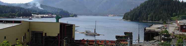
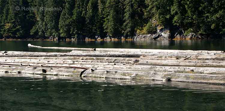
The provincial government identifies a major potential hazard in the Kitimat valley, glacio-marine clay deposits that “threaten the integrity of the pipeline.”

Overall the province appears to accept the arguments from Douglas Channel Watch and other environmental groups that geo hazards along the pipeline route present a significant risk, one perhaps underestimated by Enbridge Northern Gateway.

NG does not dispute that spills from the pipeline may occur. While the project will be new, and built using modern technology, the fact remains that pipeline spills do happen. Indeed, Enbridge had 11 releases greater than 1000 barrels between 2002 and 2012…

The Province has concerns about the assertions NG has made regarding the probability for full-bore releases resulting from geohazards. NG asserts that full-bore spills will be very rare. However, this assertion must be considered in light of the fact that NG’s analysis of the geohazards that the pipeline could face is at a preliminary stage….

The rugged topography of West Central British Columbia is prone to slope failures.
Terrain instability may pose significant challenges for linear development.
Despite these challenging admits that its assessment of existing and potential geohazards along the pipeline route is not complete and that further investigations and more detailed geohazard mapping are required. For instance, although NG acknowledges that the potential presence of glacio-marine clays in the lower Kitimat Valley can threaten the integrity of a pipeline; its report on glacio-marine clay fails to identify a significant area of potential instability that had been previously reported in the relevant literature…

Since all geotechnical hazards have not been identified with the investigations carried out to date, and since comprehensive investigations will not be completed until the detailed design phase, NG has but a rough idea of the mitigation measures that may be employed in order to mitigate the geotechnical hazards that may be encountered…

Spill response

The province’s arguments also indicates that Enbridge Northern Gateway has not done a good enough job regarding spill response, whether from a full bore rupture or a pin hole leak.

it must be remembered that full-bore spills are less frequent than smaller spills, which could still have a significant environmental effect. Indeed, since risk equals consequence times probability, smaller spills could pose a higher risk as they are more frequent. While NG has produced considerable evidence with respect to the likelihood and effects of full-bore spills… the evidence concerning the potential for other spills is limited. While the Province supports assessing the effects of any spill based on a full-bore release, as it would allow for an analysis of the worst-case scenario, focus on full-bore releases should not eliminate consideration of the potential impact of smaller events…

NG stated that [a] table [in the evidence], which includes probabilities for medium sized spills, would be “replaced by. a detailed characterization of each pipeline kilometre and region as part of the ongoing risk assessment work,” but the province says, a later table that “now replaces the concept of large and medium spills”. focussed only on full-bore releases, a relatively rare event.

Similarly, NG also calculated spill return periods for pinhole and greater-than-pinhole events. Taking the figures NG for “greater-than-pinhole” releases results in a spill return figure of 76.7 years. The Province also has concerns about the information that NG has provided in this regard. First, because it focussed on spill events, there is no information about spill size, which, we submit is a critical issue in considering the risk posed by these kinds of events. Second, NG does not include the potential for spills that could occur as a result of “operating and maintenance procedures” that deviate from the norm. Finally, NG assumes that all geotechnical threats would result in a full-bore rupture. This assumption appears to be incorrect…

Premier Christy Clark has, as part of her five conditions, said there must be a world class spill response system. Enbridge responded by saying there will be. The province then turns around and says Enbridge has failed to do prove it.

Because of the potential for spills, and their impact, NG has committed to develop a comprehensive spill response capability. Indeed, NG has stated that it intends to have a “world-class response capability” for the Project. Given the real potential for spills to occur, and the devastating effect of a spill should a significant one take place, the Province submits that NG must show that it would be able to effectively respond to a spill. As set out below, the Province submits that it has failed to do so.

High stream flow, heavy snow at Kitimat

Again, the province appears to accept arguments from Douglas Channel Watch that Enbridge has underestimated the challenges of handling a spill in a remote area. The province also accepts the argument that booms are ineffective in high stream flow in the Kitimat River.

Although it asserts that it will be able to effectively respond to any spill, NG admits that responding to a spill from the pipeline will be challenging. In particular, it admits that a spill into a watercourse at a difficult to access location would present the greatest difficulty for clean-up and remediation…

Many parts of the pipeline will be located in remote areas, located some distance from road networks and population centres. For example, many of the rivers… are identified as remote or having no access. Road access to the pipeline and places where a spill might travel down a watercourse is important to allow for effective spill response…

In some cases, the steepness of the terrain will make responding to spills very challenging. NG acknowledges that the Coast Mountains’ topography is extreme…

As the JRP noted during cross examination by the Province of NG with respect to the Clore River, it has had the opportunity to take a view of the entire route. It will therefore know the steep and rugged terrain through which the pipeline would pass.

The presence of woody debris could also pose a challenge to spill response, requiring a shift of response activities to upstream locations…

If a spill were to occur during a period of high flow conditions, a common occurrence in British Columbia rivers, then some aspects of the response may have to be curtailed, or at least delayed until the high flow event recedes. At certain water velocities, booms become ineffective, and are potentially unsafe to operate.

The presence of heavy snow could also impede access during response operations, requiring use of snowmobiles, snow cats, and helicopters. In the Upper Kitimat and Hoult Creek Valleys, snow accumulation can reach 8-9 metres. However, weather may limit the ability of helicopters to aid in spill response…

Many of these challenges are recognized by NG. In the Preliminary Kitimat River Drainage Area Emergency Preparedness Report (“Kitimat Report”), NG refers to the challenges of winter conditions, avalanches and debris slides, heavy snow, spring melt, Fall freeze-up, patchy ice, and fast-flowing watercourses.

Sinking dilbit

The province also accepts the argument that under some circumstances that diluted bitumen can sink, arguments raised by David Shannon of Douglas Channel Watch.

These challenges are compounded by the fact that in certain conditions diluted bitumen (“dilbit”) can sink in a watercourse. This occurred in the case of Enbridge’s spill in Michigan. This was, as a result, an issue of significant importance to the parties in this proceeding…

The evidence presented by NG in this regard is inconsistent. For example, some evidence it presented suggests that dilbit may sink when it enters water, after a process of weathering; other evidence it has submitted suggests that dilbit will only sink if it combines with sediment. In its response to [a submission by the Haisla Nation] NG states that “If diluted bitumen becomes heavily weathered some oil may sink in fresh water environments.” Similarly, in its response to Dave Shannon’s IR No. 1, NG states that 

Diluted bitumen emulsions will remain buoyant in waters with densities greater than approximately 1.015 g/cc. If the water density drops below approximately 1.015 g/cc,in zones of fresh-water intrusion, weathered and emulsified diluted bitumen products may sink to the depth where the density increases to above 1.015 g/cc.

Similar also is NG’s response to Dr. Weir’s IR No. 2.6, where NG states:

The weathered diluted bitumen would have a density approaching 1.0 g/cc, which indicates that once the diluted bitumen weathers it may be susceptible to sinking in fresh water.

Finally, in the Kitimat Report NG states that:

Examples that may lead to oil not remaining on the water surface include:
• Oils with specific gravities equal to or greater than the receiving medium (fresh- or saltwater)
• Oils that have weathered and, in losing lighter-end fractions, have reached a specific gravity equal to or greater than the receiving water
• Oil that is near the same density as the receiving water and that is characterized as a 3-dimensional flow (non-laminar to turbulent flow such as found in streams, rivers, areas with fast tidal currents, breaking waves)
• Oil with sediment (mixed into oil or adhered to oil droplets)…

…submerged oil may eventually sink with increased weathering, if in receiving water with lower density, or if sufficient sediment is incorporated.

Northern Gateway contradictory

The province’s argument goes on to point more inconsistencies with Northern Gateway’s submission on dilbit in rivers, telling the JRP “In short, what dilbit will do when it enters water remains unclear.”

On the other hand, another NG witness stated that dilbit cannot sink, as this would be contrary to an “immutable fact of physics”. In cross examination, Dr. Horn, Mr. Belore and other witnesses maintained that dilbit will only sink in the presence of suspended solids, or after a long period of weathering.

However, NG’s evidence with respect to the type of sediment that could combine with dilbit to form material that may sink in water is unclear. Dr. Horn testified that “fine grain sediments…provide the greatest amount of surface area which is one of the reasons that oil sank in [Michigan]”. On the other hand, Mr. Belore appeared to suggest that, in the marine context at least, finer sediments reduce the potential for oil to sink as they are lighter. The evidence with respect to the material that may bind to dilbit and contribute to its sinking is unclear…

NG’s views with respect to the flow conditions under which dilbit may sink is also contradictory. On the one hand, it states that “Higher flow rates and increased turbulence typically will entrain more oil into the water column leading to the potential for oil to enter pore spaces in permeable sediments.” On the other, it states that “Oil sinking is unlikely to occur in areas with fast currents…”

Evidence provided by other parties suggests that dilbit may sink when weathered. In particular, Environment Canada’s evidence in this proceeding contrasts sharply with NG’s. For example, Environment Canada states that:

Northern Gateway’s response planning model does not account for sinking oil or for oil suspended particulate matter interactions…For oils with densities close to that of water, like both the diluted bitumen and synthetic crude products, even small amounts of sediment can cause sinking. Environment Canada is concerned that oil sinking and oil-sediment interactions have been
underestimated in the provided scenarios. In the cases of both the Enbridge-Kalamazoo and the Kinder Morgan-Burnaby spills, significant oil-sediment interactions occurred.

The changes to dilbit as it ages in the environment may affect cleanup. Although initially buoyant in water, with exposure to wind and sun, as well as by mixing with water and sediment in the water, the density of dilbit can increase to the point that the oil may sink. Recovery and mitigation options for sunken oils are limited.

Not only has Environment Canada expressed the view that even small amounts of sediment may cause oil to sink, its witness also stated under cross-examination that high velocity rivers may carry high suspended sediment concentrations, and that, at certain times of the year, sediment load could enter the marine environment. Although NG acknowledges that sediment loads and oil-sediment interactions are a critical factor in predicting the behaviour of spilled oil, it has not, in Environment Canada’s opinion, provided a complete baseline data set on sediment loads, despite requests that such data be provided.

While NG has submitted information respecting the laboratory testing of dilbit, an Environment Canada expert testified that tests conducted in a laboratory setting provide only limited information that cannot be relied upon in isolation to predict the fate and behaviour of hydrocarbons spilled into the environment. Instead, information gathered from real spill events must inform the analysis, and consideration must be given to the conditions, including water temperature, suspended sediment concentrations and wind speed, to be encountered in the “real world”.

Environment Canada has also made it very clear that the evidence provided to date by NG does not allow for a full understanding of the behaviour of spilled dilbit. In the opinion of Environment Canada witnesses, the evidence has not provided sufficientclarity with respect to the weathering, evaporation or sedimentation processes dilbit may be subjected to in the environment. Given the unique nature of this product, further research is warranted before one can ascertain whether dilbit will sink or remain on the water surface. Those concerns were echoed by an expert retained by the Gitxaala Nation.

In addition, the evidence of other parties raises the possibility of the need to respond to submerged oil. NUKA research, on behalf of the Haisla Nation, opined that “submission documents overall still grossly underestimate the potential for sunken or submerged oil, particularly for pipeline spills to rivers.” EnviroEmerg Consulting, for the Living Oceans Society summarizes well the uncertainty that remains with respect to the behaviour of oil:

There are no definitive statements in the [Environmental Impact Statement] EIS to explain if bitumen diluted with condensate will emulsify, sink or do both if spilled. The supporting technical data analysis in the EIS is based on laboratory tests. There are no in-situ field tests, empirical studies, nor real incidents to validate these findings. This raises significant uncertainty that current spill response technologies and equipment designed for conventional oil can track and recover the diluted bitumen in temperate marine waters. In essence, the assumption that the diluted bitumen can be recovered on-water has yet to be tested.

In short, what dilbit will do when it enters water remains unclear. NG recognizes this lack of clarity itself. As was stated by one of its witnesses, “it’s extremely difficult to predict the behaviour of this product”.

NG admits that additional research needs to be done with respect to understanding how dilbit behaviour.

The provincial argument concludes:

The Province has serious concerns about the lack of clarity and certainty about what dilbit will do if it were to enter the water, the preliminary and indeed contradictory nature of the evidence with respect to NG’s remediation strategies and actions to address sunken oil, and the fact that its proposed tactics have not been evaluated for use in British Columbia. These factors, taken together, suggest that, at least as of today, NG is not yet prepared to deal with sunken oil in the event there were a spill of dilbit into a British Columbia watercourse. By itself this is a cause for serious concern in relation to the fundamental question in this proceeding, namely whether the JRP should recommend approval of this project. But at the very least, this means that a strong condition must be imposed requiring further research on the behaviour of dilbit.

Spill response only preliminary “All roads are driveable”

The provincial argument says, in italics, that the Northern Gateway’s spill response plans are “only preliminary” and adds Northern Gateway’s plan to provide detail operational plans six months before the beginning of the pipeline operations is not good enough. “It is not possible for NG to assert, nor for the JRP to conclude, that NG will be able to access all those places where a spill may travel, and to respond effectively.”

Despite the challenges to responding to a spill from the pipeline, including the challenge of responding to submerged and sunken oil, NG’s plans for responding to a spill have not yet been developed. NG has committed only to providing its detailed oil spill response plans to the National Energy Board 6 months in advance of operations. In the context of this project, the Province remains very concerned that NG has not yet demonstrated its ability to respond effectively to spills from the pipeline.

When specifically asked “In the absence of that planning…to address the challenges that we’ve been discussing, how is it we are to be confident that Northern Gateway will, in fact, be able to effectively respond to a spill?” NG replied that “There is a lot of work that needs to be done.”

Of particular concern, despite its admission that a spill into a watercourse in a remote location would pose a significant challenge, NG has not yet determined those locations it could access to respond to a spill, including the control points utilized for capturing and recovering oil passing that location. Such access will only be determined, if possible, during detailed planning. At this time, NG also does not know what portion of water bodies would be boat-accessible in the event of a spill. The 2010 Michigan spill, which was the subject of much questioning during the hearing, occurred in a populated area, where there were many potential access locations. This will of course not be the case if a spill were to occur in a remote river in British Columbia.

While NG has prepared a document showing some possible control points that might be used for spill response in the event of a spill in some rivers, NG concedes that its work in this regard is preliminary, and only pertains to some of the control points that would ultimately have to be established. NG helpfully provided additional information to that which was originally filed with respect to the travel distance between pump stations or the terminal and certain potential control points. However, travel times to the control points that have been identified do not take into account mobilization time, and assumes all roads are drivable.

Given the incompleteness of NG’s evidence in this regard, the Province submits that NG cannot currently assert that there would in fact be viable control points where a spill could travel to. In addition, even if accessibility to control points had been fully validated, in order for NG to assert that it could respond effectively to a spill, it would also have to know the means by which personnel and equipment would gain access to respond to oil that had come ashore or sunken to the sediment. Given the preliminary nature of the evidence presented by NG, this is of course not known.

The Province is very concerned that, in the event of a spill, some places where a spill could reach will be inaccessible, and therefore not amenable to spill recovery actions. While NG states that it will be able to access control points at any location along the pipeline, it has simply not provided the evidence in this proceeding to substantiate this assertion. The Province submits that, as of today, it is not possible for NG to assert, nor for the JRP to conclude, that NG will be able to access all those places where a spill may travel, and to respond effectively.

In addition to access, there are a number of other challenges to operating in British
Columbia in respect of which NG has completed only very preliminary work.

• The pipeline could be covered by heavy snow at different times of the year; NG states that it will have to review alternative methods of access to deal with this, but has presented no specific evidence on how this challenge will be addressed.
• NG has not yet developed specific plans about how it would deal with oil recovered from a spill, and has not yet determined disposal locations.
• NG has not yet determined the location or the contents of the equipment caches to be used to respond to spills.
• It has not determined year-round access to the pipeline, which will be evaluated as part of detailed planning.

Kitimat River response

The province takes a harsh look at Northern Gateway’s plan for a response on the Upper Kitimat River and Hunter Creek.

Similarly, the Province is concerned about the ability of NG to respond to a spill in the Upper Kitimat Valley. When asked by the Douglas Channel Watch

“…in the context of the Upper Kitimat Valley, does this mean because of the steepness of the terrain and limited road access to the river, that containment at some locations at the source will be impossible, and the majority of your efforts will be at the first accessible locations downstream?”

NG was only able to reply that:

“again it depends on the specific conditions. But as Dr. Taylor indicated, in the development of the response plans we would need to look at various scenarios, various times of year, develop plans so that it would identify the appropriate response locations at those times.”

NG’s targeted spill response time of 6-12 hours needs to be set against the reality that, in the case of a watercourse spill, oil may travel many kilometres downstream while NG is still mobilizing. In this proceeding NG has provided considerable information with respect to how far and fast oil can travel in a watercourse. For example, with a spill into Hunter Creek, NG has stated:

Based on water velocities, a release at this location could reach the Kitimat River estuary 60 km downstream within four to ten hours, depending on river discharge.

Dr. Horn has indicated that these figures are very conservative, and that the actual times to reach Kitimat would be a longer period. However, no other definitive evidence on these times was presented by NG.

Enbridge doesn’t learn from its mistakes

The provincial argument then goes on to say, again in italics, Enbridge does not follow procedures or learn from mistakes and concludes “while NG asserts that its spill detection systems will be world-class, it has not yet chosen to adopt spill detection technologies that would achieve that objective.”

The provincial argument goes over Enbridge’s spill record in detail, including the Marshall, Michigan spill which was harshly criticized by the US National Transportation Safety Board.

Concerns about NG’s inability to respond to a spill are magnified by Enbridge’s conduct with respect to the spill which took place in Michigan. NG concedes that, in that case, there were procedures in place that were not followed. NG asserts that it now has in place a number of “golden rules”, including that whenever there is a doubt with respect to whether the spill detection system has detected a leak, the pipeline must be shut down. However, NG concedes that this rule was in place before the Michigan spill; it self-evidently was not followed. In fact, the rule under which Enbridge would shut down its pipeline system within 10 minutes of an abnormal occurrence which could be immediately analyzed was put into place following a spill in 1991. At that time, similar commitments were made indicating that procedures would change and that a spill of that nature wouldn’t take place again….

despite the fact that the relevant technologies had been in existence for some
10 years, and despite the existence of crack-related failures that led to the development of such technologies, Enbridge had failed to put in place a program that would have detected the Marshall spill

The province wraps up the response saying by telling the JRP:

In short, if NG is relying on its ability to respond effectively to a spill for a positive recommendation from the JRP, then it must show that it will in fact have that ability. The Province submits that NG has not shown that ability in this proceeding.

The Province submits that requiring NG to show now that it will in fact have the ability to respond effectively to a spill is particularly important because there will be no subsequent public process in which that ability can be probed and tested. NG has pointed out that its oil spill response plans will be provided to the NEB for review, and has committed to a third party audit of its plans. However, it also acknowledges that there will be no means by which those plans could be tested through a public process.

On the pipeline project, BC concludes

The Province submits that the evidence on the record does not support NG’s contention that it will have a world-class spill response capability in place. The challenges posed by the pipeline route, the nature of the product being shipped, the conceptual nature of its plans to date and Enbridge’s track record mean that the Province is not able to support the project’s approval at this time. The Province submits that its concerns in this regard should be seriously considered by the JRP as it considers the recommendation it will be making to the federal government.

Coastal First Nations launch election commercial with Exxon Valdez radio call

Coastal First Nations have launched a commercial aimed at the British Columbia electorate, using the call from the Exxon Valedez to US Coast Guard Valdez traffic control saying that the tanker had run aground.


The commercial makes the connection between the Exxon Valdez disaster and the possibility of a tanker disaster on the British Columbia coast if the Enbridge Northern Gateway project goes ahead.

According to the Vancouver Sun, Paul Simon personally approved the use of the song Sounds of Silence in the commercial.

The BC New Democrats, who are leading the polls have said they oppose Northern Gateway. The ruling BC Liberals have set out five conditions that must be met if the project is to go ahead.