The study of tanker shipping and tanker spills by Genivar for Transport Canada has revealed huge gaps in how the world monitors tanker traffic.
Cover of Genivar tanker report (Transport Canada)
Genivar says
Accident data was acquired from three main sources: the CCG Marine Pollution Incident Reporting System (MPIRS); the Lloyd’s casualty database; and spill incident records maintained by the International Tanker Owners Pollution Federation (ITOPF).
MPIRS lists all marine pollution incidents occurring in Canadian waters (CCG, 2013), with information on the region within Canada in which the incident occurred, type of material spilled, accident cause, and estimated pollution volume with multiple entries for a given incident showing updates of incident status and pollution amounts if applicable. The primary use of MPIRS in this study was for spill incidents in the smaller size categories… for which worldwide data was suspected to be unreliable due to under-reporting. MPIRS appeared to be a comprehensive listing of incidents that occurred in Canadian waters, and a summary of polluting incidents
It goes on to note that some key data has not been updated since the 1990s, largely prior to the introduction of double hulled tankers.
As noted, oil spill accidents were compiled on a worldwide basis.
In order to estimate the frequency for Canada, an exposure variable was required.
A series of studies by the U.S. Minerals Management Service (MMS, now known as
the Bureau of Ocean Energy Management, Regulation and Enforcement) investigated the occurrence rates of tanker accidents against various spill exposure variables and found that the simplest and most reliable indicator was volume of oil transported. Simply put, it was determined that spill rates could be expressed, for a range of spill size categories, as an average number of spills per billion barrels transported.
The MMS studies were updated periodically until the 1990s but have not been revisited since, but they did show a steady decrease in the likelihood of casualties and resulting spill volumes, due to a number of factors including tanker design, increasing governance and overall scrutiny of the marine transportation industry. The phased-in implementation of double-hull tankers may have also had a beneficial effect on spill rates in more recent years, particularly in the category of very large or catastrophic events… In any case, it is important in interpreting accident data to reflect current trends and implemented mitigation measures. The focus was on cargo volumes and accident rates over the past decade.
It goes on to say the volumes of crude carried is also under-reported to Lloyds.
In the case of crude oil and refined products carried as cargo, the exposure variable was simply the volume of each respective category carried on an annual basis for the period of interest. Information from the Lloyds APEX database was used for this purpose; it reports volumes of crude and refined products shipped worldwide, with a breakdown by year, country of origin, and country of destination. Compared with similar data from Canadian sources, the APEX data appeared to significantly under-report the carriage of refined products. As a result, the accident rates estimated and used in this study are likely somewhat conservative, that is, they overstate the likely frequency of refined products carried as cargo. For all calculations involving the potential spillage of refined products as cargo in Canadian waters, and for the apportioning of spill frequency among the various sectors and sub-sectors of Canada, Transport Canada commodity traffic data was used
Again about Lloyds data, until 2010, it was limited in its monitoring of the BC Coast.
In analyzing the Canadian movement data supplied by Lloyds, a major shortcoming was found in the data in that movements recorded prior to 2010 did not include broad classes of vessels such as ferries, passenger vessels, and pilot boats. Given that these vessels comprise a significant proportion of traffic movement in many sectors, only data covering the final two years of the record, 2010 and 2011, were used in the analysis.
The Lloyds data was also limited when it came to oil spills:
One limitation of the MPIRS data was that it did not classify spills as to whether they were from “cargo” as opposed to “fuel”, which would have been helpful in this study as these spill types were analyzed separately. As a result, for spills of refined products, which could have hypothetically been either cargo or fuel, assumptions were made based on the type of vessel involved, the type and severity of the incident, and other notes within MPIRS.
A database was acquired from Lloyds that detailed all marine casualties over the
past ten years regardless of whether the incident involved pollution…
This database was used to provide a breakdown of incidents by cause, and as an
initial listing of those incidents that did result in pollution. The Lloyds data was of
mixed quality when it came to the reporting of polluting incidents, with numerous
records only partially filled out, ambiguities in the reporting of spill volume, and
inconsistencies in the classification of the spilled material. A significant effort was
made to provide consistency and accuracy in the information, including cross-
referencing with other data sources.
So the Genivar report exposes a significant gap in the available data on oil spills.
It is certainly true that the number of major tanker accidents and spills have decreased since the Exxon Valdez disaster, a point frequently made by Enbridge at meetings in northwestern BC.
The expert panel report which said that Canada faces the risk of a major tanker disaster of 10,000 tonnes or more once every 242 years.
The Vancouver Sun quoted Transport Canada spokeswoman Jillian Glover on that risk of a spill on the Pacific Coast as saying. “This value must be understood in relative terms, such that the risk is considered high compared to the rest of the country only…Canada enjoys a very low risk of a major oil spill, evidenced by the lack of Canadian historical spills in the larger categories. Additionally, this risk assessment is before any mitigation measures have been applied, so that is a theoretical number before additional prevention initiatives are taken.”
Note that the government always talks about a “major oil spill,” but it appears from the gaps in the data that predicting the possibility and consequences of a medium sized or smaller oil spill is now not that reliable, even though such a spill could have disastrous effects on a local area. According to a map in both reports, the entire BC coast is at risk for a “low to medium” spill. This echoes the problems with the Enbridge Northern Gateway pipeline, where Enbridge based most of its projections on a “full bore breach” or major pipeline break and did little about a medium sized or smaller leak. Data analysis by Kelly Marsh of Douglas Channel Watch on the possibility of the cumulative effects of a medium sized and possibly undetected pipeline breach could have just as disastrous consequences for the Kitimat valley as a major pipeline break. The same is likely true at sea.
The Genivar report for Transport Canada on oil spills say that some persistent effects can last for more than 40 years, based on a study of a spill in Cape Cod, Massachusetts. The report notes that persistent sub-surface oil is still a problem at Prince William Sound, site of the Exxon Valdez disaster in 1989.
On long-term effects, Genivar reports: “The ingestion of contaminated food (such as oiled mussels), may represent the most important exposure pathway for aquatic fauna during a chronic
phase. Chronic exposure to contaminated sediments is also important for fauna or
vegetation.”
It goes on to stay that “large-scale oil spills might have considerable long-term
consequences on social structure and public health, interfering with traditions and
causing cultural disruptions.”
It appears that in the case of an oil-spill, time may heal some wounds, but not all of them, at least if time is considered within human lifetimes and the lifetimes of other species.
Ecological recovery is measured by how quickly individuals and populations of
species return to pre-spill conditions. It is determined by factors such as oil type,
exposure duration, water temperature, degree of weathering, spill response and the
individual and species-specific life history traits. In most environmental habitats,
recovery is completed within 2-10 years after a spill event, but in some exceptional
cases, such as in salt marshes, effects may be measurable for decades after the
event.
In the case of the Exxon Valdez oil spill in Prince William Sound… in 1989, the persistence of sub-surface oil in sediments and its chronic exposure continues to affect some of the wildlife through delayed population reductions, indirect effects and trophic interactions 20 years beyond the acute phase of the spill.
It then goes on to stay that
Four decades after the oil spill In Wild Harbor (USA), Spartina alterniflora beds had a reduced stem density and biomass and mussels in oiled locations showed decreased growth and filtration rates.
According to a Boston Globe story, published at the time of the Deepwater Horizon oil leak in the Gulf of Mexico, in 2010, the Wild Harbor, an oil barge ran aground near Cape Cod in September, 1969, spilling 200,000 gallons of fuel, some of which is still there.
The Boston Globe story noted:
Today, Wild Harbor looks much like any other Cape Cod marsh, but the oil below the surface affects its resiliency. Fiddler crabs normally burrow deep down, funneling oxygen to the roots of marsh grass. Here, they stop digging when they reach the oil, turn sideways, and burrow back to the surface. They also act “drunk’’ from the oil they ingest, and predators can catch them more easily, research shows.
The Woods Hole Oceanographic Institute has been studying the Wild Harbor spill for the past 40 years.
At a recent conference, Dr. John Teal updated scientists on the “multi-decadal effects” of the Wild Harbor spill. According a blog on the conference:
At the time of the 1969 spill, lobsters, clams, and fish died by the thousands, but most people believed the harm would be temporary, reflecting the conventional wisdom of the time. Barge owners and oil industry experts even told residents that most of the oil would evaporate and any damage would only be short-lived. However, researchers at WHOI were not so sure and immediately began cataloging species and tracking where the oil was and kept at it for years. The researchers understood that the immediate, short term effects of oil pollution were already obvious and fairly well-understood, but that everyone was rather ignorant about the long-term and low-level effects of an oil spill….
Beginning three to five years after the spill, marsh grasses and marsh animals were again occupying most of the oiled area. An observer unfamiliar with Wild Harbor would not have been able to visually detect the oiled areas after just 10 years, and by the second decade after the spill, the marsh’s appearance had returned to normal. However, the WHOI researchers pointed out that for more than a decade after the spill, an oil sheen still appeared on the surface of the water when mud from the most heavily oiled parts of the marsh was disturbed….
In 2007, WHOI researchers documented that a substantial amount of moderately degraded petroleum still remained within the sediment and along eroding creek banks of the marsh oiled in 1969. They also demonstrated that the ribbed mussels that inhabit the oiled salt marsh, and are exposed to the oil, exhibited slower growth rates, shorter mean shell lengths, lower condition indices, and decreased filtration rates even when placed in a healthy marsh. Researchers have also documented detrimental effects of the 1969 oil spill on the salt marsh plants themselves.
Long-term effects on the population in the aquatic environment (especially on mobile fauna) are especially difficult to confirm. Benthic [bottom dwelling] invertebrates may be more at risk than fish species due to the fact that more or less sessile organisms are likely to suffer higher initial rates of mortality and exhibit long recovery times as a result of
exposure to oil-saturated habitats.
Nearshore demersal [bottom-dwelling] fish can also suffer from long-term chronic exposure, as indicated in masked greenlings and crescent gunnels by biomarkers on hydrocarbons 10 years after the Exxon Valdez spill. Mortality in sea ducks and sea turtles due to chronic exposure was also reported many years after the spill and other results indicate that effects on cetacean populations can last beyond 20 years after the acute exposure phase.
As for the recovery of the economy after a spill, Genivar notes it is based “on the time required for effected industries to be fully restored to pre-spill conditions.
The length of time required is influenced by the duration of the aquatic area closures (e.g. commercial fisheries, recreational fisheries), the public perceptions on seafood safety and the perceived effects of the aesthetic quality of the environment. Even after the full ecological recovery of the aquatic resources, fisheries can be far from reestablished, as is still the case for herring fisheries in the Exxon Valdez spill area…
As reviewed by Genivar, negative perceptions associated with the quality of fishery products, even for fisheries that have not been contaminated and also for regions not directly affected by the spill, can be far more important than the direct economic losses. This also holds true for the tourism sector and all other related spinoff sectors.
The Northern Gateway Joint Review panel, Kenneth Bateman, Sheila Leggett and Hans Matthews, listen to final arguments in Terrace, June 17, 2013. (Robin Rowland/Northwest Coast Energy News)
Buried deep in the LNG Canada environmental assessment application, a reader will find a key difference in attitude with at least one of the group of companies planning liquified natural gas development in the northwest and Enbridge Northern Gateway.
It’s an earthshaking difference, since it’s all about earthquakes.
The documents filed by LNG Canada with the BC Environmental Assessment Office and the Canadian Environmental Assessment Agency acknowledge that there is a possibility of an earthquake (a one in 2,475 year event) at the LNG terminal site.
Northwestern British Columbia was shaken by two major earthquakes in the months before the Joint Review Panel concluded its hearings in Terrace. Both were far from Kitimat, but felt across the District. On October 27, 2012, there was a magnitude 7.8 earthquake on the Queen Charlotte Fault off Haida Gwaii. That quake triggered a tsunami warning, although the actual tsunami was generally limited to the coast of Haida Gwaii. Both landline and mobile phone service in Kitimat was briefly disrupted by both the quake and overloads on the system. Kitimat was also shaken by the 7.5 magnitude earthquake centered at Craig, Alaska a few weeks later on January 9, 2013.
With the exception of one vague reference in its final argument documents presented to the Joint Review Panel, Enbridge has stubbornly refused to consider any seismic risk to the region.
That was the company’s policy long before the October. 27, 2012 Haida Gwaii earthquake and was Enbridge policy after October 27, 2012.
In a public meeting in Kitimat on September 20, 2011, more than a year before the Haida Gwaii earthquake, John Carruthers, Northern Gateway president, insisted to skeptical questioners at a community forum at Mount Elizabeth Theatre that there was no earthquake danger to the proposed Northern Gateway pipeline and bitumen terminal in Kitimat. One of the questioners, Danny Nunes, of Kitimat, asked could the pipes withstand an earthquake? Carruthers repeated that Kitimat was not in an earthquake zone, that the fault was off Haida Gwaii and so would not affect Kitimat.
After the September, 2011 meeting, I asked Carruthers if Enbridge knew about the March 27,1964 “Good Friday” magnitude 9.2 Alaska earthquake that, because of its high magnitude, had caused major shaking in Kitimat. That earthquake destroyed much of Anchorage and triggered tsunamis that caused damage and death across Alaska and in parts of British Columbia, Oregon and California.
Carruthers promised to get back to me and never did.
On June 17, 2013, six months after the Craig, Alaska earthquake, in his opening summation before the Joint Review Panel, Richard Neufeld, lead lawyer for Northern Gateway, stayed on message track, telling the JRP, referring to pipelines: “The route is not seismically unstable. The seismic risk along the pipeline right-of-way is low, with only a few locations of moderate risk encountered, none of which are within the Haisla territory.”
That brought a gasp from spectators in the room, or at least those who had felt the October and January earthquakes.
The following day, June 18, Murray Minchin of Douglas Channel Watch found an anomaly in the Enbridge documentation, arguing in the group’s summation:
“The Proponent’s written final argument gets on shaky ground regarding design and construction of the storage tanks on a ridge beside Douglas Channel in paragraph 249 where they say:
“‘It also involves the safe construction and operation of the Kitimat terminal in Kitimat Arm in an area subject to seismic activity which encompasses both terrestrial and marine components.’
“Now, that’s interesting because isn’t that the first time — the first admission by the Proponent in a little over 10,000 pages of documents that the area they intend to build their project is in a seismically-active area?
“Haven’t they been telling us all along to this point that the only seismic concerns would be from the distant Queen Charlotte fault off of Haida Gwaii?
“Now, this completely contradicts Mr. Neufeld’s statement yesterday where he described the Project area as not “seismically unstable”. So what is it? This is their final argument and they’re contradicting themselves.”
Minchin went on to quote from the Enbridge argument: “’Seismic conditions in the project area have also been addressed.’
“Well, really? Is that a truthful statement, considering Natural Resources Canada has only submitted a preliminary report concerning a 50-kilometre fault line and massive submarine landslides they accidentally discovered last year in Douglas Channel while doing a modern survey of the Channel for navigation hazards.
“How can the Proponent claim to have adequately addressed seismic forces in their design of this Project when they don’t know what those forces are or for what duration they may be subjected to those forces.
“Has there ever been a paleoseismological study in the Project area to establish past earthquake or tsunami history?
“Wouldn’t it be in the best interest of the Proponent, the Panel and Canadians to know the risks before 1.3 billion litres of liquid petroleum products are allowed to be stored on a low ridge right beside Douglas Channel?”
In his final rebuttal on June 24, Neufeld did not address the contradictions that Minchin had pointed out.
Compare Enbridge’s attitude to the view of LNG Canada, which at very least, appears willing to consider that major events could have adverse consequences on the terminal and liquifaction facilities.
The first one is a bit puzzling to Kitimat residents “A 1 in 100 year 24 hour rain event,” after all the town often gets rain for 24 hours straight or more fairly often.
The second, 1 in 200 year flood of the Kitimat River. Flooding has always been a concern and will be even more so, because as the pipelines come into town, whether natural gas or bitumen, those pipelines will be close to the river bank.
Even more interesting is that LNG Canada is willing to consider possible effects of climate change on the project, saying: “Predicted climate change effects during the project lifecycle on sea-level rise, precipitation and temperature. Where relevant and possible, the implications of such climate induced changes to the extreme weather events given above will also be addressed.”
.
Although the hydrocarbon industry as a whole is reluctant to acknowledge climate change, it appears that on a practical level, the LNG Canada partners, if they are about to invest billions of dollars in a natural gas liquifaction plant and marine terminal, will certainly take steps to protect that specific investment from the effects of climate change.
On the other hand, the National Energy Board, as matter of policy and the Northern Gateway Joint Review Panel, both still stubbornly refuse to even consider any effects of climate change, even possible effects locally on a specific project application.
The Joint Review Panel decision on the Northern Gateway is expected sometime in the next three weeks. While most reports seem to indicate that the decision will be released after Christmas before the Dec. 30 deadline, there has been recent media speculation that the decision could be released next week.
The problem for Enbridge is that the new public relations campaign is repeating the blunders that began when they first proposed Northern Gateway in 2005. There have been meetings across the northwest, but those meetings have been invitation only affairs at chambers of commerce and community advisory boards, with possible opponents or skeptics and media perceived as critical of Enbridge not invited. So Enbridge still wants to control the message and will only talk to friendly gatherings.
Then there are the television spots featuring Janet Holder, the Enbridge vice president in charge of Northern Gateway, supposedly showing her commitment to wilderness. Those commercials would have had more credibility if the agency had produced the ads with actual video of Holder walking through the bush, rather than shooting the spots in front of a green screen in a studio, with pristine wilderness stock video in the background, and Holder acting as if she was a model for an adventure clothing company rather than vice president of a pipeline company.
Right-wing business columnists in Toronto and the countless Albertans fume at the so-called “hypocrisy” of British Columbians who support LNG and oppose bitumen.
Of course, those critics didn’t feel the earth move under their feet. The critics don’t see the difference between natural gas and bitumen, differences very clear to the people of British Columbia.
It’s more than the fact, that so far, the LNG projects have been relatively open and willing to talk to potential adversaries, as Chevron has done on the controversial Clio Bay project; more than the fact that if even a fraction of the LNG projects go ahead, the money coming into northwestern BC means that the handful of permanent jobs promised by Enbridge will be literally a drop in a bucket of warm bitumen.
Although there are many other environmental issues on the Northern Gateway project, the fact the potential for earthquakes in Kitimat is brushed off by Enbridge while LNG Canada is at least willing to consider the problem, sums it all up.
Updated with link to Sept. 2011 questions and answers
Teron Moore of Emergency Management explains a surge tsunami at a emergency preparedness forum at Riverlodge, Nov. 4, 2013 (Robin Rowland/Northwest Coast Energy News)
The District of Kitimat plans to issue a tsunami hazard and evacuation map for the town.
Fire Chief Trent Bossance and Emergency Coordinator Bob McLeod told a forum on emergency preparedness on November 4 that the map is in the final stages of preparation and will be distributed to residents in the near future.
The forum was also told that the former District Council Chambers on the second floor of the public safety building (the fire hall) is being converted into “a fixed, permanent emergency operations centre,” with upgraded communications and computer equipment.
McLeod said that over the past months, since the October 27, 2012 Haida Gwaii earthquake and the January 31, 2013, Sitka, Alaska earthquake, Kitimat’s emergency planners have been working with the province to update the original emergency plan which was first developed about 12 years ago.
McLeod said that the plan was recently sent to a consultant who told Kitimat the overall plan only needed minor charges. Now, however, there is new emphasis on tsunami planning.
Fire Chief Bossance says emergency planners have been consulting with scientists who have concluded that if a tsunami was to come into Kitimat from Douglas Channel, it most likely would be between two and four metres, so to be on the safe side, the District is planning on a “six metre baseline” from the high tide line. That means the hazard map will be based on the possibility of a six metre tsunami coming up the Channel. ( A worst case scenario, however, could result in a bigger tsunami, perhaps eight metres).
The forum at Riverlodge was part of an effort by both federal and provincial officials to visit communities that were affected by the two recent major earthquakes, inform local residents of updated planning by the federal government and British Columbia and to let those officials know what local concerns are.
Anne McCarthy of Environment Canada explains that tsunami warnings on the Environment Canada website will be similar to weather warnings. Weather radios can be seen on the table in the foreground. (Robin Rowland/Northwest Coast Energy News)
Anne McCarthy of Environment Canada says her agency is planning to expand the Weather Radio system, most popular in Tornado Alley in the United States, to the northwest coast. There are already Weather Radio transmitters in the Lower Mainland. Kitimat, however, at this point, is low on the priority list, with Prince Rupert and then Sandspit and Masset roll outs in the coming year.
Environment Canada also plans to implement a Twitter feed sometime in 2014, that would supplement other Twitter feeds from Emergency Planning BC and the recently renamed US National Tsunami Warning Center (formerly the Alaska and West Coast Tsunami Warning Center), operated by the US National Oceanic and Atmospheric Administration. Tsunami warnings will also be posted on the Environment Canada website in the same way weather and other alerts are posted.
Surge of water
If an earthquake-triggered tsunami was to strike Kitimat from Douglas Channel, it would not be the big waves seen in the movies and during the 2004 Southeast Asia tsunamis, Teron Moore, a seismic specialist with the BC Provincial Emergency Management said. Given the configuration of Douglas Channel and its many islands, a tsunami is more likely to be a “surge” of water.
“Tsunamis can appear like a rising tide that quickly keeps coming in, “ Moore said. “A normal tide would stop at the high tide line.Sometimes a tsunami can be a quickly rising tide that keeps on coming….A wave can come in for 30 minutes. it’s a long, long time that these waves just keep on coming in and you wouldn’t see the crest of a wave, necessarily and then they come out. So it’s almost like that river comes in for half an hour and then can go back out for half an hour. There’s a tendency for people first of all to not think it’s dangerous, A second, third and fourth wave can come in.”
Tsunami events can last as much as eight to twelve hours, Moore said. Depending on the location of the triggering earthquake, Kitimat is likely to have some warning of a possible incoming earthquake-triggered tsunami.
The second type of tsunami could be triggered by a submarine landslide in Douglas Channel, as happened with slope failures in October 17, 1974 (triggering a 2.4 metre tsunami at low tide) and on April 27, 1975 (generating an 8.2 metre tsunami). The 1975 tsunami destroyed the Northland Navigation dock near Kitimat and damaged the Haisla First Nation docks at Kitamaat Village.
“The slide in 1975 generated an eight metre wave that came from Moon Bay across to Kitimat Village, now that is huge wave. We can’t really predict an event like that, it would happen so fast,” McLeod said.
Hazard areas
Two major fault lines could trigger shaking in Kitimat and might possibly also mean that there could be a tsunami.
The first is the Cascadia fault which goes from the northern California to the western edge of Vancouver Island. The second is the Queen Charlotte fault off Haida Gwaii.
The Cascadia fault, Moore said, is an active subduction zone. “A subduction zone is where two of earth’s large plates are colliding against each other and one of those plates is going under neath another one of those plates.’ The plates get stuck and build up strain “almost like pulling an elastic band. At sometime the elastic band snaps creating a very large earthquake,” Moore said.
The Juan de Fuca plate is a very large plate subducting underneath the continent of North American plate. The Juan de Fuca plate has been stuck for some 300 hundred years since the last time it ruptured. There is a rupture about every 500 years or so in this zone that triggers a large earthquake.
“But, Moore warned, “it’s 500 years plus or minus 200 years. even though there’s a lot of modelling doing on, there’s still a lot of uncertainty and so its a concept that it is difficult to get an understanding of.
“The Haida Gwaii or Queen Charlotte fault….is one that is going side by side. It’s called a strike slip fault. “A strike slip fault can still cause earthquakes it can still rupture and cause shaking, but if it doesn’t have that subduction, you tend to not have tsunamis. “Although science says the Charlotte fault has a low likely of causing a tsunami, but as we know from last year the Charlotte fault did cause a tsunami, quite a significant tsunami in some areas, not one that impacted Kitimat but one that could have impacted Kitimat and did impact, the west coast of Haida Gwaii quite significantly.
“We were very lucky there weren’t any large communities out there. We very lucky that it wasn’t at the height of summer tourist season with kayakers and fishing lodges. In some areas, the way the wave came into certain bays, created a five metre tsunami. “So if you were on the beach and a five metre tsunami was coming up the inlet, that’s a significant tsunami. What I want to emphasize is that people here who felt the shaking, they should have gone to high ground.”
Emergency procedures
In the case of a major earthquake, where residents of Kitimat feel shaking, then they should take appropriate precautions, the forum was told, including moving to higher ground if they think they should.
“Once the maps are available we will get them out to the public. I think it is important for the public to understand and visualize, where they sit within that six metre height. Always if you’re unsure go to higher ground. It’s easier to come back if your house is unaffected, than trying to leave if your house is being affected,” McLeod said.
There would be no reason to actually leave Kitimat, according to Emergency Management B.C.’s northwest regional manager Maurie Hurst. “Kitamaat Village should evacuate to higher ground. I would not like to see them coming down that coast highway to Kitimat, that’s not safe. Stay where you are, move to higher ground.
“At Sandspit higher ground is quite a ways a way from the community for them they are having to a bit of travel but in Kitimat higher ground is a ten minute walk, a five minute drive, it’s right here within the community.”
After an earthquake occurs, the National Tsunami Warning Center in Homer, Alaska evaluates the situation and sends out alerts to Canadian and US government agencies. In British Columbia, Emergency Management BC is the lead agency.
It communicates with Environment Canada, the Canadian Coast Guard, local emergency officials and the media. In Kitimat, it is the local emergency management officials and first responders who are in charge.
After misinformation went out over social media during the October 27, 2012 event, McLeod says the District of Kitimat now has social media specialists at the Emergency Operations Centre. “We’ve modified the district website, so there will be banners going up on it, just to get accurate information out.” Using the baseline of six metres above high tide, McLeod says the Rio Tinto Alcan wharfs, MK Bay Marina and the Kitamaat Village dock would most likely be affected.
While that means most of the Kitimat community may not be affected, there are other factors involved, according to Chief Bossance. “Because of all the islands we have in the waterways, we’re not going to have that big wave, we are going to have that surge,” he said. “If a tsunami is coming, we always look at the earthquake, what was its magnitude, obviously the higher the magnitude, the more impact it’s going to have for everyone in that case.
Kitimat Fire Chief Trent Bossance explains emergency procedures in case of a tsunami (Robin Rowland/Northwest Coast Energy News)
“We looked at seven point seven the most recent one, (on Haida Gwaii)it had very little impact here due the fact that it was a slip slide.
“The other fault, the one along Vancouver Island, is a different fault altogether. The problem we’re having with us right now, there haven’t been a lot studies conducted with how that waters going to impact coming from that direction into us.
“If it’s a significant shaking, don’t wait for us to tell you to go high ground.
“So they’re saying anywhere from two metres, depending on high tide up to four. We took the next step and said we’re going to go with six to build in a safety factor.
“But saying that, we have to know what our tide heights are at the time the tsunami strikes. The other thing we look at is the magnitude of the quake.
“So if you’re living down in the Kildala area and if we determine that it’s an eight metre event, then evacuation might be necessary.
“Everything is do dependent on what happens from the time of the earthquake, the tides, the weather. If we’re having significant rainfall at the time, that would mean the river would swell. If it’s the fall when we get our monsoons, that may change the fact of what’s going to happen.
“If you look at the dike, the dike is what is separating us from the river. Kitimat is sort of odd in that we have a dike that surrounds a lot of the town, but there’s an open spot in it, so it’s going to funnel through there and into the lower lying areas of the Kildala area.”
Under most circumstances, Bossance said, the City Centre Lower Parking lot would be above the danger zone.
“Just because we’re looking at six doesn’t mean it’s not going affect everyone, our plan is constantly evolving. Local officials are the ones to tell you it is safe to go back home.”
Boaters concerned
There was one question arose at the forum that the panelists had no immediate answer for. What should boaters do if there is a tsunami warning while they are on the Channel, especially during the summer or the peak salmon season when there could a hundred or so boats on the water?
“Douglas Channel is a deep channel,” Bossance said. “It’s in the shallow water and it builds, but here it is relativey deep water until it’s close to shore. That’s why it’s such a great deep sea port,its deep and then it shallows fairly quickly that’s why they’re saying we’re not going to have that big wave coming in., its going to be a surge of water.”
The panel they would investigate the situation further but at the moment they presume that it would be best to go the center of the channel. “The usually advice to make for open water that’s what the [US] coast guard recommends.”
A similar brochure from Hawaii recommends a minimum depth of 300 feet and staying clear of a harbour entrance channel during an event. The Hawaii brochure warns that if a boater is not on the water, they should not go down to their boats.
The brochure notes that: “In 1964 in Kodiak, Alaska, a warning was received prior to the arrival of the first tsunami waves. People who rushed down to the harbor to secure or take their boats out to sea constituted two thirds of all the fatalities caused by the tsunami at Kodiak City.” There is, so far, no similar brochure issued by the province of BC.
The panel suggested that a sign be posted at MK Bay, outlining safety procedures. Moore said: “The other thing we’re thinking about is there could be wave action for eight to ten to twelve hours maybe. If you need to have eight to ten hours of gas to fight the current, eight to ten hours of food, all the things you’re going to need. There were cases in California where boats kept on idle to keep being driven into shore and then they run out of gas, and then they ended up in dangerous situations. Each individual has to assess how big is their boat and where it is in the water and how it’s going to come in.
“For me I would rather be on shore if I could get to shore quick enough and get to higher ground but if you’re closer to the ocean and you have a big vessel and have the gasoline for 10 hours, then may be you’re better off.”
The Hawaii brochure also warns that watches and warnings for mariners on VHF Channel 16 (the calling and emergency channel) may be different for those on land. Hurst noted that some people in Haida Gwaii were picking up US Coast Guard advisories on VHF 16 which said the October tsunami warning had been downgraded. While the warning was downgraded for Alaska, the warnings continued for Haida Gwaii.
Hurst said those monitoring Channel 16 must be be sure they are monitoring the advisories on 16 from Prince Rupert Coast Guard Radio.
Another problem, given the configuration of Douglas Channel, is that if a tsunami severely damages MK Bay, Minette Bay, the Village Dock, the RTA docks and Nechako dock, there may be no place for boaters to return to safely given the rocky shore of Douglas Channel, which is quite different than coasts of California or Hawaii where boating is part of the emergency planning.
“The Kitimat emergency plan will have to take into consideration boaters on the water, it’s not necessarily covered by legislation but if the plan exists, they can get it out to citizens who are out on the water,” Hurst said
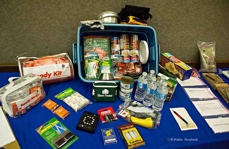
Preparation
A 72-hour emergency kit was on display at Riverlodge. It includes the civilian version of military meals ready to eat as well as both dried and canned food, water, a first aid kit and other supplies. (Robin Rowland/Northwest Coast Energy News)
“From an earthquake perspective,” McLeod said, “folks should be looking at their own home preparation, making sure your residence is as earthquake proof as you could possibly make it by anchoring things to the wall, by making every effort that things are not going to fall on you. Every October there’s going to be a shakeout, which gives all an opportunity to get under the table and practice, drop, cover and hold on.
“So know the hazards, have a plan, have an emergency kit. You rotate the products in it on say an annual basis, hopefully you never have to touch it, but it’s there if you definitely need it. The emergency kit should have supplies for both humans and pets for a minimum of 72 hours.
Planning should also take in to consideration that even if there isn’t major damage in Kitimat, due emergencies in other parts of the province, the town could be cut off for several days, resulting in shortages.
Special report: Clio Bay cleanup: Controversial, complicated and costly
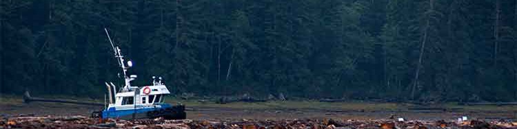
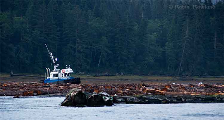
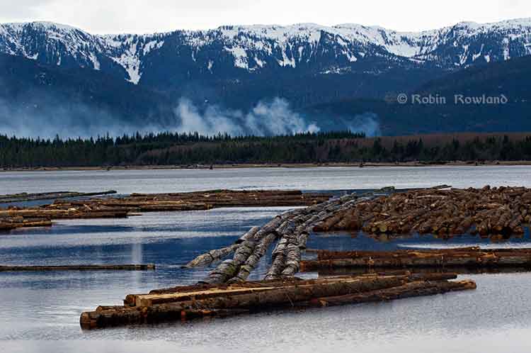
Log booming operations at Clio Bay, August 21, 2013 (Robin Rowland/Northwest Coast Energy News)
Updated October 3, 2013, with DFO statement
One of the major concerns about Clio Bay is the possible lack of oxygen to support sealife. While some people have called Clio Bay “dead,” others have pointed to catches of crab, cod and salmon to dispute that.
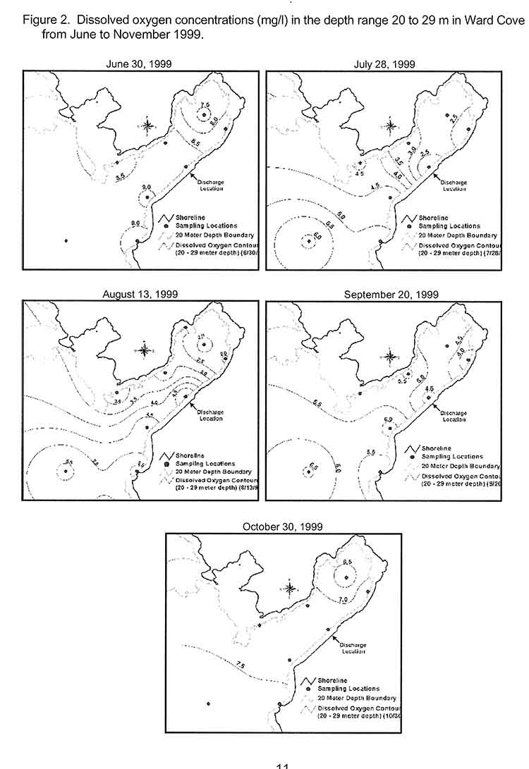
The experience at Ward Cove, Alaska, even though it was more polluted than Clio Bay, shows that oxygen levels are highly variable, depending on season, location and depth.
In 1995, the DFO`s Institute of Ocean Siences studied dissolved oxygen levels in Minette Bay, and concluded, according to a report posted on the DFO website, that because Minette Bay was stagnant from May to November” and those conditions existed even before industrial development in the Kitimat Valley:
Examination of all the dissolved oxygen data showed that conditions before or early in the industrial development of the region were not significantly different from those observed in the 1995 to 1996 study. On the basis of these analyses we concluded that log storage and handling activities in the bay do not appear to have exacerbated the naturally occurring low dissolved oxygen conditions.
Ward Cove
The US Enviromental Protection Agency studied disolved oxygen levels at Ward Cove during water quality monitoring from 1998 to 2002. The monitoring found that dissolved oxygen levels of less than 4 milligrams per litre commonly occurred in Ward Cove during the summer and early fall. “During this time, hypoxic conditions (dissolved oxygen less than 2 milliggrams per litre) occurred occasionally at and near the bottom and less frequently in midwater areas. Hypoxia can be dangerous to both fish and bottom dwelling species.”
The EPA study showed that water circulation is restricted within Ward cove. A counter-clockwise circulation brings ocean water from Tongass Narrow into the cove along the south shore. That water usually exits after 15 days.
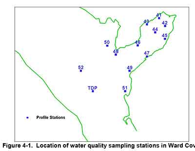
The EPA studied dissolved oxygen in Ward Cove from November 1995 to October 2002, using 13 monitoring stations, nine inside the cove and four outside in Tongass Narrows.
Map of water quality sampling stations in Ward Cove, Alaska (EPA)
This monitoring found that the water column is strongly stratified during the summer resulting in poor mixing of bottom water. The EPA says during the monitoring period:
dissolved oxygen levels between 2 and 4 mg/1 were commonly observed in Ward Cove. These conditions began at water depths greater than approximately 20 metres in mid to late July and continued until early October, but oxygen levels between 2 and 4 mg/1 may also occur in water as shallow as 15 metres.
The EPA says the normal oxygen level for the surface waters of Ward Cove is approximately 8 mg/1 at 10°C. Under natural conditions and vertical stratification, dissolved oxygen levels in deeper waters can vary considerably and be reduced significantly below 8 mg/1 by respiration and the decay of organic materials, including sunken logs.
Since Clio Bay is deeper than Ward Cove, that means dissolved oxygen levels could be decreased at the greater depths.
Maps showing differing levels of dissolved oxygen during monitoring at Ward Cove. Alaska (EPA)
Salmon
The Ward Cove study also confirmed laboratory studies that showed that salmon can detect and avoid areas of low oxygen. Coho, pink, sockeye, chum, steelhead, Dolly Varden and Cutthroat trout are all native to the cove. Introduced Chinook are also found at Wards Cove.
A Ward Cove report says:
Depressed dissolved oxygen conditions are unlikely to significantly affect the growth of juvenile or adult salmonids migrating through or feeding in or near Ward Cove. Some minor indirect effects, however, may occur as a result of hypoxia-induced changes to food chain organisms inhabiting the cove and adjacent waters.
The growth cycles of the adult stage of all seven anadromous salmon and trout species native to Ward Creek should be completed prior to their arrival in the cove from the ocean. Some feeding by adult cutthroat trout and Dolly Varden may occur in or near the cove as they hold in preparation for entering Ward Creek. The growth of subadult chinook salmon, a fish species not native to Ward Creek, is also not likely affected by exposures to these conditions.
Returning adult salmonids may be present in the cove when the lowest dissolved oxygen and highest water temperatures occur in late summer and early fall. Adult salmonids will usually avoid hypoxic conditions, except when staging to enter freshwater during the latter part of their annual spawning migrations. Severe depressed DO levels at this time in combination with low flows and high water temperatures in Ward Creek can result in adult mortality. Fish kills have not been observed recently in the cove, likely because the depressed DO conditions have not extended into a greater portion of the water column in combination with low flows in Ward Creek.
As for other species, the report says reaction varies, with species that are able to swim often leaving areas of depressed oxygen. Previous studies have shown that bottom dwelling species may be able to tolerate low oxygen for a short time and become susceptible if they don’t swim out of the area. Those species who are are not mobile, have weak swimming abilities, or live within the sediment are more likely to be susceptible.
That means that changes in oxygen level could mean that deaths or migration of mobile bottom dwelling species at a location, leaving the impression that species are no longer around, even though the changes may be seasonal. Scientific studies show that low oxygen levels can also make all species in that area vulnerable to disease due to stress. Low oxygen also limits swimming ability and makes a species more prone to predation.
Minette Bay
Log boom at Minette Bay. April 14, 2013. (Robin Rowland/Northwest Coast Energy News)
From August 1995 until October 1996, the Department of Fisheries and Oceans (Institute of Ocean Sciences and the North Coast Division of Habitat Management) with the support local companies studied the water quality in Minette Bay.
A 1961 study of oceanography of the BC fjords and a second study of in 1968 had already reported finding low dissolved oxygen levels in Minette Bay.
As far back as 1975, the report says:
Concerns have been raised that the poor water quality of the bay is exacerbated if not caused directly by the log handling practices there. Other habitat disruptions have been attributed to the industrial activities associated with log handling practices in this bay, e.g. bottom scouring, bark litter, and sinkers.
The DFO report says that the purpose of our study of Minette Bay was to determine if log handling in the bay “significantly contributed to low dissolved oxygen concentrations.”
The study of Minette Bay was similar to the one then starting at Ward Cove, but on a much smaller scale, checking salinity, temperature and levels of dissolved oxygen.
The report says:
The renewal of Minette Bay deep waters occurs annually during the winter and early spring months. Renewal occurs in the form of multiple events, some of which penetrate to the bottom while others only affect the intermediate waters. These events are caused by the outbreaks of the Arctic air mass over the region. The cold air temperatures reduce run-off thereby increasing surface salinity while at the same time the strong outflow winds push the surface layer away from the head of Kitimat Arm and bring denser water closer to the surface. The cold outflow winds also cool and mix the surface waters. In the stagnant period from May to November, dissolved oxygen concentrations in the deep waters decline rapidly to near zero conditions by July and remain low until the late fall.
The 1995 study concluded, based on surveys and reports from the previous 45 years, that measurements of dissolved oxygen in 1951 before the Alcan smelter was built, through measurements in the 1960, were not different from the 1995 measurements in the deep waters.`and concluded “that log handling practices in the bay have not exacerbated the naturally occurring low DO conditions in the bay.”
`
It goes on to say while log storage and handling at Minette Bay had no apparent effect on dissolved oxygen:
other deleterious effects on water quality and habitat are possible. These impacts might include: the disruption of animal and plant ‘life on and in the sediments by the grounding of log booms or scouring of the bottom sediments by the movement of log booms; the alteration of the natural composition of the sediments and the benthic community by the accumulation of bark, whole logs and other wood debris on the sediments underneath the log storage areas and in the log dump zone; anoxia in sediments due to an increased organic load; and toxic concentrations of leachates from the logs and other wood debris.
It called for further studies of Minette Bay such as using an underwater camera, could provide a cost effective way to visually inspect and classify the bottom sediments. Those sediments could then be sampled
based on the preliminary mapping of sediment characteristics, log handling impacts and visual ·surveys. At these locations the benthic community should be sampled for diversity and species composition. This information by itself or in conjunction with historical surveys in the bay and Kitimat Arm may give a sense of the degree of impact that log handling operations are having on the ecology of Minette Bay.
It also called for studies for “two small inlets that have very shallow sills; Foch Lagoon which has a 4 metre deep sill at low water and the other is Kiskosh Inlet which has a 2 metre deep sill.”
It notes
Kiskosh Inlet has a maximum depth of about 53m and is more like Minette Bay than Foch Lagoon which has a much deeper basin (250m). Their very shallow sills suggest that the deep basin waters in these two inlets may be oxygen depleted. A comparison with Minette Bay may be instructive as there are no log storage or handling activities in either of these inlets.
In 1997, DFO created a list of 52 sites on Douglas Channel that were used as active, abandoned or potential log dump sites, as targets for studies. The east and west sides of Minette Bay were two items on the list. Clio Bay, Foch Lagoon and Kiskosh Inlet were not on that list.
Haisla Chief Counsellor Ellis Ross says that if the Clio Bay capping project works, Minette Bay should be next.
Dissolved oxygen standards
The state of Alaska has set standards for dissolved oxygen in marine water with a minimum of six milligrams per litre in the one metre surface layer for coastal water and 5 milligrams per litre in estuaries, “except where natural conditions cause this value to be depressed,” with an additional standard of a minimum of 4 milligrams per litre at any one point in both coastal waters and estuaries.
In a statement to Northwest Coast Energy News, DFO spokesperson Carrie Mishima said, “Site-specific standards for dissolved oxygen levels will be developed for the enhanced site by sampling a control site having similar habitat parameters.”
It appears from documents posted on the DFO website that dissolved oxygen monitoring has been dismissed by DFO as too expensive until the issue became important to fish farming.
A 2005 DFO report on the Bay of Fundy noted
The time has therefore arrived for Canada to proceed seriously and rapidly toward the development and implementation of adequate dissolved oxygen standards and management protocols for the marine coastal zone and aquaculture. Such an effort will enable us to avoid the serious eco-socio-economic consequences associated with poor water quality. From a risk analyses perspective the dissolved oxygen issue might be classified as manageable. Aquaculture takes place in a relatively small proportion of the Canadian coastline and it is only within some of these areas that aquaculture is intense enough to pose potential problems. Hence, the likelihood of a major aquaculture induced depletion of dissolved oxygen is probably low to moderate and the impact of reductions is also probably low to moderate.
Another 2005 DFO report, again on aquaculture, based on meetings in Ottawa noted:
Dissolved oxygen is not yet an easily applied regulatory tool on a specific case-by-case basis, and views were mixed regarding its promise as a candidate for monitoring environmental quality in the coastal zone. However, it is one of the few options available for monitoring over hard bottoms. It is also a useful tool for predicting and assessing far-field effects in environments where oxygen levels may be a concern.
This despite the fact that Alaska and the EPA had been monitoring dissolved oxygen and setting standards for the previous decade.
Canada does not yet have national standards for dissolved oxygen levels in coastal waters. DFO says “site specific” standards will be applied at Clio Bay, but so far there are no details of what those standards will be.
Special report: Clio Bay cleanup: Controversial, complicated and costly
Ward Cove, Alaska, in 2005, after the remediation of the bay was completed in 2001 and old industrial buildings were being demolished. (EPA)
Ward Cove, just eight kilometres west of Ketchikan, Alaska, was so polluted by effluent from pulp and saw mills and a fish plant, and filled with 16,000 sunken lots that it qualified for a U.S. Environmental Protection Agency Superfund cleanup.
The Ward Cove project is now considered a benchmark for cleaning up similar bays. Alaska officials emphasized to Northwest Coast Energy News, that while Ward Cove does provide guidelines for capping and dredging logs, they were not aware of any project where logs were capped that did not have other forms of contamination.
If you take a look at satellite images of Clio Bay, BC and Ward Cove side by side you immediately you see the similarities and differences between the two bodies of water. (Note due to parameters of Google Earth, images are slightly different scales)
Google Earth image of Clio BayGoogle Earth image of Ward Cove, Alaska
Both Clio Bay and Ward Cove are 1.6 kilometres long, somewhat elbow shaped, off a main channel and surrounded by mountains.Ward Cove is 0.8 kilometres wide. Clio Bay is about 0.5 kilmetres wide, 0.8 at its widest point. Both have steep slopes from the mountains. Ward Cove is 61 metres deep at the mouth of the cove, descreasing toward the head. Clio Bay is deeper, 182 metres at the mouth, 90 metres in the centre and between 20 metres and 9 metres at the head.
Both Clio Bay and Ward Cove are subject to tidal circulation. Both Clio Bay and Ward Cove are also influenced by fresh water. Ward Cove is fed by Ward Creek, a smaller Walsh Creek and runoff precipitation the enters the cover from the steep mountain slopes. Clio Bay is fed by one creek, a number of small streams and mountain slope runoff, especially during the spring melt.
Haisla Chief Counsellor Ellis Ross estimates there are between 10,000 and 20,000 sunken logs in Clio Bay. The official summary from the United States Environmental Protection Agency said there were 16,000 sunken logs in Ward Cove.
The major difference with Ward Cove is that it was the site of major industrial development including a pulp mill, a sawmill and a fish plant. That meant the level of pollutants in Ward Cove were much higher than in Clio Bay, which has never been used for an industrial plant. It was the pollutants in Ward Cove, mainly ammonia, hydrogen sulfide, and 4-methylphenol combined with the thousands of sunken logs that made the cove a target cleanup and the associated studies.
A fish plant, Wards Cove Packing opened in 1912 and ceased operations in 2002. The Ketchikan Paper Company mill began operating in 1954 and closed in 1997. Prior to 1971, with the rise of the enviromental movement no permits were required by KPC for discharging effluent into the cove. After that the US Environmental Protection Agency issued a discharge permit and monitored effluent. Throughout the time the KPC mill was operating, the EPA says, “high volumes of log storage (approximately 7 billion board feet) caused accumulation of bark waste and sunken logs at the bottom of the cove.” Gateway Forest Products, a sawmill and veneer plant, continued to store logs in Wards Cove until 2002.
A 2009 monitoring report, conducted by the US Army Corps of Engineers after the cleanup for the EPA noted:
An ecological risk assessment was also conducted using a food-web assessment to estimate risks of bioaccumulative chemicals to representative birds and mammals at the top of the Ward Cove food web. The chemicals evaluated were arsenic, cadmium, mercury, zinc, chlorinated dioxins/furans, and PAHs. The results of this assessment indicated that there are no unacceptable risks to higher trophic level organisms in Ward Cove.
A human health risk assessment was conducted to identify potential risks posed by chemicals detected in sediments or seafood (e.g., fish, shellfish). Ingestion of seafood that may contain chemicals bioaccumulated from the sediments was identified as the only complete exposure pathway for humans. The chemicals that were evaluated included: arsenic, cadmium, mercury, zinc, phenol, 4-methylphenol, chlorinated dioxins/furans, and PAHs. Results concluded that sediments in Ward Cove do not pose an unacceptable risk to human health.
A 2007 report on the Wards Cove remediation from the Alaska Department of Environmental Conservation, noted:
The continuing residues impairment in Ward Cove is caused by the historical accumulation of wood waste on the bottom of the cove. The waste includes an estimated 16,000 sunken logs over at least 75 percent of the bottom and decomposing pulp, wood, and bark waste in sediments in thicknesses up to 10 feet over at least 50 percent of the bottom. Wood waste residues can displace and smother organisms, alter habitat, release leachates, create anoxic conditions, and produce toxic substances, all of which may adversely affect organisms that live both on top of sediments and within sediments.
That is a similar problem to Clio Bay.
The report notes that problems with oxygen increase with depth, noting:
The dissolved oxygen impairment was due largely to the fish-processing waste discharge from the seafood processing facility until 2002, and it was limited to the summer months in deeper waters of the cove (below the picnocline, or stratification layer, approximately 10 meters deep). With that discharge removed, limited monitoring in August and September 2003 indicated that dissolved oxygen impairment might remain near the bottom in waters at depths of 30 meters and greater at certain times and locations due to low natural levels of dissolved oxygen and the continuing decomposition of wood waste. Above 30 meters depth, the waters of the cove appeared to meet the [Alaska state] standard for dissolved oxygen. However, there may be limited capacity for waters at 30 meters and deeper to receive additional loading of oxygen-demanding materials and still meet the standard in summer months.
That should mean that the worries about oxygen depletion at Clio Bay are justified due to Clio’s greater depth.
Studies of the biology of Ward Cove began in 1951, with more in the 1960s and one in 1974. In 1995, Ketchikan Paper Company signed a consent decree with the EPA that called for remediation of Ward Cove, In 2000, KPC and Gateway Forest Products signed a second consent decree with the EPA. Those agreements called on the companies to dredge sediments to improve navigation, remove logs and other debris from the dredging areas and “placing a thin-layer cap of 15-30 cm (six to 12 inches) of sand over about 11 hectares (27 acres) of sunken logs.”
The major studies of Ward Cove began in 1995 after first consent decree. The remediation did not take place until the initial studies were complete in 1999, with dredging and capping taking place from November 2000 to March 2001.
The EPA positioned 13 water quality monitoring stations which operated from 1997 to 2002, to measure salinity, temperature and disolved oxygen, nine inside Ward Cove and four outside the cove in Tongass Narrows. Those studies showed that levels of dissolved oxygen in the cove varied by season, depth and location. Many species from salmon to mobile bottom dwellers like crabs were often able to detect and avoid low oxygen areas.
The plan
The EPA and the companies involved planned the remediation so that it included both dredging, capping logs and sediment and leaving some areas where nature would take its course.
The reports say that complete dredging, removal and disposal of the contamination would have cost $200 million, The total actual cost of the Ward Cove Remediation Project, beginning with development of the Remedial Design Work Plan, was estimated to have cost $3,964,000 (in 2000 US dollars).
The EPA says cost for the capping component of the project “including preliminary field investigations and reporting, design and plans development, post construction engineering, procurement, construction management, project management, mobilizationm demobilization, engineering/QC and science support, surveys, and capping items” was $2,563,506. Based on the volume of capping material placed, the unit cost of log capping for the Ward Cove Remediation Project was $110 per cubic yard.
Old logs retrieved from Ward Cove, Alaska during dredging operations to improve navigation. (EPA)
The plan called for dredging about 17,050 cubic yards in the area near the cove’s main dock and the dredging of 3,500 yards metres nearby to improved navigation. Before the dredging, 680 tonnes of sunken logs had to be removed. After dredging, a “thin-layer cap of clean, sandy material” was placed in dredged areas unless native sediments or bedrock was reached during dredging.
In other areas, most covered in sunken logs, the plan called for placement of a thin-layer cap (approximately 6- to 12-inches) of clean, sandy material, with the possibility of “mounding” dropping mounds of sand on specific areas. The 2009 report says the area of sand deposits actually increased “due to the fact that thin layer placement was found to be successful over a broader area, and it was not necessary to construct mounding.”
The plan called for natural recovery in areas where neither capping nor mounding was practicable and so about 50 acres was left alone. (DFO says it plans to leave some parts of Clio Bay uncapped as “reference areas.”) Slope and sand
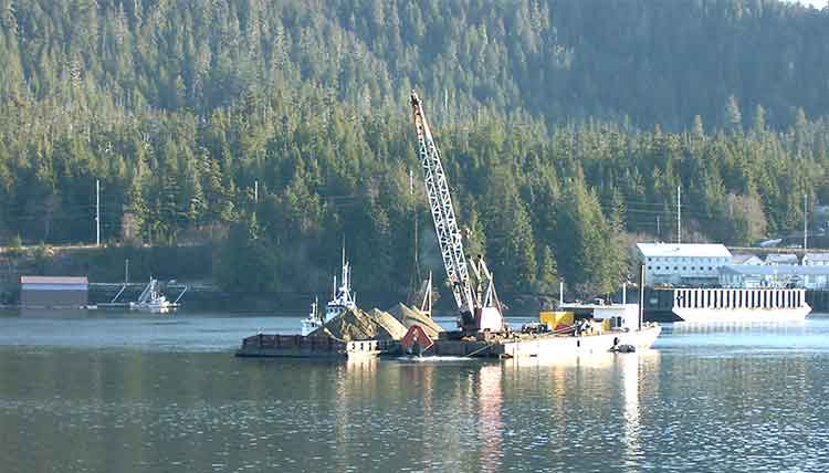
A dredging barge depositing clean sand (originally from Sechelt, BC) during capping operations at Ward Cove, Alaska in 2001. (EPA)
Two studies were carried out as part of the remediation at Ward Cove that do not appear to be contemplated at Clio Bay. The first looked at the “ability of the organic material to support the weight of 15 to 30 centimetres of sand.” Standard engineering equations used at other fill and capping sites were used as part of that study. A second study was carried out to determine the “minimum safety for a given slope,” which given the steep mountains that line Clio Bay, are likely to be factor in the deposit of marine clay. That study determined “For a silty fine sand and a factor of safety of 1.5, the maximum slope would be approximately 40 per cent.”
Those studies led to the conclusion that for the Ward Cove remediation project, the material to be placed on the fine organic sediment could not be gravel and course sand.”
That’s because the larger gravel and course sand “would tend to sink into the sediment and would not provide quality benethic (seabottom) habitat.”
The project decided to use “fine to medium sand with minimal fines.” It also concluded “Because of the very soft existing sediments and steep slopes at Ward Cove, the … material must be released slowly so that the settling velocity is low and bed impact minimized.”
That meant that the EPA had look for a source of quality sand that met their criterion. The sand was found at Construction Aggregates in Sechelt, BC, loaded on 10,000 tonne deck barges, tugged up the coast, unloaded onto land using a conveyor and stockpiled while more tests were done to determine how to deposit the sand on the sunken logs.
Dredging bucket modified to deposit sand during capping operations at Ward Cove, Alaska. (EPA)
Sand was placed on a smaller barge and taken to the deposit site. Initial tests were done with a mechanical dredge equipped with a clamshell bucket. The operator deposited the sand using “swaths” released from the bucket. To make it work properly, the bucket, as supplied by a manufacturer had to be modified by welding baffle plates to the bucket and lengthening the chains to insure consistent deposition of the sand. Two computers with special software called WINOPS, designed for dredging operations “provided the operator and deck engineer the precise locations of the derrick barge position” in order to ensure precise deposition of the sand. WINOPS dredge positioning and guidance software. The WINOPS system made use of three differential global positioning receivers. One GPS receiver was located at the top of the derrick and provided the center positioning of the dredge bucket. Two fixed receivers, one near the starboard center spud and one near the center aft, provided the barge position and heading.
Although using marine clay is likely to produce different engineering challenges at Clio Bay, it is not currently clear that the project has contemplated the level of precision that was used at Ward Cove.
While KM LNG must find a way to dispose of the marine clay from the Bish Cove excavation site, there is a silver lining for the Haisla Nation’s aim of restoring both Clio Bay and the other 50 sites in their traditional territory, since the Kitimat Sand Hill would likely be a ready resource for any future projects. Monitoring
The EPA considered the project finished in September 2001, and long term monitoring began, with major updates every five years in 2004 and 2009.
An EPA report on the 2004 review showed that the three sand-capped areas and one shallow natural recovery area (not sand-capped) had achieved biological recovery; three other natural recovery areas tested had not achieved biological recovery but were making significant progress.
The 2004 studies showed that benethic (sea bottom) communities in uncapped areas showed “species commonly found in areas where organic enrichment is low or declining.” adding “In three other natural recovery areas, benthic communities have not progressed as far toward recovery but are making significant progress.
By the time of the 2009 update, most of the old industrial infrastucture on land at Ward Cove had been demolished and the land area was slated for redevelopment. Many of the companies that had been there had either gone out of business or had declared bankruptcy and the land was taken over by the Ketchikan Gateway Borough,mostly through foreclosure.
The EPA declared that “The remedial action construction is complete, and the remedial action is an operating or ongoing remedial action.”
The 2009 report says that the project was successful in eliminating sediment toxicity. The area was then quickly being recolonized by a diverse bottom dwelling macroinvertebrate species and those species were spreading beyond the specific study areas, so recovery of Ward Cove is expected to continue.
However the 2004 report went on to say that “the achievement of stable benthic biological communities with balanced species composition in more than 75 percent of the area with documented coverage by wood residues on the bottom of Ward Cove” would happen within 40 years from the 2004 study.
The next review of Ward Cove is slated for August 2015.
Diagram of a sand capping operation from a barge. (US Army Corps of Engineers)
Diagram of a sediment capping operation knowing as diffusion (US Army Corps of Engineers)
Diagram of a Japanese system called tremie that uses a hose system to deposit capping material on the seabed. (US Army Corps of Engineers)
Special report: Clio Bay cleanup: Controversial, complicated and costly
Here is the text of a statement Chevron spokesperson Gillian Robinson Riddell sent to Northwest Coast Energy News
The Clio Bay Restoration Project proposed by Chevron, is planned to get underway sometime in early 2014. The proposal is fully supported by the Federal Department of Fisheries and Oceans and the Haisla First Nation Council. The project has been put forward as the best option for removal of the marine clay that is being excavated from the Kitimat LNG site at Bish Cove. Chevron hired Stantec, an independent engineering and environmental consulting firm with extensive experience in many major habitat restoration projects that involve public safety and environmental conservation. The Haisla, along with Stantec’s local marine biologists, identified Clio Bay as a site that has undergone significant environmental degradation over years of accumulation of underwater wood debris caused by historic log-booming operations. The proposal put forward by the marine biologists was that restoration of the marine ecosystem in the Bay could be achieved if marine clay from Chevron’s facility site, was used to cover the woody debris at the bottom of the Bay. The process outlined by the project proposal is designed to restore the Clio Bay seafloor to its original soft substrate that could sustain a recovery of biological diversity.
In preparing this restoration project proposal for Chevron, Stantec conducted independent field studies carried out by their own marine biologists who are registered with BC College of Applied Biology. Two of the studies used in the development of the proposed project were previously published scientific studies on the effects of log-boom activity and log boom activity in Clio Bay that determined log boom and storage activity has had a negative impact on marine diversity. There are previous case studies where capping activity has been used in marine environments.
Stantec’s, and previous studies, have determined that Clio Bay has changed from a once highly productive marine bay characterized by plentiful predatory species such as Dungeness Crab and sunflower stars to a less productive environment hosting more opportunistic and resilient species such as squat lobster and sea anemones. One such study found that compared to Eagle Bay, which has not been affected by logging activity had five times the Dungeness Crab population of Clio Bay. Independent studies conducted before Chevron began working at Bish Cove found that if Clio Bay is left in its current degraded condition, the woody debris will continue to foster and abnormal, species-deficient habitat for several decades. Extensive fieldwork carried out by Stantec’s marine biologists used SCUBA and Remote Operated Vehicle surveys to observe and record all flora and fauna in the bay and its levels of abundance. Stantec’s observations echoed the previous studies which determined that the massive amount of wood has harmed Clio Bay’s habitat and ecosystem.
Most importantly, when considering the work Chevron is proposing to carry out in Clio Bay, it is important to note that a primary objective of all Chevron’s operations is to protect people and the environment. A good example of how we have done that on other projects can be seen in the construction of Chevron’s Gorgon LNG plant in Australia on Barrow Island, which is a Class A nature reserve. Although identified as one of the most important wildlife refuges in the world, and the site was chosen only after a thorough assessment of the viability of other potential locations, and after the implementation of extensive mitigation measures, including a vigorous quarantine program for all equipment and materials brought on to the Barrow island site to prevent the introduction of potentially harmful alien species. Those same high environmental standards are being applied to the Kitimat LNG project and the proposed Clio Bay Restoration project. The proposed work would be carried out with a stringent DFO approved operational plan in place and would be overseen by qualified environmental specialists on-site.
Seaspan ULC, the large BC-based marine transportation and shipbuilding company is keeping its on eye on future opportunities in Kitimat and along Douglas Channel, chief executive officer Jonathan Whitworth said Tuesday.
Jonathan Whitworth, CEO of Seaspan ULC, at the RCM SAR 63 boathouse. (Robin Rowland)
Whitworth was in Kitimat to meet members of the Royal Canadian Marine Search and Rescue Unit 63, which operates from the Nechako Dock.
He also met with members of the Haisla Nation while he was in town.
Kitimat SAR 63 is one of six stations which will receive $8,500 a year for three years, to help cover operating expenses, from the Dennis and Phyllis Washington Foundation, based in Missoula, MT. Seaspan is part of the Washington group of companies, that has holdings on the west coast of Canada and the United States, owned principally by Dennis Washington.
At the moment, Whitworth said, Seaspan operates the HaiSea in partnership with the Haisla Nation. “It’s a boat that you will see up and down the Channel, she does a lot of work for RTA as well as some of the others, mainly from the construction and the up and coming constrution from the new projects. We take a lot of time and effor to make sure our equipment looks good as well as operates well. That’s the kind of pride our crew puts in the vessels and the company supports.” he said. Seaspan barges are also used for the construction projects currently under way in Kitimat.
Whitworth said that while Douglas Channel is not yet “packed on the water,” shipping will likely increase in the coming years. “There are two big dominoes to fall, the first one is any of these big projects being talked about that are going to increase shipping in the Douglas Channel, be
it Chevron or Shell or the BC LNG project. They need to get approval first, that hasn’t happened yet. We understand it may be within the next six to twelve months before we hear some announcements. When that goes ahead, we can start looking at building new boats, be it escort tugs, or docking vessels, or additional vessels… That will help up us to know the time for when we need to deliver new boats for the Douglas Channel.”
Seaspan has always had a close relationship with the Canadian Coast Guard, Whitworth said and that relationship is even closer now that the Seaspan’s Vancouver Shipyards, was chosen by the federal government for the National Shipbuilding Procurement Strategy for non combat vessels. In February, the federal government announced (pdf) a series of preliminary contracts valued at a total of $15.7 million for the joint support ships, the CCGS John G. Diefenbaker polar icebreaker and the offshore fisheries science vessels.
The Washington Foundation is giving a multi-year donation of $1.1 million to three British Columbia marine and port community charitable organizations. Partnering with Sail and Life Training Society (SALTS), Vancouver Maritime Museum (VMM) and Royal Canadian Marine Search & Rescue (RCM-SAR).
Royal Canadian Marine Search and Rescue received $300,000 over three years. “Half of it $150,000 when to Royal Canadian Marine Search and Rescue Sooke training facility on Vancouver Island, that benefits all of the different stations in BC, they all get a chance to go train and at that training centre,” Whitworth said. “The remaining funds, the $150,000 was spread between six stations that are closely associated with Seaspan, so two in Vancouver harbour, North Vancouver, West Vancouver, two on the Fraser River, one at Delta and one at Richmond, one at Victoria and one right here in Douglas Channel in Kitimat.” The $8,500 covers approximately 35 per cent of the operating costs for Kitimat’s SAR 63 station every year for three years.
The Dennis and Phyllis Washington Foundation’s charitable donations are the organization’s first direct donation of their kind in Canada. Since its inception, the Washington Foundation has donated more than $144 million in the United States to hundreds of organizations that focus on education, health and human services, arts and culture, and community service.
Mike Halligan, Executive Director of the Washington Foundation, says today’s announcementis the start of an exciting inaugural collaboration with Canadian charitable organizations in British Columbia.
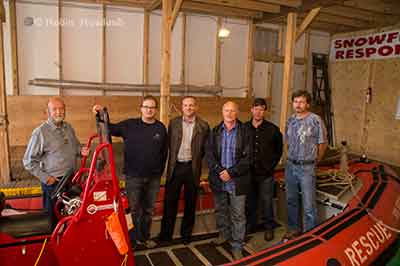
Members of RCM SAR Unit 63, on board “Snowflake Responder” with Seaspan CEO Jonathan Whitworth. (Robin Rowland)
Kitimat’s SAR 63 operates along Douglas Channel and down the Inside Passage as far as Butedale. Training takes place every Wednesday evening at the SAR 63 boathouse at the Nechako Dock. The unit will be recruiting new members in September. Anyone interested can contact training officer Duncan Peacock.
The Canadian Coast Guard says it will undertake “a significant environmental response operation” because more oil is leaking from the sunken Second World War United States Army Transport vessel, the Brigadier General M.G. Zalinski.
Hot tapping is a well-known and frequently used method of removing oil from the tanks of stricken vessels. Holes are carefully drilled into the side of the vessel to access fuel-tanks and then hot steam is pumped into the tanks. The steam increases the temperature of the oil and enables it to flow more easily. The oil is then pumped to the surface for safe disposal.
The procedure can be done with holes of very small sizes up to very large diameters. Hot tapping is used in both marine and land-based scenarios.
The red sections in the image above represent the fuel tanks of the Zalinski; the possible locations for hot tapping of the vessel. The yellow sections represent the cargo holds. (Canadian Coast Guard)
The Canadian Coast Guard says it “has engaged the Gitga’at First Nation and the Province of British Columbia to participate in the operation and maintain a presence at the wreck site” and will keep the Gitga’at First Nation informed of what is going on:
The Coast Guard recognizes that given their proximity to the Zalinski site and their interest in the oil recovery operation, the Gitga’at need to be informed on the progress of the operation and that they have important local knowledge and skill that will be beneficial to the operation.
The Coast Guard says that environmental monitoring in January and March of 2013, discovered “further upwelling” of oil and added new patches to the sunken vessel.
The Coast Guard says: “Although the patches from 2012 and 2013 remain in place, early patches have begun to leak and the Canadian Coast Guard has determined that the structural integrity of the vessel is deteriorating.”
USAT Brigadier General M.G. Zalinski (Canadian Coast Guard)
The USAT Brigadier General M.G. Zalinski was built in 1919 and served as a United States Army Transport vessel during the Second World War. It ran aground during a storm and sank in 1946 in the Grenville Channel about 100 kilometres south of Prince Rupert.
According to a Coast Guard News release, the wreck was “undetected” until the fall of 2003 in 34 metres of water near an underwater cliff about 20 metres from shore.
In September 2003, the United States Coast Guard Cutter Maple reported pollution in the Grenville Channel to the Canadian Coast Guard.
The CCGS Tanu investigated the source of the pollution and collected oil samples, but, the news release says, the vessel remained elusive and undetected.
A month later, more oil pollution was spotted so the Canadian Coast Guard used a remotely operated underwater vehicle which located the Zalinski.
New pollution was reported in the channel in October 2003 by a commercial airline pilot and at this time the Coast Guard suspected that the source of the upwelling of oil was an old wreck.
In 2003 and 2004, the Canadian Coast Guard contracted divers to patch the vessel to prevent the leak of oil.
The Coast Guard says it regularly monitored the site with the help of Transport Canada’s National Aerial Surveillance Program. Local First Nations Groups also monitored the wreck site.
More oil was spotted in April 2012, and at that time, contract divers patched the Zalinski with an epoxy that hardens underwater.
The Coast Guard says new dive footage has shown that metal rivets that hold the hull’s plates are corroding and that the hull is buckling.
as the state of the vessel deteriorates, the Coast Guard has determined that to prevent any harm to the environment, a significant operation should be undertaken to remove the oil from the vessel. The Canadian Coast Guard will be the on-scene commander for the duration of the operation, directing the recovery and the removal of marine pollutants from the vessel and actively monitoring the operation.
The Canadian Coast Guard has also engaged the province of British Columbia and local First Nations groups to solicit their feedback on the operation. On July 26, 2013, Public Works and Government Services Canada posted two requests for proposal seeking a third-party to conduct the oil removal operation and oil spill response services to assist in the case that any oil leaks from the vessel as the operation progresses.
Wreck sites for M.G. Zalinksi and Queen of the North (Canadian Coast Guard)
It is expected that the operation will begin in September 2013 and will conclude in December 2013. The Coast Guard says because the Grenville Channel is so narrow, some restrictions on vessel traffic in the Inland Passage will be needed.
The Grenville Channel is a narrow fjord-like waterway with significant tidal fluctuations and currents up to three knots. The shoreline is rocky and steep with little shoreline vegetation.
The Grenville Channel sees commercial fishing vessels, ferries, cruise ships, and pleasure craft transiting its waters on a regular basis, with increased frequency in the summer months. These waters, naturally shielded from stronger offshore winds and weather conditions, are the preferred route of many cruise ships.
The more mild sailing conditions and the stunning natural beauty of the area make the Grenville channel one of the scenic highlights of many marine travellers on Canada’s West Coast.
Kinder Morgan has filed a last minute objection to the Northern Gateway Joint Review Panel’s preliminary conditions for the Enbridge project.
One of the objections from Kinder Morgan is the provision in the JRP’s proposed Gateway conditions for “purpose built tugs” to escort tankers (a measure that Enbridge has proposed for the Gateway project). Another provision Kinder Morgan objects to is “secondary containment facilities at marine terminals” likely to become an issue if the Vancouver terminal is expanded by Kinder Morgan.
Overall, Kinder Morgan warns that if the JRP imposes some of the proposed conditions on the Northern Gateway, it could adversely affect future pipeline projects in British Columbia.
As well, Kinder Morgan, it appears, is already concerned that if the proposed oversight of Northern Gateway goes ahead, the Kinder Morgan plan to twin the pipeline from Alberta to Vancouver and expand terminal operations in Vancouver could face ongoing scrutiny and possible delays.
The Kinder Morgan document, from the company’s Calgary lawyer, Shawn Denstedt, of Osler, Hoskins and Harcourt, filed May 31, appeared among all the final arguments filed on Friday by intervenors and governments to the Joint Review Panel on Northern Gateway.
Kinder Morgan’s letter to the JRP comes long after the final deadline for such comments.
Kinder Morgan is a registered intervenor in the Northern Gateway hearings, but has only filed four previous documents during the entire multi-year process. The company does not appear on the list of intervenors scheduled to appear for oral final arguments in Terrace beginning on June 17.
On April 12, 2013, the JRP issued a preliminary list of 199 conditions for the planning, construction and operation of the Northern Gateway project.
Now Kinder Morgan is worried. Denstedt’s letter notes:
we believe a number of the proposed conditions may have a material impact on pipeline and infrastructure development in Canada and consideration should be given to the conditions from this perspective.
Diplomatically, Denstedt goes on to tell the panel:
Our comments are intended to assist the JRP in understanding the potential outcomes of the proposed conditions if they become generally applicable to industry.
Commercial considerations
Under what Detstadt calls “Commercial considerations”, Kinder Morgan says “we observe that several of the proposed conditions are likely to affect the manner and risks involved in procuring pipeline facilities and services.
The list points to
Three layer composite coating or high performance composite coating is required for the entire pipeline although other pipeline coatings are commonly used in the pipeline industry depending upon ground conditions encountered
.
Complementary leak detection systems must be identified that can be practically deployed over extended distances of pipeline.
The construction of purpose-built tugs involves significant cost and lead time
A volume is prescribed for the secondary containment facilities at the marine terminal without reference to existing codes.
The letter goes on to say that if the conditions proposed by the JRP for the Northern Gateway come into effect, in Kinder Morgan’s opinion, it could adversely affect other pipeline projects in the future.
If broadly applied to industry, such conditions may limit the ability of pipeline companies to obtain competitive quotes because there are few sources of the required materials or services. The effect of conditions that require the use of a particular material or service may be to grant commercial benefits to certain suppliers through the regulatory process beyond the requirements of existing codes. Since several export pipelines are currently proposed, there will be a heightened demand for labour and materials in the coming years. The commercial effect of conditions that may exacerbate shortages of labour and materials should be a relevant consideration for the JRP.
Timing
One of Kinder Morgan’s objections is to the timing the JRP proposes for the Northern Gateway project if it applies to other pipelines.
Several of the proposed conditions contain NEB approval requirements and filings deadlines several years prior to operations. For example, plans related to the marine terminal and research programs must be filed for NEB approval three years prior to operations.
We are concerned that requiring reports to be filed for approval several years before operations can create significant schedule risks for infrastructure development projects. For example, a project with a two year construction schedule could take three years to complete with such conditions. Any changes to the construction schedule and anticipated date of operations would affect the filing deadline. Project proponents need sufficient schedule certainty in order to plan major expenditures on labour and materials.
To mitigate such risks, it is relevant for regulators to consider whether the filing deadlines and approval requirements prescribed in conditions could materially alter a project’s schedule. Filing deadlines should be set at a reasonable time before operations in order to minimize the risk that such deadlines materially affect the critical path for a project.
Many of the conditions require NEB approval, and in some cases the participation of other parties in the approval process, in order to be satisfied. Fulfillment of those conditions will require additional time, a Board process and potentially litigation. For example, certain reports must be filed with the NEB for approval prior to commencing construction activities. Other conditions require reports to be filed for approval by the NEB prior to construction with a summary of how concerns from other government agencies and Aboriginal groups were addressed.
So Kinder Morgan says:
In our view, conditions that require subsequent board approvals and that attract the potential for additional regulatory processes should be the exception and not a new standard or norm. There must be clear, well understood rationales given as to why additional approvals are in the public interest.
And so Kinder Morgan asks:
As an alternative, the NEB may utilize its existing powers and processes to ensure that when filings are made to satisfy imposed conditions an additional approval process is not required.
Overall the company sees the rules for Northern Gateway as a step back to the days before deregulation.
A number of the conditions may be interpreted as reflecting a return to a prescriptive approach to regulation. These conditions prescribe detailed audit requirements instead of setting a goal oriented approach to allow the proponent flexibility in mitigating any adverse effects. Such conditions tend to focus on operational aspects that are covered by existing codes and regulations rather than setting goals for the proponent to mitigate any significant adverse effects.
Denstedt, again diplomatically, concludes by saying:
Kinder Morgan wishes to thank the JRP for the opportunity to present these high level perspectives regarding its proposed conditions. Our comments are intended to ensure that the wider implications of the proposed conditions on the pipeline industry and infrastructure development are given appropriate consideration in the deliberations and final recommendations of the JRP.