West Coast “kelp highway” was the earliest route for First Peoples’ settlement of the Americas is the new scientific consensus

Most historians and archaeologists believe that the First Peoples to arrive in North America came down the West Coast on what they now call the “kelp highway.”

The review paper “The First Americans” was published this week in the prestigious journal Science.

Evidence from archaeological sites from the British Columbia coast to the southern tip of South America show that First Peoples had settled on both continents by at least 18,000 years ago, according to authors T.J. Braje at San Diego State University in San Diego, CA; T.D. Dillehay at Vanderbilt University in Nashville, TN; J.M. Erlandson at University of Oregon in Eugene, OR; R.G. Klein at Stanford University in Stanford, CA; T.C. Rick at National Museum of Natural History, Smithsonian Institution in Washington, DC.

The paper also says the DNA genomic data suggests a northeast Asian origin for Native American ancestors some time in the past 20,000 years.

(Science)

One of the key sites cited in the paper is Triquet Island in the traditional territory of the Heiltsuk Nation which has been dated to at least 14,000 years ago. Heiltsuk oral history has marked the island for generations, William Housty a member of the Heiltsuk told CBC News at the time the discovery was officially announced in April 2017, “Heiltsuk oral history talks of a strip of land in that area where the excavation took place. It was a place that never froze during the ice age and it was place where our ancestors flocked to for survival.”

The authors of the review say the new consensus on the “kelp highway” is a “dramatic intellectual turnabout” from the original idea that the first indigenous settlers followed an ice free corridor from a land bridge from Siberia down the centre of North America to form the “Clovis Culture”

The land bridge between northeast Asia and North America, commonly called Beringia, came about when sea levels fell during the last ice age. Although the original Beringia hypothesis has been disputed by some First Peoples, the paper says the Beringia hypothesis is still a factor—but much farther back in time, now about 24,000 years ago.

The paper says:

most archaeologists and other scholars now believe that the earliest Americans followed Pacific Rim shorelines from northeast Asia to Beringia and the Americas.

According to the kelp highway hypothesis, deglaciation of the outer coast of North America’s Pacific Northwest about 17,000 years ago created a possible coastal corridor rich in aquatic and terrestrial resources along the Pacific Coast, with productive kelp forest and estuary  ecosystems at sea level and no major geographic barriers

The paper says that kelp resources extended as far south as Baja California, and then—after a gap in Central America, where productive mangrove and other aquatic habitats were available—picked up again in northern Peru, where the cold, nutrient-rich waters from the Humboldt Current supported kelp forests as far south as Tierra del Fuego.

The other sites cited in the paper are

  • Huca Prieta, Peru 15,000 to 14,500 years ago
  • Paisley Caves, Oregon 14,000 years ago
  • Monte Verde, Chile 14,500 years ago
  • Page-Ladson, Florida 14,500 years ago
  • Channel Islands California 13,000 years ago
  • Quebrada Santa Julia and Quebrada Huentelauquén , Chile 13,000 years ago
  • Quebrada Tacahuay Peru 13,000 years ago
  • Quebrada Jaquay, Peru 13,000 years ago

In an earlier article in Science in August, Knut Fladmark, a professor emeritus of archaeology at Simon Fraser University who was one of the first to propose a coastal migration into the Americas back in 1979, said: “The land-sea interface is one of the richest habitats anywhere in the world,” noting that early Americans knew how to take full advantage of its abundant resources.

Testing the kelp highway hypothesis is challenging, the scientists say, because much of the archaeological evidence would have been submerged by rising seas since the end of the last “glacial maximum,” about 26,500 years ago.

The earlier that the First Peoples arrived, that means the land they originally settled is now the further offshore from the current coast  (land which is now likely also at greater depth under the current ocean). So the review says that finding the evidence means that, “enlarging already vast potential search areas on the submerged continental shelf.”

The authors say:

Although direct evidence of a maritime pre-Clovis dispersal has yet to emerge, recent discoveries confirm that late Pleistocene archaeological sites can be found underwater. Recent discoveries at the Page-Ladson site, in Florida produced 14,500-year-old butchered mastodon bones and chipped stone tools in the bottom of Florida’s Aucilla River.

The report says that “Several multidisciplinary studies are currently mapping and exploring the submerged landscapes of North America’s Pacific and Gulf of Mexico coasts, searching for submerged sites. .

In British Columbia, those studies (pdf) include the discovery by Daryl Fedje, an archaeologist at the University of Victoria and the Hakai Institute of 29 footprints on Quadra Island. A piece of wood embedded in a footprint’s fill provided the radiocarbon date of 13,200 years ago and the spear points lying and a cluster of bear bones at Gaadu Din cave on the Haida Gwaii dated to 12,700 years ago.

The review says that for much of the 20th century, most archaeologists believed humans first colonized the Americas about 13,500 years ago via the overland route that crossed Beringia and followed a long and narrow, mostly ice-free corridor to the vast plains of central North America. There,  according to the earlier theories, Clovis people and their descendants hunted large game and spread rapidly through the New World.

This was initially confirmed by twentieth-century discoveries of distinctive Clovis artifacts throughout North America. Some finds associated with mammoth or mastodon kill sites, supported this “Clovis-first” model.

The early studies decided then that “North America’s coastlines and their rich marine, estuarine, riverine, and terrestrial ecosystems were peripheral to the story of how and when the Americas were first settled by humans.”

Now the recent work along the Pacific coastlines of North and South America has revealed that these environments were settled early and continuously, providing a rich diversity of subsistence options and technological resources for New World hunter-gatherers.

A detail of the map from Science shows how off from the current coast the ancient shorelines reached (Science)

At the moment,  there is little evidence on the coast so far of the kind of  stone tools and fishtail points that had previously provided a road map that archaeologists used to trace the spread of “Clovis” Paleoindians throughout the Americas. Such a roadmap is lacking for “pre-Clovis” sites on the coast.

One proposal is that distinctive stemmed (“tanged”) chipped-stone projectile points, crescents (lunate-shaped), and leaf-shaped bifaces found in Japan, northeast Asia, western North America, and South America could be potential markers of an earlier coastal migration and  ties to Ice Age peoples in East Asia.

The problem of finding final proof of the kelp highway is that the First Peoples followed a coastal route from Asia to the Americas, so that finding evidence for their earliest settlements will require careful consideration of the effects of sea level rise and coastal landscape evolution on local and regional archaeological records.

The scientists note that around the globe, evidence for coastal occupations between  about 50,000 and 15,000 years ago are rare because of postglacial sea level rise, marine erosion, and shorelines that have migrated tens or even hundreds of kilometers from their locations at the ice age glacial maximum.

They say overcoming these obstacles requires interdisciplinary research focused on coastal areas with relatively steep offshore bathymetry, formerly glaciated areas where ancient shorelines have not shifted so dramatically, or the submerged landscapes that are one of the last frontiers for archaeology in the Americas

 

Strange ancient hippo-like Pacific coast mammal “vacuumed” shoreline plant life

Scientists have identified a new species of a strange marine mammal group that lived on the Pacific Coast between 33 million years ago and 10 million years ago. The new specimens — from at least four individuals — were recovered from Unalaska, in theAleutians.

The Desmostylians, unlike other marine mammals species alive today — such as whales, seals and sea cows –are extinct. The researchers call them “desmos” for short. Unlike whales and seals, but like manatees, desmos were vegetarians

The desmos are found from Baja, California, up along the west coast of North America, around the Alaska Peninsula, the storm-battered Aleutian Islands, to Russia’s Kamchatka Peninsula and Sakhalin Island, to the Japanese islands

Their strange columnar teeth and odd style of eating don’t occur in any other mammal. They rooted around coastlines, ripping up vegetation, such as marine algae, sea grass and other near-shore plants.

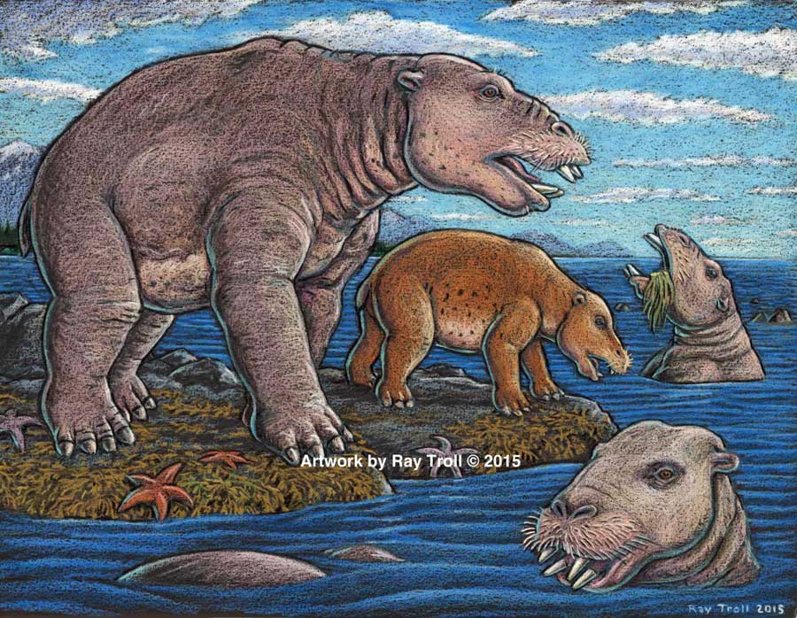
The new species, 23 million years old was a big, hippo-sized animal with a long snout and tusks, It has a unique tooth and jaw structure that indicates it was not only a vegetarian, but literally sucked vegetation from shorelines like a vacuum cleaner, said vertebrate paleontologist and study co-author Louis L. Jacobs, Southern Methodist University, Dallas.

They probably swam like polar bears, using their strong front limbs to power along. On land, they would have had the lumbering gait of a sloth.

A large, stocky-limbed mammal, desmos’ modern relatives remain a mystery. Scientists have previously linked the animals perhaps to manatees, horses or elephants. Adult desmostylians were large enough to be relatively safe from predators.

The identification of a new species belonging to Desmostylia has intensified the rare animal’s brief mysterious journey through prehistoric time, according to the new study.

While alive, the newly discovered creatures lived in what is now Unalaska’s Dutch Harbor.

“The new animal — when compared to one of a different species from Japan — made us realize that desmos do not chew like any other animal,” said Jacobs, a professor of earth sciences. “They clench their teeth, root up plants and suck them in.”

To eat, the animals buttressed their lower jaw with their teeth against the upper jaw, and used the powerful muscles that attached there, along with the shape of the roof of their mouth, to suction-feed vegetation from coastal bottoms. Big muscles in the neck would help to power their tusks, and big muscles in the throat would help with suction.

Discovery of the new genus and species that resembled a hippo and swam like a bear, from Unalaska indicates the desmostylian group was a successful group that was larger and more diverse than previously known. (Artist: Ray Troll)

“No other mammal eats like that,” Jacobs said. “The enamel rings on the teeth show wear and polish, but they don’t reveal consistent patterns related to habitual chewing motions.”

The new specimens also represent a new genus — meaning desmostylians in the same family diverged from one anoher in key physical characteristics, particularly the tooth and jaw structure, said Jacobs, who is one of 10 scientists collaborating on the research.

Discovery of a new genus and species indicates the desmostylian group was larger and more diverse than previously known, said paleontologist and co-author Anthony Fiorillo, vice president of research and collections and chief curator at the Perot Museum of Nature and Science, Dallas, and an adjunct research professor at SMU.

“Our new study shows that though this group of strange and extinct mammals was short-lived, it was a successful group with greater biodiversity than had been previously realized,” Fiorillo said.

Compared to other mammals, desmos were latecomers and didn’t appear on earth until fairly recently — 33 million years ago. Also unusual for mammals, they survived a mere 23 million years, dying out 10 million years ago.
The research was funded by the Perot Museum of Nature and Science, U.S. National Park Service – Alaska Region Office, and SMU’s Institute for the Study of Earth and Man.

The newest desmo made its home on Unalaska Island, the farthest north of any occurrence of the group, which only lived along the shores of the North Pacific.

“That’s the only place they’re known in the world,” Jacobs said. The Unalaska fossils represent at least four individuals, and one is a baby.

“The baby tells us they had a breeding population up there,” Jacobs said. “They must have stayed in sheltered areas to protect the young from surf and currents.”

In addition, “the baby also tells us that this area along the Alaska coast was biologically productive enough to make it a good place for raising a family,” said Fiorillo.

Just as cattle assemble in a herd, and a group of fish is a school, multiple desmostylians constitute a “troll” — a designation selected by Jacobs to honor Alaskan Ray Troll, the artist who has depicted desmos most.

The first Unalaska fossils were discovered in the 1950s in a rock quarry during U.S. Geological Survey mapping.

Others found more recently were on display at the Ounalashka Corporation headquarters. Those specimens were offered to Fiorillo and Jacobs for study after Fiorillo gave a public presentation to the community on his work in Alaska.

“The fruits of that lecture were that it started the networking with the community, which in turn led us to a small, but very important collection of fossils that had been unearthed in the town when they built a school a few years earlier,” Fiorillo said. “The fossils were shipped to the Perot Museum of Nature and Science for preparation in our lab and those fossils are the basis for our work now.”

From there, the researchers discovered that the fossils were a new genus and species.

The authors report their discoveries in a special volume of the international paleobiology journal, Historical Biology. The article published online Oct. 1 at http://bit.ly/1PQAHZJ

The researchers named the new mammal Ounalashkastylus tomidai. “Ounalashka,” means “near the peninsula” in the Aleut language of the indigenous people of the Aleutian Islands.

“Stylus” is from the Latin for “column” and refers to the shape of cusps in the teeth.

“Tomida” honors distinguished Japanese vertebrate paleontologist Yukimitsu Tomida.

The article appears in a special volume of Historical Biology to honor the career accomplishments of Tomida upon his retirement from the Department of Geology and Paleontology in Tokyo’s National Museum of Nature and Science.
In addition to Jacobs, Fiorillo and Polcyn, other authors were Yosuke Nishida, SMU; Yuri Kimura, Smithsonian Institution and the Tokyo Museum; Kentaro Chiba, University of Toronto; Yoshitsugu Kobayashi, Hokkaido University Museum, Naoki Kohno, National Museum of Nature and Science; and Kohei Tanaka, University of Calgary.

The Historical Biology article is titled “A new desmostylian mammal from Unalaska (USA) and the robust Sanjussen jaw from Hokkaido (Japan), with comments on feeding in derived desmostylids” and appears in the special issue “Contributions to vertebrate palaeontology in honour of Yukimitsu Tomida.”

Kitimat’s unknown role in the First World War

Ninety-seven years ago, long before the main townsite was founded in the 1950s, (the Haisla Nation, of course, had been here for thousands of years) Kitimat was to play a short, now forgotten and unlucky role in the First World War with the launch of a vessel in New Westminster called the  War Kitimat as one of the many emergency new ships commissioned by the British government to replace vessels lost to Germany’s unrestricted submarine warfare that was sinking convoys taking vital supplies across the Atlantic.

During the First World War, over nine million gross tons of British ships were lost due to enemy action, both submarines and surface raiders. The worst losses came in the three months ending June 1917 when over 1.4 million gross tons were sunk.

In December, 1916, the Prime Minister David  Lloyd George’s British Government appointed a “shipping controller” to manage a worldwide shipbuilding program to replace the lost vessels, to be built quickly, efficiently and to a series of standard designs. Although the vessels were often different, they were called “standard ships.” It was the Great War’s equivalent of the Liberty Ships built during the Second World War.

Many of the orders were placed with Canadian companies, others with the Japanese shipyards and British owned or controlled shipyards in Hong Kong and Shanghai. Canada created or contracted 19 emergency shipbuilders which built 137 cargo ships and 15 trawler/minesweepers. Some of these yards were purpose-built, others were repair yards that were converted to construction yards; seven were in BC, nine were in Ontario and Quebec, and three were in the Maritimes.

Orders were also placed with shipyards in the United States, but when the Americans entered the war in 1917, those ships were requisitioned by the U.S. Government.

All the ships’ names were given the prefix “War” no matter where they were built in the world.

The Canadians built both steel hulled and wooden hulled cargo vessels, including the War Kitimat, as well as yachts and sailing yachts (which likely became the war time “trawlers”). The British built 12 different types of “dry cargo” vessels, five types of “coasters” plus tankers.  The United States also built wooden hulled cargo vessels (slightly larger than the Canadian versions) and various types of steel hull cargo ships.

The government of France also contracted Canadian shipyards for its own vessel building program.

In Canada, the BC Marine Railway Company was one of the prime contractors, and the job of building four ships was awarded to the New Westminster Shipbuilding & Engineering on Poplar Island, which can be seen today from New West’s Esplanade at Westminster Quay.

The First Nations of the area had used the island for generations and in 1871 the island was designated an Indian Reserve. During the small pox epidemic of 1889, with many members of the Vancouver area First Nations struck down by the disease, a hospital was built on the island. It is believed that many of those who died of smallpox were buried there. Because of the association with disease and death the island was abandoned until 1917, when the war time necessity meant a shipyard was built on the island.

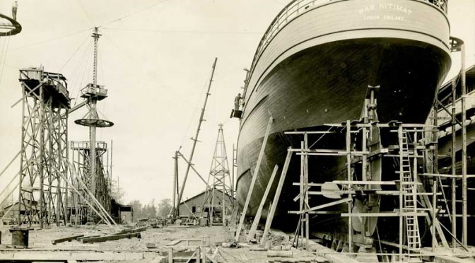
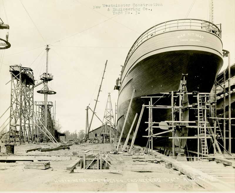
The War Kitimat under construction in New Westminster (Canadian War Museum)

New Westminster Shipbuilding had the job of constructing four “war” class wooden hulled freighters, 2300 gross tonnes, 3300 dead weight tonnes, 250 feet long with a beam of 43.5 feet, with 322 nominal horse power triple reciprocating steam engines powered by two water tube boilers, turning a single screw capable of ten knots.

The company built four ships, the War Comox, War Edensaw, War Kitimat and War Ewen. The War Comox was first launched in April, 1918, but completion was held up as the shipyard waited for equipment from suppliers. That led to pressure to build, launch and complete the War Edensaw, which was launched in June 1918, and the War Kitimat, which was launched on  Sunday, August 18, 1918.

The War Kitimat immediately ran into trouble. According to the Times Colonist, right after launch the War Kitimat ran aground off New Westminster and had to be lifted off the Fraser  river bed by using jacks until was raised enough so that tugs could attach lines and tow it to deep water.  About a week later, the War Kitimat was  towed to Victoria for repairs and further fitting out (possibly to the Foundation Company shipyard which was also building five of the war class vessels. Foundation is now Seaspan’s Point Hope Marine)

The War Kitimat did make at least one voyage to Great Britain, but by the time it arrived, the war was coming to a close. After the Armistice on November 11, 1918, the ships were no longer needed and the British government sold most of them to shipping companies. (All the ships were UK registry, not Canadian)

Flag for Lloyd Belge line
Flag for Lloyd  RoyalBelge line

In 1919, the War Kitimat was sold to the Lloyd Royal Belge S.A. line of Antwerp, Belgium and renamed the Serbier.

On January 12, 1920, the Serbier, on a  voyage from Cartagena and Oran to Antwerp with zinc ore and general cargo on board, sprang a leak in her engine room during a “raging gale” in the Bay of Biscay and sank  80 nautical miles (150 km) off Penmarc’h, Finistère, France at 47°38′N 6°10′W. Her Capt. A. Canfrère and the crew were rescued by the French ship SS Docteur Pierre Benoit.

How the ship came to be named War Kitimat isn’t certain. It was probably named after the Kitimat River since other vessels in the War category were named Skeena, Stikine, Babine, Niagara, Ottawa (others were named for cities like Halifax or Toronto).

The Belgian shipping company did not give up on the name Serbier. It purchased another US-built War cargo ship, first named the War Hound by the British. After the US entered WWI in 1917 and took over the building there it became the Lake Huron, a US Navy Transportation Service mine carrier. From later in 1920, Royal Belge operated the new Serbier until 1924, when it passed through French, Norwegian, Danish and then as the Advance,  Finnish ownership. The Advance was seized in Panama by the United States in 1941 and renamed the Trojan. After the Second World War, the US returned the ship to Finland. It sailed as the Advance until it was sold a Greek shipping company in 1965 and scrapped at Piraeus in 1966.

Of the ships under British control, 821 ships were ordered by the UK shipping board and 416 were completed. Fourteen were lost to enemy action. The remaining orders were cancelled but often completed by the shipyards.

Many of the “war” or “standard” ships passed through various owners.

During the Second World War many played their original role and took part in the convoys that crossed the Atlantic.  Many were sunk during those crossings. Others, sold to growing Japanese shipping interests in the 1920s and 1930s, were sunk by US destroyers and submarines. Others like the War Hound /Serbier survived to the 1950s and 1960s.

Of the War Kitimat’s sister ships built in New Westminster, the War Comox was sold to an Italian company, renamed the Guidatta and scrapped at Genoa in 1925, The War Ewen was sold to a German company, renamed the Etienne Marcel and scrapped in Germany in 1925. The War Edensaw, under the original name, was carrying Admiralty stores from Constantinople to Malta,  when it caught fire on June 25, 1919 and sank 94 nautical miles east of the St. Elmo Lighthouse on Malta.

As for Poplar Island, it was zoned for industrial use but no one could come up with ideas for how to use the island.   New Westminster sold the island to Rayonier Canada in 1945, where it became an anchorage for log booms on the Fraser River. The successor company, Western Forest Products sold it back to New Westminster in 1995,  The island is still a wilderness area in the middle of urban Vancouver and subject to treaty and land claims negotiations with the area’s First Nations.

Related links
Poplar Island: A History as Thick and Colorful as the Trees

Emergency Shipbuilders of World War I

World War One Standard Built Ships

World War One Standard Built Ships (this is a different site to the one above)

Vessels Built by B.C. Marine Railway Co

The Ship’s List (database of ships, link is to Lloyd Royal Belege entry)


Editor’s Note:   Up until now Kitimat has not had a reason, unlike other communities, to mark Canada’s role in the First World War.  We suggest that should the District of Kitimat choose to do so either this year or in the next three years, August 18, the date of the launch of the War Kitimat might be an appropriate date, in addition to Remembrance Day on November 11.

Tropical fish, climate change migration growing threat to seagrass, kelp beds, study says

Tropical fish are migrating into  what were once temperate water as a result of ocean warming and that poses a serious threat to the areas they invade, because they overgraze on kelp forests and seagrass meadows, according to  a new study from the University of New South Wales in Australia

The  study says the harmful impact of tropical fish is most evident in southern Japanese waters and the eastern Mediterranean, where there have been dramatic declines in kelps.

Tropical fish
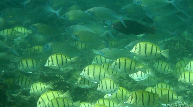
A school of tropical plant-eating fish including various species that are shifting their distribution towards temperate waters. (Adriana Verges/UNSW)

There is also emerging evidence in Australia and the US that the spread of tropical fish towards the poles is causing damage in the areas they enter.

“The tropicalisation of temperate marine areas is a new phenomenon of global significance that has arisen because of climate change,” according to the study lead author, Dr. Adriana Verges, of  the University of New South Wales.

“Increases in the number of plant-eating tropical fish can profoundly alter ecosystems and lead to barren reefs, affecting the biodiversity of these regions, with significant economic and management impacts.”

The study is published in the journal Proceedings of the Royal Society B.

As the oceans have warmed and the climate has changed, hotspots are developing in regions where the currents that transport warm tropical waters towards the poles are strengthening.

Increased flow of the East Australian Current, for example, has meant waters south-east of the continent are warming at two to three times the global average.
Tropical fish are now common in Sydney Harbour during the summer months.

Japan, the east coast of the US, northern Brazil and south eastern Africa are also strongly influenced by coastal currents that transport warm tropical waters.

“In tropical regions, a wide diversity of plant-eating fish perform the vital role of keeping reefs free of large seaweeds, allowing corals to flourish. But when they intrude into temperate waters they pose a significant threat to these habitats. They can directly overgraze algal forests as well as prevent the recovery of algae that have been damaged for other reasons,”  Dr Verges said.

Tropical fish expanding their ranges into temperate areas include unicornfish, parrotfish, and rabbitfish.

The study authors include researchers from Australia, the US, Spain, Singapore, the UK and Japan.

Kelp disappears in southern Japan

The study reports that more than 40 per cent of the kelp and algal beds have disappeared since the 1990s, a phenomenon known in Japan as isoyake.

Tropical species including rabbitfish and parrotfish appear to be mainly responsible.

Although these fish have been present for a long time, their annual grazing rates have increased dramatically as ocean temperatures in winter have risen.  Corals now dominate the ecosystem in many locations. The changes have led to the collapse of the abalone fishery.

Rabbit fish expand in eastern Mediterranean

Tropical fish moved into the eastern Mediterranean from the Red Sea after the opening of the Suez Canal. In recent decades, rabbitfish numbers have increased, resulting in hundreds of kilometres of deforested areas and a 40 per cent decrease in the variety of marine species.

As the Mediterranean warms the rabbitfish are expanding their range westward, putting other shallow ecosystems at risk.

Gulf of Mexico

There has been a more than 20-fold increase in the number of parrotfish in the Gulf of Mexico – a species which consumes seagrass at five times the rate of native grazers. The number of plant-eating green turtles and manatees has also increased.

Australia

In Western Australia, emerging evidence suggests that increases in the number of tropical fish are preventing the recovery of kelp forest damaged by a heat wave in 2011.

In eastern Australia, kelp has disappeared from numerous reefs in the past five years and Dr Verges’ research suggests intense grazing by tropical fish on the kelp preceded this.


Chevron postpones Kitimat LNG decision to 2014, seeks new equity partners, Dow Jones reports

The Dow Jones wire is reporting that Chevron has postponed a final investment decision on the Kitimat LNG project until 2014, “putting a deadline on a project that has already seen delays.”

Competitors are trying to sell natural gas to Asian customers using the cheaper Henry Hub North American market  benchmark rather than higher Japanese bench mark which is based on the price of oil. 

The Dow Jones report says Chevron, which is partnered with Apache, is still having problems finding customers in Asia.  It quotes George Kirkland, head of Chevron’s upstream business, as saying that the company is offering customers equity stakes in the Kitimat project. Kirkland told a conference call that equity should be more attractive to buyers.

Kirkland said the company won’t approve the project until it has lined up customers for at least 60 per cent of Kitimat’s total 5 million metric tons a year of export capacity, although Kirkland expects that to happen in 2014.

“We’ve have had some discussions with Asian buyers,” Mr. Kirkland said during a call with investors. He declined to name the companies with which Chevron was negotiating. “It’s more likely to be a 2014 (decision), not late 2013,” he said.

U.S. natural gas prices were $3.37 per million British thermal units Friday, down from $13.69 in July 2008.
Chevron to Make Final Kitimat LNG Decision in 2014

Scientists identify major Japanese-style tsunami hazard for west coast

American scientists studying the aftermath of the March 11, 2011, Tohoku, Japan earthquake and the resulting devastating tsunami say that a similar tsunami could be generated by an earthquake in the Aleutian Islands of Alaska.

The 9.0 magnitude Tohoku earthquake created a tsunami that was a high as 10-metres. The events killed about 18,000 people. Debris from the tsunami is now appearing on the west coast of North America.

The study, published May 8, in EOS, the Transactions of the American Geophysical Society, says:

A tsunami triggered by an earthquake along the AASZ [Alaskan-Aleutian Subduction Zone] would cross the Pacific Ocean and cause extensive damage along highly populated U.S. coasts, with ports being particularly vulnerable.

A subduction zone is where one tectonic plate, in this case, the Pacific plate, is forced down under another plate, the Alaskan continental arc.

Data from the Tohoku earthquake suggests that portions of the Alaskan-Aleutian Subduction Zone could be just as hazardous.

The study, by Holly Ryan, of the Pacific Coastal and Marine Science Center of the US Geological Survey in Menlo Park, Ca. and colleagues says the Japanese earthquake surprised scientists because the magnitude of both the earthquake and the tsunami were much larger than expected for the Tohoku region off northeastern Japan. The scientists say the region was originally considered low risk because the deep water section of the tectonic plate boundary that ruptured had been aseismic [a fault where there are no records of earthquakes] prior to the March 2011 event and was thought to be too weak to accumulate the strain to trigger a major earthquake.

In Japan and the Aleutians, there are seldom records of earthquakes where the upper tectonic plate is made up of weak, water-laden trench sediment accreted [stuck or locked] to the margin along thrust faults. The accreted sediment is not strong enough to fail in an earthquake (stick-slip behaviour) but, rather usually deforms without causing an earthquake.

Now research from the Japan shows that deep water section of the Tohoku region was fully
locked (accumulating strain at the convergence rate). The continental basement rock lies within
20 kilometres of the trench in deep water above the boundary at Tohoku. That created major accumulation of strain on the fault.

So when the earthquake occurred, there were large amounts of slip on the Tohoku megathrust, as well as corresponding movement on a deep water branch fault. Both contributed to the displacement of large volumes of water, creating the giant Japanese tsunami that smashed into the coast.

The Alaskan-Aleutian Subduction Zone is similar to the Tohoku region. The AASZ begins at a deep trench where the Pacific plate under thrusts the Alaskan continental arc and the Aleutian Islands oceanic arc.

Part of that subduction zone triggered the March 27, 1964 Good Friday magnitude 9.2 Anchorage, Alaska, megathrust earthquake. It was the largest quake ever recorded in North America and the second largest worldwide since seismic events were recorded. The epicentre was about 20 kilometres north of Prince William Sound, where a fault ruptured 25 kilometres below the surface. That quake causing major damage in Anchorage, 125 kilometres to the west and in Valdez 64 kilometres to the east. The megathursts along the ocean floor shifts created large tsunamis as high as 67 metres that struck along the North American coast from Alaska to California.

In Anchorage, nine people were killed by the quake, much of the downtown was destroyed and one neighbourhood lost 75 homes in a massive landslide. Two villages near Anchorage were destroyed when the land sank.

According to Wikipedia, the damage to British Columbia alone was estimated at $10 million in 1964 dollars (about $75 million in 2012 dollars according to the Bank of Canada inflation calculator) The Anchorage quake actually shook Kitimat and caused minor damage in the town. Due to factors such as the location of the quake at Prince William Sound , the tides and other factors along Douglas Channel, the tsunami coming into Kitimat was just a few centimetres high. Across the northwest and down the coast, there was more damage, the tsunami that hit Prince Rupert was 1.4 metres. Again to the configuration of the coast, tides and other factors, Port Alberni on Vancouver Island was hit twice, washing away 55 homes and damaging 375 others.

In California, 12 people were killed at Crescent City. There was damage in Los Angeles and as far off as Hawaii.

The study says that an Anchorage type event occurs every 900 years, so that area appears to be out of immediate danger,

According to the study, there was a magnitude 8.6 earthquake near Uninmak Pass in the same region in 1946 that triggered a tsunami that caused damage along the west coast, killed 150 people in Hawaii and inundated shorelines on South Pacific Islands and as far away as Antarctica. Another earthquake near the Andreanof Islands in 1957 also triggered a dangerous tsunami.

The new danger zone could be at the Semidi Islands, southwest of the better known Kodiak Island, where a 400 kilometre-long section of the subduction zone ruptured in 1938, causing a 8.2 magnitude earthquake. In the 1938 earthquake, the study says, that quake was beneath relatively shallow water, so it generated only a modest tsunami.

The Semidi Islands area is now fully locked, the study says, and enough strain has built up to trigger a similar event.

In 1788, a major earthquake in the Semidi Islands was recorded by Russian settlers. It is that area that the study says could trigger a Tohoku type tsunami. The segment of the trench in deeper water has not had a rupture since 1788. Satellite observations show that strain along the fault is accumulating “at a high rate.” The trench is four to five kilometres deep, just like at Tohoku, so displacement of the ocean water could trigger a similar giant tsunami.

Potential rupture of the near-trench section of the plate boundary is worrisome in that similar to the plate boundary near Tohoku, it is composed of rigid basement rock that extends beneath the margin to water depths of four to five kilometres. The presence of rigid basement rock close to the trench allows for an earthquake source beneath deep water, which would significantly amplify the height of the resultant tsunami. In addition, the possible additional rupture of an as yet undiscovered splay or branch fault, similar to circumstances during the Tohoku earthquake, would further increase the tsunami height.

The authors of the study call for more studies to compare the Aleutian area with the Tohoku region of Japan. Scientists are now working on “Paleotsunami studies” so there is a a history of tsunamis generated in the Aleutians that can be correlated to specific earthquakes.

Most of the attention on the west coast of North America has been centred on the Cascadia fault from northern California to southern British Columbia, which could also trigger a major earthquake and tsunami. It is time that scientists, emergency planners and government paid more attention to Alaska.

Link to Study Tsunami Hazards to U.S.  Coasts form Giant Earthquakes in Alaska  (pdf)


View Larger Map

What about the Northern Gateway?

My family was just sitting down for dinner in Kitimat on that Good Friday evening in 1964 when the whole house began to shake. The quake in Anchorage lasted for four minutes, the shock that hit Kitimat was probably less than a minute.

After dinner, tuning to the local TV station, CFTK, the Friday night broadcasts was interrupted by a news special, an extraordinary even for a small station, which in those days had no microwave communications with the rest of the television universe, with the local anchor telling the story based on wire service and other reports that were already trickling in, giving the people of the Kitimat-Terrace-Prince Rupert region the news of the devastation in Alaska.

Fast forward 48 years and the big question on the northwest coast is the Enbridge Northern Gateway pipeline and whether or not the pipeline and the terminals in Kitimat harbour are vulnerable to earthquake and tsunami.

In public presentations in Kitimat, Enbridge officials have always minimized the potential danger to the Northern Gateway from earthquake and tsunami. In its latest presentation, to District of Kitimat Council on April 16, 2012, Enbridge engineer Drum Cavers told council that “all of the major earthquakes have occurred well off shore on the Queen Charlotte Fault,” and that “seismic activity is low relative to south coastal BC.” Cavers also said “the Kitsumcalum-Kitimat Valley is not the site of unusual seismic events or faults.” The presentation points to an 1973 quake in the Skeena River valley that Enbridge says was small and the planned pipeline is within “seismic design parameters.”

Cavers’ presentation said “No fault breaks to surface are known near the pipeline route, but if one should be found during further work, there are methods to mitigate fault motion if required.”

There has been no mention by Enbridge Northern Gateway of the potential problems that could be caused to the Kitimat pipeline and the terminal by a major earthquake or tsunami from the Alaska Aleutian region.

I was out of town during Cavers’ presentation but I have asked questions about the 1964 quake and potential problems from Alaska at three public meetings, including a direct question to Northern Gateway president John Carruthers at the September, 2011, public forum at Kitimat’s Mount Elizabeth Theatre. Despite promises, Enbridge has so far not responded to my questions.

Shell, partners, plan giant liquified natural gas project at Kitimat, mayor sees town growing to 15,000 residents

LNG Canada logoShell Canada has confirmed that, with three partners, it is developing a giant proposed liquified natural gas export facility at Kitimat.

The project could see up to 12 million tonnes of LNG exported from Kitimat each year. What the companies are now calling LNG Canada would be built in two “trains” or stages, with each producing six million tonnes. A news release from Shell says there is an option to expand the project beyond the 12 million tonne capacity.

The announcement made international news. The Chicago Tribune said Tuesday. “Kitimat… looks set to become a major supply hub for the Pacific Rim.”

Shell’s partners, Korea Gas Corporation, Mitsubishi Corporation, and PetroChina Company Limited will work to export natural gas, mostly from northeastern British Columbia, combining the “four companies’ extensive development experience, technical depth, financial strength and access to markets required to be the leading LNG developer in Canada.”

The four companies did not say how much money is involved in the project. Reports in the Japanese media said the project could cost as much as $12 billion US.

Shell holds a 40 per cent working interest. The partners KOGAS, Mitsubishi and PetroChina each hold a 20 per cent working interest.

“Our combined expertise, and our focus on technological innovation in delivering safe and environmentally sound LNG projects around the globe, ensures that our LNG Canada project would be well-suited to deliver long-term value for British Columbia and increase access to new export markets for Canada,” says Jose-Alberto Lima, Vice President LNG Americas, Shell Energy Resources Company in a news release.

News releases from both Shell and Petrochina both say:

The proposed LNG Canada project includes the design, construction and operation of a gas liquefaction plant and facilities for the storage and export of liquefied natural gas (LNG), including marine off-loading facilities and shipping. LNG Canada can create significant economic benefit for the province, First Nations, local communities and the region. Such a project can create thousands of jobs during construction and hundreds of full-time, permanent jobs during operations. Such a significant energy project can also bring indirect economic development opportunities to the region.

Shell and PetroChina say:

A decision to move this project into development would be taken after conducting necessary engineering, environmental and stakeholder engagement work with start up around the end of the decade, pending regulatory approvals and investment decisions.
The approval process will begin with a formal consultation process with First Nations and local community residents.

“This project will contribute to a further strengthening of trade relationships between China and Canada and will help China use clean burning natural gas to fuel its economic growth,” Bo Qiliang, Vice President, PetroChina, said in the release.

“We are sitting on the doorstep of a very fast-growing market that actually wants to come to Canada because they see it as long-term stability and a secure source of supply,” Shell Canada president Lorraine Mitchelmore said. “We are now, for the first time in the natural gas industry, very competitive with other countries like Australia.”

Kitimat Mayor Joanne Monaghan said her and the District Council have been working on the project for sometime. “Council have been aware of it and have rolled up their sleeves for almost a year and half to two years,” the mayor said.

Kitimat mayor Joanne Monagahn
Kitimat mayor Joanne Monagahn reads notes on the LNG Canada announcement, May 15, 2012. (Robin Rowland/Northwest Coast Energy News)

One aspect was making sure Kitimat is ready for the project, Monaghan said: “We had to make sure there were hospital facilities, rental facilities, that we had housing available. We were getting all our inventories together. Now we know and now we can go full blast ahead.”

Monaghan hopes that eventually Kitimat will return its population peak of between 10,000 and 15,000 residents. (Since the closure of the Eurocan craft paper mill in 2010, Kitimat’s population dropped to around 8,000 but that number has been growing with the LNG projects and the Rio Tinto Alcan Kitimat Modernization Project, even though the KMP project will eventually mean fewer jobs at the aluminum smelter).

“If they have the five to seven thousand construction workers they’re looking for, they will bring in workers from all over BC, probably all over Canada,” Monaghan said.

Shell purchased the former Methanex plant site and the related Kitimat port terminal last fall, raising worldwide speculation about the LNG project. The Methanex site is now used by Cenovus to transport bitumen condensate by rail from Kitimat to the Alberta oil sands. Much of the old Methanex plant has been decommissioned and is being shipped to a buyer in China.

Most of the natural gas supply will come from the booming Horn River and Montney shale gas formations in northeastern British Columbia.

Reports say that LNG Canada will work with a third party that would build and probably own a pipeline from the northeast to the coat.

The profit picture comes from the fact that LNG prices in Asia, based on a proportion of the world price of oil, are much higher than the price of natural gas in North America, where the shale gas boom has driven gas prices to a record low.

The price boom in Asia could be a windfall for British Columbia, which could receive up to $600 billion in natural gas royalties over the next 25 years.

There is also fierce international competition to send LNG to Asia. The major energy companies are investing heavily in projects in Australia, while traditional suppliers like Qatar and Russia are ramping up their marketing efforts to Asia.

The old Methanex site in Kitimat
The decommissioned Methanex site by the Kitimat River, now owned by Shell. (Robin Rowland/Northwest Coast Energy News)

As of this week, Japan began closing down the last of its nuclear electrical generation capacity. After the March 11, 2011 earthquake, that country became a major customer for current and future liquified natural gas projects.

Since the earthquake last year, two other projects in Kitimat have proceeded. The Kitimat LNG project, a partnership called KM LNG led by Apache Corporation, Encana Corp, and EOG Resources plan to start up a Kitimat LNG plant in 2015, at Bish Cove with an initial capacity of five million tonnes a year. That project has been approved by the National Energy Board but is still waiting for a final go ahead from the boards of the three corporations, expected now in the fourth quarter of 2012.

A second project, called BC LNG, owned by the Haisla Nation in partnership with Houston-based LNG Partners, will act as broker and exporter for other LNG companies, facilitating exports to Asia from a barge based facility at North Cove, with the first shipment expected in 2014 or 2015.

There are also reports that Malaysia’s Petronas in partnership with Calgary-based Progress Energy Resources Corp., which have major stakes in B.C. shale are also looking for a possible LNG terminal on the west coast. As well, Talisman Energy, Nexen and Imperial Oil are also looking at west coast projects.

Related Links

News release from BC Premier Christy Clark Premier Applauds Progress on Kitimat Project: LNG Canada

Mitsubishi news release

Three new powerful players said to join the BC West Coast LNG export rush

The race to ship liquified natural gas to Asia is getting hotter with three new powerhouses joining the scramble for west coast export terminals.

BG GroupThe Prince Rupert Port Authority announced Tuesday, Feb. 7, that it is working with an energy powerhouse BG Group, on a feasibiity study for an LNG terminal at Ridley Island.

At the same time The Globe and Mail reports that there are rumours that Exxon Mobile is “examining LNG options” in the northwest. The paper also quotes sources as saying the Japanese firm Itochu is looking to export gas via Kitsault, where there is an abandoned molybdenum mine, town and port.

British Gas was once the retail domestic supplier of natural gas to the UK market. The company split in two in 1997, with BG Group becoming an international exploration and energy production company.

Itocchu logoItochu is a 150-year old Japanese company which began as Chibou Itoh’s one man linen trading company, later adding drapery shops and over more than a century expanding operations to become a major international conglomerate with strong interests in the energy sector. According to the company website, Itochu is also a player in the solar energy and bio-ethanol fields.

“The Prince Rupert Port Authority has engaged with the BG Group to consider Prince Rupert for a potential LNG export facility. The BG Group is number two in the world in LNG, next to Shell and they are number two depending on what measurements you look at, so they are already a big player in that industry” according to Shaun Stevenson, vice-president of Marketing and Business Development for the Prince Rupert Port Authority.

“We have an agreement signed to provide them a site and to secure that site to examine the suitability of it and the feasibility of the facility…We have given them a period of time to conduct the feasibility and suitability study, and if it is determined to be viable from the preliminary work that is done then we will look at further development,” he said.

David Byford, spokesman for the BG Group in Houston, confirmed the deal has been signed but cautioned “Prince Rupert is one of the areas we are looking at, and we are in the very early feasibility study stage.”

“The west coast of Canada is certainly advantageous for LNG export, and there is a lot of natural gas in BC as well.”

Prince Rupert port spokesperson Michael Gurney says it will be 12 to 24 months before there’s a clear commitment on the project.

A spokesman with Itochu declined comment when contacted by The Globe and Mail. Kitsault, near Alice Arm, in the traditional territory of the Nisga’a nation, was the site of  a short lived molybedenum venture by the Phelps Dodge company. After the mine was abandoned, the town was bought by Indo-American businessman Krishnan Suthanthiran and is now promoted as a nature and wilderness retreat, called Heaven on Earth.

Exxon MobileThe Globe and Mail also quotes sources as saying that Exxon Mobil Corp., which has substantial natural gas reserves in northeastern B.C., has also been examining LNG options. Pius Rolheiser, a spokesman with Canada’s Imperial Oil Ltd., which is majority-owned by Exxon, said in a statement to the Globe and Mail: “Imperial continuously reviews a variety of opportunities to increase value to our shareholders. As a matter of practice, and for competitive reasons, we do not discuss specific strategies.”