Expansion of proposed Kitimat bitumen terminal urgent to get offshore markets, Enbridge tells JRP

Enbridge Northern Gateway has told the Joint Review Panel that expansion of the proposed bitumen and condensate terminal in Kitimat is urgent so the company can access offshore markets for Alberta bitumen sands crude.

Northern Gateway filed an update on its plans for the Kitimat in response to a ruling from the JRP, after Smithers-based activist Josette Weir questioned how Enbridge filed a route update with the panel which included the plans to expand the terminal.

The JRP ruled against two of Weir’s motions but upheld, in part, her objection that the terminal plans were not part of a route revision.

In the Motion, Ms. Wier argues that there are a number of completely unrelated documents embedded within the route revision changes including, for example, a “noticeable increase in the number of oil tanks at the Kitimat terminal” with “significant size increases included.” There is no discussion in the update documents on how these changes are related to the proposed routing change. Ms. Wier further notes that this evidence was submitted after the completion of questioning on engineering (including regarding the Kitimat tank farm) in Prince George last
November.

The Panel notes that it may be of use to parties for Northern Gateway to identify which of the exhibits submitted on 28 December, 2012, were: (i) directly related to Route Revision V; (ii)corollary to Route Revision V; or (iii) unrelated to Route Revision V. Accordingly, the Panelorders Northern Gateway to submit, on or before 1 February 2013, a chart setting out this information for each of the exhibits submitted in the 28 December 2012 update. Further, where the documents are listed as “unrelated to Route Revision V”, Northern Gateway is to provide a
brief description as to why this evidence is being filed at this time.


In response, Northern Gateway filed a spreadsheet with the JRP to clarify the reasons for including the expansion of the tank farm. As the JRP requested, the explanation is brief, but significant.

Northern Gateway stated that “the size and spacing of tanks will be optimized during detailed design.”

In recognition of the urgency of accessing offshore markets, Northern Gateway and its Funding Participants have recently agreed to proceed with engineering and design activities.

Brief description as to why this evidence is being filed at this time required:

…for preparation of a Class III Cost Estimate, at an expected cost of over $150 million. Discussions with the Funding Participants in late 2012 resulted in a more detailed analysis of the tankage required by shippers, with particular emphasis on ensuring an adequate degree of commodity segregation within the tank farm. That analysis, which concluded in December 2012, revealed that additional tankage would be required to satisfy commodity segregation requirements.

Northern Gateway included this information along with its Route V filing as a matter of convenience to all involved.

In respone to Weir’s objection that the Enbridge Northern Gateway filed a major change to the project and noted that most intervenors are limited to the deadlines set by the JRP, and that the engineering hearings in Prince George had already concluded.

In response, the panel ruled that Enbridge could present the evidence at the marine hearings in Prince Rupert that resumed today.

In its letter enclosing the 28 December 2012 update on Route Revision V, Northern Gateway noted that, “to the extent that there are questions regarding this filing that have not been previously addressed, members of the Northern Gateway Kitimat River Valley engineering design and emergency preparedness witness panel will be available to answer same when they appear in Prince Rupert.”

The Panel is of the view that any substantive questions on the updated evidence could best be
addressed through questioning in Prince Rupert, as suggested.

At the opening of the hearings in Prince Rupert, Coastal First Nations withdrew from the process, citing the cost and complexity of the hearings. Both events once again call into question the fairness of the Joint Review Process and whether or not there is a double standard, with one set of standards for Enbridge Northern Gateway and another for intervenors.

Northern Gateway Response to JRP Ruling 141 Route_Rev_V

Ruling No. 141 Notice of Motion by Josette Weir


Intervenor files challenge after Enbridge tells JRP it wants major expansion of Kitimat Gateway terminal

Revised Enbridge map of Kitimat harbour.
Enbridge filed a revised map of Kitimat harbour with the revised route for the Northern Gateway Pipeline and terminal in December 2012.

Enbridge Northern Gateway wants a much larger tank farm at its proposed Kitimat terminal, the company says in documents filed with the Joint Review Panel on December 28, 2012.

On that date, Enbridge filed its fifth revision of the Northern Gateway pipeline route and plans with the JRP. While for Enbridge engineers the filing may be a routine update, as surveys and planning continue, Smithers based enviromentalist Josette Weir has filed an objection with the JRP challenging the revised plans because, she says, the JRP has closed off any opportunity for intenvenors to make their own updates, calling into question once again the fairness of the JRP process.

From the documents filed with the JRP, it appears that Enbridge wants not only to expand the tank farm and adjacent areas but also to have a potentially much larger area on the shores of Douglas Channel for even more expansion in the future.

At the Kitimat terminal, Enbridge says there will now be 16 oil tanks, up from the original 11. The company also says: “The terminal site will also have some limited additional civil site development to allow for potential future site utilization.” While Enbridge proposes to keep the number of condensate tanks at three, their capacity would be increased.

In addition, Enbridge wants an enlarged “remote impoundment reservoir” to comply with the BC Fire Code, so that it would be:

• 100% of the volume of the largest tank in the tank farm, plus
• 10% of the aggregate volume of the 18 remaining tanks, plus
• an allowance for potential future tanks, plus
• 100% of the runoff from the catchment area for a 1 in 100 year, 24 hour storm event, plus
• the amount of fire water generated from potential firefighting activities at the tank farm.

Enbridge goes on to note:

An update to 16 oil tanks at the Kitimat Terminal is not expected to alter overall visibility of the marine terminal and therefore impact visual or aesthetic resources.

In her news release, Josette Wier, who describes herself as “an independent not funded intervenor in the hearing process,” says she filed a notice of motion on January 17, 2013, noting “there are numerous embedded proposed changes which have nothing to do with the route revision,” including the fact that “the tank farm in Kitimat is considerably increased from 11 to 16 tanks for the oil tanks with an almost doubled working capacity, while the condensate tanks capacity is increased by 29 per cent.”

“What does this have to do with a route revision?” she asks in the news release.

In the news release, Wier says: “that this is an abuse of process when engineering and design question period ended in Prince George last November.  Not withstanding the underhanded way of presenting new evidence, re-questioning on those issues doubles the amount of work and expenses for intervenors.

“Abuse of process”

She asked the Joint Review Panel to order Northern Gateway to re-submit their proposed changes indicating clearly the ones unrelated to the route changes and describing them along with their rationale.

Wier goes on to say: “It is everyone’s guess why there is a doubling of the tank farm capacity, but certainly points out to the larger pipeline shipping volumes the company had indicated would be a possible Phase II of the project.” She says: “It looks like Northern Gateway is quietly moving into the 850,000 barrels a day proposal, twice the volume the application has been cross-examined about.  It is clearly an abuse of process.”

In her actual notice of motion, Wier goes further by taking aim at the JRP itself by saying that “the Applicant [Enbridge] can make changes to the Application whenever they want. We have already seen in their July submissions inclusion of new evidence which conveniently escaped information requests. The added work and cost imposed on intervenors and the Panel seem irrelevant to the Applicant.” She complains that her requests for more information in an earlier notice of motion “was dismissed by the Panel on the grounds that my request ‘would require an unreasonable amount of effort (both by Northern Gateway and other parties reviewing the material’ …. If this argument applied to my Notice of Motion, I suggest it should apply to embedded changes buried in the Applicant’s filings of December 28, 2012.”

Rerouting at Burns Lake

A number of the other changes appear to show continued strained relations between Enbridge and First Nations, for example it says:

There is a possibility of relocating the pipeline route… further north of the Burns
Lake area to avoid proposed Indian Reserve lands that would overlap the pipeline route,.. This revision will be evaluated when further information on the proposed Indian Reserve lands is available and when further consultation with the relevant Aboriginal groups has taken place.

On the other hand the revisions also show that the pipeline will be now routed through an existing right of way through the Alexander First Nation, near Morinville, Alberta, as part of an agreement with the Alexander First Nation.

Another route change is near the Morice River, where Enbridge says

The Morice River Area alternate will generally have less effect on wildlife riparian habitat since it is located away from the Morice River and floodplain. This revision is also farther from the proposed Wildlife Habitat Area for the Telkwa caribou herd and no longer intersects any primary and secondary goat ungulate winter range polygons. However, this revision no longer parallels the Morice West Forestry Service Road (FSR) and Crystal Creek FSR and offers fewer opportunities to use existing rights-of-way. This may increase linkages between cutblock road networks and increase human access locally but does not preclude Northen Gateway from applying other methods to minimize linear feature density in this region.

Wier also complains that the Enbridge did not properly file its latest documents, asking the panel to rule that it order Northern Gateway to re-submit their last revisions submitted in December
using proper JRP evidence numbering system and “Adobe pages numbers.” The huge number of documents in the JRP system is confusing and improper filing makes it harder for intervenors and others to sort their way through new information.


Enbridge map of Kitimat harbour
A revised map of the Kitimat harbour as filed by Enbridge with the JRP in December 2012.
Revised Northern Gateway pipeline route map
Revised route map for the Northern Gateway pipeline as filed with Enbridge with the JRP on Dec. 28, 2012.

Northern Gateway NEB Application Update Dec. 2012

Pine beetle moving higher into mountains, now “rising threat” to whitebark pine, study says

With temperatures climbing from climate change, the mountain pine beetle is now moving to higher elevations on mountain slopes, and is a “rising threat” to the whitebark pine, according to a University of Wisconsin-Madison study published today, Dec. 31, 2012, in the Proceedings of the National Academy of Sciences.

Map showing the range of the Whitebark pine.  (Wikipedia)
Map showing the range of the Whitebark pine. (Wikipedia)

The whitebark pine is found mainly in the Rocky Mountains and Coast Range of British Columbia and into the northern United States.

In the US, there there have been a number of studies of pine beetle infestation of the whitebark pine. In 2011, the Seattle Times reported

A study in the mid-2000s showed whitebark trees had declined by 41 percent in the Western Cascades. Tree declines throughout Washington and Oregon hovered around 35 percent. In the coastal range and the Olympics, blister rust infection ranged from 4 to 49 percent. Nearly 80 per cent of the whitebark in Mount Rainier National Park are infected. Whitebark deaths in North Cascades National Park doubled in the last five years.

The Seattle Times also quoted the U.S. Fish and Wildlife Service reporting in 2007 that beetles killed whitebark pine trees across half a million acres in the US West — the most, at the time, since record-keeping began. Two years later, beetles killed trees on 800,000 acres.

Ken Raffa, a University of Wisconsin -Madison professor of entomology and a senior author of the new report says.”Warming temperatures have allowed tree-killing beetles to thrive in areas that were historically too cold for them most years. The tree species at these high elevations never evolved strong defenses.”

A warming world has not only made it easier for the mountain pine beetle to invade new and defenseless ecosystems, the scientists say, but also to better withstand winter weather that is milder and erupt in large outbreaks capable of killing entire stands of trees, no matter their composition.

Whitebark Pine (Wikipedia)

“A subject of much concern in the scientific community is the potential for cascading effects of whitebark pine loss on mountain ecosystems,” says Phil Townsend, a Univeristy of Wisconsin-Madison professor of forest ecology and a senior author of the study.

The mountain pine beetle’s historic host is the lodgepole pine, and it was widespread lower elevations until the pine beetle infestation began to spread in the late 1990s. The pine beetle which are about the size of a grain of rice, played a key role in regulating the health of a forest by attacking old or weakened trees and fostering the development of a younger forest after the older trees died or were destroyed by fire.

However, recent years have been characterized by unusually hot and dry summers and mild winters, which have allowed insect populations to boom. This has led to an infestation of mountain pine beetle described by the scientists as “possibly the most significant insect blight ever seen in North America.”

A BC government report A History of the Battle Against the Mountain Pine Beetle 2000-2012 says:

Over most of the Interior, extreme winter weather (colder than minus 35 Celsius for at least several days or even weeks) historically killed most of the pine beetle population, limiting the duration of, and damage from, periodic epidemics. Such a wide-spread weather event has not occurred in the B.C. Interior since the winter of 1995/96.

The lodgepole pine co-evolved with the bark beetle, ad so it evolved chemical countermeasures, volatile compounds toxic to the beetle and other agents that disrupt the pine bark beetle’s chemical communication system.

According to the Wisconsin study, despite that robust chemical defense system, the lodgepole pine is still the preferred menu item for the mountain pine beetle, suggesting that the beetle has not yet adjusted its host preference to whitebark pine. “Nevertheless, at elevations consisting of pure whitebark pine, the mountain pine beetle readily attacks it,” says Townsend.

The good news, he adds, is that in mixed stands, the beetle’s strongest attraction is to the lodgepole pine, suggesting that, at least in the short term, whitebark pine may persist in those environments.

However, the 2007 US study quoted by the Seattle Times also warned that unlike lodgepole, whitebark pines produce few seed cones and do so late in life, so they “aren’t set up to survive massive slaughter.”

The new study, conducted in the Greater Yellowstone Ecosystem, also showed that the insects that prey on or compete with the mountain pine beetle are staying in their preferred lodgepole pine habitat. That, says Townsend, is a concern because the tree-killing bark beetles “will encounter fewer of these enemies in fragile, high-elevation stands.”

Whitebark pine trees are an important food source for wildlife, including black and grizzly bears, and birds such as the Clark’s nutcracker named after the famed explorer and which is essential to whitebark pine forest ecology as the bird’s seed caches help regenerate the forests.

(According to Wikipedia Clark’s Nutcrackers each cache about 30,000 to 100,000 each year in small, widely scattered caches usually under 2 to 3 centimetres of soil or gravelly substrate. Nutcrackers retrieve these seed caches during times of food scarcity and to feed their young. Cache sites selected by nutcrackers are often favorable for germination of seeds and survival of seedlings. Those caches not retrieved by time snow melts contribute to forest regeneration. Consequently,Whitebark Pine often grows in clumps of several trees, originating from a single cache of 2–15 or more seeds. Douglas Squirrels cut down and store Whitebark Pine cones in their middens. Grizzly Bears and Black Bears often raid squirrel middens for Whitebark Pine seeds, an important pre-hibernation food. Squirrels, Northern Flickers, and Mountain Bluebirds often nest in Whitebark Pines, and elk and Blue Grouse use Whitebark Pine communities as summer habitat. )

The BC government report says the pine beetle epidemic has now killed an estimated 710 million cubic metres of commercially valuable pine timber, 53 per cent of all such pine in the province. The rate of damage has been slowing for several years, but is projected to grow to 58 per cent by 2017 (to 767 million cubic metres).

Both the provincial and federal governments have spent hundreds of millions of dollars on the mountain pine beetle epidemic, beetle killed pine forest is more vulnerable to forest fires, and it is possible that the drier wood from beetle killed wood is responsible for the explosions at mills in Burns Lake and Prince George.

Map showing pine beetle infestation in British Columbia (BC Forests)

The BC government report says

B.C. has been battling the mountain pine beetle epidemic since the year 2000. From 2001 through 2004, the focus was on limiting the spread of the infestation and harvesting infested and susceptible pine stands. Not content to wait for frosts and winter cold spells that normally control the beetle, the Province took other steps to control the beetle’s spread. However the infestation continued to spread dramatically to 2007.

Throughout last decade, government and industry concentrated on salvage harvesting, to recover maximum economic value, and the reforestation of the dead stands. The provincial and federal governments invested hundreds of millions of dollars in mitigating the infestation’s impacts, in developing new markets for beetle-killed lumber, and in creating economic strategies for the future.

At the same time, the forest industry invested in adapting its harvest and milling technologies to the ever-changing forest resource, using the knowledge and experience gained from a significant, but much smaller, beetle infestation that hit the Cariboo-Chilcotin in the mid-1980s.

These actions have placed the industry, government and communities in the best position to address the next phase of the epidemic, as harvest and milling activities inevitably start declining.


Ellis Ross denies reports Haisla are softening position on Enbridge Northern Gateway

Ellis Ross, Chief Counsellor of the Haisla Nation tonight denied reports published in the Globe and Mail that the Haisla are softening their stand against the Enbridge Northern Gateway pipeline project.

Ross told Northwest Coast Energy News that the Haisla stand by their filings with the Northern Gateway Pipeline Joint Review Panel that the First Nation is opposed to the project that would build a pipeline to Kitimat to carry bitumen from Alberta and then ship to Asia by tanker.

Ross confirmed that the Haisla have withdrawn from its membership in Coastal First Nations, largely due to disagreements on liquified natural gas projects. The Haisla are a partner in the BC LNG project and have an agreement supporting the KM LNG project at Bish Cove which is in Haisla traditional territory.

In the Globe and Mail story Haisla First Nation withdraws from anti-Northern Gateway group, reporter Nathan Vanderklippe wrote:

The Haisla First Nation, an aboriginal group situated at the terminus on the B.C. coast of the proposed Northern Gateway pipeline, has pulled out of an organization that has stridently opposed the controversial project, and called for greener practices in the export of natural gas.
The Haisla said they have withdrawn from Coastal First Nations, effective immediately, amid a first nations debate about the environmental impact of West Coast industrial development that has now blown out into the open. The move also comes amid a softening Haisla stance toward oil exports from their traditional territory, which some see as evidence that the tide is turning on opposition to Gateway.

Ross strenuously denied that there has been any change in the Haisla opposition to the Northern Gateway project as the Globe and Mail is reporting. He says the disagreements with Coastal First Nations comes from the fact that the LNG project terminals are in Haisla traditional territory.

Another member of the Coastal First Nations, the Gitga’at First Nation at Hartley Bay told the Vancouver Sun it was worried about “huge volumes of pollutants could be pumped into the air associated with the development of a liquefied natural gas industry at Kitimat, affecting the health of the aboriginal community.” Gitga’at councillor Marven Robinson told the Sun that the First Nation is not opposed to LNG, but is questioning the risks and is seeking more information.

Ross said the Haisla Nation Council will likely issue a statement in the coming hours.


(more to come)


DFO study on ancient Douglas Channel tsunamis shows minimal impact on Kitimat, devastation at Hartley Bay

A follow up study by the Department of Fisheries and Oceans on the discovery of prehistoric slope failure tsunamis in Douglas Channel concludes that the events would have had minimal impact on Kitimat but would have destroyed Hartley Bay.

The studies were filed by DFO with the Northern Gateway Joint Review Panel on Friday, November 16, following an earlier study the Geological Survey of Canada that reported the discovery of the submarine slope failures. The filing comes just three weeks after the region was shaken by a 7.7 magnitude earthquake off Haida Gwaii and a subsequent coast-wide tsunami warning.

The DFO follow up study was aimed at better understanding the dynamics of tsunamis during the two slope failure events on the southern end of Hawkesbury Island during the mid-Holecene period, between 5,000 and10,000 years ago.

The wave dynamic model study does not address the discovery by the Geological Survey of Canada of a possible fault line along Hawkesbury Island which could have been the cause of the slope failures.

The study estimates that the wave amplitude of the first tsunami reaching the proposed Enbridge Northern Gateway terminal site near Kitimat would have been about .09 to .12 metres. Since the actual wave height hitting land from a tsunami is one half of the amplitude, the height of tsunami waves reaching Kitimat at the time would have been about 60 centimetres or 23 inches. At Hartley Bay, on the other hand, the maximum estimated wave amplitude from the second tsunami would have been 15 metres, meaning a wave height of 7.5 metres or about 25 feet.

The main reason for the difference is that both the submarine slope failures occurred south of  the dogleg in Douglas Channel at Gertrude Point. That meant the configuration of the channel from Gertrude Point up to Kitimat would lessen the amplitude whereas because Hartley Bay was so close, it would be hit by a higher amplitude. The report says that because of their relatively short wavelengths, the tsunami waves undergo multiple reflections that the “high degree of scattering from the complex shoreline and bottom topography in Douglas Channel” would “combined with the flux of tsunami energy through adjoining waterways and channels” have caused a rapid decrease in the energy of the waves with distance south and north of the slide area.

The study also points out a crucial difference between the ancient slides and the two that occurred near Kitimat in 1974 and 1975, while the land near the head of the Kitimat arm were largely composed of material laid down by the glaciers, the large slope failures on Hawkesbury Island were blocks of an extremely hard igneous rock called diorite. Each of the prehistoric slides would have consisted of about 65 million cubic metres of rock.

The DFO report says

Coastal British Columbia is an area of steep slopes, extreme seasonal variations in soil moisture, large tidal ranges, and the highest seismicity in Canada. Hazards of this form have been well documented for the coastal region of British Columbia, and other fjord regions of the world’s oceans, including Alaska and Norway. These factors increase the potential for both submarine and subaerial slope failures in the region. Such events generally take place in relatively shallow and confined inner coastal waterways, and can present hazards in terms of tsunami wave generation.

The two prehistoric submarine slides are located about 10 kilometres apart on the
slope of southern Douglas Channel, near the southern end of Hawkesbury Island

The report says:

The failures are defined by scallop-shaped hollows located along the edge of the fiord wall and appear to be associated with detached blocks that extend out several hundred metres into the channel. The two block slides identified in Douglas Channel are characteristic of rigid-body submarine landslides, which differ considerably from the well-documented viscous submarine landslides with a lower specific gravity (density relative to water) of about 1.5 that occurred to the north of Douglas Channel along the inner slope of Kitimat Arm in 1974 and 1975.

The report’s modelling is “considered minimum values” because the do not include debris that would have spread into the fiord after initial slide. That debris is now buried by a thick layer of post-slide sediment.

DFO diagram of the model of Slide A on Hawkesbury Island (DFO)

The reconstruction model shows that the head of the more northern slide began at a depth of around 60 to 100 metre, while that of the more southern slide began at a depth of 75 to 120 metres.

The slides would have moved down slope at about 25 metres per second, coming to rest after about 30 seconds, 250 to 350 metres from the slope at a depth of 400 metres.

The northern slide, called by the scientists Slide A:

would have generated extremely large waves in the immediate vicinity of the failure
region within a minute of the submarine landslide. Waves in the numerical simulations reach amplitudes of 30 to 40 metres at the coast near the slide area

Submarine landslides cause delays between the arrival of the first waves and the arrival of subsequent higher waves, increasing in distance from the slide, because of “reflections and non-linear interaction” along the shoreline. For Slide A, the maximum wave amplitudes at Hartley Bay would have been six metres (meaning three metre waves) “Large amplitude waves with typical periods of around 50 seconds would continue for several tens of minutes.”

The leading tsunami waves generated by Slide A reach Kitimat Arm in roughly 20 min and have small amplitudes of only a few centimetres. Although later waves have higher amplitudes, the maximum wave amplitudes (which occur 50-55 minnutes after the failure event) are still only around 0.09 to 0.12 metres.

The southern slide on Hawkesbury, called Slide B by the scientists, would have moved 400 metres before stopping. It stared at a greater depth than Slide A, with not as much vertical displacement than Slide A. That means Slide B was slower than Slide A.

Slide B:

would have generated large waves in the vicinity of the failure region. Simulated waves reach the coast adjacent to the slide region within a minute of the failure event, with wave amplitudes of up to 10 metres. The waves also hit the opposite site of the channel within a minute of the failure event and then take an additional minute to reach Hartley Bay where waves reach amplitudes of 15 metres/ Powerful oscillations in the bay last for tens of minutes.
Waves with high amplitudes (more than 2 metres) also occur in the southern part of Douglas Channel, and in certain locations of Verney Passage.

According to the models, the leading tsunami waves would have reached the Kitimat Arm 22 minutes after the start of the slide. The maximum waves would have had amplitudes of 0.08 metres to 0.3 metres (6 inches), reach the Kitimat Arm 45 to 60 minutes after the start of the failure event.

The the tsunami waves generated by Slide B that impact Kitimat Arm,  although still of low amplitude, were somewhat higher than those generated by Slide A, despite the fact that Slide B was located further to the south and generated less energetic waves in the source region than Slide A.

This seeming paradox is explained by the slower motion of Slide B, which causes it to generate more wave energy in the low frequency band…Due to their reduced scattering and reflection, the relatively long and lower frequency waves generated by Slide B propagate more readily through the complex fjord system than the relatively short and higher frequency waves generated by Slide A.

Specifically addressing the proposed site of the Enbridge bitumen terminal, as well as potential tanker traffic in Douglas Channel, the detailed explanation of the modelling accompanying the DFO report says:

If similar submarine slides were to occur again somewhere in the same general area, they could present a significant risk to navigation and to nearby shore installations and coastal communities….

As with the tsunami generation regions, the highest waves and strongest currents in any particular region of the coastal waterway would occur near the shoreline. Based on the numerical findings, tsunamis generated by submarine landslides of the form identified for the southern end of Douglas Channel would have heights and currents that could have major impacts on the coastline and vessel traffic at the time of the event throughout much of Douglas Channel, but a minor impact on water levels, currents and hence vessel traffic in Kitimat Arm. Hartley Bay, at the southern end of Douglas Channel, would be impacted by high waves and strong currents, whereas Kitimat, at the northern end of Kitimat Arm, would experience negligible wave effects. Additional modelling would be required to assess the characteristics of possible tsunamis originating beyond the area of the two identified slope failures.

At the estimated propagation speeds of about 65 metres per second, the detailed model says it takes roughly 10 to 15 minutes for the simulated waves to propagate approximately 40 to 45 kilometres to the intersection of Douglas Channel and Kitimat Arm, where peak wave amplitudes would be diminished to less than one metre. It takes another 15 minutes for the waves to reach sites near the proposed Enbridge facilities in Kitimat Arm where wave amplitudes would be reduced to a few tens of centimetres and associated currents to speeds less than a few tens of centimetres per second.


Slide tsunami area map
Slide tsunami area study map (DFO)


Fisheries and Oceans-Modelling Tsunamis Associated with Recently Identified Slope Failures in Douglas Channel  (pdf)

Numerical data for DFO tsunami study (link to JRP)


New Joint Review Panel possible for Coastal GasLink pipeline project to Kitimat

The federal Environment Assessment Agency is asking northwestern British Columbia to comment on whether or not a federal assessment is needed for the TransCanada Coastal GasLink pipeline project that would feed natural gas to the proposed Shell facility in Kitimat.

In a news release from Ottawa, the CEAA said:

As part of the strengthened and modernized Canadian Environmental Assessment Act, 2012 (CEAA 2012) put in place to support the government’s responsible resource development initiative, the Canadian Environmental Assessment Agency must determine whether a federal environmental assessment is required pursuant to the CEAA 2012 for the proposed Coastal GasLink Pipeline Project in British Columbia (B.C.). To assist it in making its decision, the Agency is seeking comments from the public on the project and its potential effects on the environment.

Coastal GasLink Pipeline Ltd. is proposing the construction and operation of an approximately 650-km pipeline to deliver natural gas from the area near the community of Groundbirch, B.C. (40 km west of Dawson Creek) to a proposed liquefied natural gas facility near Kitimat, B.C. The project will initially have the capacity to flow approximately 1.7 billion cubic feet of natural gas per day and could deliver up to approximately 5.0 billion cubic feet per day of natural gas after further expansion.

Written comments must be submitted by December 3, 2012.

Like the current Enbridge Northern Gateway project Joint Review Panel and the National Energy Board hearings in June 2011 on the Kitimat LNG project all comments received will be considered public.

The CEAA says after it has received the comments whether or not there should be an assessmet, it will post a decision on its website stating whether a federal environmental assessment is required.

The CEAA goes on to say:

If it is determined that a federal environmental assessment is required, the public will have three more opportunities to comment on this project, consistent with the transparency and public engagement elements of CEAA 2012.

Projects subject to CEAA 2012 are assessed using a science-based approach. If the project is permitted to proceed to the next phase, it will continue to be subject to Canada’s strong environmental laws, rigorous enforcement and follow-up, and increased fines.

If there is a federal assessment, the most likely course would be to create a new Joint Review Panel. However, this will not be a JRP with the National Energy Board, because the Coastal GasLink project does not cross a provincial boundary, thus it would not make it subject to scrutiny by the NEB.

Instead, if current practice is followed (and that is uncertain given the evolving role of the Harper government in environmental decisions) the new JRP would be in partnership with the British Columbia Oil and Gas Commission, which has jurisdiction over energy projects that are entirely within the province of BC.

However. Shell will have to apply to the NEB for an export licence for the natural gas as both the KM LNG and BC LNG projects did last year. That could result in parallel hearings, one for the export licence, and a second on the environmental issues, which, of course, is the direct opposite of what the Harper government intended when it said it would speed up the reviews with its “one project, one review” policy.


Confusion at Alberta Jackpine JRP

At present, there is a  CAEE-Alberta Energy Resources Conservation Board Joint Review Process underway in northern Alberta for the controversial Shell Canada Jackpine project.  Shell has proposed expanding the Jackpine Mine about 70 kilometres north of Fort McMurray on the east side of the Athabasca River. The expansion project would increase bitumen production by 100,000 barrels per day, bringing production at the mine to 300,000 barrels per day.

The Jackpine Joint Review Panel is the first to held under the new rules from Bill C-38 that limit environmental assessment.

The lead up to the Alberta Jackpine Joint Review Panel hearings was mired in confusion, partly because of the restrictions imposed by the Harper government in Bill C-38 which limited the scope of environmental assessments.

The local Athabasca Chipewyan First Nation is opposed to the project and, in October, argued that it should be allowed to issue a legal challenge against Shell’s proposed expansion of the Jackpine project.

According to initial media reports in The Financial Post, the Joint Review Panel excluded First Nations further downstream from the Jackpine project ruling and individual members of the Athabasca Chipewyan First Nation that they were not “interested parties.” The Post cited rules on who can participate were tightened up when the Harper government changed the criterion for environmental assessment under Bill C-38. The Financial Post reported a French-owned oil company was permitted to participate.

On October 26, the Jackpine JRP ruled that it did not have the jurisdiction to consider questions of constitutional law, but told the Athabasca Chipewyan First Nation and the Alberta Metis that it would “consider the evidence and argument relating to the potential effects of the project brought forward by Aboriginal groups and individuals during the course of the hearing.”

A few days after the Financial Post report, Gary Perkins, counsel for the Jackpine Joint Review Panel released a letter to participants including Bill Erasmus, Dene National chief and Assembly of First Nations regional chief, who said he was denied standing. There appears to have been confusion over how people could register as intervenors for the Jackpine hearings, since according to the Perkins letter they apparently did so on a company website that no relation to the Jackpine JRP. Perkins also attempted to clarify its constitutional role with First Nations, saying it did not have jurisdiction to decide whether or not the Crown was consulting properly. (PDF copy below)

The Perkins letter also said that the Fort McKay First Nation, Fort McMurray First Nation #468, the Athabasca Cree First Nation, Fort McKay Metis Community Association and the Metis Association of Alberta Region 1 plus some individual members of First Nations are allowed to participate in the hearings.

Controversy continued as the hearings opened, as reported in Fort McMurray Today, that there was poor consultation between Shell and the local First Nations and Metis communities.

On November 8, ACFN spokesperson Eriel Deranger and Athabasca Chipewyan Chief Allan Adam said the project was a threat to the traditional life of Alberta First Nations: “Our land … have shrunk and continue to shrink because of the development,” Adam told the newspaper.

Hot potato for the District of Kitimat

The arcane rules of the Northern Gateway Joint Review Panel has caused months of confusion and frustration for many of those who participated, whether they from the BC provincial Department of Justice or other government participants, intervenors or those making ten minute comments.

Although most people in northwestern British Columbia support the liquified natural gas projects, the prospect of a new Joint Review Panel could likely quickly become controversial in this region. A Coastal GasLink JRP will be the first real test of the restrictions on environmental review imposed on Canada by the Harper government. Environmental groups, especially the few groups that oppose any pipeline projects, will be wary of precedents and likely to test the limits from Bill C-38. Both environmental groups and First Nations will be on alert for any limitations on who can participate in a review. First Nations, even if they support the LNG projects, as most do, will be wary of any attempt by the federal government to limit consultation, rights and title.

A Coastal Gaslink JRP will be a big hot potato for District of Kitimat Council, which has taken a controversial strictly neutral position on the Enbridge Northern Gateway pipeline project until after that Joint Review Panel reports sometime in 2014. Can the District Council now take a positive position on a natural gas pipeline, which from all appearances council supports, long before a Coastal GasLink JRP report (if there is a panel) without facing charges of hypocrisy?

The northwest is in for interesting times.

Canadian Environmental Assessment Page for Coastal GasLink Project

CEAA Coastal GasLink project description  (pdf)

Letter about participation in the Jackpine JRP


After the earthquake: Kitimat must immediately upgrade its emergency communications

As a 7.7 magnitude earthquake hit off Haida Gwaii shortly after eight o’clock on Saturday, I was at the Haisla Recreation Centre as the Haisla Nation marked the return of the G’ps Golox totem pole. Like a boat being lifted by gentle waves, the Rec Centre began to quietly roll up and down, then the rolling seemed to accelerate just a bit. I realized that it was an earthquake. As I told CBC’s Ian Hanomansing  later in the evening, I have been in a number of earthquakes, and for me at least, this quake, at least at Kitamaat Village, the rec centre was not shaking as badly as in some of the others I have felt.

The subsequent events of the evening show that the emergency communication system in Kitimat needs immediate improvement.

Cell service

Cell phone service at the village is poor and after the rolling stopped neither myself nor my Kitimat Daily colleague Walter McFarlane was able to get “bars.”

Now as a former network producer for both CBC and CTV I have handled a large number of earthquake stories from around the world over the past quarter century (sitting at a desk, I should add). With that experience, I was hoping to get a cell hit at the village so I could bring up Twitter. I already subscribe to the US Geological Survey and Canadian earthquake alert feeds. The US and Canadian computers automatically report earthquakes within seconds of detection and send out a Twitter bulletin as the same time as those computers are alerting their human masters. If I had been able to get cell service I would have known within minutes that the Haida Gwaii earthquake was a major event. (I did follow the alerts from my computer once I got back to Kitimat itself).

Recommendation One. Cell service in Kitimat, Kitamaat Village, the harbour area must be upgraded as soon as possible. Telus has applied to council to erect a new cell tower here. Given the events of the past 24 hours, District Council should make sure that all parts of the District of Kitimat and the Haisla Nation have proper cell coverage no matter what service one subscribes to, not just for the convenience of subscribers but for emergency situations.

Automatic alerts

With experience one knows that in a situation such as Saturday night, the official websites such as the US Geological Survey and the Pacific Tsunami Warning Center as well as  Natural Resources Canada are often overwhelmed. That is why the media use RSS feeds, Twitter feeds and e-mail alerts. It is also important to realize that these emergency organizations have their own language and procedures. It appears that a lot of the confusion on Saturday came from misinterpretation of the various Canadian and US warning systems.

Recommendation Two. If Kitimat emergency services are not familiar with how the US based earthquake and tsunami centres work, they should be trained in those systems, simply because the Americans are well ahead of Canada in these areas because the alerts go out by computer automatically and are constantly updated and as Saturday night showed, are often quicker and farther ahead than the Canadian systems.

Once I was back in Kitimat, it was clear that communications were breaking down, and this was at a time the tsunami warning was still active. There were numerous messages on Twitter and Facebook, from residents of Kitimat either trying to find out what was going on or retweeting/reposting rumours including one that the Kildala neighbourhood was being evacuated. I am told that residents were calling the RCMP to ask what was going on. This was another breakdown since North District HQ in Prince George handles all police services in this region and were likely busy with quake calls on Haida Gwaii, so that information calls in Kitimat that should have been handled by an emergency services public communications person were being handled the Mounties.

There were reports that one man was going door to door in Kildala telling people to evacuate. Whether this person was well intentioned but misinformed or a imposter intent on mischief doesn’t matter, there was an information vacuum.

It was clear from Twitter that other districts and municipalities were using that service to spread official information. (I don’t follow other areas on Facebook so it is unclear if information was being posted on Facebook. There was certainly no official presence from Kitimat on Facebook Saturday night.) It appears from reports in the Kitimat Daily and tweets about the Northern Sentinel that Kitimat emergency services was sending information out by fax. While faxing information was an advance in the 1980s, faxes are obsolete in 2012. Many major newsrooms no longer use fax machines after being inundated by junk faxes and after they laid off all the editorial assistants who would have cleared those fax machines (even by the late 90s most faxes were dumped in the garbage unless the EA had been told to look for a specific fax). Also though it is now more than two years since I returned to Kitimat and I regularly freelance for Global, CBC and Canadian Press, I had no contact from anyone in emergency services (also I don’t have a fax machine).

Recommendation Three: The District of Kitimat must immediately bring its emergency communications into the 21st century, with Twitter accounts, a Facebook page and an emergency e-mail or text message plan for media and other officials who can get the messages. ( A number of jurisdictions already use text messages for emergency alerts at various graduated levels, official, media, public). When the main means of communication today is social media, an emergency organization can no longer follow outdated procedures, an organization must be on social media immediately it becomes clear that there is an emergency (as we are seeing with all the official tweets with the Hurricane Sandy crisis on the east coast)

CFTK

In an emergency situation, local radio and television are vital to communications and letting people know what is going on.

CFTK did a much better job on March 27. 1964 after Kitimat felt the magnitude 9.2 Good Friday Anchorage earthquake than it did on the weekend with the Haida Gwaii earthquake.

The inadequate coverage of the quake was certainly not the fault the of the current CFTK news staff who were working hard (probably on their own time and unpaid) keeping Twitter updated with what they knew. The fault lies with corporate management across the media which these days doesn’t want to spend the money and resources and training to fulfill the public service portion of their broadcast licence mandate.

(There was a similar breakdown in the May 2000, Walkerton, Ontario e-coli crisis where the local medical officer of health was initially unable to alert the public because local radio wasn’t staffed on the weekends–the local stations were taking satellite feeds from their corporate headquarters)

In 1964, long before satellites, when the microwave towers that joined CFTK to the Canadian networks were still being built, the staff of CFTK, then, of course under local management, went to a live special within an hour of the Anchorage quake being felt far off from Alaska in Kitimat. The CFTK anchors were keeping its audience updated with “rip and read” wire copy, a camera on an atlas for a map and phone interviews.

In contrast, on this Saturday night, CFTK was taking the CBC BC network feed which was a hockey rerun (hardly a show that attracts  major audience numbers and certainly not a vital broadcast) until the CBC management in Vancouver decided to go to full network news special.

Since CFTK is the station that broadcasts not only to Kitimat, but to Haida Gwaii as well, CFTK should have been ahead of Vancouver on this story, called in its staff and mounted their own live special, joining the CBC feed when it began but, as on an election night, breaking away for local news when justified. CFTK has a responsibility under its licence from the CRTC to provide that service to the northwestern region, not just sending what ad revenue it generates back to Astral.

Rio Tinto Alcan

Another question that must be asked in this situation is where was Rio Tinto Alcan on Saturday night? In all areas that were under a tsunami warning the first scrutiny and clue if there was to be a problem is that region would be found by observing what has happening between the low tide line and the maximum hide tide line. In Prince Rupert, from the Twitter feeds I saw, public officials were monitoring the waterfront and the tide lines and updating the public. RTA has all the advantages of the private port of Kitimat. It appears that monitoring the water level at the tide lines at the port of Kitimat was the responsibility of Plant Protection. Was RTA communicating what was happening with emergency services? Since RTA runs the private port, unlike in other jurisdictions, RTA had a responsibility to the people of Kitimat to report promptly to the public the conditions on the waterfront. Corporate public relations cannot just be sending out news releases with “good news.” That means that RTA public relations should have used its corporate Twitter account which usually sends out a news release every few weeks, to keep Kitimat updated on a minute-by-minute basis. If RTA communications staff in Kitimat do not have access to the RTA corporate Twitter account, they should establish their own local Twitter feed.

Both in 1964 and in 2012, the tsunami that came up Douglas Channel was minimal. But we know that this region does have a record of major quakes and that Douglas Channel has also experienced major landslides that can, in some circumstances, trigger a tsunami without an earthquake. The next few years will be seeing more industrial development along Douglas Channel which can also bring other hazards to the Kitimat region. While there are always communications breakdowns in situations like happened on Saturday, it is clear that the Kitimat emergency communications system needs a major upgrade to make sure the public is informed quickly and accurately of what is going on.


TransCanada plans rugged over-mountain route for gas pipeline to Kitimat


Coastal GasLink map
A map from TransCanada’s Coastal GasLink showing the conceptual route of the proposed natural gas pipeline from the shale gas fields in northeastern BC through the mountains to Kitimat and the proposed Shell LNG facility. (TransCanada)

TransCanada plans a rugged over-mountain route for its proposed Coastal Gaslink pipeline to the Shell Canada liquified natural gas project in Kitimat, BC, company officials said Monday, Oct. 15, 2012, in two presentations, one to District of Kitimat Council and a second at a community town hall briefing.

The pipeline would initially carry 1.7 billion cubic feet of natural gas per day from the Montney Formation region of northeastern British Columbia along a 48 inch (1.2 metre) diameter pipe over 700 kilometres from Groundbirch, near Dawson Creek, to Kitimat, site of the proposed Shell Canada LNG Canada project.

Rick Gateman, President of Coastal GasLink Project, a wholly owned TransCanada subsidiary told council that the project is now at a “conceptual route” stage because TransCanada can’t proceed to actual planning until it has done more detailed survey work and community consultations.

At the same council meeting, documents from Shell Canada notified the District that it has formally applied to the National Energy Board for an export licence for the natural gas.

Rick Gateman
Rick Gateman, president of TransCanada’s Coastal GasLink addresses District of Kitimat Council, Oct. 15, 2012. (Robin Rowland)

Gateman told council that since the pipeline itself will be completely within the province of British Columbia, it comes under the jurisdiction of the British Columbia Environmental Assessment process and the BC Oil and Gas Commission and that the NEB will not be involved in approving the pipeline itself.

At first, the Coastal Gas Link pipeline would be connected to the existing Nova Gas Transmission system now used (and being expanded) in northeastern British Columbia.

From Vanderhoof, BC to west of Burns Lake, the Coastal GasLink pipeline would be somewhat adjacent to existing pipelines and the route of the proposed Enbridge Northern Gateway bitumen pipeline and the proposed Pacific Trails natural gas pipeline.

Somewhat south of Houston, however, the pipeline takes a different route from the either the Northern Gateway or Pacific Trails Pipeline, going southwest, avoiding the controversial Mount Nimbus route.

Howard Backus, an engineering manager with TransCanada told council that the route changes so that Coastal GasLink can avoid “congestion” in the rugged mountain region.

Backus said that the Pacific Trails Pipeline for Apache and its partners in the Kitimat LNG project “is skirting” Nimbus while Enbridge plans to tunnel through the mountain. That tunnel is one of the most controversial aspects to the Northern Gateway project. The local environmental group Douglas Channel Watch has repeatedly warned of the dangers of avalanche and geological instability in the area where the Northern Gateway pipeline emerges from the tunnel. Enbridge has challenged Douglas Channel Watch’s conclusions in papers filed with the Northern Gateway Joint Review panel.

Under TransCanada’s conceptual route, the pipeline heads southwest and then climbs into the mountains, crossing what Backus calls “a saddle” (not a pass) near the headwaters of the Kitimat River. The pipeline then comes down paralleling Hircsh Creek, emerging close to town, crossing the Kitimat River and terminating at the old Methanex plant where Shell plans its liquified natural gas plant. (That means that if the conceptual plans go ahead, the TransCanada pipeline would climb into the mountains, while Pacific Trails finds a way around and Enbridge tunnels).

Backus told council that going north “created more issues,” but did not elaborate.

Backus assured people at the town hall that energy companies have a lot of experience in building pipelines in mountainous areas, including the Andes in South America.

Asked by a local businessman at the town hall if it was possible to build a road along the route of the pipeline, Backus said the mountain areas would be too steep.  Any pipeline maintenance would have to be done by tracked vehicle, he said.

Gateman told council that the pipeline would be buried along its entire route. If Shell increases the capacity of its LNG facility in Kitimat, the Coastal Gaslink pipeline could increase to 3.4 billion cubic feet a day or perhaps even more. For the initial capacity, the company will have one compressor station at the eastern end of the line. If capacity increases or if the route requires it, there could be as many as five additional compressor stations. (TransCanada’s long term planning is based on the idea that Shell will soon be adding natural gas from the rich Horn River Formation also in northeastern BC to the Kitimat export terminal.)

TransCanada will begin its field work, including route and environmental planning and “community engagement” in 2013 and file for regulatory approval in 2014. Once the project is approved, construction would begin in 2015.

Gateman said that TransCanada is consulting landowners along the proposed right of way and “on a wide area on either side.” The company also is consulting 30 First Nations along the proposed route. Gateman told council, “We probably have the most experience of any number of companies in working directly with and engaging directly with First Nations because of our pipelines across Canada.”

(Despite Gateman’s statement, the TransCanada maps showed that the Coastal Gaslink Pipeline would cross Wet’suwet’en traditional territory and officials seemed to be unaware of the ongoing problems between Apache and the Pacific Trails Pipeline and some Wet’suwet’en Houses who oppose that pipeline).

Gateman told council that the pipeline would be designed to last at least 60 years. He said that in the final test stages, the pipeline would be pressured “beyond capacity” using water rather than natural gas to try and find if any leaks developed during construction.

He said that the company would restore land disrupted by the construction of the pipeline, but noted that it would only restore “low-level vegetation.” Trees are not permitted too close to the pipeline for safety reasons.

TransCanada made the usual promises the region has heard from other companies of jobs, opportunities for local business and wide consultations. (TransCanada may have learned lessons from the botched public relations by the Enbridge Northern Gateway. A number of Kitimat residents have told Northwest Coast Energy News that TransCanada was polling in the region in mid-summer, with callers asking many specific questions about environment and the spinoffs for communities).

Councillor Phil Germuth questioned Gateman about the differences between a natural gas pipeline and a petroleum pipeline. Gateman replied that the pipelines are pretty much the same with the exception that a natural gas pipeline uses compressor stations while a petroleum pipeline uses pumping stations. Gateman did note that the original part of the controversial Keystone XL pipeline that would carry bitumen through Alberta and US mountain states to Texas was a natural gas pipeline converted to carry the heavier hydrocarbons.

Although the natural gas projects have, so far, enjoyed wide support in northwestern British Columbia, environmental groups and First Nations have raised fears that sometime in the future, especially if there is overcapacity in natural gas lines, that some may converted to bitumen, whether or not Northern Gateway is approved and actually goes ahead.

Shell application to NEB

In a fax to District of Kitimat council, Shell Canada Senior Regulatory Specialist Scot MacKillop said that the Shell had applied to the National Energy Board on September 25, 2012 for a licence to export LNG via Kitimat for the next 25 years.

The Shell proposal, like the previous Kitimat LNG and BC LNG proposals, are export applications, unlike the Enbridge Northern Gateway which is a “facility application.”
In its letter to Shell’s lawyers, the NEB took pains to head off any objections to the project on environmental or other grounds by saying:

the Board will assess whether the LNG proposed to exported does not exceed the surplus reaming after due allowance has been made for the reasonably foreseeable requirements for use in Canada. The Board cannot consider comments that are unrelated…such as those relating to potential environmental effects of the proposed exportation and any social effects that would be directly related to those environmental effects.

New US pipeline safety report finds more problems with Enbridge, problems also found in other big pipeline companies

Leak detection report coverA new draft report for the U.S. Congress from the United States Pipeline and Hazardous Materials Safety Administration takes new aim at Enbridge for failures in its pipeline leak detection and response system.

Not that the PHMSA is singling out Enbridge, the report is highly critical of leak detection systems on all petroleum and natural gas pipeline companies, saying as far as the United States is concerned, the current pipeline standards are inadequate.

The release of the “Leak Detection Report” written by Kiefner & Associates, Inc (KAI) a consulting firm based in Worthington, Ohio, comes at a critical time, just as Enbridge was defending how it detects pipeline leaks before the Joint Review Panel questioning hearings in Prince George, where today Enbridge executives were under cross-examination by lawyers for the province of British Columbia on how the leak detection system works.

In testimony on Wednesday, October 12, Enbridge engineers told the Joint Review Panel that the company’s pipelines are world-class and have a many prevention and detection systems.

Northern Gateway president John Carruthers testifed there is no way to eliminate all the risks but the company was looking for the best way of balancing benefits against the risk.

However, the KAI report points out that so far, all pipeline company cost-benefit analysis is limited by a short term, one to five year point of view, rather than looking at the entire lifecycle of a pipeline.

Two Enbridge spills, one the well-known case in Marshall Michigan which saw bitumen go into the Kalamazoo River and a second in North Dakota, both in 2010, are at the top of the list in the study for PHMSA by the consulting firm.

On the Marshall, Michigan spill the KAI report goes over and adds to many of the criticisms of Enbridge in the National Transportation Safety Report in July which termed the company’s response like the “Keystone Kops.”

The second spill, in Neche, North Dakota, which, unlike the Marshall spill, has had little attention from the media, is perhaps equally damning, because while Enbridge’s detection systems worked in that case–the KAI report calls it a “text book shutdown”– there was still a spill of 158,928 gallons (601,607 litres) of crude oil, the sixth largest hazardous liquid release reported in the United States [between 2010 and 2012] because Enbridge “did not plan adequately for containment.”

(The KAI report also examines problems with natural gas pipelines, including one by TransCanada Northern Border line at Campbell, Wyoming in February 2011. Northwest Coast Energy News will report on the natural gas aspects of the report in a future posting.)

The highly technical, 270-page draft report was released on September 28, as Enbridge was still under heavy criticism from the US National Transportation Safety Board report on the Marshall, Michigan spill and was facing penalties from the PHMSA for both the Marshall spill and a second in Ohio.

Looking at overall pipeline problem detection, KAI says the two standard industry pipeline Leak Detection Systems or LDS didn’t work very well. Between 2010 and 2012, the report found that Computational Pipeline Monitoring or CPMs caught just 20 per cent of leaks. Another system, Supervisory Control and Data Acquisition or SCADAs caught 28 per cent.
Even within those acronym systems, the KAI report says major problem is a lack of industry standards. Different companies use different detector and computer systems, control room procedures and pipeline management.

The report also concludes that the pipeline industry as a whole depends far too much on internal detectors, both for economic reasons and because that’s what the industry has always done. External detectors, the report says, have a better track record in alerting companies to spills.

A significant number of spills are also first reported by the public or first responders, rather than through the pipeline company system and as KAI says of Enbridge, “Operators should not rely on the public to tell them a pipeline has ruptured.”

The consultants also say there are far too many false alarms in spill detection systems.

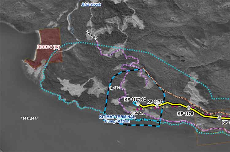
Although the KAI report concentrates on the United States, its report on Enbridge does raise serious questions about how the company could detect a pipeline breach or spill in the rugged northern British Columbia wilderness where the Northern Gateway Pipeline would be built, if approved by the federal government.

The report comes after the United States Congress passed The Pipeline Safety, Regulatory Certainty, and Job Creation Act, which was signed into law by President Barack Obama on January 3, 2012. The law called on a new leak detection study to be submitted to Congress that examines the technical limitations of current leak detection systems, including the ability of the systems to detect ruptures and small leaks that are ongoing or intermittent. The act also calls on the US Department of Transportation to find out what can be done to foster development of better technologies and economically feasible ways of detecting pipeline leaks. The final report must be submitted to Congress by January 3, 2013.

(The draft report does note in some ways, Canadian standards for detecting pipeline leaks are better than those in the United States. For example, Canada requires some pipeline testing every year, the United States every five years. It also finds European pipeline monitoring regulations also surpass those in the United States).

The spills studied in the report all found weaknesses in one or more of those three areas: people, company procedures and the technology. It appears that the industry agrees, at least in principle, with executives telling the consultants:

The main identified technology gaps – including those identified by operators – include: reduction or management of false alarms; applicable technical standards and certifications; and value / performance indicators that can be applied across technologies and pipelines.

The report echoes many of the findings of the US National Transportation Safety Board in its examination of the Enbridge Marshall, Michigan spill but it applies to all pipeline companies, noting:

Integration using procedures is optimal when it is recognized that alarms from the technology are rarely black-and-white or on/off situations. Rather, at a minimum, there is a sequence: leak occurrence; followed by first detection; followed by validation or confirmation of a leak; followed by the initiation of a shutdown sequence. The length of time that this sequence should take depends on the reliability of the first detection and the severity of the consequences of the release. Procedures are critical to define this sequence carefully – with regard to the technology used, the personnel involved and the consequences – and carefully trained Personnel are needed who understand the overall system, including technologies and procedures.

We note that there is perhaps an over-emphasis of technology in LDS. A recurring theme is that of false alarms. The implication is that an LDS is expected to perform as an elementary industrial automation alarm, with an on/off state and six-sigma reliability. Any alarm that does not correspond to an actual leak is, with this thinking, an indicator of a failure of the LDS system.

Instead, multiple technical studies confirm that far more thought is required in dealing with leak alarms. Most technologies infer the potential presence of a leak via a secondary physical effect, for example an abnormal pressure or a material imbalance. These can often be due to multiple other causes apart from a leak.

The report takes a critical look at the culture of all pipeline companies which divides problems into leaks, ruptures and small seeps. Under both pipeline practice and the the way problems are reported to the PHMSA in the US a “rupture is a situation where the pipeline becomes inoperable.” While a rupture means that a greater volume of petroleum liquid or natural gas is released, and is a higher priority than a leak or seep, the use of language may mean that there is a lower priority given to those leaks and seeps than the crisis created by a rupture.

(Environmental groups in British Columbia have voiced concerns about the cumulative affect of small seeps from the Enbridge Northern Gateway that would be undetectable under heavy snow pack either by an internal system or by external observation)

Overall, the report finds serious flaws to the way pipeline companies are conducting leak detection systems at the moment, including:

  • Precisely the same technology, applied to two different pipelines, can have very different results.
  • Leak Detection Systems do not have performance measures that can be used universally across all pipelines. Compounding the problem are different computer systems where software, program configuration and parameter selection all contribute, in unpredictable ways, to overall performance.
  • Many performance measures present conflicting objectives. For example, leak detection systems that are highly sensitive to small amounts of lost hydrocarbons are also prone to generating more false alarms.
  • The performance of a leak detection system depends critically on the quality of the engineering design, care with installation, continuing maintenance and periodic testing.
  • Even though an internal technology may rely upon simple, basic principles, it is in fact, complex system that requires robust metering, robust SCADA and telecommunications, and a robust computer to perform the calculations. Each of these subsystems is individually complex.
  • Near the inlet and the outlet of the pipeline a leak leads to little or no change in pressure. Flow rates and pressures near any form of pumping or compression will generally be insensitive to a downstream leak
  • Differences in any one of these factors can have a dramatic impact on the ultimate value of a leak detection system.

The report goes on to  say:

There is no technical reason why several different leak detection methods can not be implemented at the same time. In fact, a basic engineering robustness principle calls for at least two methods that rely on entirely separate physical principles.

The report strongly recommends that pipeline companies take a closer look at external leak detection systems. Even though the US Environmental Protection Agency began recommending the use of external detection as far back as 1988, the companies have resisted due to the cost of retrofitting the legacy pipeline network. (Of course if the pipeline companies had started retrofitting with external detectors in 1988 they would be now 24 years into the process).

KAI says:

  • External leak detection is both very simple – relying upon routinely installed external sensors that rely upon at most seven physical principles – and also confusing, since there is a wide range of packaging, installation options, and operational choices to be considered.
  • External leak detection sensors depend critically on the engineering design of their deployment and their installation.
  • External sensors have the potential to deliver sensitivity and time to detection far ahead of any internal system.
  • Most technologies can be retrofitted to existing pipelines. In general, the resistance to adopting external technologies is, nevertheless, that fieldwork on a legacy pipeline is relatively expensive.
  • The report goes on to identify major bureaucratic roadblocks within pipeline companies. Like many other big corporations, walls exist that prevent the system from working well
  • A particular organizational difficulty with leak detection is identifying who “owns” the leak detection system on a pipeline. A technical manager or engineer in charge is typically appointed, but is rarely empowered with global budgetary, manpower or strategic responsibilities. Actual ownership of this business area falls variously to metering, instrumentation and control, or IT.

The report calls for better internal standards at pipeline companies since with leak detection “one size does not necessarily fit all”.

It also notes that “flow metering is usually a central part of most internal leak detection systems,” but adds “flow meter calibration is by far the most laborious part of an internal system’s maintenance.

Also, the central computer and software technology usually has maintenance requirements far greater than most industrial automation and need special attention.”

While a company may do a cost benefit analysis of its leak detection system and risk reduction system it will generally emphasize the costs of the performance and engineering design of the leak detection system, the companies usually place less emphasis on the benefits of a robust system, especially the long term benefits.

At present the pipeline companies look at the benefit of leak detection as a reduction in risk exposure, or asset liability, “a hard, economic definition… understood by investors.” But the report adds that leak detection systems have a very long lifetime and over that life cycle, the cost-benefit approaches the reduction in asset liability caused by the system, when divided by annual operational costs. However, since pipeline companies budget on a one to five year system the long term benefit of robust, and possibly expensive spill detection is not immediately apparent.

Enbridge

The consultants studied 11 US oil spills, the top two with the greatest volume were from Enbridge pipelines. The others were from TE Products Pipeline, Dixie Pipeline, Sunoco, ExxonMobil, Shell, Amoco, Enterprise Products, Chevron and Magellan Pipeline. Not all US spills were used in the KAI report, the 11 were chosen for availability of data and documentation.

The largest spill in the KAI study was the pipeline rupture in Michigan at 843,444 gallon (3,158,714 litres) which has been the subject of continuing media, investigative and regulatory scrutiny. The second spill in North Dakota, has up to now received very little attention from the media. That will likely change once the US Congress gets the final report. Even though the Neche, North Dakota spill, has been described as “text book case” of a pipeline shutdown, there was still a large volume of oil released.

Marshall, Michigan spill

On the Marshall, Michigan spill that sent bitumen into the Kalamazoo River the report first goes over the facts of the 843,444 gallon spill and the subsequent release of a highly critical report from the US National Transportation Safety Board. It then looks at the failures of Enbridge’s detection system from the point of view mandated for the report to Congress:

The pipeline was shutting down when the ruptured occurred. Documentation indicates that a SCADA alarm did sound coincident with the most likely time of the rupture. It was dismissed. The line was shut down for around 10 hrs and crude oil would have drained from the line during this time.

On pipeline start up, alarms in the control room for the ruptured pipeline sounded. They were dismissed. This was repeated two more times. The pipeline was shut down when the control room was notified of the discharge of the crude oil by a member of the public. The time to shut down the pipeline is not relevant here because of the 17 hours that elapsed after the rupture occurred.

The review identified issues at Enbridge relevant to this Leak Detection Study:

1. Instrumentation on a pipeline that informs a controller what is happening to the pipeline must be definitive in all situations.
2. However, the instrumentation did provide warnings which went unheeded by controllers.
3. Instrumentation could be used to prevent a pump start up.
4. Operators should not rely on the public to tell them when a pipeline has ruptured.
5. Pipeline controllers need to be fully conversant with instrumentation response to different operations performed on the pipeline.
6. If alarms can be cancelled there is something wrong with the instrumentation feedback loop to the controller. This is akin to the low fuel warning on a car being turned off and ignored. The pipeline controller is part of an LDS and failure by a controller means the LDS has failed even if the instrumentation is providing correct alarms.
7. If the first SCADA alarm had been investigated, up to 10 hours of pipeline drainage to the environment might have been avoided. If the second alarm had been investigated, up to 7 hours of pumping oil at almost full capacity into the environment might have been avoided.
8. CPM systems are often either ignored or run at much higher tolerances during pipeline start ups and shutdowns, so it is probable that the CPM was inoperative or unreliable. SCADA alarms, on the other hand, should apply under most operating conditions.

Neche, North Dakota spill

At approximately 11:37 pm. local time, on January 8, 2010, a rupture occurred on Enbridge’s Line 2, resulting in the release of approximately 3000 barrels or 158,928 gallons of crude oil approximately 1.5 miles northeast of the town of Neche, North Dakota, creating the sixth largest spill in the US during the study period.

As the report notes, in this case, Enbridge’s detection system worked:

At 11:38 pm., a low-suction alarm initiated an emergency station cascade shutdown. At 11:40 pm., the Gretna station valve began closing. At 11:44 pm., the Gretna station was isolated. At 11:49 pm., Line 2 was fully isolated from the Gretna to Donaldson pump stations.

Documentation indicates a rapid shut down on a low suction alarm by the pipeline controller. From rupture to shut down is recorded as taking 4 minutes. The length of pipeline isolated by upstream and downstream remotely controlled valves was 220,862 feet. The inventory for this length of line of 26-inch diameter is 799,497 gallons. The release amount was around 20 per cent of the isolated inventory when the pipeline was shut down.

The orientation of the 50-inch long rupture in the pipe seam is not known. The terrain and elevation of the pipeline is not known. The operator took around 2 hours and 40 minutes to arrive on site. It is surmised that the rupture orientation and local terrain along with the very quick reactions by the pipeline controller may have contributed to the loss of around 20 per cent of the isolated inventory.

The controller was alerted by the SCADA. Although a CPM system was functional the time of the incident it did not play a part in detecting the release event. It did provide confirmation.

But the KAI review identified a number of issues, including the fact in item (7) Enbridge did not plan for for containment and that containment systems were “under-designed.”

1. This release is documented as a text book shut down of a pipeline based on a SCADA alarm.
2. The LDS did not play a part in alerting the pipeline controller according to
documentation. However, leak detection using Flow/Pressure Monitoring via SCADA
worked well.
3. Although a textbook shut down in 4 minutes is recorded, a large release volume still occurred.
4. The release volume of 158,928 gallons of crude oil is the sixth largest hazardous liquid release reported between January 1, 2010 and July 7, 2012.
5. The length of pipeline between upstream and downstream isolation valves is long at 41.8 miles.
6. If not already performed, the operator should review potential release volumes based on ruptures taking place at different locations on the isolated section.
7. The success of a leak detection system includes planning for the entire process: detection through shutdown through containment. In this case, the operator did not plan adequately for containment so that although the SCADA leak detection technology, the controller and the procedures worked well, the containment systems (isolation valves) were under-designed and placed to allow a very large spill.”


 KAI Draft report on Leak Detection Systems at the Pipeline and Hazardous Materials Safety Administration website


TransCanada to hold community briefing in Kitimat October 15

TransCanada will hold a community briefing in Kitimat on October 15, 2012, at Riverlodge to inform residents of its plans for its subsidiary Coastal GasLink Pipeline, which would carry natural gas for the Royal Dutch Shell LNG project.

In a letter to District of Kitimat Council, TransCanada said it the Kitimat would be one of several sessions across northern British Columbia.

The public information session will include maps “showing our conceptual route as well as information on community benefits, environmental management and other aspects of our project.  Coastal Gaslink project representatives  will be available to answer questions and share information.”

The session will be a the Riverlodge Rescreation Centre from 4:30 p.m. to 8:30 p.m. On October 15.