Decision on Black’s Kitimat refinery in 60 days, Edmonton Journal reports

The Edmonton Journal is quoting David Black as saying in Fate of proposed Kitimat refinery to be determined within 60 days:

British Columbia newspaper magnate David Black says he’ll know in about 60 days whether his controversial idea for a new refinery on the West Coast will move forward or die a quiet death.

In a recent interview, Black said he has signed memorandums of agreement with parties interested in the idea of a $15-billion refinery at Kitimat, done some preliminary design work and talked to financial backers — though any deal has a long way to go.

“I’ve been pulling threads together — potential customers, financiers, government, First Nations — and they should all be saying ‘yes’ or ‘no’ within 60 days.”

If the parties say “yes,” there would be two years of regulatory approvals required before construction could begin, he said.

Intervenor files challenge after Enbridge tells JRP it wants major expansion of Kitimat Gateway terminal

Revised Enbridge map of Kitimat harbour.
Enbridge filed a revised map of Kitimat harbour with the revised route for the Northern Gateway Pipeline and terminal in December 2012.

Enbridge Northern Gateway wants a much larger tank farm at its proposed Kitimat terminal, the company says in documents filed with the Joint Review Panel on December 28, 2012.

On that date, Enbridge filed its fifth revision of the Northern Gateway pipeline route and plans with the JRP. While for Enbridge engineers the filing may be a routine update, as surveys and planning continue, Smithers based enviromentalist Josette Weir has filed an objection with the JRP challenging the revised plans because, she says, the JRP has closed off any opportunity for intenvenors to make their own updates, calling into question once again the fairness of the JRP process.

From the documents filed with the JRP, it appears that Enbridge wants not only to expand the tank farm and adjacent areas but also to have a potentially much larger area on the shores of Douglas Channel for even more expansion in the future.

At the Kitimat terminal, Enbridge says there will now be 16 oil tanks, up from the original 11. The company also says: “The terminal site will also have some limited additional civil site development to allow for potential future site utilization.” While Enbridge proposes to keep the number of condensate tanks at three, their capacity would be increased.

In addition, Enbridge wants an enlarged “remote impoundment reservoir” to comply with the BC Fire Code, so that it would be:

• 100% of the volume of the largest tank in the tank farm, plus
• 10% of the aggregate volume of the 18 remaining tanks, plus
• an allowance for potential future tanks, plus
• 100% of the runoff from the catchment area for a 1 in 100 year, 24 hour storm event, plus
• the amount of fire water generated from potential firefighting activities at the tank farm.

Enbridge goes on to note:

An update to 16 oil tanks at the Kitimat Terminal is not expected to alter overall visibility of the marine terminal and therefore impact visual or aesthetic resources.

In her news release, Josette Wier, who describes herself as “an independent not funded intervenor in the hearing process,” says she filed a notice of motion on January 17, 2013, noting “there are numerous embedded proposed changes which have nothing to do with the route revision,” including the fact that “the tank farm in Kitimat is considerably increased from 11 to 16 tanks for the oil tanks with an almost doubled working capacity, while the condensate tanks capacity is increased by 29 per cent.”

“What does this have to do with a route revision?” she asks in the news release.

In the news release, Wier says: “that this is an abuse of process when engineering and design question period ended in Prince George last November.  Not withstanding the underhanded way of presenting new evidence, re-questioning on those issues doubles the amount of work and expenses for intervenors.

“Abuse of process”

She asked the Joint Review Panel to order Northern Gateway to re-submit their proposed changes indicating clearly the ones unrelated to the route changes and describing them along with their rationale.

Wier goes on to say: “It is everyone’s guess why there is a doubling of the tank farm capacity, but certainly points out to the larger pipeline shipping volumes the company had indicated would be a possible Phase II of the project.” She says: “It looks like Northern Gateway is quietly moving into the 850,000 barrels a day proposal, twice the volume the application has been cross-examined about.  It is clearly an abuse of process.”

In her actual notice of motion, Wier goes further by taking aim at the JRP itself by saying that “the Applicant [Enbridge] can make changes to the Application whenever they want. We have already seen in their July submissions inclusion of new evidence which conveniently escaped information requests. The added work and cost imposed on intervenors and the Panel seem irrelevant to the Applicant.” She complains that her requests for more information in an earlier notice of motion “was dismissed by the Panel on the grounds that my request ‘would require an unreasonable amount of effort (both by Northern Gateway and other parties reviewing the material’ …. If this argument applied to my Notice of Motion, I suggest it should apply to embedded changes buried in the Applicant’s filings of December 28, 2012.”

Rerouting at Burns Lake

A number of the other changes appear to show continued strained relations between Enbridge and First Nations, for example it says:

There is a possibility of relocating the pipeline route… further north of the Burns
Lake area to avoid proposed Indian Reserve lands that would overlap the pipeline route,.. This revision will be evaluated when further information on the proposed Indian Reserve lands is available and when further consultation with the relevant Aboriginal groups has taken place.

On the other hand the revisions also show that the pipeline will be now routed through an existing right of way through the Alexander First Nation, near Morinville, Alberta, as part of an agreement with the Alexander First Nation.

Another route change is near the Morice River, where Enbridge says

The Morice River Area alternate will generally have less effect on wildlife riparian habitat since it is located away from the Morice River and floodplain. This revision is also farther from the proposed Wildlife Habitat Area for the Telkwa caribou herd and no longer intersects any primary and secondary goat ungulate winter range polygons. However, this revision no longer parallels the Morice West Forestry Service Road (FSR) and Crystal Creek FSR and offers fewer opportunities to use existing rights-of-way. This may increase linkages between cutblock road networks and increase human access locally but does not preclude Northen Gateway from applying other methods to minimize linear feature density in this region.

Wier also complains that the Enbridge did not properly file its latest documents, asking the panel to rule that it order Northern Gateway to re-submit their last revisions submitted in December
using proper JRP evidence numbering system and “Adobe pages numbers.” The huge number of documents in the JRP system is confusing and improper filing makes it harder for intervenors and others to sort their way through new information.


Enbridge map of Kitimat harbour
A revised map of the Kitimat harbour as filed by Enbridge with the JRP in December 2012.
Revised Northern Gateway pipeline route map
Revised route map for the Northern Gateway pipeline as filed with Enbridge with the JRP on Dec. 28, 2012.

Northern Gateway NEB Application Update Dec. 2012

Douglas Channel Energy signs preliminary deal for two LNG tankers

LNG Partners LLC, of Houston, one of the backers of Douglas Channel Energy,  the BC LNG Douglas Channel Project, a partnership between LNG firms and the Haisla Nation, has signed a preliminary deal with Golar LNG for two tankers.

Golar logoGolar LNG, which describes itself on its website as “one of the world’s largest independent owners and operators of LNG carriers” said in its interim results report to shareholders on November 28:


On October 10, Golar entered into a 90 day Vessel Charter Option Agreement with LNG Partners LLC (Houston, TX) for the provision of two newbuild LNG carriers under long term contract to deliver LNG production from the Douglas Channel LNG Project in British Columbia (BC), Canada.
The Douglas Channel Project, in which LNG Partners is an equity owner, is a proposed liquefaction facility on the west bank of the Douglas Channel, within the district of Kitimat, BC. In addition to prospectively providing two vessels, the agreement confers certain preferential rights for Golar to participate in the project with LNG Partners LLC by way of infrastructure investment or LNG offtake.

In the same report, Golar LNG reported operating income of $70.2 million for the third quarter of 2012, an increase of 21 per cent from the second quarter.

Golar, which has its headquarters in Hamilton, Bermuda, says that since 2001, it has grown from a fleet of six LNG Carriers focused on LNG transportation, to a fleet of 13 vessels (with 13 newbuilds due from quarter three 2013), dedicated to both LNG transportation and midstream floating solutions.

The latter means that Golar is working on what the industry calls Floating Storage & Regasification Units (FSRU). LNG is transferred to the FSRU either for storage or where the low-temperature liquified natural gas is heated back to a gaseous state.

The FSRU storage tanks are generally made from aluminium.

Golar is also moving into Liquified Natural Gas production vessels, that is floating ships that produce the LNG than taking it from a shore-based plant.

Golar’s report also reflects the weakness in the LNG markets, a factor that is slowing development of the Kitimat LNG projects.

Golar says “a bearish cargo market [for shipping] prevailed in the third quarter with falling prices and weak demand in the Far East. Chartering activity remained thin and lacked direction and consequently, short-term charter rates experienced a correction from rates seen earlier in the year.”

It goes on to say:

Looking to the fourth quarter, weak Far East demand may result in additional vessels being released into the market, however, with limited available modern undedicated vessels a resumption in interest from buyers could very easily pull rates upward again.
As for the world LNG market, Golar says “downward pressure on pricing was experienced primarily due to high inventory levels that persisted East of Suez.”

It also says that more LNG projects are coming onstream which could provide potential competition for Kitimat:
New LNG supply will soon be coming to the market with the commissioning of Angola LNG in the Atlantic Basin. Despite delays at the West African project during the third quarter, exports are expected to start early in the New Year. This represents a set-back of about ten months from the original target date for the country’s first LNG project.
In the Far East, ConocoPhillips and Origin Energy announced the sanctioning of a second train at its Australia Pacific LNG project. The project is planning to bring the first train on late in 2015 with the second train following in 2016. Both trains will be sized at 4.5 million tonnes. Additionally, during the quarter Chevron made positive statements about proceeding with a fourth train at its Gorgon LNG project in Barrow Island, Western Australia. There are currently three trains at Gorgon under construction totalling 15.6 million tonnes.
In addition to Angola, given imminent start-up of the project, supply projects under construction in both the Atlantic and Pacific Basin have reached close to 100 million tonnes, with construction officially beginning at Cheniere’s Sabine Pass LNG export facility.

It was the decision by Cheniere to sell LNG to the Far East markets based on North American prices rather than the higher Japanese price that led to a further delay by Apache earlier this year to give the final go-ahead for the Kitimat LNG project.

DFO study on ancient Douglas Channel tsunamis shows minimal impact on Kitimat, devastation at Hartley Bay

A follow up study by the Department of Fisheries and Oceans on the discovery of prehistoric slope failure tsunamis in Douglas Channel concludes that the events would have had minimal impact on Kitimat but would have destroyed Hartley Bay.

The studies were filed by DFO with the Northern Gateway Joint Review Panel on Friday, November 16, following an earlier study the Geological Survey of Canada that reported the discovery of the submarine slope failures. The filing comes just three weeks after the region was shaken by a 7.7 magnitude earthquake off Haida Gwaii and a subsequent coast-wide tsunami warning.

The DFO follow up study was aimed at better understanding the dynamics of tsunamis during the two slope failure events on the southern end of Hawkesbury Island during the mid-Holecene period, between 5,000 and10,000 years ago.

The wave dynamic model study does not address the discovery by the Geological Survey of Canada of a possible fault line along Hawkesbury Island which could have been the cause of the slope failures.

The study estimates that the wave amplitude of the first tsunami reaching the proposed Enbridge Northern Gateway terminal site near Kitimat would have been about .09 to .12 metres. Since the actual wave height hitting land from a tsunami is one half of the amplitude, the height of tsunami waves reaching Kitimat at the time would have been about 60 centimetres or 23 inches. At Hartley Bay, on the other hand, the maximum estimated wave amplitude from the second tsunami would have been 15 metres, meaning a wave height of 7.5 metres or about 25 feet.

The main reason for the difference is that both the submarine slope failures occurred south of  the dogleg in Douglas Channel at Gertrude Point. That meant the configuration of the channel from Gertrude Point up to Kitimat would lessen the amplitude whereas because Hartley Bay was so close, it would be hit by a higher amplitude. The report says that because of their relatively short wavelengths, the tsunami waves undergo multiple reflections that the “high degree of scattering from the complex shoreline and bottom topography in Douglas Channel” would “combined with the flux of tsunami energy through adjoining waterways and channels” have caused a rapid decrease in the energy of the waves with distance south and north of the slide area.

The study also points out a crucial difference between the ancient slides and the two that occurred near Kitimat in 1974 and 1975, while the land near the head of the Kitimat arm were largely composed of material laid down by the glaciers, the large slope failures on Hawkesbury Island were blocks of an extremely hard igneous rock called diorite. Each of the prehistoric slides would have consisted of about 65 million cubic metres of rock.

The DFO report says

Coastal British Columbia is an area of steep slopes, extreme seasonal variations in soil moisture, large tidal ranges, and the highest seismicity in Canada. Hazards of this form have been well documented for the coastal region of British Columbia, and other fjord regions of the world’s oceans, including Alaska and Norway. These factors increase the potential for both submarine and subaerial slope failures in the region. Such events generally take place in relatively shallow and confined inner coastal waterways, and can present hazards in terms of tsunami wave generation.

The two prehistoric submarine slides are located about 10 kilometres apart on the
slope of southern Douglas Channel, near the southern end of Hawkesbury Island

The report says:

The failures are defined by scallop-shaped hollows located along the edge of the fiord wall and appear to be associated with detached blocks that extend out several hundred metres into the channel. The two block slides identified in Douglas Channel are characteristic of rigid-body submarine landslides, which differ considerably from the well-documented viscous submarine landslides with a lower specific gravity (density relative to water) of about 1.5 that occurred to the north of Douglas Channel along the inner slope of Kitimat Arm in 1974 and 1975.

The report’s modelling is “considered minimum values” because the do not include debris that would have spread into the fiord after initial slide. That debris is now buried by a thick layer of post-slide sediment.

DFO diagram of the model of Slide A on Hawkesbury Island (DFO)

The reconstruction model shows that the head of the more northern slide began at a depth of around 60 to 100 metre, while that of the more southern slide began at a depth of 75 to 120 metres.

The slides would have moved down slope at about 25 metres per second, coming to rest after about 30 seconds, 250 to 350 metres from the slope at a depth of 400 metres.

The northern slide, called by the scientists Slide A:

would have generated extremely large waves in the immediate vicinity of the failure
region within a minute of the submarine landslide. Waves in the numerical simulations reach amplitudes of 30 to 40 metres at the coast near the slide area

Submarine landslides cause delays between the arrival of the first waves and the arrival of subsequent higher waves, increasing in distance from the slide, because of “reflections and non-linear interaction” along the shoreline. For Slide A, the maximum wave amplitudes at Hartley Bay would have been six metres (meaning three metre waves) “Large amplitude waves with typical periods of around 50 seconds would continue for several tens of minutes.”

The leading tsunami waves generated by Slide A reach Kitimat Arm in roughly 20 min and have small amplitudes of only a few centimetres. Although later waves have higher amplitudes, the maximum wave amplitudes (which occur 50-55 minnutes after the failure event) are still only around 0.09 to 0.12 metres.

The southern slide on Hawkesbury, called Slide B by the scientists, would have moved 400 metres before stopping. It stared at a greater depth than Slide A, with not as much vertical displacement than Slide A. That means Slide B was slower than Slide A.

Slide B:

would have generated large waves in the vicinity of the failure region. Simulated waves reach the coast adjacent to the slide region within a minute of the failure event, with wave amplitudes of up to 10 metres. The waves also hit the opposite site of the channel within a minute of the failure event and then take an additional minute to reach Hartley Bay where waves reach amplitudes of 15 metres/ Powerful oscillations in the bay last for tens of minutes.
Waves with high amplitudes (more than 2 metres) also occur in the southern part of Douglas Channel, and in certain locations of Verney Passage.

According to the models, the leading tsunami waves would have reached the Kitimat Arm 22 minutes after the start of the slide. The maximum waves would have had amplitudes of 0.08 metres to 0.3 metres (6 inches), reach the Kitimat Arm 45 to 60 minutes after the start of the failure event.

The the tsunami waves generated by Slide B that impact Kitimat Arm,  although still of low amplitude, were somewhat higher than those generated by Slide A, despite the fact that Slide B was located further to the south and generated less energetic waves in the source region than Slide A.

This seeming paradox is explained by the slower motion of Slide B, which causes it to generate more wave energy in the low frequency band…Due to their reduced scattering and reflection, the relatively long and lower frequency waves generated by Slide B propagate more readily through the complex fjord system than the relatively short and higher frequency waves generated by Slide A.

Specifically addressing the proposed site of the Enbridge bitumen terminal, as well as potential tanker traffic in Douglas Channel, the detailed explanation of the modelling accompanying the DFO report says:

If similar submarine slides were to occur again somewhere in the same general area, they could present a significant risk to navigation and to nearby shore installations and coastal communities….

As with the tsunami generation regions, the highest waves and strongest currents in any particular region of the coastal waterway would occur near the shoreline. Based on the numerical findings, tsunamis generated by submarine landslides of the form identified for the southern end of Douglas Channel would have heights and currents that could have major impacts on the coastline and vessel traffic at the time of the event throughout much of Douglas Channel, but a minor impact on water levels, currents and hence vessel traffic in Kitimat Arm. Hartley Bay, at the southern end of Douglas Channel, would be impacted by high waves and strong currents, whereas Kitimat, at the northern end of Kitimat Arm, would experience negligible wave effects. Additional modelling would be required to assess the characteristics of possible tsunamis originating beyond the area of the two identified slope failures.

At the estimated propagation speeds of about 65 metres per second, the detailed model says it takes roughly 10 to 15 minutes for the simulated waves to propagate approximately 40 to 45 kilometres to the intersection of Douglas Channel and Kitimat Arm, where peak wave amplitudes would be diminished to less than one metre. It takes another 15 minutes for the waves to reach sites near the proposed Enbridge facilities in Kitimat Arm where wave amplitudes would be reduced to a few tens of centimetres and associated currents to speeds less than a few tens of centimetres per second.


Slide tsunami area map
Slide tsunami area study map (DFO)


Fisheries and Oceans-Modelling Tsunamis Associated with Recently Identified Slope Failures in Douglas Channel  (pdf)

Numerical data for DFO tsunami study (link to JRP)


New Joint Review Panel possible for Coastal GasLink pipeline project to Kitimat

The federal Environment Assessment Agency is asking northwestern British Columbia to comment on whether or not a federal assessment is needed for the TransCanada Coastal GasLink pipeline project that would feed natural gas to the proposed Shell facility in Kitimat.

In a news release from Ottawa, the CEAA said:

As part of the strengthened and modernized Canadian Environmental Assessment Act, 2012 (CEAA 2012) put in place to support the government’s responsible resource development initiative, the Canadian Environmental Assessment Agency must determine whether a federal environmental assessment is required pursuant to the CEAA 2012 for the proposed Coastal GasLink Pipeline Project in British Columbia (B.C.). To assist it in making its decision, the Agency is seeking comments from the public on the project and its potential effects on the environment.

Coastal GasLink Pipeline Ltd. is proposing the construction and operation of an approximately 650-km pipeline to deliver natural gas from the area near the community of Groundbirch, B.C. (40 km west of Dawson Creek) to a proposed liquefied natural gas facility near Kitimat, B.C. The project will initially have the capacity to flow approximately 1.7 billion cubic feet of natural gas per day and could deliver up to approximately 5.0 billion cubic feet per day of natural gas after further expansion.

Written comments must be submitted by December 3, 2012.

Like the current Enbridge Northern Gateway project Joint Review Panel and the National Energy Board hearings in June 2011 on the Kitimat LNG project all comments received will be considered public.

The CEAA says after it has received the comments whether or not there should be an assessmet, it will post a decision on its website stating whether a federal environmental assessment is required.

The CEAA goes on to say:

If it is determined that a federal environmental assessment is required, the public will have three more opportunities to comment on this project, consistent with the transparency and public engagement elements of CEAA 2012.

Projects subject to CEAA 2012 are assessed using a science-based approach. If the project is permitted to proceed to the next phase, it will continue to be subject to Canada’s strong environmental laws, rigorous enforcement and follow-up, and increased fines.

If there is a federal assessment, the most likely course would be to create a new Joint Review Panel. However, this will not be a JRP with the National Energy Board, because the Coastal GasLink project does not cross a provincial boundary, thus it would not make it subject to scrutiny by the NEB.

Instead, if current practice is followed (and that is uncertain given the evolving role of the Harper government in environmental decisions) the new JRP would be in partnership with the British Columbia Oil and Gas Commission, which has jurisdiction over energy projects that are entirely within the province of BC.

However. Shell will have to apply to the NEB for an export licence for the natural gas as both the KM LNG and BC LNG projects did last year. That could result in parallel hearings, one for the export licence, and a second on the environmental issues, which, of course, is the direct opposite of what the Harper government intended when it said it would speed up the reviews with its “one project, one review” policy.


Confusion at Alberta Jackpine JRP

At present, there is a  CAEE-Alberta Energy Resources Conservation Board Joint Review Process underway in northern Alberta for the controversial Shell Canada Jackpine project.  Shell has proposed expanding the Jackpine Mine about 70 kilometres north of Fort McMurray on the east side of the Athabasca River. The expansion project would increase bitumen production by 100,000 barrels per day, bringing production at the mine to 300,000 barrels per day.

The Jackpine Joint Review Panel is the first to held under the new rules from Bill C-38 that limit environmental assessment.

The lead up to the Alberta Jackpine Joint Review Panel hearings was mired in confusion, partly because of the restrictions imposed by the Harper government in Bill C-38 which limited the scope of environmental assessments.

The local Athabasca Chipewyan First Nation is opposed to the project and, in October, argued that it should be allowed to issue a legal challenge against Shell’s proposed expansion of the Jackpine project.

According to initial media reports in The Financial Post, the Joint Review Panel excluded First Nations further downstream from the Jackpine project ruling and individual members of the Athabasca Chipewyan First Nation that they were not “interested parties.” The Post cited rules on who can participate were tightened up when the Harper government changed the criterion for environmental assessment under Bill C-38. The Financial Post reported a French-owned oil company was permitted to participate.

On October 26, the Jackpine JRP ruled that it did not have the jurisdiction to consider questions of constitutional law, but told the Athabasca Chipewyan First Nation and the Alberta Metis that it would “consider the evidence and argument relating to the potential effects of the project brought forward by Aboriginal groups and individuals during the course of the hearing.”

A few days after the Financial Post report, Gary Perkins, counsel for the Jackpine Joint Review Panel released a letter to participants including Bill Erasmus, Dene National chief and Assembly of First Nations regional chief, who said he was denied standing. There appears to have been confusion over how people could register as intervenors for the Jackpine hearings, since according to the Perkins letter they apparently did so on a company website that no relation to the Jackpine JRP. Perkins also attempted to clarify its constitutional role with First Nations, saying it did not have jurisdiction to decide whether or not the Crown was consulting properly. (PDF copy below)

The Perkins letter also said that the Fort McKay First Nation, Fort McMurray First Nation #468, the Athabasca Cree First Nation, Fort McKay Metis Community Association and the Metis Association of Alberta Region 1 plus some individual members of First Nations are allowed to participate in the hearings.

Controversy continued as the hearings opened, as reported in Fort McMurray Today, that there was poor consultation between Shell and the local First Nations and Metis communities.

On November 8, ACFN spokesperson Eriel Deranger and Athabasca Chipewyan Chief Allan Adam said the project was a threat to the traditional life of Alberta First Nations: “Our land … have shrunk and continue to shrink because of the development,” Adam told the newspaper.

Hot potato for the District of Kitimat

The arcane rules of the Northern Gateway Joint Review Panel has caused months of confusion and frustration for many of those who participated, whether they from the BC provincial Department of Justice or other government participants, intervenors or those making ten minute comments.

Although most people in northwestern British Columbia support the liquified natural gas projects, the prospect of a new Joint Review Panel could likely quickly become controversial in this region. A Coastal GasLink JRP will be the first real test of the restrictions on environmental review imposed on Canada by the Harper government. Environmental groups, especially the few groups that oppose any pipeline projects, will be wary of precedents and likely to test the limits from Bill C-38. Both environmental groups and First Nations will be on alert for any limitations on who can participate in a review. First Nations, even if they support the LNG projects, as most do, will be wary of any attempt by the federal government to limit consultation, rights and title.

A Coastal Gaslink JRP will be a big hot potato for District of Kitimat Council, which has taken a controversial strictly neutral position on the Enbridge Northern Gateway pipeline project until after that Joint Review Panel reports sometime in 2014. Can the District Council now take a positive position on a natural gas pipeline, which from all appearances council supports, long before a Coastal GasLink JRP report (if there is a panel) without facing charges of hypocrisy?

The northwest is in for interesting times.

Canadian Environmental Assessment Page for Coastal GasLink Project

CEAA Coastal GasLink project description  (pdf)

Letter about participation in the Jackpine JRP


Apache delays Kitimat decision again, Wall Street Journal reports

The Wall Street Journal (subscription required) is reporting that Apache has once again delayed its decision whether or not to go ahead with the Kitimat LNG project.

So far there is no news release on the Apache site and no other media has matched the Wall Street Journal story.

Analysts are blaming the decision on the recent move by some players in the energy industry to sell natural gas to Asia at low  North American prices, rather than the world price, which is determined as a percentage of the price of oil.   A move by Asian countries to buy LNG at the lower North American market price would undercut the profitability of any LNG export project through Kitimat.


TransCanada to hold community briefing in Kitimat October 15

TransCanada will hold a community briefing in Kitimat on October 15, 2012, at Riverlodge to inform residents of its plans for its subsidiary Coastal GasLink Pipeline, which would carry natural gas for the Royal Dutch Shell LNG project.

In a letter to District of Kitimat Council, TransCanada said it the Kitimat would be one of several sessions across northern British Columbia.

The public information session will include maps “showing our conceptual route as well as information on community benefits, environmental management and other aspects of our project.  Coastal Gaslink project representatives  will be available to answer questions and share information.”

The session will be a the Riverlodge Rescreation Centre from 4:30 p.m. to 8:30 p.m. On October 15.

Kitimat LNG progressing–or is it?

At the District of Kitimat Council meeting on Monday, October 1, as part of Mayor Joanne Monaghan’s regular “good news” briefing, she told council that the Kitimat LNG  project continues to “progress positively.”  The news from Calgary on Tuesday, however, was not as promising.

Both Bloomberg News and the Calgary Herald reported that  Apache, which owns 40 per cent of the KM LNG partnership is worried about a recent decision by a rival gas company to sell natural gas to world markets at low North American prices rather than, as been customary up until now, as percentage of the world oil price. That differential gives the North American gas companies a profit in Asia and it is that profit difference that makes Kitimat attractive for LNG projects.

At the council meeting, Monaghan reported, quoting Apache’s  Apache’s Manager of Public and Government Affairs Natalie Poole-Moffatt, as saying that  Kitimat LNG will be opening a full time community office in downtown Kitimat near the City Centre mall in the near future.  Apache says renovations are nearly complete and they will be holding an open house in the near future.

Monaghan said that work on the Kitimat LNG site at Bish Cove continues with blasting to create proper elevation, crushing and sorting of rock and constructing an access route to the forest service road. This summer work began on the two year $25 million upgrades to the old forest service road “which will improve conditions on the road.”

However, in Calgary, the Herald quoted KM LNG vice-president David Calvert as saying “things are going so well that it has been decided to risk spending on clearing ground before completion of the front end engineering and development study and final investment decision.”

But according to several media reports,  Calvert told an Energy Roundtable in Calgary on Tuesday that a final go-ahead for Kitimat LNG is not a done deal. the Herald quoted Calvert as saying: “We remain convinced that oil-linked pricing is critical to the viability of our Canadian LNG industry.”

Bloomberg reported that a recent deal by Cheniere Energy Inc. to sell liquefied natural gas based on North American pricing (also known as Henry Hub pricing) means that it is difficult for Apache to find Asian customers to sign the long term LNG contracts needed to make the Kitimat project viable. (Asian LNG prices are based on the “Japan Customs Cleared Price” set by the Japanese government as a percentage of the price of crude oil).

Bloomberg quoted Calvert as saying: “It created quite a ripple through the marketplace,” and Bloomberg said, the Cheniere deal has created “unrealistic expectations.”

Related

Globe and Mail

Canadian gas producers dreaming big – again 

Canada losing the race to sell LNG

Updated

The Haynesville Shale

Cheniere Deal Hurts Canadian LNG Project

Cheniere is less sensitive to prices given its role as a middleman, while Apache, Encana and EOG are producers, for whom the price is very important.  One advantage of Kitimat is its west coast location, but that is only a minor cost advantage over Gulf Coast facilities.

The clock is ticking on Kitimat.  It sounds like Asian buyers are sitting on the sidelines waiting for lower prices.  Right now the U.S. government is sitting on future LNG approvals pending the release of a study around year-end.  If the U.S. approves the pending applications, a proverbial flood of LNG will come to market with Henry Hub-based pricing.  At that point Kitimat’s owners will be in a tough spot.  Kitimat is vital to B.C., but the economics might not work.

Wall Street Journal

Cheniere Lights a Match in the Gas Market


Minor oil leak at Bish Cove

In a report to District of Kitimat Council, Apache’s Manager of Public and Government Affairs,  Natalie Poole-Moffatt,  also reported that on September 19, an oil leak was spotted on a piece of heavy equipment at Bish Cove.  The report says;

WestCoast Marine was notified and booms were deployed as a preemptive measure in Bish Cove, no machine oil has migrated to Bish Cove. Environmental crews are on site executing a remediation plan.  Both the [BC] Provincial Emergency PLan (PEP) and Aboriginal and Northern Affairs Canada  were notified of the incident.

The piece of equipment  is currently being repaired and will undergo operational tests to ensure  the equipment can function without further concern.  Environmental staff will remain on the site 24/7 until remediation is complete.

What is it about Douglas Channel islands? Now a US agency has added a “Douglas Island”

US FERC Map of LNG terminals in North America
Map from the United States Federal Energy Regulatory Commission showing LNG export terminal projects in North America (FERC)

What is it about the islands in Douglas Channel? First, Enbridge gets in to a lot of hot water, so to speak, for erasing the islands in Douglas Channel in an animation promoting the Northern Gateway Pipeline.  See for example The Vancouver Sun on back on Aug. 16, 2012, when it picked up a story from the Times Colonist – Enbridge map sinks islands, angers critics.   The controversial video segment showed Douglas Channel wide open for navigation, rather than marked with about one thousand square kilometres of mountainous islands. Map of Douglas Channel Islands from Leadnow.ca This map, created by the Leadnow.ca and  Sumofus.org websites was widely used by the media to show the difference.  Enbridge later amended its video with a disclaimer that it is “broadly representational.” A video by Shortt and Epic Productions “This is Not An Enbridge animation” showing the beauty of northwestern BC quickly went viral.

As this was happening, the United States government Federal Energy Regulatory Commission issued a map that shows Liquified Natural Gas import and export terminals across North America, a map that adds an island to the Channel–“Douglas Island.”

In fact, the map manages to get a lot about Canadian LNG projects wrong. It locates the BC LNG project on the non-existent Douglas Island. The company’s name Douglas Channel Energy Partnership actually gives the proper location this way

 south of the Moon Bay Marina, within the District of Kitimat and the asserted traditional territory of the Haisla Nation. The site is approximately 10 km southwest of Kitimat and 7 km north of Bees Cove Indian Reserve 6 (Bish Cove)

The small cove where BCLNG will put its barges to create the LNG is often locally called North Cove.

The FERC map also misplaces the Shell LNG project, now known as LNGCanada, in Prince Rupert, even though Shell confirmed the Kitimat location on May 15, 2012. It also calls it Prince Rupert Island, although the town of Prince Rupert is actually located on Kaien Island.

The map does apparently get the KM LNG project somewhat correct, attributing it to Apache Canada, but leaving off Apache’s partners, Encana and EOG.

The map recently also appeared on the website of Oregon Public Broadcasting in an article Five Keys To The Pacific Northwest’s Natural Gas Export Debate by reporter Amelia Templeton, which outlines the growing controversy over the plans to export US LNG through Coos Bay, Oregon via the Jordan Cove Project.

It appears that in Oregon, the Coos Bay LNG project is becoming as controversial as the Northern Gateway project is in Canada.

The issues outlined by Templeton include the threat of expropriation (called “eminent domain” in the US and also a key issue in the debate over the Keystone XL pipeline on the plains).  There are arguments on jobs versus the environment, especially the perceived threat to wild rivers and salmon spawning grounds. Finally one issue that is lower on the agenda in northwestern BC but a big worry in Oregon, the potential for a devastating earthquake along the Cascadia fault.

During the NEB hearings on the KM LNG (Apache/EOG/Encana) project in June, 2011, many of the  “expert” witnesses urged that that first Kitimat project go ahead quickly because of perceived competition from Oregon.

Unlike in Oregon, LNG projects are generally perceived positively in the northwest and all three are going ahead, although not as quickly as originally planned due to market volatility among prime potential customers in Asia.


How “On the Waterfront” could decide the fate of Enbridge’s Kitimat terminal

There’s one question about the Enbridge Northern Gateway project that many people ask and few can answer: Who is responsible for the port of Kitimat? Who would be liable should there be a disaster in the port? Nobody really knows.

Unlike many harbours in Canada, the port of Kitimat is “private,” although as the District of Kitimat says, “Transport Canada and other federal agencies continue to regulate navigation, security and environmental safety.” Kitimat has promoted that private status as an economic advantage.

If there’s a dispute, the question of responsibility and liability would probably end up in the Supreme Court of Canada, with the justices sorting out a historic puzzle. Or perhaps that historical puzzle could mean that the future of the port of Kitimat might be decided by the next B.C. provincial election.

Most of the other harbours in Canada are the responsibility of Ports Canada, a branch of Transport Canada or run by (usually not-for-profit) semi-public port corporations or local harbour commissions.

To find out why Kitimat is one of the few private ports in Canada, the first thing to do is watch Eliza Kazan and Bud Schulberg’s classic 1954 multiple Oscar winning movie, On the Waterfront, starring Marlon Brando, about how the mob ran the New York docks.

What has On the Waterfront got to do with Kitimat? It goes back to when the then Aluminum Company of Canada/Alcan (now Rio Tinto Alcan) was planning the Kitimat project; much of that work was done in New York both by employees and consultants. It was in 1949, that Malcolm Johnson, a New York Sun reporter, wrote a Pulitzer Prize winning series of investigative reports called “Crime on the Waterfront,” exposing corruption and Mafia involvement with the docks and the longshoremans’ union. The movie was based, in part, on that investigative series.

So in its planning, Alcan was determined that the longshore unions would not be involved in running the docks in Kitimat. The publicly stated reason has always been that Alcan wanted a seamless 24/7 operation that would be integrated with the aluminum smelter. Alcan would sign a collective agreement with the United Steelworkers that covered both the smelter and the docks. (CAW 2301 now represents most of the workers at the Kitimat smelter.)

When the Kitimat project was being finalized in 1949 and 1950 at the height of the Cold War, aluminum was a strategic commodity, security was high on the agenda, and it was not just the Soviet bloc but the mob as well that worried the authorities.

Add two factors. First, in 1949 the province of British Columbia was anxious to promote what would today be called a “mega-project.” Second, in the post-war era when corporations were relatively enlightened compared to today, Alcan was determined not to create the traditional “company town.”

To promote private-sector development of both hydro-electricity and aluminum, B.C. signed a rather loosely worded agreement with Alcan, noting that the project was going on “without investment by or risk to the government.” That agreement was implemented by the Legislative Assembly of B.C. by an equally wide open Industrial Development Act. One aim of both was try to ensure that future “socialists” would not expropriate the project.

Industrial township

With the province handing over the Crown land at the head of Douglas Channel at a very nominal price to Alcan, next came the creation of the District of Kitimat. With the town under construction, with few buildings and a small population, under normal B.C. practice, the area would be “unincorporated” and would not have a municipal government. But Alcan and the province came up with a new concept, which they called “an industrial township,” which would allow a municipal government to be established in anticipation of future growth.

The act that established the District of Kitimat put the boundaries outside the land owned by Alcan (excluding land reserved for the Haisla Nation).

Alcan began selling off the land in the planned areas of the town and other land it didn’t need. Individuals bought houses and businesses bought the land for their own use. Alcan retained ownership of the harbour and estuary lands and the small “Hospital Beach.”

The District of Kitimat has some legal responsibility for “wharfs” at the port of Kitimat. At council meetings, the environmental group, Douglas Channel Watch, has raised the question of the district’s responsibility and liability in case of an Enbridge incident but there’s been no definitive response from district staff. There is no municipal harbour commission as there is in other jurisdictions.

Up until recently, it was a convenient arrangement for everyone involved. Alcan, Eurocan and Methanex ran their dock operations without any interference, beyond standard Transport Canada oversight.

Things began to change in 2007, when the Rio Tinto Group bought Alcan, creating Rio Tinto Alcan. A couple of years ago, a senior staff source in the Canadian Auto Workers explained it to me it this way. “Alcan was a big corporation, but Alcan was a corporation with a big stake in Canada. As a union, we could do business with them. Rio Tinto is a transnational corporation with businesses in lots of countries but no stake in any of them. So it’s a lot harder now.”

With the Rio Tinto acquisition of Alcan, things tightened up in Kitimat. Negotiations between the District and RTA for the District to obtain more land stalled. Access to the estuary and other RTA lands that had been somewhat open under Alcan became more restrictive. In 2010, the Eurocan paper mill shut down along with its dock. In 2011, Rio Tinto bought the dock from West Fraser, owner of Eurocan. The Kitimat community noted that when the dock was repainted, it said just “Rio Tinto.” not “Rio Tinto Alcan” and that led to lots of gossip and wondering about what the Rio Tinto Group really plans for Kitimat. Last fall, Shell Canada purchased the former Methanex dock for part of its liquified natural gas operations.

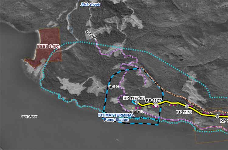
With the Enbridge Northern Gateway project, the BC LNG project at North Cove and the KM LNG project at Bish Cove all along the shore of Douglas Channel and within the boundaries of the District of Kitimat which extends as far south as Jesse Lake, the question that has to be asked is, what happens now? If the Enbridge project is built, it will start just beyond the boundaries of the land owned by Rio Tinto Alcan.

That old arrangement between Alcan and the District of Kitimat is facing many new challenges.

The district once had a harbour master, but the position was eliminated because he had nothing to do. Alcan owned its docks, Alcan managed the docks and Alcan union employees worked on the docks. Later came the Eurocan (now owned by Rio Tinto) and Methanex (now owned by Shell) docks, again owned and operated by private corporations.

The District of Kitimat, nominally in charge, was content to sit back and collect taxes.

With the Enbridge Northern Gateway project, the B.C. LNG project at North Cove and the KM LNG project at Bish Cove all along the shore of Douglas Channel and within the boundaries of the District of Kitimat, the question that has to be asked is, what happens now? If the Enbridge project is built, it will start just beyond the boundaries of the land owned by Rio Tinto Alcan.

In Canada, ports and harbours are normally under federal jurisdiction and Transport Canada has oversight. But Alcan’s “private port” and the District of Kitimat were created by acts passed by the B.C. government.

The original agreement between the province and Alcan mentions an “aluminum plant” and “low-cost electrical power,” it doesn’t mention bitumen or liquified natural gas. Those provincial acts do not cover bitumen, supertankers and liquified natural gas.

B.C. Opposition Leader Adrian Dix has made it clear that his New Democratic Party opposes the Northern Gateway project. The federal government has said the province can’t really do anything to stop Enbridge Northern Gateway once Stephen Harper has decided that the pipeline project is in the national interest.

At this moment, Dix is a “contender” for the premiership, with Christy Clark and the B.C. Liberals dropping in the polls and with key members of her government deciding not to run in the election next spring.

So, if, as expected, Adrian Dix becomes the next B.C. premier, he has one very strong hand to play. Any act can, with proper legal advice, be amended by the B.C. legislature. That means the “socialists” so feared by Alcan and the premier of the day, Byron “Boss” Johnson, could alter the 1949 law. That in turn may upset the decades-old arrangement that created the private port which Enbridge is banking on.