Enbridge’s Michigan cleanup costs now exceed JRP pipeline conditions for Gateway, SEC filing shows

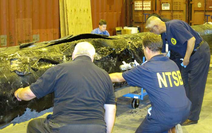
NTSB staff examine ruptured pipe
US National Transportation Safety Board staff examine a ruptured pipe from the Enbridge oil spill in August, 2010. The photo was released by the NTSB May 21, 2012. (NTSB)

The costs for Enbridge to clean up the 2010 Marshall, Michigan oil spill now far exceeds the maximum estimate that the Joint Review Panel gave for a major spill on the Northern Gateway Pipeline and also exceeds the amount of money the JRP ordered Enbridge to set aside to deal with a spill. Enbridge’s cleanup costs have also now edged past the higher liability amount requested by the Haisla Nation.

According to the US firm Enbridge Energy Partners’ filing with the United States Securities and Exchange Commission, as of September 30, 2013, the cost of cleanup was $1.035 billion US, not including possible additional fines and penalties that might be imposed by US authorities in the future.

In its decision, the Joint Review Panel estimated the cost a major oil spill from the Northern Gateway project would be about $693 million.  As part of the 209 conditions, the JRP ordered Enbridge to set aside “financial assurances” totaling $950 million.

Note all costs in this article are for a pipeline breach. The Joint Review Panel had different estimates for a tanker spill and the liability rules for marine traffic are different from pipelines.

In its filing for the third quarter of 2013, with the SEC, Enbridge Energy Partners say that the cost up until September 2013 had “exceed[ed] the limits of our insurance coverage.” The same filing says that Enbridge is in a legal dispute with one its insurers.

In its SEC filing, Enbridge says:

Lakehead Line 6B Crude Oil Release
We continue to perform necessary remediation, restoration and monitoring of the areas affected by the Line 6B crude oil release. All the initiatives we are undertaking in the monitoring and restoration phase are intended to restore the crude oil release area to the satisfaction of the appropriate regulatory authorities.
As of September 30, 2013, our total cost estimate for the Line 6B crude oil release is $1,035.0 million, which is an increase of $215.0 million as compared to December 31, 2012. This total estimate is before insurance recoveries and excluding additional fines and penalties which may be imposed by federal, state and local governmental agencies, other than the Pipeline and Hazardous Materials Safety Administration, or PHMSA, civil penalty of $3.7 million, we paid during the third quarter of 2012. On March 14, 2013, we received an order from the EPA, or the Environmental Protection Agency, which we refer to as the Order, that defined the scope which requires additional containment and active recovery of submerged oil relating to the Line 6B crude oil release. We submitted our initial proposed work plan required by the EPA on April 4, 2013, and we resubmitted the workplan on April 23, 2013. The EPA approved the Submerged Oil Recovery and Assessment workplan, or SORA, with modifications on May 8, 2013. We incorporated the modification and submitted an approved SORA on May 13, 2013. The Order states that the work must be completed by December 31, 2013.

The $175.0 million increase in the total cost estimate during the three month period ending March 31, 2013, was attributable to additional work required by the Order. The $40.0 million increase during the three month period ending June 30, 2013 was attributable to further refinement and definition of the additional dredging scope per the Order and associated environmental, permitting, waste removal and other related costs. The actual costs incurred may differ from the foregoing estimate as we complete the work plan with the EPA related to the Order and work with other regulatory agencies to assure that our work plan complies with their requirements. Any such incremental costs will not be recovered under our insurance policies as our costs for the incident at September 30, 2013 exceeded the limits of our insurance coverage.

According to the SEC filing, the breakdown of costs include $2.6 million paid to owners of homes adversely impacted by the spill.

Despite the efforts we have made to ensure the reasonableness of our estimates, changes to the recorded amounts associated with this release are possible as more reliable information becomes available. We continue to have the potential of incurring additional costs in connection with this crude oil release due to variations in any or all of the categories described above, including modified or revised requirements from regulatory agencies in addition to fines and penalties as well as expenditures associated with litigation and settlement of claims.
The material components underlying our total estimated loss for the cleanup, remediation and restoration associated with the Line 6B crude oil release include the following:
(in millions)

Response Personnel & Equipment  $454

Environmental Consultants  $193

Professional, regulatory and other $388

Total $ 1,035

For the nine month periods ended September 30, 2013 and 2012, we made payments of $62.3 million and $120.9 million, respectively, for costs associated with the Line 6B crude oil release. For the nine month period ended September 30, 2013, we recognized a $2.6 million impairment for homes purchased due to the Line 6B crude oil release which is included in the “Environmental costs, net of recoveries” on our consolidated statements of income. As of September 30, 2013 and December 31, 2012, we had a remaining estimated liability of $265.9 million and $115.8 million, respectively.

As for insurance, Enbridge Energy Partners say:

The claims for the crude oil release for Line 6B are covered by the insurance policy that expired on April 30, 2011, which had an aggregate limit of $650.0 million for pollution liability. Based on our remediation spending through September 30, 2013, we have exceeded the limits of coverage under this insurance policy. During the third quarter 2013, we received $42.0 million of insurance recoveries for a claim we filed in connection with the Line 6B crude oil release and recognized as a reduction to environmental cost in the second quarter of 2013. We recognized $170.0 million of insurance recoveries as reductions to “Environmental costs, net of recoveries” in our consolidated statements of income for the three and nine month periods ended September 30, 2012 for the Line 6B crude oil release. As of September 30, 2013, we have recorded total insurance recoveries of $547.0 million for the Line 6B crude oil release, out of the $650.0 million aggregate limit. We expect to record receivables for additional amounts we claim for recovery pursuant to our insurance policies during the period that we deem realization of the claim for recovery to be probable.

In March 2013, we and Enbridge filed a lawsuit against the insurers of our remaining $145.0 million coverage, as one particular insurer is disputing our recovery eligibility for costs related to our claim on the Line 6B crude oil release and the other remaining insurers assert that their payment is predicated on the outcome of our recovery with that insurer. We received a partial recovery payment of $42.0 million from the other remaining insurers and have since amended our lawsuit, such that it now includes only one insurer. While we believe that our claims for the remaining $103.0 million are covered under the policy, there can be no assurance that we will prevail in this lawsuit.


The Joint Review, Enbridge and Michigan

The Joint Review Panel based its finding on the Marshall, Michigan spill on the figure of $767 million from the summer of 2012 –again showing the limitations of the JRP’s evidentiary deadlines since the costs are now much higher.

The JRP quoted Enbridge as saying:

Northern Gateway considered the high costs of the Marshall, Michigan spill, which were at least $252,000 per cubic metre ($40,000 per barrel), to be an outlier or a rare event because the spill occurred in a densely populated area, because the pipeline’s response time was abnormally long, and because there was the prospect of potentially lengthy legal proceedings.

Enbridge assured the JRP that the corporate culture and management changes and equipment upgrades since the Marshall, Michigan spill lowered that chances of a similar event.

The company based its models for the JRP on much smaller spills, including one spill at Lake Wabamun, Alberta from a train not a pipeline (Vol. 2 p 357)

Enbridge’s risk assessment did not “generate an estimate of economic losses caused
by a spill.”

The JRP says Northern Gateway relied on its analysis of literature, and spill events experienced by Enbridge and other liquid hydrocarbon carriers in Alberta and British Columbia. After assessing all of this information, Northern Gateway regarded the high costs of a cleanup as “conservative”–meaning the company expects costs to be lower than its estimates in evidence before the JRP.

In Northern Gateway’s view the most costly pipeline spill incident would be a full-bore oil pipeline rupture, with an estimated cost of $200 million, and an extremely low probability of occurrence.

Haisla evidence

In their evidence, the Haisla (and other First Nations and intervenors) were doubtful about Northern Gateway’s assurances. The Haisla asked that Enbridge have a minimum of $1 billion in liability, an amount Enbridge has now exceeded in Michigan.

Haisla Nation estimated the cost of damage to ecosystem services because of a terrestrial oil spill from Northern Gateway’s pipeline would be in the range of $12,000 to $610 million for a 30-year period.

The Haisla’s cost estimates were based on values for environmental goods and services and probabilities of spills that were independent of Northern Gateway’s parameters for estimating oil spill costs. In contrast to Northern Gateway’s estimated spill frequency and costs, the Haisla predicted that spills would occur more often and placed a higher value on damages to environmental goods and services.

Haisla Nation argued that Northern Gateway overestimated its ability to detect and respond to a spill. In the Haisla’s view this resulted in the cost of a spill and the requisite financial assurances being understated. Haisla cited several factors, including: remote location, limited access, challenging terrain, seasonal conditions, and river flow conditions that would cause the cost of cleaning up a spill in the Kitimat River valley to be significantly greater than the costs associated with Enbridge’s Marshall, Michigan spill.

For these reasons, Haisla proposed that Northern Gateway should be required to obtain a minimum of $1 billion of liability coverage through insurance and financial assurances. Haisla said that Northern Gateway should file annually the report from an independent third party assessing the financial assurances plan. (Vol 2 p359)

In response Northern Gateway said:

Northern Gateway said that Haisla’s findings were based on a number of fundamental methodological flaws and a lack of probability analysis to support the high frequency of occurrence of oil spill events. Northern Gateway argued that Haisla’s estimates of ecosystem service values were inflated because they were based on values from unrelated studies. In Northern Gateway’s view, Haisla relied on high passive use values that were not justified.

JRP ruling

As it has in most of its decision, the JRP accepted Northern Gateway’s evidence, including its explanation of the Marshall, Michigan spill and then went on to base its spill cost estimates not on a pipeline breach but on the 2005 railway spill at Lake Wabumum, near White Sands, Alberta.

The Panel accepts that the cleanup costs for the Marshall, Michigan spill were orders of magnitude higher because of the extended response time. In this application, the Panel accepts Northern Gateway’s commitment to complete the shutdown in no more than 13 minutes after detection. For this reason the Panel did not use the Marshall spill costs in its calculations. The spill volume and the resulting costs are directly dependent on the Northern Gateway’s control room staff and the pipeline control system fully closing the adjacent block valves no longer than 13 minutes from the detection of an alarm event, as well as the amount of oil which would drain out of the pipeline after valve closure due to elevation differences.

The Panel decided on a total unit cost of $138,376 per cubic metre ($22,000 per barrel). This is midway between the unit cost of $88,058 per cubic metre ($14,000) per barrel proposed by Northern Gateway and the unit cost of $188,694 per cubic metre ($30,000 per barrel) for the Lake Wabamun spill. It is about one-half of the Marshall spill’s unit cost. Giving weight to the Lake Wabamun costs recognizes actual costs experienced in a Canadian spill and the greater costs of spills in high consequence areas. In these areas, individuals, populations, property, and the environment would have a high sensitivity to hydrocarbon spills. The deleterious effects of the spill would increase with the spill volume, the extent of the spill, and the difficulty in accessing the spill area for cleanup and remediation.

Using these spill volume and unit cost values in the calculation below, the Panel estimated the total cost of a large spill could be $700 million. Total cost of a spill = 31,500 barrels x $22,000 per barrel = $693 million, or $700 million when rounded up.

(p362)

The Panel based the financial assurances requirements for Northern Gateway on a spill with a total estimated cost of $700 million and directs Northern Gateway to develop a financial assurances plan with a total coverage of $950 million that would include the following components:
i. Ready cash of $100 million to cover the initial costs of a spill;
ii. Core coverage of $600 million that is made up of stand-alone, third party liability insurance and other appropriate financial assurance instruments, and
iii. Financial backstopping via parental, other third party guarantees, or no fault insurance of at least $250 million to cover costs that exceed the payout of components i. and ii.
The financial backstopping would be available to fill the gap if the spill volumes or unit costs were under-estimated or if the payout from the core coverage would be less than 100 per cent.

The Panel noted that:

The evidence indicates that there is some probability that a large oil spill may occur at some time over the life of the project. In these circumstances the Panel must take a careful and precautionary approach because of the high consequences of a large spill. The Panel has decided that Northern Gateway must arrange and maintain sufficient financial assurances to cover potential risks and liabilities related to large oil spills during the operating life of the project.

Northern Gateway committed to investing $500 million in additional facilities and mitigation measures such as thicker wall pipe, more block valves, more in-line inspections, and complementary leak detection systems. This initiative should enhance the safety and reliability of the system and help reduce and mitigate the effects of a spill, but it would not eliminate the risk or costs of spills. This initiative is not a direct substitute for third party liability insurance and does not eliminate the need for liability insurance or any other form of financial assurance to cover the cost of a spill. (p 361)

So the JRP decision comes down to this, if you accept Northern Gateway’s position that pipeline spills are rare and mostly small, then the company has the financial resources to cover the damage. If, however, Northern Gateway is wrong and the costs of a pipeline cleanup exceed the $950 million required by the Joint Review Panel, as has happened in Michigan, then those JRP conditions are already obsolete.

(Northwest Coast Energy News encourages all readers to read the complete JRP report  and SEC filing since space and readability does not permit fully quoting from the report)
Enbridge misses deadline to clean up Michigan’s Morrow Lake; EPA cites reluctance to do winter cleanup

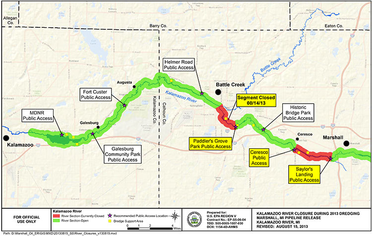
EPA map of Kalamazoo River
EPA map of river closures and dredging operations on the Kalamazoo River during 2013. (EPA)

Enbridge has missed the US Environmental Protection Agency’s deadline to clean up parts of the Marshall, Michigan bitumen spill by December 31, 2013.

Local television news, WOOD-TV says the EPA is now considering “enforcement options.”
The EPA had already granted Enbridge a 10 month extension that the company requested in March, 2013, setting the new December deadline.

In November, Enbridge requested a second extension. The EPA denied that request.

From the EPA letter it appears that, as in previous years, Enbridge is trying to avoid continuing clean up work into the winter. The EPA rejects that position, telling Enbridge it shouldn’t wait until the spring run off could spread the sunken bitumen.

The EPA says that beginning in March, 2013, “Enbridge has successfully removed oil and sediment from two of the three major impoundment areas identified in the order and from several smaller sediment trap locations.”

The area that Enbridge failed to clean up is known as the Morrow Lake and Morrow Lake Delta. The cleanup in that area was delayed when the Comstock Township planning commission unanimously  denied Enbridge a permit for “dredge pad” after fierce public opposition

The letter to Enbridge, from Jeffrey Kimble, Federal On-Scene Coordinator denying the extension is another scathing indictment of Enbridge’s attitude toward the public and the cleanup, citing Enbridge failing to prepare “adequate contingency plans,” by failing to recognize the “serious opposition” the dredging plans.

Although the EPA had told Enbridge to consider alternative plans—and Enbridge claimed it did that—the EPA found the Enbridge’s own logs showed the company didn’t start considering alternatives until it was obvious that Comstock Township would reject their dredging plans.

The EPA letter also reveals that once again Enbridge is reluctant to do further cleanup work during the Michigan winter. The EPA rejects that stance, saying that “Removal of oiled sediments prior to the spring thaw will lessen the potential oiled sediment transport in the spring to Morrow Lake via increased river velocities from rain and ice melt.”

Although we recognize that the work required by the Order is unlikely to be completed by December 31, 2013, U.S. EPA believes that had Enbridge taken appropriate steps earlier as requested, it would not require an extension now. In particular, U.S. EPA believes that Enbridge has continuously failed to prepare adequate contingency plans for a project of this nature. For example, U.S. EPA acknowledges that failure to obtain a site plan approval for use of the CCP property for a dredge pad was a setback in the timely completion of the work in the Delta.

However, Enbridge failed to prepare any contingency plans recognizing the possibility of such an occurrence. Enbridge has known since at least the middle of July 2013 that there was serious opposition to its proposed use of the CCP property. When it became clear in August 2013 that opposition to the site use might delay the project, U.S. EPA directed Enbridge to “conduct a more detailed review of your options in short order.”

Although your letter claims that Enbridge “has considered such alternatives,” your logs indicate that Enbridge did not hold initial discussions with the majority of these property owners until long after the final decision to abandon plans for use of the CCP property. These contact logs do not demonstrate that Enbridge fully explored and reviewed alternative options in a timely manner so as to avoid delay in completion of the work. Although Enbridge claims that use of identified alternative properties would be denied by Comstock Township, Enbridge did not present any site plans to the Township for approval (other than use of the county park for staging of frac tanks). To the extent that any of Enbridge’s contingency plans include the use of land for dredge pads, U.S. EPA believes that Enbridge should begin multiple submissions for property use until one is accepted….

Enbridge claims that it cannot install winter containment in the Delta to prevent the potential migration of sediments to the lake. To support that claim, Enbridge has attached a letter from STS directing Enbridge to remove anchors and associated soft containment during winter monthsas these structures could damage STS’s turbines. However, none of the correspondence provided by Enbridge discusses the use of more secure containment methods, such as metal sheet piling, which may not pose the same risks as soft containment structures. Enbridge should consider using sheet piling to construct cells which would both allow winter work and contain the sediment during that work. Enbridge should therefore try to obtain access from STS for this specific work, and for other appropriate work, for the winter timeframe. Use of sheet pile cells would allow continued operations during the winter, especially in the southern zone of the Delta outside of the main river channel. Removal of oiled sediments prior to the spring thaw will lessen the potential oiled sediment transport in the spring to Morrow Lake via increased river
velocities from rain and ice melt.

Finally, U.S. EPA is unwilling to allow Enbridge to wait until after the likely spring high
velocity river flush to reinstall the E-4 containment structures. U.S. EPA has reviewed Enbridge’s modeling, which Enbridge claims supports its requested timeline, and has found it incomplete. The model has not incorporated, and does not match, field observation of flow velocities and water levels and their potential to impact upstream critical structures if containment is in place. Moreover, U.S. EPA completely disagrees with Enbridge’s assertion that there is no evidence of migration of submerged oil during high flow events. The results of three years of poling and sheen tracking demonstrate that Line 6B oil is mobile during periods of
high flow. Now that Enbridge has a five year permit from MDEQ for the E-4 containment system, U.S. EPA reiterates that this containment must be in place immediately upon thawconditions in the spring….

Although Enbridge’s proposed two phase approach may have components that can be incorporated into a final plan, it should not be considered the approved way forward. U.S. EPA believes that pausing the work cycle until new poling can be done in June or July of 2014 could again result in a wasted construction season in the Delta. Enbridge should consider and utilize a combination of techniques in the plan. For example, several dredge pad sites have been identified by Enbridge. Enbridge should obtain approval for one of these sites, or a combination of smaller sites, so as to support hydraulic dredging in conjunction with the current approved
approach and any potential dry excavation techniques. Enbridge should also consider other winter work techniques, such as cell build out and dewatering in the Delta via sheet piling.

As always, U.S. EPA will continue to work with Enbridge to develop adequate plans and complete the work required by the Order. However, nothing in this letter excuses any noncompliance with the Order nor does it serve as the granting of any extension to any deadline in the Order. U.S. EPA reserves all its rights to pursue an enforcement action for any noncompliance with the Order.

The EPA letter also calls into question the ruling of the Joint Review Panel on the Enbridge Northern Gateway. The JRP accepts, without question, Enbridge’s assurances that the company has changed its attitude and policies since the long delay in 2010 in detecting the pipeline rupture in Marshall, Michigan.

The JRP, on the other hand, accepts, without question, Enbridge’s assurances that it has expertise in winter oil recovery from a pipeline spill.

Parties questioned Northern Gateway about locating and recovering oil under ice. Northern Gateway said that Enbridge conducts emergency exercises in winter and that Northern Gateway would learn from those experiences.
Northern Gateway outlined a number of oil detection techniques including visual assessment (at ice cracks and along the banks), drills, probes, aircraft, sniffer dogs, and trajectory modelling. It said that, once located, oil would be recovered by cutting slots into the ice and using booms, skimmers, and pump systems to capture oil travelling under the ice surface.

The company said that oil stranded under ice or along banks would be recovered as the ice started to melt and break up. It discussed examples of winter oil recovery operations during Enbridge’s Marshall, Michigan incident, and said that operational recovery decisions would be made by the Unified Command according to the circumstances.

Northern Gateway said that equipment caches would be pre-positioned at strategic locations, such as the west portal of the Hoult tunnel. It said that decisions regarding the location or use of pre-positioned equipment caches would be made during detailed design and planning, based on a number of considerations including, but not limited to, probability of a spill, access, site security,
environmental sensitivities, and potential for oil recovery at the response site.

(vol 2 page 153)

In its ruling, the Joint Review Panel said

The Panel finds that Northern Gateway’s extensive evidence regarding oil spill modelling, prevention, planning, and response was adequately tested during the proceeding, and was credible and sufficient for this stage in the regulatory process.
Parties such as the Province of British Columbia, Gitxaala Nation, Haisla Nation, and Coalition argued that Northern Gateway had not provided enough information to inform the Panel about proposed emergency preparedness and response planning. The Panel does not share this view.

Northern Gateway and other parties have provided sufficient information to inform the Panel’s views and requirements regarding malfunctions, accidents, and emergency preparedness and response planning at this stage of the regulatory process.

Many parties said that Northern Gateway had not demonstrated that its spill response would be “effective.” Various parties had differing views as to what an effective spill response would entail.

The Panel is of the view that an effective response would include stopping or containing the source of the spill, reducing harm to the natural and socio-economic environment to the greatest extent possible through timely response actions, and appropriate follow-up and monitoring and long-term cleanup. Based on the evidence, in the Panel’s view, adequate preparation and planning can lead to an effective response, but the ultimate success of the response would not be fully known
until the time of the spill event due to the many factors which could inhibit the effectiveness of the response. The Panel finds that Northern Gateway is being proactive in its planning and preparation for effective spill response….

The Panel is of the view that an effective response does not guarantee recovery of all spilled oil, and that that no such guarantee could be provided, particularly in the event of a large terrestrial, freshwater, or marine spill.

The oil spill preparedness and response commitments made by Northern Gateway cannot ensure recovery of the majority of oil from a large spill. Recovery of the majority of spilled oil may be possible under some conditions, but experience indicates that oil recovery may be very low due to factors such as weather conditions, difficult access, and sub-optimal response time, particularly for large marine spills. …

To verify compliance with Northern Gateway’s commitments regarding emergency preparedness and response, and to demonstrate that Northern Gateway has developed appropriate site-specific emergency preparedness and response measures, the Panel requires Northern Gateway to demonstrate
that it is able to appropriately respond to an emergency for each 10-kilometre-long segment of the pipeline.

The Panel notes the concerns of intervenors regarding Northern Gateway’s ability to respond efficiently and effectively to incidents in remote areas, and its plan to consider this during detailed design and planning. The Panel finds that Northern Gateway’s commitment to respond immediately to all spills and to incorporate response time targets within its spill response planning is sufficient to
address these concerns. Northern Gateway said that its emergency response plans would incorporate a target of 6 to 12 hours for internal resources to arrive at the site of a spill. It also said that it would target a response time of 2 to 4 hours at certain river control points.

The Panel agrees with Northern Gateway and several intervenors that access to remote areas for emergency response and severe environmental conditions pose substantial challenges. The Panel notes that the company has committed to develop detailed access management plans and to evaluate contingencies where timely ground or air access is not available due to weather, snow, or other logistic
or safety issues.

Despite the EPA letter (which admittedly was released long after the JRP evidentiary deadline) that shows that Enbridge did not consult the people of Comstock Township, Michigan, the JRP says

The Panel accepts Northern Gateway’s commitment to consult with communities, Aboriginal groups, and regulatory authorities. The objective of this consultation is to refine its emergency preparedness and response procedures by gaining local knowledge of the challenges that would be present in different locations at different times of the year
(Vol 2 p 165-167)

EPA letter to Enbridge denying deadline extension  (pdf)

How Gateway’s plans to dredge Douglas Channel show the limitations of the JRP mandate and ruling

(First in series of reports on how the Joint Review Panel report will affect the Kitimat region)

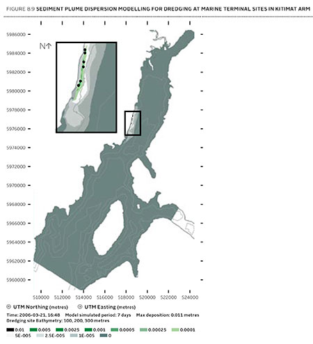
JRP map of blasting on Douglas Channel
Joint Review map of Northern Gateway plans for dredging and blasting on Douglas Channel (JRP)


If there is a significant flaw in the Joint Review Panel report on Northern Gateway, it can be found in the panel’s analysis of Enbridge Northern Gateway’s plans to blast and dredge at the proposed Kitimat terminal site.

While the Joint Review Panel does consider what it calls “cumulative effects,” the panel plays down those effects and offers no specifics about interaction between the Northern Gateway project and the two liquified natural gas projects, the KM LNG project at Bish Cove and the BC LNG floating terminal at the old log dump.

It appears the JRP considered the legacy effects of the Rio Tinto Alcan smelter and other Kitimat industries while not taking into consideration future development.

The dredging and blasting planned by Northern Gateway, as Enbridge said in its evidence,  appears to have only a minimal effect on Douglas Channel.

A glance at the map in the Joint Review ruling shows that that the dredging and blasting site is directly opposite Clio Bay, where Chevron, in partnership with the Haisla Nation, plan a remediation project using marine clay from the Bish Cove construction site to cap decades of sunken and rotting logs.

The Clio Bay project was not part of the evidence before the Joint Review Panel, the plans for the project were not formulated until well after the time for evidence before the JRP closed. But those deadlines show one area where the rules of evidence and procedure fail the people of northwestern BC.

The JRP is a snapshot in time and changes in the dynamics of the industrial development in the Kitimat Arm are not really considered beyond the terms of reference for the JRP.

It appears from the report that Enbridge plans to simply allow sediment from the blasting and dredging to float down Douglas Channel, dispersed by the currents and the outflow from the Kitimat River.

Northern Gateway said that dredging and blasting for marine terminal construction would result in a sediment plume that would extend over an area of 70,000 square metres for the duration of blasting activities.

Approximately 400 square metres of the assessed area of the marine terminal is expected to receive more than 1 centimetre of sediment deposition due to dredging. Outside of this area, typical sediment deposition levels alongshore where sediment is widely dispersed (a band approximately 4 kilometres long and 400 metres wide) are very low; in the range of 0.001 to 0.1 centimetres. Dredging and blasting activities are expected to occur over a period of approximately 18 weeks.

Northern Gateway expected most of the sediment plume created by construction activities to be minor in relation to natural background levels.

Northern Gateway would use bubble curtains to reduce pressure and acoustic effects of blasting, and silt curtains to reduce the effect of sedimentation from dredging. It said that bubble curtains are used extensively for other activities, such as pile driving, to reduce the effect of high pressure pulses that can cause injury to fish.

It added that bubble curtains have been tested extensively with blasts, and literature shows they are effective.

Northern Gateway said that physical effects from suspended sediment on marine fish and invertebrates could include abrasion and clogging of filtration mechanisms, which can interfere with ingestion and respiration. In extreme cases, effects could include smothering, burial, and mortality to fish and invertebrates. Direct chemical-related effects of suspended sediment on organisms, including reduced growth and survival, can also occur as a result of the uptake of contaminants
re-suspended by project construction activities, such as dredging and blasting, and as a result ofstorm events, tides, and currents.

The Haisla Nation and Raincoast Conservation objected to Northern Gateway’s figures, noting

Northern Gateway’s sediment and circulation model and its evidence related to contaminated sediment re-suspension at the terminal site. Both parties said that the sediment model was applied for the spring, when the increase in total suspended solids would be negligible compared to background values. In the event of delays, blasting and dredging would likely occur at other times of the year when effects would likely be higher, and these scenarios were not modelled.

The panel’s assessment of the area to be blasted found few species:

Species diversity within Kitimat Arm’s rocky intertidal community is generally low. Barnacles, mussels, periwinkles, and limpets can be found on rocky substrate. Sea urchins, moon snails, sea anemones, sea stars, and sea cucumbers are in shallow subtidal areas. Sandy areas are inhabited by commercially-harvested bivalves such as butter clams and cockles.

Northern Gateway told the JRP that it would “offset” any damage to Douglas Channel caused by the blasting and dredging

Northern Gateway said that construction, operations, and decommissioning of the marine terminal would result in both permanent and temporary alteration of marine fish habitat. Dredging and blasting, and installing physical structures in the water column for the marine terminal would permanently alter marine fish habitat. Based on the current terminal design, in-water site preparation would result in the physical alteration of approximately 1.6 hectares of subtidal marine habitat and 0.38 hectares of intertidal marine habitat. Northern Gateway expected approximately 353 square metres of subtidal marine habitat and 29 square metres of intertidal habitat to be permanently lost.This habitat would be compensated for by marine habitat offsets.

The project’s in-water vertical structures that would support the mooring and berthing structures could create new habitat, offsetting potential adverse effects. The structures may act as artificial reefs, providing marine fish habitat, food, and protection from predation. Although organisms currently inhabiting the work area would be killed, the exposed bedrock would be available for colonization as soon as the physical works are completed.

In its finding on marine sediment, the panel, as it does throughout the ruling, believes that the disruption to the environment caused by previous and ongoing human activity, means that the Northern Gateway Kitimat terminal won’t make that much difference.

Sediment quality in the marine environment is important because sediment provides habitat for benthic aquatic organisms. Northern Gateway’s baseline data for the area immediately surrounding the marine terminal indicated some contamination of water, sediments, and benthic organisms from previous industrial activity. Industrial activities in the Kitimat area have released contaminants through air emissions and effluent discharges since the 1960s. Sources of contaminants to Kitimat Arm
include effluent from a municipal wastewater treatment plant, the Alcan smelter, Methanex Corporation’s methanol plant, and the Eurocan pulpmill, as well as storm water runoff from these operations and the municipality.

Area is largely controlled by natural outflow from the Kitimat River with suspended sediment levels being highest during peak river runoff (May to July, and October) and lowest during winter. Storm events, tides, and currents can also suspend sediments. Levels of total suspended solids fluctuate seasonally and in response to climatic variations, but are generally highest during the summer.

Commercial and recreational vessels currently operating in the area may increase suspended solids by creating water turbulence that disturbs sediments. Given the current sediment contamination levels and the limited area over which sedimentation from construction activities would be expected to disperse, the Panel finds that the risk posed by disturbed contaminated sediment is low. Northern Gateway has committed to monitoring during construction to verify the predicted effects on sediment and water quality for both contaminants and total suspended solids..

The dredging and blasting section of the Joint Review Report is small when compared to the much more extensive sections on pipeline construction and tanker traffic, and the possible effects of a catastrophic oil spill.

Although minor, the marine sediment section exposes the question that was never asked, given the disruptions from years of log dumping at Clio Bay and Minette Bay and the decades of  developments at the mouth of the Kitimat River, and future development from LNG, when do cumulative effects begin to overwhelm? How much is enough? How much is too much? If every project continues to be viewed in isolation, what will be left when every project is up and running?


Commentary: In the tanker study, the District of Kitimat was missing in action

kitimatlogoThe list of participants in the oil spill preparedness and response study released last week by the federal government shows two glaring no shows, the District of Kitimat and Rio Tinto Alcan.
The Haisla Nation and the Gitga’at Nation did provide written submissions to the panel.

The expert panel was set up by the federal government to review “oil handling facilities and ship-source oil spill preparedness and response.” The expert panel was to review the “structure, functionality and the overall efficiency and effectiveness of the system, as well as analyzing the requirements for hazardous and noxious substances, including liquefied natural gas.”

Transport Canada tanker report
Expert panel tanker risk assessment report cover (Transport Canada)

As well as commissioning the Genivar report on the state of oil spill preparedness and consequences, the panel interviewed stakeholders and visited a few key locations, including Port Metro Vancouver.

The panel also invited any interested groups to submit documents or their own views to be taken into consideration.

Among the stakeholders interviewed by the panel were companies and organizations very familiar to Kitimat; Chevron and Shell, main partners in two of the LNG projects; Enbridge, which has proposed the Northern Gateway Pipeline and Kinder Morgan which has proposed expanding the dilbit pipeline on the Lower Mainland. Other stakeholders included Coastal First Nations, the Prince Rupert Port Authority, SMIT Marine and the Vancouver Port Authority.

As well as the Haisla and the Gitga’at, five west coast municipalities submitted their own reports to the tanker panel, both the city and districts of North Vancouver, the city of Richmond, the District of Ucluelet and the District of West Vancouver. San Juan County in Washington State also made a submission to the panel. So did the Prince Rupert and Vancouver Port authorities.

Chevron, Enbridge, Imperial Oil, Kinder Morgan, Pacific Northwest LNG, Seaspan Marine, and the Union of BC Municipalities, among others also submitted their views to the panel.

So why didn’t the District of Kitimat participate? When it came to the Enbridge Northern Gateway Joint Review, the mayor and council always maintained their neutrality motion meant that the District would not be an active participant. That was always a short sighted viewpoint. The District should have participated actively in the JRP in such a way as to protect the region’s interests where necessary while remaining neutral. If the District of Kitimat sat out the tanker panel because of the Northern Gateway neutrality policy, that was no excuse, because the expert panel’s mandate specifically included LNG.

Tanker traffic is a potential threat to the San Juan Islands (the Gulf Islands on the American side of the border). It is astounding that San Juan County would think that the Canadian tanker panel was important enough to make a submission and the District of Kitimat did not.

RTA logoWhat about Rio Tinto Alcan? Kitimat has been a private port for 60 years, run first by Alcan and then by Rio Tinto Alcan. Why wasn’t RTA asked to participate as a stakeholder? Why didn’t RTA make a submission? Those who are pushing the Northern Gateway terminal always like to say that tankers have been calling at Kitimat for those 60 years. That is true. Of course, none of those tankers have been the Very Large Crude Carriers proposed by Northern Gateway. However, those 60 years means that RTA has the expertise on the Port of Kitimat and Douglas Channel. RTA probably has important data that could have helped both the expert panel and Genivar (which pointed out the paucity of data on small and medium sized tankers). In not participating in the tanker panel submissions and possibly not providing valuable data on Douglas Channel, RTA neglected its social responsibility both to the community of Kitimat and the rest of the province of British Columbia.

Editorial: Once again the National Energy Board shows its contempt for British Columbia

Second Update December 10- NEB refuses to release JRP report in BC

The Globe and Mail reports Dec. 10, 2013

The National Energy Board says releasing its decisions in Calgary is standard practice regardless of where in Canada the project is located, and it will not make an exception for its report on the controversial $6.5-billion Northern Gateway pipeline proposal.

Apparently the NEB doesn’t trust reporters in BC to act as professionals. Also, as usual the stock market is more important than the people of BC.

NEB spokesperson Sarah Kiley told the Globe the board ruled out simultaneous lock-ups in Alberta and British Columbia.

“As far as hosting multiple media lock-ups, we need to make absolutely sure that the report is not inadvertently released before the markets close,” Ms. Kiley said. “This becomes more challenging if there are multiple events due to things like the need to ship reports.”

Because the ruling will affect markets, she said the report must be kept confidential until they close on the day of release.


A couple of years ago, on a visit to the Lower Mainland, I was speaking to man who was considering making a 10 minute comment before the Northern Gateway Joint Review panel. In the end, this man, who is by no means a radical environmentalist, just someone worried about the future, decided not to testify, telling me: “The National Energy Board is nothing more than an extension of the Petroleum Club.”

Once again today, the National Energy Board showed its contempt for British Columbia and proved my source’s belief that it is nothing more than an extension of the Petroleum Club.

Vancouver radio station News 1130 made a routine inquiry to the NEB about a reporters’ “lockup” on the day that the JRP decision is released. A “lockup” allows the media to read an embargoed report a few hours in advance so that  at the moment it is officially released, it can print or broadcast an accurate account of a government report.

News 1130 was told by the NEB that there would be no lockup in British Columbia, only reporters in Calgary, the home of the NEB, will have that opportunity, because “logistics did not work out for a lock-up” in Vancouver.

(Reporters who work along the actual pipeline route in the north are even farther off the NEB radar. The Calgary lockup will leave northerners to figure out what the JRP decision actually means from reports from Alberta-based journalists. The history of the past few years has proven that most Alberta-based reporters have little interest or knowledge of the concerns of northwest British Columbia.)

Before the JRP hearings began in January, 2012, a well-known northern First Nations leader predicted all this in a background conversation. He noted that there was no representation from British Columbia on the Joint Review Panel. The JRP had two members from Alberta, chair Sheila Leggett, and member Kenneth Bateman, while the “First Nations member,” Hans Matthews, was from Ontario. The First Nations leader, who would have to appear before the JRP, privately called them “flatlanders” with no knowledge of B.C.

He was right.

Even before that conversation, the Joint Review Panel blundered in its first appearance in Kitimat, the preliminary hearing at Riverlodge on August 30, 2010, by offending the Haisla Nation with a schedule of appearances crafted in Calgary that ignored that Kitimat is on Haisla traditional territory and put then Chief Counsellor Dolores Pollard well down on the schedule. That hearing was held up for about half an hour while the JRP scrambled to undo their mistake.

While the JRP did finally learn to respect the customs of BC’s First Nations, and the panel was often hamstrung by arcane and obsolete rules of procedure, the panel too often proved far too inflexible in understanding the issues along the pipeline route and up and down the coast.

The most recent example was the JRP’s refusal to consider the recent evidence from both scientists and Fisheries and Oceans about the growing importance of humpback whales in Douglas Channel. The JRP’s excuse was that the window for evidence had closed. If the Northern Gateway actually goes ahead, Enbridge speaks about the 30-year-life of the project. Yet the JRP’s continuing inflexibility acts as if all the key issues can be decided by the December 30 deadline and after that everything will be just fine.

In the past few weeks, report after report has been released on projects that will change the lives of the people of the northwestern British Columbia. The media of the northwest, all with very limited budgets, have been ignored time and time again.

Take another example from today. In March, the federal government flew its First Nations negotiator Douglas Eyford and Natural Resources Minister Joe Oliver to Terrace to announce the beginning of the Eyford’s meetings with BC First Nations (while at the same time Oliver didn’t bother to visit Kitimat). This morning, the Eyford report was released at a press event in media-rich Vancouver. For the release of the report, the northwest didn’t count.

On Tuesday, the federal government also used Vancouver to release a report on tanker traffic. While Vancouver is also vulnerable to tanker problems, the feds considered their message could be carried best by the mainstream major metro media. Again, no one bothered with the northwest, where the tankers will be sailing along the coast and up and down Douglas Channel.

A few weeks ago, BC Premier Christy Clark announced her agreement with Alberta Premier Alison Redford on the compensation issue, one of her five conditions for heavy oil development in the province. Clark solved the political dispute with Alberta by handing off the compensation issue from the province to the energy industry with absolutely no guarantee that the energy companies will actually offer compensation for crossing BC. Northern reporters could listen in to an audio feed of the news conference from the BC government website, but could not ask questions.

In the 21st century, of course, these news conferences are not about presenting factual information; the news conferences are about getting out a government message track, so questions from reporters who actually know about issues are not wanted.

The Joint Review Panel (with the NEB one of the “joint” partners) is supposedly, on paper, a quasi-judicial body, independent of the government.

If the JRP wants to salvage even a bit of its crumbling credibility for its Northern Gateway decision, it will show that it respects British Columbia. The means holding two additional lockups. If Terrace was good enough for the final arguments, and a central location for the northwest, one lockup should be held in Terrace, so northerners can read reporting by northwest-based reporters. The second, of course, should be in Vancouver for the province’s major media centre.

Given the record of the past two years, don’t hold your breath, time and time again the bureaucratic priorities and the fact that the NEB is thoroughly embedded in the energy culture of Alberta, it is likely that the release of the report sometime in the coming weeks will be Alberta-centric and will prove my source right, that the NEB is nothing more than that extension of the Petroleum Club.


Update: The Globe and Mail has confirmed News1130’s report in National Energy Board sidestepping B.C. on Northern Gateway.

The board plans to hold a media lock-up in Calgary, but does not have similar plans to brief reporters in British Columbia, says an official with the independent federal agency established to regulate international and interprovincial issues around the electrical utility, gas and oil sectors.

Board spokesperson Sarah Kiley said Thursday that the board recognizes there is an interest in B.C. in the subject, and said there is no final plan yet.

The Globe was unable to get a statement from the Liberal government of BC but for the opposition,Spencer Chandra Herbert (Vancouver-West End) said, the energy board should not be hiding out in Calgary when they announce what they are going to do, regardless of whether they approve or reject the project.

“You would think they would have the ability and respect for B.C. to host it here and explain whatever decision they make here to B.C. media and intervenors,” he said.

“We’re worthy of that respect.”

BC calls for input on conservation plan for Ashdown Island, one of the “disappeared” on Douglas Channel

Ashdown Island
Sea lions basking on Ashdown Island (BC Parks)

BC Parks and the Gitga’at First Nation are calling for public input as they development a management plan for the K’nabiyaaxl/Ashdown Island Conservancy at the mouth of Douglas Channel.

BC Parks describes the area as:

K’nabiyaaxl/Ashdown Conservancy covers 727 hectares of marine and uplands ecosystem on the northwest coast of British Columbia, south of Gil Island. The conservancy is 40 kilometres south of Hartley Bay and 120 kilometres southwest of Kitimat. The conservancy is in the traditional territory of the Gitga’at First Nation.

The public has until December 9 to read the management plan and file comments with BC Parks and the Gitga’at Nation.

Although not well known outside the Kitimat region, Ashdown Island did receive some measure of fame because it was one of the islands that disappeared from Enbridge’s promotional animation of the tanker route for diluted bitumen from Kitimat to Asia if the controversial Northern Gateway project goes ahead. As well as a haven for wildlife, Ashdown is known as a prime halibut fishing area.

Ashdown Island
Ashdown Island study area (BC Parks)

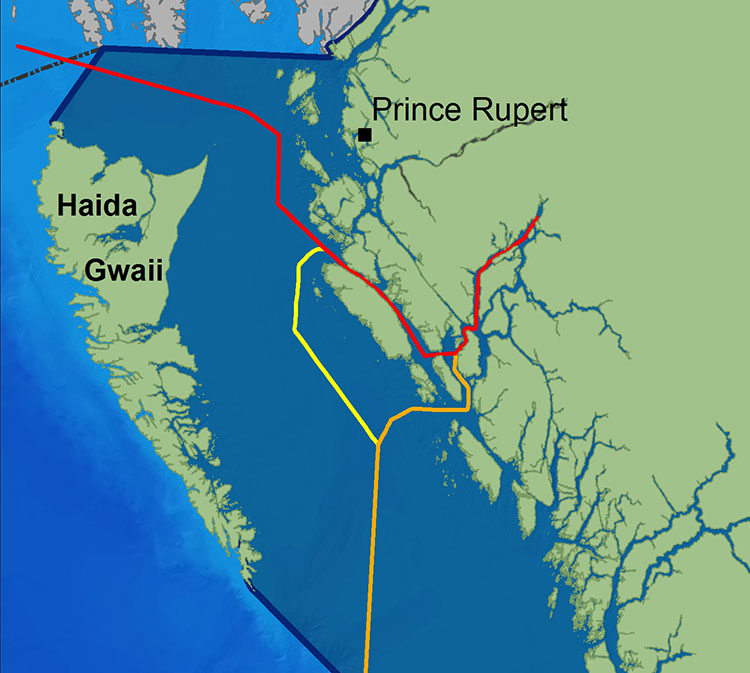
Ashdown Island is on the proposed “Southern Approach” for Enbridge’s tanker traffic routes.

Tanker routes (Wikipedia from Living Oceans)


Recent studies by both Fisheries and Oceans and scientists have identified the area as “critical habitat” for the rebounding humpback whale population visiting the BC Coast. The Northern Gateway Joint Review panel recently refused to consider those studies because they were released after the deadline for filing evidence.

The BC management plan notes:

The area and nearby waters have been and continue to be intensively used by the Gitga’at people for cultural, social and economic purposes. In Tsimshian language (Sm’algyax), K’nabiyaaxl means “place where cliff” – which is located on the west side of Ashdown Island.

The conservancy encompasses all of Ashdown Island and the foreshore area
and land covered by water within 200 metres of the high tide line. It
has high intertidal values, especially for seaweed, and contains an important
Steller Sea Lion haulout. The waters around the island support important Gitga’at
community fisheries.


Although in Gitga’at traditional territory, the plan notes that the Haisla, the Kitasoo community of Klemtu; and Gitxaala community of Kitkatla on Dolphin Island should be consulted.

It goes on to say:

The conservancy protects an entire small island representative of the Hecate Lowlands Ecosection. The island’s foreshore marine environments include high value intertidal areas which provide high value habitat for important marine wildlife species and migratory birds. The conservancy also protects a haulout for Stellar Sea Lions (Eumetopias jubatus), a species of concern (provincially blue- listed3)…

Stellar Sea Lions use small islets off the south end of Ashdown Island as a winter
haulout, with up to 12 pups and 107 adults observed

The plans lists the Humpback Whale (Blue-listed, S1N); the. Killer Whale (Red- or Blue-listed, S2 or S3 depending on sub-species); and the Fin Whale; as Ashdown Island species at risk. (SARA species schedule procedure site)

As well:

The conservancy contains seven hectares of potential Marbled Murrelet habitat
which, although small, may provide important habitat when combined with core
Marbled Murrelet habitat in nearby areas.

K’nabiyaaxl’s remote location provides an excellent opportunity for maintaining
biological diversity and natural environment values. This habitat should not be
disturbed by conservancy use and development.

The island and the near shore are also part of the Gitga’at’s rich cultural heritage.

The conservancy is near the seasonal Gitga’at village camp of K’yel. The Gitga’at
travel in the spring from Hartley Bay to K’yel, which they use as a base for conducting intensive marine and intertidal harvesting and hunting activity.

Since time immemorial, the Gitga’at people have harvested fish and marine
mammal species in waters adjacent to K’nabiyaaxl. They also collect seaweed,
plants and berries from intertidal and upland areas on the island.

Archaeological sites are known to exist in the area. That the BC Archaeological
Branch does not have archaeological sites registered in the conservancy is not
indicative of the rich history of Gitga’at occupancy and use of K’nabiyaaxl.

Second floating LNG terminal eyed for Kitimat at Douglas Channel log sort

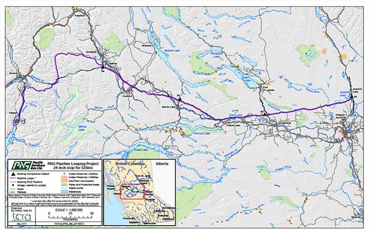
PNG Pipeline Looping Project map (PNG)

A second floating liquified natural gas terminal may be planned for Kitimat, Northwest Coast Energy News has learned.

According to multiple sources in Kitimat, Altagas, the parent company of Pacific Northern Gas plans the terminal at the old log sort site on Douglas Channel, where the barge carrying the liquifaction equipment would likely be moored next door to the already planned BC LNG/Douglas Channel Partners LNG project which would be served by gas delivered by the PNG pipeline system.

Pacific Northern Gas has filed an application with the BC Environmental Assessment Office to construct and operate an approximately 525 kilometre, 610 millimetre (24 inch) diameter natural gas pipeline from the natural gas hub at Summit Lake, near Prince George, to Kitimat that would loop or twin the existing PNG existing natural gas pipeline.

The application to the BCEAO says: “The proposed Project would supply natural gas to proposed liquefied natural gas (LNG) export facilities as well as the Proponent’s existing customers. The proposed Project would include the replacement of four existing compressor stations and would have an initial capacity of 600 million standard cubic feet per day.”

PNG Open House
PNG Pipeline Looping Project Open House at Tamitik. Nov. 26, 2013. (Robin Rowland/Northwest Coast Energy News)

On Tuesday, November 26, Pacific Northern Gas held a sparsely attended open house at Tamitik Arena as part of the BCEAO public comment procedure.

A 38 day public comment period on the application information requirements started on November 25 and will end on January 2, 2014.

At the open house,  PNG officials explained that “looping” means that there would be a second or twin pipeline that would mostly be on a parallel route to the existing pipeline. Since both pipelines would begin at the Summit Lake terminal and end at the Kitimat terminal that is where the term “looping” comes in.

The PNG officials said that the pipeline was initially designed to service the first floating LNG terminal at the old log sort site on Douglas Channel south of Kitimat, but north of the KM LNG site at Bish Cove.

It would be operated by  BC LNG Energy Cooperative, through Douglas Channel Energy Partnership, a partnership with the Haisla Nation and LNG Partners, the energy investors mainly from Texas,

Unlike the bigger project Kitimat LNG or KM LNG, a partnership between Chevron and Apache (and according to reports possibly Sinopec) or the Shell-led partnership LNG Canada, the BC LNG project would allow smaller companies to provide LNG to Asian customers.

At the open house, the PNG officials said the two pipelines could also service “another Kitimat floating LNG project” but declined to give details for confidentiality reasons. The same officials also said the proponent of that project was also looking at Prince Rupert as a possible site for the second floating terminal.

Kitimat sources have confirmed that AltaGas has told them that the company is also considering Prince Rupert as a site for a floating LNG terminal.

However, the current documentation and maps filed with the BCEAO show the PNG looping pipeline terminating at Kitimat, not Prince Rupert.

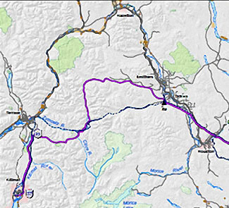
PNG pipeline map
Detail of the PNG Pipeline Looping proposal. The existing pipeline is shown at the dashed line, the new pipeline is shown in purple. (PNG)

According to the maps filed with the BCEAO and made available at the open house, the new pipeline would not be twinned completely along the existing route across the mountains west of Smithers to Terrace, but would head north at Telkwa parallel to Highway 16 before making its own way through the mountains, crossing the existing pipeline at the Zymoetz River east of Terrace and then taking a westerly route toward Lakelese Lake before joining the existing pipeline corridor along Highway 37.
AltaGas took over Pacific Northern Gas in the fall of 2011.

The Texas-based arm of Douglas Channel Energy partnership, LNG Partners,  is currently in financial difficulty. Reports say that the Texas investors in the company are having difficulty repaying a $22.5 million loan from China’s ENN Group.

The problems currently faced by the Texas group have no affect, at this point, on the Haisla Nation investment in the BC LNG Energy Cooperative. There is already speculation in Kitimat that if the LNG Partners get into further financial difficulty, AltaGas may step in and take over. The would raise the question whether or not there would still be two floating LNG terminals on Douglas Channel, or just the one, as originally planned, but under new ownership.

In it’s project proposal PNG says

The Project will generate approximately 1800-2400 direct person years of employment during construction. Additionally, tax benefits will be generated for Kitimat and the regional districts crossed by the pipeline. PNG anticipates the project will also result in a significant reduction in natural gas transportation rates for its existing customers.

Natural gas transportation costs are a major issue in the northwest, for those costs appear to keep going up while the price of natural gas in North America is generally going down. Natural gas transportation costs in Kitimat spiked after the closure of the Methanex plant and have continued to be quite high, which is just one of the increasing burdens for residents of Kitimat on fixed or low incomes, who are not benefiting as others from the current boom town economy.

Another problem facing PNG is that the new pipeline will cross the traditional territory of the Wet’suwet’en First Nation, where one house, the Unist’ot’en oppose both the Northern Gateway and Pacific Trails Pipeline and have set up a blockade camp on access roads.

The PNG filing with the BCEAO promises consultation with both the Wet’suwet’en Council, and the Office of the Wet’suwet’en, which represents the hereditary chiefs and matriarchs, as well as other First Nations along the proposed route.


PNG Open houses for the project are scheduled for:

Vanderhoof
Friendship Centre Hall
Thursday, November 28, 2013

Terrace
Best Western Inn
Monday, December 2, 2013

Smithers
Hudson Bay Lodge
Tuesday, December 3, 2013

Burns Lake
Chamber of Commerce
Wednesday, December 4, 2013

Summit Lake
Community Hall
Thursday, December 5, 2013


Defend our coast rally in Kitimat

Protest rally
Protesters march down Kingfisher Ave, during the Defend Our Coast Rally in Kitimat, Nov. 16, 2013. (Robin Rowland/Northwest Coast Energy News)

About 250 people took part in the Defend Our Coast Rally at Mount Elizabeth Secondary School, Saturday, Nov. 16, 2013. The Kitimat protest was part of what organizers said were 130 rallies across Canada to protest environmentally threatening energy developments including the Alberta bitumen sands and various pipeline projects under the labels of Defend Our Climate or Defend Our Coast.


Gerald Amos
Gerald Amos addresses the rally. (Robin Rowland/Northwest Coast Energy News)
Kelly Marsh
Kelly Marsh speaks about his studies that show small or mid-level pipeline breaches are inevitable. (Robin Rowland/Northwest Coast Energy News)
Protest
Family at the rally. (Robin Rowland/Northwest Coast Energy News)
Patricia Lange
Patricia Lange addresses the rally. (Robin Rowland/Northwest Coast Energy News)
Protesters join arms
Protesters join arms, a feature of every one of the rallies across Canada. (Robin Rowland/Northwest Coast Energy News)
Protest march
The protest march on Kingfisher. (Robin Rowland/Northwest Coast Energy News)
Protest march
The protest march. (Robin Rowland/Northwest Coast Energy News)

Ellis Ross posts development philosophy on Facebook

Haisla Chief Counsellor Ellis Ross has posted a statement on Facebook, outlining his philosophy on energy development.


Ellis Ross
Haisla Nation Chief Counsellor Ellis Ross at Bish Cove, June 19, 2013. (Robin Rowland/Northwest Coast Energy News)

In 2003 I was first elected to Haisla Nation Council, and I was intent on opposing just about every economic development project coming our way, from fish farms to natural gas. Fortunately experienced councilors suggested that before I took any hard and fast positions that I consider unbiased facts and the community’s social situation.

It didn’t take long before the full extent of our community’s problems hit home, angering and saddening me at the same time. Before my political career I was one of those who applauded political speeches on unemployment, poverty, independence, and the relationship between First Nations and the Crown. But it was now clear that 30 years of speeches and government programs had changed nothing for the average Haisla person who just wanted a job. Unemployment was still at 60 per cent, housing was based on hand-outs from Ottawa, and, worst of all, substance abuse and suicides were commonplace and were destroying our people’s hopes for a brighter future.

I was fortunate to have found work outside of my reserve for most of my adult life but there are only so many jobs in depressed economies and the long term jobs were kept out of our reach by organizations associated with the corporations set up in our territory. The result was our young men and women either had to leave home for employment or stay home and accept seasonal work (UIC) or welfare. Leaving ancestral homes is a hard decision for First Nations to make. The land is connected to our protocols, our culture and to our past.

Many reasons have contributed to the demise of our peoples and communities but perhaps the foremost is the culture of dependence. Dependance in our case was from the top down; from council dependant on government funding to the individual band member being dependant on council or welfare. Our people are not lazy. The culture that preceded the non haisla culture was one of hard work to bring in food, resources and wealth. That culture has not merged so well with non haisla culture but our work ethic is the same as the non haisla culture.

If poverty is the only lifestyle you know, it is very difficult to know there is a way out, much less thinking of a way to get out of it. The individual band member that is watching development in their territory and watching the wealth being generated without having an opportunity to be a part of it is going to have resentment.

Those Nations which are succeeding — strong employment levels, healthy communities, few social ills — appear to have gained a level of independence and have done it mostly through economic development. The newer discussions are those concerning shiftwork, double time, new bosses and how paychecks will go towards the next hunting trip or holidays to vancouver or elsewhere.

We have many proposals put in front of us now that we have to sift through. When we look at these proposals we have to find accurate information in terms of impacts, benefits and feasibility. Sub topics can be right of ways, fracking, logging practices, financing, permitting, corporate structures, emissions, land ownership and the list goes on and on. We do have to consider the future but we also have to consider the present and the situation we know that our membership is in and try to put them in a position where they can help themselves.

So far, the outlook has been positive. Our people have jobs. They have hope. They are confident about their futures. The despair that comes with poverty is slowly disappearing but we have more work to do to ensure their confidence can be sustained. We know that to become a strong independent Nation, we need to have strong independent members.

We will continue to look at the contentious issues that are in front of us and will try as much as we can to resolve with both the crown and the proponent but we cant lose sight of one of the biggest reasons of why we’re doing what we do. Our members need a future.

By the way, the work we have done to date has not only assisted our members but has assisted the region and non Haislas in ways that we have not yet even started to measure yet.
Ross.

Ross later posed two comments:

Ellis Ross: got some good feedback on this but also got feedback that it was unclear on the point I was trying to make so I rewrote it. the point was in light of all the issues we have to look at, we can’t lose sight of the social factor in that some Haislas (and non Haislas) deserve the employment/contract opportunity that comes with proposed projects.

Ellis Ross: fracking, emissions, land ownership, etc… are issues that are extremely important but our people living in poverty with no hope is also an extremely important issue.

Clio Bay: Clay capping “relatively new technique”: DFO statement

Carrie Mishima, a communications advisor for the Department of Fisheries and Oceans sent this statement in response to questions from Northwest Coast Energy News:

· The proposal by the Kitimat LNG project uses a relatively new technique that is expected to improve aquatic habitat in Clio Bay. The bay has been used as a log handling site for decades, resulting in areas of degraded habitat from woody debris on the seafloor. The project will cap impacted areas with inert material to restore the seafloor.

· Capping at smaller-scale sites in Canada has shown that the technique has successfully restored low-value aquatic habitat.

· The project will implement standard and project-specific measures to protect fish and aquatic habitat and will conduct a five-year monitoring program to determine how well the habitat is recovering.

· Data from the monitoring program will be used to guide future habitat reclamation at impacted habitat sites. Reference sites are being established as benchmarks against which the capped sites can be measured.

· Site-specific standards for dissolved oxygen levels will be developed for the enhanced site by sampling a control site having similar habitat parameters.

· Detailed mapping has been done to identify the best areas for the soil placement and to protect sensitive habitat such as intertidal areas, rocky substrates and eelgrass beds.
· Other required mitigation measures will include analyzing the cap material to confirm it is free of contaminants and placing this material during appropriate tidal conditions to ensure accurate placement of the cap in accordance with design plans.

[rps-include post=5057]