Bitumen excluded from data for federal tanker study, documents reveal

Tanker risk map
Transport Canada tanker report map shows current risk for spills in BC (Transport Canada)


Genivar report
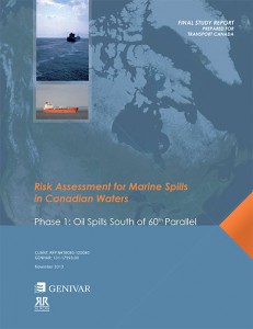
Cover of Genivar tanker report (Transport Canada)


The possible effects of a bitumen spill on Pacific waters were not considered in the oil response preparedness report released last week by the Harper government, the background data study reveals.

The consulting firm that did the study for Transport Canada, Genivar Inc, had no reliable data on the effect of a bitumen tanker disaster—because, so far, there has been no major ocean disaster involving diluted bitumen.

Instead, Genivar, based its findings on potential hazards and response on existing data on crude oil spills.

The Genivar study, however, does warn, that if the Enbridge Northern Gateway project does go ahead,  the spill risk from diluted bitumen carrying tankers in Douglas Channel and along the north Pacific coast will jump from “low” or “medium” to “very high.” If the twinning of the Kinder Morgan pipeline goes ahead, then the risk in Vancouver also jumps to “very high.”

The question of how bitumen might behave in the cold and choppy waters of the North Pacific was hotly debated during the Northern Gateway Joint Review hearings earlier this year. Enbridge Northern Gateway based its position on laboratory studies, studies that were challenged by environmental and First Nations intervenors, pointing both to the unknowns of the ocean environment and the continuing problems Enbridge has in cleaning up the spill in the Kalamazoo River in Michigan.

Genivar tried to base its report to Transport Canada on existing data on oil spills and related hazards. What it found instead is that that there are often gaping holes in the reporting and monitoring of oil spills world wide, especially small and medium sized spills.

Lack of data also meant that Genivar had little to go on when it calculated the effect on an oil spill on key areas of interest to northwest British Columbia, the recreational fishery and tourism.
Genivar, however, did uncover disturbing data about the long term effects of oil spills, studies that show even minute amounts of remaining oil can still disrupt the marine environment 40 years after an event.

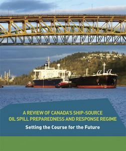
The Genivar report, Risk Assessment for Marine Spills in Canadian Waters Phase 1: Oil Spills South of 60th Parallel, was completed in November, then passed on to the “expert panel” that released their own report: A Review of Canada’s Ship-source Oil Spill Preparedness and Response Regime — Setting the Course for the Future. That second report was based not only on the data provided by Genivar but on the expertise of three panel members, their visits to some locations and input from government, industry, First Nations and municipalities.

Transport Minister Lisa Raitt and Natural Resources Minister Joe Oliver unveiled the second report at a glitzy media event  in Vancouver on Tuesday, December 10. At that time the expert panel report was released to the media along with an abstract of the data.

The actual data report was not posted; it had to be requested through the Transport Canada website, which is how Northwest Coast Energy News obtained the background study.

High risk for Kitimat

Transport Canada tanker report
Expert panel tanker risk assessment report cover (Transport Canada)

The expert panel found “a very high risk” of oil spills in two areas of the Pacific Coast, in the north around the ports of Kitimat and Prince Rupert and in the heavy ocean traffic area of southern British Columbia, especially Port Metro Vancouver and into Washington State.

The expert panel made 45 recommendations that covered a wide range of issues including eliminating the present $161-million liability limit for each spill and replacing it with unlimited liability for polluters, annual spill training involving the Canadian Coast Guard, Environment Canada, provincial and local authorities and the private sector, increased and improved annual spill training exercises, basing risk assessment on local geography and conditions and faster emergency responses to spills.

The expert panel calls for greatly increased research on the ocean environment at a time that Harper government has been gutting environmental research across Canada, while spinning that its policies are “science based.”

The science and technology around both the movement of oil and spill response has advanced significantly over the past several decades. We feel that while some aspects of the Regime have kept pace with these developments, in some areas, Canada has fallen behind world-leading countries like Norway and France. This can be attributed to a general lack of investment in research and development as well as the lack of coordination between industry and government over research priorities.

The Government of Canada should work closely with industry to establish a national research and development program for oil spill preparedness and response. The program should be co-funded by industry and the Government, and the research priorities should be set through a collaborative process that involves academia, where possible. Like the Regime itself, we view this program as a partnership between industry and government.

We envision that this program would also seek to leverage the work being done internationally on oil spill preparedness and response. The program should seek to establish partnerships with other world-leading countries in order to stay current on international advances and new technologies.

The expert panel, however, does not say how the federal government is expected to pay for meeting BC Premier Christy Clark’s condition for a “world class” spill prevention and response system at a time that Finance Minister Jim Flaherty is determined to balance the budget and the Harper government is continuing to cut back government services.

Bitumen excluded

On bitumen, the Genivar data study says:

Modified bitumen products represent the majority of the “crude carried as cargo” in
Pacific sub-sector 5. They are not modelled as a separate category in this spill behaviour analysis but are represented as “persistent crude”.

Changes in spill behaviour depend to some extent on the environmental conditions at the time of the spill, as described in greater detail below. However, over the range of wind and sea conditions typically experienced in the Canadian marine environment, changes in oil properties are not overly sensitive to variations in climatic values, so a single set of wind and sea conditions will be used in the analysis.

The idea that “changes in oil properties” not being sensitive to variations in climate was also frequently challenged before the Joint Review Panel.

On the increase in traffic volume if the Northern Gateway project goes ahead, the Genivar report says.

Enbridge Inc. has proposed to construct a marine terminal at Kitimat, B.C. and a dual pipeline from the terminal to oil sands production in northern Alberta. The terminal would handle up to 193,000 barrels/day of imported diluents (i.e., low-gravity condensate) that would be piped to Alberta and used to dilute bitumen to enhance its flow properties. The diluted bitumen would then be piped to Kitimat at rates up to 525,000 barrels/day that would be shipped by tanker to export to markets in Asia and California.

At full capacity, the import of diluent and export of diluted bitumen would total up to 35 Mt/year. This amount is comparable to the currently-shipped volume in the Pacific sector related to volumes being exported from Vancouver and related to volumes being exported from the Alaskan to Washington State trade.

It goes on to say that the current tanker traffic on the north Pacific coast “has negligible risk in the near shore and intermediate zones, but significant potential spill frequency in the deep-sea zone related to the Alaskan trade.” Similarly, according to Genivar the environmental risk in the region “currently ranges from ‘medium’ to “very low” from near shore to deep-sea zones, respectively…. mainly driven by a combination of physical and biological features.”

The increase in traffic from Northern Gateway would likely increase the environmental risks. The the near shore risk from would jump from “very low” to “very high.” For the largest spill category, deep-sea risk would likely increase from “low” to “medium.”

No data on recreational or traditional First Nations fishery

To study the effect on an oil spill on the fishery, Genivar used data from the Department of Fisheries and Oceans as the provinces to gauge “the port value of commercial fishing and the value of the fish, shellfish and aquaculture” in each zone it studied and then compared it to the the national averages for commercial fishery. Those figures included any commercial fishery by First Nations.

But Genivar noted, there is no reliable data on either the recreational fishery or the First Nations traditional, food, social and ceremonial fishery, saying:

It is important to highlight that this indicator does not consider recreational or traditional fishing. The importance of this industry is notable and an oil spill could damage the recreational fishing stock as well. However, the absence of comparable data and the fact that this study is restricted to federal and international data, and some provincial data from Quebec and Ontario for commercial fisheries, limits the ability to include recreational fishing… Nevertheless, as an absolute index, it will provide an overall vulnerability in the event of an oil spill.

The ongoing impact of cutbacks at Fisheries and Oceans has had a continuing impact on the northwest, especially in the controversial halibut recreational fishery, where DFO has admitted that it is basically guessing the size of each year’s recreational halibut catch.

Tourism

Genivar also notes that lack of reliable data on the effect on a oil spill on tourism. The consultants go so far as to say one of the indicators they will use to measure the effect of any oil spill on tourism would come from “data extracted from the 2011 National Household Survey at the census division level and the accommodation and food services data will be used.”

The “National Household Survey” is also known as the long form census and it is the National Household Survey that the Harper government made voluntary rather mandatory, decreasing the reliability of the data. Global News recently analyzed those who had contributed to the survey and found that it poor people, the very rich and people in low population areas were least likely to fill out the voluntary census—which means the data for northwest BC is likely highly unreliable from the 2011 survey even though “The census divisions in coastal regions will be selected for each of the sub-sectors. This method will express the economic vulnerability of each sub-sector to a potential collapse in tourism following a spill.”

Despite the importance of cruise ship traffic on the west coast, Genivar notes, “In Canada, data for passenger vessels were unavailable.”

It also notes that “this study does not specifically take into account national parks and other landmarks, since their influence on tourism is indirectly included in the tourism employment
intensity index” so that Genivar could create what it calls the Human-Use Resource Index (HRI), even though that index appears to be based on incomplete data.

Tanker study shows huge gaps in shipping and hazard data, documents show

The study of tanker shipping and tanker spills by Genivar for Transport Canada has revealed huge gaps in how the world monitors tanker traffic.

Genivar report
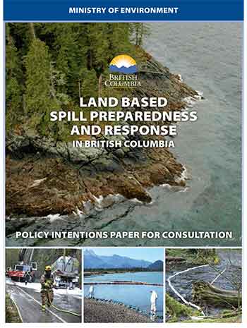
Cover of Genivar tanker report (Transport Canada)

Genivar says

Accident data was acquired from three main sources: the CCG Marine Pollution Incident Reporting System (MPIRS); the Lloyd’s casualty database; and spill incident records maintained by the International Tanker Owners Pollution Federation (ITOPF).

MPIRS lists all marine pollution incidents occurring in Canadian waters (CCG, 2013), with information on the region within Canada in which the incident occurred, type of material spilled, accident cause, and estimated pollution volume with multiple entries for a given incident showing updates of incident status and pollution amounts if applicable. The primary use of MPIRS in this study was for spill incidents in the smaller size categories… for which worldwide data was suspected to be unreliable due to under-reporting. MPIRS appeared to be a comprehensive listing of incidents that occurred in Canadian waters, and a summary of polluting incidents

It goes on to note that some key data has not been updated since the 1990s, largely prior to the introduction of double hulled tankers.

As noted, oil spill accidents were compiled on a worldwide basis.

In order to estimate the frequency for Canada, an exposure variable was required.

A series of studies by the U.S. Minerals Management Service (MMS, now known as
the Bureau of Ocean Energy Management, Regulation and Enforcement) investigated the occurrence rates of tanker accidents against various spill exposure variables and found that the simplest and most reliable indicator was volume of oil transported. Simply put, it was determined that spill rates could be expressed, for a range of spill size categories, as an average number of spills per billion barrels transported.

The MMS studies were updated periodically until the 1990s but have not been revisited since, but they did show a steady decrease in the likelihood of casualties and resulting spill volumes, due to a number of factors including tanker design, increasing governance and overall scrutiny of the marine transportation industry. The phased-in implementation of double-hull tankers may have also had a beneficial effect on spill rates in more recent years, particularly in the category of very large or catastrophic events… In any case, it is important in interpreting accident data to reflect current trends and implemented mitigation measures. The focus was on cargo volumes and accident rates over the past decade.

It goes on to say the volumes of crude carried is also under-reported to Lloyds.

In the case of crude oil and refined products carried as cargo, the exposure variable was simply the volume of each respective category carried on an annual basis for the period of interest. Information from the Lloyds APEX database was used for this purpose; it reports volumes of crude and refined products shipped worldwide, with a breakdown by year, country of origin, and country of destination. Compared with similar data from Canadian sources, the APEX data appeared to significantly under-report the carriage of refined products. As a result, the accident rates estimated and used in this study are likely somewhat conservative, that is, they overstate the likely frequency of refined products carried as cargo. For all calculations involving the potential spillage of refined products as cargo in Canadian waters, and for the apportioning of spill frequency among the various sectors and sub-sectors of Canada, Transport Canada commodity traffic data was used

Again about Lloyds data, until 2010, it was limited in its monitoring of the BC Coast.

In analyzing the Canadian movement data supplied by Lloyds, a major shortcoming was found in the data in that movements recorded prior to 2010 did not include broad classes of vessels such as ferries, passenger vessels, and pilot boats. Given that these vessels comprise a significant proportion of traffic movement in many sectors, only data covering the final two years of the record, 2010 and 2011, were used in the analysis.

The Lloyds data was also limited when it came to oil spills:

One limitation of the MPIRS data was that it did not classify spills as to whether they were from “cargo” as opposed to “fuel”, which would have been helpful in this study as these spill types were analyzed separately. As a result, for spills of refined products, which could have hypothetically been either cargo or fuel, assumptions were made based on the type of vessel involved, the type and severity of the incident, and other notes within MPIRS.

A database was acquired from Lloyds that detailed all marine casualties over the
past ten years regardless of whether the incident involved pollution…
This database was used to provide a breakdown of incidents by cause, and as an
initial listing of those incidents that did result in pollution. The Lloyds data was of
mixed quality when it came to the reporting of polluting incidents, with numerous
records only partially filled out, ambiguities in the reporting of spill volume, and
inconsistencies in the classification of the spilled material. A significant effort was
made to provide consistency and accuracy in the information, including cross-
referencing with other data sources.


So the Genivar report exposes a significant gap in the available data on oil spills.

It is certainly true that the number of major tanker accidents and spills have decreased since the Exxon Valdez disaster, a point frequently made by Enbridge at meetings in northwestern BC.

The expert panel report which said that Canada faces the risk of a major tanker disaster of 10,000 tonnes or more once every 242 years.

The Vancouver Sun quoted Transport Canada spokeswoman Jillian Glover on that risk of a spill on the Pacific Coast as saying. “This value must be understood in relative terms, such that the risk is considered high compared to the rest of the country only…Canada enjoys a very low risk of a major oil spill, evidenced by the lack of Canadian historical spills in the larger categories. Additionally, this risk assessment is before any mitigation measures have been applied, so that is a theoretical number before additional prevention initiatives are taken.”

Note that the government always talks about a “major oil spill,” but it appears from the gaps in the data that predicting the possibility and consequences of a medium sized or smaller oil spill is now not that reliable, even though such a spill could have disastrous effects on a local area. According to a map in both reports, the entire BC coast is at risk for a “low to medium” spill. This echoes the problems with the Enbridge Northern Gateway pipeline, where Enbridge based most of its projections on a “full bore breach” or major pipeline break and did little about a medium sized or smaller leak. Data analysis by Kelly Marsh of Douglas Channel Watch on the possibility of the cumulative effects of a medium sized and possibly undetected pipeline breach could have just as disastrous consequences for the Kitimat valley as a major pipeline break. The same is likely true at sea.

Oil spill dangers can linger for 40 years, report shows

Genivar report
Cover of Genivar tanker report (Transport Canada)

The Genivar report for Transport Canada on oil spills say that some persistent effects can last for more than 40 years, based on a study of a spill in Cape Cod, Massachusetts. The report  notes that persistent sub-surface oil is still a problem at Prince William Sound, site of the Exxon Valdez disaster in 1989.

On long-term effects, Genivar reports: “The ingestion of contaminated food (such as oiled mussels), may represent the most important exposure pathway for aquatic fauna during a chronic
phase. Chronic exposure to contaminated sediments is also important for fauna or
vegetation.”


It goes on to stay that “large-scale oil spills might have considerable long-term
consequences on social structure and public health, interfering with traditions and
causing cultural disruptions.”

It appears that in the case of an oil-spill, time may heal some wounds, but not all of them, at least if time is considered within human lifetimes and the lifetimes of other species.

Ecological recovery is measured by how quickly individuals and populations of
species return to pre-spill conditions. It is determined by factors such as oil type,
exposure duration, water temperature, degree of weathering, spill response and the
individual and species-specific life history traits. In most environmental habitats,
recovery is completed within 2-10 years after a spill event, but in some exceptional
cases, such as in salt marshes, effects may be measurable for decades after the
event.

In the case of the Exxon Valdez oil spill in Prince William Sound… in 1989, the persistence of sub-surface oil in sediments and its chronic exposure continues to affect some of the wildlife through delayed population reductions, indirect effects and trophic interactions 20 years beyond the acute phase of the spill.

It then goes on to stay that

Four decades after the oil spill In Wild Harbor (USA), Spartina alterniflora beds had a reduced stem density and biomass and mussels in oiled locations showed decreased growth and filtration rates.

According to a Boston Globe story, published at the time of the Deepwater Horizon oil leak in the Gulf of Mexico, in 2010, the Wild Harbor, an oil barge ran aground near Cape Cod in September, 1969, spilling 200,000 gallons of fuel, some of which is still there.

The Boston Globe story noted:

Today, Wild Harbor looks much like any other Cape Cod marsh, but the oil below the surface affects its resiliency. Fiddler crabs normally burrow deep down, funneling oxygen to the roots of marsh grass. Here, they stop digging when they reach the oil, turn sideways, and burrow back to the surface. They also act “drunk’’ from the oil they ingest, and predators can catch them more easily, research shows.

The Woods Hole Oceanographic Institute has been studying the Wild Harbor spill for the past 40 years.

At a recent conference, Dr. John Teal updated scientists on the “multi-decadal effects” of the Wild Harbor spill. According a blog on the conference:

At the time of the 1969 spill, lobsters, clams, and fish died by the thousands, but most people believed the harm would be temporary, reflecting the conventional wisdom of the time. Barge owners and oil industry experts even told residents that most of the oil would evaporate and any damage would only be short-lived. However, researchers at WHOI were not so sure and immediately began cataloging species and tracking where the oil was and kept at it for years. The researchers understood that the immediate, short term effects of oil pollution were already obvious and fairly well-understood, but that everyone was rather ignorant about the long-term and low-level effects of an oil spill….

Beginning three to five years after the spill, marsh grasses and marsh animals were again occupying most of the oiled area. An observer unfamiliar with Wild Harbor would not have been able to visually detect the oiled areas after just 10 years, and by the second decade after the spill, the marsh’s appearance had returned to normal. However, the WHOI researchers pointed out that for more than a decade after the spill, an oil sheen still appeared on the surface of the water when mud from the most heavily oiled parts of the marsh was disturbed….

In 2007, WHOI researchers documented that a substantial amount of moderately degraded petroleum still remained within the sediment and along eroding creek banks of the marsh oiled in 1969. They also demonstrated that the ribbed mussels that inhabit the oiled salt marsh, and are exposed to the oil, exhibited slower growth rates, shorter mean shell lengths, lower condition indices, and decreased filtration rates even when placed in a healthy marsh. Researchers have also documented detrimental effects of the 1969 oil spill on the salt marsh plants themselves.


Related Oil Spill on the Wild Harbor Marsh by John M. Teal and Kathryn A. Burns
The Genivar report goes on to note:

Long-term effects on the population in the aquatic environment (especially on mobile fauna) are especially difficult to confirm. Benthic [bottom dwelling] invertebrates may be more at risk than fish species due to the fact that more or less sessile organisms are likely to suffer higher initial rates of mortality and exhibit long recovery times as a result of
exposure to oil-saturated habitats.

Nearshore demersal [bottom-dwelling] fish can also suffer from long-term chronic exposure, as indicated in masked greenlings and crescent gunnels by biomarkers on hydrocarbons 10 years after the Exxon Valdez spill. Mortality in sea ducks and sea turtles due to chronic exposure was also reported many years after the spill and other results indicate that effects on cetacean populations can last beyond 20 years after the acute exposure phase.

As for the recovery of the economy after a spill, Genivar notes it is based “on the time required for effected industries to be fully restored to pre-spill conditions.

The length of time required is influenced by the duration of the aquatic area closures (e.g. commercial fisheries, recreational fisheries), the public perceptions on seafood safety and the perceived effects of the aesthetic quality of the environment. Even after the full ecological recovery of the aquatic resources, fisheries can be far from reestablished, as is still the case for herring fisheries in the Exxon Valdez spill area…

As reviewed by Genivar, negative perceptions associated with the quality of fishery products, even for fisheries that have not been contaminated and also for regions not directly affected by the spill, can be far more important than the direct economic losses. This also holds true for the tourism sector and all other related spinoff sectors.

Seaspan keeping an eye open for opportunities in Kitimat, CEO says

Seaspan ULC, the large BC-based marine transportation and shipbuilding company is keeping its on eye on future opportunities in Kitimat and along Douglas Channel, chief executive officer Jonathan Whitworth said Tuesday.

Jonathan Whitworth, CEO of Seaspan ULC, at the RCM SAR 63 boathouse.  (Robin Rowland)
Jonathan Whitworth, CEO of Seaspan ULC, at the RCM SAR 63 boathouse. (Robin Rowland)

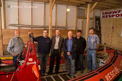
Whitworth was in Kitimat to meet members of the Royal Canadian Marine Search and Rescue Unit 63, which operates from the Nechako Dock.

He also met with members of the Haisla Nation while he was in town.

Kitimat SAR 63 is one of six stations which will receive $8,500 a year for three years, to help cover operating expenses, from the Dennis and Phyllis Washington Foundation, based in Missoula, MT. Seaspan is part of the Washington group of companies, that has holdings on the west coast of Canada and the United States, owned principally by Dennis Washington.

At the moment, Whitworth said, Seaspan operates the HaiSea in partnership with the Haisla Nation. “It’s a boat that you will see up and down the Channel, she does a lot of work for RTA as well as some of the others, mainly from the construction and the up and coming constrution from the new projects. We take a lot of time and effor to make sure our equipment looks good as well as operates well. That’s the kind of pride our crew puts in the vessels and the company supports.” he said. Seaspan barges are also used for the construction projects currently under way in Kitimat.

Whitworth said that while Douglas Channel is not yet “packed on the water,” shipping will likely increase in the coming years. “There are two big dominoes to fall, the first one is any of these big projects being talked about that are going to increase shipping in the Douglas Channel, be
it Chevron or Shell or the BC LNG project. They need to get approval first, that hasn’t happened yet. We understand it may be within the next six to twelve months before we hear some announcements. When that goes ahead, we can start looking at building new boats, be it escort tugs, or docking vessels, or additional vessels… That will help up us to know the time for when we need to deliver new boats for the Douglas Channel.”

Seaspan has always had a close relationship with the Canadian Coast Guard, Whitworth said and that relationship is even closer now that the Seaspan’s Vancouver Shipyards, was chosen by the federal government for the National Shipbuilding Procurement Strategy for non combat vessels. In February, the federal government announced (pdf) a series of preliminary contracts valued at a total of $15.7 million for the joint support ships, the CCGS John G. Diefenbaker polar icebreaker and the offshore fisheries science vessels.

The Washington Foundation is giving a multi-year donation of $1.1 million to three British Columbia marine and port community charitable organizations. Partnering with Sail and Life Training Society (SALTS), Vancouver Maritime Museum (VMM) and Royal Canadian Marine Search & Rescue (RCM-SAR).

Royal Canadian Marine Search and Rescue received $300,000 over three years. “Half of it $150,000 when to Royal Canadian Marine Search and Rescue Sooke training facility on Vancouver Island, that benefits all of the different stations in BC, they all get a chance to go train and at that training centre,” Whitworth said. “The remaining funds, the $150,000 was spread between six stations that are closely associated with Seaspan, so two in Vancouver harbour, North Vancouver, West Vancouver, two on the Fraser River, one at Delta and one at Richmond, one at Victoria and one right here in Douglas Channel in Kitimat.” The $8,500 covers approximately 35 per cent of the operating costs for Kitimat’s SAR 63 station every year for three years.

A July 25 news release from the foundation   (pdf) says:

The Dennis and Phyllis Washington Foundation’s charitable donations are the organization’s first direct donation of their kind in Canada. Since its inception, the Washington Foundation has donated more than $144 million in the United States to hundreds of organizations that focus on education, health and human services, arts and culture, and community service.

Mike Halligan, Executive Director of the Washington Foundation, says today’s announcementis the start of an exciting inaugural collaboration with Canadian charitable organizations in British Columbia.

RCM SAR 63
Members of RCM SAR Unit 63, on board “Snowflake Responder” with Seaspan CEO Jonathan Whitworth. (Robin Rowland)

Kitimat’s SAR 63 operates along Douglas Channel and down the Inside Passage as far as Butedale. Training takes place every Wednesday evening at the SAR 63 boathouse at the Nechako Dock. The unit will be recruiting new members in September. Anyone interested can contact training officer Duncan Peacock.


Kinder Morgan files last minute objection to Joint Review’s proposed conditions for Northern Gateway

Kinder Morgan logoKinder Morgan has filed a last minute objection to the Northern Gateway Joint Review Panel’s preliminary conditions for the Enbridge project.

One of the objections from Kinder Morgan is the provision in the JRP’s proposed Gateway conditions for “purpose built tugs” to escort tankers (a measure that Enbridge has proposed for the Gateway project). Another provision Kinder Morgan objects to is “secondary containment facilities at marine terminals” likely to become an issue if the Vancouver terminal is expanded by Kinder Morgan.

Overall, Kinder Morgan warns that if the JRP imposes some of the proposed conditions on the Northern Gateway, it could adversely affect future pipeline projects in British Columbia.

As well, Kinder Morgan, it appears, is already concerned that if the proposed oversight of Northern Gateway goes ahead, the Kinder Morgan plan to twin the pipeline from Alberta to Vancouver and expand terminal operations in Vancouver could face ongoing scrutiny and possible delays.

The Kinder Morgan document, from the company’s Calgary lawyer, Shawn Denstedt, of Osler, Hoskins and Harcourt, filed May 31, appeared among all the final arguments filed on Friday by intervenors and governments to the Joint Review Panel on Northern Gateway.

Kinder Morgan’s letter to the JRP comes long after the final deadline for such comments.

Kinder Morgan is a registered intervenor in the Northern Gateway hearings, but has only filed four previous documents during the entire multi-year process. The company does not appear on the list of intervenors scheduled to appear for oral final arguments in Terrace beginning on June 17.

On April 12, 2013, the JRP issued a preliminary list of 199 conditions for the planning, construction and operation of the Northern Gateway project.

Now Kinder Morgan is worried. Denstedt’s letter notes:

we believe a number of the proposed conditions may have a material impact on pipeline and infrastructure development in Canada and consideration should be given to the conditions from this perspective.

Diplomatically, Denstedt goes on to tell the panel:

Our comments are intended to assist the JRP in understanding the potential outcomes of the proposed conditions if they become generally applicable to industry.

Commercial considerations

Under what Detstadt calls “Commercial considerations”, Kinder Morgan says “we observe that several of the proposed conditions are likely to affect the manner and risks involved in procuring pipeline facilities and services.

The list points to

Three layer composite coating or high performance composite coating is required for the entire pipeline although other pipeline coatings are commonly used in the pipeline industry depending upon ground conditions encountered
.
Complementary leak detection systems must be identified that can be practically deployed over extended distances of pipeline.

The construction of purpose-built tugs involves significant cost and lead time

A volume is prescribed for the secondary containment facilities at the marine terminal without reference to existing codes.

The letter goes on to say that if the conditions proposed by the JRP for the Northern Gateway come into effect, in Kinder Morgan’s opinion, it could adversely affect other pipeline projects in the future.

If broadly applied to industry, such conditions may limit the ability of pipeline companies to obtain competitive quotes because there are few sources of the required materials or services. The effect of conditions that require the use of a particular material or service may be to grant commercial benefits to certain suppliers through the regulatory process beyond the requirements of existing codes. Since several export pipelines are currently proposed, there will be a heightened demand for labour and materials in the coming years. The commercial effect of conditions that may exacerbate shortages of labour and materials should be a relevant consideration for the JRP.

Timing


One of Kinder Morgan’s objections is to the timing the JRP proposes for the Northern Gateway project if it applies to other pipelines.

Several of the proposed conditions contain NEB approval requirements and filings deadlines several years prior to operations. For example, plans related to the marine terminal and research programs must be filed for NEB approval three years prior to operations.

We are concerned that requiring reports to be filed for approval several years before operations can create significant schedule risks for infrastructure development projects. For example, a project with a two year construction schedule could take three years to complete with such conditions. Any changes to the construction schedule and anticipated date of operations would affect the filing deadline. Project proponents need sufficient schedule certainty in order to plan major expenditures on labour and materials.

To mitigate such risks, it is relevant for regulators to consider whether the filing deadlines and approval requirements prescribed in conditions could materially alter a project’s schedule. Filing deadlines should be set at a reasonable time before operations in order to minimize the risk that such deadlines materially affect the critical path for a project.

Many of the conditions require NEB approval, and in some cases the participation of other parties in the approval process, in order to be satisfied. Fulfillment of those conditions will require additional time, a Board process and potentially litigation. For example, certain reports must be filed with the NEB for approval prior to commencing construction activities. Other conditions require reports to be filed for approval by the NEB prior to construction with a summary of how concerns from other government agencies and Aboriginal groups were addressed.

So Kinder Morgan says:

In our view, conditions that require subsequent board approvals and that attract the potential for additional regulatory processes should be the exception and not a new standard or norm. There must be clear, well understood rationales given as to why additional approvals are in the public interest.

And so Kinder Morgan asks:

As an alternative, the NEB may utilize its existing powers and processes to ensure that when filings are made to satisfy imposed conditions an additional approval process is not required.

Overall the company sees the rules for Northern Gateway as a step back to the days before deregulation.

A number of the conditions may be interpreted as reflecting a return to a prescriptive approach to regulation. These conditions prescribe detailed audit requirements instead of setting a goal oriented approach to allow the proponent flexibility in mitigating any adverse effects. Such conditions tend to focus on operational aspects that are covered by existing codes and regulations rather than setting goals for the proponent to mitigate any significant adverse effects.

Denstedt, again diplomatically, concludes by saying:

Kinder Morgan wishes to thank the JRP for the opportunity to present these high level perspectives regarding its proposed conditions. Our comments are intended to ensure that the wider implications of the proposed conditions on the pipeline industry and infrastructure development are given appropriate consideration in the deliberations and final recommendations of the JRP.

Kinder Morgan letter to JRP

SFU study says spill hazards for Kitimat from tankers and pipelines much greater than Enbridge estimate

A study by two scholars at Simon Fraser University says that the Enbridge Northern Gateway project is much more hazardous to Kitimat harbour, Douglas Channel and the BC Coast than Enbridge has told the Joint Review Panel.

The study by Dr. Thomas Gunton, director of the School of Resource and Environmental Management at SFU and Phd student Sean Broadbent, released Thursday May 2, 2013 says there are major methodological flaws in the way Enbridge has analyzed the risk of a potential oil spill from the bitumen and condensate tankers that would be loaded (bitumen) or unloaded (condensate) at the proposed terminal at Kitimat.

Enbridge Northern Gateway responded a few hours after the release of the SFU study with a statement of its own attacking the methedology used by the two SFU scholars and also calling into question their motivation since Gunton has worked for Coastal First Nations on their concerns about the tanker traffic.

Combination of events

One crucial factor stands out from the Gunton and Broadbent study (and one which should be confirmed by independent analysis). The two say that Enbridge, in its risk and safety studies for the Northern Gateway project and the associated tanker traffic, consistently failed to consider the possibility of a combination of circumstances that could lead to either a minor or a major incident.

Up until now, critics of the Northern Gateway project have often acknowledged that Enbridge’s risk analysis is robust but has consistently failed to take into consideration the possibilty of human error.

As most accidents and disasters happen not due to one technical event, or a single human error, the SFU finding that Enbridge hasn’t taken into consideration a series of cascading events is a signficant criticism.

Overall the SFU study says there could be a tanker spill every 10 years, not once in 250 years, as calculated by Enbridge.

It also says there could be 776 oil and condensate spills from pipelines over 50 years, not 25 spills over 50 years as projected by Enbridge. (And the life of the project is estimated at just 30 years, raising the question of why the 50 year figure was chosen)

Enbridge track record

The study also bases its analysis of the possibility of a spill not on Enbridge’s estimates before the Joint Review Panel but on the company’s actual track record of pipeline spllls and incidents and concludes that there could be between one and 16 spills (not necessarily major) each year along the Northern Gateway pipeline.


Findings for Kitimat

Among the key findings for Kitimat from the SFU study are:

  • Enbridge said the possibility of tanker spill was 11.3 to 47.5 per cent over the 30 year life of project. The SFU study says the possibility of a spill within the 30 years is 99.9 per cent.
  • The SFU study says it is likely there will be a small spill at the Kitimat Enbridge terminal every two years.
  • The SFU study estimates that there will be eight tanker transits each week on Douglas Channel if the Northern Gateway project goes ahead and more if it is expanded.  (This, of course, does not include LNG tankers or regular traffic of bulk carriers and tankers for Rio Tinto Alcan)
  • The SFU study says that while Endridge did study maneuverability of tankers, it paid little attention to stopping distance required for AfraMax, SuezMax tankers and Very Large Crude Carriers.
  • The SFU study says Enbridge inflated effectiveness of the proposed tethered tugs and maintains the company did not study ports and operations that use tethered tugs now to see how effective tethering is.
  • The SFU says Enbridge’s risk analysis covered just 233 nautical miles of the British Columbia coast, where as it should have covered entire tanker route both to Asia and California, raising the possibility of a tanker disaster outside British Columbia that would be tied to the Kitimat operation.
  • Based on data on tanker traffic in Valdez, Alaska, from 1978 to 2008, the SFU study estimates probability of a 1,000 barrel spill in Douglas Channel at 98.1 per cent and a 10,000 barrel spill at 74.2 per cent over 30 year Gateway life. The Valdez figures account for introduction of double hulls after Exxon Valdez spill in 1989 and notes that spill frequency is much lower since the introduction of double hulled tankers.
  • According to a study by Worley Parsons for Enbridge in 2012, the Kitimat River is the most likely area affected by an unconstrained rupture due to geohazards in the region. According to the Worley Parsons study, geohazards represent the most significant threat to the Northern Gateway pipeline system.

Flawed studies

The SFU scholars list a series of what they say are major methological or analytic flaws in the information that Enbridge has presented to the Joint Review Panel, concluding that “Enbridge significantly understates the risk of of spills from the Northern Gatway.

Enbridge’s spill risk analysis contains 28 major deficiencies. As a result of these deficiencies, Enbridge underestimates the risk of the ENGP by a significant margin.
Some of the key deficiencies include:

  • Failure to present the probabilities of spills over the operating life of the ENGP
  • Failure to evaluate spill risks outside the narrowly defined BC study area
  • Reliance on LRFP data that significantly underreport tanker incidents by between 38 and 96%.
  • Failure to include the expansion capacity shipment volumes in the analysis
  • Failure to provide confidence ranges of the estimates
  • Failure to provide adequate sensitivity analysis
  • Failure to justify the impact of proposed mitigation measures on spill likelihood
  • Potential double counting of mitigation measures
  • Failure to provide an overall estimate of spill likelihood for the entire ENGP
  • Failure to disclose information and data supporting key assumptions that were used to reduce spill risk estimates
  • Failure to use other well accepted risk models such as the US OSRA model


SFU reports that Enbridge provides separate estimates of the likelihood of spills for each of the three major components of the project:

      • tanker operations,
      • terminal operations,
      • the oil and condensate pipelines.

The SFU scholars say Enbridge does not combine the separate estimates to provide an overall estimate of the probability of spills for the entire project and therefore does not provide sufficient information to determine the likelihood of adverse environmental effects……

It notes that “forecasting spill risk is challenging due to the many variables impacting risk and the uncertainties in forecasting future developments affecting risk. To improve the accuracy of risk assessment, international best practices have been developed.”

Part of the problem for Enbridge may be that when the company appeared before the Joint Review Panel it has repeatedly said that will complete studies long after approval (if the project is approved), leaving large gaps in any risk analysis.

The SFU study may have one example of this when it says Enbridge did not complete any sensitivity analysis for condensate spills at Kitimat Terminal or the condensate pipeline.

Enbridge response

Enbridge responded by saying

Our experts have identified a number of omissions, flawed assumptions and modeling errors in the study and have serious concerns with its conclusions:
The spill probability numbers are inflated: The author uses oil throughput volumes that are nearly 40 per cent higher than those applied for in this project which also inflates the number of tanker transits using these inflated volumes
The pipeline failure frequency methodology adopted by Mr. Gunton is flawed, and does not approximate what would be deemed a best practices approach to the scientific risk analysis of a modern pipeline system
Mr. Gunton based his failure frequency analysis on a small subset of historical failure incident data. Why would he limit the source of his data to two pipelines with incidents not reflective of the industry experience and not reflective of the new technology proposed for Northern Gateway?
The study results are not borne out by real world tanker spill statistics. Based on Mr. Gunton’s estimates we should expect 21 to 77 large tanker spills every year worldwide while in reality after 2000 it has been below 3 per year and in 2012 there were zero.

Most of Enbridge’s rebuttal is a personal attack on Gunton, noting

We are very concerned about the misleading report released by Mr. Gunton, who was a witness for the Coastal First Nations organization during the Northern Gateway Joint Review Panel process.
Mr. Gunton should have made his study available to the JRP process, the most thorough review of a pipeline that’s ever taken place in Canada. All of Northern Gateway’s conclusions have been subject to peer review, information requests and questioning by intervenors and the Joint Review Panel.

In response, Gunton told the Globe and Mail “the report took over a year to complete and it was not ready in time to be submitted as evidence before the federal Joint Review Panel which is now examining the proposed pipeline.”

Enbridge’s statement also ignores the fact under the arcane rules of evidence, any study such as  the  one from Simon Fraser had to be submitted to the JRP early in the process, while evidence was still being submitted.

The recent ruling by the JRP for closing arguments also precludes anyone using material that was not entered into evidence during the actual hearings.

That means that the SFU study will be ignored in the final round of the Joint Review Panel, which can only increase the disillusionment and distrust of the process that is already common throughout northwest British Columbia.

“No need to scare people” about tanker disasters, Transport Minister tells Commons

“There is no need to scare people,” about tankers, Transport Minister Denis Lebel told the House of Commons on Thursday, March 28.

Lebel was answering a question from Skeena Bulkley Valley MP and NDP House Leader Nathan Cullen.

The official transcript from Hansard records Cullen’s question about the federal government’s unexpected declaration that Kitimat would become a public port.

Mr. Speaker, last week, in their panic to ram a bitumen pipeline through to British Columbia’s north coast, the Conservatives simply decreed that they would take over the Port of Kitimat. Rather than picking up the phone and talking with the local council or the Haisla Nation, the government parachuted in a minister from Toronto to make the announcement. There was no consultation, no respect, just bulldozers.
We see again the fundamental disrespect the government has for first nations here today. Now the Conservatives are scrambling, saying that they will consult after they have clearly made up their minds, the exact approach they take on the pipeline. When will the government start to respect the people of the northwest?

Lebel replied in French, and as is usual in Question Period did not answer Cullen’s question.

The official translation in Hansard reads.

Mr. Speaker, last week we announced the creation of an expert panel. These people will work together to think of how to improve things.
We have a very good system for dealing with oil spills. We will continue to move forward and keep everyone safe.
Canada has not had any major oil spills in its history. There is no need to scare people. We will continue to work on measures.
I thank all members of the panel led by Mr. Houston for their ability to find solutions.

This Youtube video shows Cullen’s question and Lebel’s response. The live translation is a little different, but the effect is the same.


Cullen later issued a news release commenting

Cullen’s question came on the heels of reports that neither Kitimat Council nor the Haisla Nation were consulted in advance of the federal government’s decision to take over the Kitimat port. The move represents an apparent ongoing tendency by the Conservative federal government to offer consultation with communities and First Nations, but only after they’ve already made their decision.

Cullen later reflected that, regardless of one’s position on the Northern Gateway pipeline, open and prior consultation is crucial to fostering good governance and the trust of the general public. By contrast, said Cullen, “the Conservatives are writing the book on how to ignore communities and First Nations, and damage public faith. This is just the latest chapter.”

Denis Lebel represents that land locked Quebec riding of  Roberval—Lac-Saint-Jean. The riding does have Lac St. Jean which is described in Wikipedia as

a large, relatively shallow lake in south-central Quebec, Canada, in the Laurentian Highlands. It is situated 206 kilometres north of the Saint Lawrence River, into which it drains via the Saguenay River. It covers an area of 1,053 km2 (407 sq mi), and is 63.1 m (207 ft) at its deepest point.

It is unlikely there will ever be a Very Large Crude Carrier on Lac St. Jean.

In its earliest statements the Harper Conservatives were careful to say that there had never been a tanker disaster on the west coast. Now, in its Orwellian fashion, the government is now saying “Canada has not had any major oil spills in its history.”

That statement, of course, ignores the Arrow tanker disaster off  Chedabucto Bay, Nova Scotia on  February 4, 1970, which the Environment Canada website, (as of April 1, 2013), describes this way

the calamity had reached catastrophic proportions. Out of the 375 statute miles of shoreline in the Bay area, 190 miles had been contaminated in varying degrees.

The Maritime Musem of the Atlantic wreck site describes a double barreled disaster where the oil was transferred to the Irving Whale, which later sank

There is also this report from a student at St Francis Xavier university.

 Related:

Analysis: The Harper government’s week of history-making blunders

PART FOUR: State Department assessment of the railway to Rupert route for bitumen

Here are edited portions of the EIS assessment for a major oil terminal at Prince Rupert

Environmental Setting

The EIS says “the local surface geology at the Prince Rupert site consists of bedrock (granitic rocks) overlain by glacial outwash and a thin soil cover.” and goes on to note that “Prince Rupert is located along the coastal region of Canada, which is seismically active.”

Potential Impacts

At Prince Rupert, depth to bedrock is expected to be relatively shallow, so rock ripping and some blasting could be necessary. The impacts of rock ripping and blasting are limited to the immediate area and would not result in any significant impacts to the underlying or nearby geology. Excavation activities, erosion of fossil beds exposed due to grading, and unauthorized collection can damage or destroy paleontological resources during construction.

(The report notes that The potential for finding paleontological resources in the areas that would be disturbed is unknown. But the area of the coast has been heavily metamorphisized and most fossils, so far, have been found further inland, largely along the Copper River near Terrace)

In terms of geologic hazards, the Prince Rupert terminals would be located along the coastal region of Canada, which is seismically active. In addition, the presence of steep slopes increases the risk of landslides and the port’s coastal location increases the risk of flooding…. The Prince Rupert rail terminals and port facilities would be designed to withstand potential seismic hazards and flooding…

Construction of the proposed terminals and port expansion in Prince Rupert would result in the disturbance of approximately 3,500 acres (1,400 hectares) of land for the construction of the rail terminal complex and approximately 1,200 acres (487 hectares) for the expansion of the port. Potential impacts to the soils resources of the area could result from vegetation clearance, landscape grading, and recontouring to ensure proper drainage, the installation of storm water drainage systems, construction of the required infrastructure, and other construction activities.
One of the primary concerns during construction activities is soil erosion and sedimentation.
Potential impacts to soils from erosion are expected to occur in areas where the slopes are greater than 20 per cent and where the erosion potential due to their nature is high. Based on available landscape and soils information, the soils found in the area are not highly erodible and the required infrastructure would be located in areas that are relatively flat. Therefore, the impact of the proposed terminal complex and port construction activities on soil erosion would be minor.


Groundwater
Environmental Setting

The Prince Rupert Terminals and port expansion would occur in British Columbia on Kaien Island, which receives about 102 inches of rainfall per year. The terminals would be located on an inlet that is part of the eastern Pacific Ocean on the Venn Passage near the much larger Inland Passage, which extends from Washington State to Alaska along the islands and mainland of British Columbia, Canada. Venn and Inland Passages are marine (salt water) waterbodies. The islands consist of bedrock (granitic rocks) overlain by glacial outwash and a thin soil cover.
Groundwater is shallow, poor quality, and unused. Drinking water is derived from lakes on the mainland. Water quality in the terminal complex area is seawater and inland brackish.

Potential Impacts

During construction of the facilities at Prince Rupert, the primary potential impacts to groundwater would be spills or leaks from construction equipment. Mitigation for these impacts includes having in place appropriate plans in place and appropriate cleanup materials available.
During operations of the facilities at Prince Rupert, the primary potential impacts to groundwater would again most likely be spills or leaks from operation equipment or associated with crude oil unloading of railcars. Although the initial impacts of potential releases or spills may be contained or limited to soil, potential impacts to groundwater may occur depending on the depth to groundwater, soil characteristics (e.g., porosity, permeability), spill volume and extent, and whether the spill reaches surface water bodies, some of which are interconnected to groundwater.

Surface Water
Environmental Setting

The upland character surrounding the potential Prince Rupert terminal area is dominated by bog forest uplands and the flowing surface water bodies are predominantly precipitation- and shallow groundwater-fed intermittent streams. Some open waterbodies are present in the southeast portion of Kaien Island. Tidal shore zones are of a rugged and rocky nature and receive wave energy generated by naturally occurring fetch and large wakes from marine traffic. Winter winds are strong and from the southeast to southwest, with surface currents predominantly northward from the Hecate Strait. Lighter summer winds have less influence on currents and allow freshwater runoff from land and deep water tidal effects to exert more control and provide variation in summer current patterns. Significant wind and tidal mixing tend to occur where waters are shallow and around islands and rocky points of land. The coastal landscape is predominantly fjords carved into the granitic Coast Mountains, created by the last of several glacial periods approximately 12,000 years ago. Shores tend to be rocky and steep with beaches restricted to sheltered areas adjacent to estuaries and the navigable straits and channels provide a wide variety of exposures and habitats.

Potential Impacts

Construction of the facilities at Prince Rupert would disturb approximately 4,700 acres. The primary potential impacts to surface waters include erosion and sedimentation and spills/leaks of hazardous materials. Mitigation for these impacts includes having in place appropriate SPCC plans in place and appropriate cleanup materials available.
During operations, the primary potential impacts to surface waters include storm water runoff, spills, or leaks from operation equipment or associated with crude oil unloading of railcars.
Provision of storm water management measures would mitigate the impacts of stormwater runoff.

Terrestrial Vegetation
Environmental Setting

The Prince Rupert terminals and port facilities would be located in the Coastal Gap Level III Ecoregion. The vegetation immediately adjacent to the Pacific Ocean includes stunted, opengrowing western red cedar, yellow cedar, and western hemlock with some stunted shore pine and Sitka spruce . There are also open areas present within the affected areas. It is unclear if biologically unique landscapes or vegetation communities of concern exist within the proposed Prince Rupert terminal complex boundary.

Potential Impacts

The proposed rail terminal complex and port facilities at Prince Rupert would require the clearing of up to 4,700 acres of natural vegetation, most of which is forested based on aerial photo interpretation. There does not appear to be any biologically unique landscapes or communities of conservation concern within the terminal complex boundary. Nearly all of these impacts would be permanent as natural habitats are converted for use as rail terminals and port facilities.

Wildlife
Environmental Setting

Many wildlife species use this coastal area for hunting, foraging, roosting, breeding, and nesting (Tourism Prince Rupert 2012). Wildlife characteristic of this ecoregion include grizzly bear (Ursus arctos horribilis), black bear (Ursus americanus), mountain goat (Oreamnos americanus), black-tailed deer (Odocoileus hemionus
columbianus), wolf (Canis lupus), moose (Alces alces), mink (Mustela sp.), bald eagle
(Haliaeetus leucocephalus), seabirds, shorebirds, waterfowl, and grouse (Tetraoninae)
The Prince Rupert terminal complex would be located in the Northern Pacific Rainforest(Region 5) bird conservation region, which is an ecologically distinct region in North America…

The coast of the Northern Pacific Rainforest is characterized by river deltas
and pockets of estuarine and freshwater wetlands set within steep, rocky shorelines. These wetlands provide critical nesting, wintering, and migration habitat for internationally significant populations of waterfowl and other wetland-dependent species. The area includes major stopover sites for migrating shorebirds, especially western sandpipers (Calidris mauri) and dunlins (Calidris alpina). Black oystercatchers (Haematopus bachmani), rock sandpipers (Calidris
ptilocnemis), black turnstones (Arenaria melanocephala), and surfbirds (Aphriza virgata) are common wintering species. Nearshore marine areas support many nesting and wintering sea ducks. Many seabirds breed on offshore islands, including important populations of ancient murrelet (Synthliboramphus antiquus), rhinoceros auklet (Cerorhinca monocerata), tufted puffin (Fratercula cirrhata), common murre (Uria aalge), western gull (Larus occidentalis), glaucouswinged gull (Larus glaucescens), and Leach’s storm-petrel (Oceanodroma leucorhoa). Pelagic
waters provide habitat for large numbers of shearwaters (Calonectris spp. and Puffinus spp.), storm-petrels (Hydrobatidae), and black-footed albatross (Phoebastria nigripes)

Potential Impacts

Direct impacts could occur due to vegetation removal or conversion, obstructions to movement patterns, or the removal of native habitats that may be used for foraging, nesting, roosting, or other wildlife uses (Barber et al. 2010). Indirect impacts to wildlife are difficult to quantify and are dependent on the sensitivity of the species, individual, type and timing of activity, physical parameters (e.g., cover, climate, and topography), and seasonal use patterns of the species (Berger 2004). Most of these impacts would be essentially permanent.

Fisheries
Environmental Setting

Prince Rupert is an important deepwater port and transportation hub of the northern coast of British Columbia. It is located on the northwest shore of Kaien Island, which is connected to the mainland by a short bridge. The town of Prince Rupert is just north of the mouth of the Skeena River, a major salmon-producing river. Key commercial fisheries include Pacific salmon, halibut, herring, and groundfish, which are processed from Prince Rupert.

Prince Rupert area supports a high density of streams and rivers that host an array of valuable recreational fisheries for salmon, steelhead (anadromous rainbow trout), rainbow trout, lake trout, cutthroat trout, char, Arctic grayling, and northern pike .

Potential Impacts

New impacts to commercial and recreational fisheries’ habitats from the construction and operation of the facilities in Prince Rupert could include marine intertidal zones as well as fish spawning zones (e.g., herring), if present. There would likely be short-term impacts to the benthic (bottom dwelling) community during construction of the berths and mooring facilities. Bottom-dwelling
fish (i.e., halibut, flounder, and rockfish) and marine invertebrates (i.e., clams, mussels, crabs, and other bivalves and crustaceans) could potentially be impacted during construction as well, but these affects are expected to be minor and temporary or short-term in duration.

Additional shipping traffic would increase underwater sound because large vessels, including tankers, put out relatively high noise levels. Fish and other aquatic organisms (including invertebrates and marine mammals) use sound as a means of communication and detection within the marine acoustic environment. Increased shipping traffic could mask natural sounds by increasing the ambient noise environment from Prince Rupert Harbor and along the marine route to the Gulf Coast area. Long-lasting sounds, such as those caused by continuous ship operation, can cause a general increase in background noise and there is a risk that such sounds, while not causing immediate injury, could mask biologically important sounds, cause hearing loss in affected organisms, and/or have an impact on stress levels and on the immune systems of aquatic species.

Exotic and invasive species are sometimes transferred in the ballast water of tanker ships.
Monitoring and controls would need to be implemented to treat ballast water discharged into Prince Rupert Harbor such that invasive or exotic species would not be released into the marine environment.

Threatened and Endangered Species

This section focuses on animal and plant species present in the Prince Rupert area that are Canada SARA protected. As a coastal area along the Pacific Migratory Bird Route, and an area that receives a lot of precipitation and is heavily forested, many wildlife species inhabit the area, as discussed in Section 5.1.3.6, Wildlife. According to the British Columbia (B.C.) Conservation Data Centre (2012), only one SARA threatened/endangered species is known to occur in Prince Rupert—the green sturgeon (Acipenser medirostris), a Pacific Ocean inhabitant. In addition, several SARA special concern species occur in Prince Rupert, including western toad (Anaxyrus boreas), coastal tailed frog (Ascaphus truei), North American racer (Coluber constrictor), grey whale (Eschrichtius robustus), and Stellar sea lion (Eumetopias jubatus)

Potential Impacts

The green sturgeon is typically found along nearshore marine waters, but is also commonly observed in bays and estuaries. The expansion of the proposed port facility could have minor adverse effects on the green sturgeon, but the sturgeon could readily avoid the port area.
Increased shipping traffic at Prince Rupert and as the vessels transit to the Gulf Coast area refineries may affect the feeding success of marine mammals (including threatened and endangered species) through disturbance, because the noise generated by tankers could reduce the effectiveness of echolocation used by marine mammals to forage for food. Whales use underwater vocalizations to communicate between individuals while hunting and while engaged in other behaviors. Increased underwater noise from additional shipping traffic could disrupt these vocalizations and alter the behavior of pods of whales. Moreover, additional boat and
tanker traffic could also increase the potential for collisions between marine mammals and shipping vessels. These effects would be additive in nature and could potentially add to existing disturbance effects and collision risks caused by the current level of shipping traffic, commercial and recreational fishing, and cruise ship passage.

Land Use, Recreation, and Visual Resources
Environmental Setting

Land use, recreation, and visual resources for the Prince Rupert area where the new terminals and expanded port facilities would be built differ sharply from the other terminal sites. Prince Rupert is located on an inlet of the Pacific Ocean in a heavily forested area of British Columbia.
Urban land use is generally limited to the communities in and around the city of Prince Rupert, with some small outlying communities and villages in the area. Given Prince Rupert’s role as a terminus of the Alaska Ferry System, many people see the port and surrounding areas in a recreational context. The area is largely undeveloped and would be sensitive to changes in the visual landscape.

Potential Impacts

If constructed on previously undeveloped land, the new facilities would primarily impact mixed forest… The construction and operational impacts on land use, recreation, and visual resources at the Lloydminster, Epping, and Stroud terminal complex sites and along the Cushing pipeline route would be the same as for the Rail/Pipeline Scenario.

Socioeconomics
Environmental Setting

Population/Housing

Construction and operations activities are not expected to have a significant effect on population and housing for this scenario. Because construction and operations job estimates have not yet been determined for this scenario, worker requirements for Prince Rupert, Lloydminster, and Epping are assumed to be minor..additional temporary housing could be needed in Prince Rupert… Prince Rupert only has about 740 hotel/motel rooms

Local Economic Activity

Tanker infrastructure and operations would be affected as ships transport crude oil from Prince Rupert through the Panama Canal to Texas ports near Houston.

Direct construction expenditures for facilities at Prince Rupert would be approximately $700 million, with approximately 1,400 annual construction jobs, based on the cost estimates of the proposed Enbridge Northern Gateway marine terminal in Kitimat

Despite the large population of First Nations people in the Prince Rupert area, Canada does not have a similar definition to minorities as the Keystone report applied under US law and so it notes “Impacts to minority and low-income populations during construction and would be similar to those described for the proposed [Keystone] Project and could possibly result in increased competition for medical or health services in underserved populations. Canada does not define HPSA and MUA/P, so it is unknown whether or not the minority populations in Prince Rupert or Lloydminster exist in a medically underserved area.

Tax Revenues and Property Values

It says construction of a new terminal Prince Rupert would generate provincial sales taxes, goods and services taxes, and hotel taxes. Construction of the tank and marine terminals at Prince Rupert…would involve large numbers of road trips by heavy trucks to transport construction materials and equipment to and from the sites. Construction in Prince Rupert could also potentially involve vessel deliveries of material. This traffic could cause congestion on major roadways, and would likely require temporary traffic management solutions such as police escorts for oversize vehicles.

Cultural Resources

Despite the rich heritage of First Nations in the Prince Rupert area, the Keystone alternative study reported;

No cultural resources studies have been conducted for the Prince Rupert area. Review of aerial photographs shows that a small portion of the area that could potentially be developed has already been disturbed by development, including port facilities, structures, and roads. This preliminary review shows that most of the area appears undeveloped and would have the potential for intact buried cultural resources.

The report notes that “Any ground disturbance, especially of previously undisturbed ground, could potentially directly impact cultural resources.”

It goes on to note that the potential to

include intact buried cultural resources would require evaluation through research and cultural resources surveys. If cultural resources were identified, follow-up studies could be required. In general terms, the archaeological potential of heavily disturbed areas, such as might be found in active rail yards or within developed transportation corridors, is normally lower than in undisturbed areas.

Archaeological potential is also contingent upon factors such as access to water, soil type, and topography, and would have to be evaluated for each area to be disturbed. Aboveground facilities have the potential to indirectly impact cultural resources from which they may be visible or audible. The potential for increased rail traffic to contribute to indirect impacts would require consideration.

Air and Noise

The report also summarizes the possible green house gas emissions for the rail and tanker project as whole from Prince Rupert to the Gulf Coast refineres and notes that overall

On an aggregate basis, criteria pollutant emissions, direct and indirect GHG emissions, and noise levels during the operation phase for this scenario would be significantly higher than that of the proposed [Keystone XL] Project mainly due to the increased regular operation of railcars, tankers, and new rail and marine terminals.

Air Quality

The rail cars and tankers transporting the crudes would consume large amounts of diesel fuel and fuel oil each day….The criteria pollutant emissions would
vary by transportation segment, particularly during marine-based transit. Oil tankers traveling from the Prince Rupert marine terminal through the Panama Canal to Houston/Port Arthur pass through several different operational zones, including reduced speed zones leading into and out of the ports, North American Emission Control Areas where the use of low-sulfur marine fuel is mandated, and offshore areas where the tankers travel at cruise speeds.

During the return trip, tankers are filled with seawater (ballast) to achieve buoyancy necessary for proper operation, which affects the transit speeds of the vessel. Furthermore, the tankers spend several days loading or unloading cargo at each marine terminal with auxiliary engines running (an activity called hoteling). The tanker emissions accounted for return trips (i.e., both loaded cargo going south and unloaded cargo going north).

In aggregate, the total operational emissions (tons) estimated over the life of the project (50 years) are several times greater than those associated with the combined construction and operation of the proposed Keyston XL Project

Greenhouse Gases

Direct emissions of GHGs would occur during the construction and operation of the Rail/Tanker Scenario. GHGs would be emitted during the construction phase from several sources or activities, such as clearing and open burning of vegetation during site preparation, operation of on-road vehicles transporting construction materials, and operation of construction equipment for the new pipeline, rail segments, multiple rail and marine terminals, and fuel storage tanks.

Due to limited activity data, GHG emissions from construction of the Rail/Tanker Scenario were not quantified; however, these emissions would occur over a short-term and temporary period, so construction GHG impacts are expected to be comparable to the proposed [Keystone XL] Project.
During operation of the railcars and tankers that comprise this scenario, GHGs would be emitted directly from the combustion of diesel fuel in railcars traveling over 4,800 miles (7,725 km) and fuel oil in marine tankers traveling over 13,600 miles (21,887 km) round-trip.

The Rail/Tanker Scenario would also result in indirect emissions of GHGs due to the operation of 16 new rail terminals, an expanded port, and potential pumping stations. The new rail terminal in Prince Rupert would be projected to require 5 MW of electric power to operate, possibly bring indirect GHG emissions

Noise

Noise would be generated during the construction and operation of the Rail/Tanker Scenario. Noise would be generated during the construction phase from the use of heavy construction equipment and vehicles for the new pipeline, rail segments, and multiple rail and marine terminals, and fuel storage tanks. Due to limited activity/design data, noise levels from the construction of this scenario were not quantified; however, this noise would occur over a short term and temporary period, so construction noise impacts are expected to be comparable to those
of the proposed Project. During operation of the railcars and tanker ships that comprise this scenario, noise would be generated from the locomotives, movement of freight cars and wheels making contact with the rails as the train passes, train horns, warning bells (crossing signals) at street crossings, and tanker engines during hoteling and maneuverings at the new rail and marine terminals in Prince Rupert.

(Noise from ocean going vessels which is a concern for coastal First Nations and environmental groups is covered later on impact on wildlife)


Climate Change Effects on the Scenario
Environmental Setting

The Keystone study looks at the affects of climate change, but concentrates largely on the Gulf Coast beause the most of the Rail/Tanker Scenario was outside of the boundaries of the study, but it does note that the sea levels are projected to rise due to glacial melting and thermal expansion of the water. The rate, total increase, and likelihood of the rise is in part dependent on how rapid the ice sheets warm and is a source of ongoing scientific uncertainty.

The United States Global Change Research Program (USGCRP) estimates that sea level rise could be between 3 to 4 feet by the end of the century.

Increasing sea level projected due to climate changes as described above shifts the impact of mean high tide, storm surge, and saltwater intrusion to occur further inland and this would negatively affect reliable operation of the port infrastrucure for tanker traffic. Mitigation of these climate effects could be addressed by making engineering and operational changes at the port.

Potential Risk and Safety
Environmental Setting

The Rail/Tanker Option would combine the risk inherent in both pipeline and oil tanker
transport. However, the risks and consequences for using oil tankers to transport the hazardous materials are potentially greater than the proposed Project. Overall, crude oil transportation via oil tankers has historically had a higher safety incident rate than pipelines for fire/explosion, injuries, and deaths.

Spills have been reported while the vessel is loading, unloading, bunkering, or engaged in other operations

The main causes of oil tanker spills are the following:
• Collisions: impact of the vessel with objects at sea, including other vessels (allision);
• Equipment failure: vessel system component fault or malfunction that originated the release of crude oil;
• Fires and explosions: combustion of the flammable cargo transported onboard;
• Groundings: running ashore of the vessel; and
• Hull failures: loss of mechanical integrity of the external shell of the vessel.

From 1970 to 2011, historical data shows that collisions and groundings were the maincauses of oil tanker spills worldwide.

Potential Impacts

Loading and unloading of the railcars at tank farms near seaports could allow spills to migrate and impact seawaters and shorelines.

However, the loading and unloading are generally carried out under supervision and would be addressed promptly by the operators, limiting the potential migration and impacts of the spill to the immediate area.

Once the tanker is loaded and at sea, the propagation and impacts of a spill could become significant. Oil tankers may carry up to 2,000,000 bbl of oil

A release of oil at sea would be influenced by wind, waves, and current. Depending on the volume of the release, the spreading of oil on the surface could impact many square miles of ocean and oil birds, fish, whales, and other mammals and could eventually impact shorelines. Oil would also mix with particulates in sea water and degrade. As this occurs some oil will begin to sink and either be retained in the water column (pelagic) or settle to the ocean floor (sessile).

Pelagic oil could be consumed by fish or oil fauna passing though the submerged oil. Sessile oil could mix with bottom sediment and potentially consumed by bottom feeding fauna. Spills in ports-of-call could affect receptors similar to an open ocean release but also could temporarily affect vessel traffic and close ports for cleanup activities.

The identification of key receptors along the rail route alternative was not available for this evaluation. Therefore a comparison to the proposed project was not completed.

Surface Water

The Lloydminster to Prince Rupert portion of this route would begin in the western plains at the Saskatchewan/British Columbia border and travel west through an area of high-relief mountains with large valleys, referred to as the Cordillera region. From a water resource perspective, the plains region of Canada is characterized by relatively large rivers with low gradients. The plains rivers drain the Rocky Mountains to the Arctic Ocean. The Cordillera region is largely composed of northwest-southwest trending mountain ranges that intercept large volumes of Pacific
moisture traveling from the west towards the east. River systems in this region are supplied by a combination of seasonal rainfall, permanent snowfields, and glaciers.

The following are larger rivers crossed by the existing rail lines between Lloydminster and Prince Rupert:

• North Saskatchewan River, Alberta
• Pembina River, Alberta
• McLeod River, Alberta
• Fraser River, British Columbia
• Nechako River, British Columbia
• Skeena River, British Columbia

Wetlands

Spills within wetlands would most likely be localized, unless they were to occur in open, flowing water conditions such as a river or in the ocean. A crude oil spill in a wetland could affect vegetation, soils, and hydrology. The magnitude of impact would depend on numerous factors including but not limited to the volume of spill, location of spill, wetland type (i.e., tidal versus wet meadow wetland), time of year, and spill response effectiveness. The construction of additional passing lanes to accommodate increased train traffic resulting from this scenario could
result in permanent impacts to wetlands if passing lanes were constructed where wetlands occur.
However, as there is some leeway regarding the exact location of the passing lanes, it is expected that wetlands would be avoided by design.

Fisheries

The Rail/Tanker Scenario railroad route would cross numerous major streams and rivers in Canada, many of which support anadromous fish species such as salmon.

Anadromous species are those that spawn and rear in freshwater but migrate to the ocean at a certain size and age. Pacific salmon are large anadromous fish that support valuable commercial and recreational fisheries. Commercial fisheries for salmon occur in marine water and most recreational fishing for salmon occurs in freshwater. Salmon eggs are vulnerable to the effects of fine sediment deposition because female salmon deposit their eggs in stream bed gravels.

Despite this vulnerability, the overland railway route is not expected to present any new impacts to salmon unless there is a spill into its habitat, although the risk of spills does increase under this scenario due to the increase in the number of trains that would use the route.

Potential new impacts under the Rail/Tanker Scenario on commercially or recreationally significant fisheries along the route would be minor because the railroads that would be used are already built and in operation. However, the risk of an oil spill or release of oil or other materials still exists. The tanker portion of this route scenario is also subject to oil spill risk.

Threatened and Endangered Species

The rail route would cross over the Rocky Mountain region of western Alberta, which is inhabited by species such as the woodland caribou (Rangifer tarandus) (a SARA threatened species) and grizzly bear (a SARA special concern species). This region of British Columbia is home to a number of SARA threatened/endangered species, including the peregrine falcon (Falco peregrinus anatum) (SARA threatened), salish sucker (Catostomus sp.) (SARA endangered), white sturgeon (Acipenser transmontanus) (SARA endangered), caribou (southern mountain population) (SARA threatened), northern goshawk (Accipiter gentilis laingi) (SARA threatened), and Haller’s apple moss (Bartramia halleriana) (SARA threatened).

A number of additional SARA special concern species inhabit the regions of Canada that would be traversed by the Rail/Tanker Scenario, including but not limited to those special concern species expected to occur in the Prince Rupert region, and discussed above (B.C. Conservation Centre 2012).

Northwest Coast Energy News Special report links

What the Keystone Report says about Kitimat and Northern Gateway
What the Keystone Report says about the Kinder Morgan pipeline to Vancouver.
What the Keystone Report says about CN rail carrying crude and bitumen to Prince Rupert.
The State Department Environmental Impact Study of the railway to Prince Rupert scenario.

State Department news release

State Department Index to Supplemental Environmental Impact Study on the Keystone XL pipeline
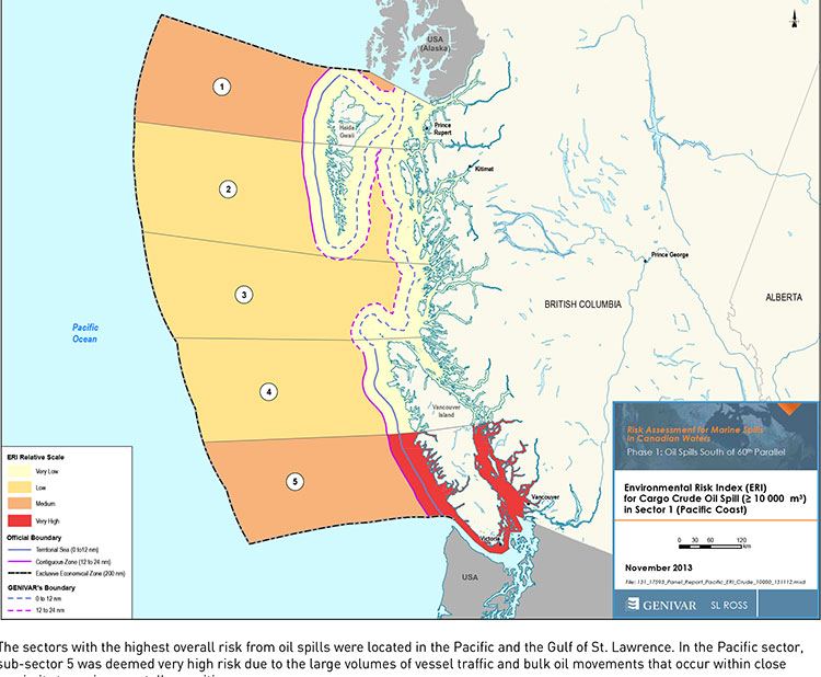
 

Two days left for public input on BC “heavy oil” spill response plans

oilspillresonsepaperResidents of British Columbia have just two days to file information and opinions on the province’s  plans for “options for strengthening BC’s spill preparedness and response policies and capacity.”

A page on the BC Ministry of the Environment’s web site  wants public input as part of “BC’s five conditions necessary for support of heavy oil projects.”

Premier Christy Clark announced her controversial five conditions for pipeline development in BC in July 2012. Clark’s announcement was aimed both at the Northern Gateway Pipeline which would have its terminal in Kitimat, and the proposed Kinder Morgan pipeline expansion which has its terminal in Vancouver.

It is not clear how long the web page has been up,  but the call for input from the public has received little, if any, publicity. The deadline for public submissions is February 15, 2013.

(Northwest Coast Energy News was alerted to the story by a Kitimat-based hiking club)

A separate call for academic papers had a deadline of January 25. The province plans a conference on oil spill response  in Vancouver from March 25 to March 27. The website says”

As part of British Columbia’s commitment to a world leading preparedness and response regime for land based spills, it is hosting a symposium March 25-27, 2013 in Vancouver, BC. Due to the anticipated high interest in the symposium, attendance is by invitation only.

One question would be if invitation only is designed to exclude activist groups who may wish to participate or demonstrate. The Northern Gateway Joint Review panel banned public input at hearings in Vancouver and Victoria earlier this year to try, not always successfully, to head off demonstrations. The webpage says:

In keeping with the established polluter-pay principle, and recognizing the increase in development activities across the province, the Ministry of Environment (the ministry) is reviewing industry funded options for strengthening BC’s spill preparedness and response policies and capacity. Land based spill refers to any spill impacting the terrestrial environment, including coastal shorelines, regardless of the source.

This review addresses three aspects of land based spill preparedness and response: World leading regime for land based spill preparedness and response

Effective and efficient rules for restoration of the environment following a spill

Effective government oversight and coordination of industry spill response The ministry has developed a policy intentions paper for consultation (intentions paper) on the three aspects of the province’s land based spill preparedness and response regime under consideration.

The purpose of this intentions paper is to describe the ministry’s proposed policy direction and seek input on enhancing spill preparedness and response in BC. The intentions paper is a discussion document and your feedback will influence the policy approach.

Although the call for input is on the ministry website, the contact is a management consulting firm C. Rankin & Associates.

BC asks municipalities to “clarify” earthquake and tsunami response

Update:B.C. modifies, enhances emergency notification process (Official news release)

CBC: New tsunami warning protocol rolled out in B.C.

EmergencyInfoBC Please be advised that @EmergencyInfoBC is the only authorized emergency alert feed for Gov’t of BC.
Tweet Thu 8 Nov 11 48

The British Columbia Solicitor General’s department is asking northwest municipalities to “clarify the initial response actions” to the October 27 2012, magnitude 7.7 earthquake off Haida Gwaii and the resulting tsunami warning.

A covering letter to municipalities from Lori Wannamaker BC Deputy Solicitor General says the province is reviewing the response to the earthquake and tsunami and is “seeking input from affected community leaders.” The package includes a letter sent to Emergency Program Coordinators across British Columbia, adding: “Input will be sought in an endeavour to hear from those directly impacted as a measure of enhancing our operations and response,” adding. “Events like present all levels of government with a learning opportunity.”

In the main letter to the municipalities outlining emergency procedures, the department also offers a time line of its response to the incident.

Clarify the initial response actions

The package sent to municipalities by Rebecca Derlinger, Assistant Deputy Minister /Fire and Emergency Management Coordinator, opens by saying: “The earthquake/tsunami event on October 27, 2012 demonstrated the high level of emergency preparedness that has been undertaken by local governments in BC. Elected officials and emergency managers in all impacted communities deserve praise for a timely and effective response that was undertaken, including evacuations.”

But in the next paragraph the letter goes on to say: “Prior to the completion of the provincial debrief process, we would like to clarify the initial response actions of local government emergency management personnel including how information should be managed after an earthquake that impacts BC.”

The letter also says that “Local governments must complete a hazard risk and vulnerability analysis for their communities according to the Emergency Program Act and regulations, keeping in mind that all parts of British Columbia have a risk of earthquake impacts. Coastal communities have the added risk of tsunami.”

The letter then outlines three scenarios for various communities

  • Significant earthquake is felt in a community located in an area with tsunami risk
  • Earthquake is not felt, however, a community is located in an area with tsunami risk (teletsunami)
  • Earthquake is felt in a community that is not located in area that has tsunami risk

In all three scenarios it says Emergency Management BC “will provide the general public with ongoing situational awareness through:

  • EmergencyInfoBC blogsite
  • Social media such as Twitter
  • Mainstream media (press conferences and releases)

For areas such as Kitimat, which is in a possible tsunami zone, the letter advises “Local governments should undertake the following emergency response activities immediately following a significant earthquake (do not wait for official notification)

  • Activate their local emergency response plans and if deemed necessary
  • Active local first responders
  • Undertake public alerting and initiate evacuations of low lying areas
  • Open an emergency operations centre in a safe location
  • Report to EMBC
  • Ensure ongoing public messaging to their citizens
  • Gather information to develop situational awareness

For areas that don’t feel the earthquake, the province recommends

Local governments should undertake…emergency response activities immediately following the receipt of a West Coast Alaska Tsunami Warning Centre (or WCATTWC) and/or EMBC notification of a potential tsunami event. It then calls on local emergency officials to follow the same procedure outlined above “if a notification indicates an increased risk of a tsunami (warning or advisory only)

As you can see from the Twitter profile, Emergency Info BC works during normal office hours, Monday to Friday unless there is a declared emergency

The warnings October 27


In the letter the province outlines a time line of how the emergency system worked on October 27.

It says the provincial Tsunami Notification plan was activated at 8:10 pm. October 27, approximately four minutes after the earthquake.

In a provincial acronym soup it then says

The EMBC (Emergency Management BC) Emergency Coordination Centre initiated an internal resource request to activate the PECC (Provincial Emergency Coordination Centre) and the PREOCs (Provincial Regional Operations Centres).

EMBC and Temporary Emergency Assignment Management System (TEAMS) staff were in attendance at PECC and PREOCs by 8:33 pm.

“Based on the initial bulletin from WCATTWC, social media staff sent out a message via Twitter” at 8:48 pm At that time EMBC regional offices began contacting communities with potential tsunami risk by telephone. “Subject matter experts from Natural Resources Canada and Canadian Hydrographic Service were contacted by PECC at 8:30 pm and at 9 pm to review the information received from WCATWC.

“Based on these discussions, the PENS (Provincial Emergency Notification) was initiated at 9:05 while efforts to make contact with those communities under tsunami warning continued.

At 10:45 pm a media conference call was held by the Minister of Justice.

The letter continues to say that conference calls were held with EMBC, US state emergency management offices, and the West Coast Alaska Tsunami Warning Centre hourly until the final cancellation of the west coast warning by WCATWC at 2:47 am Sunday morning and by the province at 3:03 am

It concludes “Staff responsible for social media were actively engaged in informing the public.”

Denlinger’s letter then goes on to note that the provincial debrief will include “a discussion on the information flow from the province to emergency management stakeholders and the public (for example the use of social media as a communications tool for public awareness of the event)… This information….will assist in the creation of a provincial after action report and in the enhancement of subsequent provincial earthquake and tsunami response plans.”

How warnings worked on November 7


Earthquake November 7
Earthquake Nov. 7, 2012 (USGS)

On November 7, 2012, the US Geological Survey reported a 6.3 magnitude earthquake took place at 6:01 pm. Pacific Standard Time off the west coast of Vancouver Island, 186km (116mi) south southwest of Port Hardy.

At 6:06 I received an automatic text message from the West Coast Alaska Tsunami Warning Centre
Tsunami Info Stmt: M6.3 085Mi SW Port Alice, British Columbia 1802PST Nov 7: Tsunami NOT expected #WCATWC

At 6:07 I received an automatic tweet from Canadaquakes : @CANADAquakes: Automatic detection of seismic event: magnitude 4.4 – 7 Nov 18:01 PST – PORT HARDY, BC region

At 6:15, I received the WCATWC message on Twitter that I had received 9 minutes earlier via text
Tsunami Info Stmt: M6.3 085Mi SW Port Alice, British Columbia 1802PST Nov 7: Tsunami NOT expected #WCATWC

@EmergencyInfoBC retweets the WCATWC message

At 6:27 Canada quakes updated their tweet with corrected information: @CANADAquakes: EARTHQUAKE Mag=6.3 on 07 Nov at 18:01 PST. Details : http://t.co/OL9RTPKC 101 km SSW of Port Alice, BC

@EmergencyInfoBC retweets the CANADAquakes message

Analysis The province didn’t get it

Tweets from Emergency Info BCRead between the lines of the Solicitor General’s letter and a couple of things stand out. While at first the officials say things went fine according to procedures in the book, events appear to show that in practice, the system didn’t work as well as expected on the night of October 27.

First the province, reminds municipalities of that they “must complete a hazard risk and vulnerability analysis for the communities.”

Second, while EM BC social media staff were, according to the letter, “were actively engaged in informing the public,” there was actually scant evidence of that during the crucial first 90 minutes after the earthquake on Haida Gwaii. While the emergency coordination officials and bureaucrats apparently were well informed about what was happening, the public was not. As I pointed out in an earlier post, differences between the US and Canadian warning systems contributed to the confusion. As well there was a problem on both Twitter and Facebook of rumour, misleading and false information being posted on social media during that crucial 90 minutes.

The line about the “the use of social media as a communications tool for public awareness of the event” is a clear indication that not all went well with the EM BC Twitter feed the night of the Haida Gwaii earthquake.

While Emergency Info BC is a sort of blog, again you have to know to go there and it is only active during an emergency. There were no posting on the night of the earthquake and tsunami. The last “blog” was during the Johnson’s Landing landslide evacuation in July 2012, and even that doesn’t give much information. Looks like Emergency Info doesn’t understand that a blog entry that says “no danger, nothing much is happening” is just as important as evacuation instructions.

The main website is Emergency Management BC,  with a link to the Info site—if there is an emergency—not exactly a prime example of web design for someone in a hurry, whether an official, the media or the public, since it was what the web calls “brochure ware.”

The first indication of whether or not there would be major danger to the BC coast on Oct. 27 was at Langara Island at 9:16 pm. Local officials in northwest BC were monitoring Langara and the relatively low surge indicated–at least at that time– that danger was not as great as feared. Yet it was only seven minutes earlier that EM BC activated the Provincial Notification Program at 9:05, and that was an hour after it was known that the earthquake was 7.7 in magnitude, which had the potential for catastrophic damage. The tweets that I saw about the small surge at Langara, came from Prince Rupert. It is in a situation like the Langara monitoring that the Emergency Info blog would have been relevant.

The need for constant official updates is clear. Earthquakes do not work 8:30 to 4:30, Monday to Friday. The province has to be able to activate emergency notification much faster. If a web journalist whether working for the mainstream media or a responsible individual on a small site can tweet or post in seconds, usually working from a home office or even a smart phone, emergency officials can do the same.

In these days, travel by government officials is often frowned upon. A couple of months from now, when New York and New Jersey have recovered from the Superstorm Sandy and this weeks Nor’easter, a visit from BC emergency officials is in order to see how it is done.